Torrance’s Old Towne Mall developers wanted to add a lot more to the mix

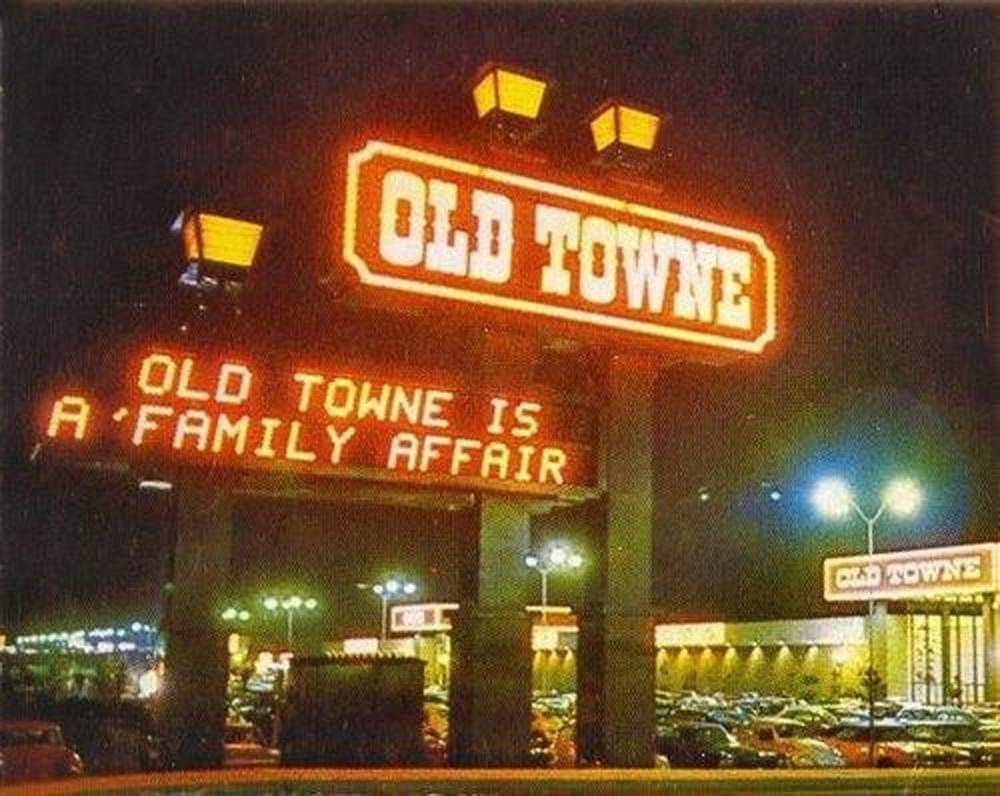
Image from postcard circa 1976.

Those who remember the enclosed Old Towne Mall in Torrance often  remark on the quaintness of its old-time nostalgia vibe.

The mall was built by developer Robert Brindle through his El Segundo-based Lincoln Realty Old Towne arrangement with Mik Brindle, Clifford Hemmerling and the Southern California Financial Corporation.

Brindle’s firm wasn’t attempting to compete with Torrance’s nearby megamalls like Del Amo Fashion Center and the South Bay Center (now the Galleria). The developer saw the smaller, mostly single-story complex as filling a complementary niche to the larger centers, using entertainment elements in a concept they called “recreational retailing.”

Old Towne’s location on the northwest side of the intersection of Hawthorne and Del Amo boulevards had an adjoining K mart that had opened in 1971 that served as a kind of anchor store. Other than that, most of its tenants were shops operated by small businessmen when it opened in October 1972.
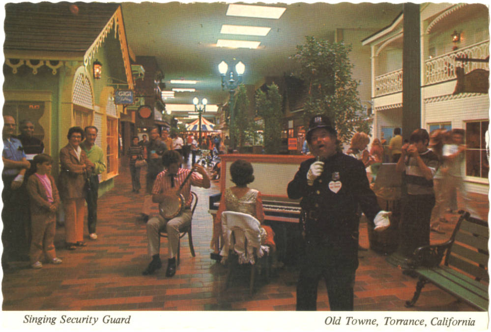
Keystone Kop Bruce Bishop, right, patrolled Old Towne Lane and belted out delightful songs as he worked his beat at Old Towne Mall in Torrance. From postcard circa 1976.

Its unique interior was filled with touches meant to give the mall an old-time 1890s-style nostalgic effect. Period costumes and decor included costumed bands performing at an old-fashioned gazebo, a singing security guard, a refurbished cable car and a fully operational carousel for kids.

Special events included everything from dance marathons to frog jumping contests, bingo games and armwrestling tournaments. Arts festivals and  concerts featuring all different types of music were held frequently. The mall even had its own theater space, the Old Towne Mall Little Theater, at the south end of the complex.

It was all very small-scale and intimate. But management had much bigger plans in mind, according to a July 1973 draft environmental impact report submitted to the City of Torrance that reference librarian Mike George at the Katy Geissert Civic Center Library unearthed recently.
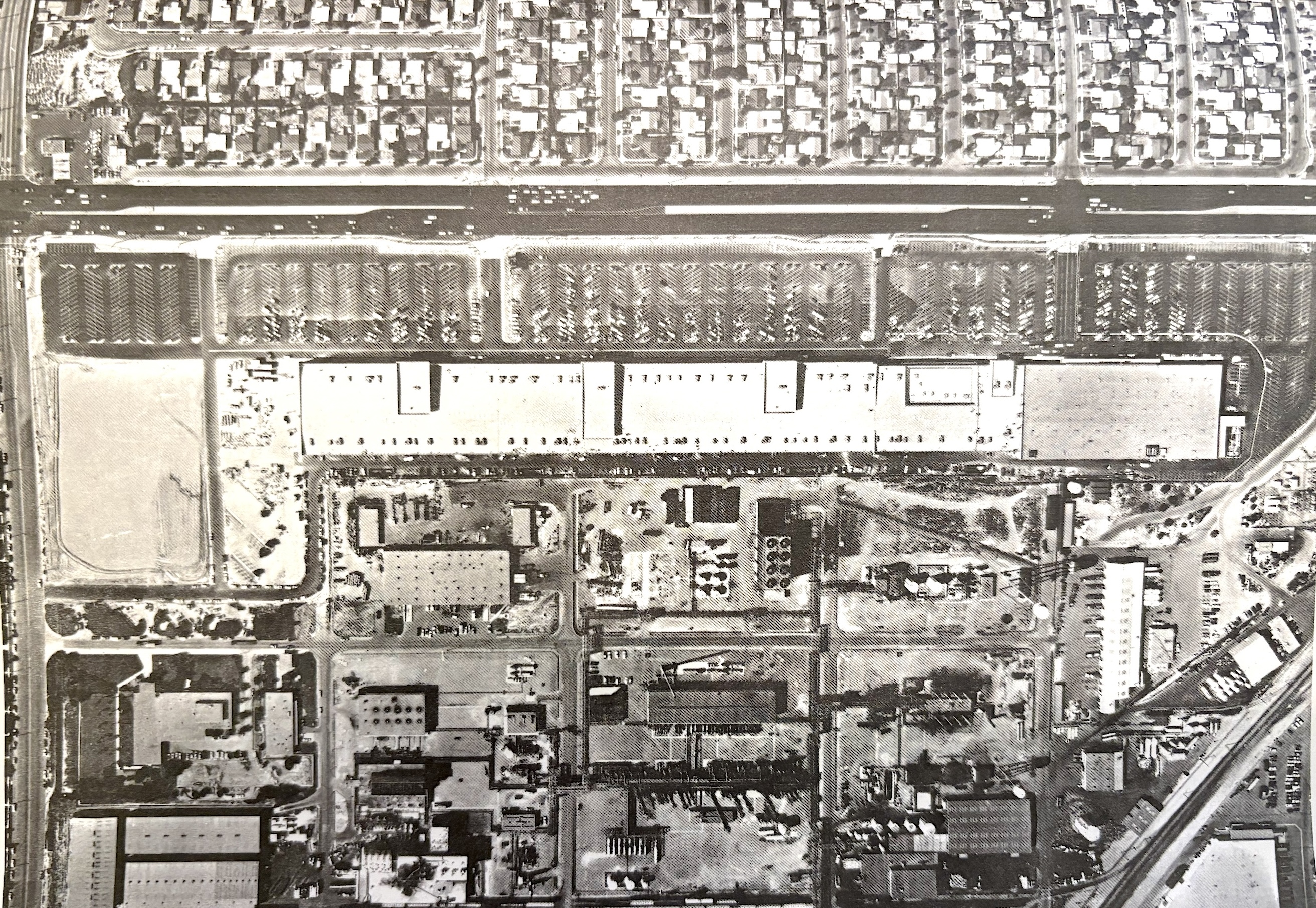
This 1973 aerial shows Hawthorne Blvd. at top, the Old Towne Mall (horizontal row of white roofs), and the Union Carbide plant, bottom half of photo. (Source: Draft Environmental Impact Report for the Lincoln Realty Old Towne Project, Torrance, California)

According to the EIR, the Lincoln Realty Old Towne Project proposal called for the addition of a large outdoor amusement park, indoor recreation center, a multistory hotel complex and a parking structure on land adjacent to the mall. The land, extending east of the Old Towne Mall to Mariner Ave., was then occupied by the Union Carbide chemical plant at 19500 Mariner.

The project would be introduced in two phases. Phase I called for the construction of the indoor “Old Towne Fair” building, which would have been 250 feet wide, 500 feet long and 48 feet high, with an interior area of 125,000 square feet.

It would have housed 24 amusement rides, food and souvenir concession stands, a shooting gallery and a 1,524-seat theater. The rides would have included bumper cars, a roller coaster, multiple carousels, and a tilt-a-whirl, among others. A two-level parking structure with 795 spaces also would be built.

Phase II was even more ambitious. It called for the removal and replacement of the neighboring Union Carbide polyethylene plant: “Negotiations are now underway for the purchase of the property by the Lincoln Realty Company,” the report states.
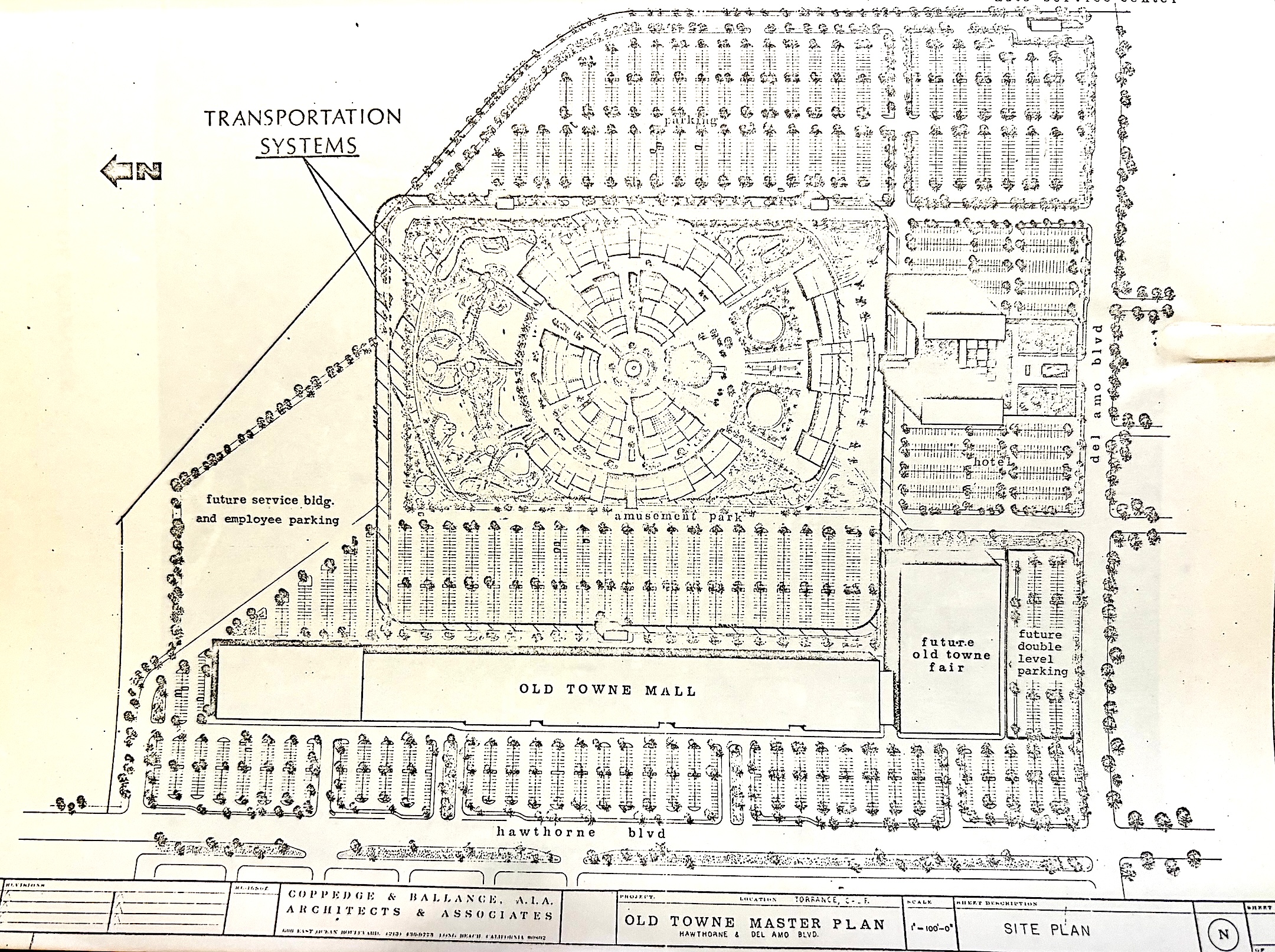
Diagram of the project shows the outdoor amusement park, center, the hotel and convention center to its right, and the indoor Old Towne Fair building below the hotel. (Source: Draft Environmental Impact Report for the Lincoln Realty Old Towne Project, Torrance, California)

This parcel would contain the 600-room hotel and convention center complex with four restaurants and a swimming pool as well as a large outdoor amusement park with “as yet unspecified outdoor rides and recreational features.” 

Total new parking for the whole project amounted to nearly 10,000 spaces. Oh, and a “people mover” transportation system of unspecified design would ferry people around the area, which would likely have been open from 2:00 pm until midnight in the summer and on weekends and holidays.

The rosy EIR saw the only negative effects as being on area traffic, which was already heavy and growing heavier. Positive effects included the addition of hundreds of new jobs, a new source of recreation for local residents and an attractive convention destination for out-of-towners.
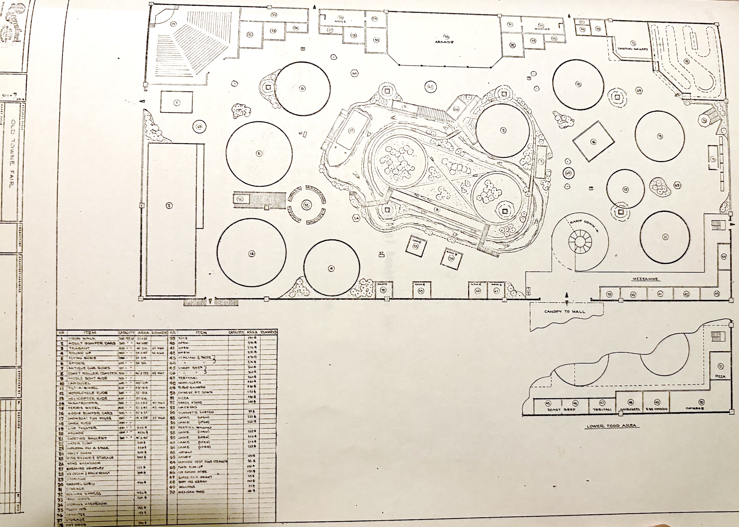
Diagram shows the various rides and attractions proposed for the outdoor amusement park area. (Source: Draft Environmental Impact Report for the Lincoln Realty Old Towne Project, Torrance, California)

Needless to say, the project never happened, though it was announced in the July 22, 1973 Los Angeles Times as “in its final design stages” and as being expected to be completed by the summer of 1974.

The main stumbling block seems to have been the acquisition of Union Carbide’s plant, which Brindle’s firm, by then renamed Recreational Retail Builders of El Segundo, was unable to pull off. 

Instead, the Union Carbide plant continued to operate on the site until its closure in 1981. For the next four years, the company spent millions of dollars cleaning up hazardous waste from the former chemical plant. Construction finally began in late 1985 on the $100 million Torrance Business Park that currently occupies the site.
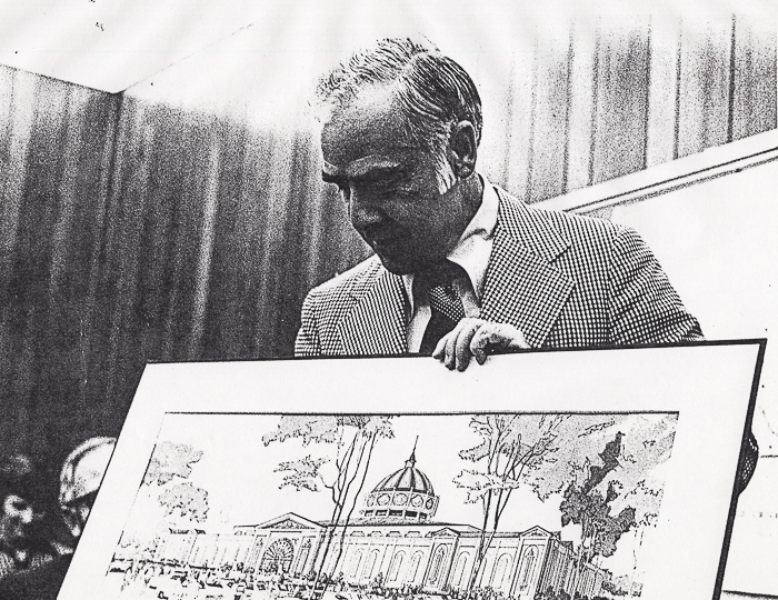
Robert Brindle presents the plans for what was to become Old Chicago Mall in Bolingbrook, Illinois. The initial proposal was similar to the Torrance pitch, with plans for an amusement park, convention center and hotel, Photo circa 1974. (Credit: Negative G blog)

The Recreational Retail Builders firm moved from El Segundo to Bolingbrook, Illinois, near Chicago, in early 1974 and proceeded to build the Old Chicago Mall there. The complex incorporated the same nostalgic shopping mall and amusement park combination as the one proposed for Torrance and opened with much fanfare in June 1975.

Old Chicago Mall ran into financial and operational difficulties soon thereafter, and closed for good in 1980.

As for Old Towne Mall, it struggled financially during the 1980s, changing owners a couple of times. In 1989, the roof was removed and the stores re-oriented to face Hawthorne Blvd. The outdoor shopping center currently operates as the Torrance Promenade.

Note: Special thanks to Katy Geissert Civic Center Library reference librarian Mike George for the story idea and related reference material.
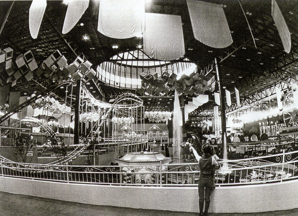
Old Chicago Mall combined an indoor shopping mall and an amusement park in Bolingbrook, Illinois from 1975 through its untimely end in 1980. Photo shows interior of the Fairgrounds building circa 1975. (Credit: Negative G blog)

Sources:

Daily Breeze archives.

Draft Environmental Impact Report for the Lincoln Realty Old Towne Project, Torrance, California, prepared by Opinion Research of California, Inc. in conjunction with Socio-Economic Systems, July 1973.

Los Angeles Times archives.

“Old Chicago Shopping Center & Amusement Park, Bolingbrook, Illinois,” Negative G blog.

Wikipedia.
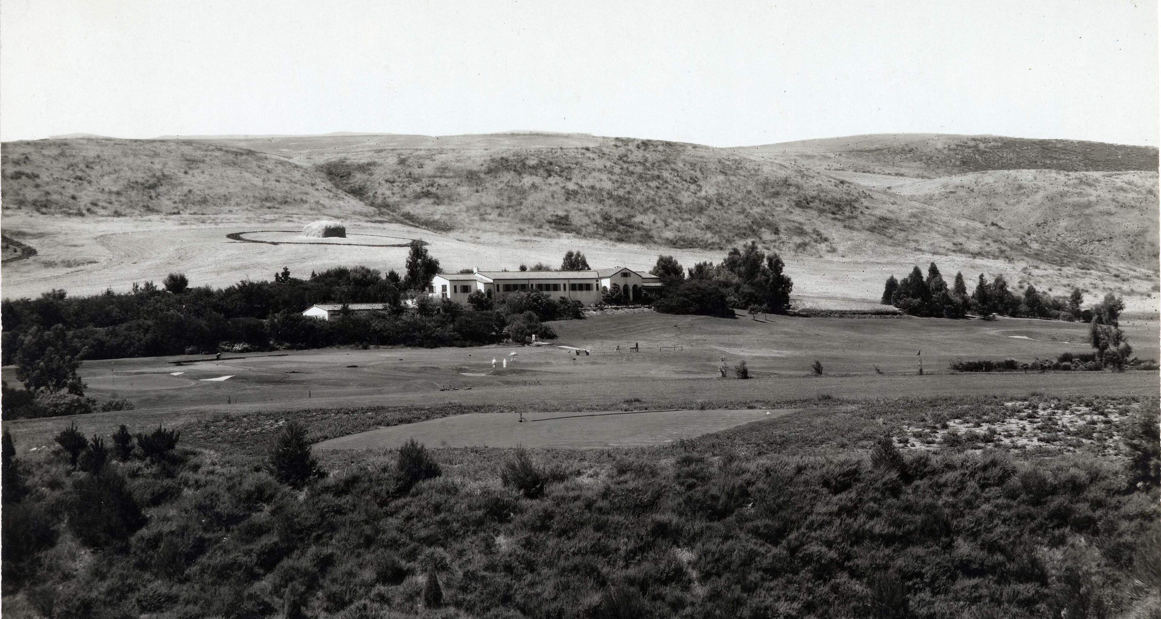
The Palos Verdes Peninsula’s recreational options lured society’s upper crust in its early days

The Palos Verdes Golf Club circa 1924. (Credit: Palos Verdes Library District, Local History Collection)

Horseback riding, golf, polo matches, faux fox hunts – all of them were popular pursuits among the high society set during the early development of the Palos Verdes Peninsula.

The taming of the Peninsula began with the sale of lots for Palos Verdes Estates in early 1923. At the time, there was little sign of civilization there, save for a few buildings at Malaga Cove. East Coast banker Frank Vanderlip had purchased the undeveloped land in 1913 and built an estate he named Villa Narcissa in the then-remote Portuguese Bend area.

From the beginning, Palos Verdes was intended to be a meticulously planned city. The Palos Verdes Homes Association was formed in 1923, and it in turn formed an adjunct group, the Palos Verdes Art Jury, whose purpose would be to maintain the area’s planning standards and stylistic uniformity.

Land sales were brisk at Malaga Cove, and the Art Jury strictly policed its style mandates. When the area’s natural beauty was combined with the landscape designs by the Olmsted brothers, the resulting settlement attracted both the rich and famous.

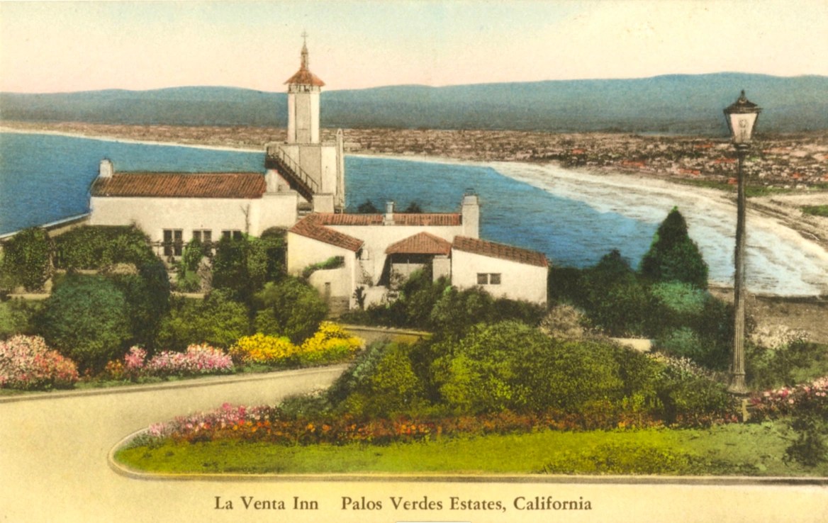
La Venta Inn postcard, circa 1936.

Recreation opportunities abounded, and developers added two key man-made facilities as part of their original plans. The La Venta Inn was first to open in 1923, followed by the Palos Verdes Golf Club in 1924. 

Architect brothers Pierpont and Walter Swindell Davis designed the Spanish-style Inn, with the Olmsteds laying out its lush outdoor grounds. 

During the 1920s and 1930s, a long list of celebrities and movie stars dined indoors and al fresco at the Inn, considered to be a high-class celebrity hideaway at the time. Famous visitors included aviator Charles Lindbergh, violinist Jascha Heifetz, and movie stars Greta Garbo, Tyrone Power, Cary Grant, Gloria Swanson, Myrna Loy, Errol Flynn, Betty Grable, Margaret Sullavan, Charlie Chaplin, Janet Gaynor and Bob Hope.

Designed and built by the renowned team of William P. “Billy” Bell and George C. Thomas, the Palos Verdes Golf Club was a hit from the very beginning. Just days after it opened, plans  were already underway to expand its clubhouse building. 

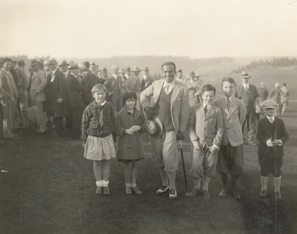
 Actor Douglas Fairbanks Sr. poses with five children at the Palos Verdes $2,500 “Open” Golf Tournament held December 30 , 1927 through January 1, 1928 at the Palos Verdes Golf Club. (Credit: Palos Verdes Library District, Local History Collection)

Hollywood star spotters could’ve caught Walter Pidgeon working on a film there in 1926. Douglas Fairbanks made a memorable appearance there during a 1928 tournament. In 1930, MGM Studios sponsored a celebrity golf tournament that included studio stars such as Buster Keaton and Robert Montogomery, father of Eliabeth Montgomery of “Bewitched” fame.

In 1950, parts of the film “Follow The Sun” were shot there. Legendary golfer Ben Hogan and Glenn Ford, the actor who played him in the biographical film, stayed at the golf course during filming.

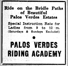
Horses and equine-related activities also have long been a part of the Peninsula recreational scene. Developers and city planners built a series of bridle paths and trails in open country especially meant for the ponies, along with separate walking spaces for people. 

Palos Verdes Peninsula News ad, Nov. 1937, Page 6. (Credit: Palos Verdes Peninsula News archives)

The original Palos Verdes Project called for 14 miles of bridle trails, with their number and length only increasing as the area continued to be developed.

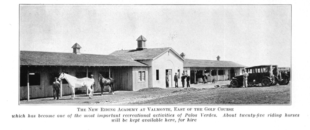
Stables and equestrian clubs formed early on. Horseback riding instructor O.C. Clausby moved his operation from Beverly Hills to the Peninsula, opening the Palos Verdes Riding Academy, on May 17, 1925, in a barn adjacent to the Palos Verdes Golf Club.

In its early days, Clausby apparently also fashioned an impromptu polo field on a natural stadium-like area among the nearby hills in the Valmonte area. Information on the field is scant,  but we feel free to speculate that informal polo games held there probably attracted upper crust denizens.

The Palos Verdes Riding Academy opened in 1925. (Credit: PV Heritage Preservation Facebook page)

Little more than a decade later, area socialite Mrs. Phyllis French attracted the attention of blue bloods from Beverly Hills to Pasadena when she formed the Rolling Hills Hunt Club in 1937. Its purpose? To stage fox hunts.

According to the Palos Verdes Land Conservancy, a small population of red and gray foxes continue to live on The Hill even in 2024. But the Hunt Club didn’t actually hunt the critters. French’s group staged what are known as “drag hunts.”

During drag hunts, the nattily attired horse riders sporting those distinctive black riding hats would follow bloodhounds chasing through the hills after fox scents carefully applied beforehand by hunt organizers in the wild. There was no actual live fox involvement.

John Jacob Astor VI and his wife, Ellen. Undated. (Credit: FindaGrave website)

The Palos Verdes Peninsula News described the club’s initial drag hunt in 1938 as a “complete  success,” noting that “the large field, composed of notables and the cream of society, raced across the horizon with both the vast Pacific and Santa Catalina Island lending their majestic qualities to the background.”

Participants and observers at the hunts in 1938 and 1939 included fur fortune heir John Jacob Astor VI and his wife Ellen, actors Victor McLaglen and his wife Enid, Charles Laughton, who owned 15 acres of land nearby, Robert Montgomery (again) and actress Claudette Colbert, who watched her husband Joel Pressman participate.

Those were indeed different times. But the large network of bridle trails and a host of active stables and horse riding clubs, along with the Palos Verdes Golf Club and La Venta Inn, continue to be an important part of the Palos Verdes Peninsula’s  cultural and social fabric. 

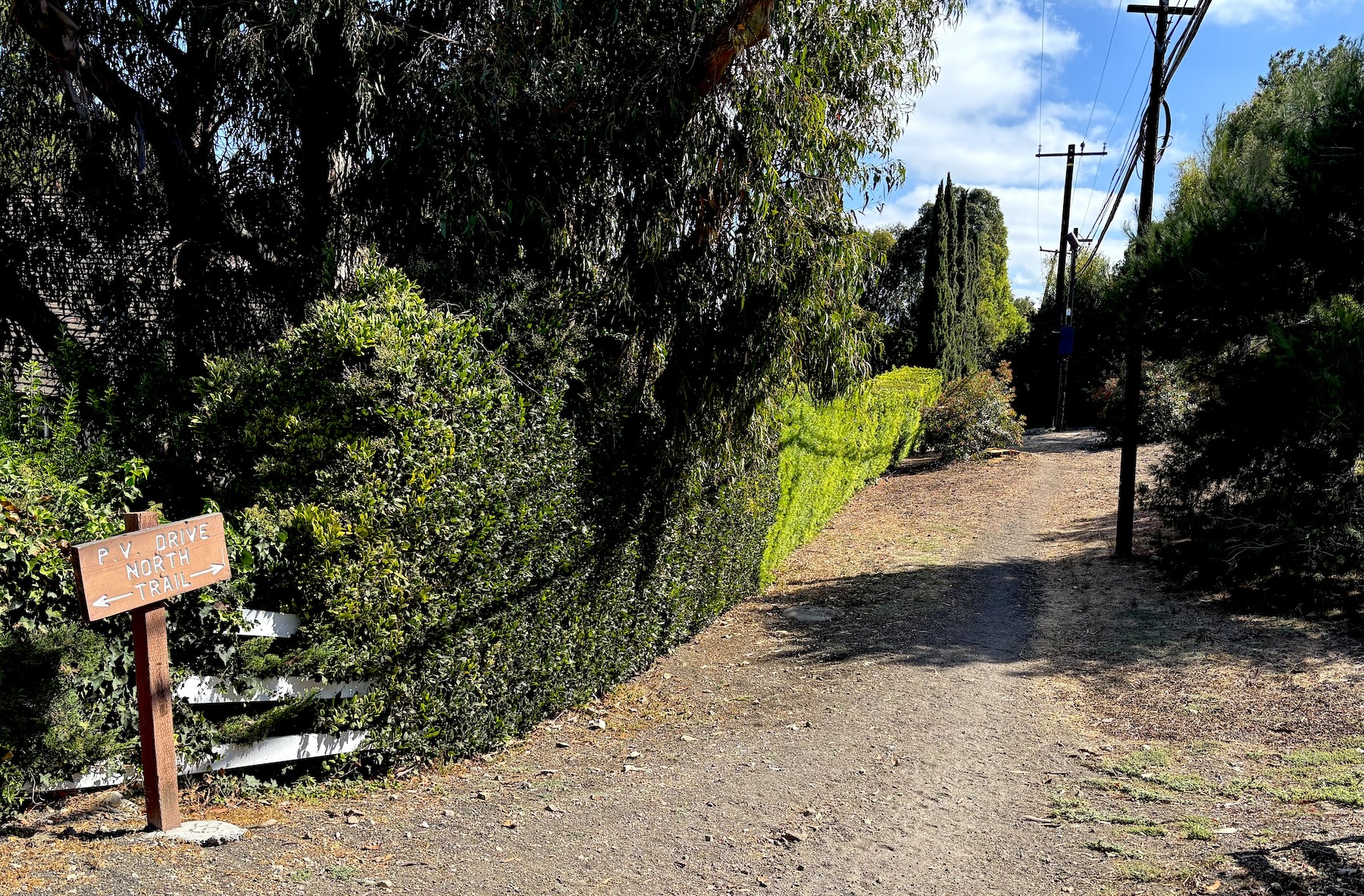
Looking east along the bridle trail from Palos Verdes Drive North at Latigo Lane in Rolling Hills Estates in October 2024. (Photo by Sam Gnerre)

Sources:

Daily Breeze archives.

Los Angeles Times archives

.“Palos Verdes Golf Club: A Historic Hole-in-One” by Denise Kano, DIGS website, Jan. 15, 2018.

“No, your eyes aren’t playing tricks on you. South Bay is actually home to a little red fox population,” by Yusra Farzan, LAist website, July 16, 2024.

Palos Verdes Peninsula News archives.

“PVP’s Equestrian Lifestyle,” by Dennis Piotrowski and Monique Sugimoto, Palos Verdes Magazine, June 18, 2024.

Wikipedia.
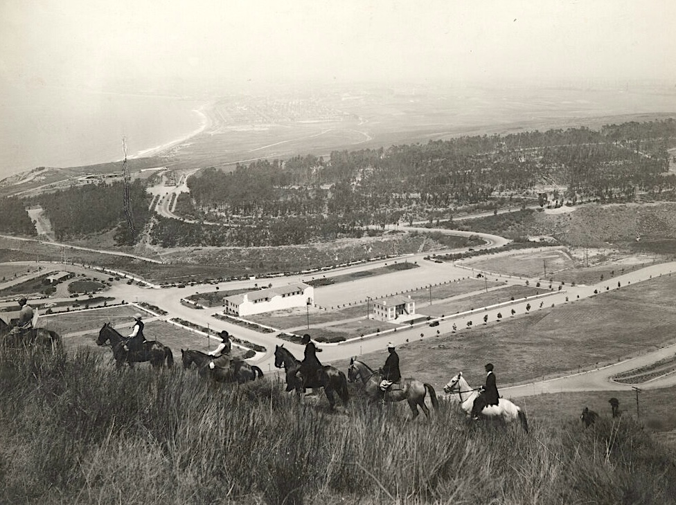
Horseback riders enjoy the view from above Malaga Cove in 1926. The back of the Gardner Building can be seen at center, with a grove of eucalyptus trees, Santa Monica Bay, and the city of Redondo Beach in distance. (Credit: Palos Verdes Library District, Local History Collection)

The long-lived National Supply Co. had roots in Torrance’s first industrial firm

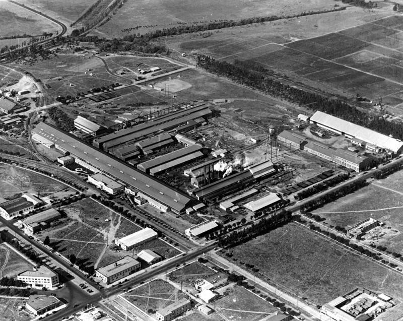
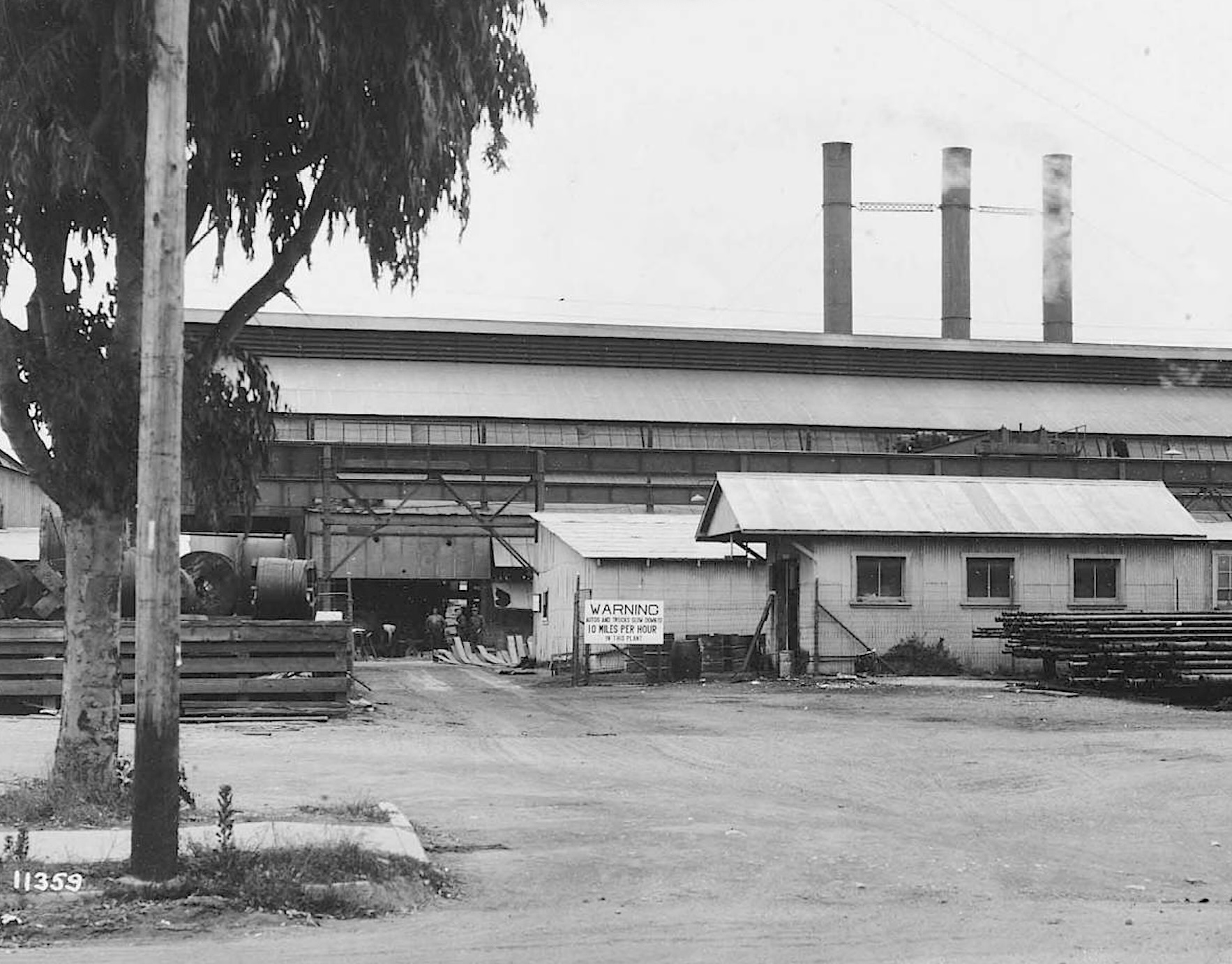
The National Supply Co. on Border Ave., center, in Torrance in 1924. Carson St. runs diagonally from bottom left, with Western Ave. at upper right. (Credit: Los Angeles Public Library Photo Collection)

By the time Jared Sydney Torrance publicly announced the founding of the city that bears his name in 1912, he had already arranged for two major industrial employers to establish operations there.

In December 1911, the Pacific Electric Railway Co. agreed to build its maintenance facility there in return for 125 acres of land.

Torrance sat on the board of directors of the other major employer, the Union Tool Co. In July 1911, he persuaded the firm, which was looking for cheaper land on which to build its new factory, to invest in 25 acres of dusty fields in his new settlement.

The National Supply Co. plant in Torrance in 1924. Photo by G. Haven Bishop. (Credit: Huntington Library)

Union Tool, founded in 1908, had outgrown its Los Angeles location. The company, which specialized in making equipment and machinery for the oil drilling industry, found its business was booming due to the increasingly rapid proliferation of oil wells in the Los Angeles area.

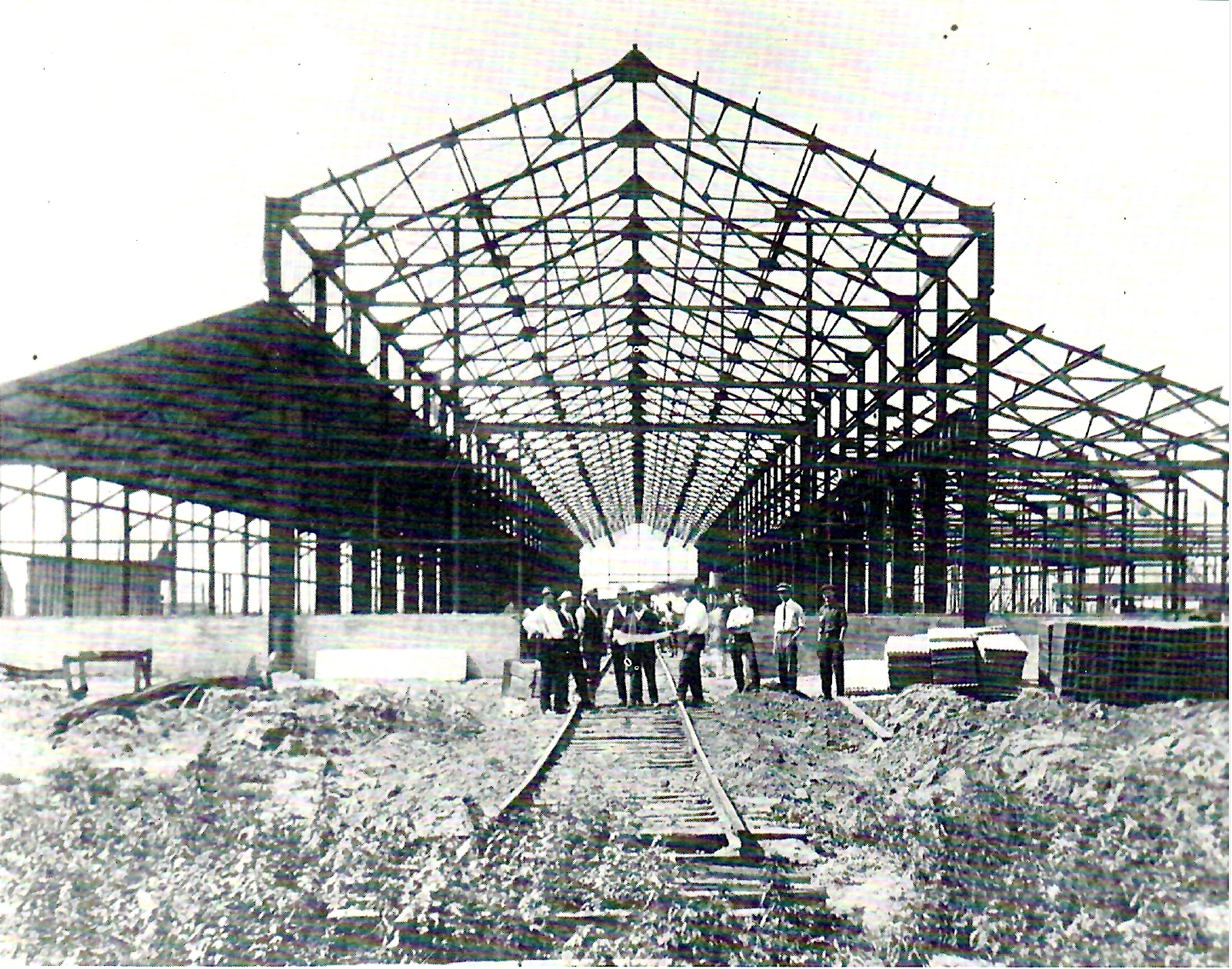
Union Tool’s owners were unfazed by Torrance’s insistence that its new plant needed to be up and running within 18 months of signing the deal, and agreed to the plan. In December 1912, Union Tool’s factory at 1542 Border Ave., just northwest of the intersection of Carson St. and Western Ave., began operations with 280 employees, mostly drawn from its Los Angeles location.

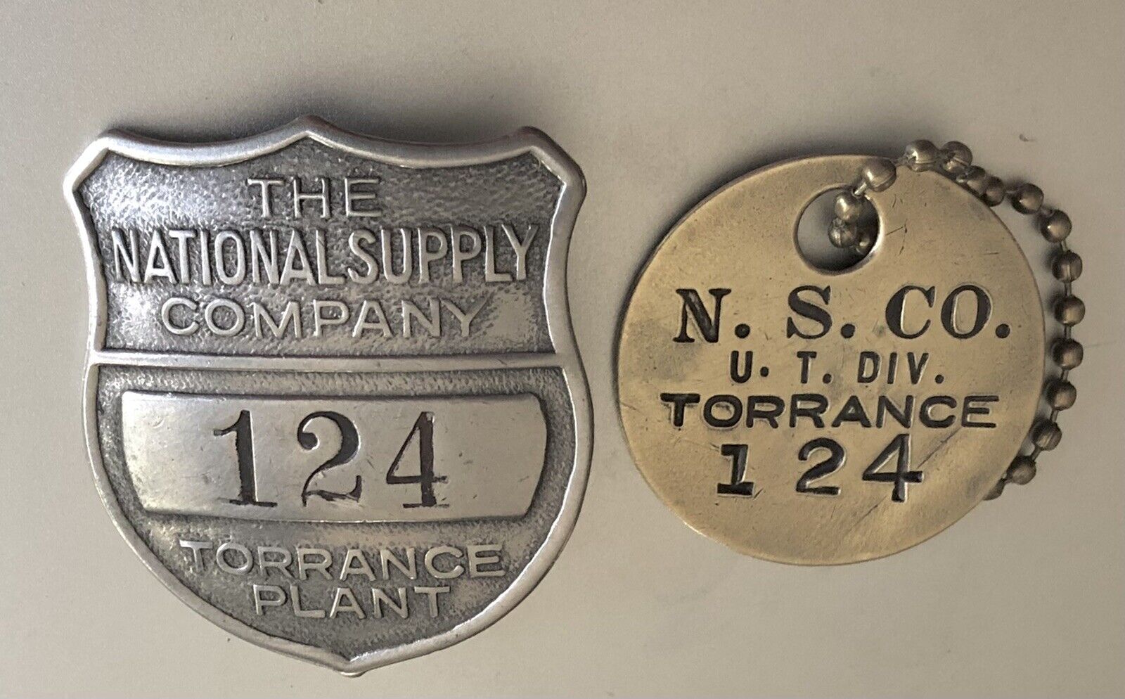
Company identification badges.

According to the Torrance Herald, most of them had to commute at first, as there were only three houses in the city at the time. That would change rapidly as the new city raced to build houses and businesses to support other companies which began moving operations there.

These included the Hendrie Rubber Co., Pacific Metal Products Co., Fuller Shoe Co., Acme Brass Foundry, Llewellyn Iron Works and many others.

Business continued to boom at Union Tool, and the firm was acquired in 1920 by the National Supply Co., a large industrial machinery firm founded in 1894 in Pittsburgh, Pennsylvania. It would become the nation’s largest supplier of equipment to the oil industry, and a pioneer in the development and production of materials for the rotary drilling process.

Its Torrance operation changed its name to the National Supply Co., and its business exploded during the 1920s oil drilling boom. Large swaths of oil derricks soon covered the South Bay and Long Beach areas, from the Inglewood oil field to the north to Signal Hill.

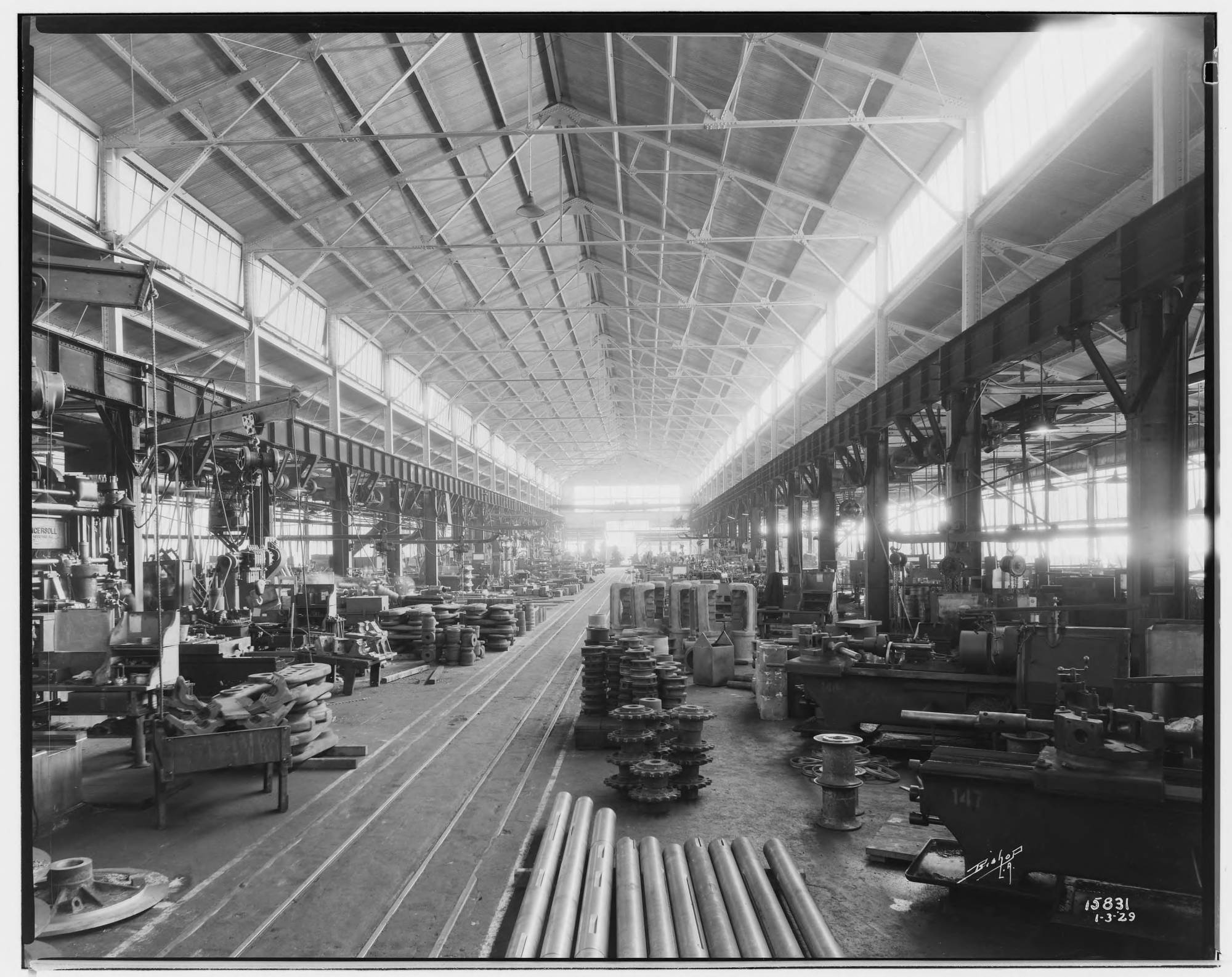
The machine shop at National Supply Co.’s Torrance plant on Jan. 3, 1929. (Credit: Huntington Library)

As if that didn’t keep the company busy enough, oil wells soon blanketed the city of Torrance itself during the mid-1920s during its own oil boom. The last oil derrick wasn’t removed from the city until 1961, and oil operations continued long after that.

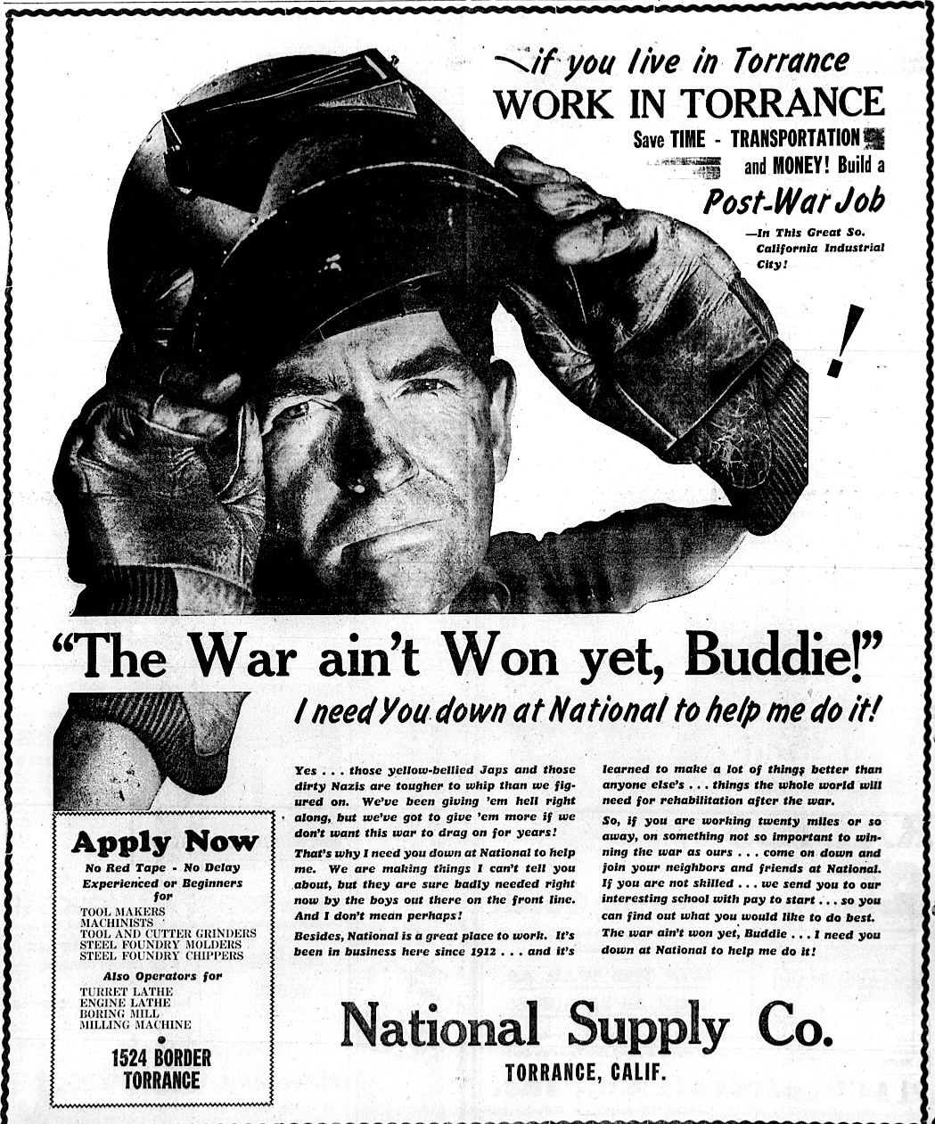
By the late 1930s, National Supply employed more than 1,000 workers on its payroll. As the nation ramped up for possible entry into World War II, the company began shifting over to manufacturing wartime materials.

In November 1941, just weeks before the Pearl Harbor attack, National Supply announced it would build a $2.3 million plant under a contract from the U.S. Navy. The 74-by-750 foot building would house the largest forging press on the West Coast, and six large lathes, all to be used to produce materials for ship construction.

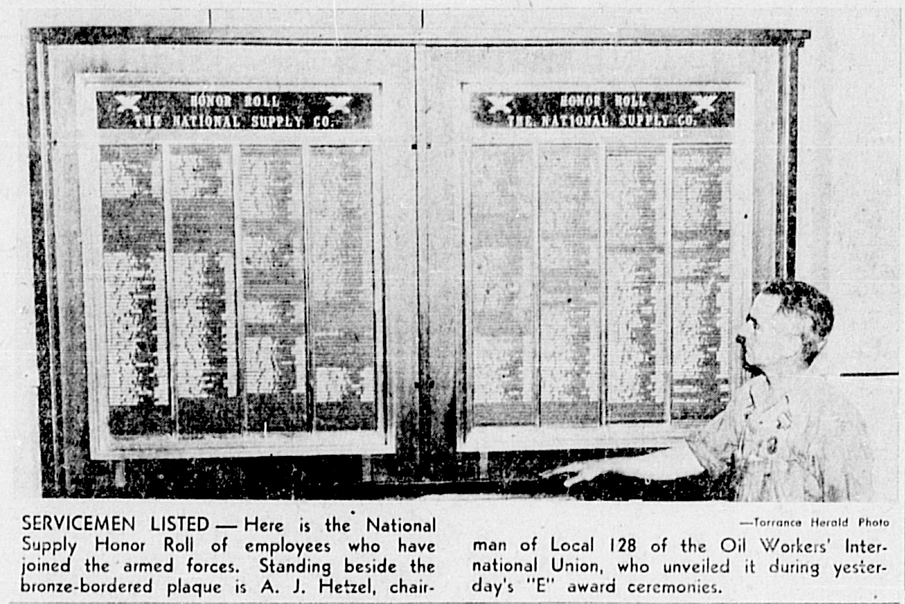
Torrance Herald, May 20, 1943, Page 1. The U.S. Army and Navy gave “E” awards to defense plants for exemplary performance during World War II. (Credit: Torrance Historical Newspaper and Directories Archive database, Torrance Public Library).

The day after Pearl Harbor, Torrance police and fire personnel were on alert to help protect National Supply and other defense-related industries in town, and the companies themselves posted extra guards around their plants.

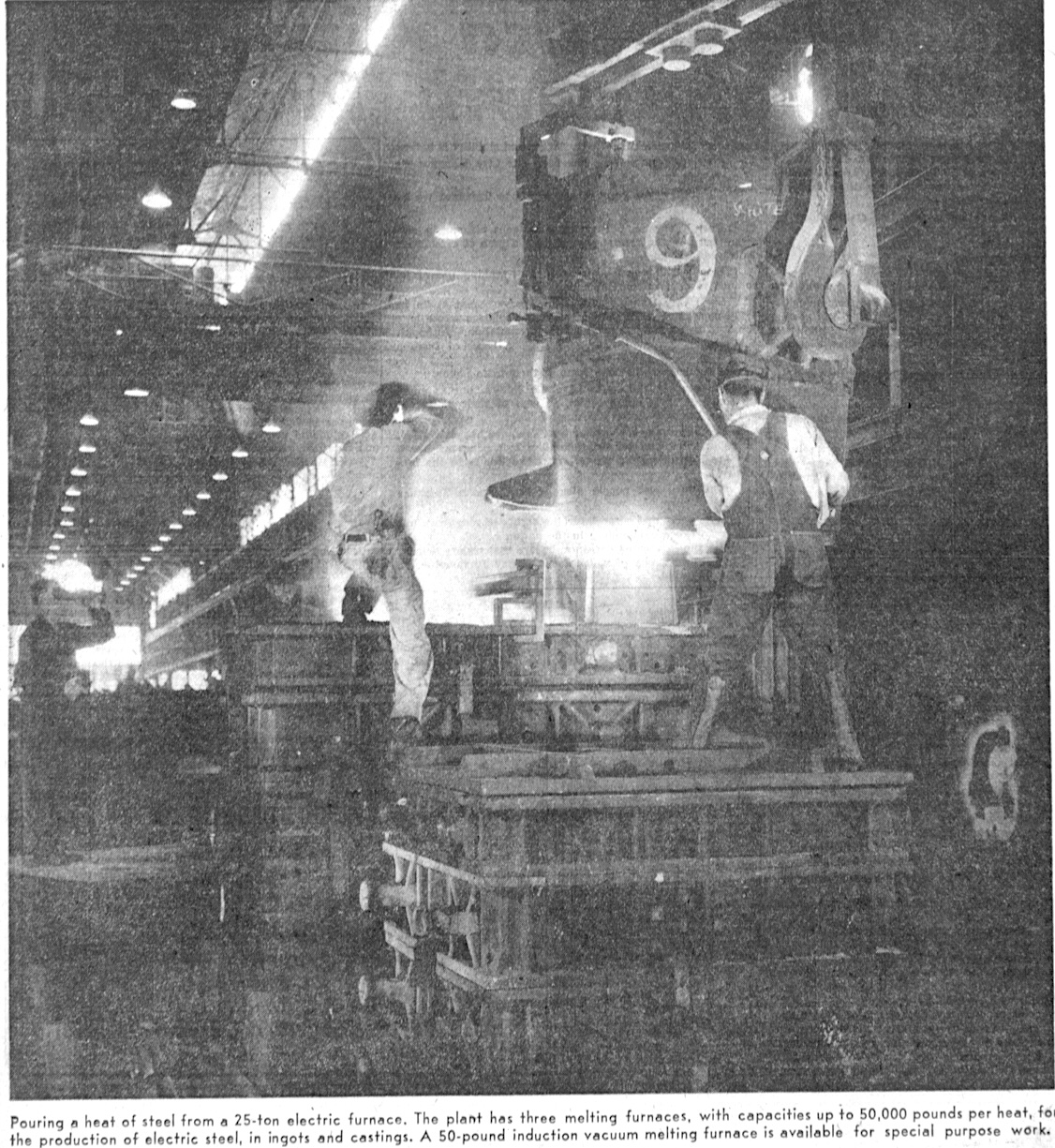
With the end of the war, National’s defense operations subsided. During the 1950s, the company became the world’s largest manufacturer and distributor of oil drilling equipment, employing more than 1,500 workers.

In early January 1958, National’s board of directors unanimously voted to merge with MIddletown, Ohio-based Armco Steel Corp., then the seventh largest steel producer and the 43rd largest company in general in the U.S.

After the merger went into effect a few weeks later, the company became known as the National Supply Division of Armco. Together with the U.S. Steel plant and the Bethlehem Steel fabricating operation, National Supply had turned Torrance into one of California’s major steel manufacturing centers during the 1960s.

Torrance Press, April 25, 1957, Page 4. (Credit: Torrance Historical Newspaper and Directories Archive database, Torrance Public Library).

But the 1970s and 1980s were less kind to the steel industry. Downturns in the production of steel and, more tellingly, an increased reliance on foreign oil and the resulting slump in domestic oil drilling and production took a toll on plant operations.

The National Supply buildings were razed shortly afterward, and were replaced by a large industrial park that currently occupies the site. (The U.S. Steel plant had been converted into an industrial park a decade earlier.)

By 1985, the National Supply Division of Armco Steel had reduced its workforce to 230 employees. That October, Armco announced plans to close it and a sister plant in Houston. Finally, on Feb. 28, 1985, with its employee pool down to just 100 or so people, the Torrance National Supply plant was shuttered for good after more than 70 years of operation.

The redevelopment of the site marked the continuing gradual shift from Torrance’s position as a center for heavy manufacturing to more technology-based industries.

Company officials pose in front of the under-construction Union Tool Co. in the fall of 1912. (Daily Breeze file photo)

Sources:

Daily Breeze archives.

Historic Torrance: A Pictorial History of Torrance, California, by Dennis F. Shanahan and Charles Elliott Jr., Legends Press, 1984.

Los Angeles Times archives.

Torrance Press Herald archives.

Torrance Herald ad, Dec. 28, 1944, Page 2-B. (Credit: Torrance Historical Newspaper and Directories Archive database, Torrance Public Library).

Pann’s restaurant survives as one of a dying breed of Googie-style eateries

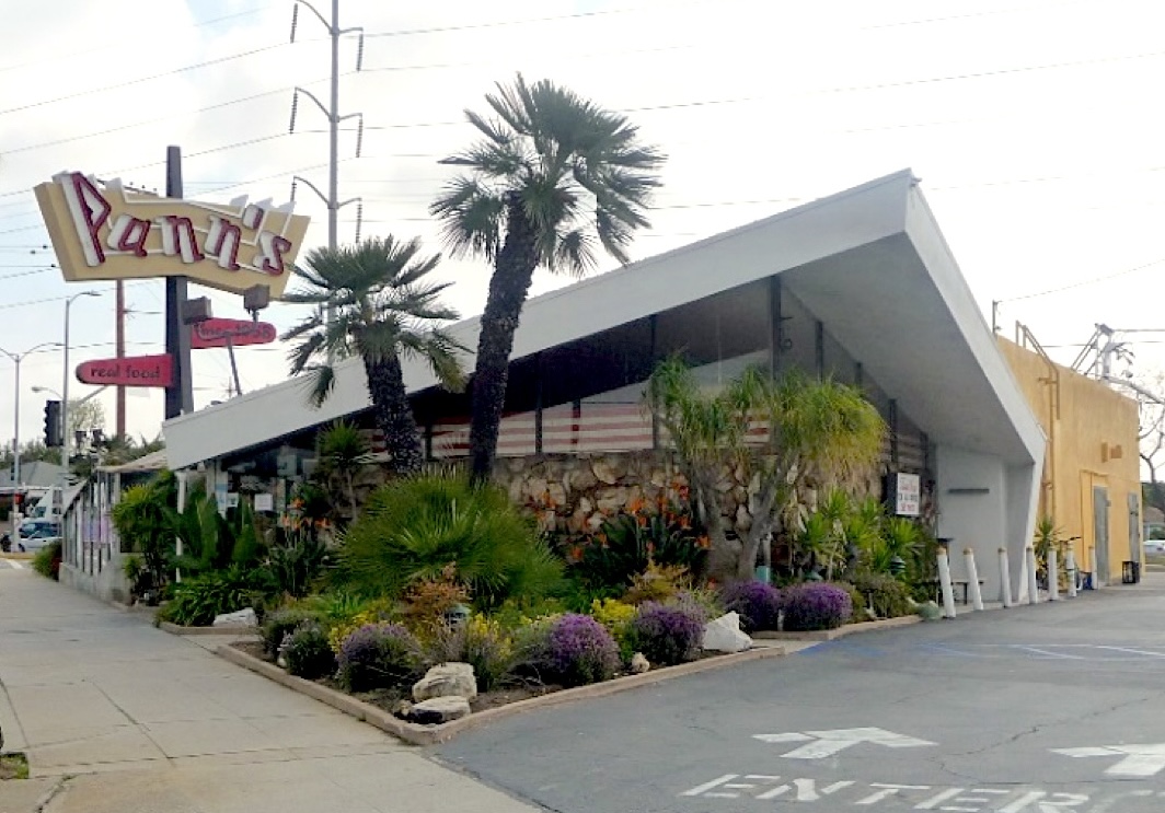
Pann’s restaurant at La Tijera and La Cienega boulevards opened in 1958 and is considered a classic example of the Googie style. Undated photo circa 2016. (Credit: SurveyLA, Los Angeles Historic Resources Survey website)

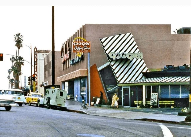
The Googie style of mid-century modern architecture got its name from Googie’s Coffee Shop, a Hollywood diner built in 1949. Architect John Lautner designed the building at the corner of Sunset and Crescent Heights boulevards, right next to Schwab’s drugstore.

Lautner’s creation sported wildly angular roofs, giant glass walls, dayglo-bright neon signage and modernist interiors. All of these characteristics would come to be considered as typical elements of the fanciful Atomic Age-based Googie style, which also is known by the less colorful name of Coffee Shop Moderne. Sadly, the original Googie’s was demolished in 1988.

Architects Louis Armet and Eldon Davis picked up on Lautner’s ideas not long after forming their Santa Monica firm, Armet & Davis, in 1947. (When Victor Newlove became partner in 1972, the firm adopted its current name, Armet Davis Newlove.)

The original Googie’s Coffee Shop in Hollywood, right, designed by John Lautner. Undated photo circa late 1950s.(Credit: MCM blog)


s

The partners soon found a niche in designing diners and restaurants. Some were relatively conventional in design, such as Bob’s Big Boy and Denny’s. Others, such as Ships, Holly’s, The Wich Stand and some Norm’s locations, were full-on Googie in character. But all of them had some elements of the inventiveness and kitsch that became Armet & Davis hallmarks.

I wrote in 2019 about The Wich Stand at 4508 W. Slauson Ave., which is located about a mile and a half northwest of Pann’s. The restaurant, a favorite 1960s cruising haunt once frequented by Beach Boy Brian Wilson, closed in 1988. The building was saved, however, and has been transformed into the architecturally toned-down Simply Wholesome restaurant and health foods store.

Holly’s in Hawthorne became renowned after it closed when Quentin Tarantino used it as a film location for the opening scene in “Pulp Fiction” (1984). The film’s popularity inspired a brief reopening of the restaurant, but it closed shortly afterward. The building was razed and is now an Auto Zone store.

Developers also came for the landmark Ships restaurants in Westwood, Culver City and Los Angeles, the various Coffee Dan’s locations and many other restaurants designed by architects such as Lautner and Armet & Davis that are no more. Fortunately, Chips in Hawthorne continues to operate.

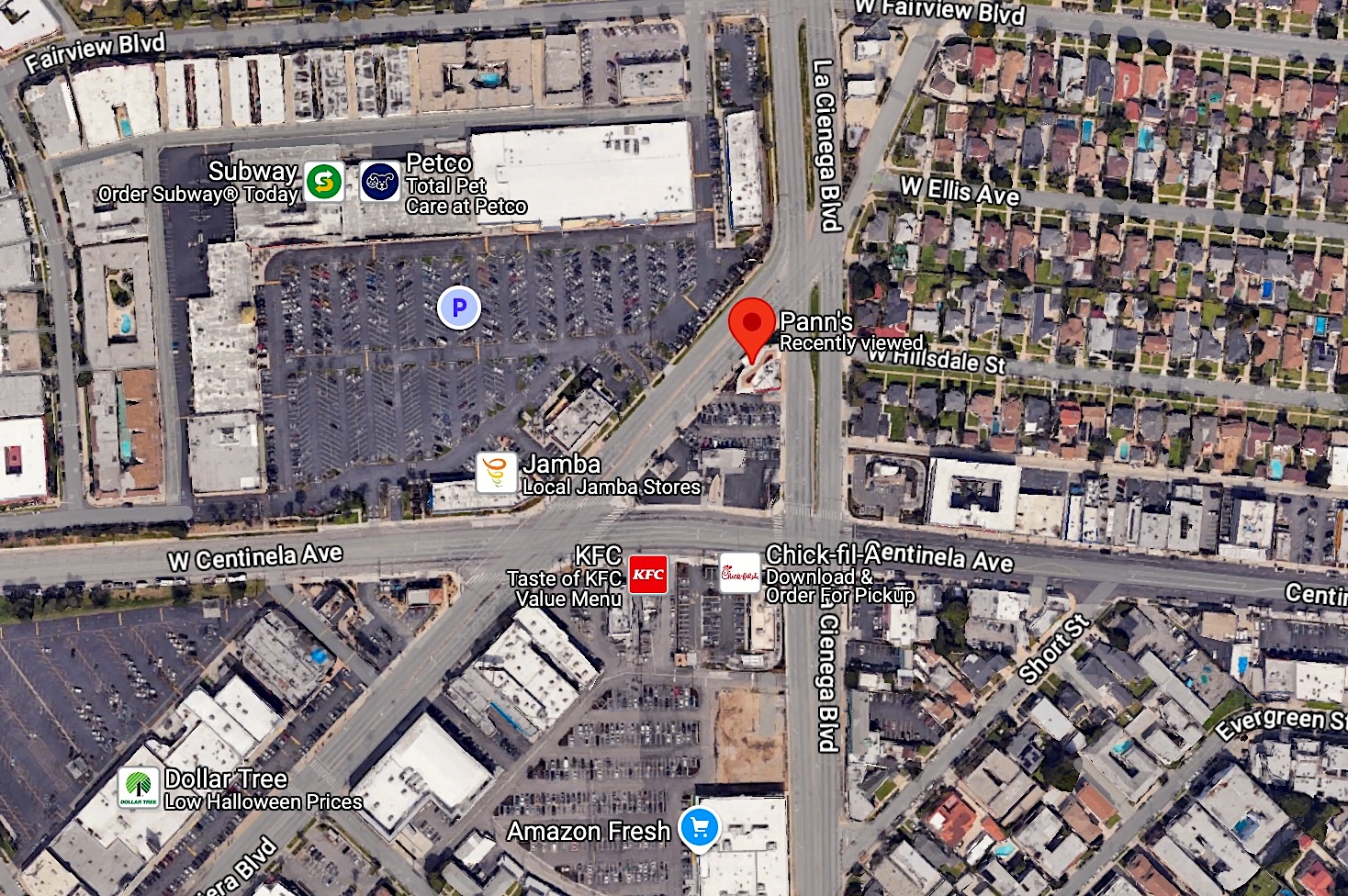
And Pann’s survives. The distinctive building is situated on a small triangular island of land at the intersection of La Tijera and La Cienega boulevards. Technically, it’s part of the City of Los Angeles, though various sources describe its location as being in Westchester, Ladera Heights and Inglewood, all of which are nearby.

Pann’s restaurant, center with red marker, is located in the City of Los Angeles, just north of Inglewood. 2024 image. (Credit: Google Earth)

In fact, Pann’s is close enough to Inglewood that the city launched an attempt in 1978 to annex a 62-acre portion of L.A. City land on its northern border that included it, but the bid failed.

Armet & Davis had already designed several Googie-inspired restaurants when they took on the Pann’s project in 1957. The land was owned by McCulloch Motors, which leased it to the restaurant’s husband-and-wife owners, George and Rena Panagopoulos. They later shortened the last name to Poulos. (The couple also owned Holly’s.)

Poulos, a Greek immigrant, learned how to cook while serving as a chef in the U.S. Air Force during World War II, and worked in several Los Angeles-area restaurants before starting his own.

Construction of the 4,000-square-foot building at 6710 La Tijera Blvd. began in July 1957. The estimated cost of the project was put at $150,000. Pann’s opened its large glass doors to the public in 1958.

Armet & Davis employee Helen Liu Fong is credited with the restaurant’s design, working together with Eldon Davis. Its exterior features a large neon sign with “Pann’s” in distinctive lettering, a sharply cantilevered roof section, and palm trees and tropical vegetation inside and out.

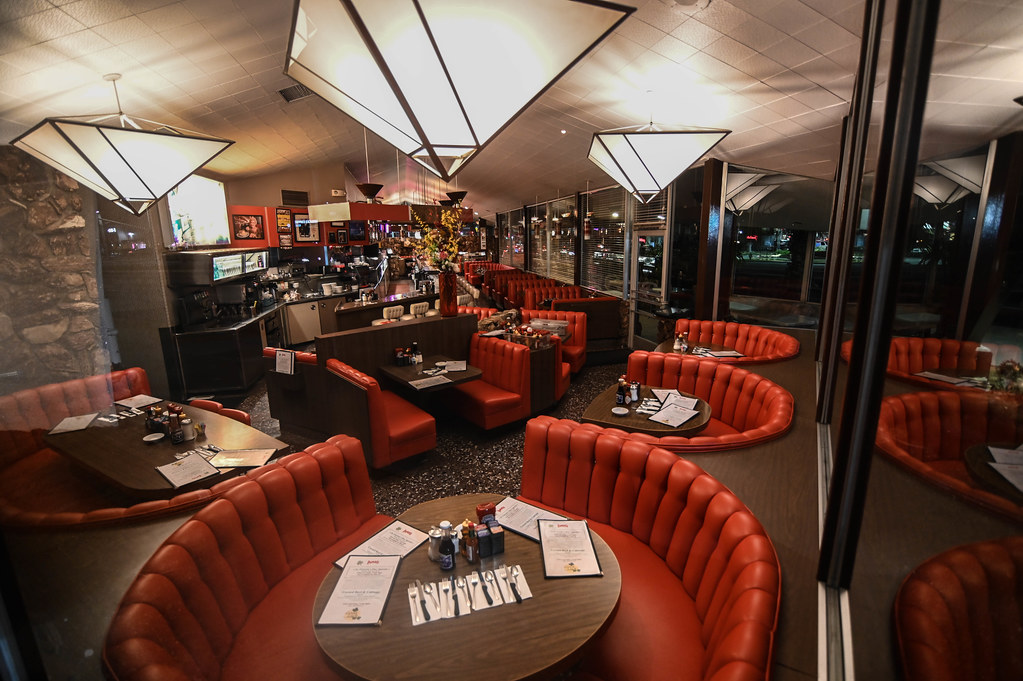
Interior photo of Pann’s restaurant, featuring red leather booths and large glass windows. Undated. (Credit: Windsor Square – Hancock Park Historical Society website)

Its interior has bright red leather booths in addition to a long lunch counter. The walls are mostly glass, along with flagstone. Planters filled with lush foliage are plentiful, giving the restaurant a tropical feel.

The charm of its retro design has been kept intact through the years. Jim Poulos, son of the original owners, completely restored the restaurant to its original form in 1993, and won a Conservancy Preservation Award from the Los Angeles Conservancy for his efforts.

Its menu certainly has been updated over the years, but it still features staples of diner fare such as hamburgers and chicken dishes. Pann’s stopped serving dinners in 2016, and now serves breakfast and lunch until 3 p.m. daily.

Its ambitious and audacious look continues to recall the anything-is-possible optimism of an earlier era. 

Author Alan Hess wrote in his definitive guide Googie: Fifties Coffee Shop Architecture (Chronicle Books, 1985) that Googie-style restaurants such as Pann’s “told us about ourselves by showing us in full scale and three dimensions what we once thought our future would look like.”

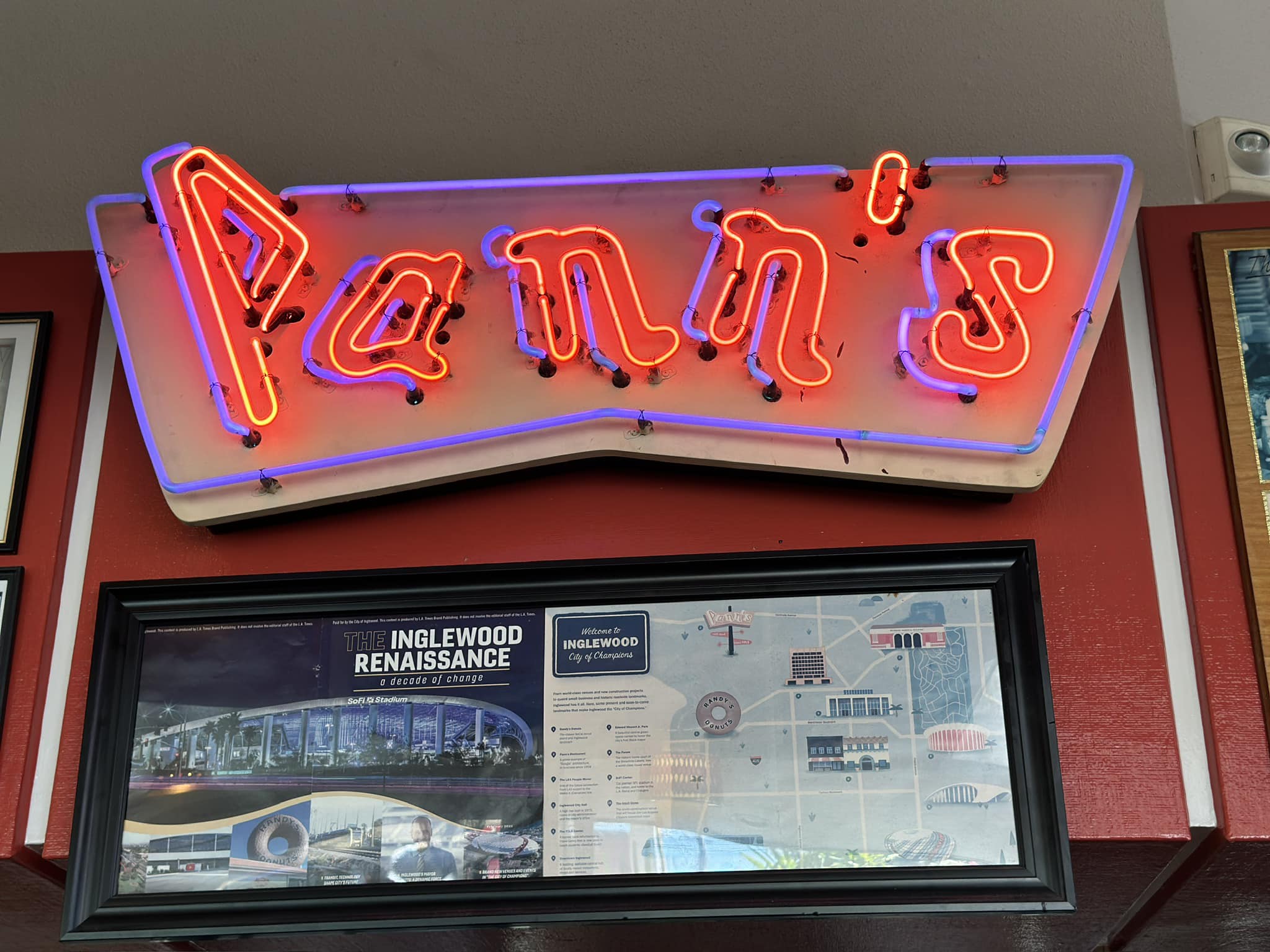
Neon sign adds color inside Pann’s restaurant. 2023 photo. (Credit: Pann’s Facebook page)

Sources:

Daily Breeze archives.

Googie: Fifties Coffee Shop Architecture, by Alan Hess, Chronicle Books, 1985.

“Googie Coffee Shops,” by Austin, Mid-Century Mondays website, July 1, 2024.

Los Angeles Times archives.

“Pann’s Coffee Shop,” Los Angeles Conservancy website.

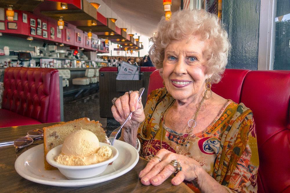
Pann’s co-founder Rena Poulos with dessert at Pann’s restaurant. She died in 2017 at 100. Undated photo. (Credit: Legacy.com website)

Comments:

From Cynthia Dunbar:

Your article made it sound like Chips on Hawthorne Boulevard is no longer around, but it’s definitely still in operation and has a lot of the same original design charm. I just ate there on Saturday morning and would love to see continued business for them.

Also, a commercial was filmed there within the last couple years or so:

Cynthia,

Thanks for the correction. I’ve fixed the blog accordingly.

Sam

Trading stamps once were all the rage in suburban South Bay and Harbor Area households

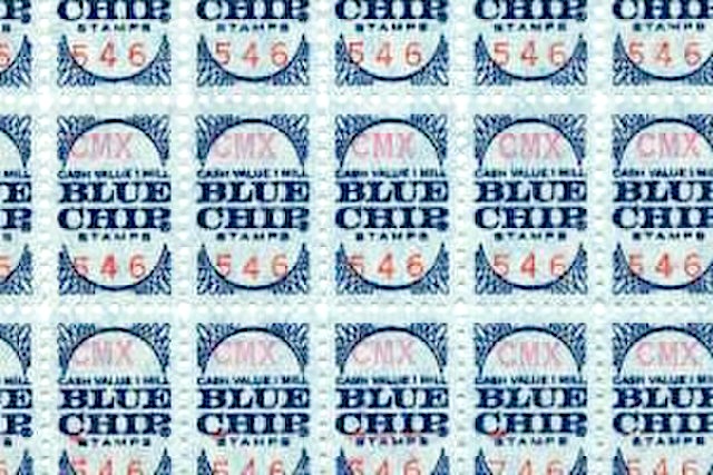
Blue Chip stamps were introduced in 1960. Undated photo. (Credit: Wikimedia Commons)

These days, we earn Starbucks bonus stars, Target Circle rewards and a host of other loyalty programs directly from individual retailers. Though they existed then, such programs were less commonplace during the mid-1900s, when trading stamp businesses were in their heyday.

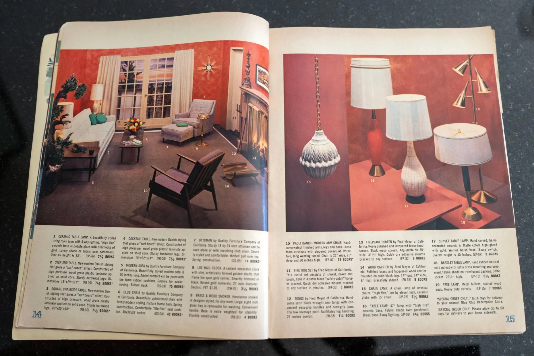
Retailers signed up with various trading stamp companies and gave out stamps to their customers based on the amount of money they spent in their stores. Consumers collected the physical stamps and pasted them in savings books that could then be exchanged for merchandise at redemption centers operated by the stamp companies.

Retail trading stamps were introduced in the early 1890s originally to reward shoppers who made their purchases using cash instead of credit. In 1896, the Sperry & Hutchinson Co. became the first independent trading stamp company, signing up a wide range of retailers to offer its S&H Green Stamps to their customers.

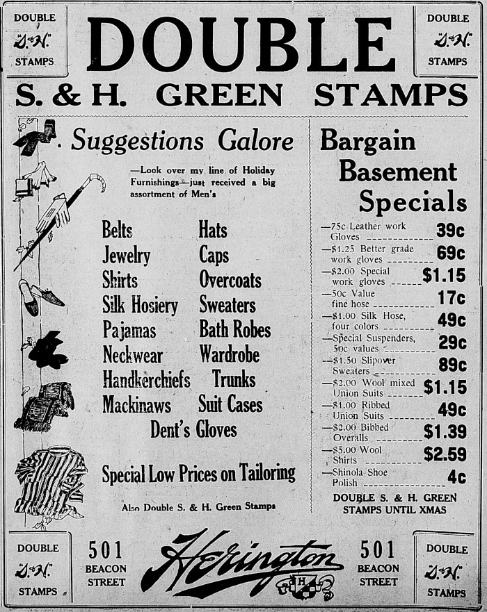
San Pedro News Pilot clothing store ad offers S&H Green Stamps. Dec. 2, 1921, Page 5. (Credit: San Pedro News Pilot archives)

Green Stamps, issued mostly by grocery stores and gas stations, proved popular among consumers. Other companies, including Gold Bond Stamps (founded in 1938), began entering the business. Under the Gold Bond plan, a complete stamp book could be turned in at participating Torrance merchants in order to receive a $3.00 reduction off store purchases.

Interest in the trading stamp programs soared following the end of World War II and the rise of the suburbs. Middle class families viewed the stamps as a way to get “free” household goods and other products from trading stamp redemption stores.

Family members would be enlisted to aid in the licking and pasting of stamps in books. The stamp companies widely distributed free catalogs, which were pored over intently, and the stamp books also were free and widely available.

Pages from a Blue Chip Stamps merchandise catalog. Undated, circa late 1960s. (Photo by Hans Gutknecht, Los Angeles Daily News)

Competition among grocery stores and other retailers became fierce, with some offering double and triple trading stamps in order to lure customers.

During the 1950s, S&H Green Stamps, which still dominated the market,  announced that it was printing more stamps annually than the U.S. Post Office. According to a 1957 Gallup Poll, 33 million American households, two out of every three, were saving trading stamps.

Blue Chip was headquartered in Los Angeles, and began by opening five redemption centers, including one in Westchester and another in Long Beach. It promised to have at least 50 redemption centers open by the end of that year.

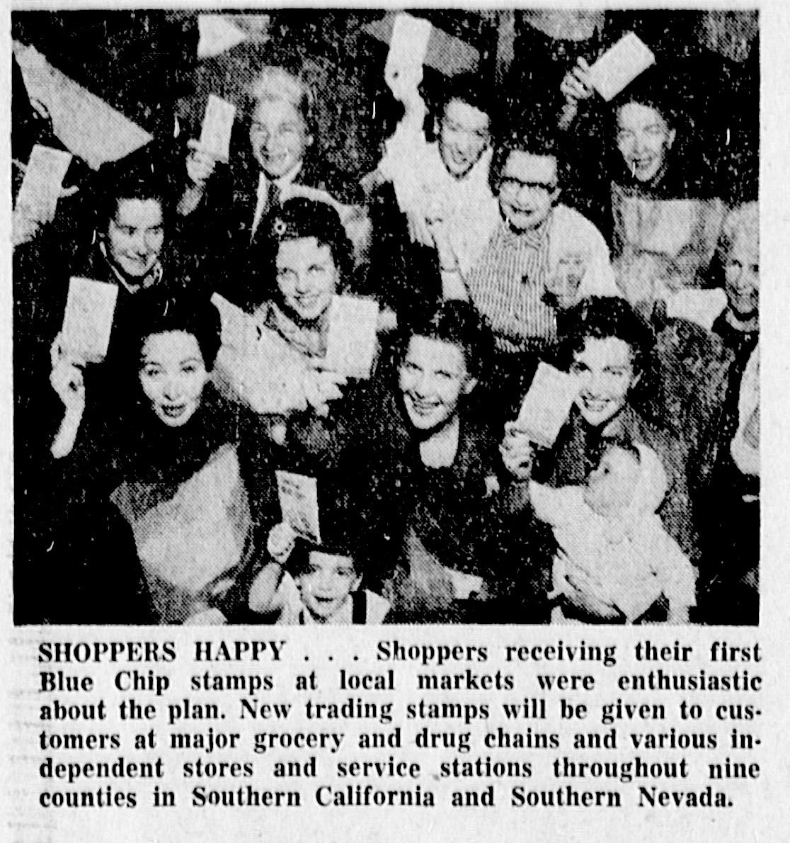
In Southern California, Green Stamps began to face serious competition starting on Jan. 4, 1960, when a coalition of chain grocers, drug stores and other retailers announced the formation of the Blue Chip Stamp Company cooperative venture and began distributing its stamps.

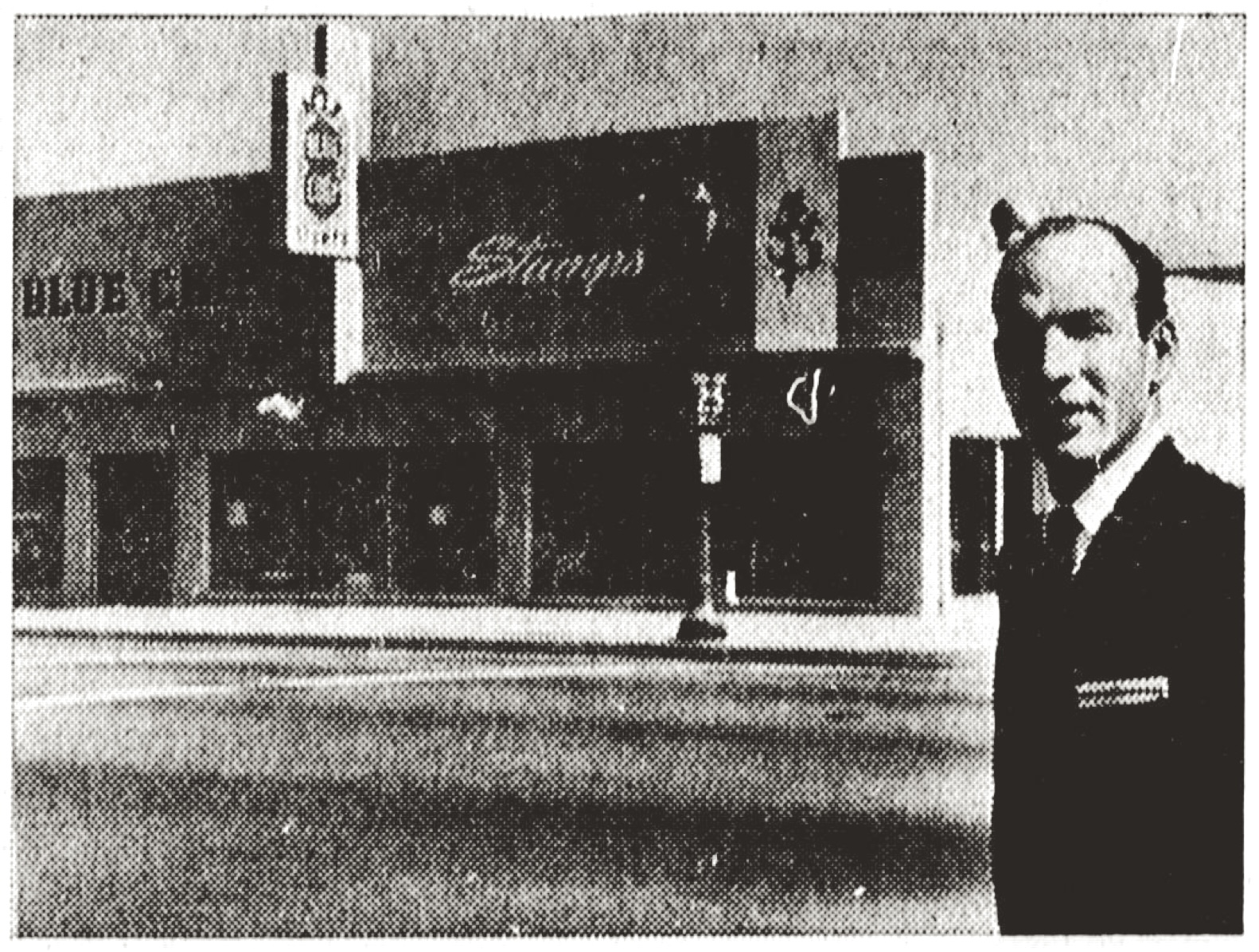
Manager Robert Burns stands outside the new Blue Chip Stamps redemption center in Torrance. Torrance Herald, June 30, 1960, Page 45.(Credit: Torrance Historical Newspaper and Directories Archive database, Torrance Public Library)

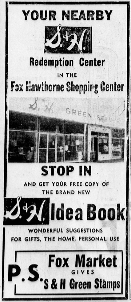
By June 1960, a Torrance Blue Chip redemption center had opened at 2153 Torrance Blvd. in a building which now houses a carpet store. Down the street, at Torrance and Hawthorne boulevards, an S&H redemption center had opened in the shopping center near the northeast corner of the two major boulevards.

Torrance Herald, May 11, 1961, Page 36. (Credit: Torrance Historical Newspaper and Directories Archive database, Torrance Public Library).

The 1950s and 1960s proved to be the boom years for trading stamp companies. Some merchants objected to them, claiming they were too costly and cumbersome to administer. A group of independent Torrance gas station owners stopped offering the stamps for a while in July 1960, but they were swimming against the tide. Everyone seemed to be handing out the stamps.

Families weren’t the only ones who used trading stamps. They became popular fundraising tools for churches, social clubs, schools and charities. Admission into South Bay and Harbor Area community benefits and galas at times required contributing a completed book of trading stamps along with or instead of the usual entry fee.

Several factors contributed to the precipitous decline of trading stamps beginning in the 1970s. Most service stations stopped offering them after the 1973 gas shortage. With long lines of cars waiting for hours for fuel, station owners no longer needed to pay for inducements such as trading stamps to attract customers.

Supermarkets also turned to other customer strategies. Some preferred to undercut competitors through lower prices and coupons rather than pay for trading stamp programs. As supermarket checkout systems became more automated, the markets began offering price discounts through membership programs instead.

Consumer ardor for amassing the pesky little stamps and pasting them in books had cooled considerably as well. By the late 1990s, most traditional merchant trading stamp programs had ceased operations.

Torrance Herald, Jan. 10, 1960, Page 8. (Credit: Torrance Historical Newspaper and Directories Archive database, Torrance Public Library)

Sources:

Daily Breeze archives.

Los Angeles Daily News archives.

Los Angeles Times archives.

San Pedro News Pilot archives.

Torrance Press Herald archives.

“The Trading Stamp Story,” by Jeff R. Lonto, Studio Z-7 Publishing website, 2000/2013.

Wikipedia.

Torrance Herald, April 28, 1960, Page. (Credit: Torrance Historical Newspaper and Directories Archive database, Torrance Public Library)

Comments:

Sept. 30, 2024

Just read your article about Blue Chip and S&H Green Stamps and thought you should know that we are bringing back the iconic S&H Green Stamp program , now digital! We are just getting started and are excited to carry on the legacy of what S&H Green Stamps meant to so many!

Check us out – Https://mygreenstamps.com

Carl Norloff, S&H Green Stamps CEO

El Segundo takes its time to create a splendid setting for its public library

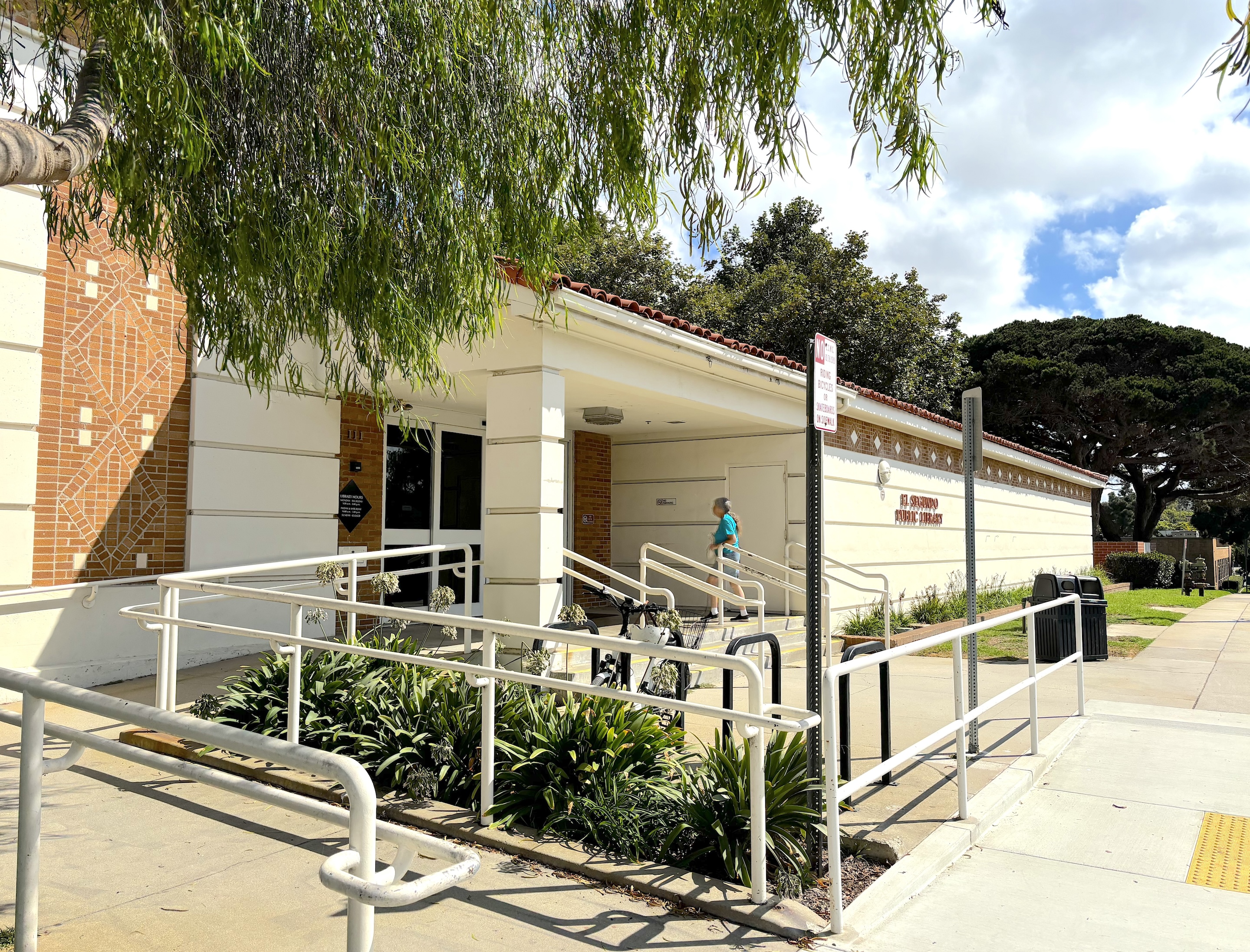
The El Segundo Public Library opened on the northeast corner of Richmond St. and Mariposa Ave. in 1948. (Sept. 2024 photo by Sam Gnerre)

The Standard Oil Company of California essentially created the city of El Segundo when it opened its massive refinery there in late 1911.

The company had purchased Frank Bennett’s 840-acre farm in June 1911 after its Richmond refinery in the Bay Area had reached its production capacity. I

Standard, now known as Chevron USA, put Pennsylvania oilman R.J. Hanna in charge of the project, and his wife got credit for naming the site “El Segundo,” Spanish for “the second,” with the Richmond refinery being “El Primero,” the company’s first California refinery.

The town grew up quickly around the refinery. At the time its incorporation became official in 1917, it had many services already in place. The first grammar school and church had been founded, a volunteer fire department had been formed, and R.W. Jackson had been named the town marshal.

In addition, a branch of the Los Angeles County library had been established in the El Segundo Hotel, built in 1911. Virginia Fitzgerald served as the town’s first  librarian, receiving $10 per week for her services.

The El Segundo Public Library in Library Park as shown on the El Segundo Herald front page of Jan. 8, 1948. (Credit; El Segundo Herald archives)

The library grew along with the town. In 1918, it was moved to a room in the new City Hall. This would turn out to be a temporary solution, as the city’s population would soon outgrow the one-room library.

Even at this early date,  the city had started looking toward replacing the County Library branch with its own independent library. It took a while, but that change became official in September 1930, when a new El Segundo Library opened at 123-125 W. Grand Ave. with a collection of 1,400 books. 

At the grand opening, Mayor George Love told the El Segundo Herald that, while happy with the newly independent library, the city still hoped to build a bigger and more permanent building to house it.

Three years later, the library moved once again, this time into the new Converse building down the street at 204-206 W. Grand.

During this same time frame, improvements were being made to lower-case “library park,” the informal name for 3.35 acres of greenery across Main St.. from El Segundo High School, which had opened in 1927.

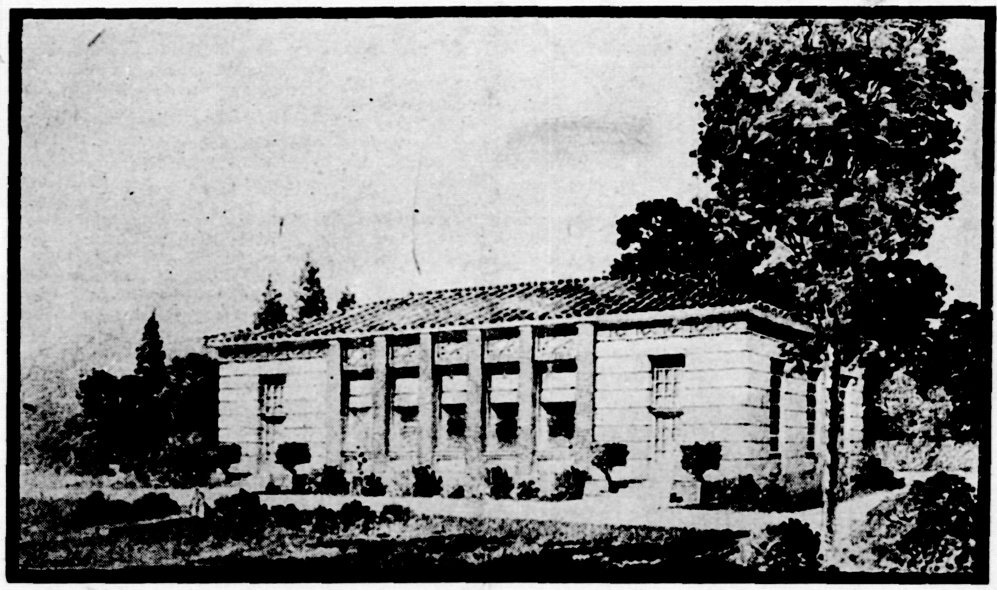
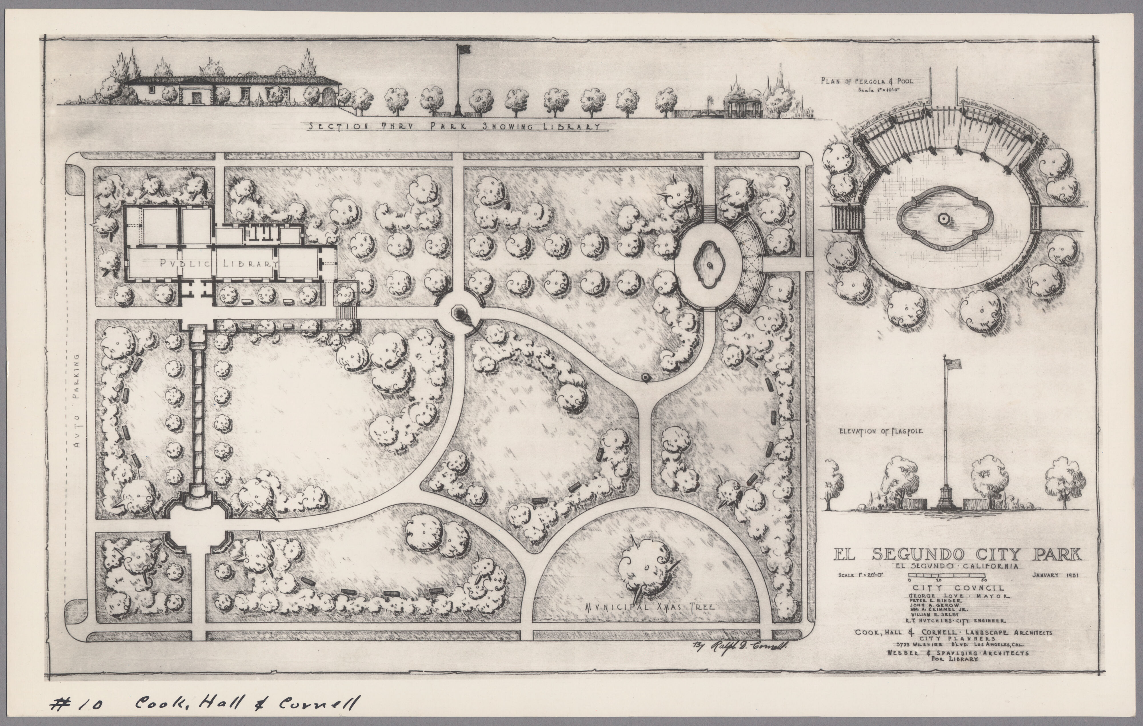
This rendering shows the planned layout for “El Segundo City Park,” later renamed Library Park. The library itself is placed at top left. (Credit: UCLA Library, Special Collections archive)

A 1931 envisioning of what was rather generically called “El Segundo City Park” drawn up by the Webber & Spaulding architectural firm shows the proposed layout, with the new library holding down its southeast corner. It also shows a pergola, centralized flagpole and the site of the “Municipal Xmas Tree.”

But the city’s plan to build its once-and-for-all library didn’t begin to gather steam until 1935, when the El Segundo School District, owners of the land, deeded it to the City of El Segundo for $10. Once that transaction had taken place, plans for the new library began in earnest.

Construction of the single-story structure began in 1939 under the aegis of the National Youth Administration, a jobs-oriented New Deal agency begun under the WPA (Works Progress Administration). Like so many other activities in American life, the project had to be halted before completion due to the outbreak of World War II.

During the war, its unfinished sections were boarded up and the building was used as a control center for the Civilian Defense Control (CDC) public security agency.

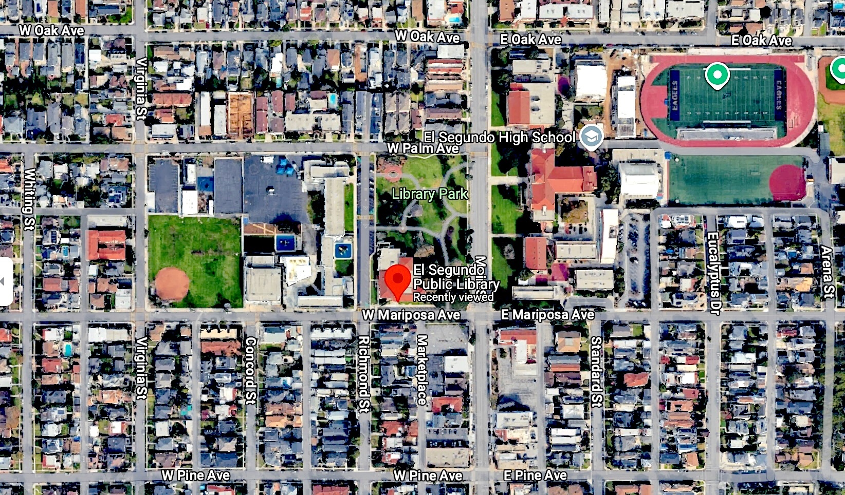
The El Segundo Public Library, center, red dot, is in Library Park, is located across Main St. from El Segundo High, right, and Richmond Street School, left. 2024 image. (Credit; Google Earth)

It stood empty for a couple of years following the war’s end while financing and construction were put back on track by the city. After the city council authorized the funding, work on the building resumed in early 1948.

The Los Angeles-based architectural firm of Austin, Field and Fry provided the final design of the single-story building, which featured a 25-by-80-foot main reading room.

The long wait for a new free-standing library finally ended with the grand opening of the building on the corner of Richmond St. and Mariposa Ave. on Aug.16, 1948. The city designated Aug. 16-21 as public library week in honor of the occasion.

The library has been a fixture in the city ever since. It has been remodeled and expanded several times over the years. During an 8,000-square-foot addition that was finished in 1964, the staff and collection had to move into and operate from nearby Richmond Street School.

Another expansion that more than doubled the library’s floor space was proposed in 1983 and received final approval in 1989. The project entailed adding an entire new wing to the building, more than doubling its total floor space. Construction began in 1990, and the expanded library opened  in March 1992.

Last year, the library, still going strong, marked 75 years at its present location.

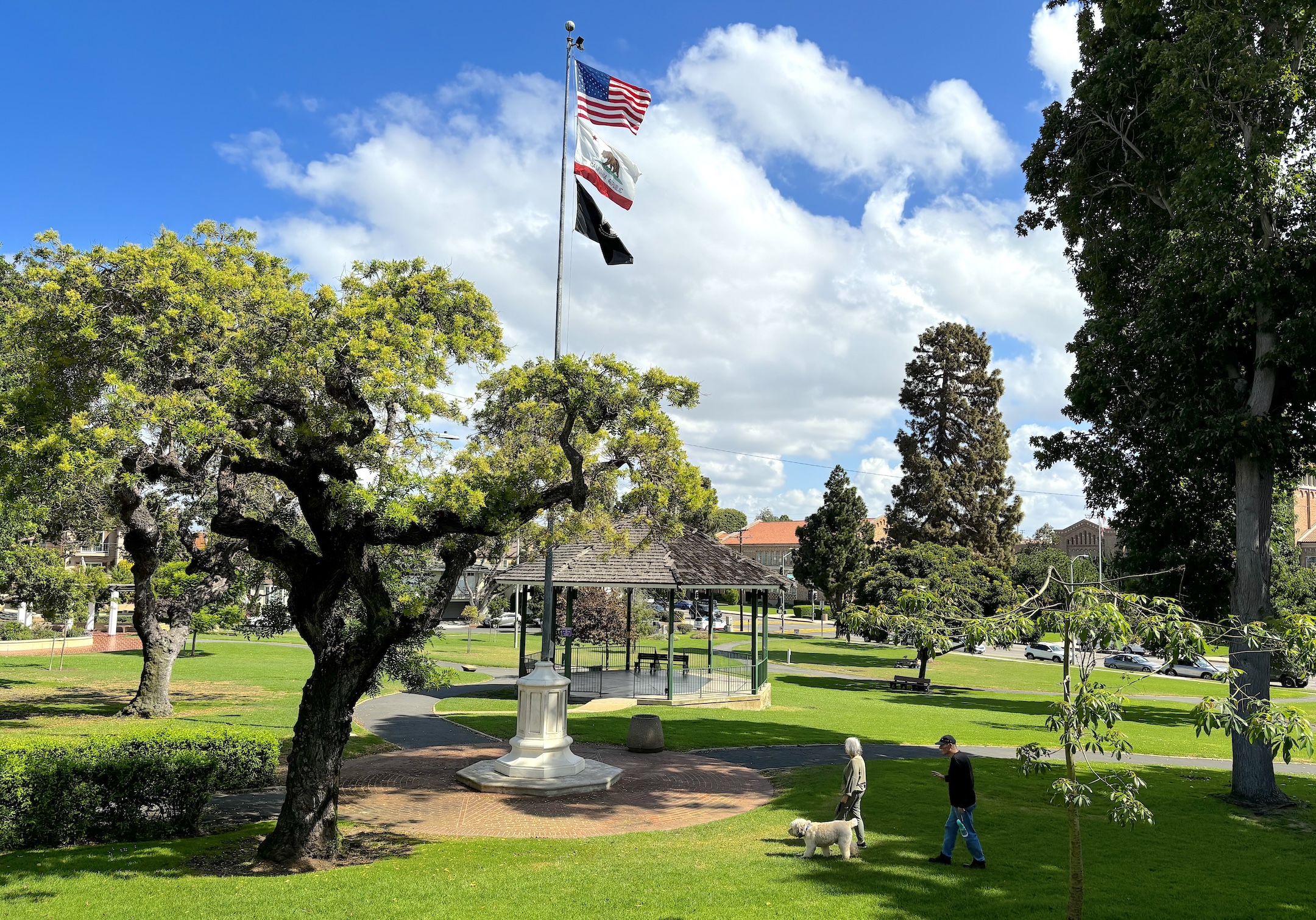
Library Park as seen from rear of El Segundo Public Library, looking east toward El Segundo High. (Sept. 2024 photo by Sam Gnerre)

Sources:

Daily Breeze archives.

El Segundo Herald archives.

El Segundo: Seventy-Five Years: A Pictorial History of El Segundo, California, by Eileen Curry Hunter, H2 Limited Publishers, 1991. 

Los Angeles Times archives.

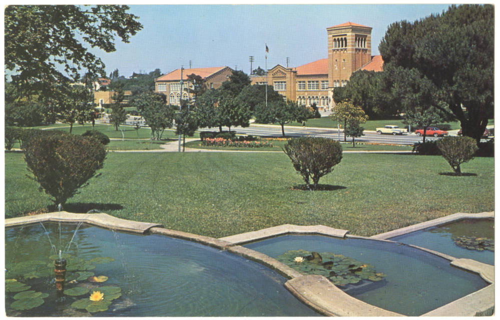
1959 postcard shows El Segundo’s Library Park, with El Segundo High School across Main St. in background. (Credit: CSUDH Digital Archives)

Wilmington Airport underwent a startling transformation in 1958

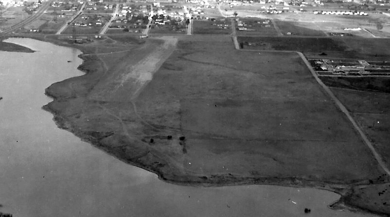
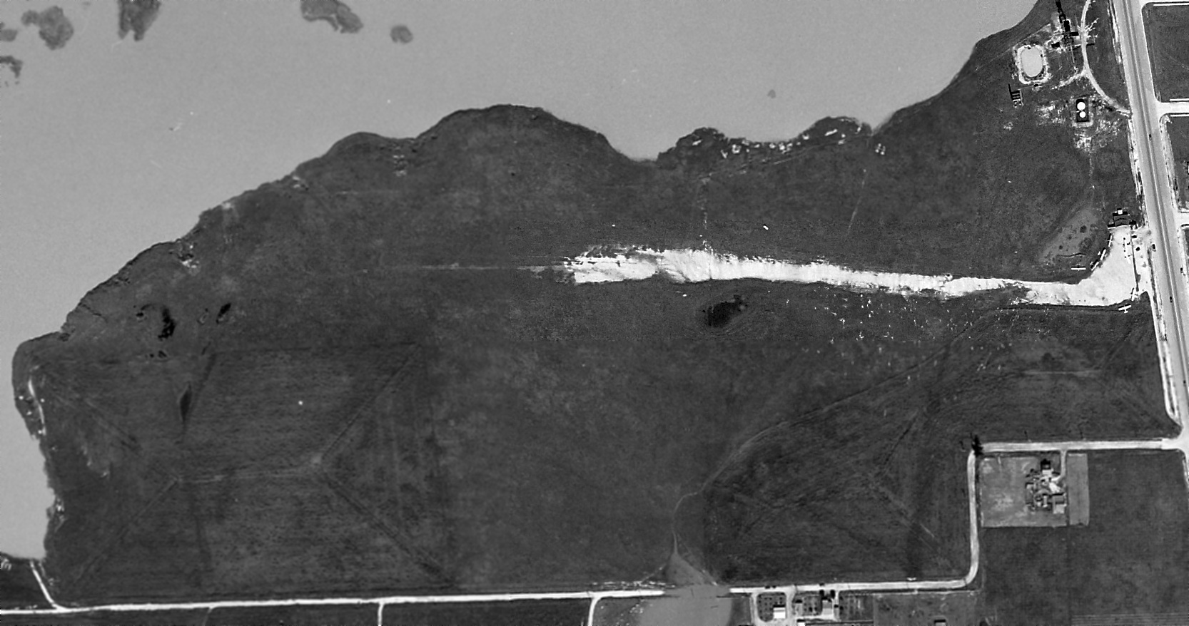
A circa 1938-41 aerial view looking east at Wilmington Airport shows the east/west unpaved runway. Bixby Lake, later renamed Machado Lake, is at left. Figueroa St. runs left to right just above the airstrip. Photo courtesy Buzz Tupman. (Credit: Abandoned & Little Known Airfields website)

My recent post about Bay Cities Airport, a long-gone airfield in north Torrance, tipped me off to the presence of another one-time local airport further south in Wilmington.

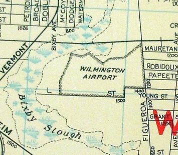
The Wilmington Airport opened in 1929 on roughly 80 acres of land west of Figueroa and L streets.The land was adjacent to Bixby Lake and the larger Bixby Slough, an untamed body of water whose size varied with the weather. Fortunately, the airport land was elevated, had good drainage and was not susceptible to flooding.

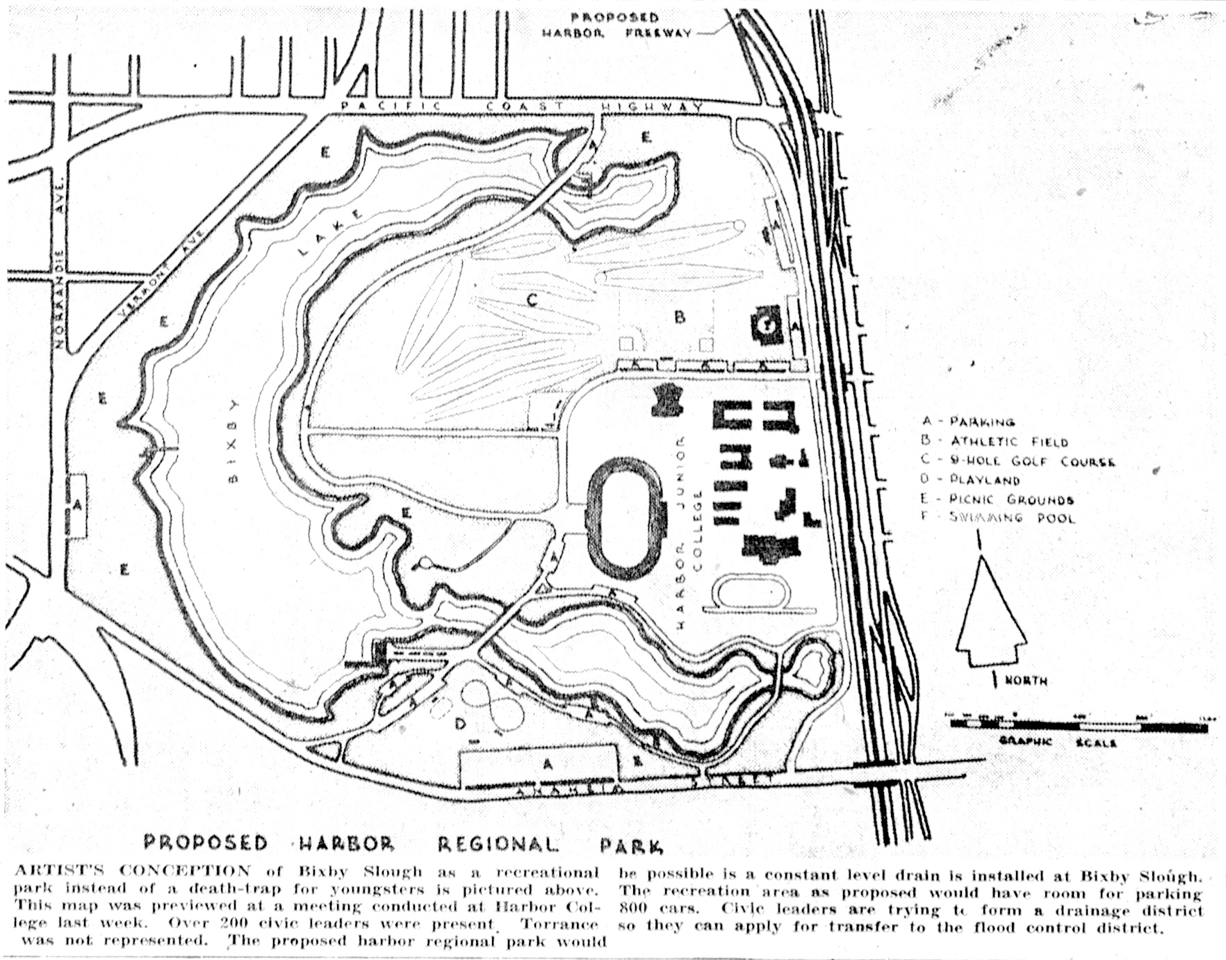
Flooding at the slough and its wetlands would be a huge problem until the mid-1960s, when the Dominguez Channel flood control project was completed. By then, Bixby Lake had been renamed Machado Lake and had become part of Harbor Regional Park.

A 1940s map locates Wilmington Airport between Bixby Slough and Figueroa St.(Credit: Abandoned & Little Known Airfields website)

But all of that was barely a gleam in the eyes of Los Angeles city planners when Wilmington Airport was officially dedicated in late July 1929, roughly six weeks after it had opened to flyers in early June.

George Matteson was in charge of the facility, which was the home of the Wilmington Aerial club. The new airport also included a 17-member flight school operated by Bob Eccles. 

The small airport had few amenities. Its airstrip was unpaved, and it only had one small hangar.  It continued to operate as part of the informal network of small Los Angeles-area airfields until late July 1937, when the Carson Oil Co., the owner of an oil lease on the property, thought it detected a possible strike and closed the airport while it conducted a test drill..

It turned out to be a dry hole. The drilling equipment was dismantled, and the airport reopened for business In early October 1937.

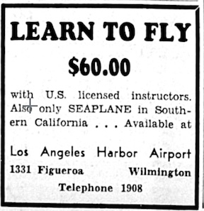
San Pedro News Pilot ad, Oct. 27, 1941, Page 5. (Credit: San Pedro News Pilot archives)

It would soon close again, this time for a longer stretch, following the Japanese attack on Pearl Harbor on Dec. 7, 1941. When news of the attack broke, all civilian planes were grounded by the Civil Aeronautics Administration, predecessor of the FAA.

Airport manager Stanley Woodman told the San Pedro News Pilot at the time that 12 airplanes, two of them seaplanes, were based there. In addition, he noted that more than 50 student pilots were then learning to fly at Wilmington Airport. Woodman took on a new role during the war, flying military planes from the airfield to battle zones all over the world.

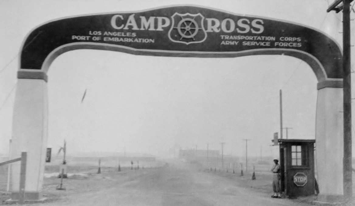
The U.S. Army had taken possession of the field as part of the sprawling Los Angeles Port of Embarkation facility, known informally as Camp Ross, from which thousands of soldiers were shipped overseas to fight in World War II.

Part of Camp Ross consisted of a military encampment that was built on land just south of the former airport. These barracks housed a variety of occupants: troops stationed in the area, Army personnel headquarters, the Women’s Army Corps (WACS), and, for a time, foreign prisoners of war.

Entrance to Camp Ross in Wilmington. Undated photo. (U.S. National Archives)

Barracks were also built on the airport site itself. Some were used for housing, while others provided entertainment and services for troops onsite. The former airport hangar was transformed into a post exchange and recreational building.

When it closed after the war, the various barracks were used for veterans’ housing, accommodating about 500 families. That arrangement was temporary, and ended when the Los Angeles Board of Education bought the land south of the airport to use as the location for its new junior college, Los Angeles Harbor College. The school opened in September 1949.

Recommendations to reopen and upgrade Wilmington Airport were made by the CAA in 1944, which proposed spending $342,000 on the project, and by the Los Angeles county planning commission in October 1945.

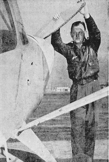
Robert Wyckoff at Wilmington Airport. San Pedro News Pilot, Dec. 29, 1948, Page 5. (Credit: San Pedro News Pilot archives)

No action was taken immediately on the proposals. Enter former Air Force lieutenant Robert H. Wyckoff, who had taken over management of the field after the military returned the land to its owners in 1947. Wyckoff was determined to reopen the airport.

Unfortunately for Wyckoff, the city of Los Angeles had rezoned the parcel as restricted residential land in 1946. It had been formulating plans for a large recreational park that would include Bixby Lake and the surrounding lands that were being reclaimed from Bixby Slough.

A court battle ensued. On Nov. 30, 1948, the courts ruled in favor of Wyckoff, who had presented a letter during the trial from the city planning department authorizing him to re-establish the airfield.

Wyckoff began airport operations, but the city wasn’t done. It appealed the court ruling for months, claiming among other things that the presence of the airport would impair any plans to expand Harbor College, then under construction.

With no resolution to the dispute seemingly in sight, the city finally decided to just purchase the 80 acres of airport land outright from its owners in August 1949, putting an end to the court  battle and, eventually, to the airport.

Torrance Press, Nov. 1, 1951, Page 12. (Credit: Torrance Historical Newspaper and Directories Archive database, Torrance Public Library).

The city’s parks and recreations department announced various plans for recreational facilities on the former airport land, including a community swimming pool and perhaps a nine-hole golf course. No firm dates were given as to when these improvements would happen. All would be part of the proposed large park.

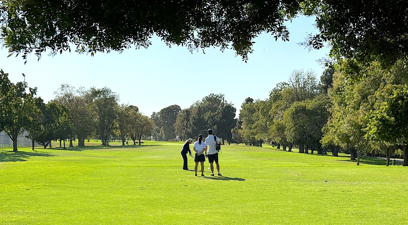
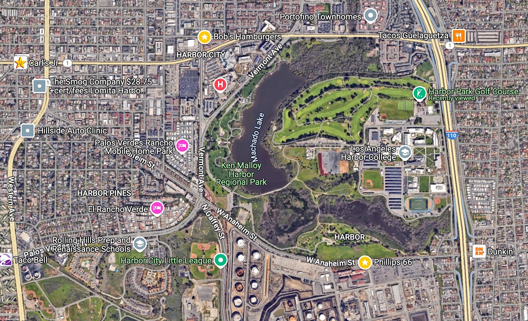
A few years later, on Oct. 12, 1958, the Harbor Park Golf Course opened for business on the former airport site. The nine-hole, tree-lined course designed by William F. Bell was lengthened in 1966. It remains one of the city’s most-played golf venues.

Harbor Regional Park, the fulfillment of the city’s desire to reclaim Bixby Slough as a public recreation area, was first dedicated in June 1971. It was renamed Ken Malloy Harbor Regional Park in 1992, and in 2017 reopened after major renovations.

Golfers tee off on the first hole at Harbor Park Golf Course in Wilmington on Sept. 9, 2024. (Photo by Sam Gnerre)

Sources:

 Abandoned & Little-Known Airfields website.

Daily Breeze archives.

San Pedro News Pilot archives.

The Southern California Golf Guide, by Daniel Wexler, MTIII Golf Media, El Segundo, 2017.

Torrance Press Herald archives.

Airplanes are barely visible at far right middle near Figueroa St. in this March 6, 1941 photo. L Street runs along the bottom. The dirt airstrip shows up as being white in color. (Credit: University of California, Santa Barbara archives)
Google Earth image shows the area as it appears in Feb. 2024. (Credit: Google Earth)

Reader comments:

Sam,

Just read your article online at DailyBreeze.com about the history of Wilmington Airport.

I had no idea that an airport even existed in my old hometown. Fascinating article!  I loved it.

Matter of fact, in the first black and white picture you included in the article circa 1938-41, you can see my old block where I grew up!  It’s so cool.  

I love reading about the history of Wilmington, it’s so rich and so gratifying to read.  Thank you for all of your hard work and effort in researching this article and writing about the old Wilmington Airport.

Enjoyed it so much.  Thanks again Sam!

Ray Samapaga

Redondo Beach

Community group gets blowback for staging blackface minstrel show in Torrance

Torrance Herald, Oct. 18, 1951, Page 9. (Credit: Torrance Historical Newspaper and Directories Archive database, Torrance Public Library).

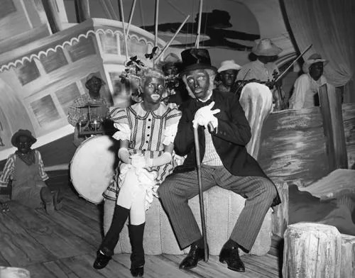
The sight of middle-class South Bay suburbanites donning blackface makeup in order to play roles in minstrel shows at the local high school auditorium benefit show seems wildly inappropriate by modern standards.

But it wasn’t considered unusual until the early 1950s, when a groundswell of disapproval arose from civil rights groups calling attention to the racial caricatures present in minstrel shows.

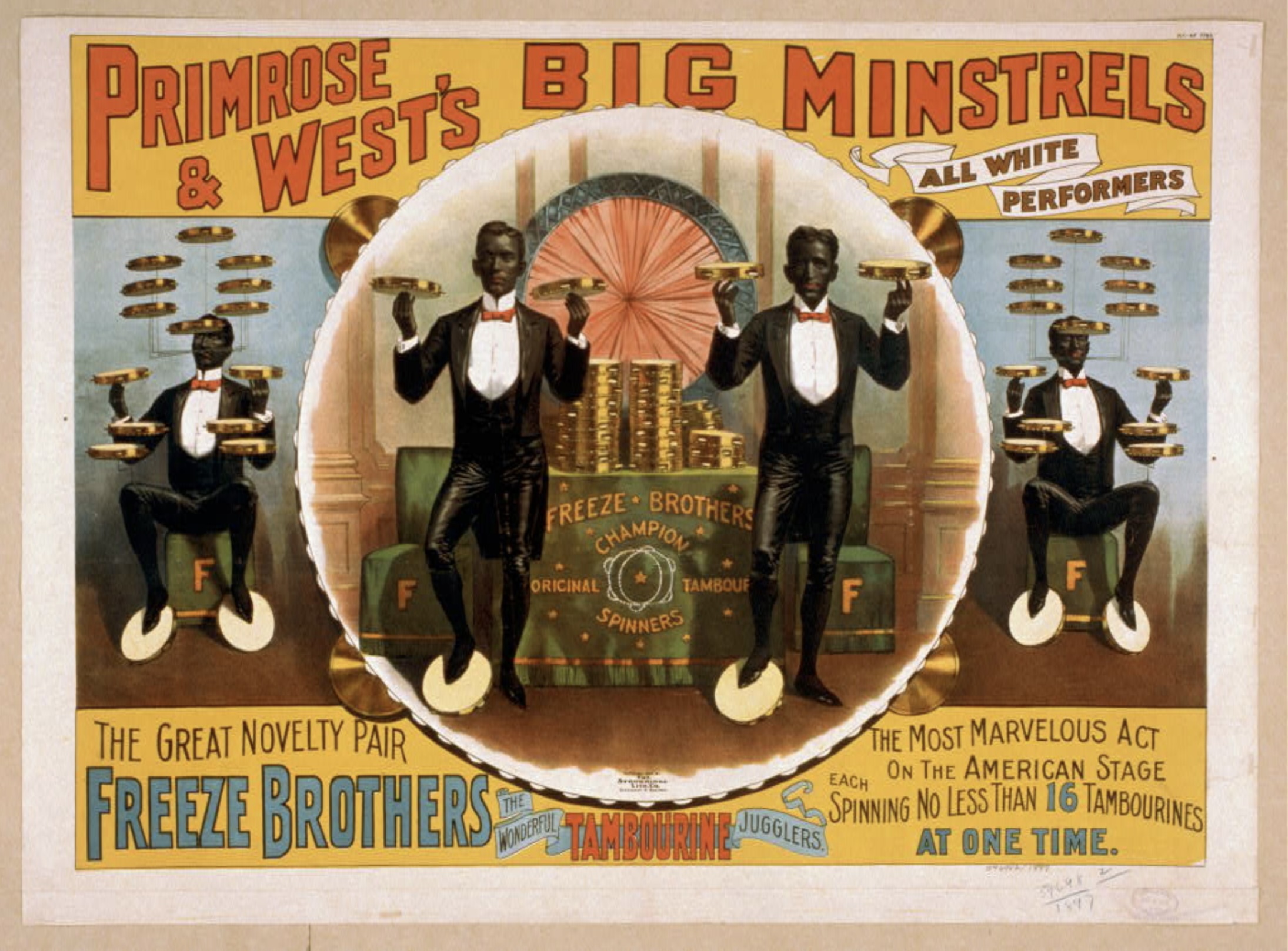
First, some background. Minstrel shows originated in the northeast states in the early 1800s. They usually featured mostly white actors comically portraying black stereotyped characters in jokes, songs and skits staged in the revue format.

Uniquely American, the shows became the most popular theatrical art form in the country during the 1840s. Troupes of professional minstrel performers criss-crossed the country in shows that presaged the vaudeville era of the early 1900s, whose popularity eventually outstripped minstrelsy.

Primrose & West was one of several touring minstrel show companies. 1897 poster. (Credit: Library of Congress, Prints & Photographs Division)

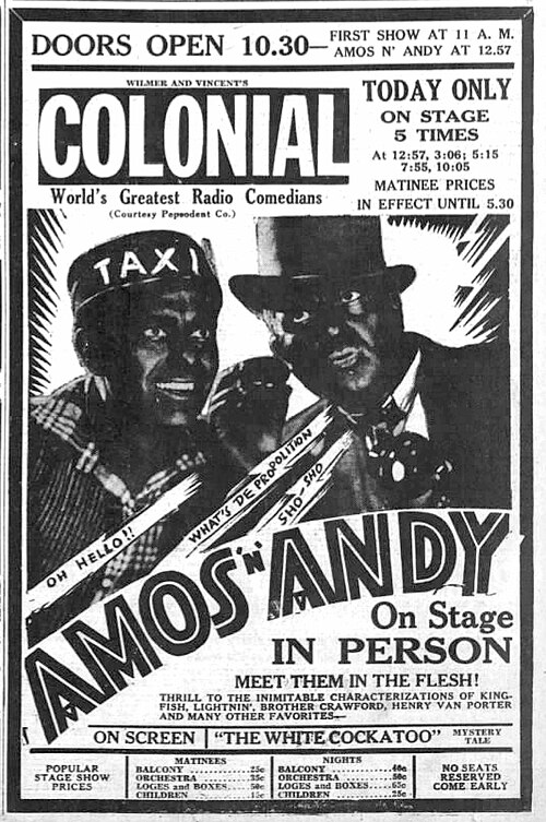
The “Amos ‘n Andy” characters were created in the mid-1920s by two white actors, Freeman Gosden and Charles Correll, who were very familiar with the minstrel show tradition. The show became one of the radio era’s most popular programs, airing between 1928 and 1960 in various forms.

The minstrel show format also became a popular one for local theater productions, and was often used by service clubs and other community organizations staging fundraisers and benefit shows. Librettos and songbooks from popular minstrel shows were readily available from theater publishers at the time.

A front-page Feb. 8, 1924 Torrance Herald story noted that members of the Torrance Business Men’s association had voted unanimously to stage their own minstrel show to benefit the local Boy Scouts organization. 

It was planned to be one of the first public productions to be staged in the then-new Torrance High School auditorium, which would later have to be replaced after being severely damaged in the 1933 Long Beach earthquake.

Torrance Herald, Nov. 1, 1951, Page 1. (Credit: Torrance Historical Newspaper and Directories Archive database, Torrance Public Library).

The Torrance Women’s Club announced its own minstrel show production, “comprised entirely of home talent” according to the Herald, at its clubhouse in April 1926.

The practice of staging amateur minstrel shows continued to be commonplace in the years after the end of World War II. After all, many movie stars, most notably Al Jolson in the late 1920s, had performed in blackface.

Marjorie Reynolds and Bing Crosby appear in blackface in the minstrel segment in “Holiday Inn” (1942). (Credit: Internet Movie Database)

In addition to Jolson, there was Fred Astaire in “Swing Time” (1936), Judy Garland and Mickey Rooney in “Babes on Broadway” (1941), and, famously, Bing Crosby’s blackface minstrel segment in “Holiday Inn” (1942). The latter is often excised from television screenings of the film, though the TCM channel still includes it, with an explanation.

By the late 1940s, the amateur community minstrel shows still drew good-sized crowds, and many groups staged them annually.

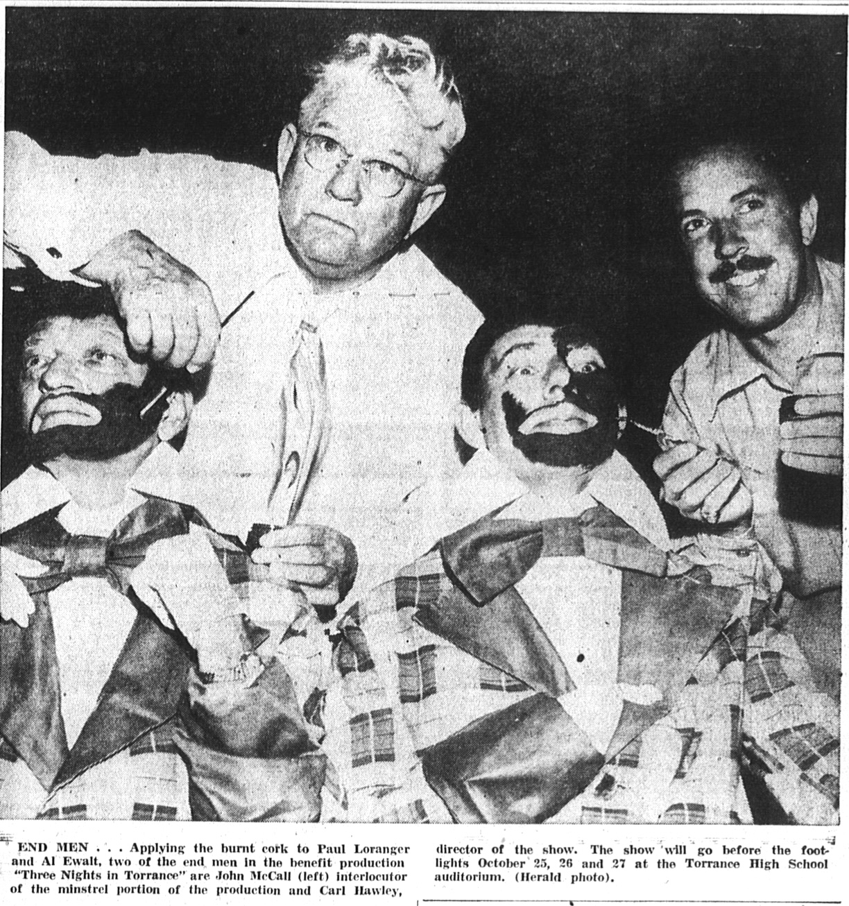
In 1951, the Junior and Senior Women’s Clubs in Torrance came up with their own minstrel show, “The Three Nights of Torrance,” which they planned to stage at the Torrance High School auditorium on Oct. 25. It included a blackface minstrel segment.

A few days before the scheduled performance, Mrs. Emma Roberts, president of the senior Woman’s Club, reported to the Herald that she’d received a phone call demanding that the performance be canceled because “it made buffoonery of a minority group,” according to the newspaper.

A handbill decrying the show also had been distributed in downtown Torrance, signed by Cora Johnson, president of the Southeast Interracial Council. It stated, in part, that minstrel shows “are carry-overs from a part of our national history and national shame which all thinking Americans are now trying to rectify.”

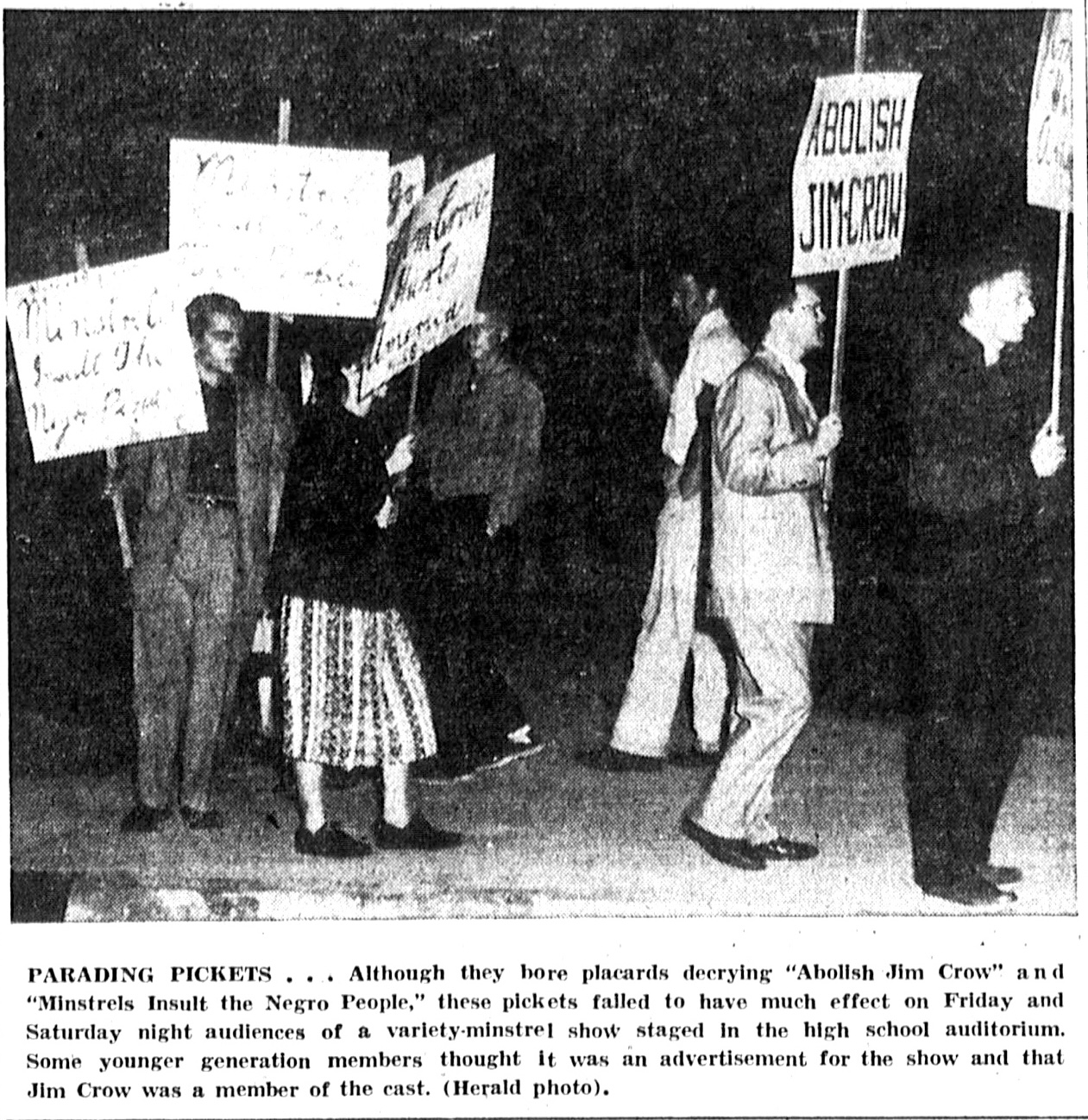
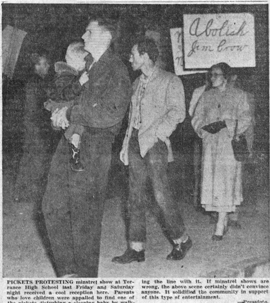
The show went on as planned, but so did a small picket line of 15 protesters carrying signs decrying it beforehand. The Herald and the Torrance Press complained that the whole protest was the work of pro-Communist groups, echoing the then-prevalent anti-Red sentiments being hammered home by groups such as the House Un-American Activities Committee (HUAC) in the U.S. Congress.

Torrance Press, Nov. 1, 1951, Page 1. (Credit: Torrance Historical Newspaper and Directories Archive database, Torrance Public Library)

The YWCA, the Los Angeles County Joint Commission on Human Relations and the National Association for the Advancement of Colored People (NAACP) sided with the protesters, also denouncing the minstrel shows.

As for Senior Women’s Club president Roberts, she told the Torrance Press: “I think the picketing was disgraceful, particularly when there are no Negroes living in Torrance.”

1951 also was the year that the “Amos ‘n Andy” show began airing on national television. It only lasted until 1953, when its sponsors withdrew due to pressure over its perceived racist content and it was canceled.

It wasn’t the end for such shows, but societal pressures and the growing civil rights movement made them far less common. Professional minstrel show companies had pretty much died out, with only a few independent tent shows still operating by the late 1950s

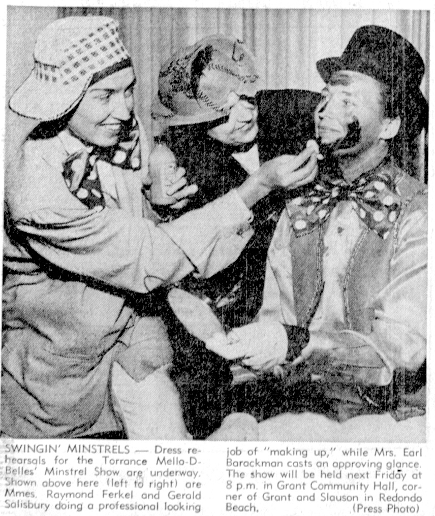
During my research, the latest article I came across regarding a local minstrel show production was promoting an April 1962 Redondo Beach charity show sponsored by a Torrance signing troupe, the Mello-D-Belles:

Torrance Press, April 25, 1962, Page B-1. (Credit: Torrance Historical Newspaper and Directories Archive database, Torrance Public Library).

Sources:

The Blackface Minstrel Show in Mass Media: 20th Century Performances on Radio, Records, Film and Television, by Tim Brooks, McFarland & Co., 2020.

San Pedro News Pilot archives.

Torrance Press-Herald archives.

Wikipedia.
Wilmington Press Journal archives.

Poster from a 1935 live appearance. (Credit: Wikimedia Commons)

East San Pedro School principal Mildred Walizer won hearts and minds on Terminal Island

Small businesses thrived on Tuna Street, Terminal Island’s main roadway. Undated, circa 1930s. (Credit: National Archives)

Imagine an educator who meant so much to her students and their community that they renamed the school in her honor just five years after her death.

Meet Mildred Walizer, who taught and later became principal at East San Pedro School on Terminal Island in the years before World War II.

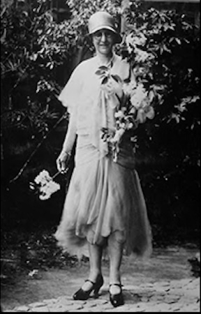
Mildred Walizer in 1925. (Credit: Los Angeles Harbor College Special Collections, Annie Garcia Photo Album)

She was born Mildred J. Obarr on July 14, 1874, in the small town of Booneville, near Ukiah in northern California. Her parents arrived in the frontier town in 1850 after making the cross-country trek in an oxcart.
She trained as a kindergarten teacher in San Francisco, getting her first job in Sacramento. She moved to San Pedro in 1918 with her husband, Charles, an insurance agent. She then landed a job with East San Pedro School, then a one-room Los Angeles City elementary school serving the rapidly growing Japanese population on Terminal Island.

Walizer previously had trained in what was then called the “Americanization” of foreign students, helping them to adjust to their new surroundings and culture.

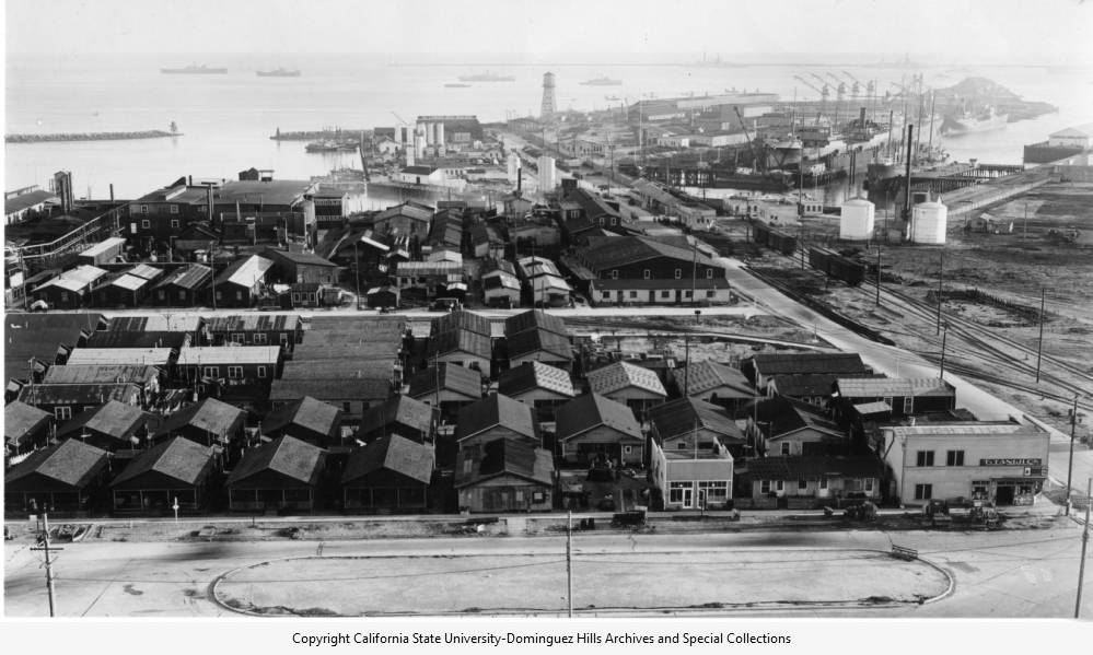
The small school’s setting, Terminal Island, was transitioning at the time from a fading attempt at being a tourist resort to becoming home for a thriving new community of Japanese fishermen. (The island got its name from the Los Angeles Terminal Railway, which completed a rail line there in 1900.)

Albert Halfhill’s California Fish Co. had introduced tuna into mainstream food stores in 1908. The company soon discovered that local Japanese fishermen were expert at hauling in large albacore catches. It built a settlement of simple wooden houses for them near its plant at what would come to be known as Fish Harbor.

The Japanese fishermen and their families who lived in those houses soon made the area into a self-sufficient cultural enclave. Their word for it: Furusato, which translates roughly into “old village.” Its residents included “Issei,” first-generation immigrants, and “Nissei,” their American-born children.

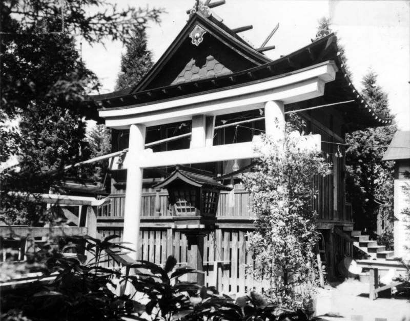
Exterior view of the Shinto shrine located on Terminal Island. A staircase, seen on the right, leads into the temple. A second building is partially visible on the right. Undated, circa 1920s. (Credit: Los Angeles Public Library Photo Collection)

Tuna Street was its main commercial area, with restaurants, stores and other businesses. The village also included a Shinto shrine, Buddhist and Baptist churches, a bank, an assembly hall, a lush garden and an iconic red footbridge.

Walizer fully committed herself to the small community. She went beyond being a mere teacher, devoting hours of extra time to her students. She often visited the homes of students to get to know their families and help them with learning to cope with life in America.
She organized fairs and special events involving community and students, including a very popular annual doll festival that attracted hundreds of visitors. When particularly busy, she would spend the night at the school instead of returning to her home in San Pedro.
After just a few years, she was named as the first principal of East San Pedro in 1922, a post she held for roughly ten years. During her tenure, many improvements were made to the school, including the addition of several new buildings.The staff grew to 14 teachers.

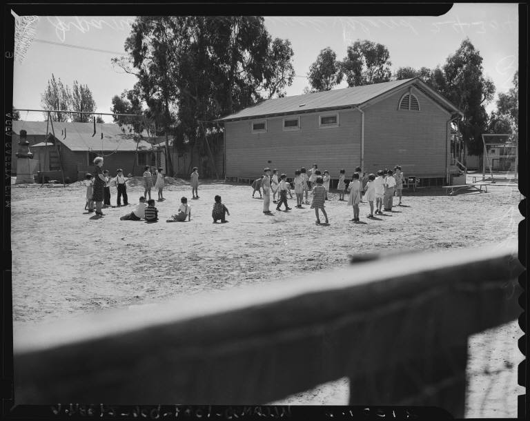
Japanese schoolchildren play in the schoolyard of the Mildred O. Walizer Grammar School, earlier known as East San Pedro School. 1940 photo. (Credit: UCLA Library Special Collections)

Walizer was so revered by the community that its appreciative residents decided to take up a collection for the purpose of financing a months-long trip to the Far East for her. They raised about $4,000, a small fortune, in order to give her a chance to experience Japanese culture first-hand.

Walizer was given time off from her school duties, and left on March 26, 1930, for what would be a three-and-a-half month trip. (She traveled by herself, as her husband Charles had died in 1928.) Hundreds of people saw her off as she boarded the then-new ocean liner the Asama Maru at its Terminal Island berth.

The experience turned out to be life-changing for Walizer. She visited rural areas as well as cities, and spent a full three weeks in the city of Wakayama, where many of the Terminal Island families had come from originally. There, she met with the families of  former students.

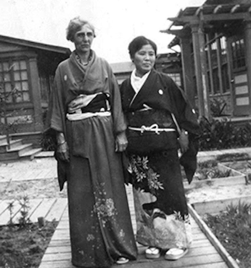
Mildred Obarr Walizer in traditional Japanese dress with village resident Mrs. Yokozeki in 1926. (Credit: Los Angeles Harbor College Special Collections, Annie Garcia Photo Album)

Upon her return in July, Walizer immediately began describing her overseas  experiences at civic functions, service club meetings, and community gatherings of all types. Her presentations  stressed the beauty and unique features of the country and its people, illustrated by photographs she’d taken there.

Sadly, she took ill a few months after returning from her trip, and never recovered. After a yearlong illness during which she had to give up her job as principal, she died from cancer at her San Pedro home on Jan. 19, 1933.

The San Pedro News Pilot estimated that more than 1,000 people attended Walizer’s funeral in East San Pedro, including some 500 of her former students.

In March 1938, as part of the annual doll festival begun by Walizer, a ceremony was held during which East San Pedro was renamed the Mildred O. Walizer Grammar School.

The ever-popular doll festival continued to draw large crowds even as late as the March 1941 event. It would be the last one ever held.

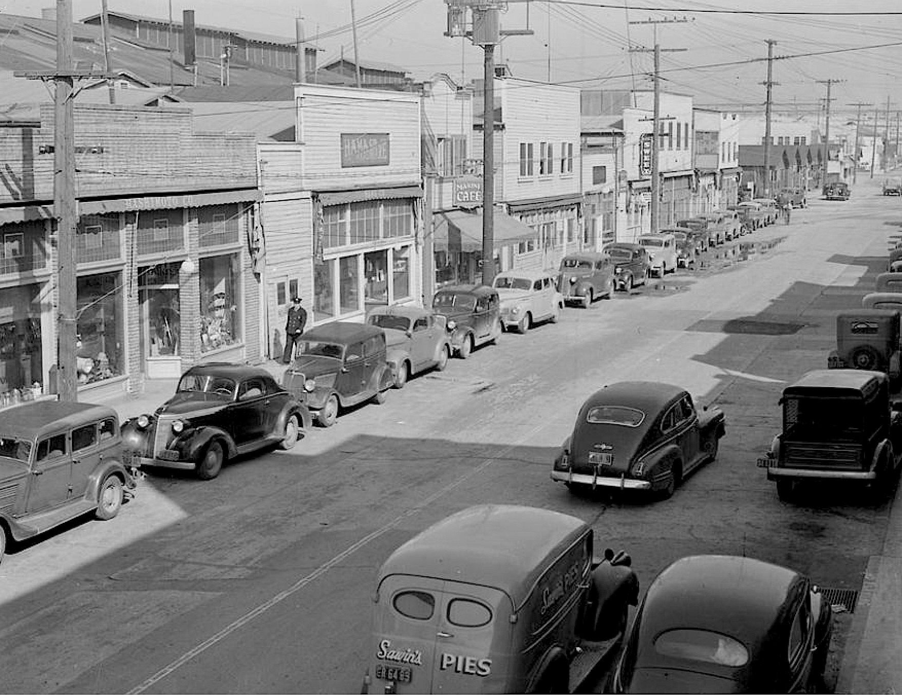
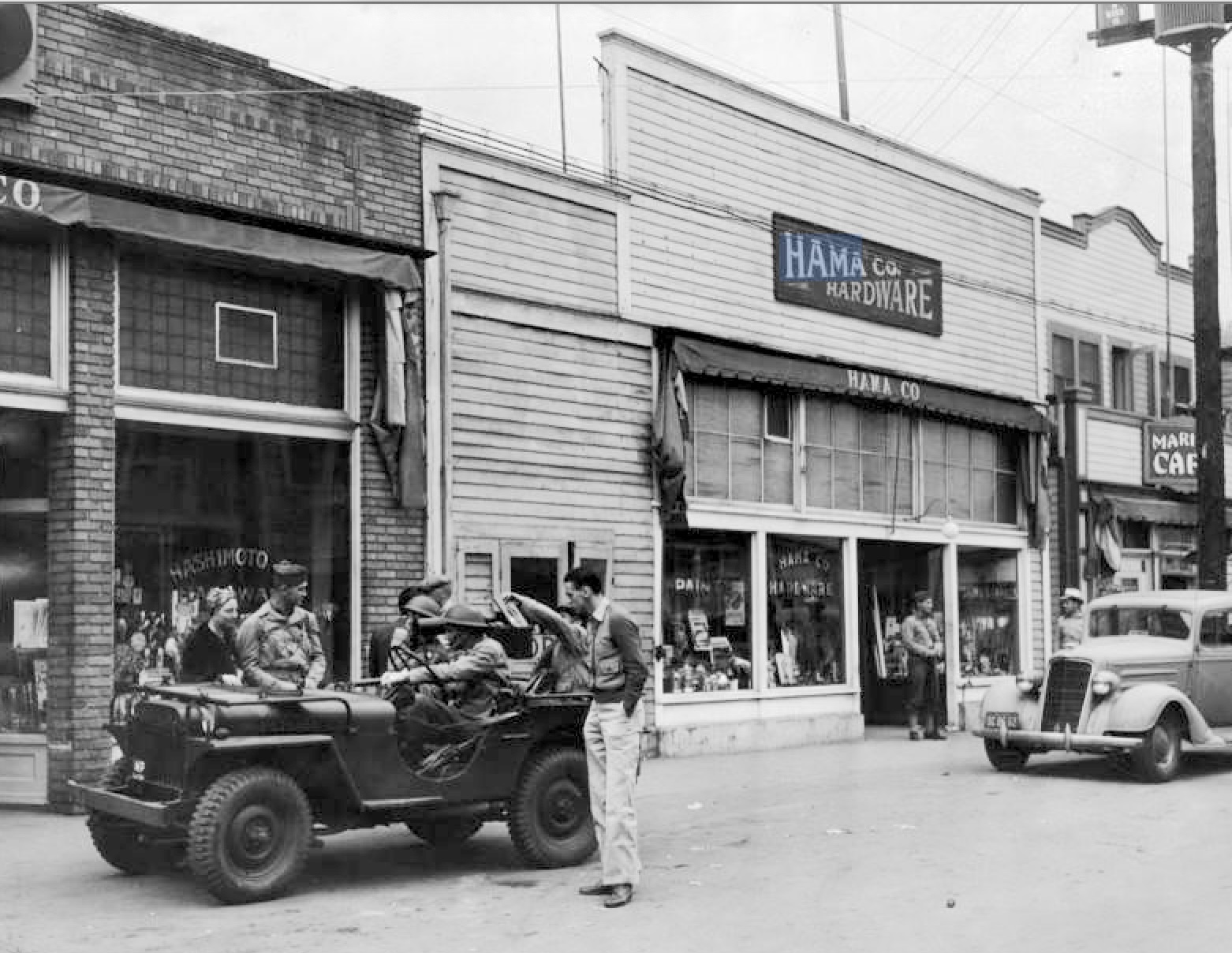
Japanese-owned shops and cafes on Terminal Island were closed on December 8, 1941, and army sentries posted. This photo shown an army jeep or scout car, which carried soldiers on the rounds, leaving armed sentries. (Credit: Los Angeles Public Library Photo Collection)

The Japanese attack on Pearl Harbor that December changed everything. For security reasons, authorities began rounding up many of the 3,000-plus Japanese residents living on Terminal Island immediately. 

Then, on Feb. 19, 1942, President Franklin Delano Roosevelt signed Executive Order 9066. It required that all people of Japanese descent on the West Coast be sent to relocation camps. The island village’s residents all were rounded up and moved out.

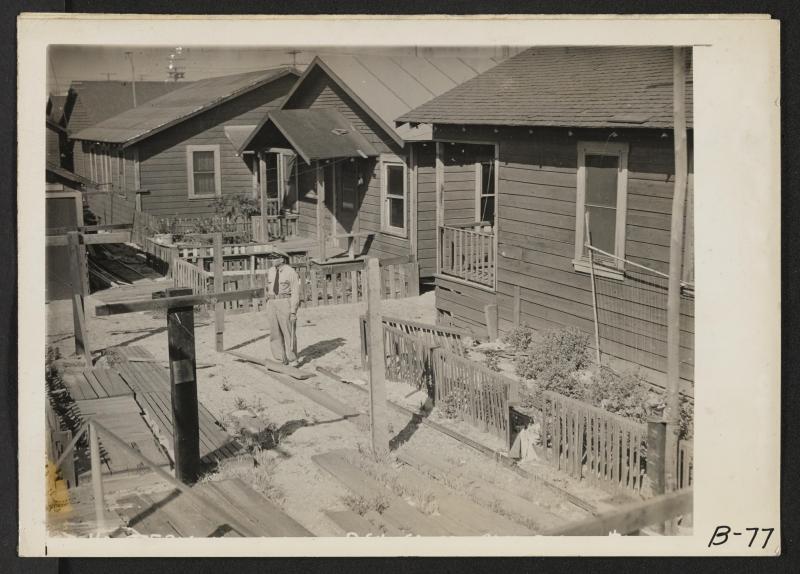
By then, the school had been closed and would soon be bulldozed along with the rest of the fishermen’s village. The entire settlement was razed to the ground following its evacuation.

A lone military officer stands among vacant former dwellings of fishermen of Japanese ancestry, on Terminal Island. The village’s residents had been removed to relocation centers at the time this photo was taken circa April 1942. (Credit: UC Berkeley, Bancroft Library)

Sources:

“Japanese-American History at Terminal Island,” Los Angeles Conservancy website.

Los Angeles Times archives.

San Pedro News PIlot archives.

“Terminal Education: A Junior High School Yearbook and a Lost Community,” by Nicholas Beyelia, LAPL Blog, Los Angeles Public Library, Jan. 10, 2019. 

Terminal Island: Lost Communities of Los Angeles Harbor, by Naomi Hirahara and Geraldine Knatz, Angel City Press, 2015.

Terminal Island – San Pedro, CA. website.

The Japanese fishing village on Terminal Island in November 1927. (Credit: CSUDH Archives)

For a few short years, two municipal airports operated in Torrance

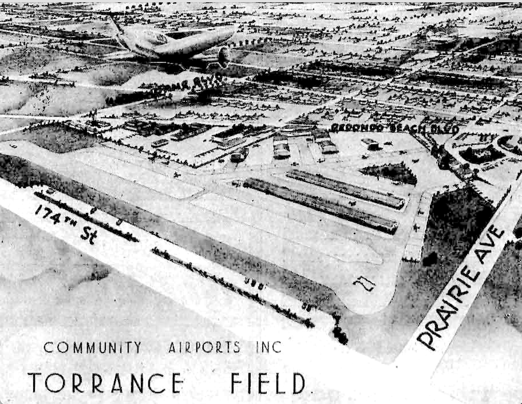
Artist rendering shows the proposed Torrance Community Airport. Hawthorne Blvd. runs diagonally at top left. Torrance Herald, May 30, 1946, Page 1. (Credit: Torrance Historical Newspaper and Directories Archive database, Torrance Public Library).

Torrance Municipal Airport has become a fixture in the city over the years, though it has its detractors who complain mostly about noise pollution.

It began humbly in 1941 with construction of the bare-bones Lomita Flight Strip by the U.S. government with the aim of encouraging the development of civil aviation. Just months later, it   transformed into a military facility after the outbreak of World War II, serving as a training field for Army Air Forces pilots.

After the war, the government ceded the land back to Torrance for civilian use, but kept operational control of the airport until 1956, when Torrance regained control. The city then officially renamed the facility Torrance Municipal Airport.

But, for about four years during the late 1940s, a second general aviation airport also operated in the city.

On Nov. 8, 1945, a newly incorporated firm, Community Airports Inc., announced plans to build the first of a planned series of community airports in the Los Angeles area. They chose a 40-acre site in northwest Torrance for their initial project.

The facility was situated on open land south of Redondo Beach Blvd. to 174th St.,and between Hawthorne Blvd. and Prairie Ave. The airport was to be named Torrance Community Airport.

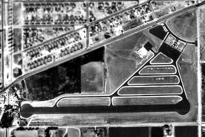
Aerial view of Bay Cities Airport on Sept. 9, 1946 shows buildings and parked planes, top right, and paved landing strip, bottom. (Credit: Jim Osborne, via Abandoned & Little-Known Airfields website)

The top two men behind the operation had military backgrounds. Company president Col. William J. Fox was still in the Marines at the time of the announcement. He had been recognized for building the makeshift airport at Guadalcanal while under fire during the famous battle.

Company VP Major Joseph J. Foss was a skilled pilot who was the first to equal World War I ace Eddie Rickenbacker’s record of enemy planes shot down.

Features planned for the Torrance airport included an administration building, a restaurant and lounge, showers and locker rooms, and a daycare playground where children could be taken care of while their parents went flying. “The private flier has been operating off of a back-alley field much too long,” Fox told the Torrance Herald while promoting the airport’s modern features.

All of this, according to the company, would be offered to customers “at a price which they will be able to afford.” It set an opening date of June 1, 1946 for the new airport, which cost an estimated $500,000 to build.

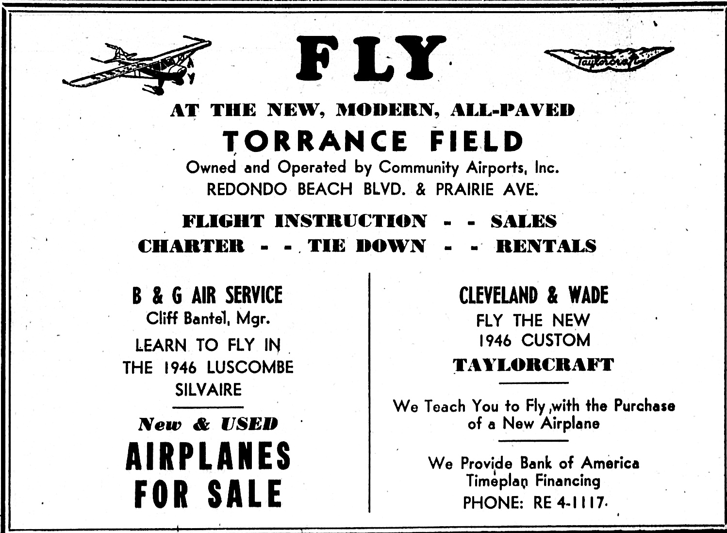
Torrance Herald ad, Aug. 15, 1946, Page 15-A. (Credit: Torrance Historical Newspaper and Directories Archive database, Torrance Public Library).

The Herald described the new airport as “the most modern on the West Coast.” Col. Fox said no military planes or noisy trainers would be allowed in order to keep noise down. 

The airport’s 2,700-foot paved runway was ready to go for the June 1st grand opening, which went off without a hitch. Even the expected noise complaints failed to materialize, at least during its first few days of operation.

Meanwhile, proponents of transforming the Lomita Flight Strip into Torrance’s main airport presented a glowing picture of its prospects to civic leaders and Chamber of Commerce members in late February 1946. Civil Aeronautics Administration airports superintendent R.W.F. Schmidt assured the assembled that they would get their airport,  and soon.

Names for the two airports caused confusion. Fox’s project was known in its early stages as Torrance Community Airport. After it opened, it was called Torrance Field for a time, to distinguish it from Torrance Airport under development to the south. (Torrance Airport didn’t add the “Municipal” to its name right away.) Finally, the north Torrance facility was renamed Bay Cities Airport in 1948.

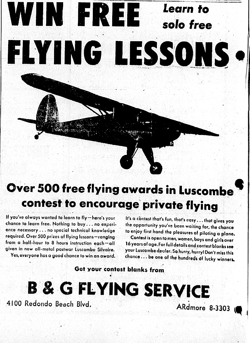
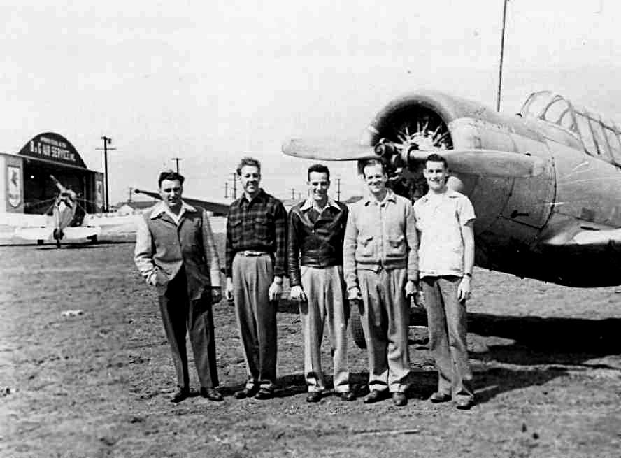
Instructors such as Cliff Bantel of B & G Air Service and those at the Cleveland & Wade firm offered free lessons to those purchasing small aircraft such as Taylorcraft, Luscombe and others offered for sale.

Torrance Herald ad, July 4, 1946, Page 4-A. (Credit: Torrance Historical Newspaper and Directories Archive database, Torrance Public Library).

For a while, the airport continued to operate as usual, but it was becoming more and more apparent that Torrance Municipal Airport soon would become the city’s choice for its local airfield. No official closure date for Bay Cities could be located, but by late 1950, it was being described as “abandoned” in the Herald.

On Nov. 12, 1950, 19-year-old Paul Galla was killed during an illegal motorcycle race being held on the abandoned airport’s runway. As a result, the city moved to shut down racing there.

Later that month, the Herald announced that building permits valued at $519,506 were issued to Community Airports Inc. for the purpose of building 79 new family homes on the site. 

Construction was well underway in 1951 and, by 1952, houses covered the site, leaving no traces of the former airport. Except, that is, for nearby businesses such as Airport Lumber, whose aviation-themed name would puzzle future area residents, as there was no corresponding airport in the area after 1950.

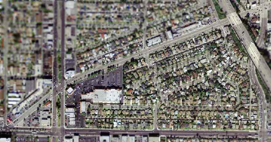
The North Point Center outdoor shopping mall and rows of homes blanket the former Bay Cities Airport site. Hawthorne Blvd., left, Artesia Blvd., bottom, and Redondo Beach Blvd., top diagonal bracket the area. (Credit: U.S. Geological Survey photo)

Sources:

“Airport Matters,” City of Torrance website.

 Abandoned & Little-Known Airfields” website.

San Pedro News Pilot archives.

Torrance Press Herald archives.

Frank Shatz, Dave Pierson, Bert Bender, Jack Locke and Norm Peterson stand in front of a Vultee B-13 airplane at Bay Cities Airport. The B&G Air Service hangar can be seen at left rear. Photo circa 1948. (Credit: Dave Pierson and Jim Osborne, via Abandoned & Little-Known Airfields website)

Is this your new site? Log in to activate admin features and dismiss this message
Log In