Gardena’s early days and its eventual incorporation as a city

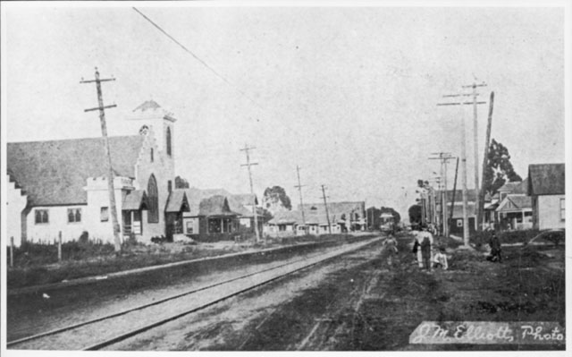
Gardena Blvd. looking east, circa 1900. (Courtesy of the Gardena City Clerk’s Office)

Before the arrival of the Spanish land grant owners in the latter part of the 1700s, the Tongva branch of the indigenous Gabrielino tribe inhabited the area that later became Gardena.

They farmed its fertile soil, enriched by natural irrigation arising from its location at the northern end of Dominguez Slough, a body of water named for land grant owner Juan Jose Dominguez. He received the grant from Spain in 1781 as part of the large Rancho San Pedro tract.
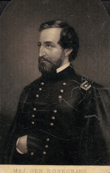
Major Gen. William Starke Rosecrans, circa 1860s. (Credit: Wikimedia Commons)

The next major player in the region, former Union Army Gen. William Starke Rosecrans, bought 16,000 acres of land in the area for $2.50 an acre in 1869, and eponymously named it Rosecrans. Its borders were Crenshaw Boulevard on the west and Central Avenue on the east, and Florence Avenue on the north and roughly Artesia Boulevard on the south.

He lived there for several years, in a home he built near the present-day intersection of Vermont and Rosecrans avenues. After serving as a U.S. congressman in the early 1880s, he turned his energies toward developing his land into a city.

In 1887, he subdivided the land and began selling some 3,000 house-sized lots for $50 a piece.

Other developers also began selling parcels in the area in 1887, including Abram Pomeroy and Spencer R. Thorpe. Both men have been credited with playing a major role in bringing settlers to the nascent city.

The real estate market in the entire Los Angeles region was booming in the late 1880s, and Gardena was no different. Farms and ranches began springing up in the area. Its fertile soil was particularly suited to raising ground crops such as flowers and berries.
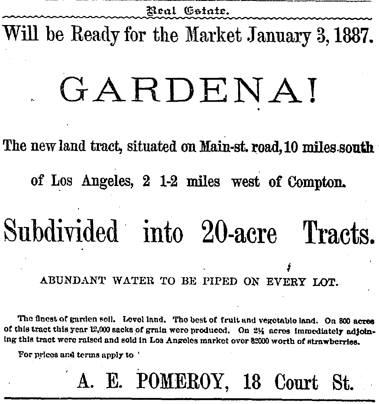
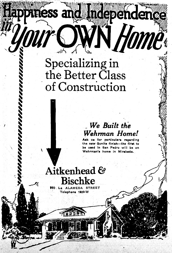
Los Angeles Times ad, Jan. 6, 1887, Page 7. (Credit: Los Angeles Times archival database)

Businesses catering to the needs of the farmers followed, and a small downtown area began forming around the intersection of Figueroa and 161st streets. It shifted west to Vermont Ave. with the completion in 1890 of the Redondo Railway Company’s new line connecting Redondo Beach to Los Angeles.

Anti-Chinese sentiments, aimed at the influx of laborers from China starting in the 1860s, led to the passage of the Chinese Exclusion Act in 1882. This led to the recruitment of Japanese immigrants to take their place working in the railroad, mining and agriculture industries.

The Gardena Valley’s rich farmland attracted the Japanese newcomers, who worked raising flowers and berries on the area’s farms. The whole area came to be known as Berryland, with a smaller segment named Strawberry Park.
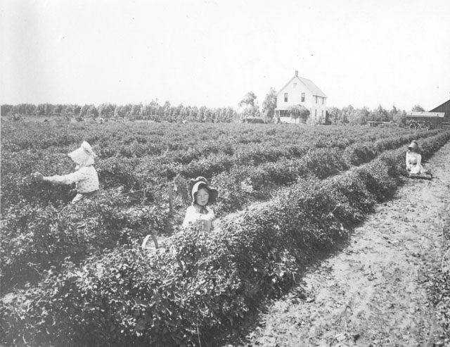
Women and children picking berries on 161st Street in Gardena, circa 1900. (Credit: Courtesy of the Gardena City Clerk’s Office)

The origins of Gardena’s name itself are hazy, but most likely it came from the area’s reputation as a “garden spot” amid the then mostly dry and dusty territory surrounding it.

By the early 1900s, agriculture in the region was booming and its residential population also had increased. With nearly 1,000 people living in the area by 1904, the decision was made to build Gardena High School, which opened in 1908.

Agriculture still was the dominant industry, but the growing residential development began reducing the size and number of the berry farms. The annual Strawberry Day Festival and Parade was still being held every May, however.
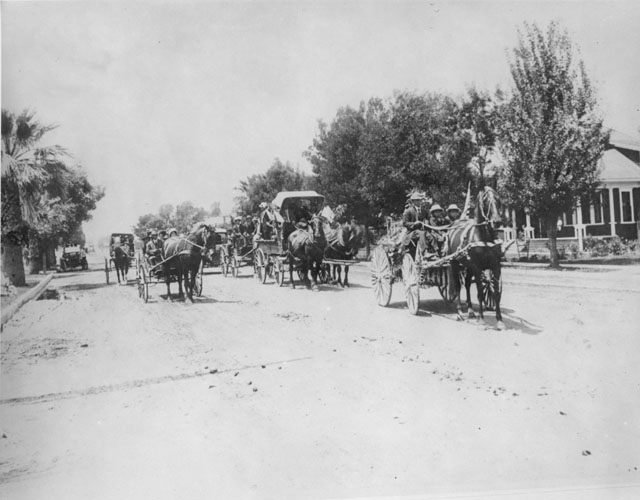
Strawberry Day Festival parade on Gardena Blvd. in 1920. (Credit: Courtesy of the Gardena City Clerk’s Office)

The emphasis on raising berries also was reduced by the onset of World War I, when the farms shifted to other food crops more critical to the war effort.

A series of events in the 1920s  led to the eventual incorporation of the city of Gardena. First, ambitious plans to build a scenic highway, the Hollywood Palos Verdes Parkway, were introduced in 1924.

The 225-foot wide roadway would run from the Palos Verdes Peninsula through Redondo Beach, Torrance, Gardena and Inglewood before meeting up with the southern edge of Los Angeles. The highway would be costly, with residents of cities along its route facing hefty tax assessments to pay for it.
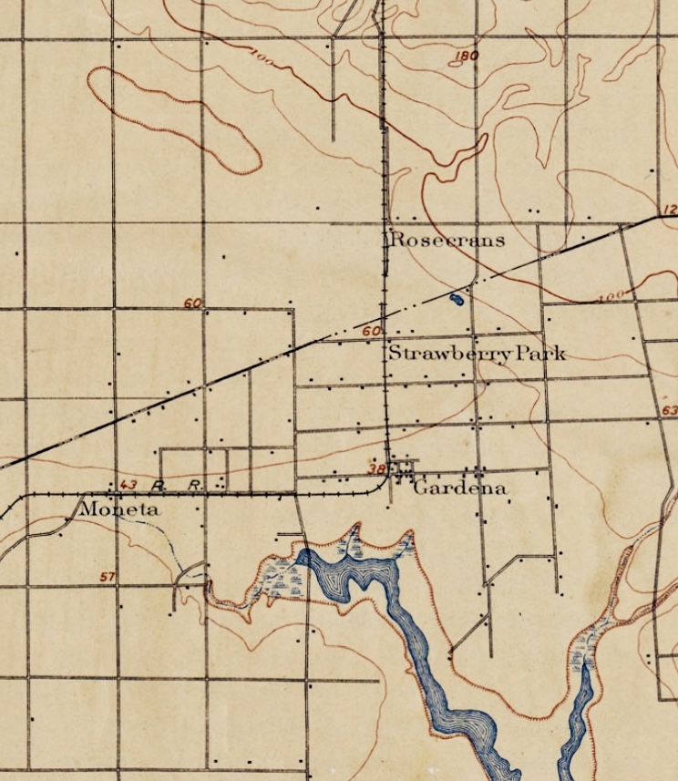
Portion of a U.S. Geological Survey map shows Moneta, Gardena and Strawberry Park, as surveyed in 1894. The body of water at the bottom of the frame is Dominguez Slough. (Credit: Wikimedia Commons)

Second, Los Angeles County purchased 320 acres of land on Gardena’s western border from the Bank of Italy for just over $1 million in 1927 with the intent of turning it into a regional park.

Alondra Park wouldn’t become a reality until the 1940s, but the project also raised the possibility of increased taxes to pay for it as well.

For these reasons and others, residents of the communities of Gardena, Moneta and Strawberry Park felt a pressing need to incorporate, especially after the nearby incorporated cities pulled out of the Alondra Park deal once they realized the tax burden it would create.

That would have left residents of the unincorporated Gardena to bear the financial brunt of the project. An incorporation election was held on Aug. 5, 1930. Residents voted to incorporate by a vote of 502 for to 242 against. Gardena’s cityhood became official on Sept. 11, 1930.
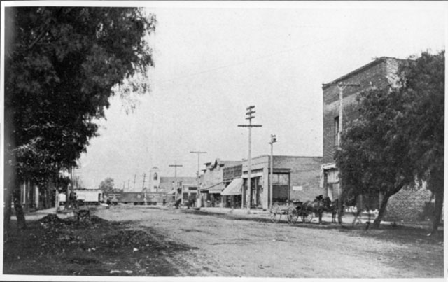
Gardena Blvd. looking west toward Vermont Ave., circa 1890s. (Credit: Courtesy of the Gardena City Clerk’s Office)

At the time of incorporation, the three communities that made up Gardena had a combined population of about 20,000 people and encompassed roughly four square miles. The 2020 U.S. Census put Gardena’s population at 61,027.

Footnotes: Only a small, scaled-down portion of the Hollywood Palos Verdes Parkway was ever built, and Alondra Park opened to the public in 1946.
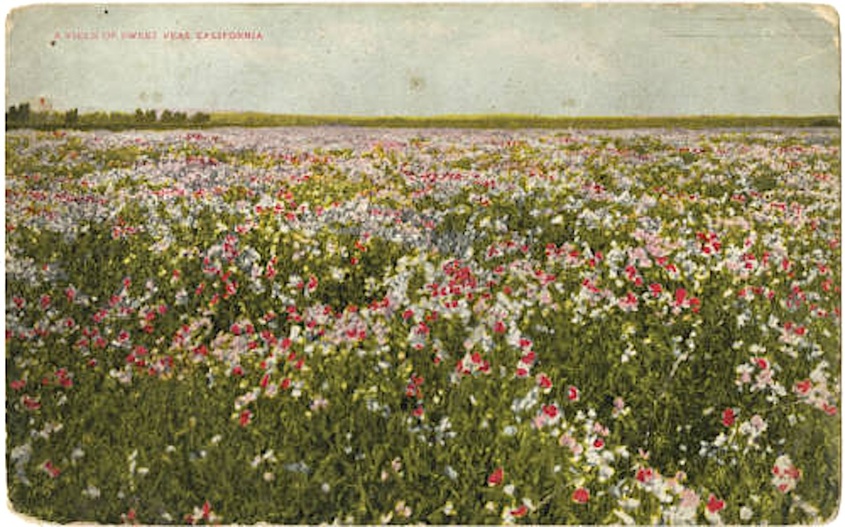
Postcard view of the sweet pea field at the Bodger seed farm in Gardena Valley, circa 1905. (Credit: CSUDH Digital Archives

Sources:

Daily Breeze archives.

“Gardena,” Los Angeles County Library website.

Gardena Valley News archives.

“The History of a Diverse Community,” City of Gardena website.

Images of America: Gardena, by the Gardena Heritage Committee,  Arcadia Publishing, 2006.

Los Angeles Times archives.

Wikipedia.
Miraleste has been part of the Palos Verdes Peninsula for more than a century

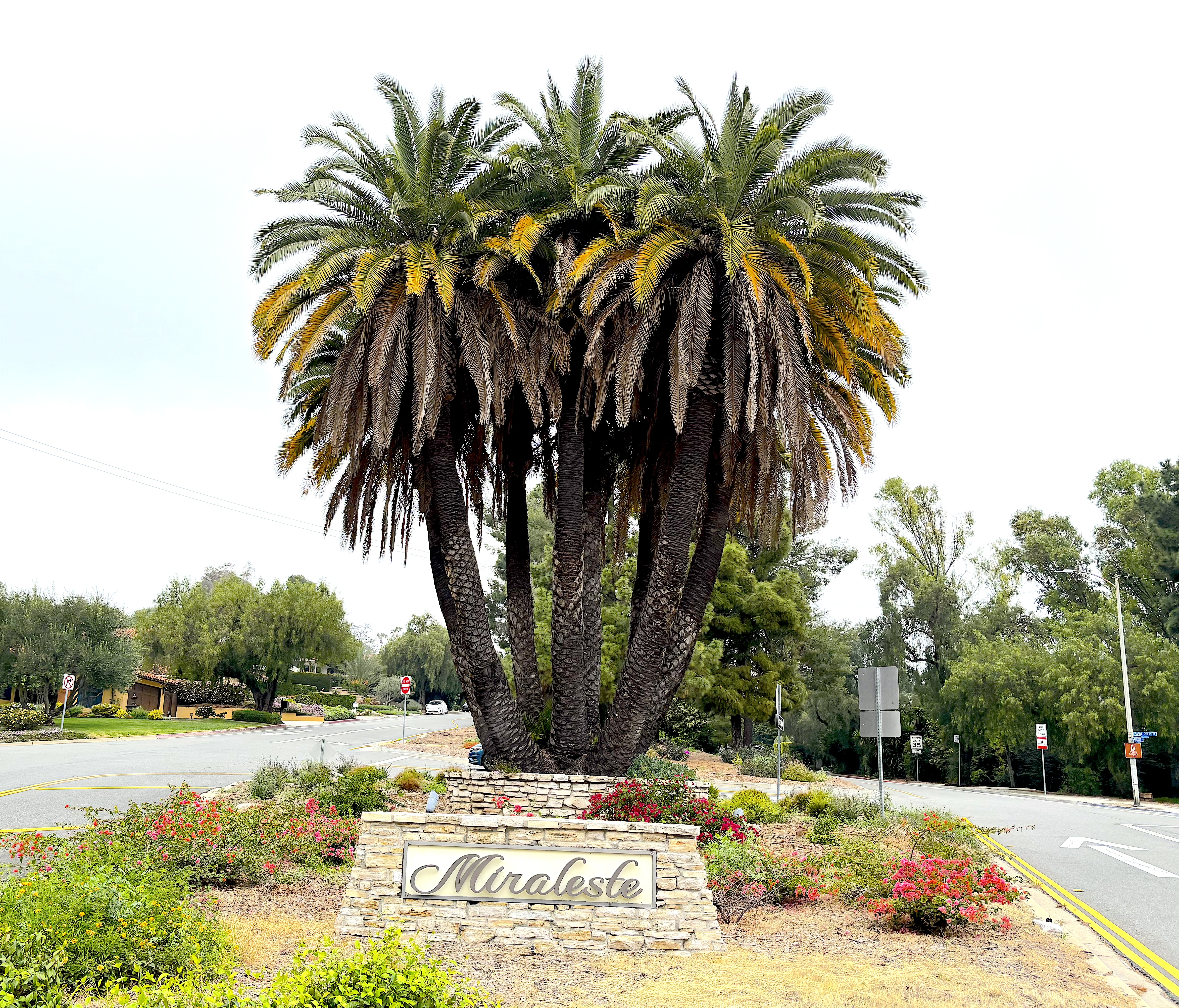
Sign on Miraleste Drive, March 4, 2026. (Photo by Sam Gnerre)

When Palos Verdes Peninsula landowner Frank Vanderlip and his associates drew up the detailed master plan for their Palos Verdes Project in 1923, it consisted of four distinct areas to be developed: Malaga Cove, Lunada Bay, Valmonte and Miraleste. 

The first three were connected areas on the west side of the Palos Verdes Hills. Miraleste was a free-standing area on the east side of the hills near San Pedro.

Even with these identified areas under development, large chunks of the Peninsula remained unincorporated Los Angeles County land for years. I recently wrote about one such area, the once-unincorporated Eastview section of Rancho Palos Verdes and its contentious history.

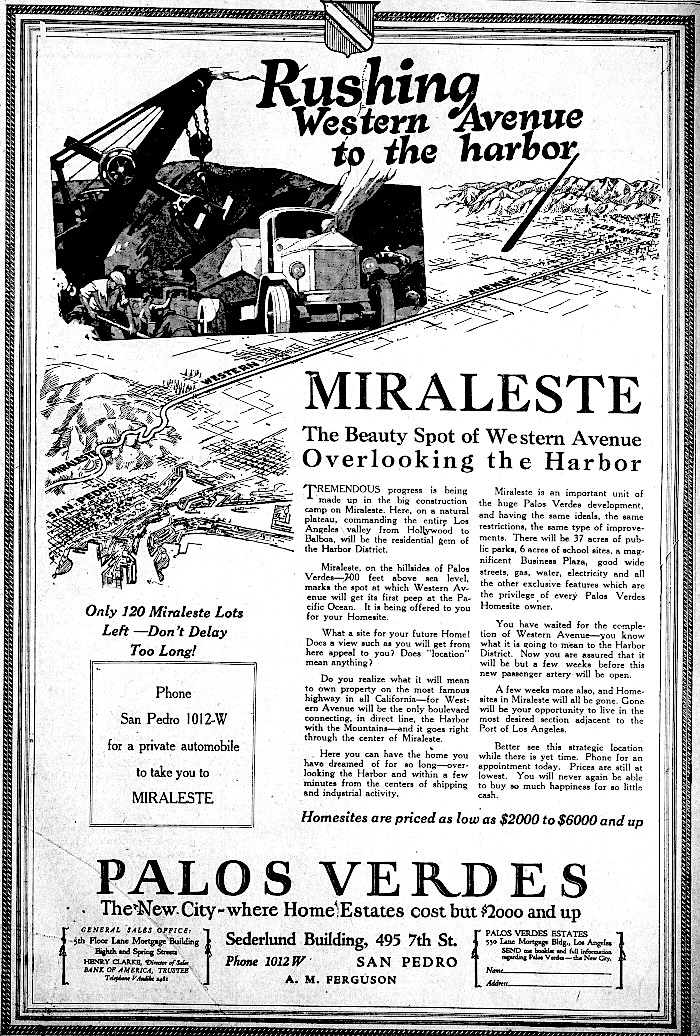
San Pedro News Pilot ad, July 7, 1924, Page 5. (Credit: San Pedro News Pilot archives)

Miraleste lies just west of Eastview and just east of the city of Rolling Hills, the latter of which was incorporated in 1957. Western Avenue once formed part of its southern border until it was re-routed to the east in the 1930s.

So why didn’t Miraleste become part of Palos Verdes Estates when that city was formed in 1939? Because it was not contiguous, sharing no borders with PVE, even though it was planned at the same time in the 1920s. The rules set down by Palos Verdes Art Jury, which dictated which types of structures and layouts were acceptable, were applicable to Miraleste as well.

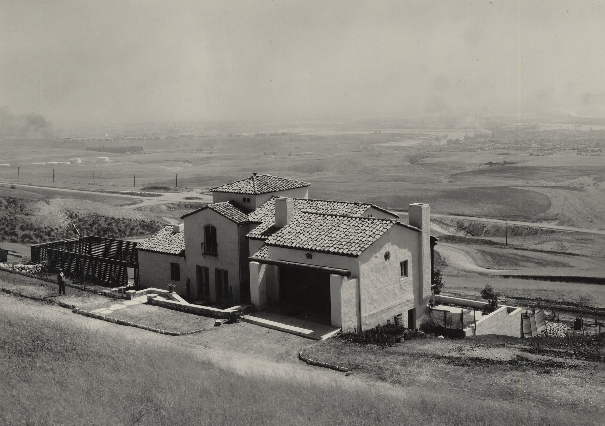
Aug. 1, 1925 photo shows the Wehrman residence, located at 6325 Via Colinita in Miraleste. View looking east shows Los Angeles Harbor and community of San Pedro in background, with the two-story stucco house, with tile roof, chimney and attached two-car garage in foreground. A man is visible at far left, standing by the unpaved Via Colinita. (Credit: Local History Center, Palos Verdes Public Library)

The first house to be built in the Miraleste district was finished in 1924. John Wehrman paid $18,000 for the house at 6325 Via Colinita, then a dirt road with no other structures nearby. (The house still stands.)

Those empty spaces filled in soon enough, but public services were slower to arrive. Miraleste Elementary, the area’s first public school, opened in 1929 at 6245 Via Canada.

Residents formed the Miraleste Homes Association in 1938, and one of its first accomplishments was to establish the Miraleste Parks & Recreation District in 1940 to preserve its parks and natural features.

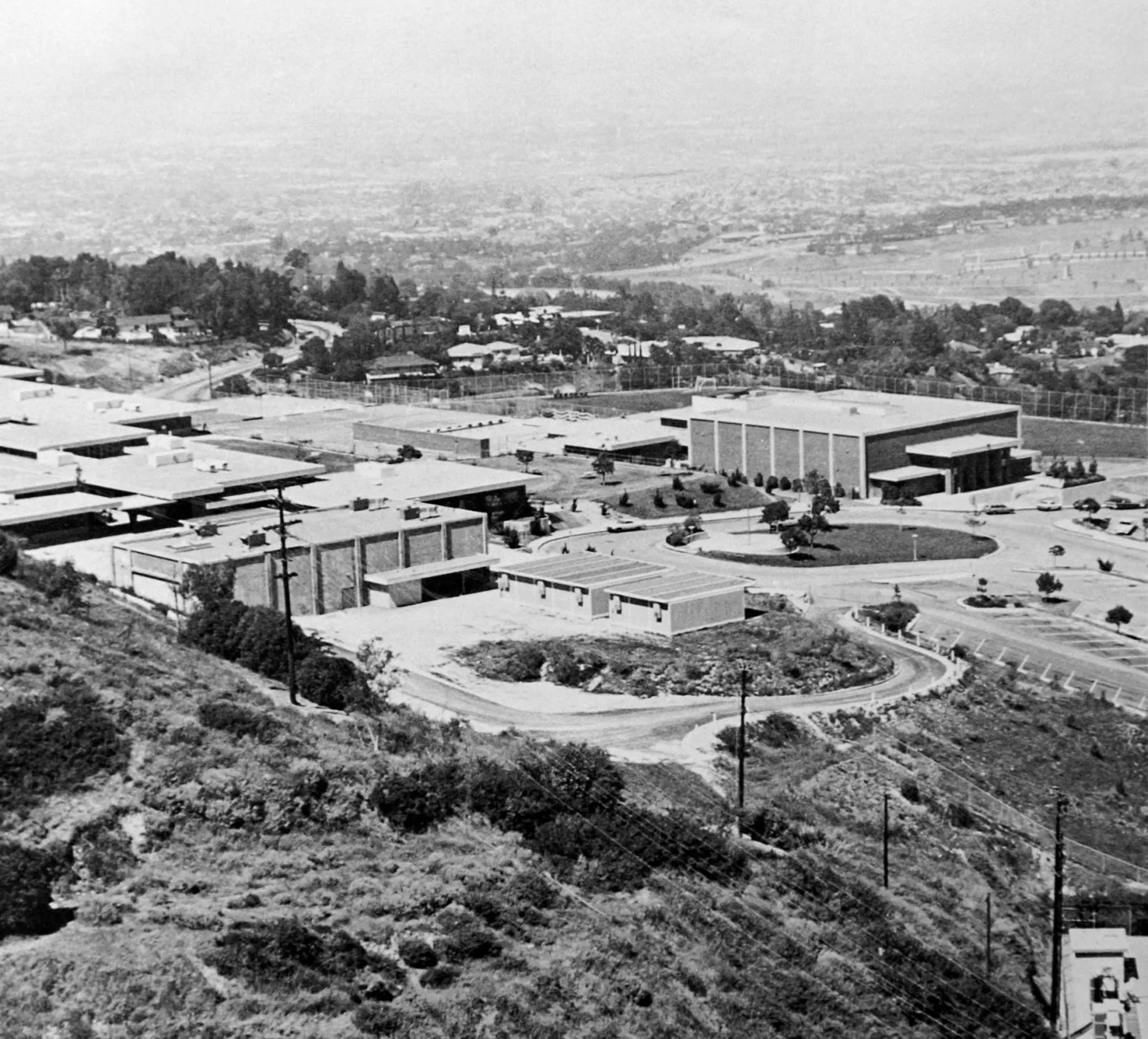
Miraleste High School in 1968. (Daily Breeze file photo)

The Miraleste Fire Station was built in 1947. After years of groundwork, Miraleste High School accepted its first students in September 1968. In 1970, the Miraleste branch of the Palos Verdes Public Library opened its doors.

The years 1970-1973 saw Miraleste debating whether to become part of what was called “the fourth city,” to be called Rancho Palos Verdes. (Palos Verdes Estates, Rolling Hills and Rolling Hills Estates are the other three.) 

Some residents favored forming their own city, though the region lacked a large tax base of retail and industrial businesses. Others felt it made more sense to become part of the larger  Rancho Palos Verdes. On Aug. 28, 1973, an election was held to determine the area’s fate. 

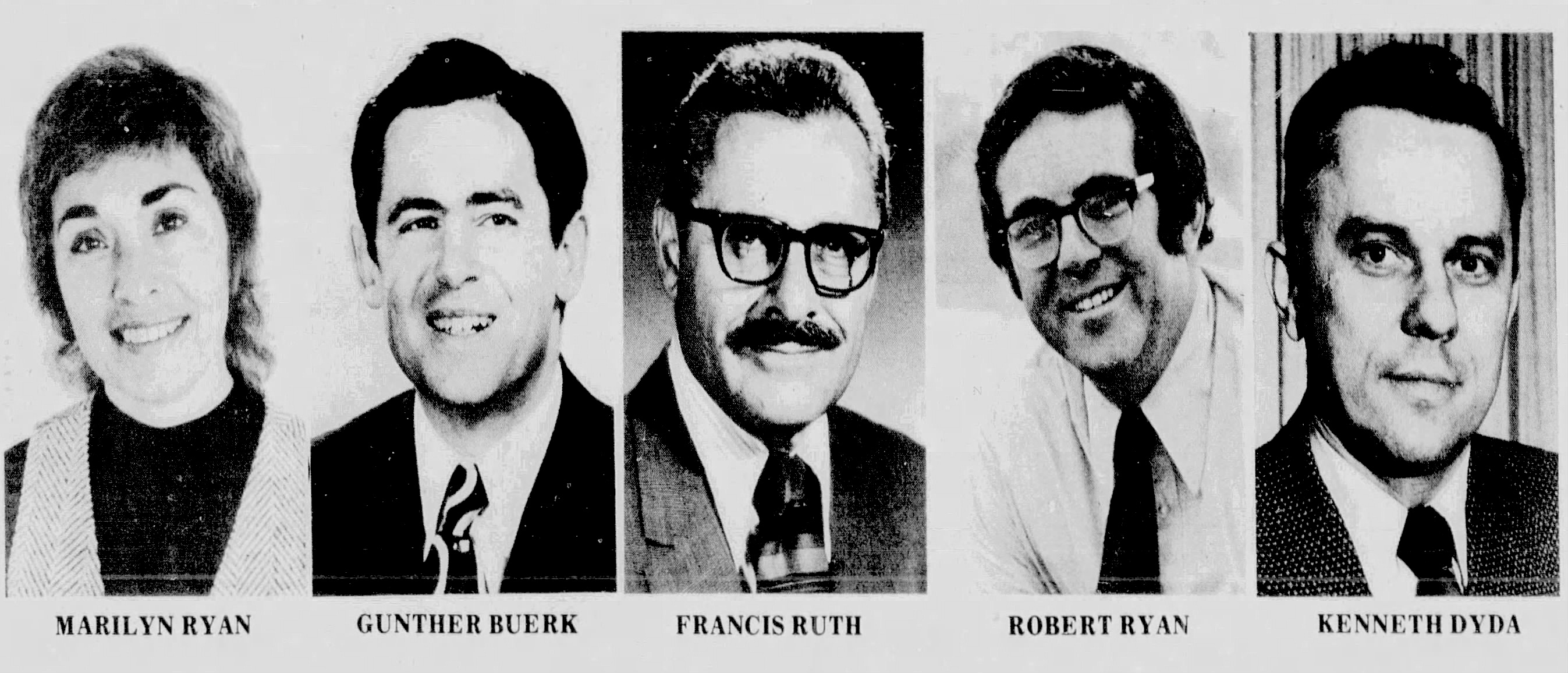
In addition to the incorporation issue, voters also had to select the first five council members for the new city should the outcome favor incorporation.

The five council members elected for the new city of Rancho Palos Verdes in 1973. (Credit: San Pedro News Pilot archives)

The results overwhelmingly favored incorporation, which garnered 82 percent of the vote. The only area showing even a modicum of no votes was Miraleste, where it still passed handily.

The next issue to roil Miraleste residents was sparked by intimations from the Palos Verdes Peninsula School District that falling enrollments and rising costs might be leading to the closure of Miraleste and Palos Verdes high schools. Students would be then folded into one high school, Peninsula High (formerly Rolling Hills High).

The reaction was swift. Many parents and students decried the move, which was passed by the board on Oct. 31, 1987. The opponents filed a lawsuit, which succeeded in overturning the district’s plan in 1988.

But the numbers didn’t lie. Faced with a $2.1 million deficit, the district voted in December 1990 to make the closures and consolidation final, effective June 1991.

Its students never forgot Miraleste High, though. In July 2023, an all-years high school reunion for former Miraleste attendees held at Miraleste Intermediate School, the school’s former location, drew more than 1,000 former Marauders to celebrate their former school. A second such celebration, now titled “Miraleste Fest,” was held in July 2025.

According to the City-Data.com website, the 3.697-square-mile Miraleste area had an estimated 12,703 residents in 2023. More than a century after its founding, it still adheres to the Palos Verdes Art Jury rules set down in 1923.

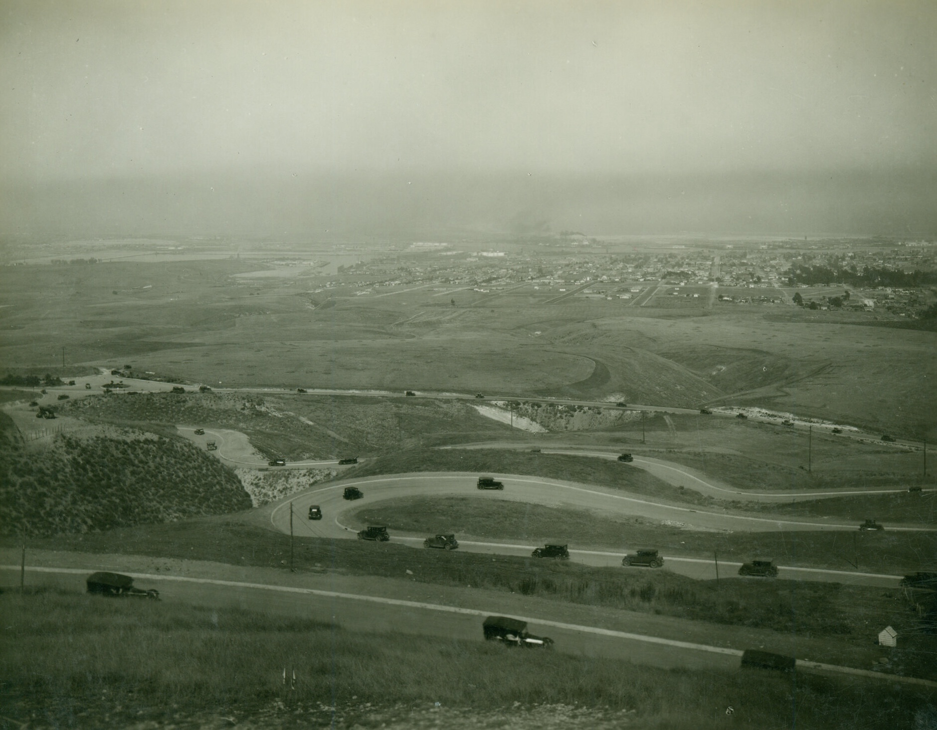
July 31, 1926 photo taken from just above the Wehrman residence, on Via Colinita in Miraleste, looking southeast with Los Angeles Harbor and the community of San Pedro in background and a portion of the caravan of 300 automobiles commemorating the opening of the new Palos Verdes Coast Highway, dedicated on July 31, 1926. The caravan was several miles long, going westward up the hill from San Pedro by way of Ninth Street and Western Avenue, entering Miraleste, and continuing past Portuguese Bend, Lunada Bay, to the center of Redondo. (Credit: Local History Center, Palos Verdes Public Library)

Sources:

City-Data.com website.

Daily Breeze archives.

Miraleste Homes Association website.

Palos Verdes Peninsula News archives.

The Palos Verdes Story, by Delane Morgan, The Palos Verdes Review, 1982.

San Pedro News Pilot archives.

San Pedro News Pilot ad, Feb. 21, 1925, Page 3. (Credit: San Pedro News Pilot archives)

Pacific Coast Highway was part of an ambitious master plan in its early days

Undated postcard circa 1930s shows houses along the Roosevelt Highway in Santa Monica. (Credit: Wikimedia Commons, public domain)

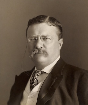
President Theodore Roosevelt did not come up with the Roosevelt Highway plan, which was launched two years after his death in 1921. The ambitious undertaking was named in honor of the charismatic late president after the fact. 

President Theodore Roosevelt in 1904. (Credit: Wikimedia Commons)

The Roosevelt Highway master plan envisioned the building of an intercontinental roadway that would stretch along the western coast of the Americas. It would run from Seward, Alaska on the north, down the western Canada coast through Vancouver, then down through Washington, Oregon and California to the Mexican border.

It would then cut inland upon reaching Tijuana, Mexico, traverse Latin America, and end up in Buenos Aires, Argentina, covering more than 13,000 miles.

Construction on the superhighway began with considerable ballyhoo in 1921 in the Santa Monica-Malibu area. No single road then existed that connected that area with Ventura and points further north.

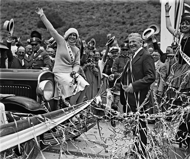
Building this winding two-lane shoreline roadway took nearly a decade. On June 26, 1929, this first segment of Roosevelt Highway officially opened. It ran from north of the Santa Monica Pier and extended through Malibu to Sycamore Canyon on the Ventura side of the county line.

In Sycamore Canyon north of Santa Monica. Gov. C.C. Young, assisted by Miss Mexico, right, and Miss Canada, left, prepares to sever the barrier and throw the road open to the peoples of three nations. on June 29, 1929. Los Angeles Times photo from UCLA Special Library Photo Collection. (Credit: Wikimedia Commons)

The highway’s number wasn’t identified as Highway 1 from the start, but went by three different numbers. Originally, it was Route 60, then Route 3, then Route 101 Alternate, before receiving the Highway 1 label in the 1960s. 

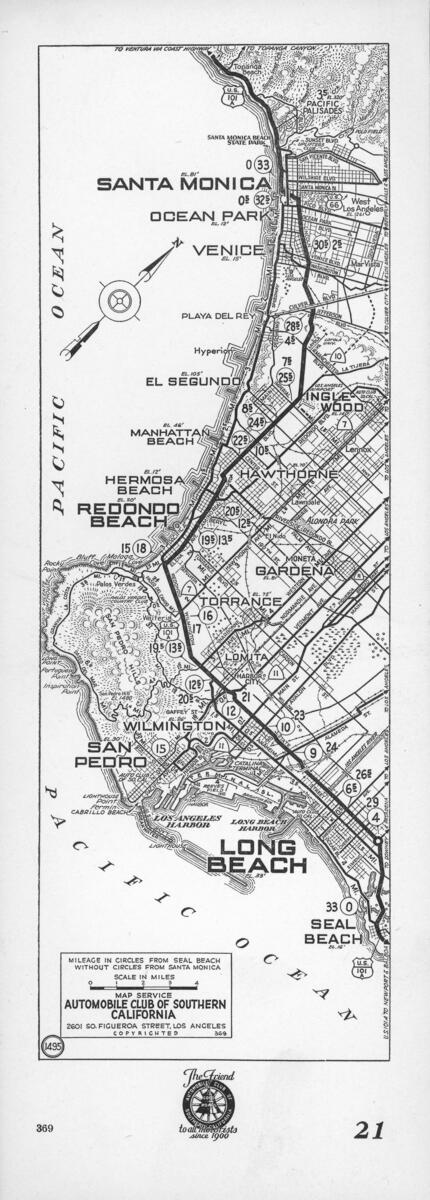
1936 Automobile Club map. Heavy black line running through center shows the route of Roosevelt Highway from Santa Monica through Long Beach. (Credit: USC Digital Library)

Despite all the celebrating over the completion of the Santa Monica section, there was much more to be done. At that time, the Roosevelt Highway was unfinished between Santa Monica on the north, and Long Beach on the south. 

 In 1931, work began on connecting the segments of the highway running southward through the South Bay to Long Beach, and from there, through coastal Orange County to Dana Point. While it didn’t garner as much publicity as the Santa Monica-Malibu portion, this route through a variety of jurisdictions had its fair share of complications.

After leaving Santa Monica, the road followed Sepulveda Blvd. south through Westchester. It had to be threaded around (and later under) Los Angeles Municipal Airport (now LAX) and then through El Segundo and the beach cities. 

In South Redondo, the Roosevelt Highway veered inland, following the path of Redondo-Wilmington Blvd. through the then sparsely developed southern Torrance border.

By October 1934, work on the Torrance segment of the road was ten percent complete. A tricky section along South Elena St. in Redondo Beach had been finished in June 1933, and the public works money was continuing to flow.

In 1935, the state department of public works estimated that the international roadway would be completed in six years. That June, the stretch of new roadway following the route of the former Redondo-Wilmington Blvd. from Redondo Beach through Torrance to Lomita was opened to traffic.

Judging by newspaper accounts, the construction through Lomita and Wilmington seemed especially fraught with delays and red tape. After traversing Wilmington, the roadway would connect with State St. in Long Beach and then continue into Orange County.

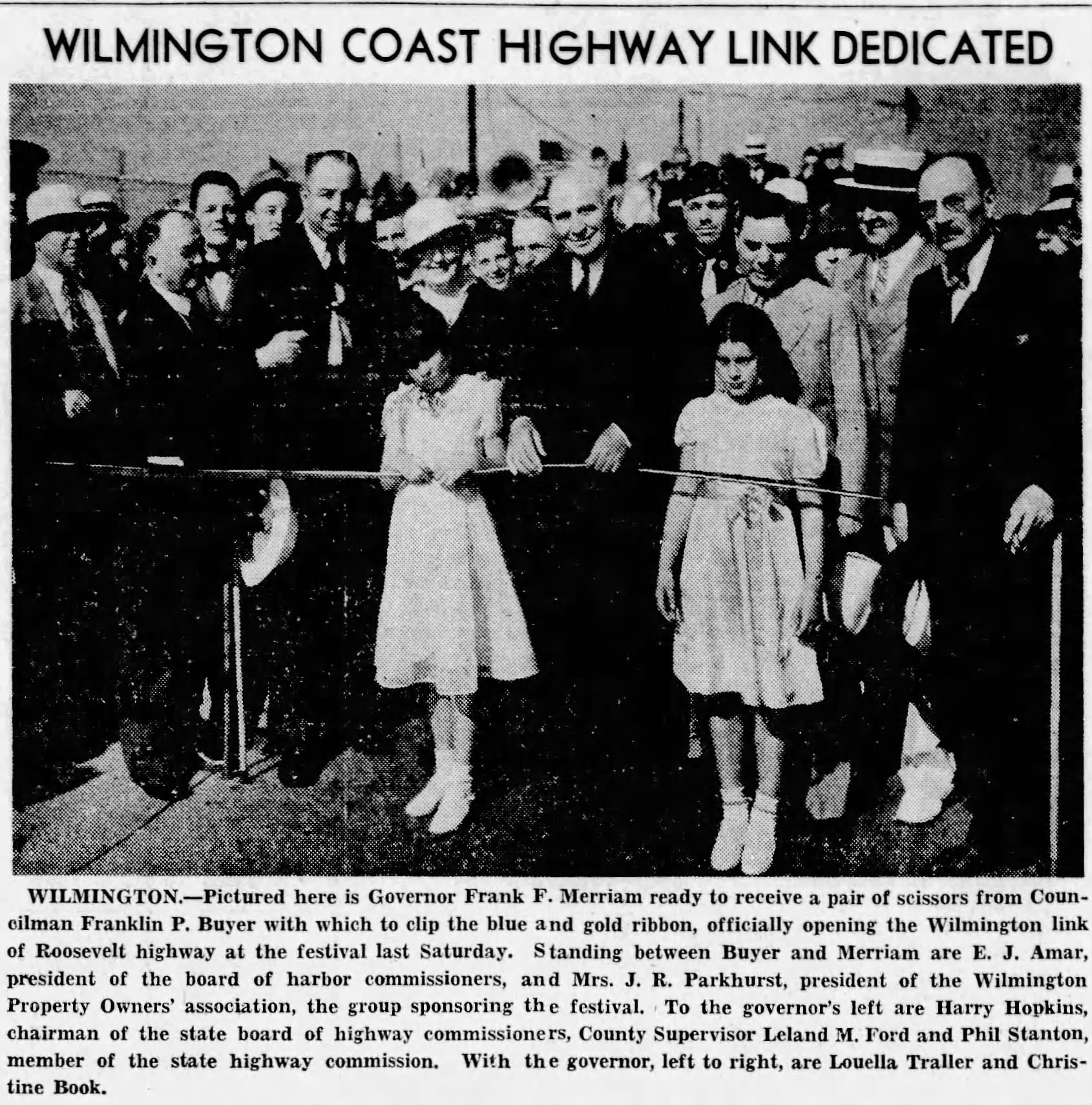
After some bureaucratic and weather delays, the Wilmington section following avenues N and O through to State St. was completed. Dedication for the new roadway was held on June 5, 1937.

San Pedro News Pilot, June 9, 1937, Page 9. (Credit: San Pedro News Pilot archives)

Along the once-empty east-west roadway through the South Bay, businesses began to spring up as highway traffic increased. These included a Safeway grocery store that opened in Lomita in 1937, which was followed by new cafes, service stations and other small stores.

Ironically, as the new roadway neared completion, the ardor for the Roosevelt Highway scheme seemed to be subsiding. As early as 1936, chambers of commerce for cities along the route were asking for a name change for the new road. 

Lomita asked for the change in 1939, and Torrance officially adopted the new name in April 1941. A month later, Los Angeles County officials agreed on the use of the name “Pacific Coast Highway” throughout the whole route.

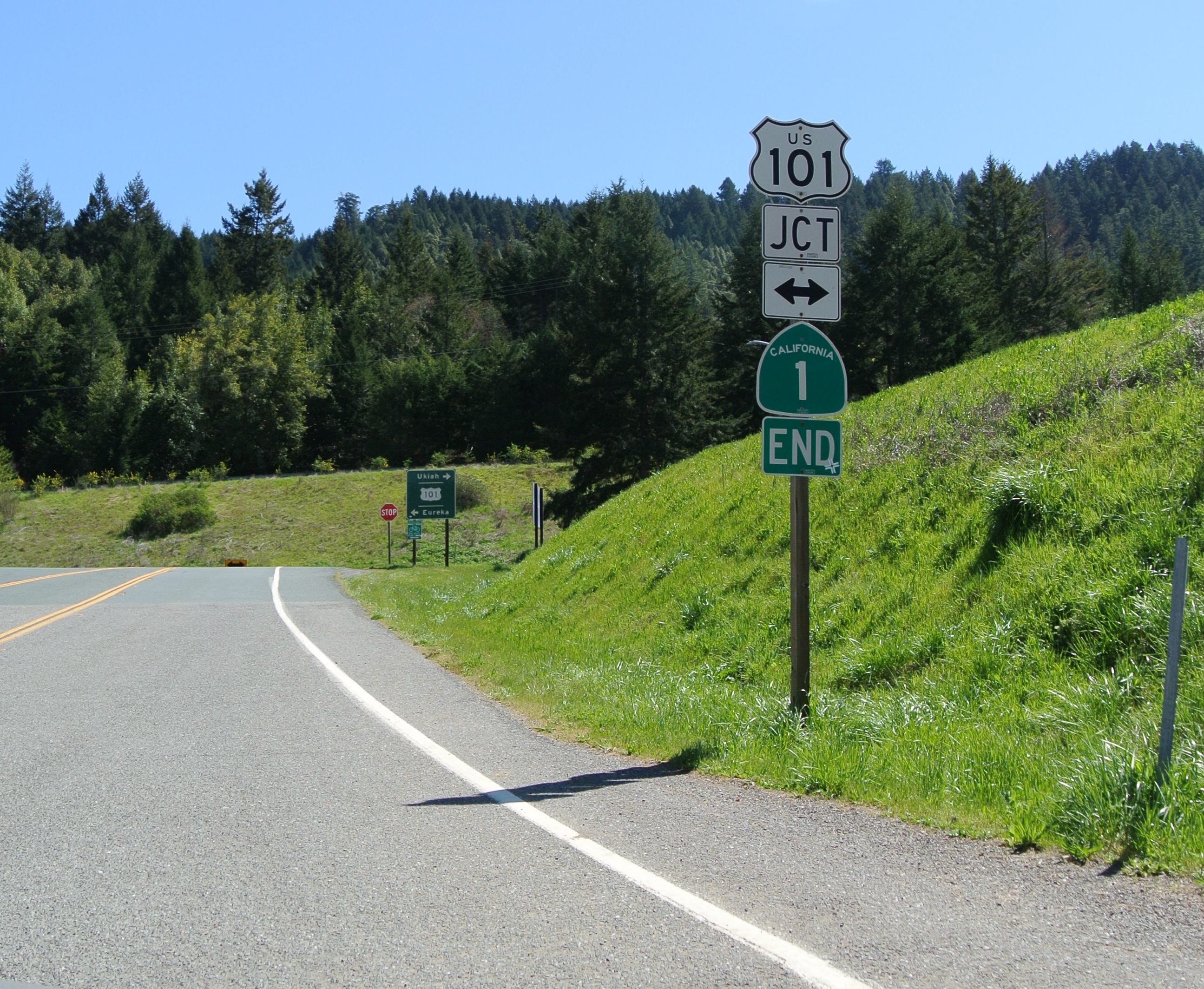
The quixotic idea of a contiguous intercontinental Roosevelt Highway never came to pass. In 1964, the state of California designated the roadway as State Route 1. It stretches from Dana Point in Orange County northward to the town of Leggett north of Fort Bragg, where it joins Highway 101.

At 656 miles in length, Highway 1 is the longest state highway in California and the second longest state highway in the U.S. behind State Highway 200 in Montana’s 706-mile stretch.

Three roadways do currently connect Canada and Mexico, a feat to which the Roosevelt Highway once aspired. The Interstate 5 Freeway runs from Tijuana, Mexico to Vancouver, Canada, passing through California, Oregon and Washington on the way. It was completed in 1979.

U.S. Highway 62 winds its way from the Mexico border at El Paso, Texas eastward, ending at Niagara Falls in New York/Canada. The Can-Am Highway is actually a series of connected roadways running from El Paso to the Canadian border at Fortuna, North Dakota.

Signs marking the northern terminus of SR 1 near Leggett in Northern California. Credit: Wikimedia Commons)

Sources:

Daily Breeze archives.

“From Roosevelt Highway to the 1: A brief history of Pacific Coast Highway,” by Nathan Masters, PBS SoCal website, May 2, 2012.

Los Angeles Times archives.

San Pedro News Pilot archives.

“State Route 1,” California Highways website.

Wikipedia.

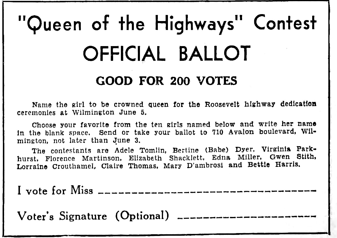
Virginia Parkhurst was announced as the winner of the “Queen of the Highways” contest at the June 5, 1937 Roosevelt Highway dedication ceremony in Wilmington. San Pedro News Pilot, May 31, 1937, Page 7. (Credit: San Pedro News Pilot archives)

Howard Hughes’ Glomar Explorer operated out of Long Beach, Los Angeles ports

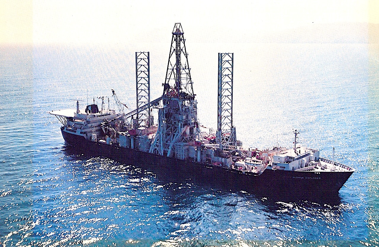
The Glomar Explorer at sea. Undated U.S. Government photo. (Credit: Wikimedia Commons)

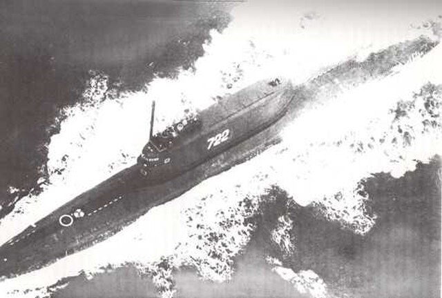
The saga of the Glomar Explorer begins with the disappearance of a Russian submarine, the K-129, in the Pacific Ocean about 1,560 miles northwest of Hawaii on March 8, 1968. Russian vessels tried to locate the sub, which was carrying five nuclear missiles, but declared it lost after an extensive search.

Remember that the Cold War between the U.S. and Russia was still very much alive during this era. Retrieving a recently operational Russian submarine had all the earmarks of an intelligence goldmine for the U.S.

The U.S. Navy located the downed sub with one of its own submarines, the USS Halibut, on Aug. 20, 1968. The problem: it had sunk to the bottom of the Pacific at a depth of 16,500 feet, more than three miles under the surface. At that point in time, the deepest successful retrieval of something heavy from the ocean floor was 1,000 feet.

The diesel-electric Soviet ballistic missile submarine K-129, hull number 722, part of whose wreckage was picked up off the ocean floor by the Glomar Explorer. (Credit: CIA photo)

There was little question that the U.S. would attempt to retrieve the sub. For the next several months, debate raged within the U.S. Government over who would take command of the secret  operation, which was given the codename Project Azorian. The Central Intelligence Agency finally was given the assignment in April 1969.

The CIA formulated a plan to build a large, powerful ship with a giant submersible claw device capable of clutching the sub’s remains and lifting them to the surface. But such a project would quickly attract the attention of the Soviets, so a cover story had to be concocted.

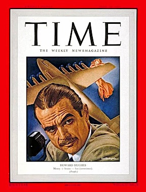
Howard Hughes. Time, July 1948 cover. (Credit: Wikimedia Commons)

Enter eccentric genius Howard Hughes. Hughes partnered with Global Marine, a London-based company, to design and build the ship, which was named the Glomar Explorer. The cover story? Hughes announced he would be using the ship for a mining operation to scoop up valuable manganese nodules from the deep ocean floor.

The building of the massive ship, now officially named the Hughes Glomar Explorer, began in November 1971 at the Sun Shipbuilding yard in Chester, Pennsylvania. It launched in November 1973.

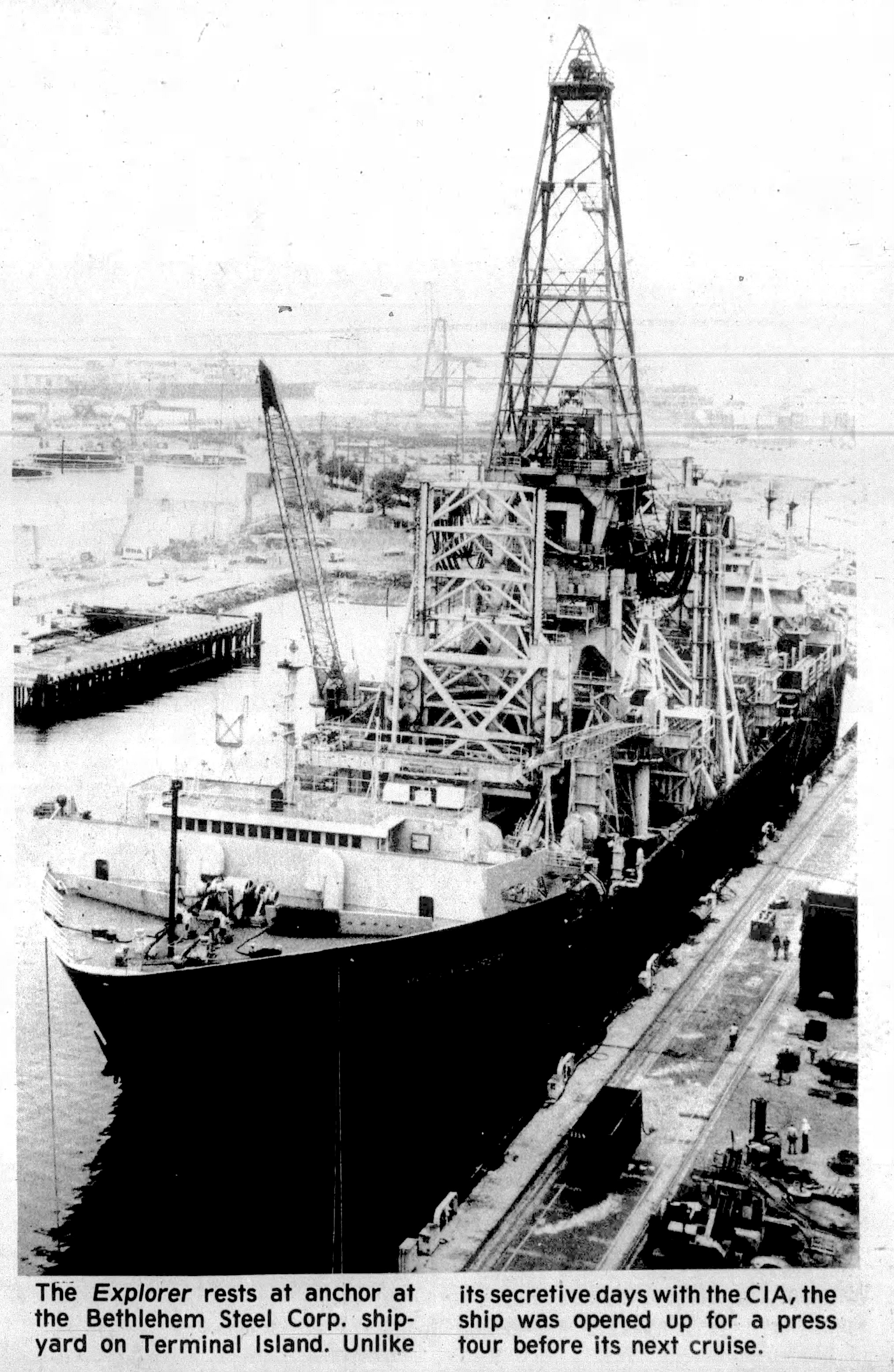
The 618-foot-long vessel with its 116-foot-tall derrick weighed about 70,000 tons, about 10,000 tons heavier than a typical World War II battleship. It was too large to traverse the Panama Canal, so it had to travel around Cape Horn to get to its California berth, arriving on Sept. 30, 1973.

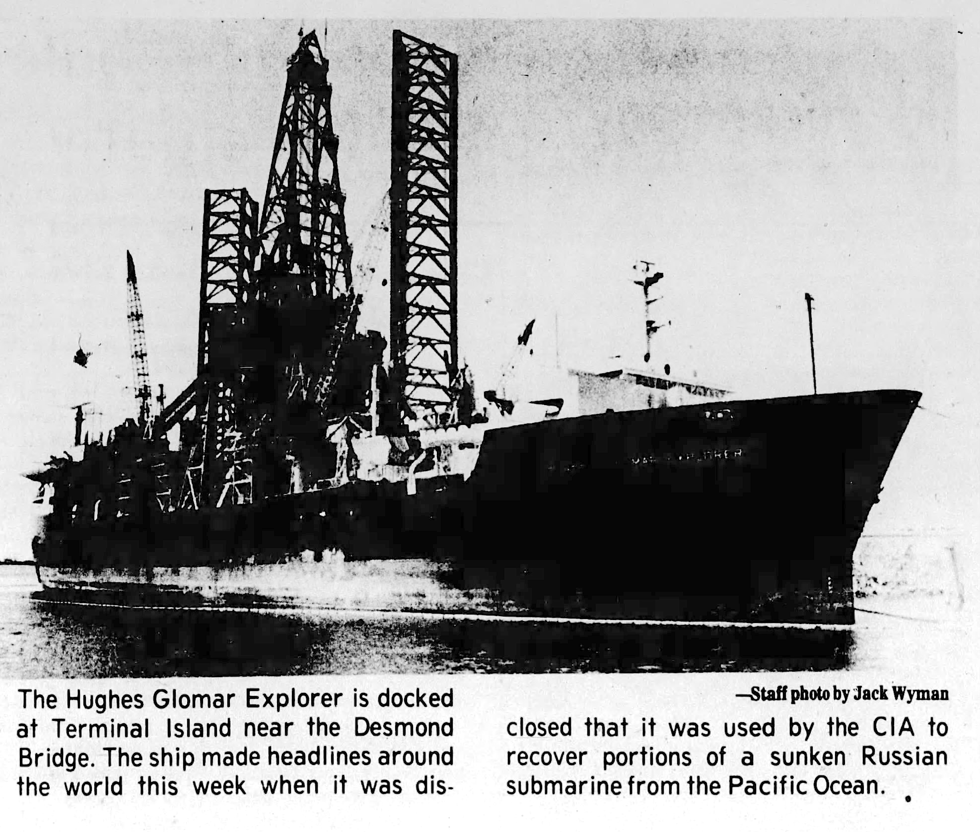
The spy ship docked at Pier E at the Port of Long Beach, near where Hughes’ famous “Spruce Goose” wooden seaplane was located. Docking it there may have been another attempt to downplay the boat as just another one of Hughes’ fanciful creations.

Daily Breeze, March 20, 1975, Page 3. Staff photo by Jack Wyman. (Credit: Daily Breeze archives)

There was much curiosity about the mysterious ship, but its true mission remained hidden. A San Pedro News Pilot story from Jan. 12, 1974 reported that the ship was preparing to leave port to conduct an undersea manganese mining operation near Nicaragua.

The actual operation began on July 4, 1974, and lasted for two months. Reports on its ultimate outcome vary, but most agree it was a qualified success. According to the CIA’s webpage, the Explorer retrieved a good chunk of the Russian sub – and two nuclear warheads – but lost some key elements, including the ship’s codebook, when part of the section broke off while being lifted up from the ocean floor.

The real purpose of the mission didn’t become public until the Los Angeles Times and New York Times broke the story in 1975. The CIA didn’t declassify its report on Azorian until 2010, when it issued a redacted report that revealed the project’s codename for the first time.

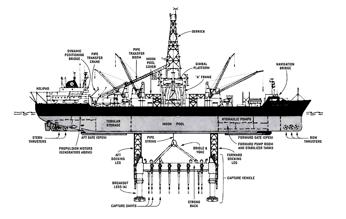
Detailed diagram of the Hughes Glomar Explorer by Antonio Raspa. (Credit: U.S. Naval Institute website)

Once the news of the operation went public, Russia assigned ships to patrol the area, making  further attempts to scoop up more wreckage from the site impossible. The Explorer returned to its berth.

In September 1975, the Daily Breeze reported that a Soviet spy ship had been planting electronic sensors on the ocean floor off the Palos Verdes Peninsula in an area that the U.S. military was using for underwater weapons testing. The Explorer was sent to those waters to remove the Soviet devices using its lifting mechanism.

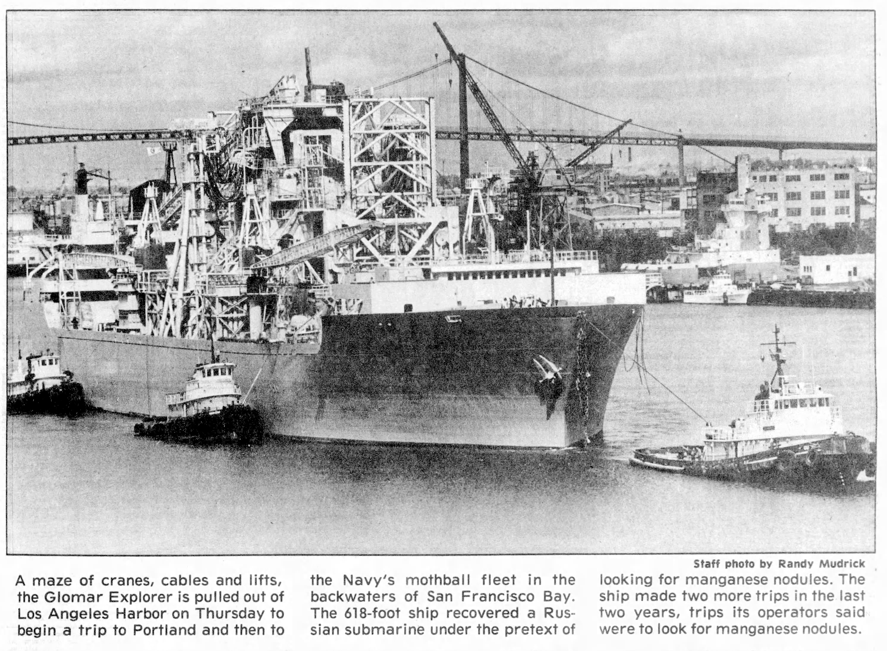
San Pedro News Pilot, March 7, 1980, Page 1. Staff photo by Randy Mudrick. (Credit: San Pedro News Pilot archives)

With the Explorer’s unique original mission finished, the question of what to do with the giant ship arose. In early 1976, the U.S. government offered to lease it to private ocean mining operations, but got no immediate takers. The vessel had become something of a “white elephant,” expensive to operate and maintain.

Finally, the decision was made to put the ship in mothballs, and it was sent to the National Defense Reserve Fleet in Suisun Bay near San Francisco. But it would have a second life.

It returned to the Port of Los Angeles in early July 1978 to undergo retrofitting for its planned use in a deep-sea mining venture involving four companies who had leased it from the government. 

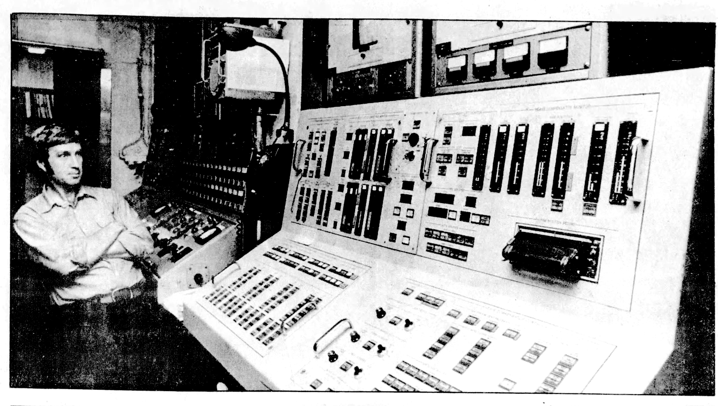
The control room of the Glomar Explorer as seen during a 1978 press tour of the ship. Staff photo by Jack Lardomita. (Credit: San Pedro News Pilot archives)

The retrofitting took place at the Bethlehem Steel Co. shipbuilding yard on Terminal Island at the Port of Los Angeles in San Pedro. For the next 20 years, the Explorer was used in a variety of ocean mining and other such commercial operations. It often returned to San Pedro for maintenance and refittings, even after Bethlehem Steel sold its shipyard to Southwest Marine in 1983.

In 1998, the Explorer was converted into a deep sea oil drilling ship, and operated in that manner until 2015, when its Swiss owner, Transocean Ltd., announced that it would be scrapped.

The ship took its final voyage to Zhousahn, China, in June 2015, where it was dismantled.

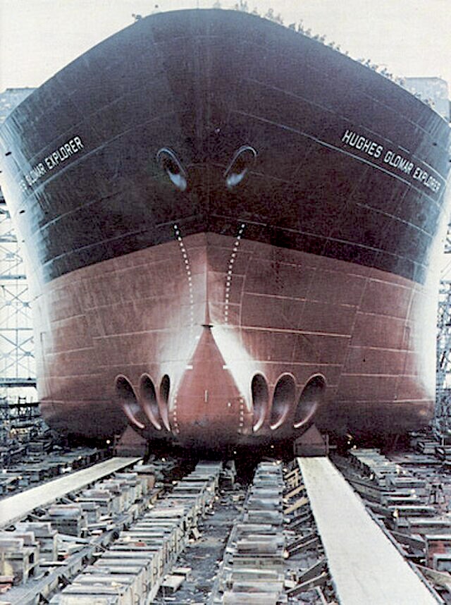
The Hughes Glomar Explorer’s initial launch on Nov. 1, 1972. (Credit: CIA photo)

Sources:

“About Project Azorian,” CIA website.

Daily Breeze archives.

“5 Things About America’s Daredevil Mission to Salvage a Soviet Nuclear Sub,” by Andrew Moseman, Popular Mechanics website, Aug. 29, 2017.

“Inside Project Azorian,” by Capt. Jack G. Newman, U.S. Naval Reserve (retired), U.S. Naval Institute website, December 2025.

Los Angeles Times archives.

San Pedro News Pilot archives.

Wikipedia.

Daily Breeze, Sept. 9, 1978, Page 9. Staff photo by Jack Lardomita. (Credit: Daily Breeze archives)

The Carson Civic Center complex helped put a new South Bay city on the map

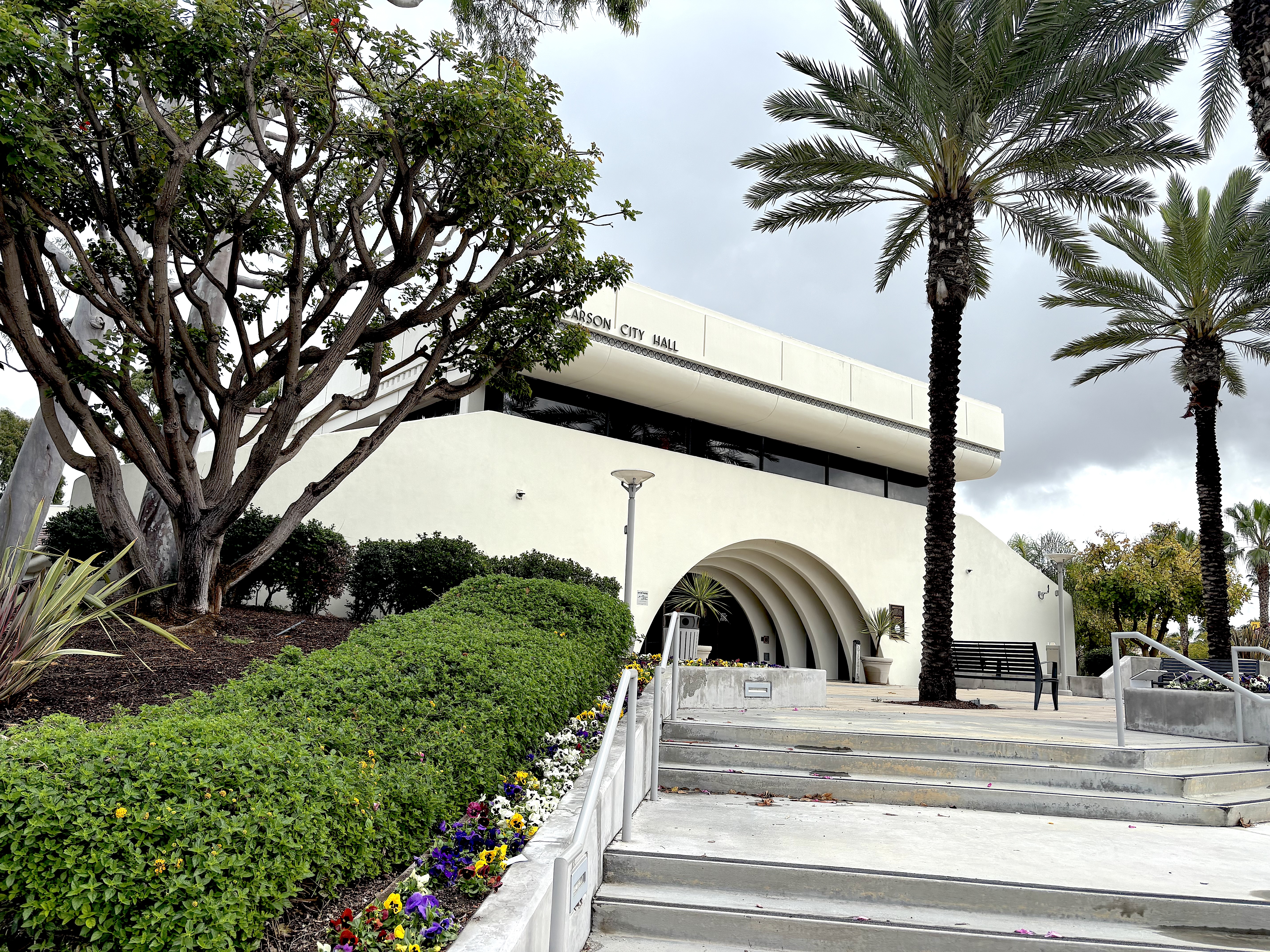
The front entrance to Carson City Hall in the Carson Civic Center. Feb. 11, 2026. (Photo by Sam Gnerre)

The struggle to incorporate the area that would make up the city of Carson began in the late 1950s and continued on for nearly the entirety of the 1960s. The topics of the debate ran the gamut from the important and the complex – which neighborhoods and chunks of land to include, to the most basic – what to call the new city.

Various consolidation attempts were filed under different names during these early efforts: Dominguez, Keystone, Victoria Park, Carsolinguez, Carson-Dominguez, and finally, officially, Carson.

The election to vote on incorporation was held on Feb. 6, 1968, with 17,351 voting for and 9,951 voting against. Voters also chose “Carson” as its name over “Dominguez,” and elected a slate of people to run the new burg. Carson’s incorporation became official on Feb. 19, 1968.

Once that matter had been settled, Carson’s new council members seemed to realize that their new city was seriously lacking in some necessary public facilities. 

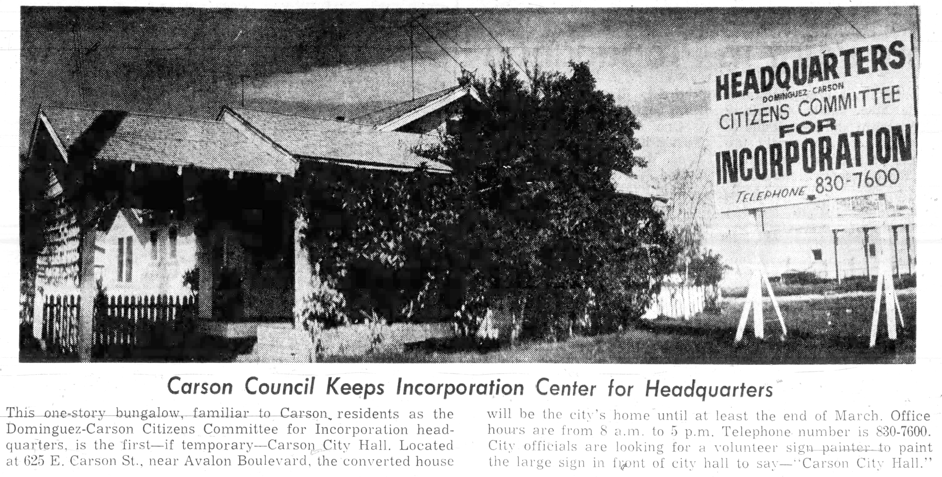
Daily Breeze, Feb. 26, 1968, Page 9. (Credit: Daily Breeze archives)

After all, the official swearing in ceremony and celebration following incorporation had to be held at Carson High School to accommodate the crowds. 

The house-like building at 625 E. Carson St. that was acting as the city’s first city hall had previously served as headquarters for the incorporation effort. It quickly became apparent that it would be way too small for the city’s present and future needs.

A modular unit in a vacant lot at 228th St. and Avalon Blvd. was used temporarily as its second city hall, followed by a move to an industrial building at 21919 S. Avalon Blvd. in 1968. It sufficed for several years before the rapidly growing city outgrew it as well. Something bigger was needed.

Fortunately, city leaders in the late 1960s had formulated plans to create the Carson Civic Center, a full complex of municipal buildings with a new city hall as its nexus. The civic center plan was approved by the city council in 1969, and ground was broken for it in February 1971. 

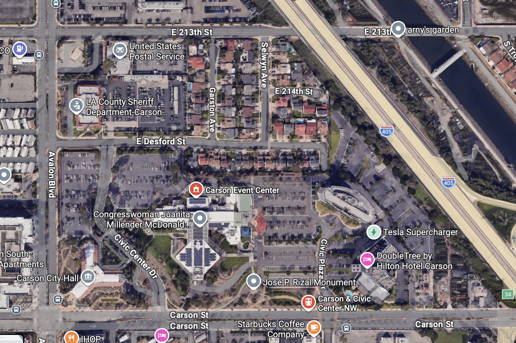
In addition to the Carson City Hall, it would eventually include a community building, an event center, an outdoor amphitheater, and, just across E. Desford St., a long-needed Los Angeles County Sheriff’s regional station and a U.S. Post Office.

The Carson Civic Center complex. 2026 data. (Credit: Google Earth)

The 60-acre site lies between Carson St.. and 213th St. on the north and south, and Avalon Blvd. and the 405 Freeway on the east and west.

The new post office building opened first, in 1973, followed by the sheriff’s station in 1974. Unfortunately, the plans for the main buildings in the new civic center had to be placed on hold in 1971 due to adverse economic conditions resulting from a nationwide recession.

At long last, ground was broken for the new Carson City Hall on Jan. 10, 1975. The city had hired three architects to design the new building in 1973: Robert Alexander, Frank Sata and Robert Kennard.

Kennard was an award-winning Black architect who had been mentored by renowned African American architect Paul Revere Williams. Kennard, who died in 1995, formed the Kennard Design Group in 1957. His daughter, Gail Kennard, now runs the firm.

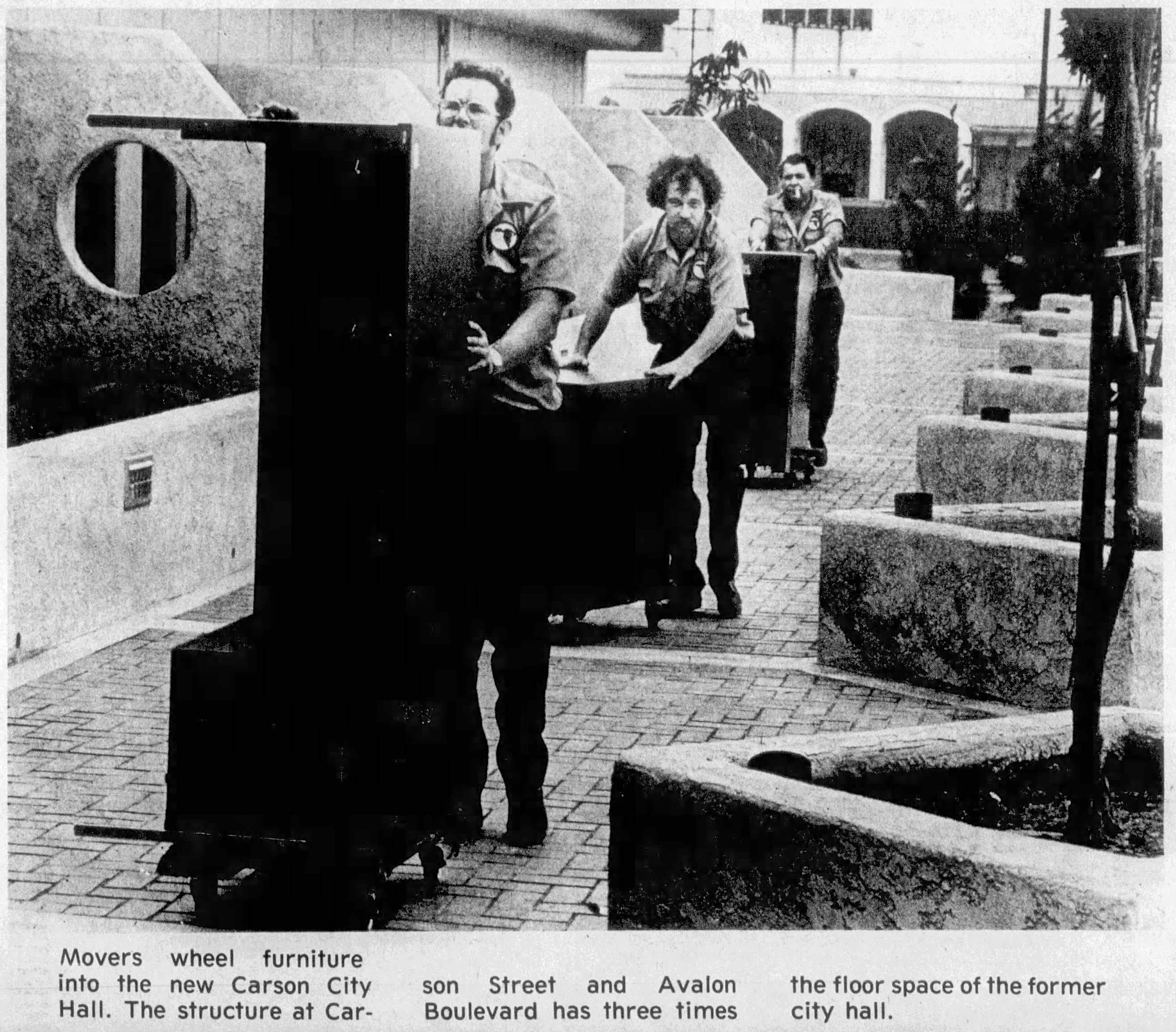
The $3.5 million, 60,000-square-foot, Carson City Hall with its innovative interior design and Aztec temple-styled facade was dedicated on Feb. 21, 1976. Still undergoing finishing touches at the time, it opened for business a few months later on July 12th.

Daily Breeze, April 17, 1983, Page 17. (Credit: Daily Breeze archives)

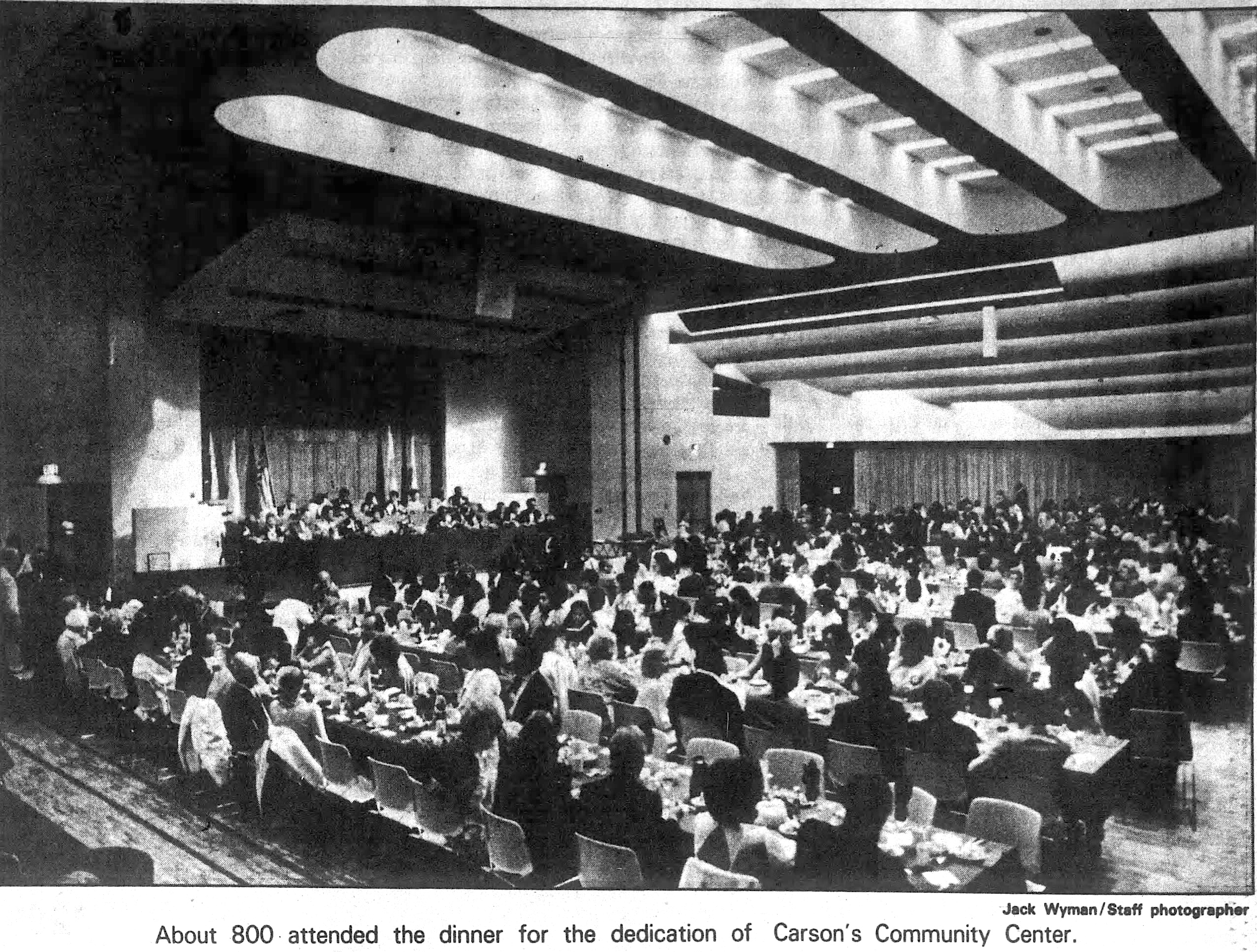
Next came the 73,0000-square-foot Carson Community Center, an $8.5 million structure that lies just east of City Hall. Its dedication on April 15, 1983, was the centerpiece of a weekend-long celebration of the 15th anniversary of the city’s incorporation.

Eight hundred people attended the ceremonies at the center, which was followed the next day by a city-sponsored parade and a gala ball held there.

The opening of the adjacent Clarion Hotel at 2 Plaza Center Drive on the eastern edge of the civic center complex in 1988 helped to boost meeting and convention business at the Civic Center. The hotel is now a DoubleTree by Hilton location. 

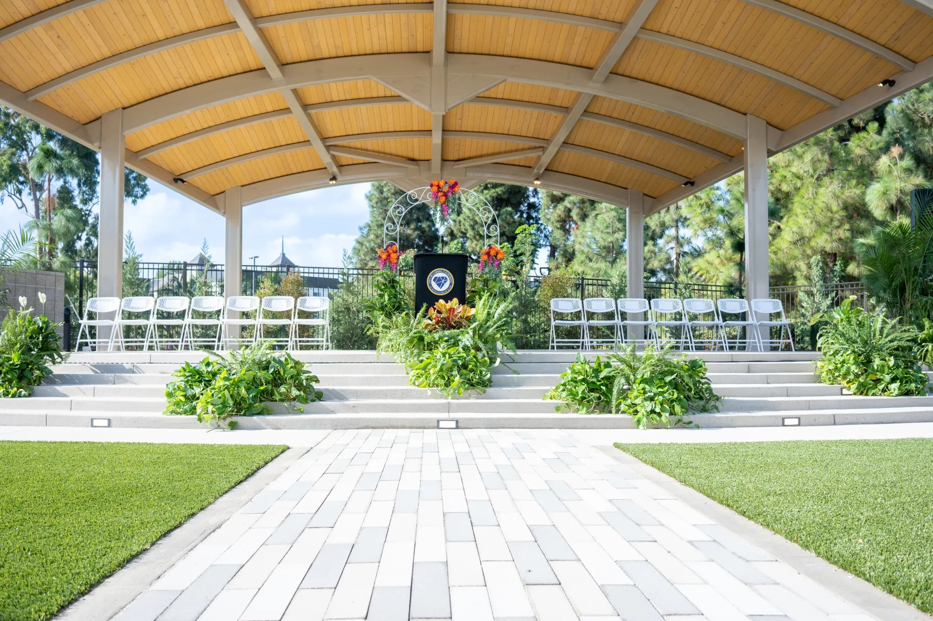
Thirty-two years later, a new facility was dedicated in the Carson Civic Center on Oct. 23, 2025. The $10 million, 1,000 seat outdoor amphitheater and event center took three years to plan and construct. 

Carson Mayor Lula Davis-Holmes told those at the ceremony that the amphitheater project would bring “world-class performances, community celebrations and cultural transitions” to the city.

This latest addition to the Carson Civic Center is another example of how far the city’s public facilities have come since its 1968 incorporation.

Carson’s new amphitheater, which is part of a 13,000-square-foot facility, is part of the largest outdoor space in the South Bay. The amphitheater and a neighboring courtyard area provide a central gathering space to host artistic performances, cultural events and community celebrations reflecting the community’s diversity and vibrancy. (October 2025 photo courtesy City of Carson)

Sources:

Carson, by Cindy Tino-Sandoval, Arcadia Publishing Co. (Images of America series), 2006.

Daily Breeze archives.

Los Angeles Times archives.

The History of a City … Carson, California, by Jack E. Jerrils, City of Carson, 1972.

My Carson, Your Carson: A Picture Book of the Past and Present, by Charlotte Trejos, Trejos Literary Agency, 1987.

Daily Breeze, July 12, 1976, Page 13. Photo by staff photographer Bill Cameron. Credit: Daily Breeze archives)

The Rolling Hills Country Club’s origin and subsequent iterations

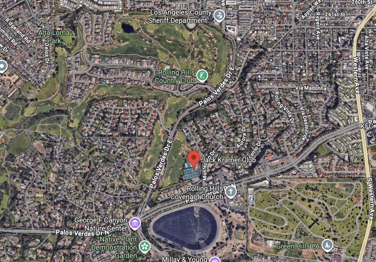
Rolling Hills Country Club, upper center labeled in green, lies in the eastern end of Rolling Hills Estates. 2026 image. (Credit: Google Earth)

Plans to build a golf course and a large housing development near the eastern edge of the Palos Verdes Hills were first floated in 1958. The area just north of the Palos Verdes Reservoir had become a part of Rolling Hills Estates when that city incorporated in 1957.

The roughly 30 acres of hillside land adjoined the Jack Kramer Tennis Club. The tennis club was originally slated to be a part of the golf course complex, until former pro Kramer entered the picture and developed the racket sports center as a separate facility. It opened in 1962.

Palos Verdes developer Omer K. Tingle owned about half the land to be used for the course. He had always planned to build a full-size 18-hole course in the area, but the pathway to that goal turned out to be lengthy and circuitous.

To start with, Tingle needed more land, some of which was taken up by the owners of  the nearby Chandler’s Palos Verdes Sand & Gravel Co. quarry. 

In 1962, he made a land swap deal with fellow developer and landowner George Chacksfield to acquire enough room to build the course. Chacksfield wanted to build his Rolling Hills Country Club Estates homes with golf course views there.

Torrance Herald, Aug. 8, 1963, Page 25. (Credit: Torrance Historical Newspaper and Directories Archive database, Torrance Public Library)

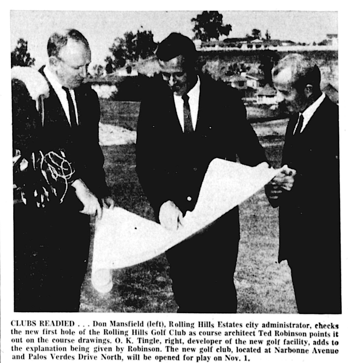
Tingle started by hiring Peninsula resident Ted Robinson to design a smaller nine-hole executive course. At the time, Robinson was just beginning his long and successful career as a golf course architect, during which he designed more than 150 courses worldwide.

Grading the land began in April 1963. The Rolling Hills Golf Club, as it was initially named, opened for play on Nov. 9, 1963. It was a par 29, with seven smaller par 3 holes and 2 longer par 4 holes.

From this first iteration forward, the club was always intended to be a private club, drawing its members from residents of the Peninsula. The small course was successful from the first, and planning for a larger one soon began.

In July 1965, Tingle announced that his architect Robinson had completed plans for the next phase of the Rolling Hills course. After signing a long-term lease for additional land from the Chandler’s quarry owners, construction was ready to begin on a new 18-hole layout across the way from the original 9-hole executive course.

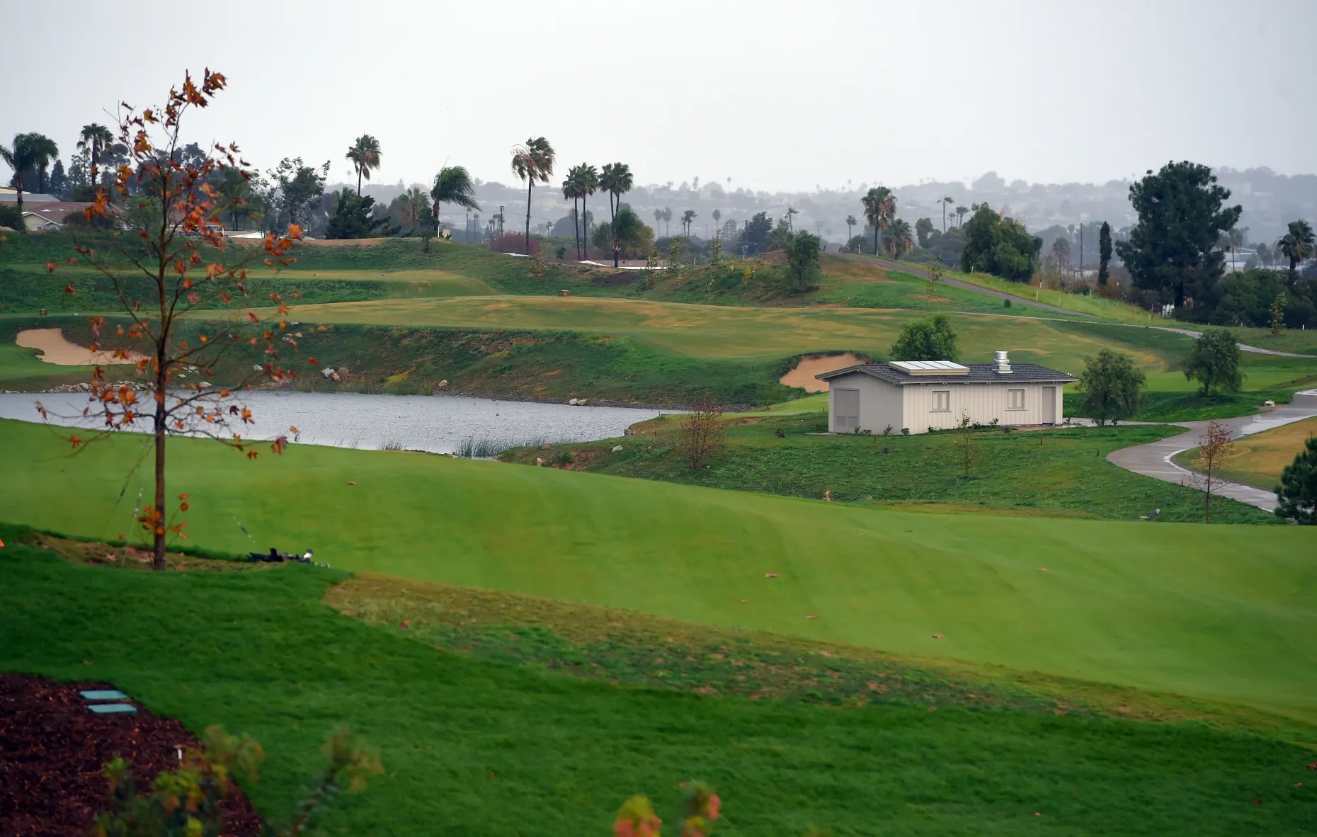
The new Rolling Hills Country Club nears completion in Rolling Hills Estates on Tuesday, Jan 9, 2018. (Credit: Daily Breeze staff photographer Scott Varley)

This iteration of the course would be the most creative in the club’s history. Nicknamed the “double nine,” it featured 18 full-length holes. The twist: it only had nine fairways. Once golfers had played the front nine holes, they would turn around and play the final nine holes using the same fairways in reverse.

It took four years, but the new course was opened for play on Oct. 9, 1969. Fears that players would be hitting golf balls into each other while sharing the same fairway from opposite ends proved to be unfounded.

Still, the “double nine” arrangement was strictly an interim step towards the end goal of creating a full 18-hole course. In November 1971, a plan to build the long-desired regulation 18-hole course was approved by the club’s board of directors.

This design, again crafted by Ted Robinson, would add nine new holes in place of the old executive course in addition to replacing the “double nine” layout. It also included new amenities such as an expanded clubhouse, new practice tees and a swimming pool. It opened on March 1, 1973.

The layout and facilities served members of the private club well for nearly three decades. Then, in the year 2000, the Chandler family announced it was shutting down its quarry operation for good, and planned to sell all its land holdings in the area, including the land it had leased to the Rolling Hills Country Club.

This led to a long series of negotiations between RHCC, the Chandler estate and various civic and regulatory agencies. Under the terms of a deal struck between the two parties in 2008,  RHCC would build a whole new golf course incorporating the former quarry site, and developer John Laing would erect a substantial number of new homes.

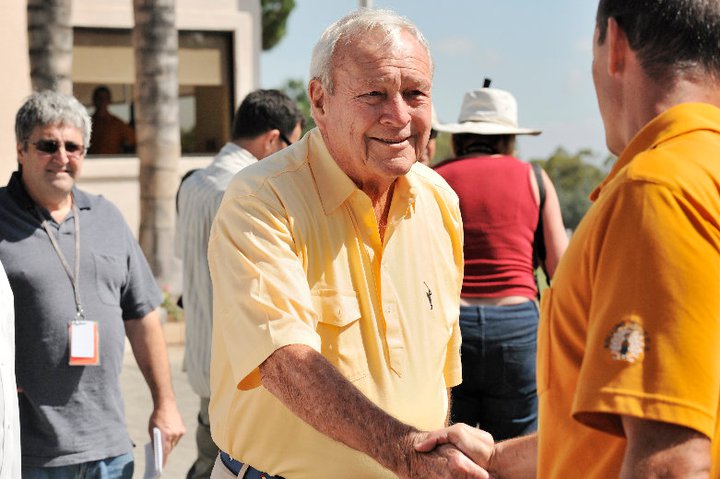
Arnold Palmer greets a fan at Rolling Hills Country Club on Oct. 3, 2009, as Daily Breeze reporter Josh Grossberg looks on, left. (Credit: Rolling Hills Country Club Facebook page)

Enthusiasm spiked when it was learned that the firm run by legendary golfer Arnold Palmer would be designing the new course. Unfortunately, the 2008 recession crushed the plans for Laing’s new housing development and stalled what had become known as the Chandler Ranch plan.

Palmer showed optimism when he visited the site in October 2009, but ultimately his firm did not  participate in the Chandler Ranch project. (He died on Sept. 25, 2016.)

The Chandler Ranch project and its new golf course plan eventually recovered from the ill effects of the economic downturn and began regaining momentum in 2011. In 2014, RHCC hired architect David McLay Kidd to design the new course.

The course was closed in early 2015, and construction began that August. The closure lasted for just over three years. It finally reopened with gala ceremonies on Jan. 13, 2018.

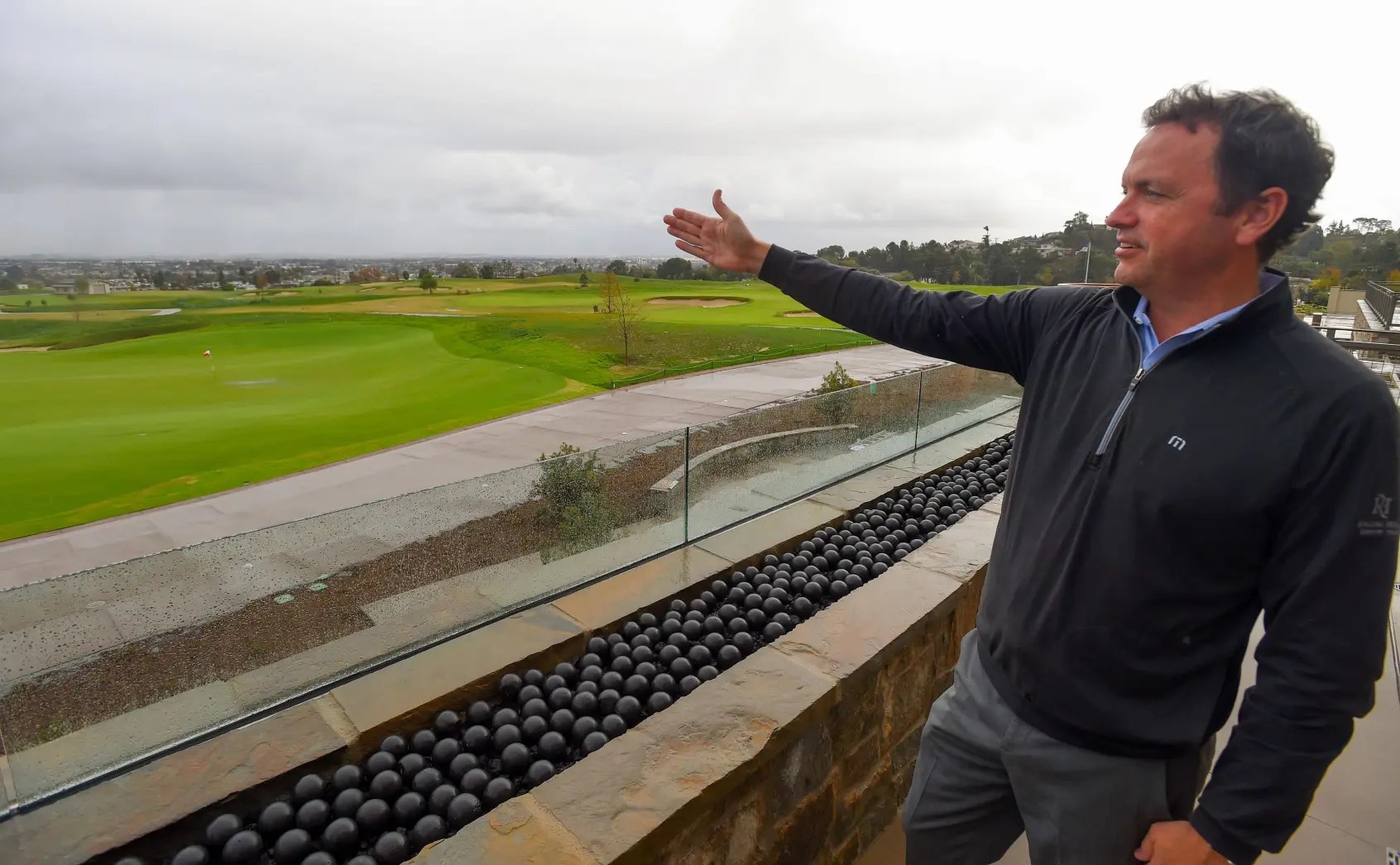
The $75 million,160-acre development included an 18-hole, 7,090-yard golf course, a huge 75,000-square-foot clubhouse, exercise facilities and pool, and more than $400 million in new homes. It remains a private club.

Rolling Hills Country Club General Manager Greg Sullivan looks over the club”s new golf course in Rolling Hills Estates on Tuesday, Jan 9, 2018. (Credit: Daily Breeze staff photographer Scott Varley)

Sources:

“Carrying Out a Big Dig at Rolling Hills Country Club,” by Adam Lawrence, Golf Course Architecture website, Feb. 13, 2018.

Daily Breeze archives.

Los Angeles Times archives.

Palos Verdes Peninsula News archives.

Rolling Hills Country Club website.

The Southern California Golf Guide, by Daniel Wexler, MTIII Golf Media, El Segundo, 2017.

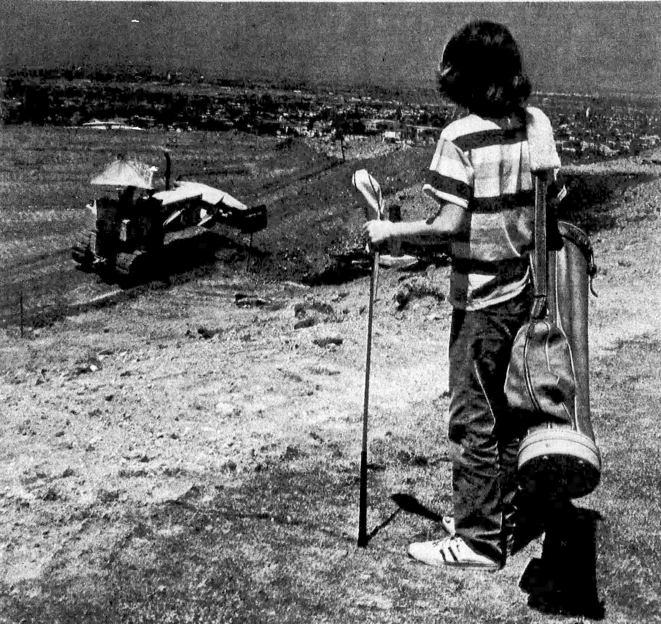
An unidentified young golfer looks out at new course construction at Rolling Hills Country Club. Daily Breeze, July 11, 1972, Page 29. (Credit: Daily Breeze archives, photo by staff photographer Jack Wyman)

Cisco’s in Manhattan Beach was an action-packed nightspot for a few years

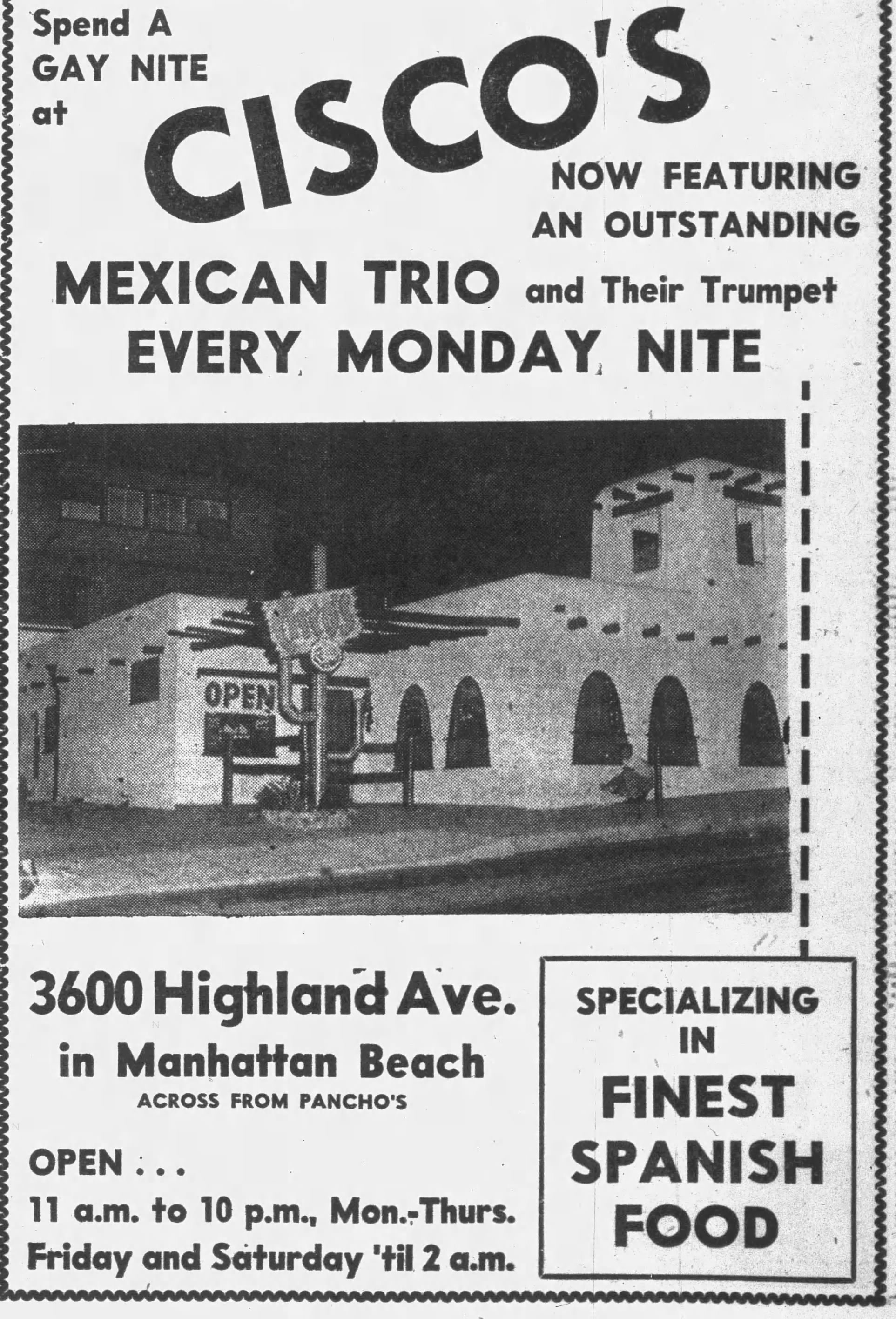
Daily Breeze ad, June 24, 1955, Page 3. (Credit: Daily Breeze archives)

The original building at 3600 Highland Ave. in Manhattan Beach that once housed Cisco’s restaurant and nightclub has long since been replaced. But longtime residents still remember the northeast corner of 36th St. and Highland Ave. in its prime as a bustling nightlife hot spot.

It wasn’t always so. The earliest mention of the address in the Daily Breeze is in a 1935 advertisement as the location of Barney’s auto repair shop. In September 1954, Joe Provencio, owner of the Beacon Cafe at Rosecrans Ave. and The Strand, applied for a liquor license for Cisco’s restaurant using that address.

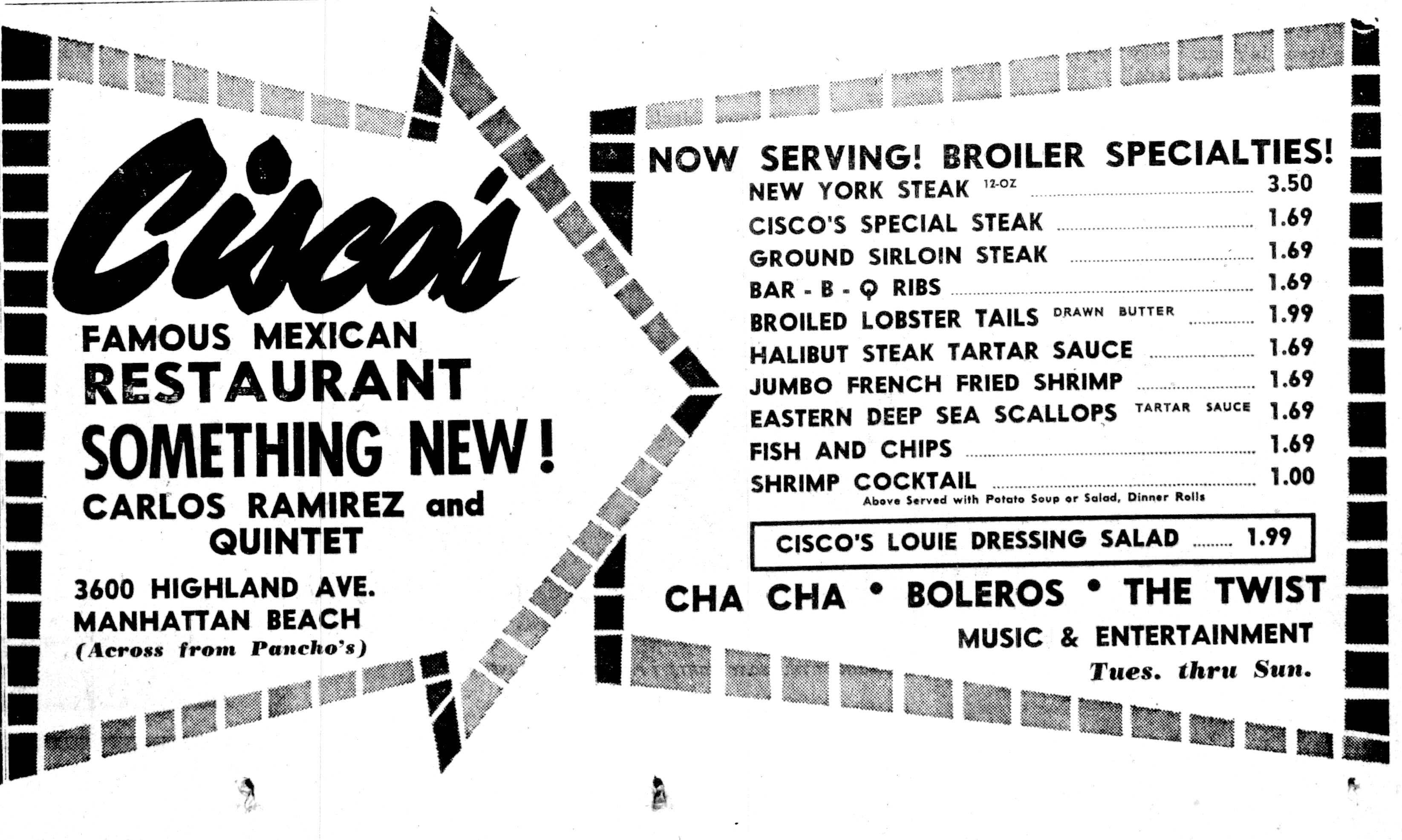
As did his Beacon Cafe, the new eatery offered Mexican cuisine. In addition to “Specializing in Finest Spanish Food,” per the June 1955 ad above, it also featured Latin and Spanish-themed  musical entertainment.

The Twist is on the entertainment menu at Cisco’s in this Daily Breeze ad from March 9, 1962, Page 3. (Credit: Daily Breeze archives)

He added on to the increasingly popular restaurant in 1957. In February 1960, he asked for and was granted a dance permit for the night spot, in time for a full-on “Cinco de Mayo Festival” held there over several days that May.

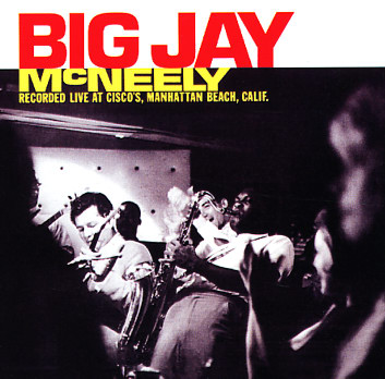
Big Jay McNeely’s album from 1963. (Credit: Discogs website)

Music would continue to be a big part of the Cisco’s experience. A 1962 appearance there by Los Angeles tenor saxophone legend Big Jay McNeely was recorded by Warner Bros. Records. The company released the album, “Big Jay McNeely Recorded Live at Cisco’s, Manhattan Beach, Calif.” in 1963.

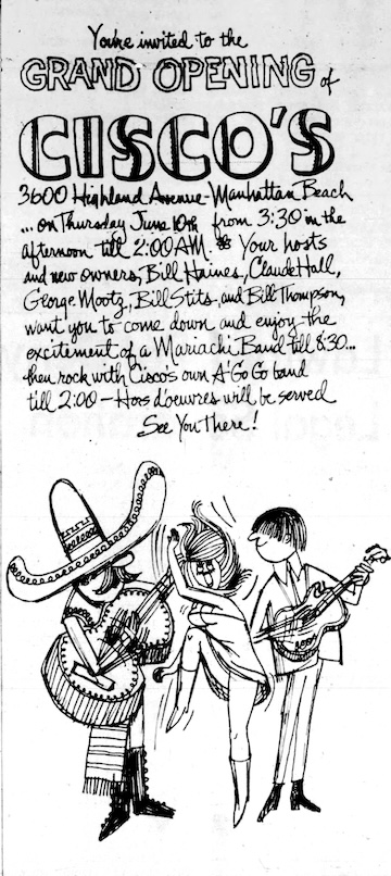
By 1965, Provencio was ready to give up ownership in the club, selling it to four partners in the spring of 1965. The partnership group, Cisco’s Manhattan Beach, Inc., included William P. Haines, Claude G. Hall, George Mootz, William D. Stitts, and William C. Thompson, all of them Manhattan Beach residents.

The corporation became recognized by the state of California on June 7, 1965. The club was completely refurbished inside and out to give it a more up-to-date look for its June 10th grand re-opening.

By the fall of 1965, local bands such as the Jesters and Richard and the Bowmen were playing regularly there. On Nov. 10, British performer Ian Whitcomb played a night at the club on the strength of his national Top Ten hit, “You Turn Me On.” Big Jay McNeely returned for a two-week engagement in 1966.

After that, it quickly became apparent that the new owners were targeting a younger audience. In addition to the Latin dance bands, they began booking teen-oriented acts. 

Actor Jack Ging. (Credit: Wikimedia Commons)

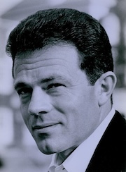
In 1968, actor Jack Ging took over management of the club, bringing along with him two celebrity investors: actor Clint Eastwood, and comedian and Redondo Union High alum Tommy Smothers. Co-owner William Haines remained from the 1965 ownership team.

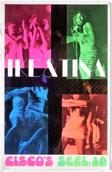
The new participants upped Cisco’s visibility by booking higher-profile acts. Ike and Tina Turner played dates there in 1969 and 1970. A March 1970 ad touted upcoming appearances by Bill Medley of the Righteous Bros, Jennifer Warnes, Rick Nelson, Etta James and Kenny Rogers and the First Edition.

Daily Breeze, June 7, 1965, Page 8. (Credit: Daily Breeze archives)

An undated poster exists for a Neil Diamond show at Cisco’s, though it’s unclear when it occurred. But Cisco’s attracted name acts like Diamond, Glen Campbell, Cheech and Chong, and others who could use the occasion to try out new material and work out performing kinks.

The club was beginning to live up to its advertised billing as  “where the action is,” but amping up the entertainment led to louder volume rock music and attracted larger, more boisterous crowds.

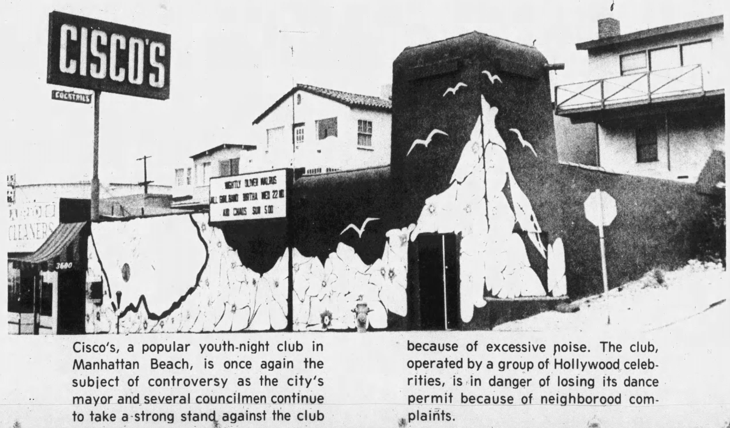
In August 1971, nearby resident Brenton Goodrich, representing 35 neighbors living near Cisco’s, brought a noise complaint to the Manhattan Beach City Council. It described overly loud music blasting into the neighborhood until 2 a.m. on most nights.

After warning the club of the complaint, the council declared Cisco’s a public nuisance on Dec. 7. It was given a reprieve a month later when it was determined that club owners were working on the problem.

According to the Daily Breeze, the soundproofing contractor doing the modifications told the council, “If the loud music being played at Cisco’s was by Guy Lombardo or Lawrence Welk, there never would have been any complaints in the first place.”

At its March 7, 1972 meeting, the council voted to revoke the club’s dance permit on March 21  on the grounds that the anti-noise measures had not been effective in solving the neighborhood noise problem.

This Daily Breeze staff photo shows the close proximity of houses to Cisco’s. March 19, 1972, Page 15. (Credit: Daily Breeze archives)

Co-owner Tommy Smothers told the Breeze that “Mayor (Mike) Sweeney has been operating like a Boss Tweed. He’s playing power politics because it’s an election year. He wants to get rid of everyone under 40 in this town.”

The furor died down somewhat after the city eventually established a zone around Cisco’s outside of which excessive noise would not be allowed.

Perhaps discouraged by the whole dispute, Cisco’s owners called it quits, closing and selling the club entirely in February 1973. By October 1974, Cisco’s had reopened as Brennan’s, a branch of the popular Marina del Rey restaurant with a much lower entertainment – and noise – profile. 

After many more later changes, including a whole new building, the 3600 Highland site is now occupied by a Baja Sharkeez restaurant/bar.

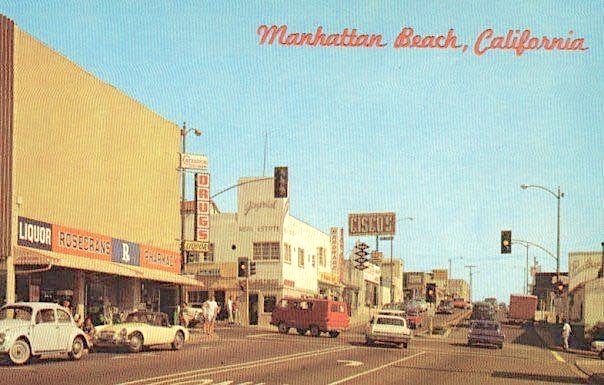
The Cisco’s sign can be seen, center, in this circa 1967 postcard showing Highland Ave. at Rosecrans Ave. in Manhattan Beach. (Credit: Manhattan Beach Historical Society Facebook page)

Sources:

Daily Breeze archives.

Los Angeles Times archives.

“South Bay/Los Angeles Days of Old California” Facebook page.

Poster for Sept. 10, 1969 Ike & Tina Turner show at Cisco’s. (Credit: Concertposterauction.com website)

The Eastview annexation battle of the 1980s led to further complications

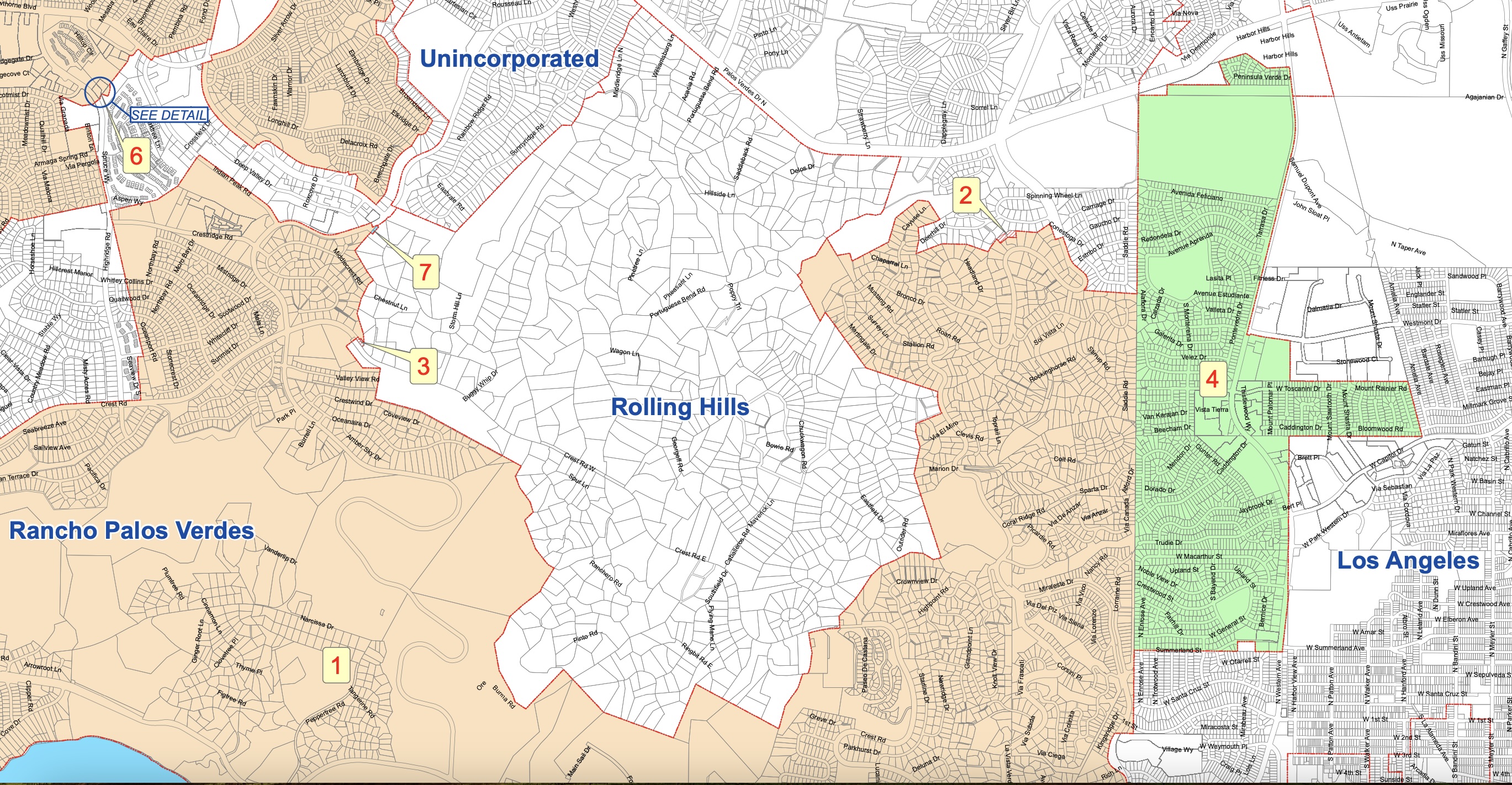
The Eastview area is highlighted in green at right, with Rancho Palos Verdes in tan at left and San Pedro in white at right. (Credit: Los Angeles County Department of Public Works website)

When the city of Rancho Palos Verdes incorporated in 1973, the new city did not include a vertical strip containing 1.4 square miles of unincorporated Los Angeles County land between its new eastern boundary and the Los Angeles city land on which San Pedro rests.

The Eastview area then stretched from Palos Verdes Drive North to Summerland Ave. It included Green HIlls Memorial Park cemetery and the U.S. Navy housing development, the latter of which has since become the Ponte Vista tract of homes.

Eastview straddles Western Ave., the main north-south artery through western San Pedro, and includes land both west and east of Western. The section west of Western includes homes on the sloping eastern hills of the Palos Verdes Peninsula.

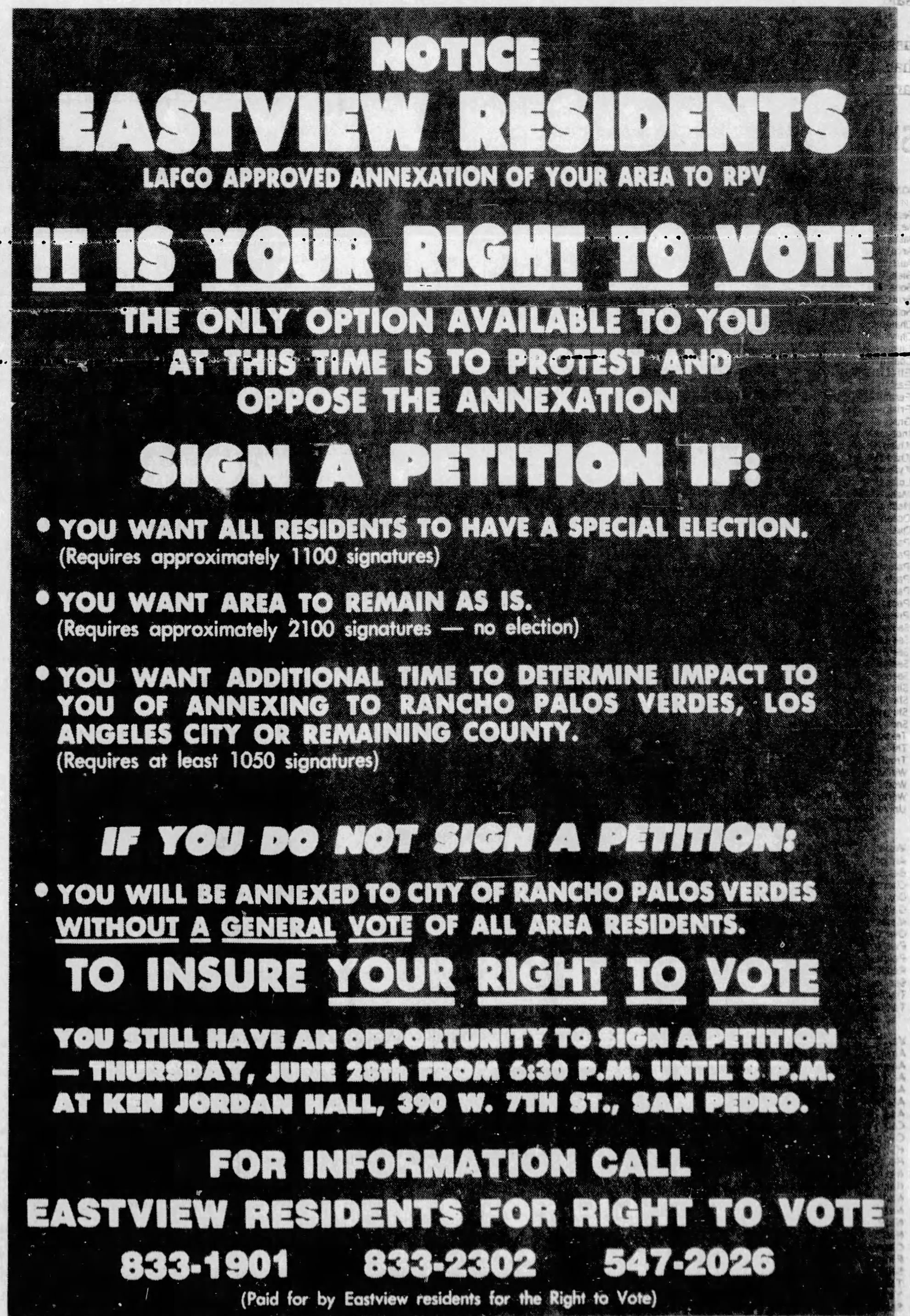
Anti-annexation ad. San Pedro News Pilot, June 26, 1979, Page 3. (Credit: San Pedro News Pilot archives)

Eastview residents, numbering more than 9,000 at the time, felt snubbed by being left out of the new city’s boundaries, and began a years-long campaign in support of annexation to RPV. 

They were unhappy with having to rely on Los Angeles County for services, confusingly having to use Los Angeles, San Pedro or Lomita mailing addresses, and with being forced to send their children to Los Angeles Unified District schools.

They fervently petitioned the county on behalf of their cause. On May 9, 1979, Los Angeles County’s Local Agency Formation Commission (LAFCO) approved the petition calling for Eastview’s annexation to Rancho Palos Verdes. 

Their only adjustment was the removal of Green Hills cemetery and the Navy housing area, which reduced the tract’s land area from 1.4 to 1.1 square miles.

Daily Breeze, Nov. 7, 1979, Page 3. (Credit: Daily Breeze archives)

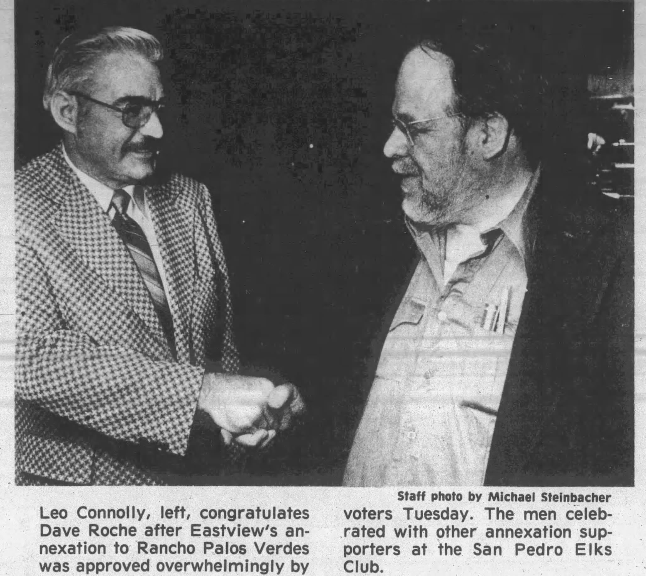
Eastview residents voted on the matter on Nov. 6, 1979. They approved the annexation by a more than two-to-one margin – 1,813 votes for and 755 against. So that settled the matter? Not quite.

Next came the campaign to convince RPV to approve the new annexation. This would become a four-year battle. Then-RPV Councilman Gunther Buerk steadfastly opposed the Eastview annexation, creating the group CAFA, Citizens Against Forced Annexation.

Gunther W. Buerk

CAFA’s position was that the annexation vote was not binding, since the citizens of RPV had not been included in the voting. Annexation proponents accused the group of snobbery, saying that they looked down on those residing on the east side of the hill and didn’t want them in their city.

CAFA stood firm, and the legal battle over the annexation was pressed all the way to the California Supreme Court. The Court ruled in December 1982 that RPV residents did not have the right to vote on the matter, and LAFCO gave its final approval to the annexation in 1983.

Eastview’s integration into Rancho Palos Verdes did not go particularly smoothly, however. Initially, the U.S. Post Office insisted that residents of the tract continue to use a San Pedro or Lomita address and zip code for mail purposes, as their zip codes don’t always correspond to city boundaries.

It took years, but eventually an Eastview Post Office was built and the area’s address and zip code was changed to Rancho Palos Verdes, 90275, ending some of the confusion.

Eastview residents also weren’t granted regular Palos Verdes Peninsula Library cards, instead receiving “courtesy cards” stamped “non-resident.” A library spokesperson said they were ruled  ineligible for regular cards because they lived outside the library district’s boundaries.

A deeper problem arose around the public education of children living in the Eastview area.

Before the annexation, Eastview students were part of the Los Angeles Unified School District, and were compelled to enroll in LAUSD schools.

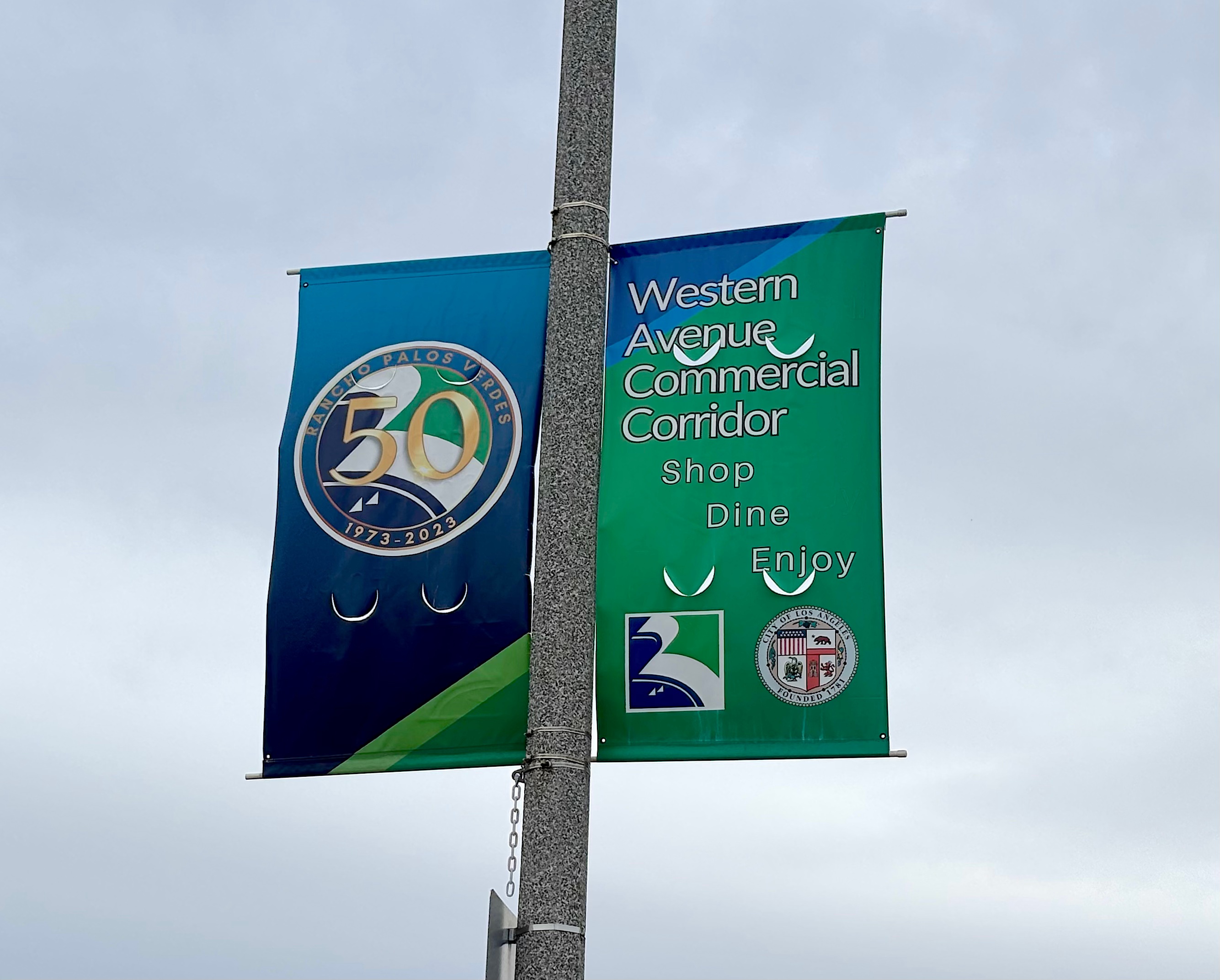
Banners such as this one on Western Ave. indicate that the Eastview area east of Western lies in the city of Rancho Palos Verdes. Jan. 22, 2025. (Photo by Sam Gnerre)

Residents assumed that the annexation into RPV would include access to the city’s schools. They were wrong, at first. Children of school age were still required to attend LAUSD schools.

A group of parents began the campaign to change that in 1990. A local election was held in 1992 proposing the change. The measure passed with 84.5% of the vote, but it was invalidated by a Superior Court judge who ruled in favor of LAUSD.

Finally, a bill giving students a one-time choice between LAUSD and RPV schools was introduced by state Sen. Betty Karnette and signed into law in September 1998. It remains in force, leaving the school decision up to Eastview students and their parents.

A long-promised amenity became a reality in 1990 when Los Angeles County agreed to build Eastview Park at 1700 Westmont Drive, just east of Western Ave. After polling residents, a dog park was added to its facilities in 2017.

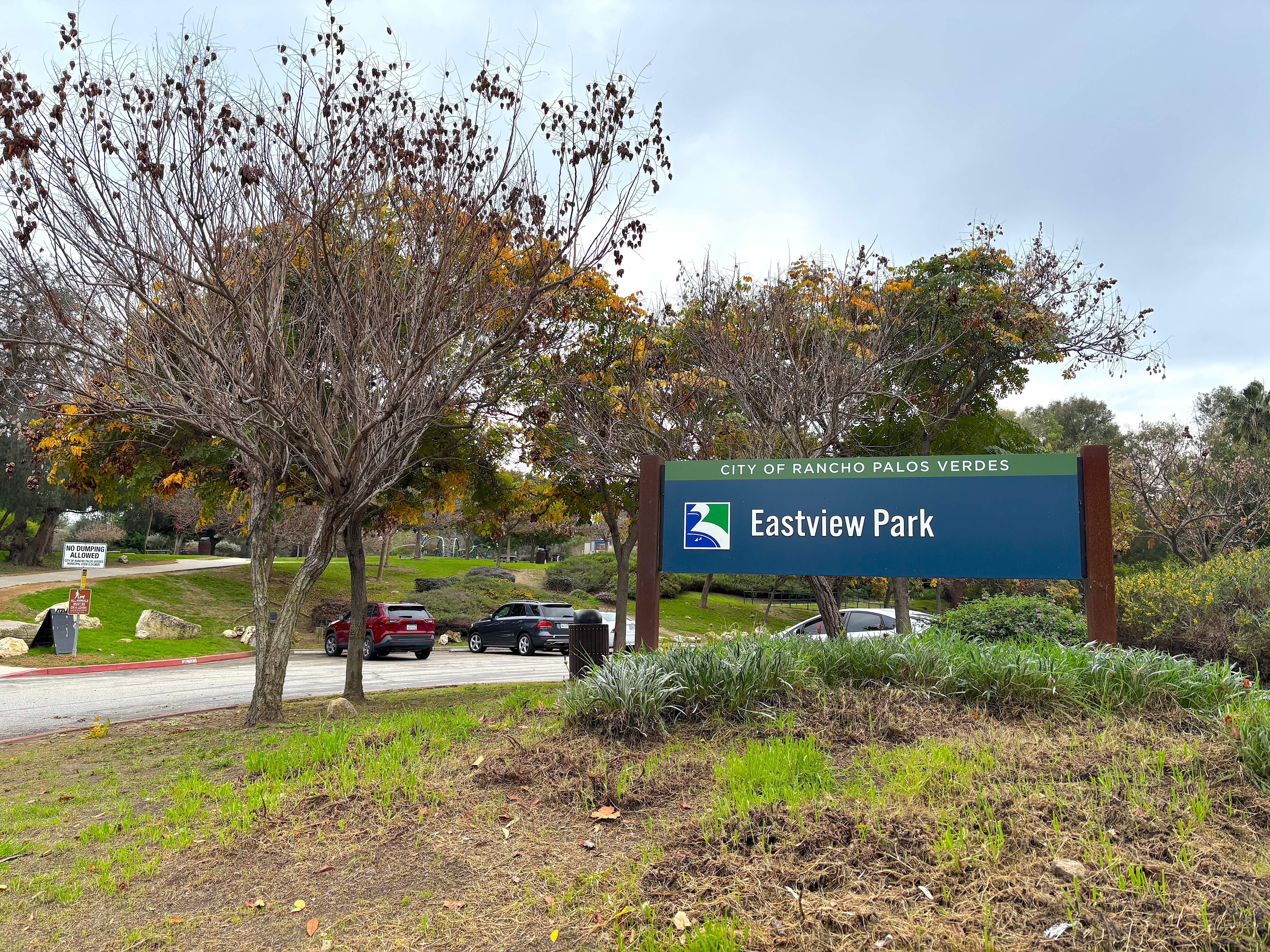
Eastview Park at 1700 Westmont Ave. in Rancho Palos Verdes. Jan. 22, 2025. (Photo by Sam Gnerre)

Note: Special thanks to reader Kevin Wei for suggesting this topic.

Sources:

Daily Breeze archives.

Los Angeles Times archives.

San Pedro News Pilot archives.

Civil War tensions led to the creation of Wilmington’s Drum Barracks

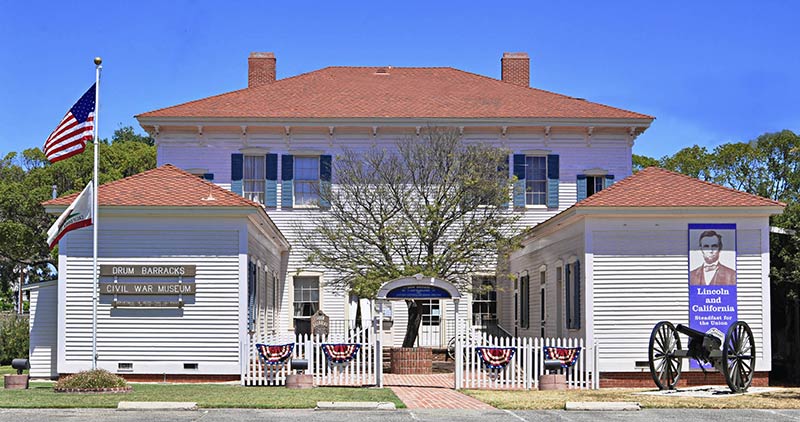
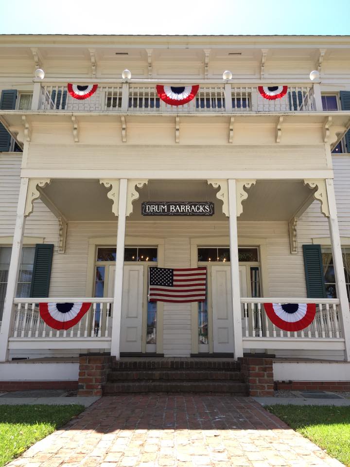
The Drum Barracks Civil War Museum was once the Union Army headquarters for Southern California and the Arizona Territory between 1862 and 1871. (Courtesy Drum Barracks Civil War Museum)

The Drum Barracks in Wilmington was the first U.S. military base to be built in Los Angeles County. It takes its name not from the percussion instrument, but from Lt. Col. Richard Coulter Drum, the Adjutant General then based in San Francisco who commanded California’s militia forces.

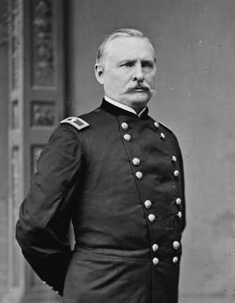
U.S. Army Adjutant General Richard Coulter Drum. Undated. (Credit: Wikimedia Commons)

Drum played a key role in the creation of the U.S. Army camp established north of San Pedro in 1861. Its first location was in an area then called “New San Pedro” in present-day Wilmington.

The dry, sandy soil proved to be unsuitable for a military outpost, especially during a particularly rainy season that year that turned the whole grounds into a muddy mess.

Shipping magnate Phineas Banning operated his burgeoning empire from the area, and favored having troops nearby to protect it. In late 1861, he and fellow landowner Benjamin Wilson offered 59.4 acres for the government to use.

Construction of what originally was called Camp Drum began in February 1862. The Camp Drum name was then changed to the Drum Barracks; Banning had changed the name New San Pedro to Wilmington a few months earlier.

Building materials were shipped by boat from the East Coast around South America’s Cape Horn. By September 1863, its 22 permanent buildings had been completed. These included separate quarters for officers and enlisted men, a hospital, a commissary, a blacksmith shop, stables and various storage buildings.

Those stables briefly included camels. They were part of an Army experiment using the desert beasts that had begun in 1856. Though the animals could go long periods without water, Army officials decided that their temperament and irascibility made them unusable. The Drum Barracks camels were sold off in 1863.

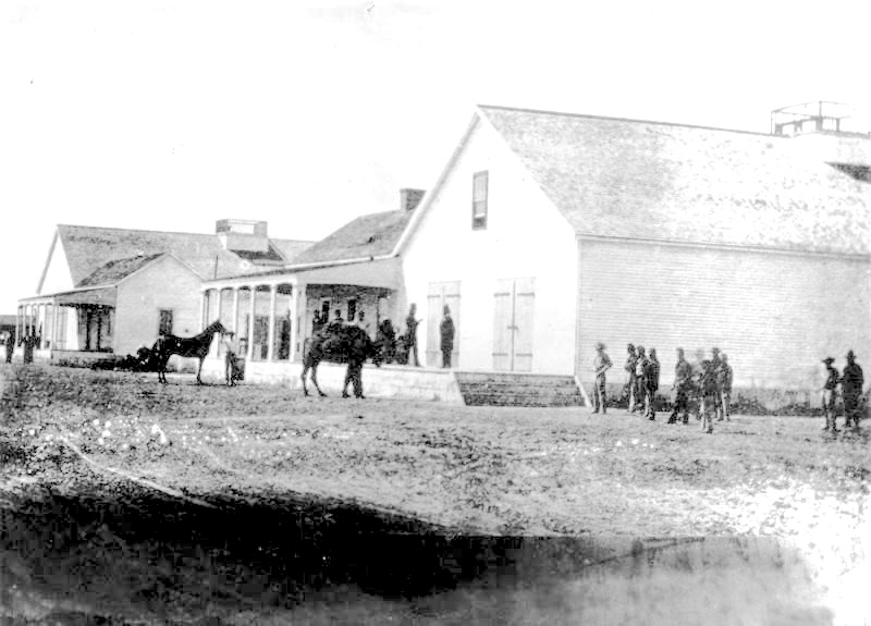
A camel at the Fort Drum Barracks military headquarters during the Civil War. The men are wearing Union uniforms. The camel, center, was imported from Arabia in the 1850s for desert freighting. In this photo the camel is being loaded at the warehouse. (Credit: Los Angeles Public Library Photo Collection)

Why was all this military activity necessary? Because of the perceived threat that Confederate forces would take control of California. Rebel troops were assembling in the Southwest and had proclaimed parts of New Mexico and Arizona as Confederate territory. 

Union forces worried that the Rebs could successfully take over the state, or at least its southern settlements. 

During the early years of the Civil War, California settlers from Southern states who supported the Confederacy outnumbered Union supporters by an estimated three-to-one margin. (Northern California had a majority of Union supporters.) So it was felt that, without a military force to oppose them, Confederate troops could achieve their goal without much resistance.

One of the first military missions undertaken from this new base of operations occurred on April 15, 1862. A detachment of 2,350 Union troops, known informally as the “California Column,” traveled from Camp Drum to confront a small force of Confederate troops based at Picacho Pass near Tucson, Arizona. 

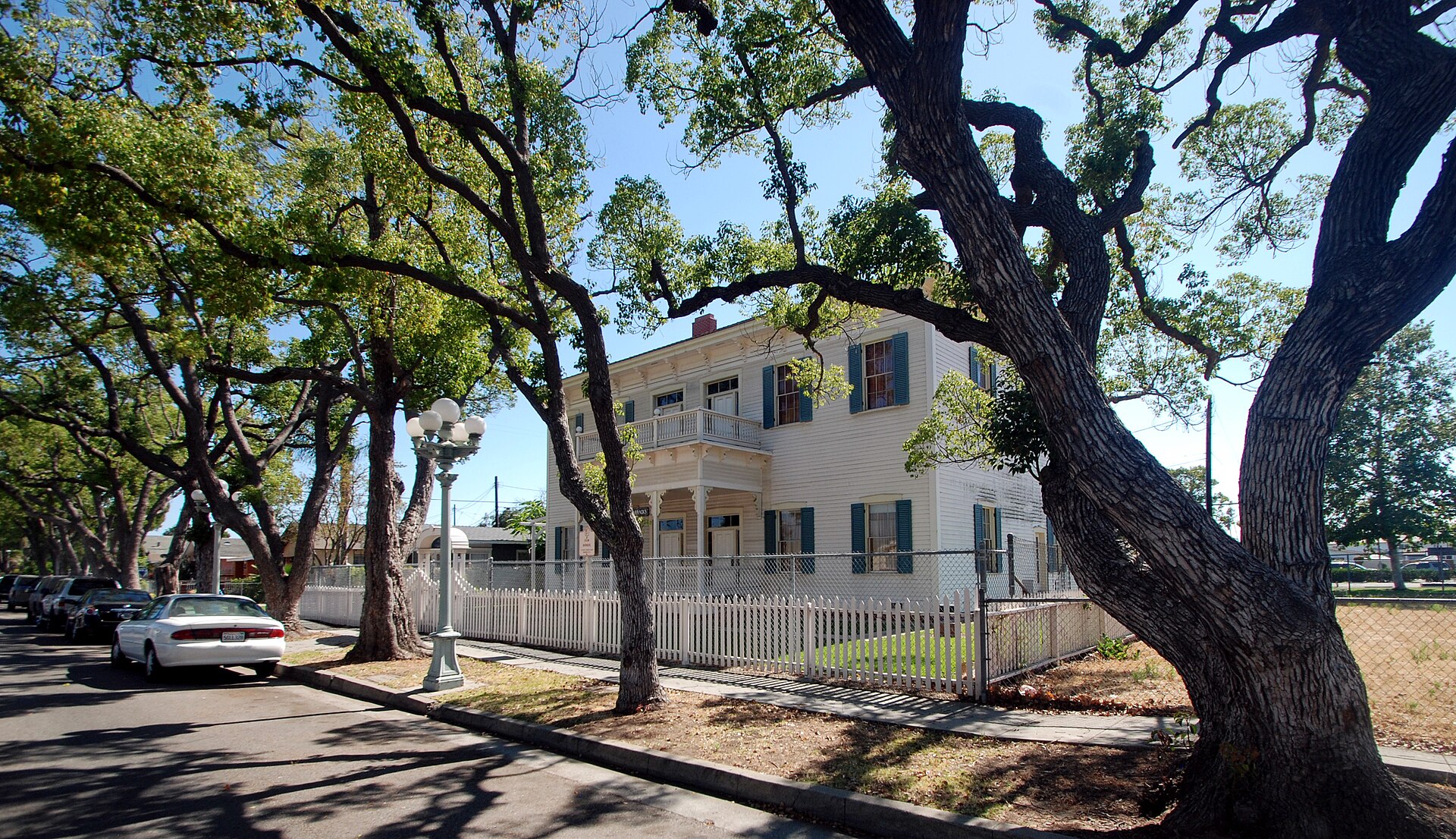
The Drum Barracks Civil War Museum lies within a residential Wilmington neighborhood. This 2016 photo by Michael J. Locke shows its east facade, which faces onto Cary Ave. (Credit: Wikimedia Commons)

Three Union soldiers were killed in the 90-minute skirmish. Without reinforcements, the Confederate soldiers ultimately had to withdraw from the area. Skirmishes with the Rebs later occurred in Arizona, but the Confederates made no inroads further into the West. The Battle of Picacho Pass is considered to be the westernmost battle of the Civil War.

Federal troops also used the Barracks as a base for conducting operations against Apache and other Native American tribes.

At its peak, the Drum Barracks housed 7,000 Union troops. It operated until November 1871, by which time all of its men and most of its equipment had been removed. The property was returned to Banning and Wilson.

After it was abandoned, the former Drum Barracks site deteriorated, and faced being demolished on several occasions. In 1913, plans to raze it were halted when Thomas P. Kaveney purchased the property.

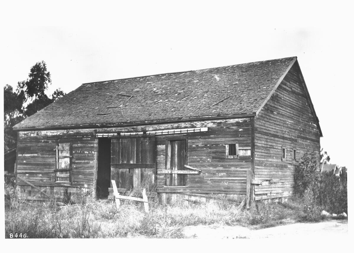
Circa 1910 photo shows a single-story wooden building in dilapidated condition. It has two boarded up windows, a sliding door which is shown open, and smaller sized windows with bars. Picture file card reads: “Willmington, the Drum Barracks Guard House”. (Credit: UCLA Library Dept of Special Collections)

Fifty-two years later, Kaveney, frustrated by the inability to transform the property into a museum, filed papers in early 1965 to demolish it for development.

That never came to pass. A group of citizens interested in its preservation worked to save the site, persuading the state of California to purchase it in 1967.

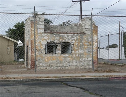
A chain link fence surrounds the powder magazine at Opp St. and Eubank Ave. in Wilmington. 2020 photo. (Credit: Drum Barracks Civil War Museum Facebook page)

Only two of its original buildings still stand. One, the two-story former junior officers living quarters, now houses the Drum Barracks Civil War Museum. Preservationists worked tirelessly in order to open the museum at 1052 N. Banning Blvd in 1987.

The other structure, a small stone gunpowder magazine, is located three blocks away from the museum at the corner of East Opp St. and Eubank Ave.

The Drum Barracks has been recognized officially as California Historical Landmark #169 (1935) and Los Angeles Historic-Cultural Monument #21 (1963) and has also been placed on the National Register of Historic Places (1971). The gunpowder magazine is Los Angeles Historic-Cultural Monument #249 (1982).

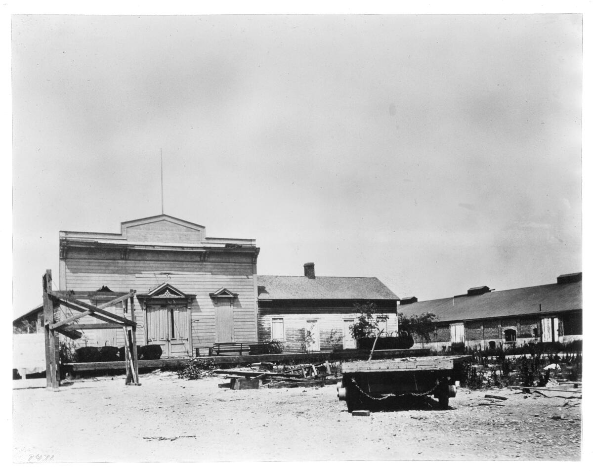
Photo of U.S. Army Quartermaster Headquarters, center, and the Town Hall at Camp Drum in Wilmington in 1862. Debris and an unhitched palate cart stand in the foreground in the dusty yard. Behind them, wooden scaffolding stands in front of a double-doored building with tall windows and clapboard siding and a flagpole, likely the Town Hall. Longer, less decorated wooden buildings stand to the right. The second building at the far right appears to be a stable. (Credit: USC Digital Library)

Sources:

The Beat of the Drum: The History, Events and People of Drum Barracks, Wilmington, California, by Don McDowell, Drum Barracks Civil War Museum, Graphic: Publishers, 1993.

Daily Breeze archives.

Los Angeles Times archives.

“Military Installations in Los Angeles County, Past and Present,” Los Angeles Almanac website.

San Pedro News Pilot archives.

Wikipedia.

The Drum Barracks Civil War Museum is situated in the final surviving wooden building left from the original encampment. (Credit: Drum Barracks Civil War Museum Facebook page)

Sonny Bono left Inglewood High early to pursue an often-chaotic life in show business

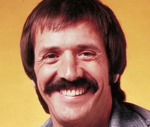
Sonny Bono. Undated publicity photo.

Sonny Bono’s tumultuous life began in Detroit, Mich. on Feb. 16, 1935. His father, Santo Bono, had emigrated to the U.S. from Montelepre, Sicily. His mother, Jean, was a second-generation Italian forced by her parents to marry at fourteen.

Salvatore Phillip Bono was the couple’s third child, and first boy. The family had settled in Detroit, where Santo found steady employment. But the Bonos soon grew tired of Detroit, and, on advice from relatives, decided to move to California in 1942 when Sonny was seven years old.

Santo moved out west first. He found a job as a truck driver, and was able to buy the family a new two-bedroom tract home in the South Bay, a significant improvement over their home in Detroit. Jean drove out with the kids later on a cross-country trip, during which the family car broke down in Cheyenne, Wyoming. They finished the rest of the trip by bus.

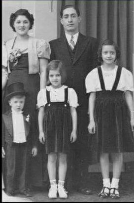
Sonny Bono, bottom left, with his sisters Fran and Bette and (back row) parents Jean and Santo. Undated, circa late 1930s. (Credit: Sonny Bono Facebook page)

Their new home’s exact location is unclear. In his autobiography, And The Beat Goes On (Pocket Books, 1991), Sonny says it was in Hawthorne. Most other sources put the house in  Inglewood, possibly because Sonny attended Inglewood High School starting in 1949. (He did not attend Hawthorne High School, which wouldn’t open until 1952.)

Because Sonny attended Dana Junior High (now Dana Middle School) in the Wiseburn area, it’s possible that the house was situated in that unincorporated county area west of Hawthorne, some parts of which have an Inglewood mailing address. 

Bono also says in his autobiography that he graduated from Inglewood High in 1952, but most biographical sources indicate that he left high school before graduation. This disappointed his parents, who wanted him to be a doctor or a lawyer.

Unfortunately, his poor grades didn’t support that ambition. Sonny himself recalls in his book exclaiming at a family dinner where his academic deficiencies were being discussed, “Who cares about school? I’m going to be a movie star!”

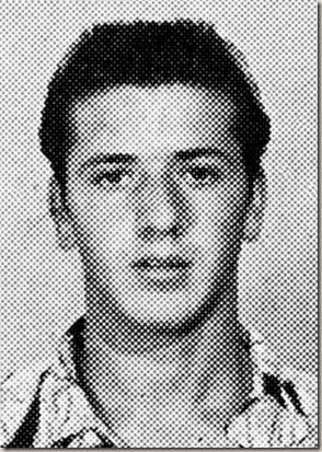
Sonny Bono, 1951 Inglewood High yearbook photo.

The entertainment world beckoned. He began his climb to fame by playing the conga drums and singing while a friend pounded out boogie-woogie piano riffs at the post-football game dances at Inglewood High.

When he hired local sax player Jimmy Johnson to play at a school assembly, the raucous music alarmed the faculty and earned Sonny a three-day suspension. He saw how the rhythm and blues music he loved had a powerful effect on teenagers, and it only made him more  determined to find his place in the music industry.

He bought a cheap ukulele and wrote his first song with his friend John Bloomfield, “Ecstasy.” He performed it on a local talent show, and won a transistor radio for his efforts. He knew then that he’d found his niche.

In the meantime, he got a job working at the Better Foods market in Hawthorne. Inspired by Coco Joes brand cookies sold at the store, he wrote “Koko Joe,” which became a minor hit record for Don & Dewey six years later. (It was also recorded by the Righteous Brothers.)

After his grocery gig ended, he got a job at Douglas Aircraft in El Segundo where Santo also now worked. But his heart was set on breaking into the music business. He played hooky from work one day to go visit local rhythm and blues star Johnny Otis, who thought his songs showed potential.

Sonny took the song “Ecstasy” to singer Frankie Laine, who liked it but didn’t record it. Bono began making the rounds of local record labels, getting his first real music business job with Art Rupe’s Specialty Records, home of rock pioneer Little Richard and soul singer Sam Cooke.

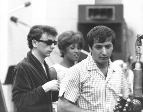
Sonny Bono, right, with Phil Spector (sunglasses) and singer Darlene Love during the recording of the Spector-produced A Christmas Gift for You From Philles Records album in 1963. (Credit: Sonny Bono Facebook page)

All of this hustling around town ended his marriage to his first wife, Donna, whom he’d married in 1954. After the breakup, he met Jack Nitzsche, who was working as a musical arranger for teen music producer Phil Spector.

Bono began working as a promotion man for Spector, pushing his records to radio stations. One night in 1962, a fellow promo man brought him along on a double date at Aldo’s Italian restaurant in Hollywood, where Sonny, then 27, met and fell in love with 16-year-old Cherilyn Sarkisian La Pierre.

In Cher’s distinctive contralto voice, he found the vehicle for his musical vision. His own vocal talents were average at best, but when the two of them sang together, they had that undefinable something that reached record buyers.

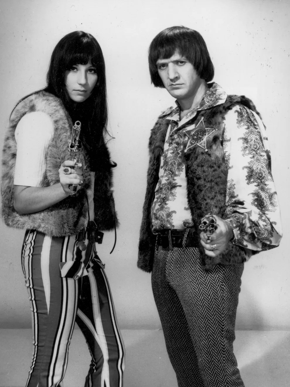
Sonny & Cher are shown in costume from their movie “Good Times” in May 1966. (Credit: Associated Press)

It didn’t happen right away. Their first record, “The Letter,” came out under the name Caesar & Cleo, the name trading on the popularity of the 1964 film “Cleopatra.” It was only a mild local hit. 

“Baby Don’t Go” as Sonny & Cher fared better, but it was the Bono-written and produced “I Got You Babe” that brought them their first number one hit in August 1965. It remains their best-known song. (“Baby Don’t Go” reached the Top Ten after it was re-released that same month.)

Sonny had a solo top ten record in late 1965 with “Laugh At Me,” a protest number he wrote and recorded after being thrown out of the tony Hollywood restaurant Martoni’s following a dispute during which he was verbally attacked for his appearance.

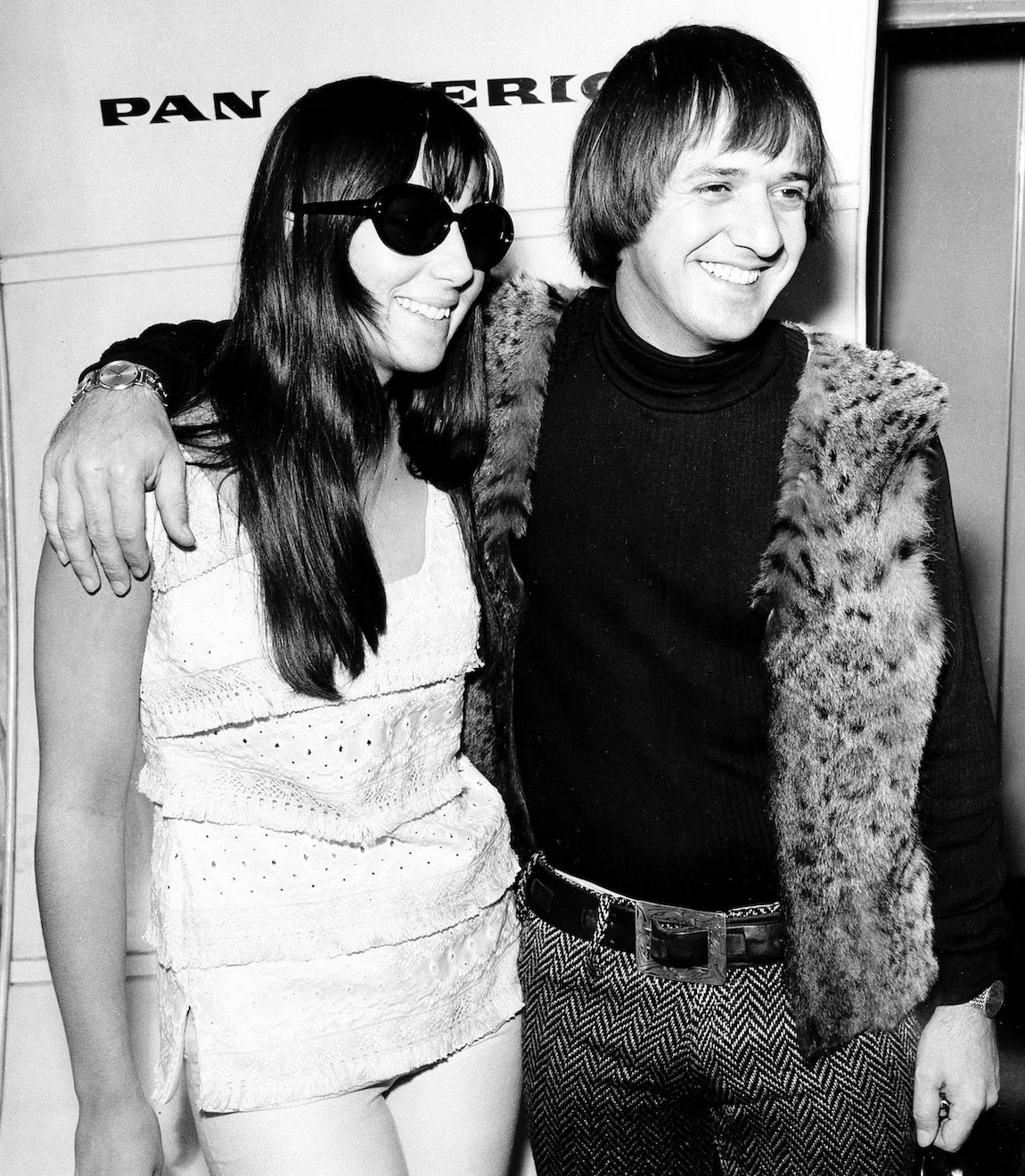
Cher and Sonny Bono pose before boarding a Pan Am flight to Hawaii at LAX on Dec. 7, 1965. (Credit: Associated Press)

“Babe” began a series of pop hits which evolved into their popular 1970s TV variety show, “The Sonny & Cher Comedy Hour” on CBS, as well as an acrimonious personal and professional breakup.

Sonny married Mary Whittaker in 1986. The couple moved to Palm Springs. Red tape from the city involving their new house there led an incensed Bono to run for mayor of the city in 1988. He won. In 1994, he ran for and won a seat in the U.S. Congress as a conservative Republican.

He died tragically on January 5, 1998, suffering fatal injuries when he hit a tree while skiing at Heavenly Mountain Resort in South Lake Tahoe. His widow, Mary, ran for his seat in Congress and won, serving in that role from 1998-2013.

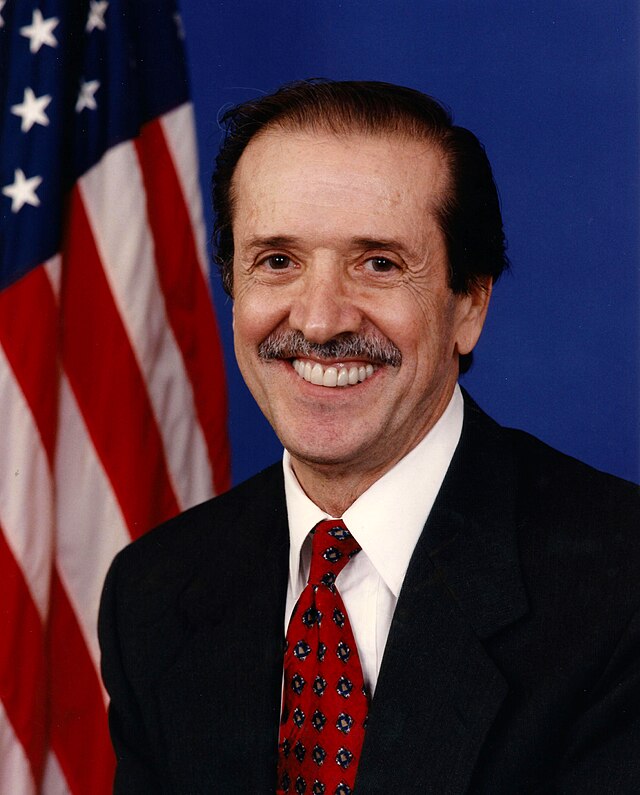
Rep. Sonny Bono, official portrait, 1995. (Credit: U.S. Congress photo)

Sources:

And The Beat Goes On, by Sonny Bono, Pocket Books, 1991.

Daily Breeze archives.

Los Angeles Times archives.

Wikipedia.
Sonny & Cher’s star on the Hollywood Walk of Fame. May 17, 2008 photo by Jon Lee Clark. (Credit: Wikimedia Commons)
Is this your new site? Log in to activate admin features and dismiss this message
Log In