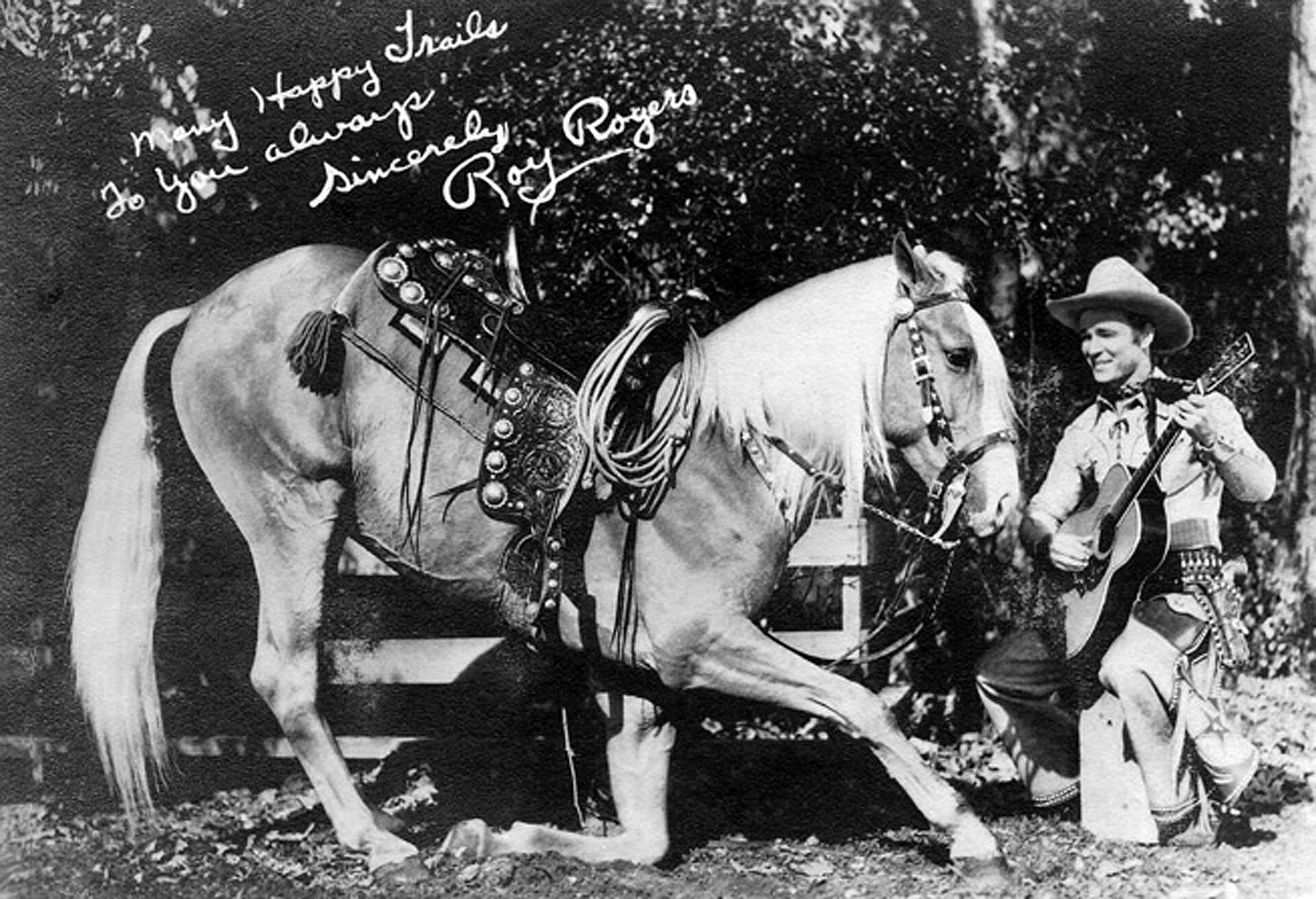
Singing cowboy Roy Rogers had brief but significant ties to Lawndale early in his career

Undated publicity photo of Roy Rogers and his horse Trigger circa 1940s. (Credit: Wikimedia Commons)

In 1943, Republic Studios dubbed Roy Rogers as “King of the Cowboys,” doing so as part of the  promotion for its film of the same name in which he was then starring.

It was pretty heady stuff for the man born Leonard Franklin Slye in Cincinnati, Ohio, on Nov. 5, 1911. His parents, Andy and Mattie Slye, were living frugally in a four-story red brick tenement at the time.

His father Andy worked in a shoe factory. Tired of being poor in the big city and in search of a better life, he and his brother built a houseboat out of scrap lumber and whatever else they could find. The plan was to sail it back down the Ohio River to Portsmouth, a smaller city where Andy had grown up.

It worked. They made it to Portsmouth eventually. At the end of the journey, they were carried by the floodwaters of a mammoth storm right to the site Andy had picked out for them to live. When the floodwaters receded, they continued to live on the houseboat on dry land.

Disillusioned with Portsmouth – he felt the city had grown too large and was filled with danger – the elder Slye eventually moved the family to a house in Duck Run, Ohio, a tiny rural settlement. It was here that young Leonard, who everyone knew as “Len,” lived in a proper house until his late teens, helping his father run the farm they started on the property.
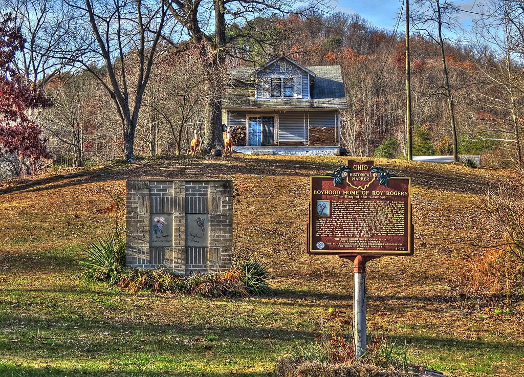
Historical plaque identifies Roy Rogers’ boyhood home at Duck Run near Lucasville, Ohio. 2012 photo by Don O’Brien. (Credit: Wikimedia Commons)

In addition to his farm chores, Len learned to shoot and ride horses. He also learned how to sing and play traditional country music during family singalongs, and even learned square dance calling at local barn dances in the area.

When he was 17, he quit school in order to help the struggling family financially. He ended up working with his father back at the shoe factory in Cincinnati when times grew really tough and the family had to move back there.

His sister, Mary, had moved to California with her husband a couple years earlier, and her letters back home were filled with positive descriptions of her new life in the South Bay city of Lawndale. One day in 1929, Len suggested to his dad that they pool their resources – Roy recalled later that he himself had saved $90 – and move to California.
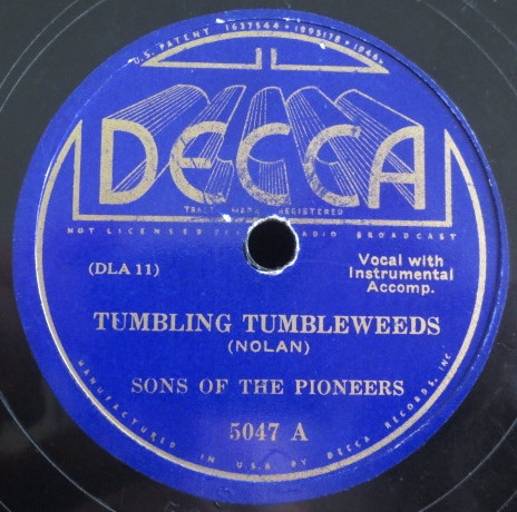
78 rpm record released in 1934. (Credit: Discogs)

They packed up their battered 1923 Dodge truck and piled it high with all their possessions, and, like thousands of others during that era, began the trek west along the two-lane highway, Route 66.

They stayed with Mary at her home on Freeman Avenue in Lawndale for four months. (Sadly, the exact address is lost to posterity.) They then returned to Cincinnati, but soon after their return, an anxious-to-return Len offered to help Mary’s father-in-law drive on his trip out to stay with his daughter-in-law in Lawndale.

The rest of the family eventually returned to Lawndale as well, and stayed in a rented house not far from Mary’s. Len and Andy got jobs driving trucks for a gravel company. It soon went bankrupt, though, leaving Len and his father to try and find work as crop pickers in the Central Valley along with thousands of others.

If that sounds like John Steinbeck’s novel The Grapes of Wrath, it’s no coincidence. In his biography, Roy recalls seeing Steinbeck at one of the numerous farmworker camps, where the author was researching his new book.
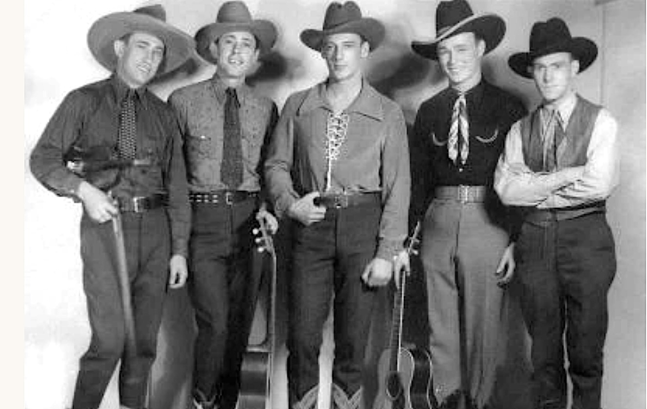
Publicity photo of the Sons of the Pioneers in 1934. From left, Hugh Farr, Karl Farr, Bob Nolan, Leonard Slye (Roy Rogers) and Tim Spencer. (Credit: Courtesy Sons of the Pioneers website)

About this time, Len was pretty fed up with trying to make a living. Despite his inherent shyness, he  turned to music, pairing with his cousin Stanley to form the short-live Slye Brothers. He then played with Uncle Tom Murray’s Hollywood Hillbillies, but quit when he got no pay.

His sister Mary encouraged him to keep trying, and pointed him toward nearby Inglewood, where the small radio station KMCS aired an amateur talent show called “The Midnight Frolic.” In 1931, he forced himself to perform on the air, and it led to a break: A phone call from local group the Rocky Mountaineers, who were in search of a vocalist.

He joined them. They weren’t paid much either, but through the group, he met Bob Nolan, with whom he would eventually form the Sons of the Pioneers. Nolan wrote “Cool Water” and “Tumbling Tumbleweds,” among other cowboy classics.

After a couple more years of scuffling with other touring bands, Len contacted his friend Nolan, and together with Tim Spencer, they formed the Sons of the Pioneers, originally named the Pioneers Trio, in 1933. The group landed an unpaid spot on KFWB radio, where they were allowed to advertise for gigs.
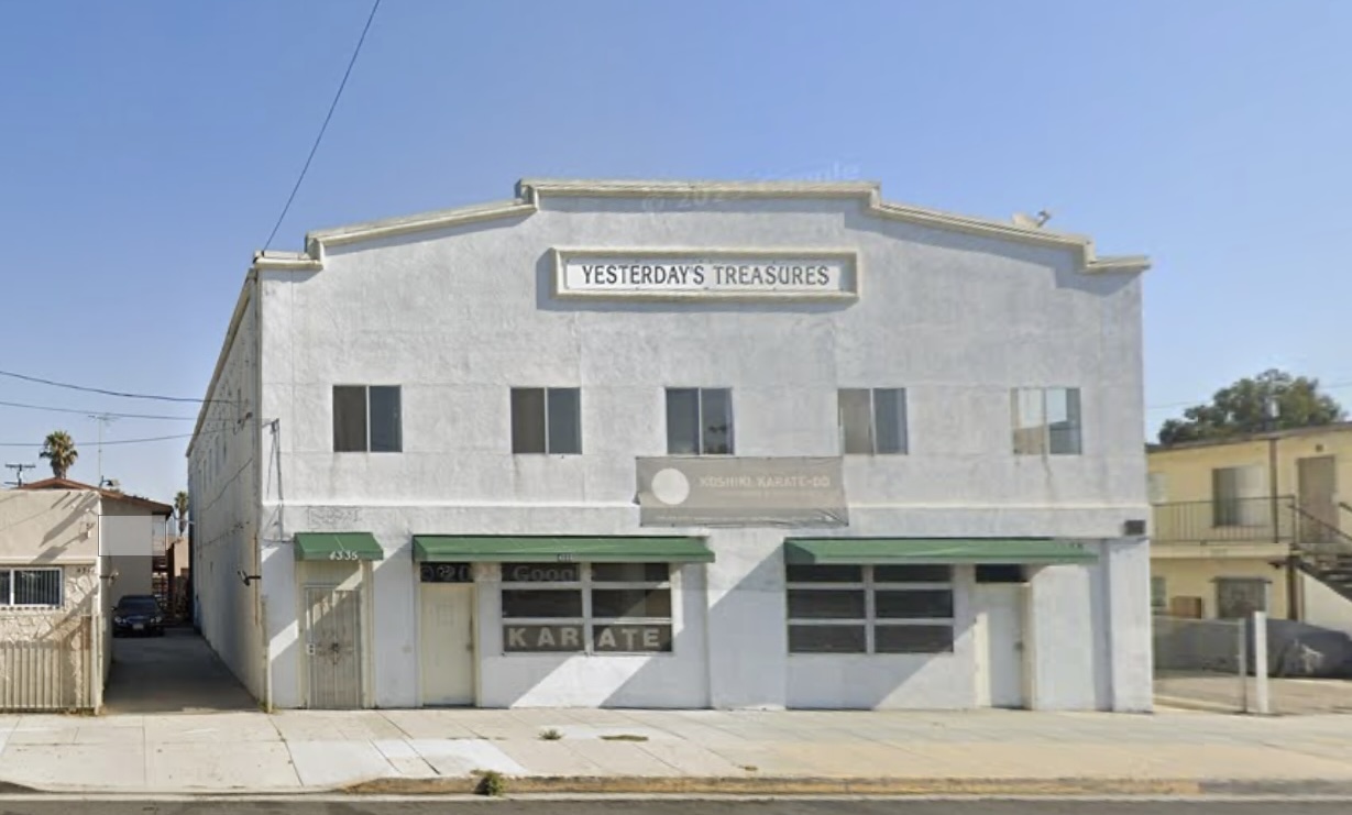
The former Shriners hall where Rogers and the Sons of the Pioneers rehearsed in the early 1930s. 2026 image. (Credit: Google Earth)

The Sons of the Pioneers used to practice during this era at the former Shriners dance hall building at 4335 W. 147th St. in Lawndale. Built in 1923, the building, which still stands, also has been a Marine radar battalion headquarters and is the former home of Mac’s Old Time Radio Museum. It’s currently the home of an antique store and a karate studio.

The Sons of the Pioneers began to take off in 1934, after a positive review ran in the Los Angeles Examiner. This led to them cutting their first songs, including “Tumbling Tumbleweeds,” for Decca Records in 1934. Soon they were making cameo appearances in films, including Charles Starrett and Gene Autry westerns.

Len left the group in 1937, determined to find a permanent place in the film industry. One day, he made an unsuccessful attempt to get past the studio guards at Republic Pictures so he could audition for a new singing cowboy feature.

As Len was leaving, dejected, film producer Sol Siegel called him back to the gate. He recognized him from the Sons of the Pioneers, and took him in to the audition. Len won the role in 1938’s “Under Western Stars,” and would go on to become, along with his horse, Trigger, one of America’s top-grossing film, and, later, television stars for the next couple of decades.

He became Roy Rogers: Roy from “roi,” the French word for king, and Rogers from Will Rogers, whom he greatly admired. He married one of his female co-stars, Dale Evans, in 1947, and they acted together in films and on television for years.

He died on July 6, 1998, at 86. Evans, who wrote the couple’s television show theme song “Happy Trails,” died three years later at 88 on Feb. 7, 2001.

Roy Rogers and Dale Evans. at the 61st Academy Awards on March 29, 1989. Photo by Alan Light. (Credit: Wikimedia Commons)

Sources:

Daily Breeze archives.

Los Angeles Times archives.

Happy Trails: Our Life Story, by Roy Rogers and Dale Evans with Jane and Michael Stern, Simon & Schuster, 1994.

Wikipedia.

Note: Thanks to reader David Matson for providing the street name on Lawndale where Roy Rogers’ sister lived.
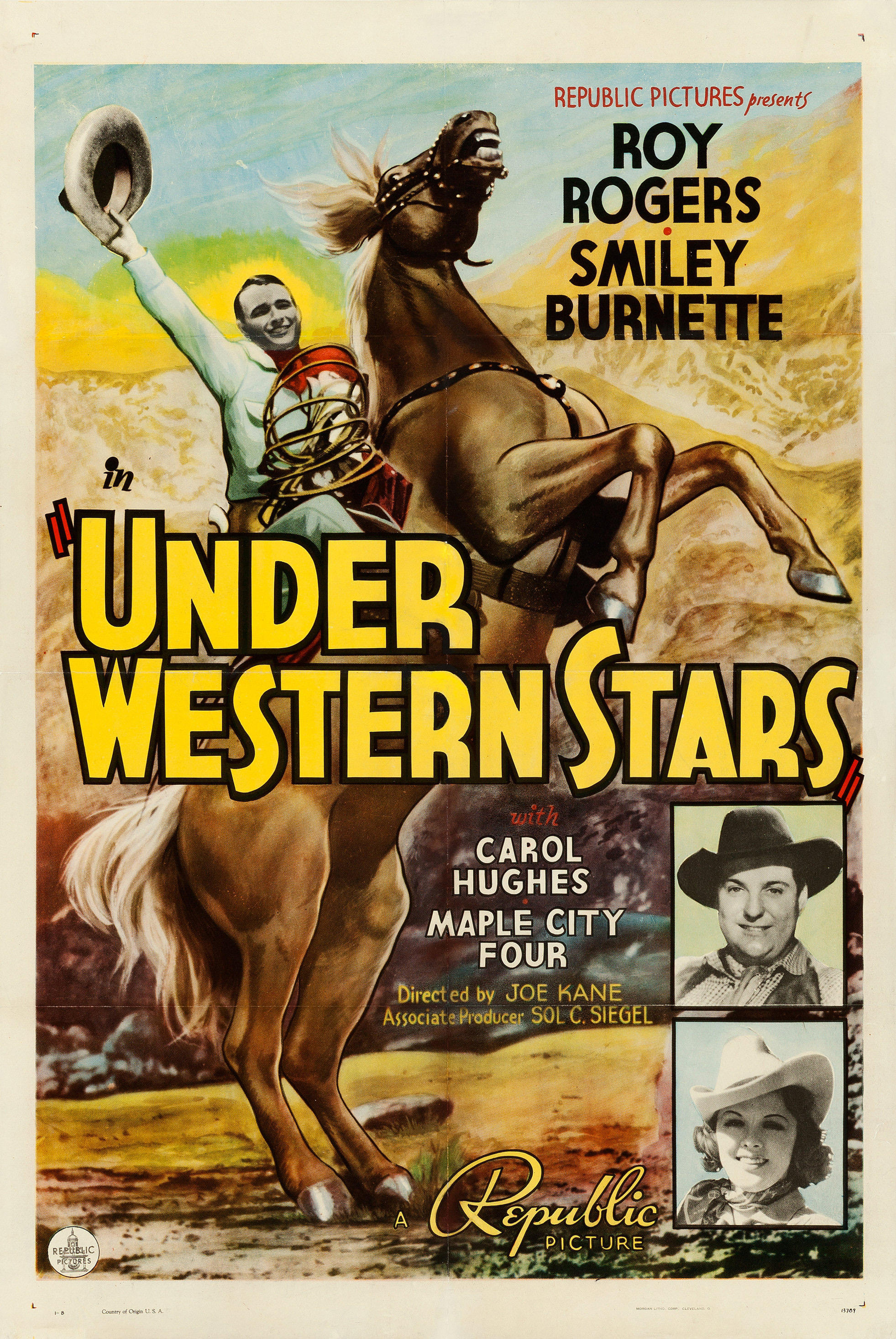
1938 movie poster. (Credit: Wikimedia Commons)

It took many years for the two Cabrillo marinas in San Pedro to become reality

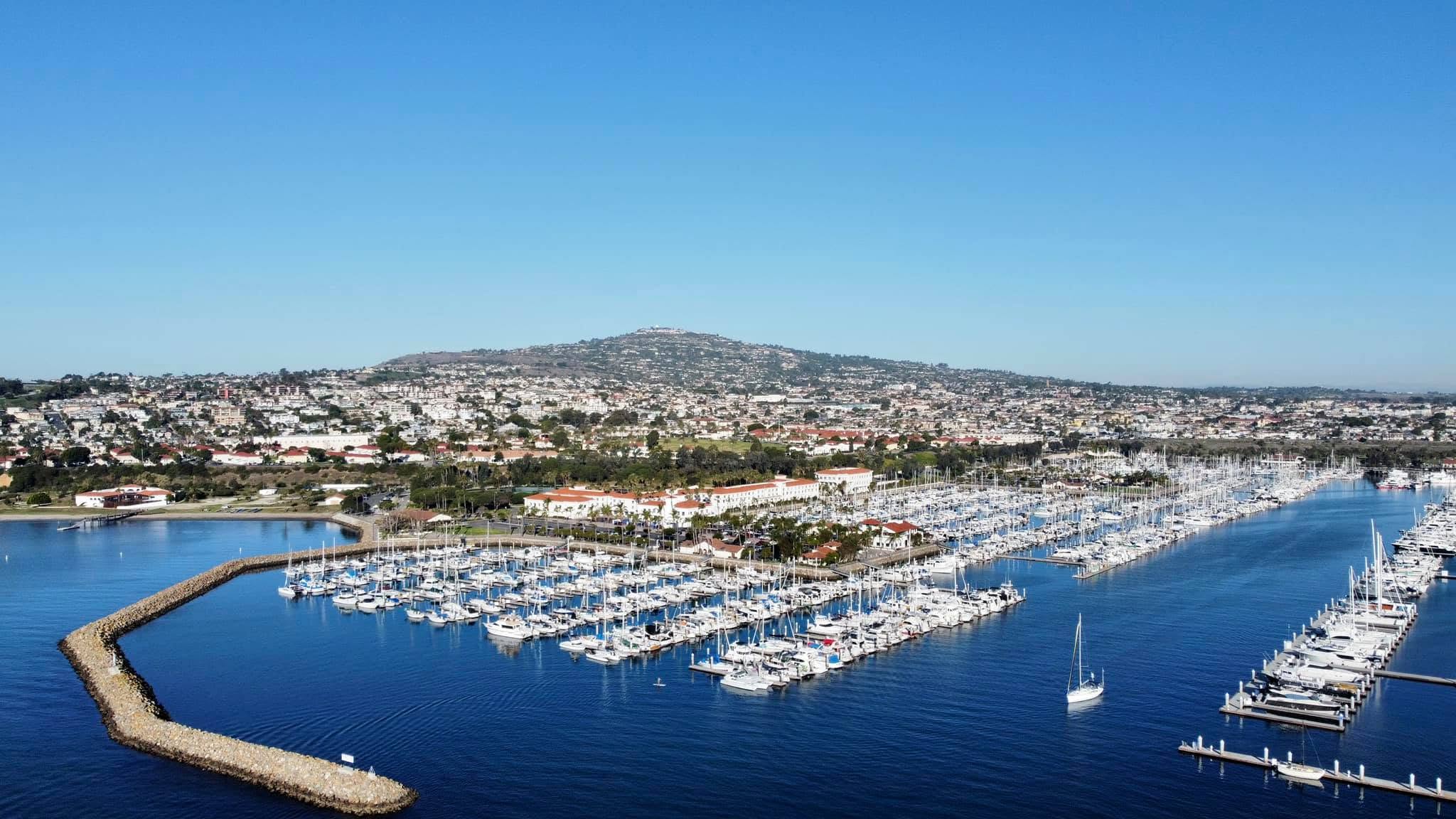
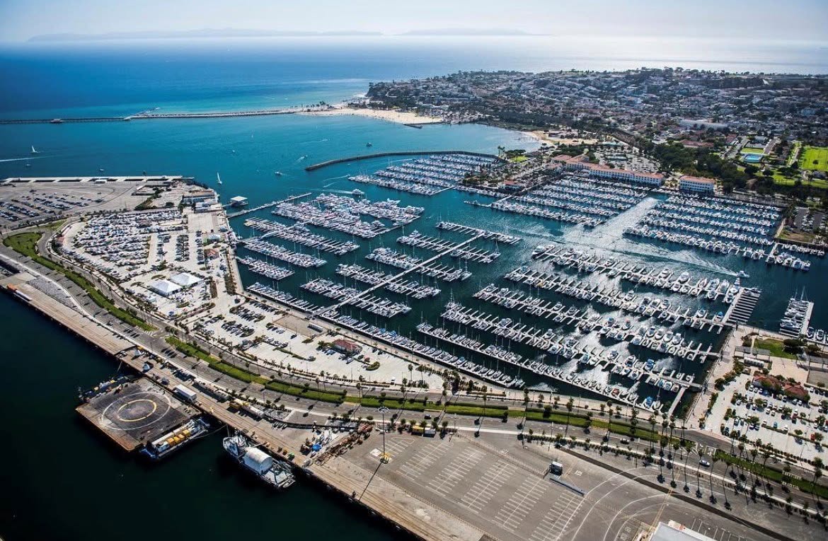
The Cabrillo Way Marina, foreground. The Cabrillo Marina can be seen across the West Channel at upper right. Undated photo. (Credit: Cabrillo Way Marina Facebook page)

Los Angeles Harbor Area pleasure boat marinas have been around for a long time. The Al Larson Boat Shop, one of the oldest, opened its 128-slip small boat marina in 1924.

Two marinas were built in Wilmington right after World War II, the Yacht Haven Marina in 1947, and Holiday Harbor in 1954, with more than 300 slips between the two of them..

The 1950s saw an increase in larger marina projects in general along the Santa Monica Bay. Construction on the massive Marina del Rey boat marina began in 1957, and it opened in 1965. Its various operators manage more than 5,000 boat slips.

Work on the King Harbor project that changed the face of coastal Redondo Beach began in 1958 and opened in 1966. In addition to rearranging city streets in the area, King Harbor also provided boaters with more than 800 boat slips.

Unlike these large projects, San Pedro has the Port of Los Angeles, one of the ten largest commercial boat harbors in the U.S., to consider before building a large marina. Pleasure boat traffic and massive freighters and tankers need their own spaces to co-exist.

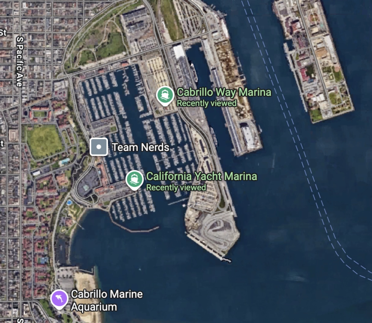
Google Earth aerial view shows the two marinas, center.,identified in green lettering. The Main Channel of Los Angeles Harbor is at right, marked by twin dotted lines. 2026 image. (Credit: Google Earth)

The closure of the Lower Reservation of the Fort MacArthur military base potentially freed up land along the West Channel, just west of the Port’s Main Channel, for development.

The West Channel area seemed ideal for a boat marina, adjacent to the Port’s Main Channel but not intertwined with its waterways. IN 1986, port officials told San Pedro News Pilot reporter Teresa Simons that plans to build a large marina there could be dated back to engineering drawings made in 1928.

The Long Beach engineering firm of Moffat & Nichol made the first official proposal to build the Cabrillo Marina project to the Los Angeles Harbor Commission on Sept. 13, 1960. It called for a $6.15 million marina to be built that could accommodate roughly 1,800 boats.

Five years after that, L.A. Mayor Sam Yorty unveiled a revised marina plan, telling members of the press in March 1965, “The people of Los Angeles have needed a proper place for private craft at the Harbor for at least 35 years.” 

He went on to point out that when completed, it would be the closest small craft harbor to Catalina Island, a distance of 22 miles, and would boost tourism there.

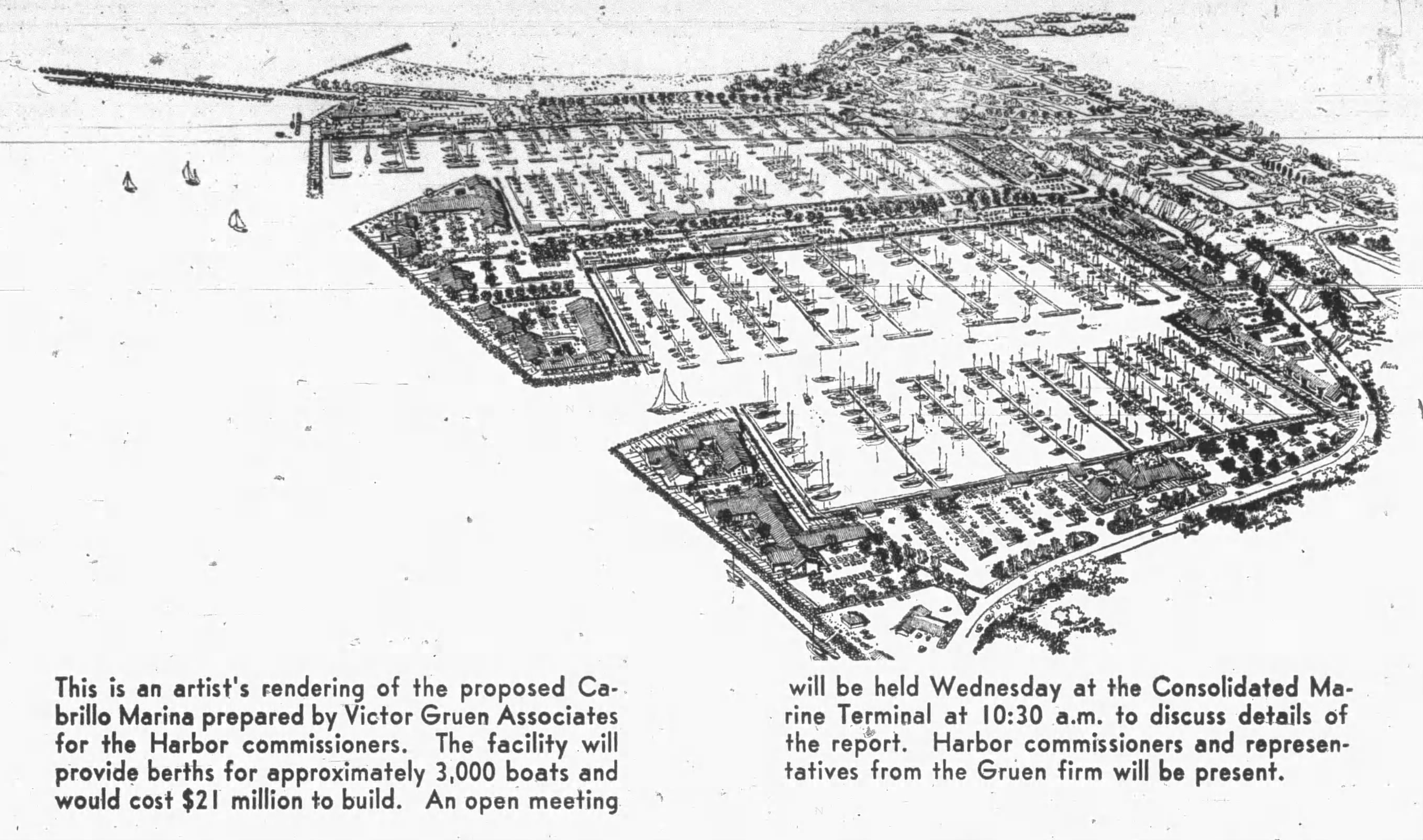
Early vision of the marina plan. San Pedro News Pilot, Nov. 2, 1967, Page 9. (Credit: San Pedro News Pilot archives)

It all sounded good, but building a marina there turned out to be another matter entirely. At that same press conference, it was announced optimistically that construction would begin in January 1966, with berth occupancy starting in 1967.

Move ahead to November 1968, and the debate over the marina site’s appropriateness seems to have gathered steam, with opposition coming from conservationists and skeptics of the plan.

Debate and new studies of the project would continue for the next few years. In July 1972, the U.S. Navy threw up another roadblock when it announced it had no plans to vacate its moldering facilities in the Lower Reservation area.

Four years later, the project finally began to get off the ground when the federal government overruled the Navy and declared the project area as being surplus land. Three years after that, in December 1979, a compromise plan that called for a combined marina and recreational area was approved.
The Cabrillo Marina, center. Slips at lower right are part of the Cabrillo Way Marina. Undated photo. (Credit: Cabrillo Marina Facebook page)

Seven years later, construction was nearly complete on the marina on the east side of the Outer Harbor. The first boaters began moving into their slips in January 1986, a mere 26 years after plans first were officially submitted.
This facility at 224 Whalers Walk is named Cabrillo Marina and has 885 permanent slips. Operated by the Los Angeles Harbor Dept. for its first dozen years, ownership passed to the private California Yacht Marina company in 1998.

An additional marina on the east side of the West Channel took longer to complete, opening in 2011 after older, smaller marinas were bought out and additional detritus left over from its Fort MacArthur days was cleared.
Named Cabrillo Way Marina and located at 2293 Miner St., it’s owned by the Port of Los Angeles and operated by Suntex Marinas/Westrec Marinas. It has 697 permanent slips.
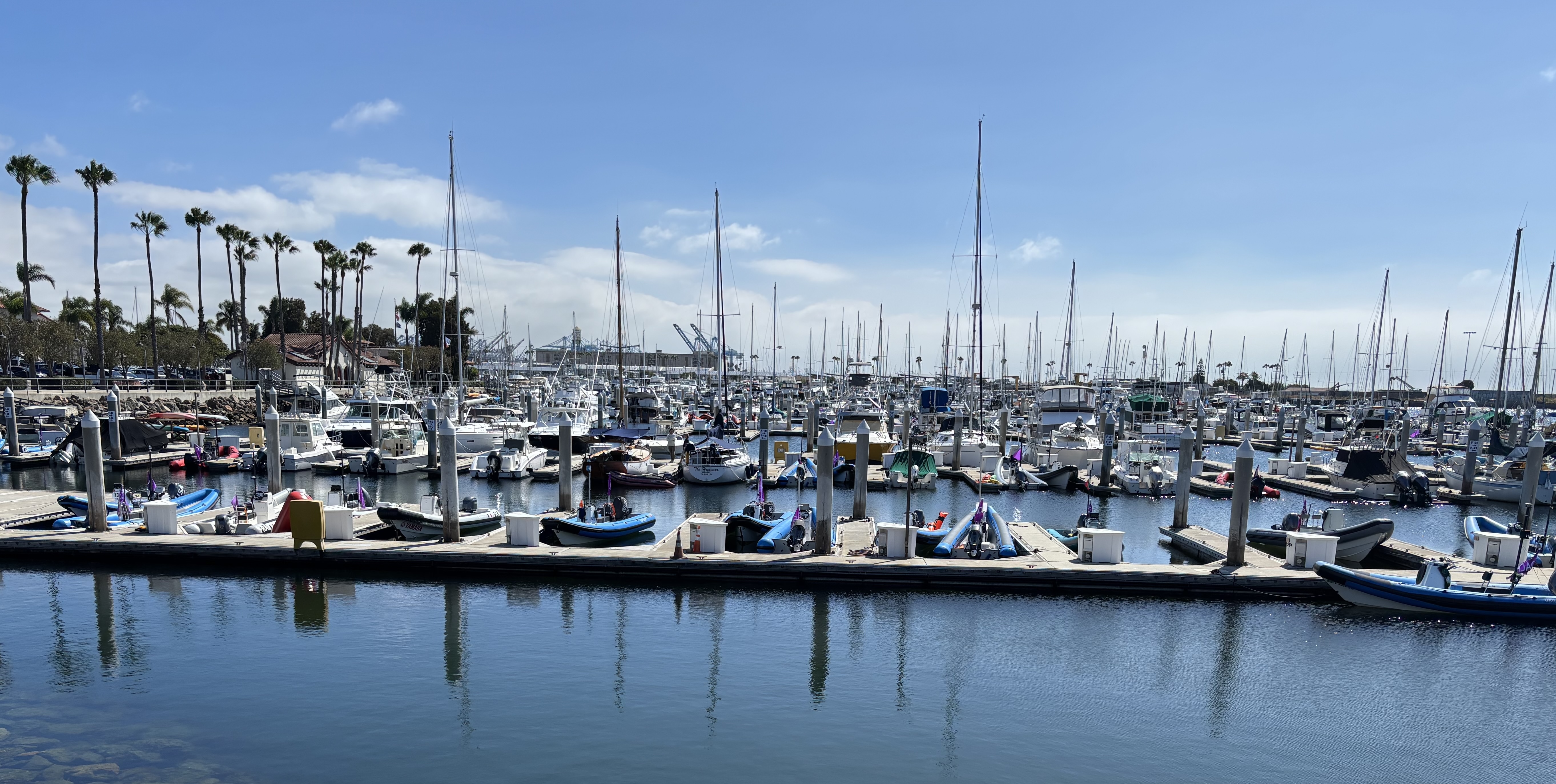
Small boats docked at the Cabrillo Marina in San Pedro on July 22, 2026. (Credit: Photo by Sam Gnerre)

Sources:

Daily Breeze archives.

Los Angeles Times archives.

Port of Los Angeles website.

San Pedro News Pilot archives.

Wikipedia.

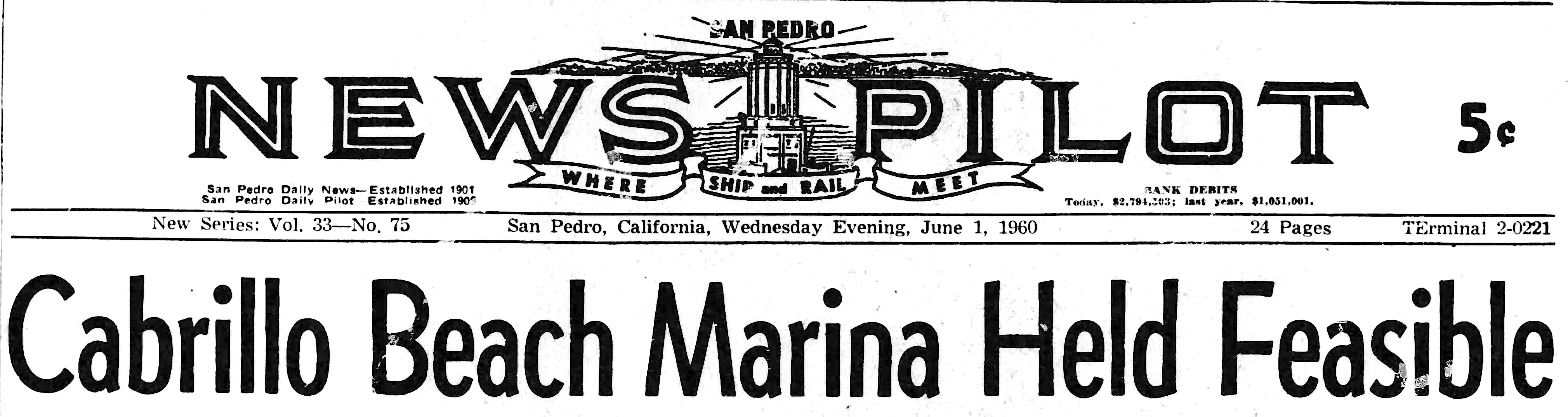
Banner headline, San Pedro News Pilot, June 1, 1960, Page 1. (Credit: San Pedro News Pilot archives)

The worst accident in LAX history took place miles away from the airport itself

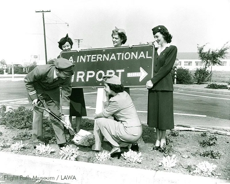
The “L.A. International Airport” sign dedication in 1949 celebrates the airport’s expansion into international flight service.
(Credit: Flight Path Museum LAX/LAWA)

The 80th anniversary of the first commercial flights at Los Angeles International Airport will arrive this December.

The former Mines Field west of Inglewood became the city’s first official airfield, Los Angeles Municipal Airport, on Oct. 1, 1928, but the first commercial flights to use the facility didn’t do so until Dec. 9, 1946. It was renamed Los Angeles International Airport (LAX) on Oct. 11, 1949.

Since then, LAX has had several serious aviation accidents, but considering its size and volume of flights, its overall safety record is impressive.

In fact, the worst LAX-related accident in its history actually took place more than 30 miles from the airport, over the city of Cerritos.

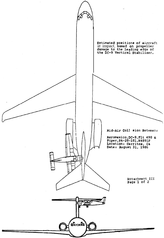
Shortly before noon on Sunday, Aug. 31, 1986, a Piper Cherokee private plane headed for Big Bear that had taken off minutes earlier from Torrance Municipal Airport flew undetected into the tail assembly of Aeromexico Flight 498. The Aeromexico DC-9 had just started its descent into LAX on its flight from Tijuana after originating in Mexico City.

Diagram shows the approximate positions of the planes at impact above Cerritos on Aug. 31, 1986. (Credit: National Transportation Safety Board (NTSB))

The Piper Cherokee went undetected by the Aeromexico pilot because he was dealing with reports of another private plane in the area. Airplanes in those days were not universally equipped with adequate detection systems, nor were smaller planes equipped with transponders that would make them easily detectable.

The collision at roughly 6,560 feet in the air sent both planes hurtling to the ground. The Piper Cherokee crashed into an empty elementary school playground, its three occupants killed in the initial collision..

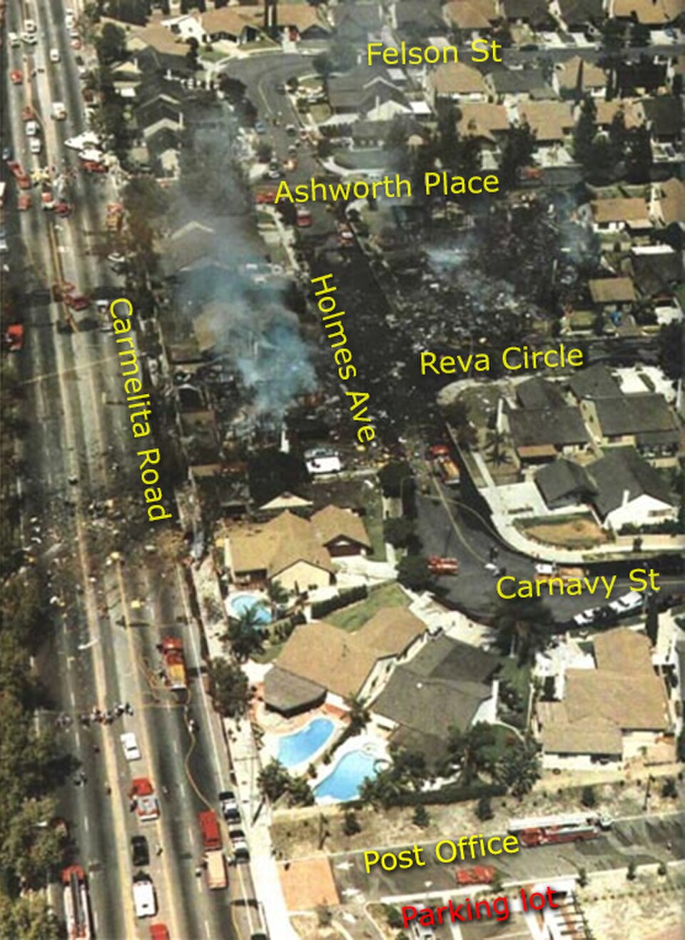
Tragically, the Aeromexico plane crashed and burned into a neighborhood of tract homes in Cerritos. 82 people died in total from the crash,, including all 64 on the jetliner, 15 on the ground, and the three in the Piper. Six houses were destroyed on the ground, and many more damaged.

Devastation on the ground in Cerritos following the Aug. 31, 1986 Aeromexico crash. (Credit: Wikimedia Commons)

Ultimately, blame for the crash was shared by the Piper pilot and LAX air traffic control. But much was done to help prevent future tragedies following the crash. Small planes in the LAX air space area were required to carry transponders, making them detectable by larger planes. In 1989, the FAA also began requiring all commercial airliners to install onboard traffic avoidance systems.

17 years earlier, pilot error caused the crash of a Scandinavian Airlines DC-8 jetliner into Santa Monica Bay some six nautical miles short of its landing strip at LAX on Monday Jan. 13, 1969. 15 people died in the SAS Flight 933 crash, the first commercial airline flight deaths in LAX’s history.

Five days later on Jan. 18, 1969, a United Airlines 727 jet suffered an unexplained total power failure four minutes after takeoff from LAX. Without power, the crew of Flight 266 lost control of the aircraft, and it plunged into the sea. All 38 people, passengers and crew, lost their lives.

The other most deadly LAX crashes mostly took place on the ground, not in the air. 

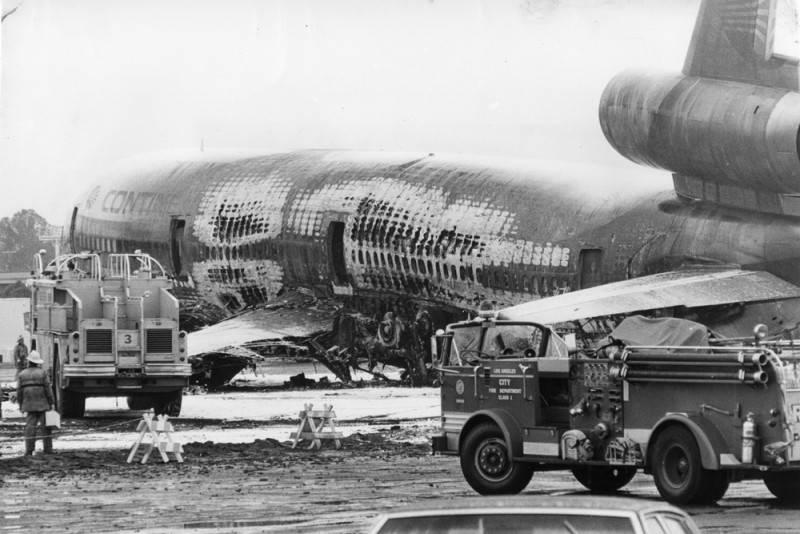
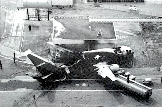
On March 1, 1978, at 9:30 a.m., a Continental Airlines DC-10 airliner blew two tires as it attempted to take off from a rain-soaked LAX runway. Flight 603 never left the ground. A nose wheel collapsed, causing the plane to skid to a halt and erupt into flames.

A Continental Airlines DC-10 bound for Honolulu experienced tire failure of the left main landing gear during take-off on March 1, 1978. Two of Flight 603’s 200 occupants were killed in the accident. (Credit: Los Angeles Public Library Photo Collection)

Two passengers died when they jumped from the airplane’s wing into an area of the plane that then burst into flames. 79 people were injured.

The worst ground accident at LAX was a runway incursion that occurred on the evening of Friday, Feb. 1, 1991.

The LAX control tower mistakenly gave the go-ahead for USAir Flight 1493 to land on a runway where SkyWest Airlines Flight 5569 had just been given the go-ahead to take off. The SkyWest plane, a smaller turboprop Fairchild Swearingen Metroliner with 12 people aboard, was crushed by the larger Boeing 737 as it attempted to land in the same spot.

35 people died when this USAir 737 crashed into a smaller SkyWest commuter plane using the same LAX runway on Feb. 1, 1991. (Credit: National Transportation Safety Board (NTSB))

35 people died, all 12 aboard the SkyWest aircraft and 23 people aboard the USAir 737, in the fiery crash and aftermath. 20 of the 23 USAir casualties came from asphyxiation due to smoke inhalation.

Investigators later found that the airport’s ground radar system wasn’t working at the time of the crash, and that the SkyWest plane was in a blind spot not visible from the control tower.

As with the 1986 Aeromexico tragedy, the horrifying USAir crash resulted in improvements in LAX operations. Takeoffs and landings henceforward were made on completely separate runways, a recommendation made by the National Transportation Safety Board (NTSB) following its investigation of the crash.

The price paid for the safety improvements resulting from these accidents has been high, but the results are a drastic reduction in LAX incidents in recent years.

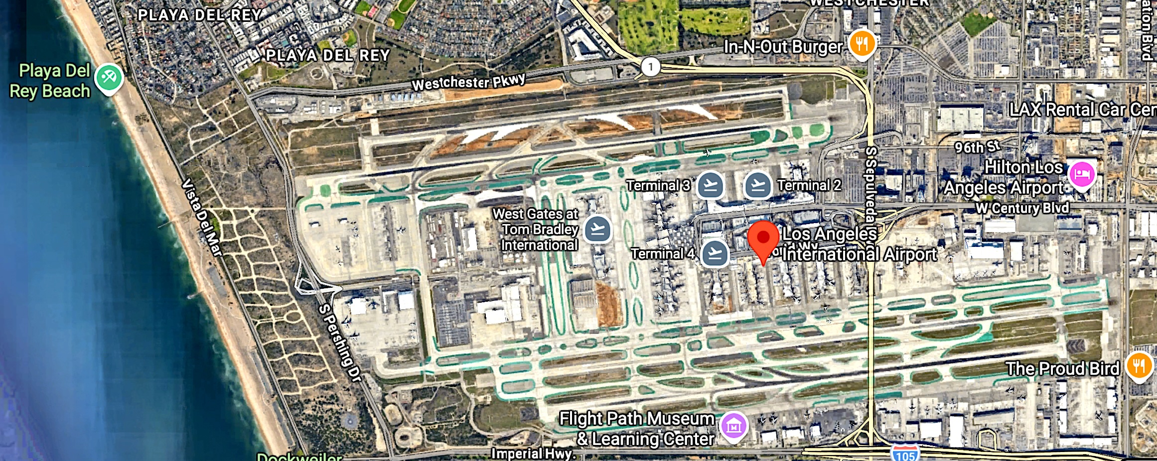
Los Angeles International Airport. 2026 image. (Credit: Google Earth)

Sources:

Bureau of Accidents Archives website.

Daily Breeze archives.

“LAX History,” Los Angeles World Airports (LAWA) website.

Wikipedia.

The National Aquaplane Races caused a sensation in the beach cities in the 1930s and 1940s

Hermosa Beach Review, Aug. 15, 1935, Page 1. (Credit: Hermosa Beach Review archives)

When the first aquaplane race from Catalina Island to Hermosa Beach by way of Manhattan Beach was held in 1935, the race got unofficially nicknamed the “ironing board derby.”

It would later officially be named the National Aquaplane Race. What in the world am I talking about? Let me explain.

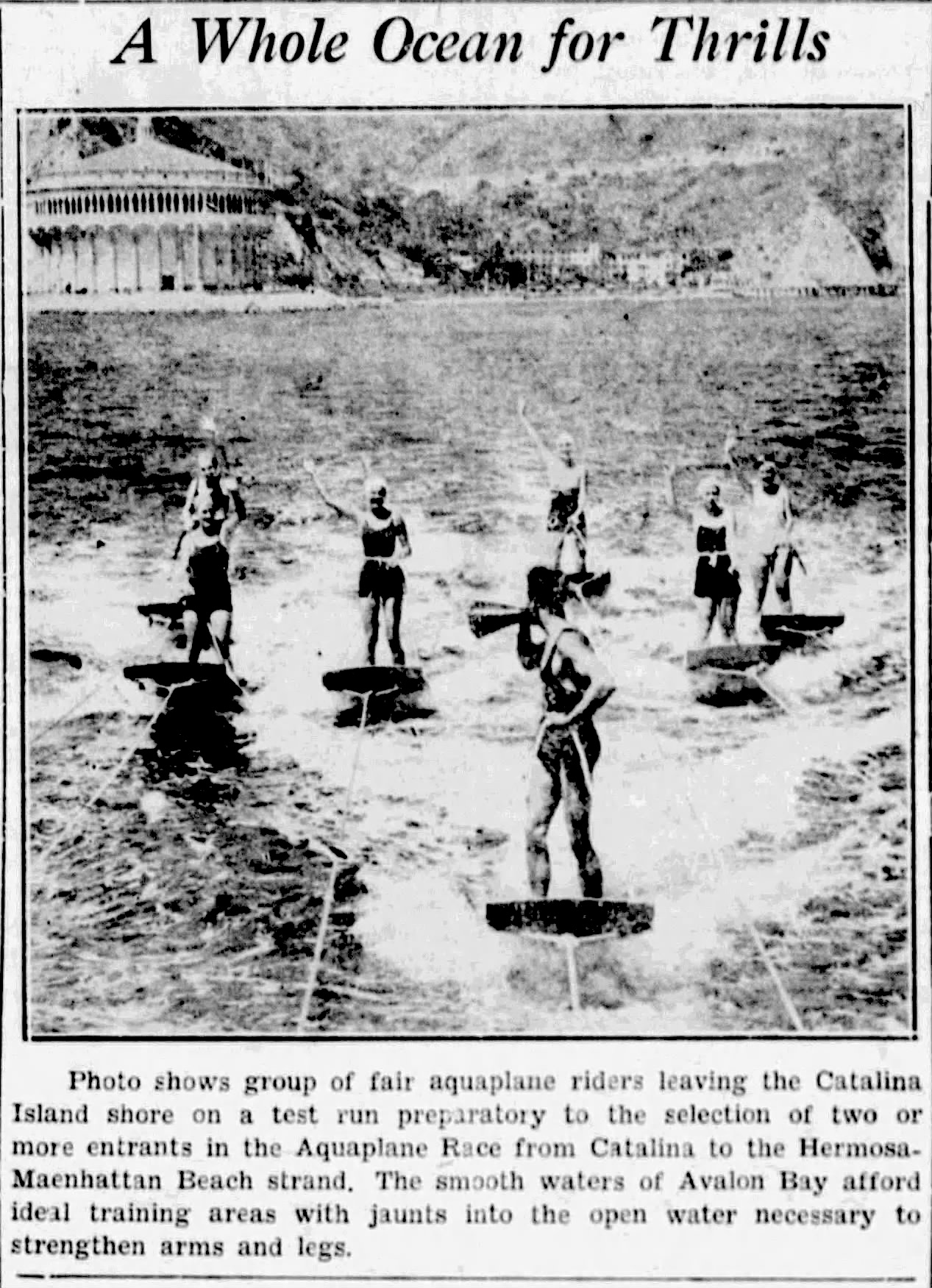
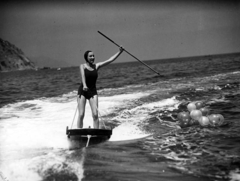
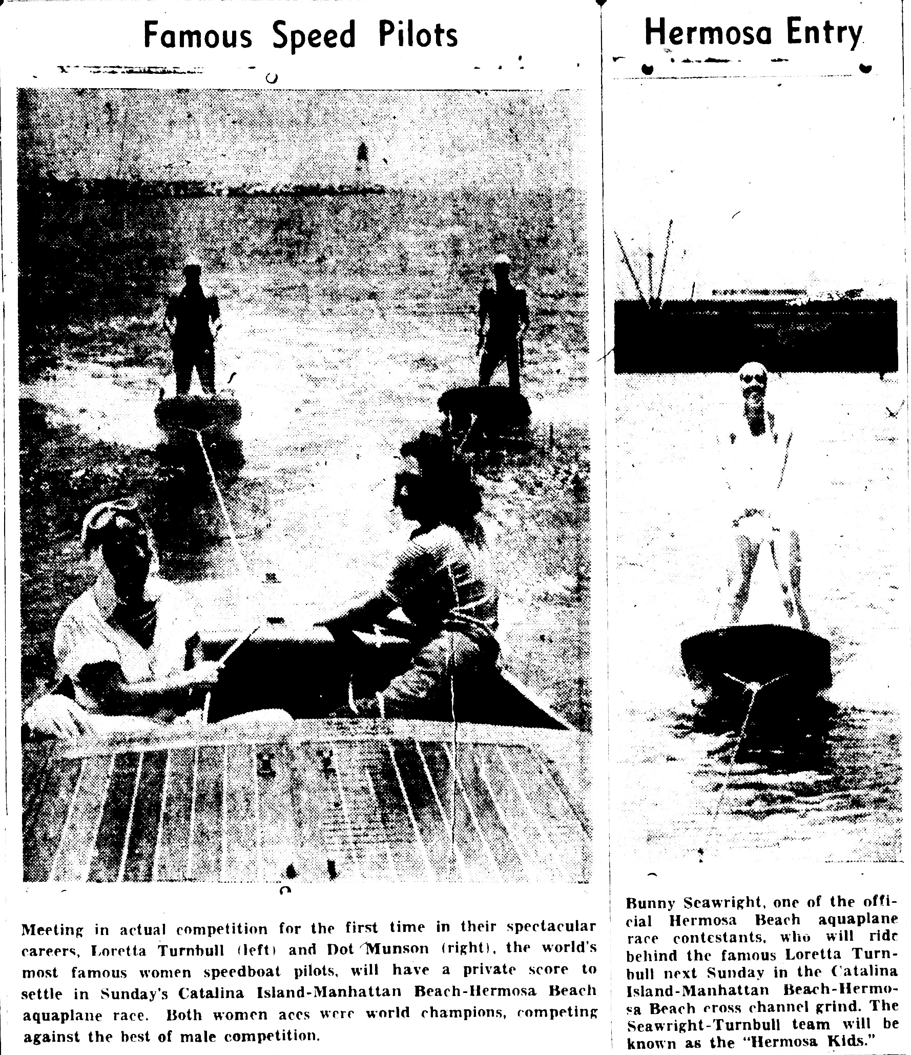
Despite the name, aquaplane races had nothing to do with sea planes. They were open-sea ocean races between contestants standing on single wooden planks that were roughly the dimensions of an ironing board as they were towed over the water course by regular speedboats. 

The riders would hold on to a rope attached to the boat, and have to balance themselves on the wooden planks as they were towed through the open ocean waters. Because of the physical difficulty of navigating the waves while moving through the choppy seas, many riders would be unable to finish the long races.

An unidentified woman holding a spear does some stunt aquaplaning near Santa Catalina Island. Undated photo circa 1930s. (Credit: Los Angeles Public Library Photo Collection)

Aquaplane racing had originated in the early 1900s as a kind of precursor to water skiing. 18-year-old Jack Samuelson has been credited with inventing the latter sport when he used a separate board on each foot as he was towed across Lake Pepin in Minnesota in 1922. Water skis were patented in 1925 by inventor Fred Waller.

In early 1935, the Hermosa Beach Junior Chamber of Commerce came up with the idea of holding a national championship aquaplane race. They charted the race’s original 40-mile course from the Catalina Island’s Avalon Harbor across the Pacific to the Manhattan Beach pier where it zigged back to the race’s finish on the beach just south of the Hermosa Beach pier.

The inaugural race was held on Sept. 7, 1935. Jack Burrud’s entry, “Cats and Dogs,” won the event with a time of one hour and sixteen minutes. The event drew large crowds and received wide publicity for the beach cities involved. (Tragically, Burrud would later be killed in action during World War II.)

The aquaplaning event was so successful that Hermosa Junior Chamber members immediately began planning for the 1936 race. It was held on Aug. 2 of that year, and was even more successful than the first one. In fact, a movement arose in Hermosa Beach to make the aquaplane race into an Olympic event. (That never came to pass.)

The aquaplane race gets a Page 1 banner headline in the Hermosa Beach Review of June 17, 1937. (Credit: Hermosa Beach Review archives)

The event’s popularity grew after it was held again in 1937. Its burgeoning success led to more elaborate plans for the next year. Hermosa Beach Mayor G.V. Learned went so far as to declare Aug. 1-7, 1938, as “Aquaplane Race Week.”

A full slate of community events and water sports competitions took place in the week before the Aug. 7th race, which was watched from shore by an estimated 100,000 people. 

The race even attracted participation from Hollywood stars Errol Flynn and the husband-and-wife team of Betty Grable and Jackie Coogan.

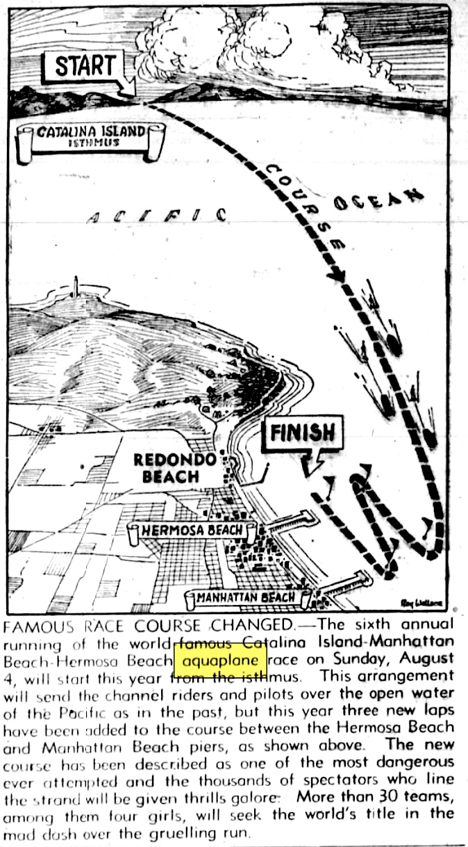
In 1940, the departure point of the race was changed from Avalon Harbor to the Isthmus at Two Harbors. The idea was to streamline the start, and increase the amount of time the racers would be visible from the mainland by lengthening the course at its end destination. The 44-mile distance remained the same.

Daily Breeze, July 25, 1940, Page 10. (Credit: Daily Breeze archives)

Bob Brown just nipped Miriam Williams before 150,000 spectators on Aug. 4th, 1940.

On Aug. 3, 1941, the seventh annual aquaplane race was won by Dave Vachon before an estimated 500,000 spectators. It would be the final race before the event was canceled due to World War II.

A version of the race returned to the beach cities on Aug. 11, 1946, but the distance was shortened to 20 miles, and the route ran across the offshore waters of the beach cities instead of across the channel from Catalina.

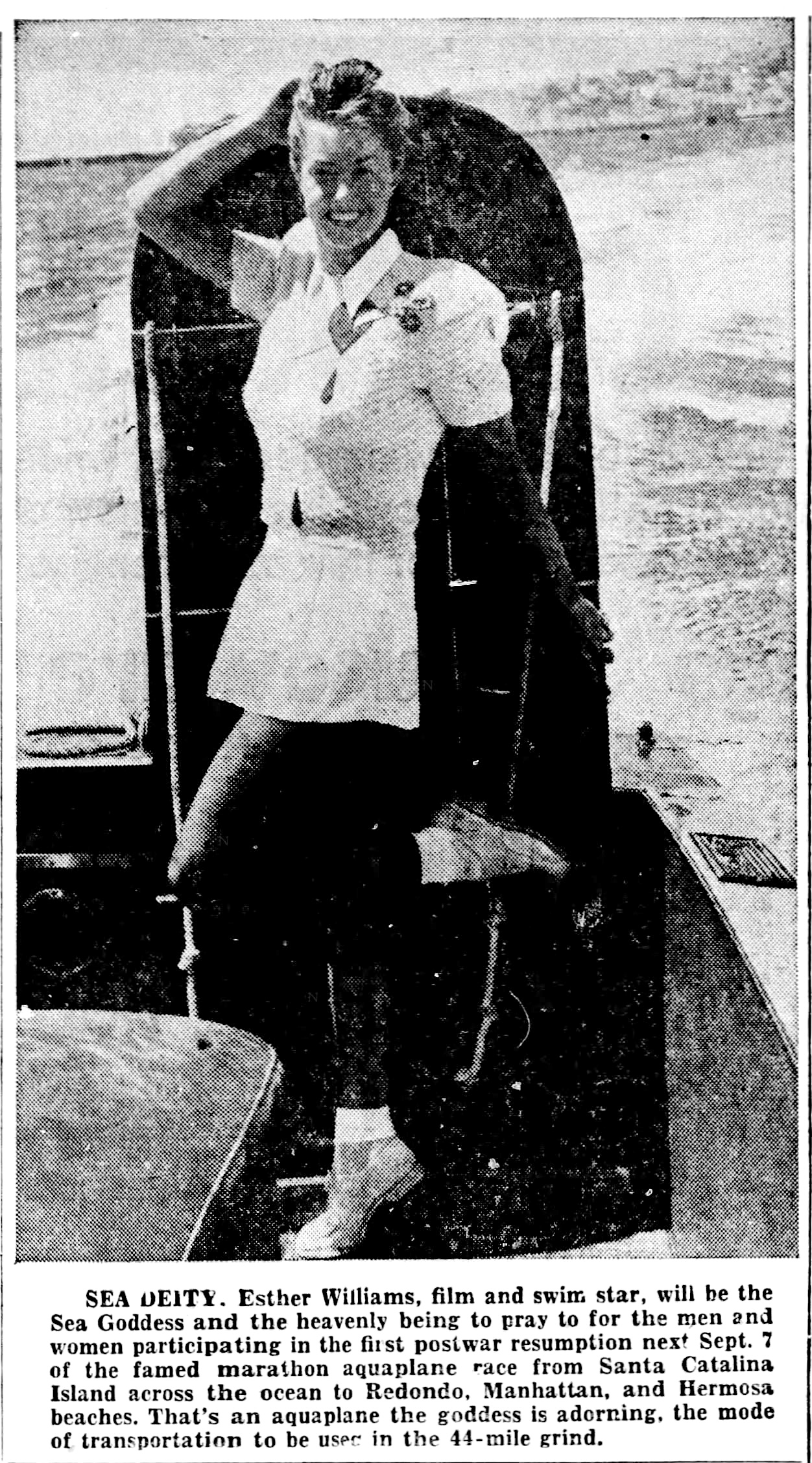
In 1947, the race returned to the prewar format and distance of 44 miles, beginning from  Catalina Island again. Former Olympic swimmer turned glamorous movie star swimmer Esther Williams was named “Sea Goddess” of the festivities. 

Redondo Reflex, Aug. 22, 1947, Page 11. (Redondo Reflex archives)

Municipal funds from the beach cities involved in sponsoring the race were hard to come by during 1946, so organizers turned to a public fundraising campaign which succeeded in raising the required capital.

Race contestant Price Sloan of Pasadena finished first in the Sept. 7, 1947 race. This ninth running of the National Aquaplane Race overall, six before and two after the war, would be its last, however.

Financial difficulties disclosed in May 1948 among both the sponsoring cities and the National Aquaplane-Water Ski Association resulted in the organizers of the event canceling the event for that year. It was never restarted.

Daily Breeze, July 29, 1937, Page 9. (Credit: Daily Breeze archives)

Note: This British Pathe video shows aquaplane competitors in action in the 1938 National Aquaplane Race.

Sources:

Daily Breeze archives.

Redondo Reflex archives.

Wikipedia.

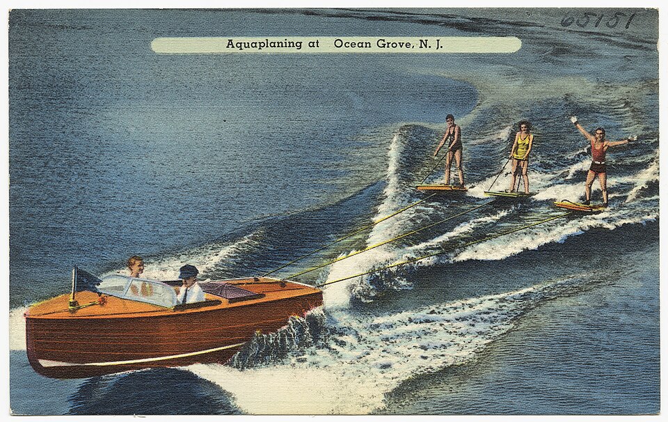
Undated postcard circa 1930-1945 shows that aquaplaning was popular on the East Coast, too. (Credit: Wikimedia Commons)

Rancho Palos Verdes’ seaside shopping center at Golden Cove

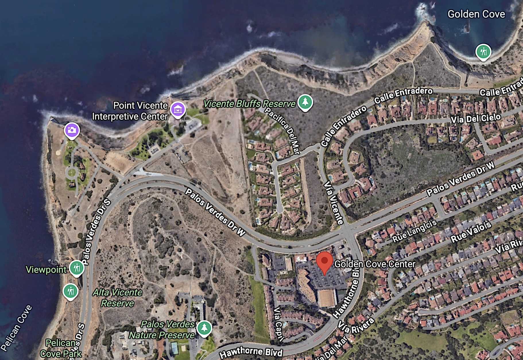
The Golden Cove Shopping Center, bottom middle, is near Point Vicente and the Pacific Coast, upper left. 2026 image. (Credit Google Earth)

The Golden Cove Shopping Center in Rancho Palos Verdes isn’t located directly on the ocean. It just feels like it is.

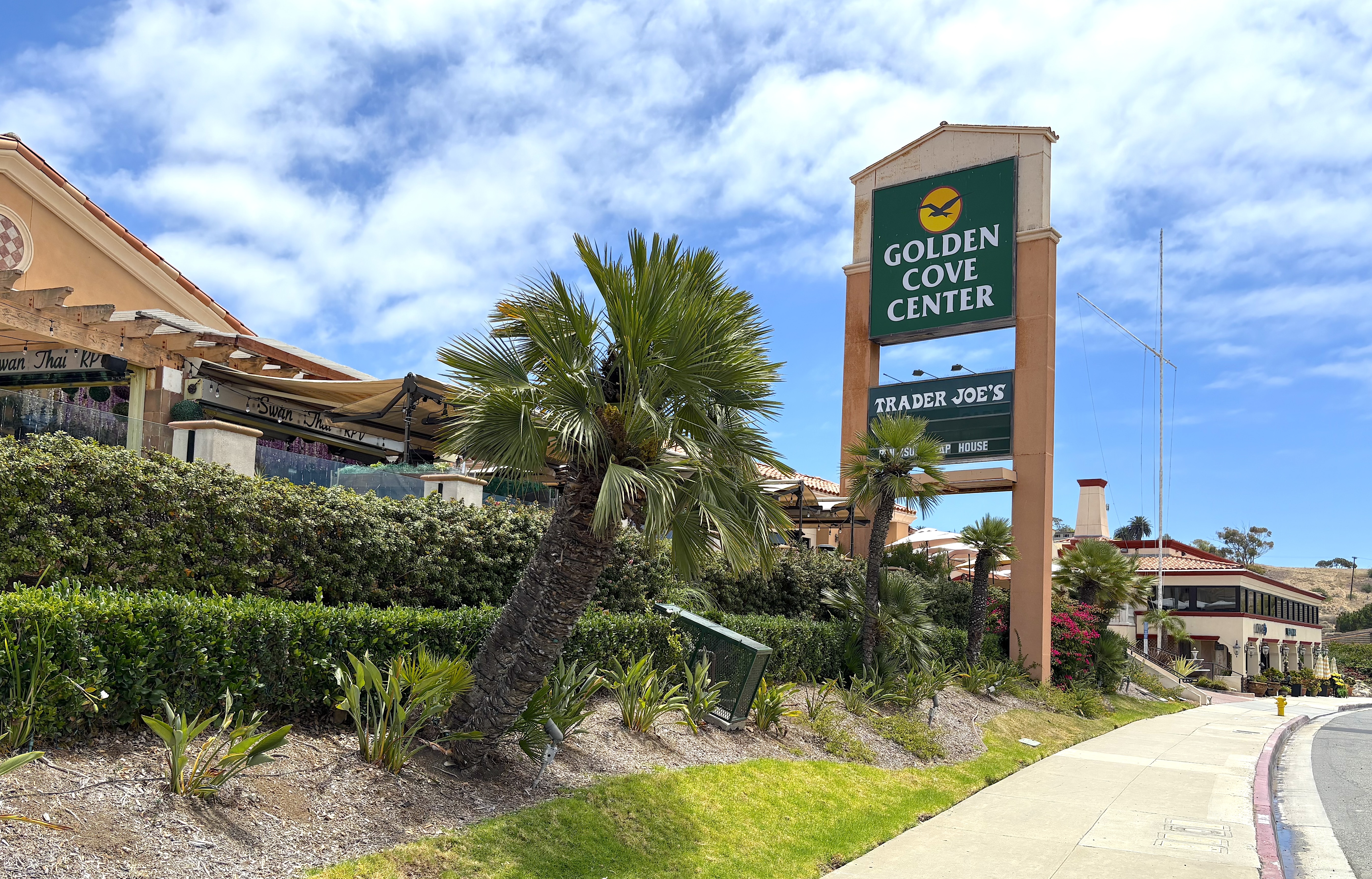
Situated at the southern terminus of Hawthorne Blvd. at its intersection with Palos Verdes Drive West, the cozy center is named for Golden Cove, an ocean cove dotted by tidepools that’s just a brief hike away.

The picturesque location just north of Point Vicente appealed to developer Jerry Moss, who announced plans for the construction of the new shopping center in May 1965. The seven-acre site he chose was on the landward side of Palos Verdes Drive, just below the bluffs from the Los Verdes golf course.

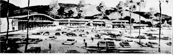
The Los Angeles firm Novikoff Engineers designed the center, which was estimated initially to cost $1 million. The plan called for 76,000 square feet of one and two story buildings designed in a muted Mediterranean style meant to be compatible with the natural setting.

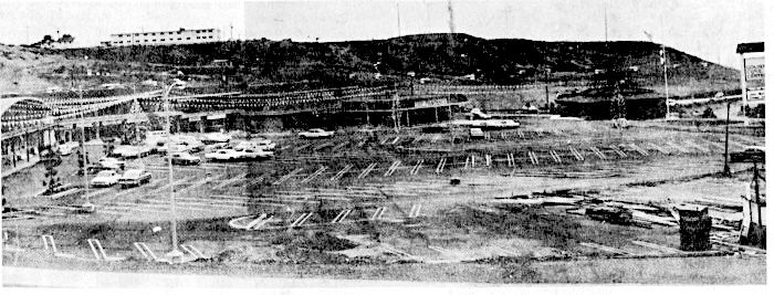
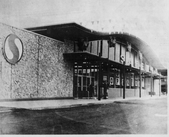
The architect’s rendering of Golden Cove Shopping Center, top, begins to take shape, bottom pic, with the frame for the new Safeway store nearing completion, left. 1965 and 1966 images from the Palos Verdes Peninsula News. (Credit: Palos Verdes Peninsula News archives)

The center would be anchored by a 28,000-square-foot Safeway grocery store, and include several smaller businesses, including a Bank of America branch, beauty shop, independent drug store, shoe repair, dress shop and others. 

Office suites also would be available on the top floor of a two-story office/small business combination building.

By the time ground was broken officially for the project on Dec. 2, 1965, its estimated cost had risen to $2.5 million. Its builder, the general contracting firm Ernest W. Hahn, predicted that construction would be complete by June 1966.

Golden Cove’s anchor Safeway grocery store opened for business on July 21, 1966. For a time, it and the Bank of America branch were the only two retailers open at the new center.

The new Safeway store is open for business at the Golden Cove Shopping Center. Palos Verdes Peninsula News, Aug. 18, 1965, Page 20. (Credit: Palos Verdes Peninsula News archives)

In April 1966, the recently formed St. Paul’s Lutheran Church announced it would build its church on a site that it had purchased adjacent to the center

Restaurateur Ralph Wood Jr., owner and operator of the Woody’s Smorgasburger chain  established in Southern California in the 1950s, heard about openings at the Golden Cove center. After investigating it, he decided it would be ideal for a new fine dining restaurant he’d been considering.

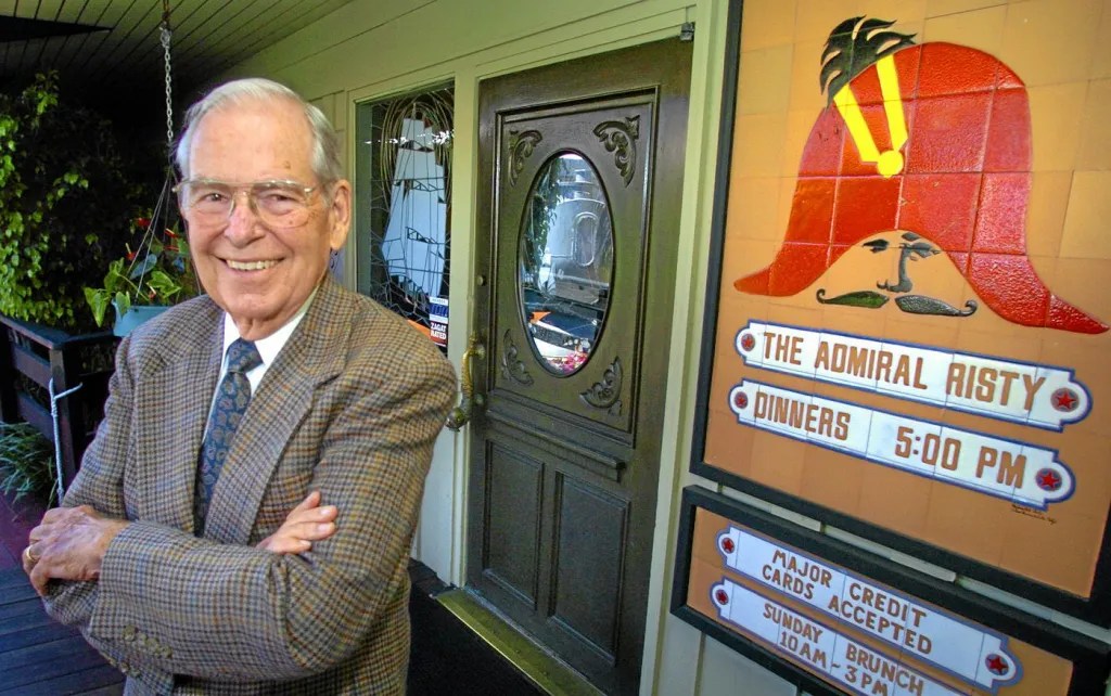
He opened the Admiral Risty on Oct. 10, 1966. Named after his wife, Barbara “Risty” Wood, the steak and seafood eatery became a landmark Peninsula restaurant for the next five decades. 

Ralph Wood Jr., founder of the Admiral Risty, in front of his restaurant in the Golden Cove shopping center in July 2006. He died in 2015 at 90. (Credit: Daily Breeze staff file photo)

An unfavorable lease renewal deal led to its closure on Aug. 17, 2019. It was replaced by a Chase Bank branch office.

In 2025, I wrote about a teen club for Palos Verdes area high schoolers that opened in one of the second-floor office suites at Golden Cove on June 24, 1967. Club Bagatelle operated until its founder, Elin Vanderlip, discontinued it in November 1968.

A Vons supermarket eventually took over the original Safeway location. Vons closed that store in 1994, and the building was repurposed eventually into the Rancho Palos Verdes branch of Peninsula Montessori School, which opened in 2001.

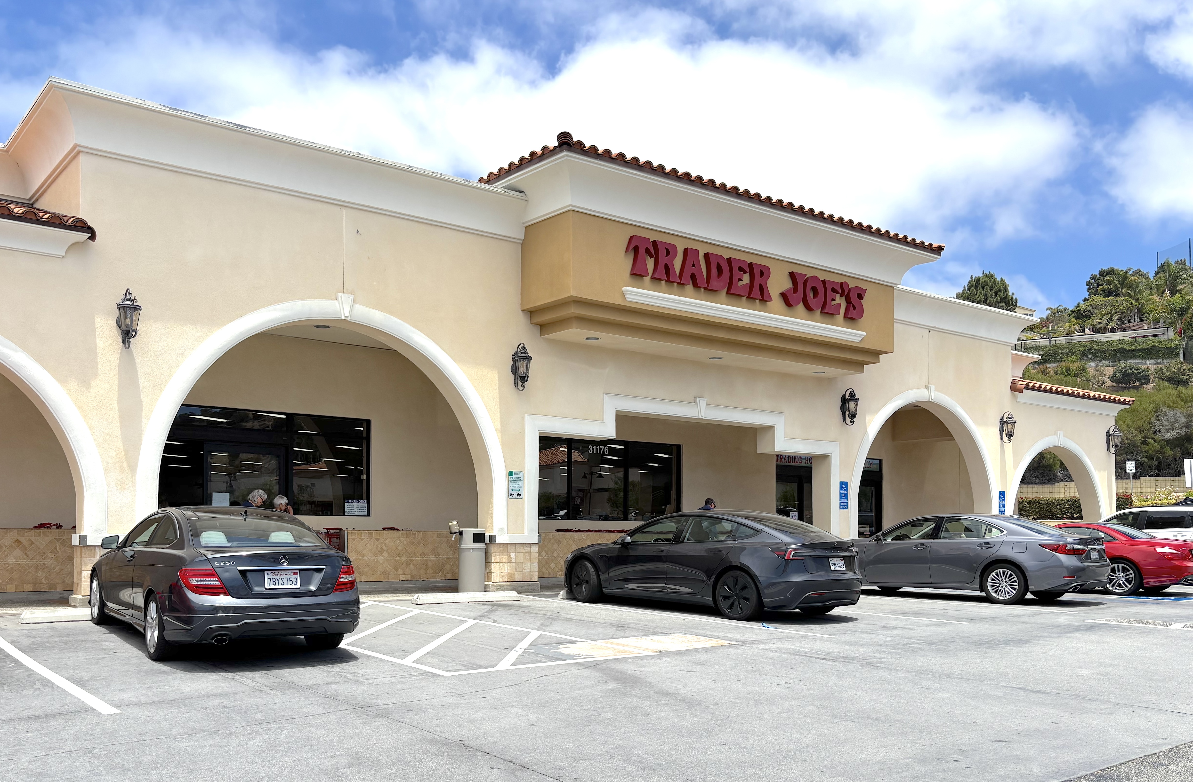
Trader Joe’s opened at the Golden Cove Shopping Center in 2010. July 2, 2026. (Photo by Sam Gnerre)

After more than a decade without a grocery store or food market of any kind, a Trader Joe’s market opened for business on April 17, 2010, after its owners replaced and remodeled the former Golden Lotus restaurant building.

One of the more picturesque Starbucks coffee outlets opened in the center on Aug. 8, 2003. Its outdoor back patio offers a stunning view of the Pacific Ocean that includes, on a clear day, Santa Catalina Island.

The Starbucks was added as part of a year-long overall renovation that concluded in October 2003.

Though developer Jerry Moss went on the record in April 1967 as opposing incorporation, the Golden Cove Shopping Center became and remains part of the newly formed city of Rancho Palos Verdes when the latter officially became a city on Sept. 7, 1973.

The Golden Cove Shopping Center in Rancho Palos Verdes on July 2, 2026. (Photo by Sam Gnerre)

Sources:

Daily Breeze archives.

Palos Verdes Peninsula News archives.

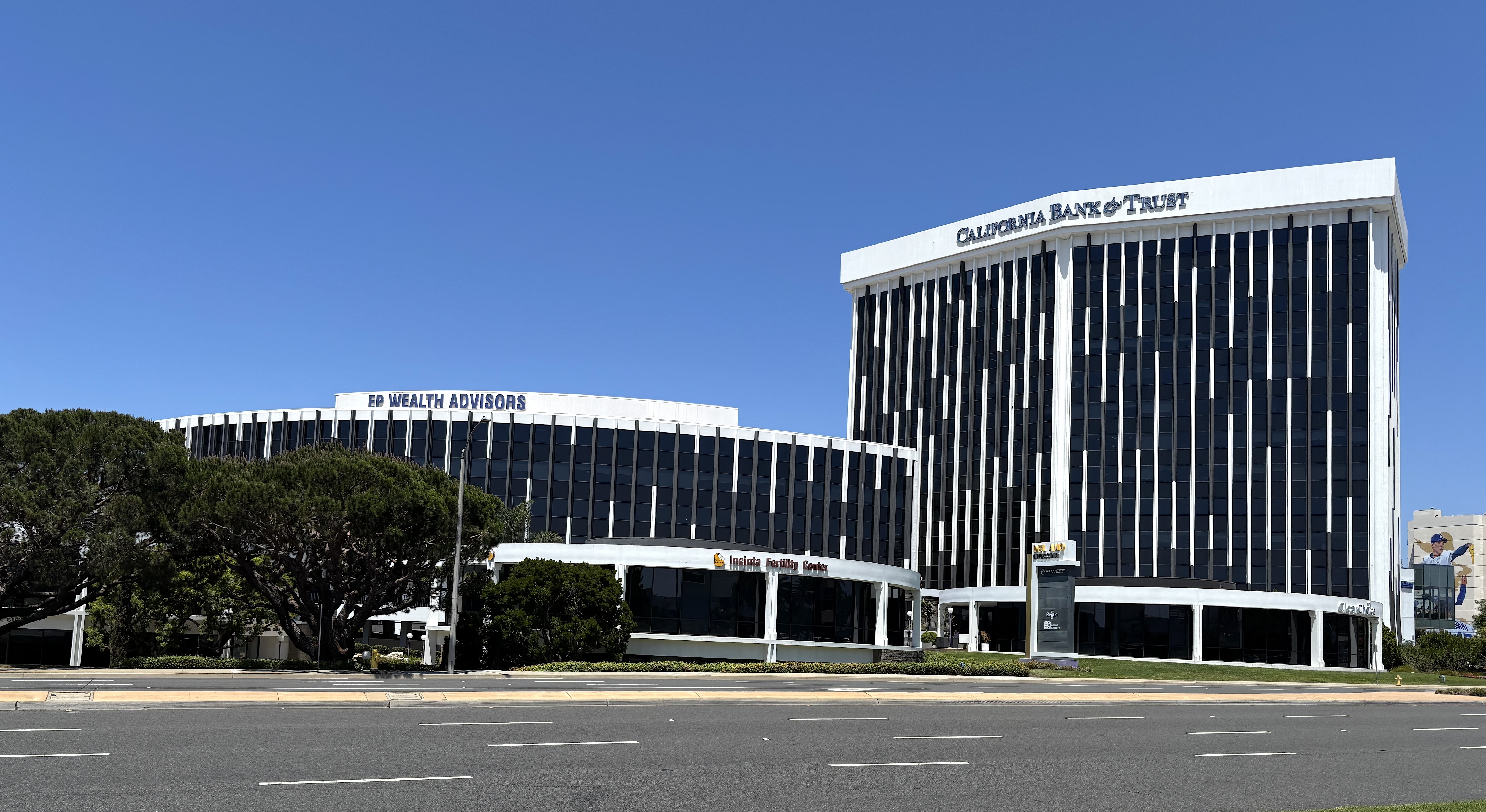
Del Amo Financial Center spotlighted Torrance’s thriving 1960s business community

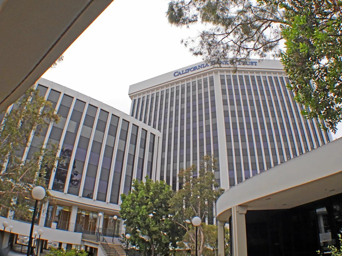
The Del Amo Financial Center, Hawthorne Blvd. at Carson St. in Torrance, in June 2013. (Photo by Daily Breeze photographer Brad Graverson)

Everything was clicking for the South Bay economy in the latter half of the 1960s. Employment opportunities abounded, and residential and commercial development was booming.

Along the Hawthorne Blvd. retail corridor, the large outdoor South Bay Center had been a  success since opening in 1957 in Redondo Beach. A couple miles further south, Torrance responded by opening the Del Amo Shopping Center on the southeast corner of Hawthorne Blvd. and Carson St. in 1959.

Business was brisk enough to support a neighboring center. Starting with the Bullock’s department store anchor store, the new Del Amo Fashion Center opened up directly across Carson on the northeast corner of the intersection with Hawthorne in 1966. 

Torrance Press-Herald, June 15, 1966, Page C-1. (Credit: Torrance Historical Newspaper and Directories Archive database, Torrance Public Library)

That same year, the Great Lakes Realty Corp., a division of the Great Lakes Carbon Corp. that operated an open-air diatomaceous soil mine on the Palos Verdes Peninsula for years, announced ambitious plans calling for a giant financial center on the northwest corner of Hawthorne and Carson. 

The complex would be situated directly across Hawthorne from the two rapidly growing shopping centers. (The two centers would merge in 1981, making Del Amo Fashion Center the largest indoor mall in the world for the next 11 years.)

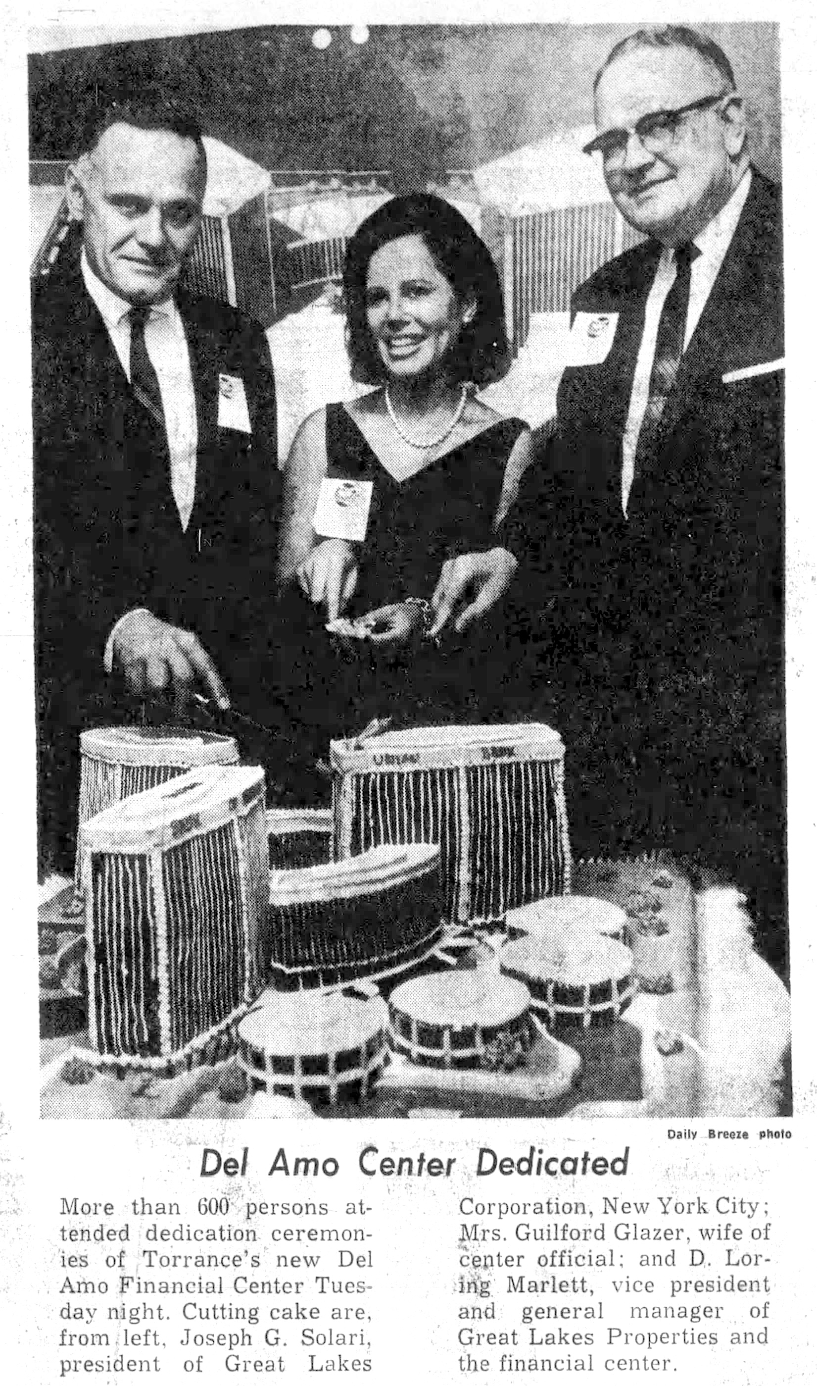
Great Lakes, in partnership with real estate development firm Guilford Glazer & Associates, officially broke ground for the $30 million project on March 12, 1966. Political bigwigs present at the ceremony included Rep. Alphonzo Bell, Los Angeles County Supervisor Burton Chace, and Torrance Mayor Albert Isen.

The first phase of  the plan included a 13-story tower, which would become Torrance’s tallest building, a five-story circular building built over a below-ground parking garage with room for 683 cars, and four additional circular pavilions with a total of 56,000 square feet of office space.

The second phase called for two more towers and two additional pavilions. When completed, the financial center would have more than 1 million square feet of space. Los Angeles architectural firm Victor Gruen Associates designed the project.

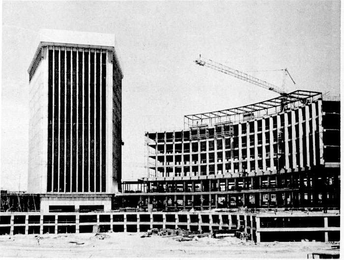
The Del Amo Financial Center under construction in June 1967. The 12-story tower has topped out, and the frame of the five-story ring building is in place. Palos Verdes Peninsula News, Sept. 20, 1967, Page 21. (Credit: Palos Verdes Peninsula News archives)

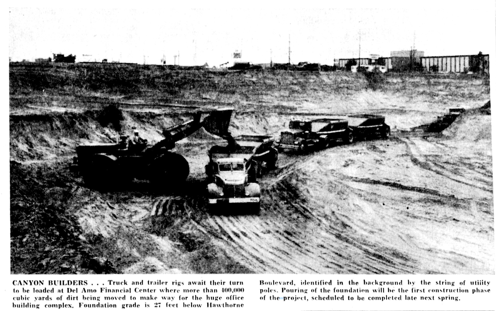
By June 1966, more than 400,000 cubic yards of dirt had been unearthed from the site before foundations could begin to be laid. That total eventually would reach 700,000 cubic yards.

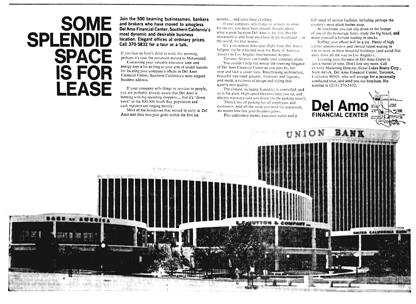
While the buildings were being erected, their future occupants began to be announced. The financial heavy hitters included Union Bank in the 13-story tower, United California Bank (UCB), and Western Federal Savings. Bank of America would open there during the second phase of development.

In addition to banks and savings and loans, the center also attracted its first stock brokerage firm when Bateman, Eichler, Hill Richards announced in June 1967 that it would open a branch office there. 

Many others would follow suit over the years, including E.F. Hutton, Merrill Lynch and Fidelity Invesments. Several insurance firms also opened offices there, including branches of Equitable, Travelers and New York Life.

Western Federal became the first business to open its doors in the Center on June 30, 1967, followed by Union Bank on Aug. 21 of  that year.

Torrance Press-Herald ad, Sept. 4, 1968, Page A-2. (Credit: Torrance Historical Newspaper and Directories Archive database, Torrance Public Library)

A boatload of political and business figures enjoyed a continental breakfast and many speeches at the center’s official grand opening on Sept. 20, 1967.

Fast forward to the 1990s, when the now-aging center was deteriorating physically and in need of a facelift. At some point before 1998, the San Diego company Southwest Value Partners purchased it, and remodeled it in 1998.

In 2005, Southwest successfully flipped the property, selling it to Jamison Properties for $68 million. Jamison immediately announced that it had no plans to make changes to the complex. Its interest in the center perhaps was spurred on by major remodeling plans announced by the massive Del Amo Fashion Center mall across the street.

Jamison apparently was true to its word, making little effort to upgrade the property over the next ten years. Several tenants moved out as a result. The complex was one-third vacant when Jamison sold the property in June 2015 to the San Diego real estate firms The Muller Co. and GreenOak Real Estate for $62.5 million.

Muller and GreenOak have since remodeled the center, and refashioned it from a strictly financial complex into more of a mixed-use business/retail/medical complex, which they have renamed “Del Amo Crossing.”

Del Amo Crossing now includes restaurants, some retail outlets and a two-story 24-Hour Fitness facility.

Looking across Hawthorne Blvd. toward Del Amo Crossing. June 24, 2026. (Photo by Sam Gnerre)

Sources:

Daily Breeze archives.

Palos Verdes Peninsula News archives.

Torrance Press-Herald archives.

Wikipedia.

The cake in question is a rendition of the Del Amo Financial Center. Daily Breeze, Sept. 20, 1967, Page 29. (Credit: Daily Breeze archives)

1940s Hollywood found the South Bay and Harbor Area ideal for film location shooting

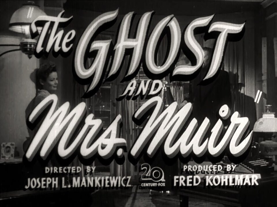
Screenshot from “The Ghost and Mrs. Muir” 1947 film trailer. The film, set in England, was partially filmed along the Palos Verdes Peninsula.(Credit: Wikimedia Commons)

Modern filmmakers – and not just Quentin Tarantino – have often used South Bay and Harbor Area locations as cinematic backdrops.

Ten years ago, I wrote about some of the notable films that have been filmed here, including “Pulp Fiction,” “Jackie Brown,” “Gone in 60 Seconds,” “The Usual Suspects” and many more.

Countless television episodes also have been filmed in the region.

It turns out not to be such a recent phenomenon. Silent films by Charlie Chaplin (“A Busy Day,” 1914) and Harold Lloyd (“Lonesome Luke’s Wild Women,” 1917) were filmed in San Pedro, the latter on the no-longer-existing Deadman’s Island.

Today we’re looking at selected films made in the 1940s, a particularly interesting era for location shoots in this neck of the woods.

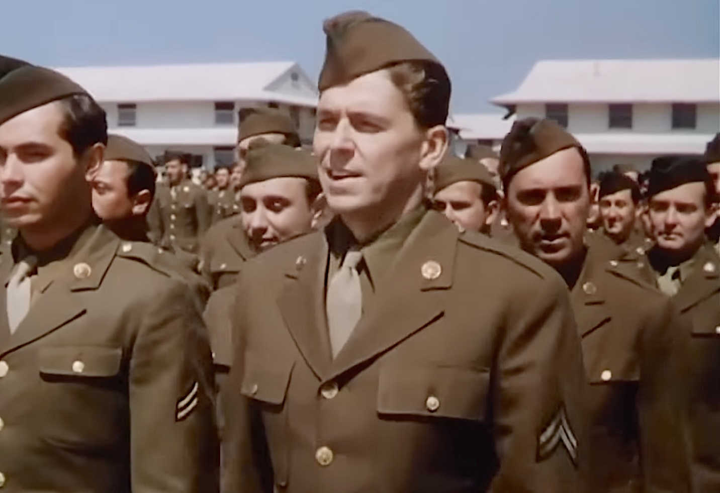
Ronald Reagan at Fort MacArthur in San Pedro in a still taken from YouTube from the 1943 film, “This Is The Army.” (Credit: YouTube)

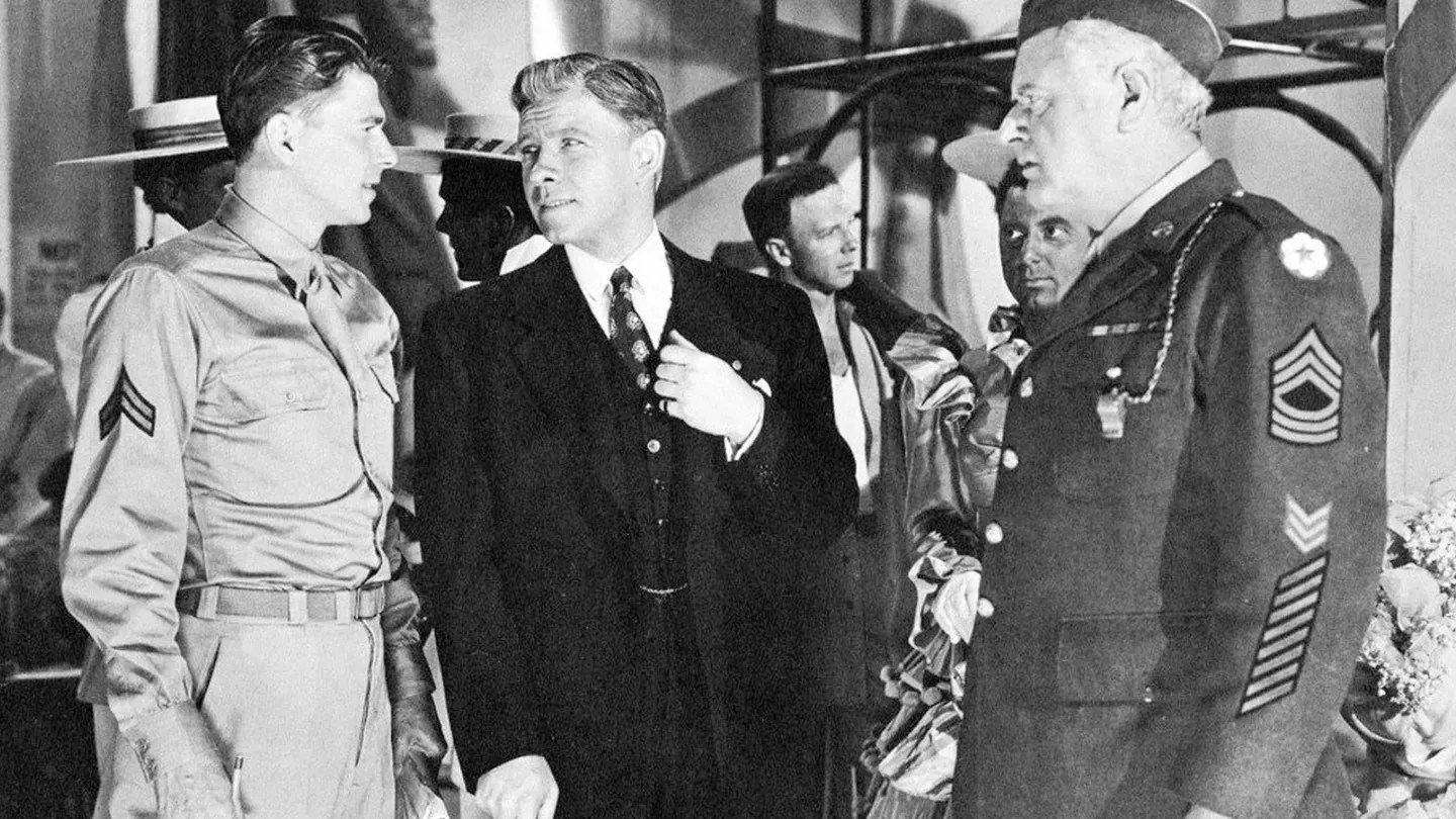
San Pedro became a popular filming spot during the 1940s for a number of reasons. One was the presence of Fort MacArthur. The U.S. Army base proved an ideal setting for service comedies such as the Irving Berlin-written musical revue “This Is the Army” (1943), which featured George Murphy and a young Ronald Reagan alongside hundreds of actual troops.

Mr. Winkle Goes to War” (1944), a service comedy starring Edward G. Robinson, also was filmed at Fort MacArthur.

The Army base’s seaside gun emplacements and batteries also were popular filming location for war films.

From left, Ronald Reagan, George Murphy and Alan Hale in the 1944 film, “This Is The Army.” (Credit: PBS SoCal website)

Pat O’Brien hunted saboteurs in the 1944 drama “Secret Command,” filmed chiefly at the California Shipbuilding Company, a government-owned warship manufacturing firm on Terminal Island. 

The film provides an accurate cinematic record of the actual Calship shipyards during the height of wartime production, its ships lined up for construction. The plant closed with the end of the war in 1945.

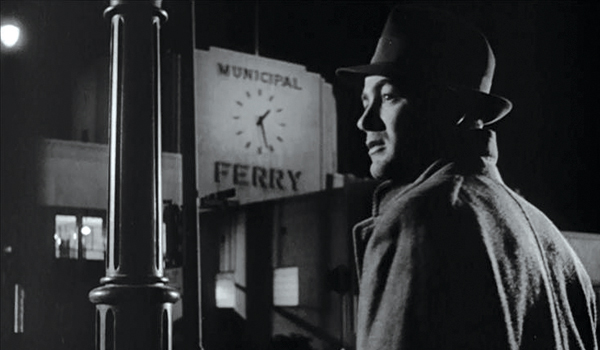
Film noirs often used South Bay and Harbor Area locations. Director William Keighley shot the 1948 noir film, “The Street With No Name,” starring Richard Widmark and Lloyd Nolan, mostly on location in downtown Los Angeles. But its memorable chase scene was filmed in and around the San Pedro Municipal Ferry Building.

Actor Mark Stevens at the San Pedro Municipal Ferry Building in San Pedro. Still from the film, “The Street With No Name” (1948). (Credit: Fredrikonfilm blog)

The ferry stopped running on Nov. 14, 1963 after the Vincent Thomas Bridge, which opened the next day, rendered it obsolete. Its main building was preserved, however, and was refitted to house the Los Angeles Maritime Museum in 1977.

By the 1940s, metro area Los Angeles coastal sites had become less useful for certain types of films due to their rapid urban development. 

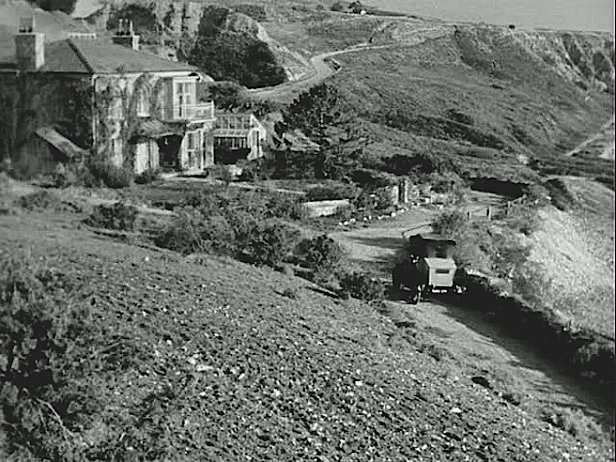
If Joseph Mankiewicz, director of the memorable 1947 film “The Ghost and Mrs. Muir,” say, was seeking a stretch of undeveloped rocky coastline as the setting for a remote English seaside cottage, the Palos Verdes coastline was seen as a better option than Santa Monica.

The completion of the Palos Verdes Drive roadway in 1926 made the developing, then relatively sparsely populated area accessible by automobile. The southern section of the Peninsula in current-day Rancho Palos Verdes seemed the perfect place for the filmmakers to build their outdoor movie set, Gull Cottage.

20th Century Fox built this movie set on Palos Verdes Drive South (rear) in present-day Rancho Palos Verdes for the 1947 film, “The Ghost and Mrs. Muir.” The film was set along the English coast in Cornwall. (Credit: 20th Century Fox)

Exterior establishing shots showed the rocky coastline as well as the house. Though not exactly a perfect match for the Cornwall coast, it was a much cheaper choice than an actual location shoot in Cornwall would have been. The Gull Cottage set, which had cost $25,000 to construct, no longer exists; it was completely taken down after filming wrapped.

Santa Catalina Island also became a popular locale for film shoots. Its varied and rugged terrain and scenic shoreline proved an attractive choice for filmmakers.

The 1940 adventure film, “Typhoon,” with Dorothy Lamour and Robert Preston, used the island’s lush vegetation as a backdrop for its South Seas tropical storm tale. 

Director Howard Hawks wanted to use Catalina to double for coastal Florida in the 1944 film “To Have and Have Not.” Unfortunately, the U.S. Army said no due to wartime security concerns, and Lauren Bacall and Humphrey Bogart were left to re-create the tale on a Warner Bros. sound stage in Burbank.

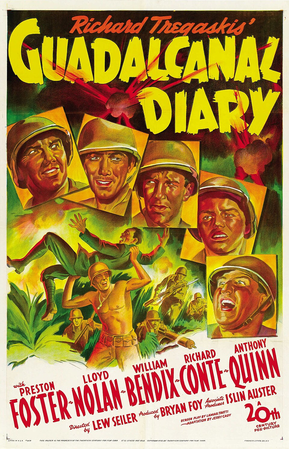
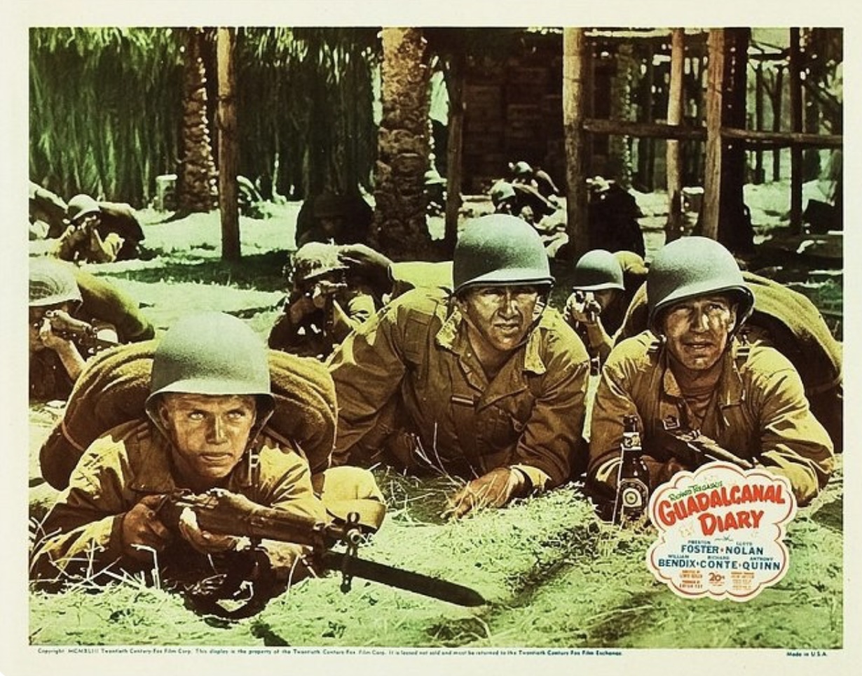
Lobby card for the 1943 film “Guadalcanal Diary.” (Credit: 20th Century Fox)

Though it was closed to the public from 1942 to 1945, the U.S. government did grant the  filmmakers of the 1943 film “Guadalcanal Diary” permission to film at Little Harbor on the west side of the island. The popular film’s propaganda value was deemed to be important enough to wartime morale to make the exception.

Legendary B-movie director Edgar G. Ulmer (“Detour”) used Catalina’s remote Toyon Bay for his 1948 film noir “Ruthless,” starring Zachary Scott and Sydney Greenstreet. The cove is only accessible by foot or by boat and is currently the site of the Catalina Island Marine Institute and Catalina Sea Camp.

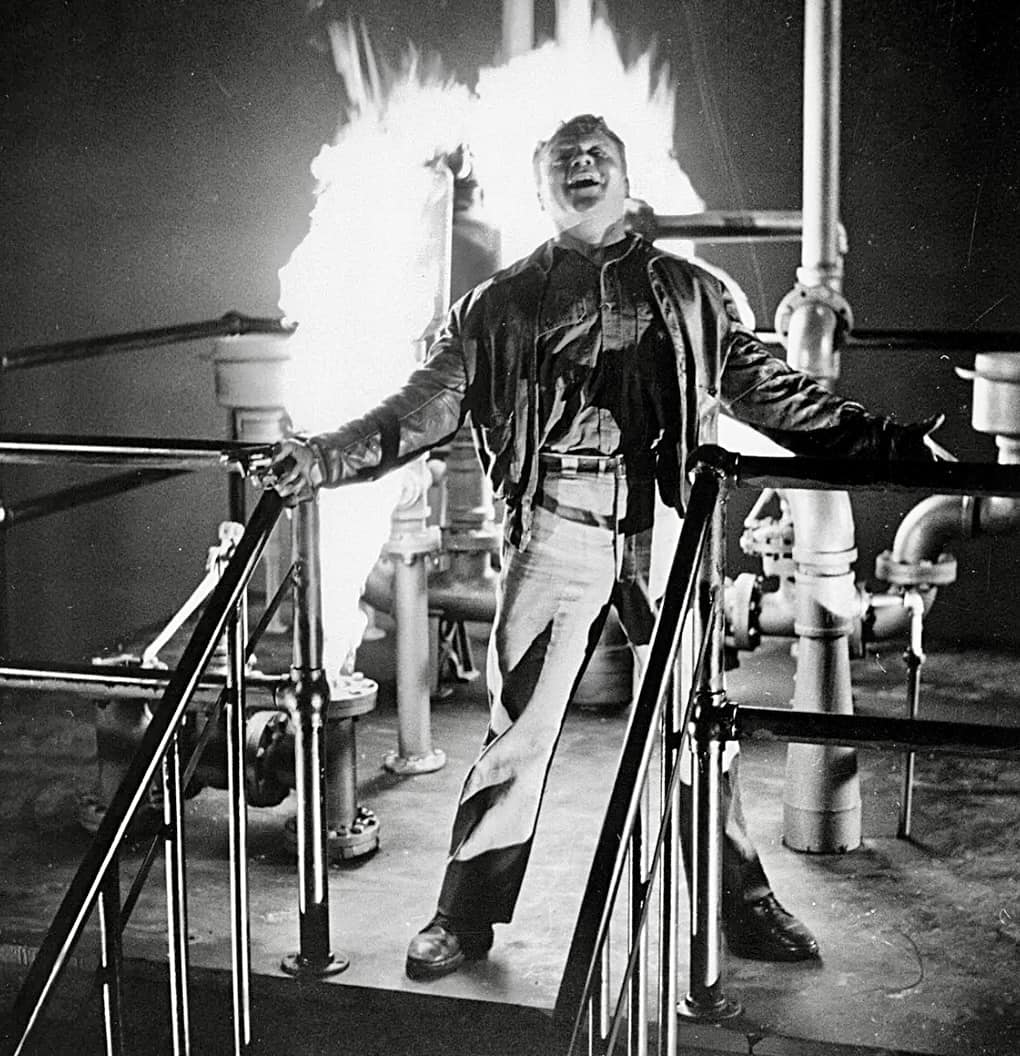
Finally, we need to re-mention that one of the most iconic final scenes of the decade was filmed at  the former Shell Oil rubber plant in Wilmington. James Cagney goes up in a blaze of glory at the site, then owned by the federal government, after hollering his immortal last words, “Made it, Ma! Top of the world!”

James Cagney in the climactic final scene from “White Heat” (1949). The scene was filmed in Wilmington. (Credit: Warner Bros.)

Sources:

Classic Movie Ramblings website.

Daily Breeze archives.

Filmed In San Pedro and Wilmington Facebook page.

Internet Movie Database.

San Pedro News Pilot archives.

Wikipedia.

Movie poster for 1944 film, “Guadalcanal Diary.” (Credit: Wikimedia Commons)

Unusual financing plan launched San Pedro’s Hacienda Hotel in 1955

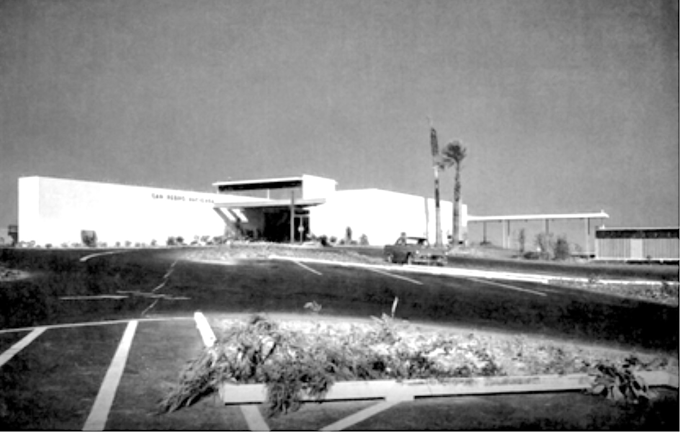
The Hacienda Hotel in San Pedro in 1955. (Credit: ResearchGate website, Creative Commons)

According to the San Pedro News Pilot, the idea arose out of a chamber of commerce meeting in San Pedro in 1950.

Having observed the rapid postwar growth boom of neighboring suburban communities, a unnamed member of the group of local business leaders and boosters said something like, “What this community needs is a good hotel with facilities for parties, banquets and civic functions.” 

One can imagine lots of nodding heads in the room – at the time, most all of those activities took place in Long Beach or the South Bay – but the inevitable next question to be asked was, where would blue-collar, working class San Pedro ever get the money to finance such an undertaking?

Well, what if a large group of residents could be persuaded to fill the need by kicking in smaller donations toward making it happen?

If the term had been around in the early 1950s, we’d call the resulting financing plan adopted for the Hacienda Hotel construction in San Pedro “crowdsourcing.” Or more accurately, “crowdfunding.” Except, in this case, the investors became stakeholders in the enterprise.

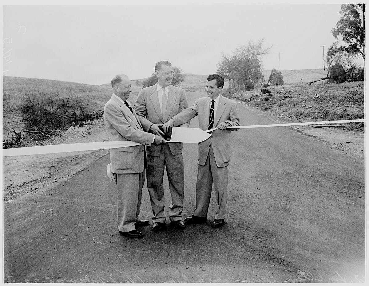
Dr. Elton Spires, president of San Pedro Chamber of Commerce, John Gibson, president of Chamber of Commerce and Councilman from the Harbor District; and Lloyd Menvig, president of Board of Harbor Commissioners wield a huge knife to cut ribbon opening Hacienda Road, connecting Western Ave. to Miraliste Dr. and linking to San Pedro’s Hacienda Hotel. (Credit: USC Digital Library)

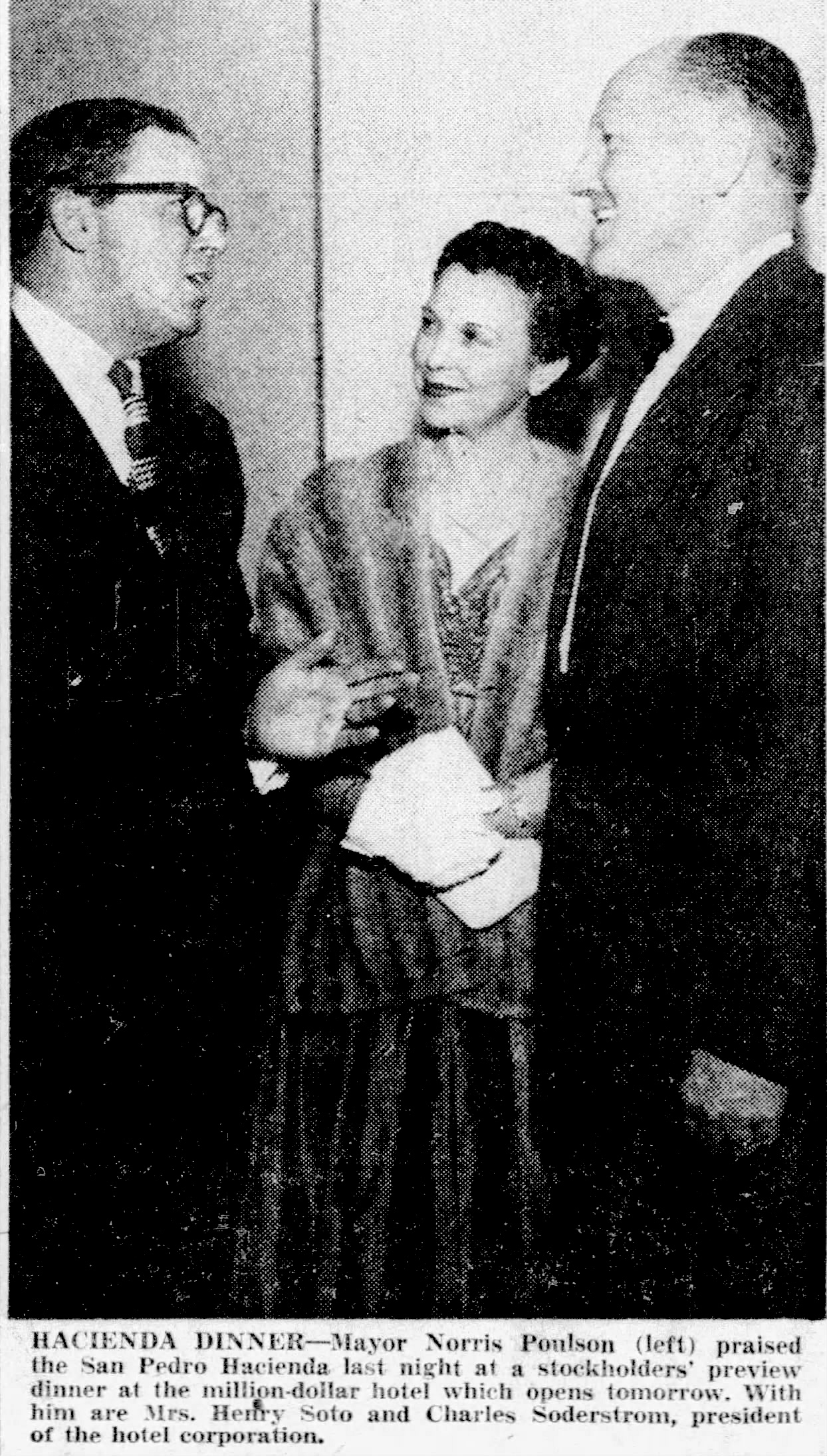
Businessmen Charles Soderstrom and Al Atchison were put in charge of managing the project. Atchison told the News Pilot years later that the California Hotel Association trade group said to the duo at the time that “anyone who would build a hotel in San Pedro would have to have a hole in his head.” The duo were undaunted.

After a professional study determined that the plan might actually work, 54 acres of land in the Miraleste area west of Western Ave. were acquired. A team of 150 volunteers was formed, and charged with the task of  convincing San Pedrans to contribute $100 (or more) to become partners in the newly formed San Pedro Community Hotel Corp.

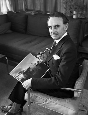
Richard Neutra in 1935. (Credit: Wikimedia Commons)

Some 1500 people signed up, raising $540,000 in the process, and the San Pedro Hacienda Hotel project was off and running. The impressive fundraising total convinced the Bank of America to loan an additional $360,000 for the Hacienda. 

Noted architect Richard Neutra was enlisted to design the buildings in the distinctive style that would later become known as mid-20th Century modernism. Better known for his Los Angeles-area buildings, Neutra had also designed the Channel Heights housing project in San Pedro in the early 1940s.

Los Angeles City Councilman John Gibson officially broke ground for the hotel during a ceremony on March 7, 1954, and the Hacienda officially opened to the public on March 1, 1955. 

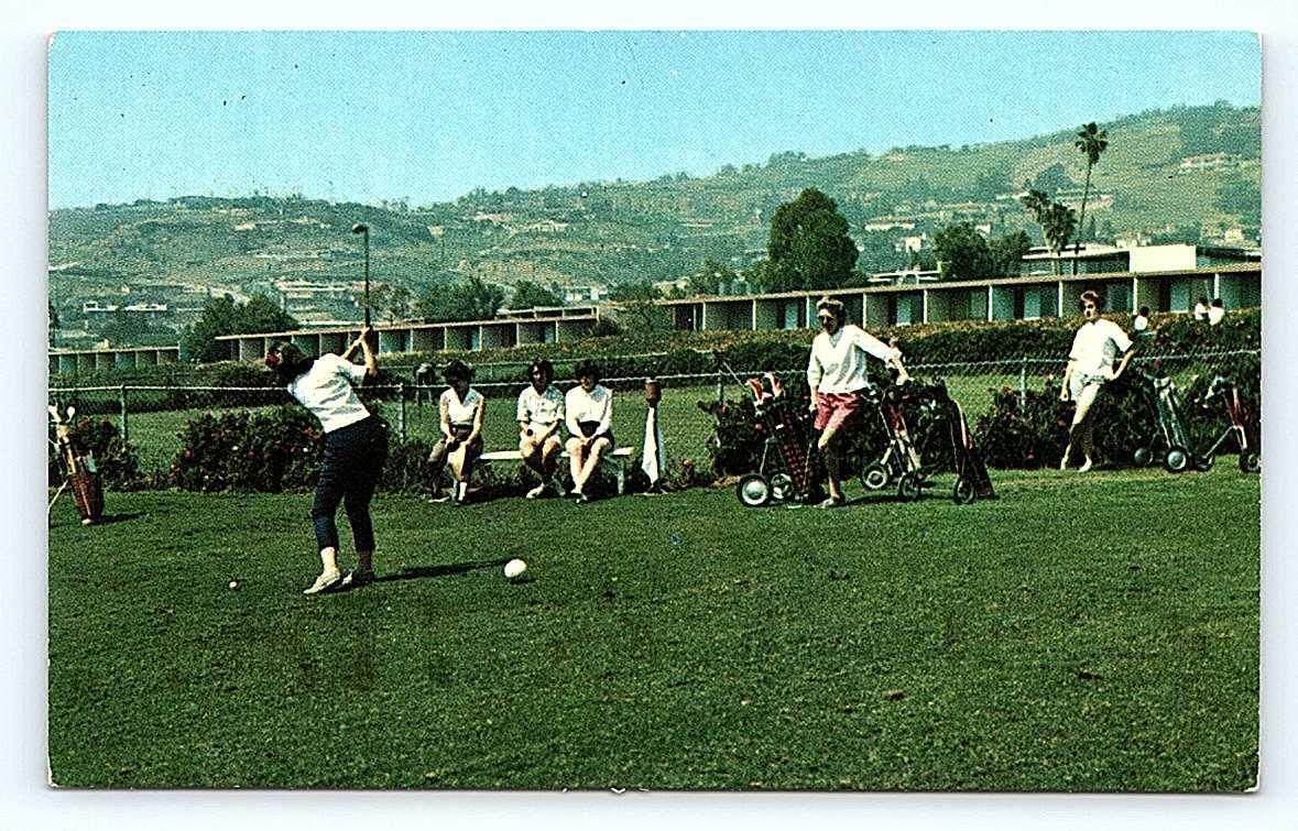
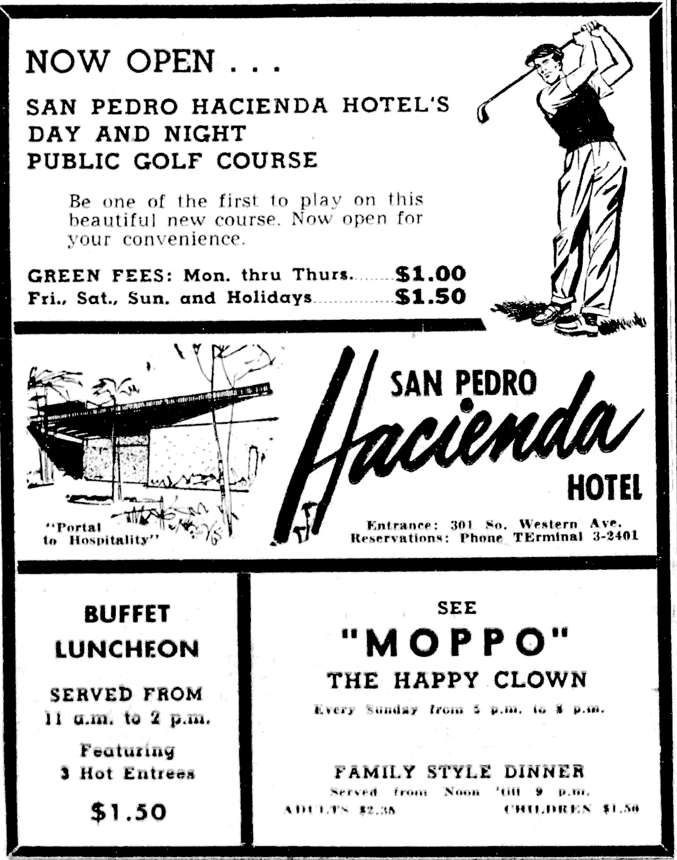
Another fundraising drive held in 1954 raised $40,000 for the construction of a 9-hole golf course near the Western Ave. end of the property. It opened to the public in February 1957. A swimming pool and tennis courts were also added.

Postcard shows women golfers at the Hacienda Hotel’s 9-hole golf course in San Pedro. Undated, circa late 1950s. Hacienda Hotel in background.

The response was everything Soderstrom and Atchison had hoped for. Not only did the hotel become a popular destination, but real estate in the area became much in demand for new housing subdivisions as a result.

The hotel itself hosted all kinds of events over the next decade, including political gatherings, area business meetings and community gatherings.

But by the late 1960s, the Hacienda was becoming a victim of its own success. The appreciation of real estate values thanks to its presence resulted in ever-higher property taxes on the hotel property, which put a financial strain on its continued operation.

In December 1969, Soderstrom, now president of the Hacienda Hotel corporation, announced that a Torrance firm had made an offer to buy the hotel property. Torino & Collins planned to build garden apartments around the hotel, saying that it would leave Neutra’s original central hotel buildings intact.

In late October 1971, the 517-unit Miraleste Village townhouse and apartment complex held its gala grand opening on the former hotel site. 

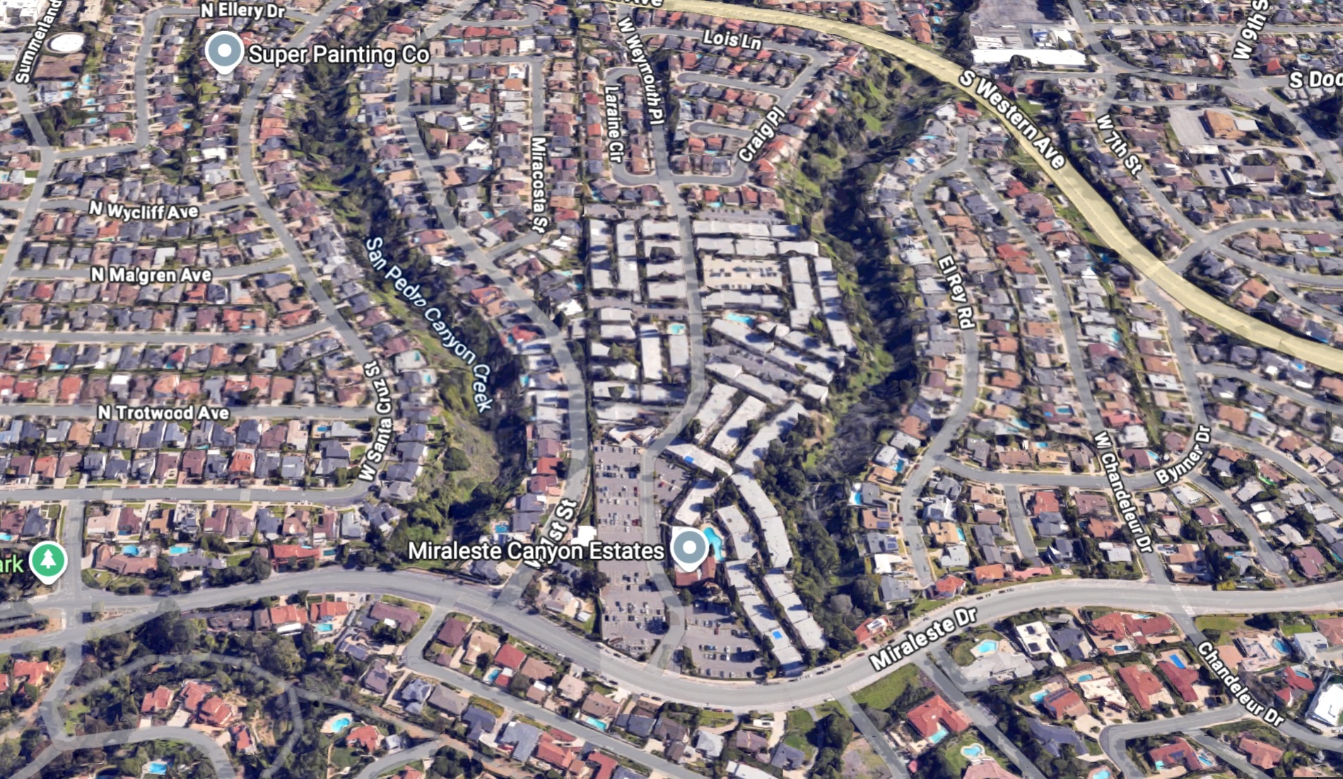
Miraleste Canyon Estates, center, was built on the former Hacienda Hotel site in San Pedro. 2026 image. (Credit: Google Earth)

Among its recreational facilities were separate men’s and women’s fitness gyms outfitted with exercise equipment from local television fitness guru Jack LaLanne, who made a personal promotional appearance at the grand opening.

Sadly, the promise to preserve Neutra’s original community buildings from the Hacienda was not kept. Everything was razed to make room for the new development, with Neutra’s legacy living  on only in photos.

Now named Miraleste Canyon Estates, the townhouse development still occupies the former hotel site. In 1972, the golf course land was sold, with the links being replaced by 101 single-family residences.

As for those original investors who helped bankroll the Hacienda, they received $250 for every $100 they had originally invested when the San Pedro Community Hotel Corp. was liquidated in 1973.

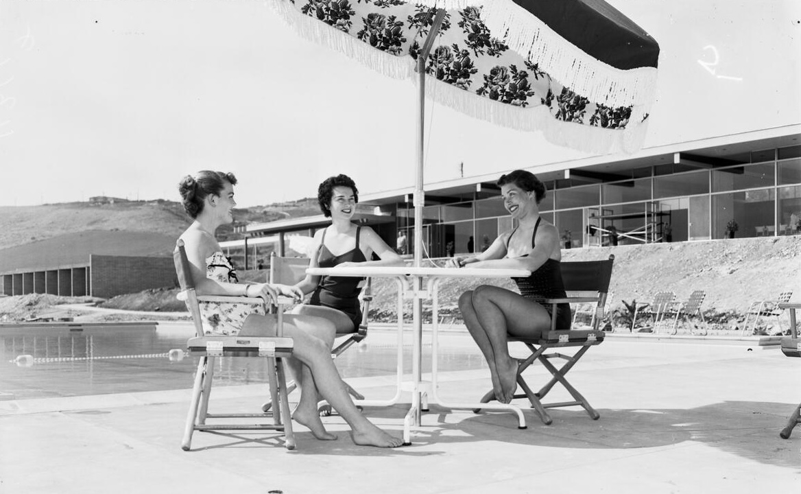
Seated at table under umbrella with pool and main public Hacienda Hotel building in background are, left to right: Molly Markham, Ardys Hanson and Marlene Johnson. Photo taken Feb. 24, 1955, one week before the Hacienda opened. (Credit: USC Digital Library)

Sources:

San Pedro: A Pictorial History, by Henry Silka, San Pedro Bay Historical Society, 1984.

San Pedro News Pilot archives.

San Pedro News Pilot ad, Feb. 14, 1957, Page 2. (Credit: San Pedro News Pilot archives)
Paulson was mayor of Los Angeles at the time. San Pedro News Pilot, Feb. 28, 1955, Page 1. (Credit: San Pedro News Pilot archives)

Note: Visit the Modernist Collection’s Facebook page for more photos of the Hacienda.

The Point and Plaza El Segundo transform former El Segundo chemical plant site

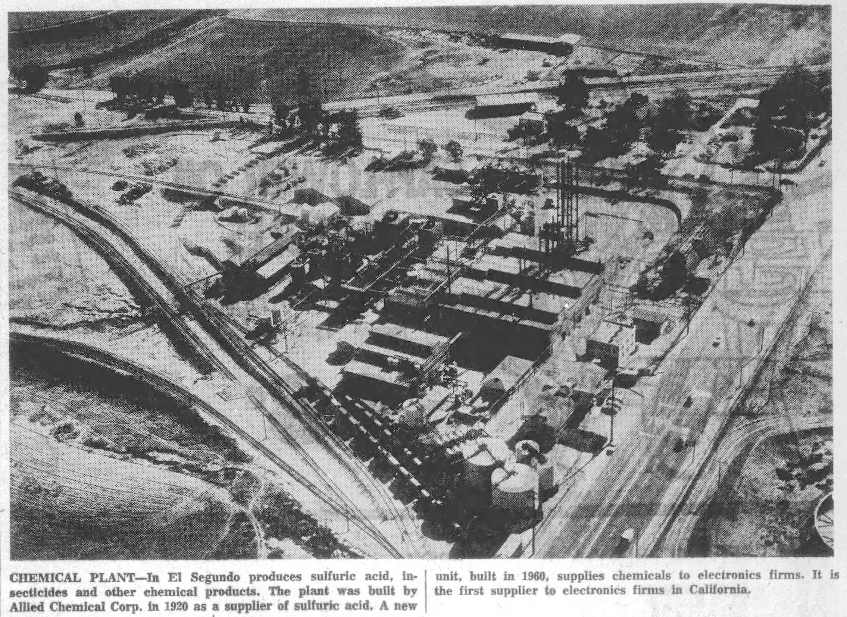
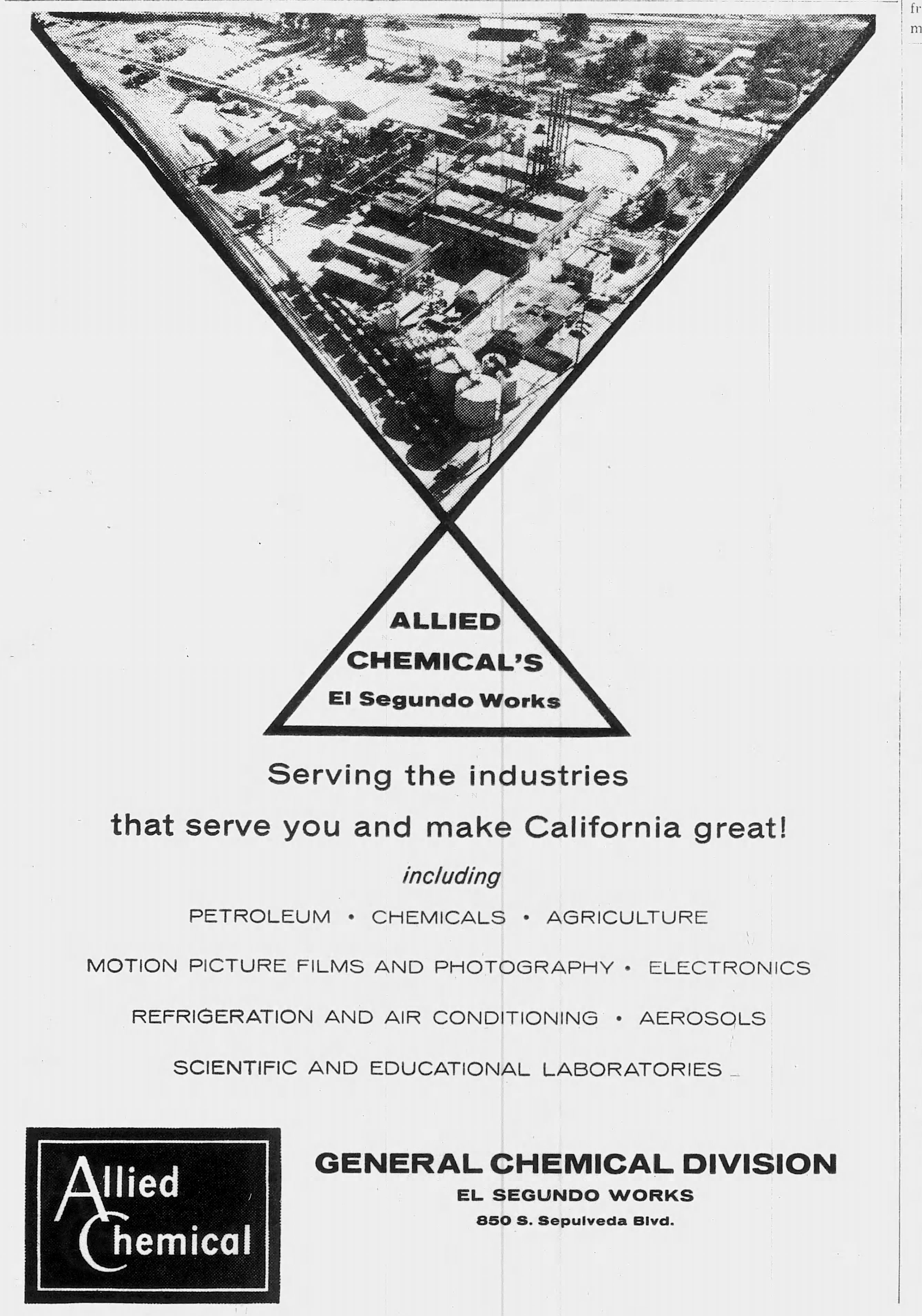
Sepulveda Blvd., right. Rosecrans Ave. crosses it at upper right. Daily Breeze, Aug. 26, 1960, Page 9. (Credit: Daily Breeze archives)

The El Segundo Works of Allied Chemical’s General Chemical Division opened in El Segundo in 1920 on a large lot on the northeast corner of Sepulveda Blvd. and Rosecrans Ave. It produced agricultural and industrial chemicals.

The town itself had incorporated just three years earlier, but it was growing quickly. Standard Oil of California had put the area on the map by locating its second California refinery there in 1911

Over the next eight-plus decades, the Sepulveda-Rosecrans intersection would become one of the busiest in the South Bay. The Manhattan Village Mall opened on its southeast corner adjoining Manhattan Beach in 1981. The South Bay’s first Apple store opened in the mall in 2005.

As the corridor’s commercial prospects continued to increase, the fortunes of the Allied plant were heading on a downward spiral. A 1994 hydrofluoric acid gas leak caused the evacuation of the Lakes at El Segundo golf course and construction workers building the West Basin water recycling plant nearby.

No one was injured, but residents and some city officials began to more strongly question the efficacy of having dangerous chemicals being produced in the increasingly densely populated area.

The plant itself had undergone several operational and name changes over the years. By the 1990s, it was known as AlliedSignal. In December 1999, the company merged with Honeywell Corp., and the El Segundo plant was renamed Honeywell International.

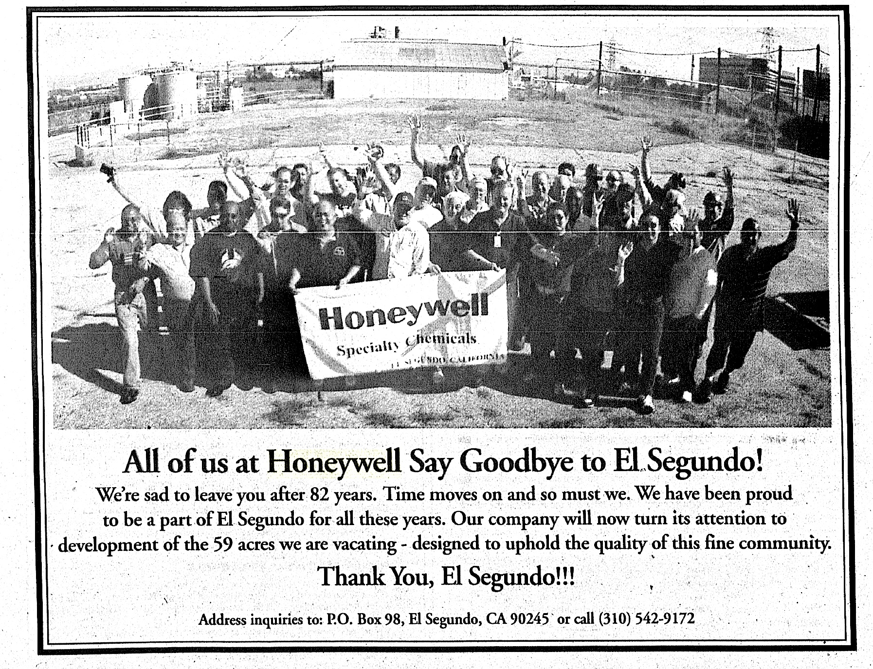
El Segundo Herald ad, Feb. 20, 2003, Page 5. (Credit: El Segundo Herald archives)

By the early 2000s, only fifty employees were working at the El Segundo Honeywell plant. The 2002 implementation of an international agreement limiting the production of ozone-depleting chemicals proved to be its death knell. 

As it was engaged in such production, Honeywell announced in December 2002 that it would close its El Segundo facility at the end of January 2003, and demolish the plant’s structures later that same year.

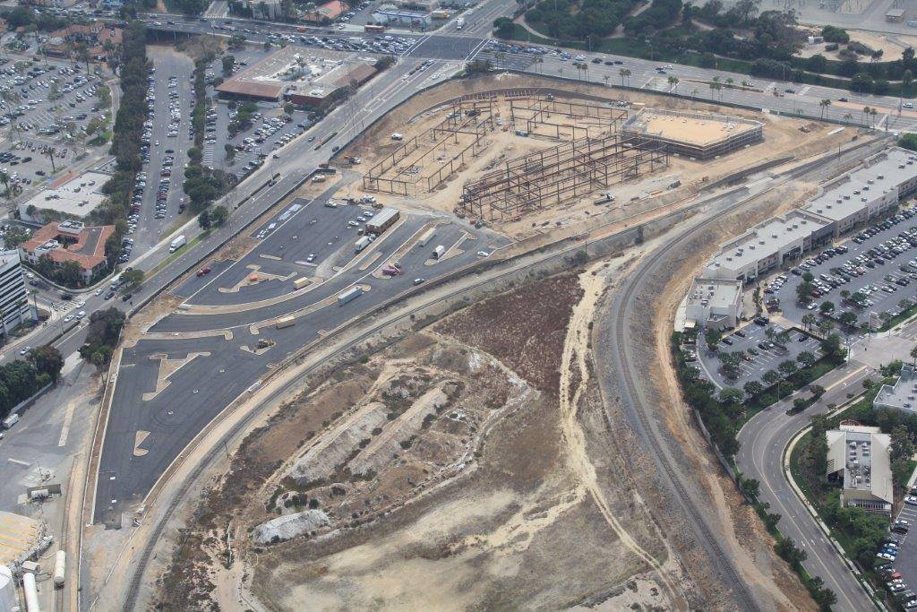
Aerial view from July 14, 2014, shows paving and construction under way at The Point, upper center. A portion of the Manhattan Village Mall parking lot and Fry’s Electronics (now closed) can be seen at upper left across Rosecrans Ave., and a portion of the Plaza El Segundo shopping center is at right. The Rosecrans-Sepulveda intersection is at top. (Credit: The Point Facebook page)

Commercial developers began putting forth proposals almost immediately. The first, Plaza El Segundo, came from the Mar Ventures firm. After some dickering with neighboring Manhattan Beach officials over its size and traffic impact, a 425,000-square-foot center was approved by the El Segundo City Council on Feb. 16, 2005.

Plaza El Segundo was built on the northern portion of the former chemical plant site, with its entrance on Sepulveda Blvd. 

The outdoor shopping center featured bigger retail outlets such as Best Buy, Borders Books, Chick’s Sporting Goods (acquired by and renamed Dick’s Sporting Goods in 2007), and a very large Whole Foods Market. (Later additions include Nordstrom Rack, Home Goods and PetSmart.)

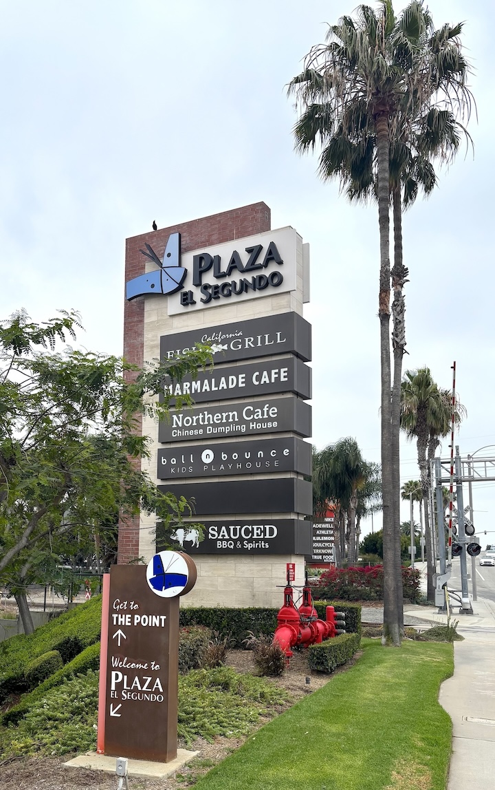
Entrance to Plaza El Segundo on Sepulveda Blvd. June 4, 2026. (Photo by Sam Gnerre)

After the site had been cleared and its soil remediated, its stores began opening in phases starting on Nov. 18, 2006.

Ideas for the second phase of the site’s development set for the smaller site south of Plaza El Segundo and closer to the Rosecrans-Sepulveda intersection began to be introduced by developer Federal Realty Investment Trust in July 2007.

Its retail outlets would be smaller, and more oriented toward upscale clothing and lifestyle boutiques. It was first referred to as “The Pointe at South Bay” in 2008. Its name would later be shortened to simply “The Point.”

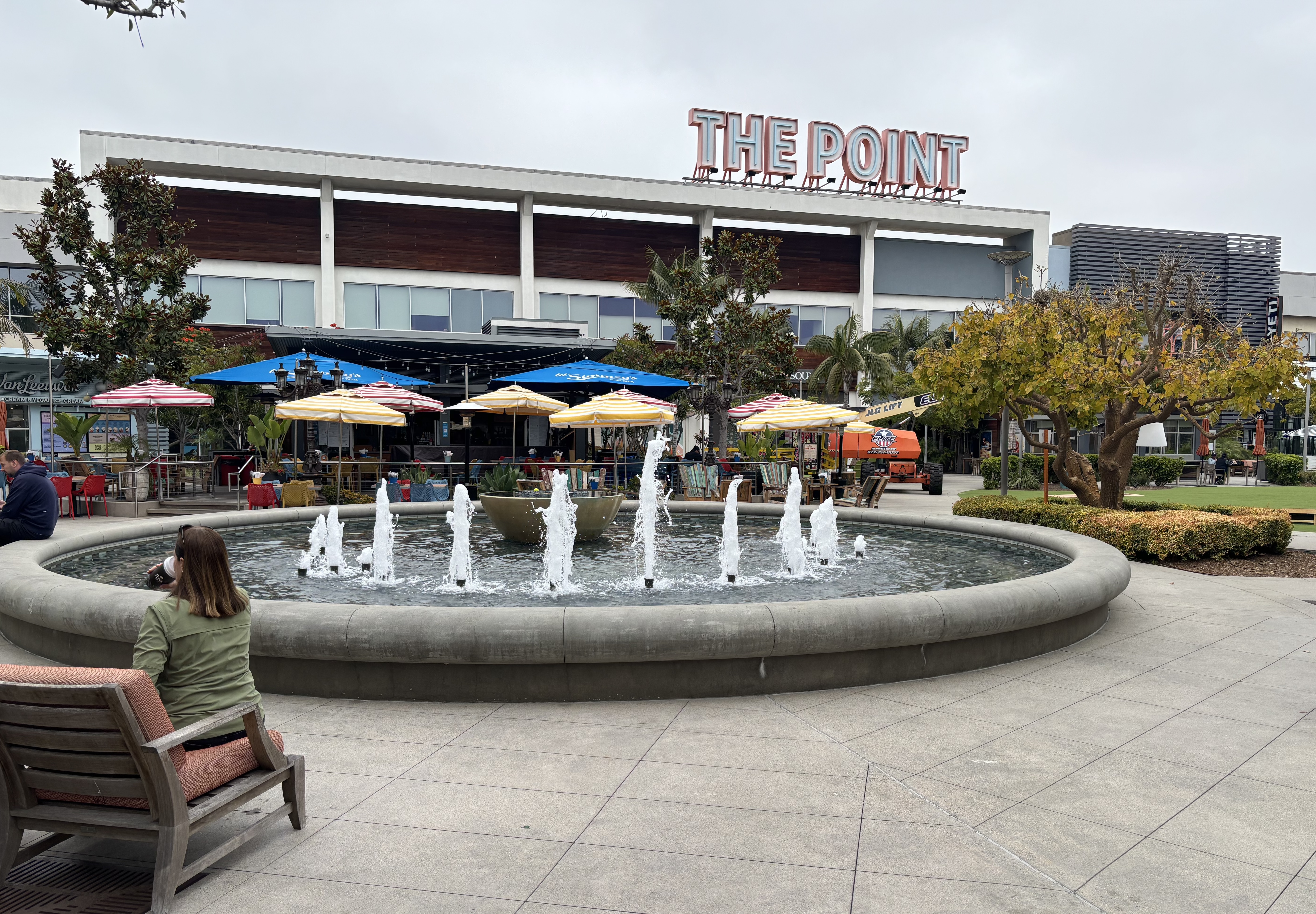
Architectural designs revealed plans for four unique buildings to be built in a parklike setting with a children’s playground set around a lushly landscaped open-air central courtyard with a fountain, creating an area envisioned as a community gathering place. 

To that end, all the restaurants at The Point, most of them upscale and new to the area, were built with outdoor patios. Automobile entrances to the center were built on Rosecrans and on Sepulveda. Parking for cars was limited to a single-level lot to the east of The Point.

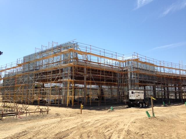
Buildings begin to take shape at The Point shopping center in El Segundo. July 10, 2014 photo. (Credit: The Point Facebook page)

Construction on the Point didn’t begin until 2014, and its grand opening was held on July 30, 2015. From the beginning, the grassy plaza was a hit, with steady bookings for parties, small concerts, movie screenings and other events.

The twin developments on the former chemical plant site were effective enough to cause Manhattan Beach Village operators to pursue a $110 million renovation of the mall located just south of Plaza El Segundo and The Point. That makeover was mostly complete by 2021.

The Plaza El Segundo shopping center has succeeded in bringing  much greater retail options to El Segundo, which previously had only its charming but small downtown businesses to offer. 

As for The Point, its niche-filling success proves that thinking outside of the “big box” stores can have impressively popular results.

Central courtyard at The Point shopping center in El Segundo. June 4, 2026. (Photo by Sam Gnerre)

Sources:

Daily Breeze archives.

El Segundo Herald archives.

El Segundo: Seventy-Five Years: A Pictorial History of El Segundo, California, by Eileen Curry Hunter, H2 Limited Publishers, 1991.

Los Angeles Times archives.

Daily Breeze ad, May 29, 1960, Page 60. (Credit: Daily Breeze archives)

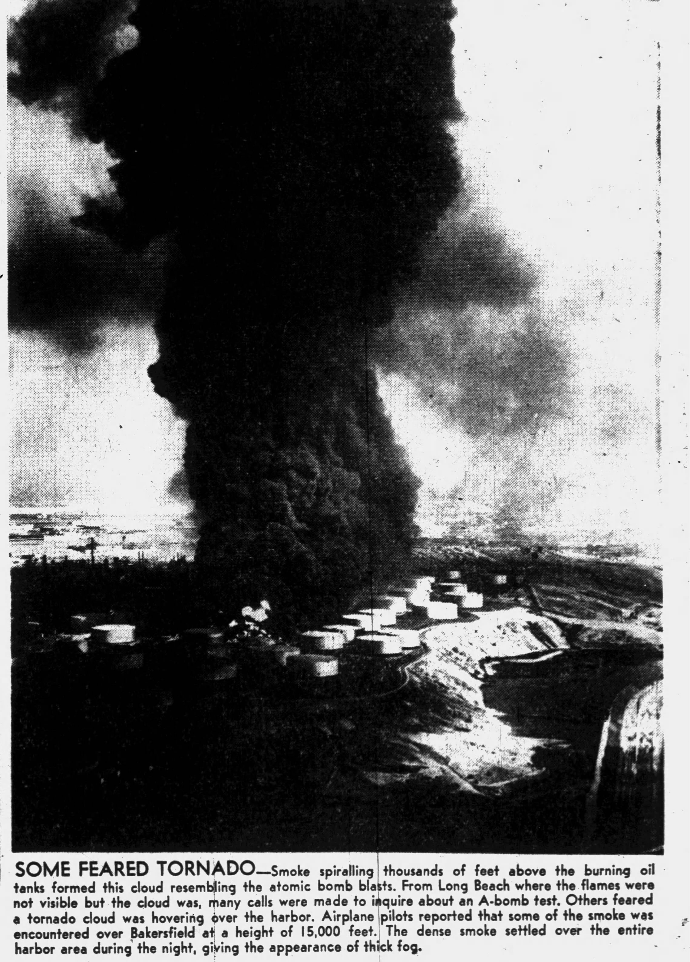
Explosion and fire at Union Oil tank farm in Wilmington lit up the skies in 1951

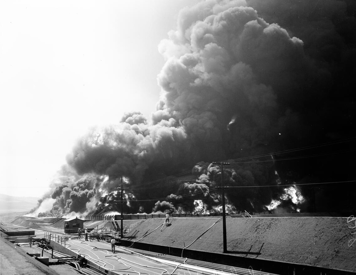
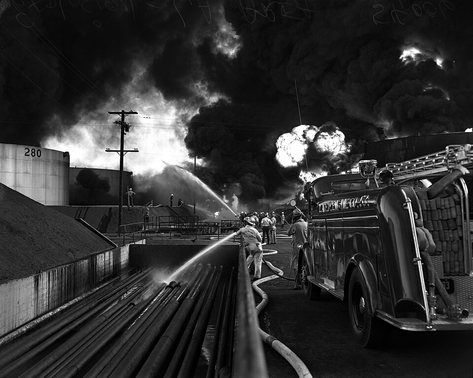
Firefighters battle the Union Oil tank farm fire in Wilmington on July 12, 1951. (Credit: UCLA Library, Dept. of Special Collections)

After more than a century in operation, the owners of the Phillips 66 Los Angeles Refinery officially closed down operations at its plants in Wilmington and Carson on Dec. 31, 2025.

Union Oil owned the Wilmington refinery, located at 1660 W. Anaheim St., until 1997, when the company sold it to Tosco Corp. Tosco turned around and sold it to Phillips in 2001.

I wrote about the Wilmington refinery’s history – it began as a Union Oil facility in 1919 – in 2022. I briefly mentioned a major explosion and fire at the plant in 1951 that’s worth examining more closely.

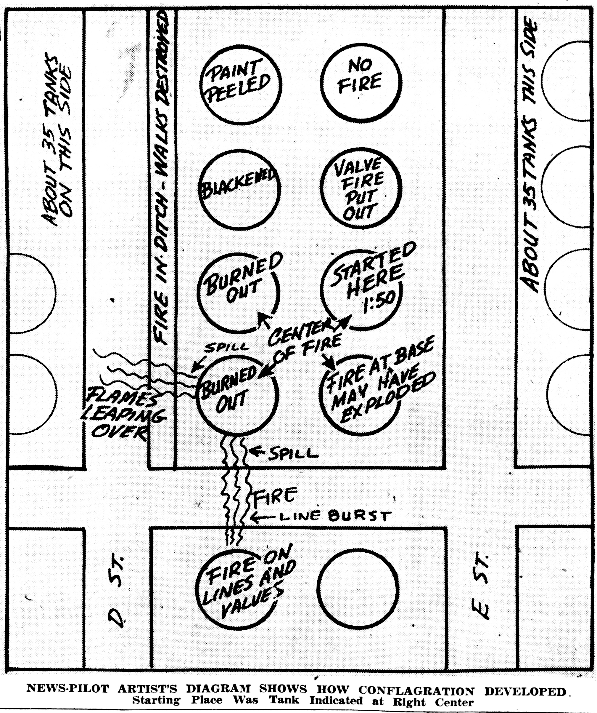
The blaze began with a bang on Thursday, July 12, 1951, when Tank #100 exploded suddenly at about 1:50 p.m. in the afternoon. The blast, which could be heard from as far as 10 miles away, blew the circular tank’s lid approximately 100 feet in the air and spread flaming gasoline among the other tanks nearby. 

Great clouds of black smoke rose in the sky, blocking the sun for miles around. The ferocity of the ensuing flames posed a major and immediate threat to the nearby Port of Los Angeles.

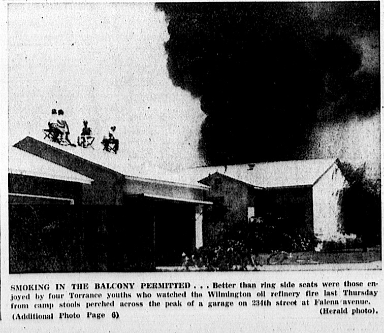
San Pedro News Pilot, July 13, 1951, Page3. (Credit: San Pedro News Pilot archives)

The refinery had more than 200 tanks at the time. The raging blaze spread to Tank 200 and Tank 72, causing further explosions and fire. A total of five tanks, each holding about 80,000 gallons of gasoline, ultimately would be lost in the blaze.

The flames spread quickly through ground fires, especially along pipe channels connected to the various tanks. With the blazing tanks burning wildly out of control, firefighters had to concentrate on keeping the fire from spreading on the ground to other tanks.

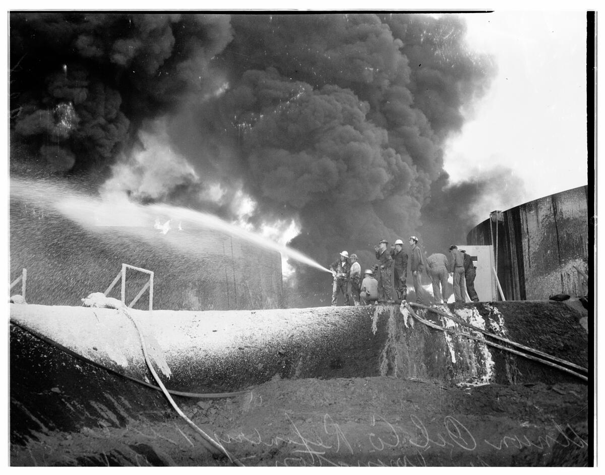
The emergency response was immediate. According to the San Pedro News Pilot, more than 100 Army and Navy servicemen from area bases joined 120 firefighters and more than 80 police officers and at least 300 Union Oil employees in battling the fires, which raged through the first night.

Attempting to quell the Union Oil tank farm blaze in Wilmington on July 12, 1951. (Credit: USC Digital Library)

At one point during the battle, a fuel pipe burst, spraying diesel fuel into a group of firefighters. In the ensuing confusion, the Union Oil man holding the nozzle of a water hose inadvertently let go of it. The uncontrolled hose whipped around and knocked a group of six men holding onto the hose to the ground from the retaining wall on which they were standing.

Three of the men fell into a trench and had to be hospitalized for their injuries, while another trio of men received only minor scrapes and burns in the incident. Somewhat miraculously, all the injuries turned out to be non-life threatening, and would turn out to be the only ones suffered during the four-day conflagration.

The fire’s ferocity and the addition of more fire engines in an attempt to slow it put a great strain on the water resources needed to fight it. At first, four Navy tugboats were enlisted to help pump water up to the fire site, but they soon were replaced by a specialized fire boat. 

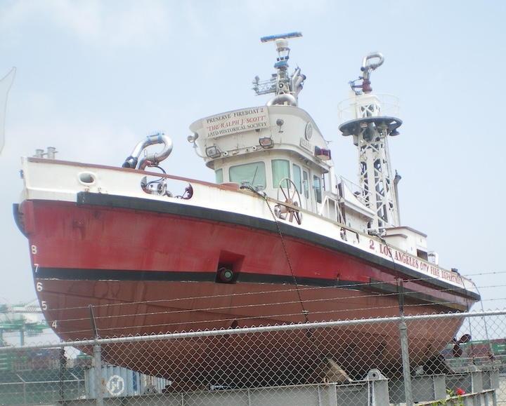
The Los Angeles Fire Dept. acted quickly to hook up its Fire Boat 2, the Ralph J. Scott, to pump ocean water through hoses connected to the water sources being used to battle the fire. It would continue to pump water for the next 30 hours.

The LAFD fireboat Ralph J. Scott in 2008. (Credit: Wikimedia Commons)

The Scott’s pumping power was so valuable that it wasn’t retired from service until 2003. (A group of volunteers from the LAFD Historical Society has preserved the Ralph J. Scott.)

In addition to water from the port, firefighters used special chemicals such as du-Gas, a dry chemical powder, and Foamite, a foaming fire retardant used on flaming liquids.

Hundreds of calls poured into the San Pedro LAPD station, as well as into the offices of the San Pedro News Pilot, mostly from people wanting to know not only what had happened, but also if they needed to evacuate. Thousands of spectators also flocked to the nearby Palos Verdes Peninsula hills and other Harbor area sites to try and get a look at the blaze.

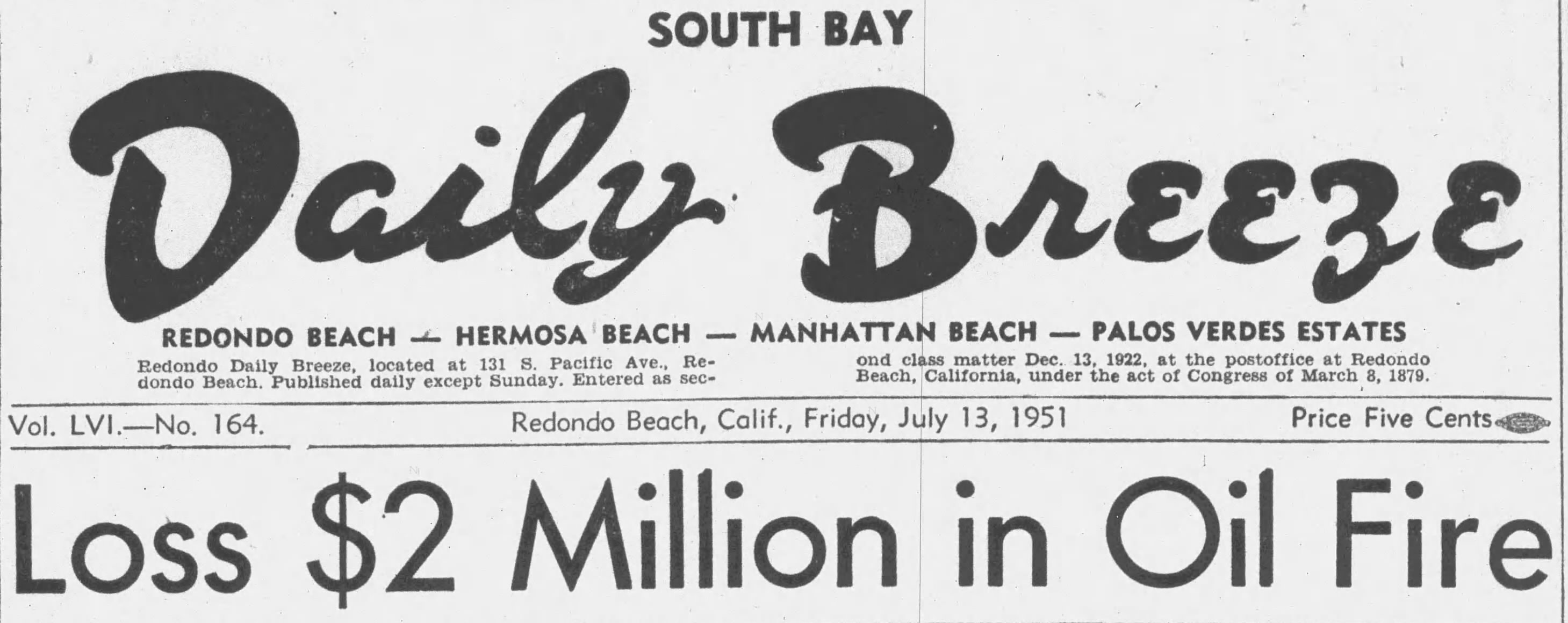
South Bay Daily Breeze headline, July 13, 1951, Page 1. (Credit: Daily Breeze archives)

When evening came, business at the nearby San Pedro Drive-In Theater fell by about half, according to what manager Frank Sohner told the News Pilot. Many of those who did show up were annoyed when intense brightness caused by flareups of the blaze made the picture on the screen difficult to see. Sohner had to issue several refunds.

By 8 p.m. of the first night, the fire was declared under control and contained. It was still burning furiously, but was no longer in danger of spreading. Firefighters would spend the next two days keeping flames from reaching other tanks while letting the fire burn itself out.

Torrance Herald, July 19, 1951, Page 1. (Credit: Torrance Historical Newspaper and Directories Archive database, Torrance Public Library)

They extinguished the last of the flames at 4:32 p.m. on Sunday, July 15, 1951. Total damage estimates ranged from $1.5 to $2 million. No official cause ever was determined, though static electricity around the tanks was suspected by some. Operations resumed at the refinery on Monday, July 16th.

Current plans for the now-closed refinery site include a massive mixed-use project, called Five Points Union, featuring retail, outdoor space, indoor sports complexes and much more, assuming that the soil beneath the refinery structures can be remediated successfully and deemed safe for such a development.

Firefighters spray pipe channels at the Union Oil tank farm in Wilmington in an attempt to keep the flames from spreading to more tanks. July 13, 1951 photo. (Credit: Los Angeles Daily News)

Sources:

Daily Breeze archives.

Long Beach Press Telegram archives.

“LAFD History — Old Engine 49 and Old Fireboat 2 at the Union Oil Fire — 1951,” Los Angeles Firemen’s Relief Association website, July 31, 2019.

Los Angeles Times archives.

San Pedro News Pilot archives.

No, it wasn’t an A-bomb test. Long Beach Press-Telegram, July 13, 1951, Page 3. (Credit: Long Beach Press-Telegram archives)

Is this your new site? Log in to activate admin features and dismiss this message
Log In