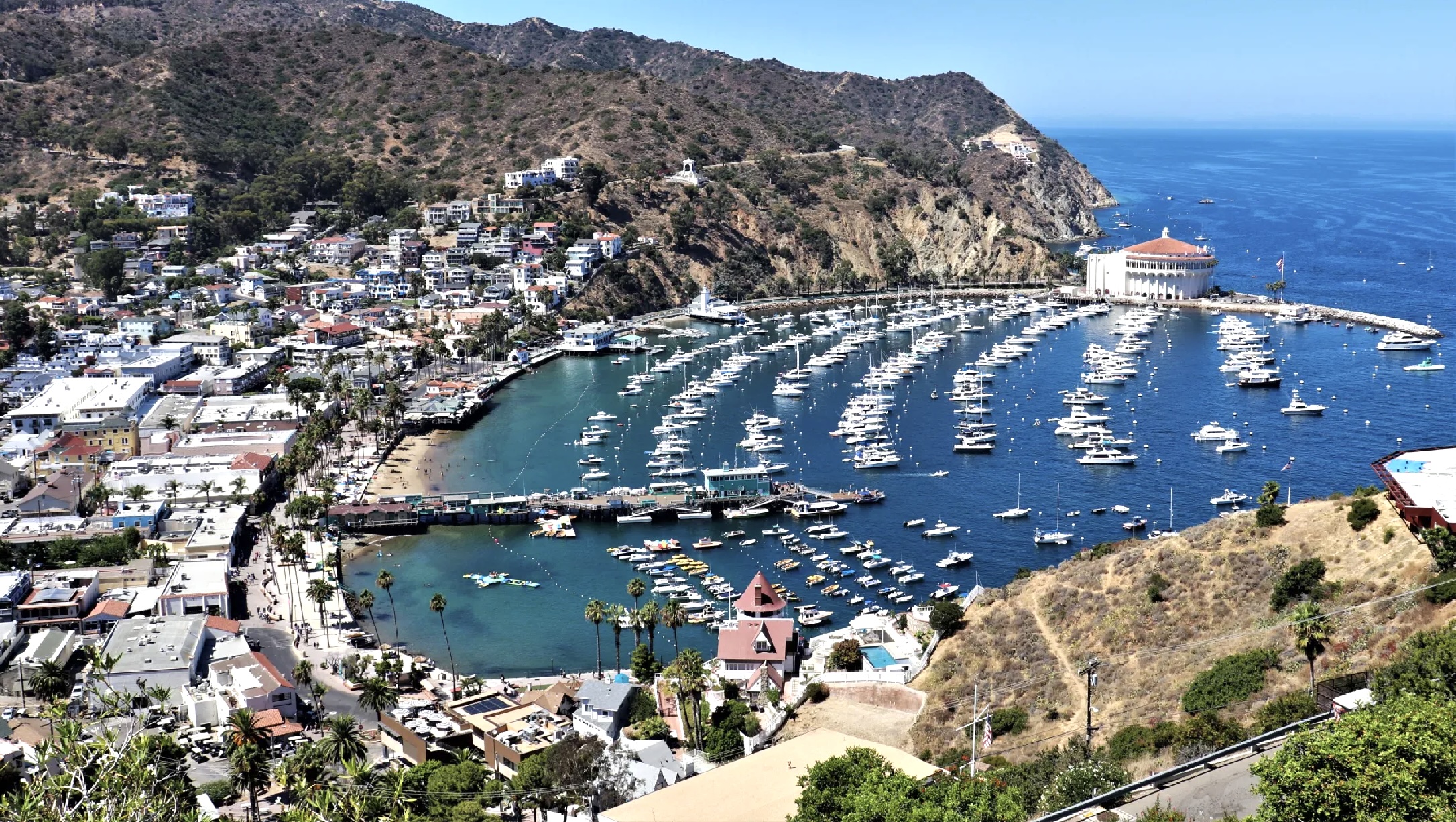
Catalina Island’s casino has been an iconic presence in Avalon for nearly a century

The Catalina Casino, upper right, stands near the entrance to Avalon Harbor. October 2019 photo by David Dickstein. (Credit: Orange County Register)

Santa Catalina Island passed through many hands after first being claimed for Spain by Juan Rodriguez Cabrillo in 1542. 

Its 76 square miles of land was used mostly for farming and ranching until the late 19th century. When George Shatto purchased it in 1887, he became the first owner to see the value of  transforming the island into a resort mecca. He built the landmark Hotel Metropole in 1887, and laid out plans for the city of Avalon.
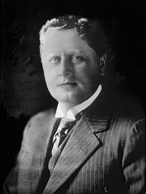
William Wrigley Jr. in 1915. (Credit: Wikimedia Commons)

Shatto sold the island to the Banning family in 1891. Over the years, the Bannings continued developing Avalon, but were set back by the disastrous fire which swept through the city in 1915. It dealt a major blow to the family’s fortunes, enough so for them to have to sell it to chewing gum magnate William Wrigley Jr. in 1919.

Wrigley was even more committed than the Bannings into turning the island into a major resort area, and immediately set about to rebuild and reconfigure Avalon according to his vision. One of his first projects: to build a casino and dance hall on a promontory of Avalon Bay known as Sugar Loaf Point.

Sugar Loaf Point had long been a landmark for sailing ships, marking the northern end to Avalon Harbor. Its main features were two large rock formations, Big Sugar Loaf and Little Sugar Loaf. Crude wooden stepladder planks were built on LIttle Sugar Loaf in 1896 to allow tourists to climb to the top of it and take in the spectacular views.
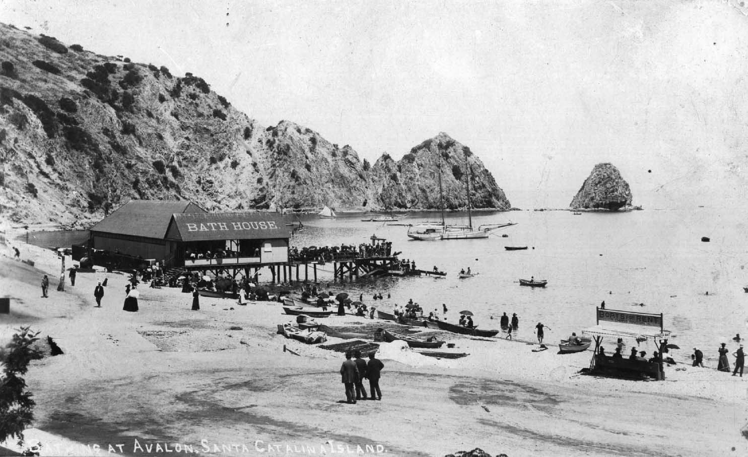
Photo of Catalina Island Bath House at Avalon Bay circa 1900 shows both large and smaller Sugar Loaf rock formations in the background at right rear.

Wrigley decided that Sugar Loaf Point would make the perfect location for his casino. He dynamited Big Sugarloaf rock to the ground to make room for the octagonal building, leaving Little Sugar Loaf standing on the very end of the Point. Construction was completed in 1921.

Neither the original casino building nor its successor ever offered gambling of any kind. In naming the building, Wrigley was using the more general Italian meaning of the word, seeing this casino as a social gathering place. As such, the first casino hosted entertainments including dancing and silent movie screenings during the 1920s.
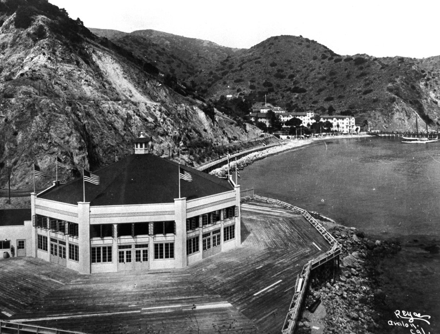
1920s view looking north shows original Sugarloaf Casino in foreground with the Hotel St. Catherine visible in the distance along the shoreline of Descanso Canyon. (Credit: Historical Photo Collection of the Department of Water and Power, City of Los Angeles)

Wrigley eventually decided that the casino just wasn’t large or splendid enough to attract throngs of visitors. He had it demolished in February 1928. He saved the octagonal metal framework of the building, and transported it inland in pieces for reuse in the construction of the main aviary of the Catalina Island Bird Park complex, which opened in 1929.

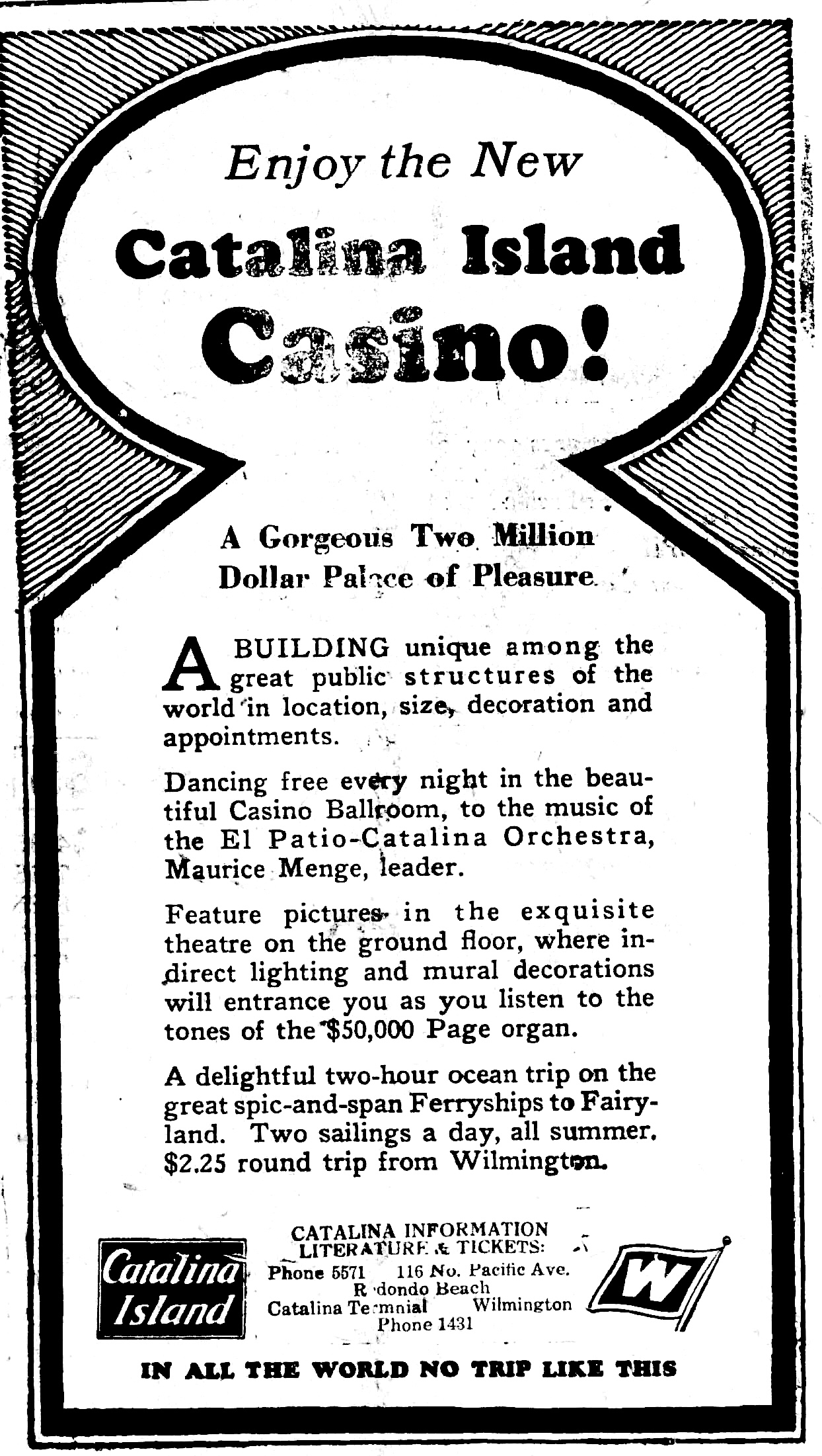
A much bigger ballyhoo ensued that same year with the opening of the new Casino building, which cost $2 million to build.

Wrigley had already blasted away Big Sugar Loaf rock to build the earlier casino. For a time it was thought that Little Sugar Loaf rock would remain on the end of the promontory, but Wrigley decided to dynamite it away in March 1929 to give his new edifice more visibility to incoming ships and provide visitors unobstructed views from its terraces.

The new casino opened on May 29, 1929, and it was, and still is, a marvel. The round building stood the equivalent of 12 stories high, though it only had two levels.
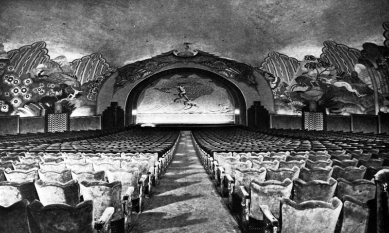
Interior of the Casino’s theater and stage. Seen along the walls are John Gabriel Beckman’s murals, as well as the original fire curtain from the 1929 opening, with a mural titled “The Flight of Fancy Westward”. (Credit: Los Angeles Public Library Photo Collection)

The bottom level consisted of a state-of-the-art movie theater with seating for 1,184 customers. It was fully outfitted with the very latest equipment capable of screening the new “talking pictures” then coming out of Hollywood in increasing numbers.

The elegant ballroom on the top level, at the time the largest round ballroom in the world, was capable of accommodating 2,000 dancing couples. 
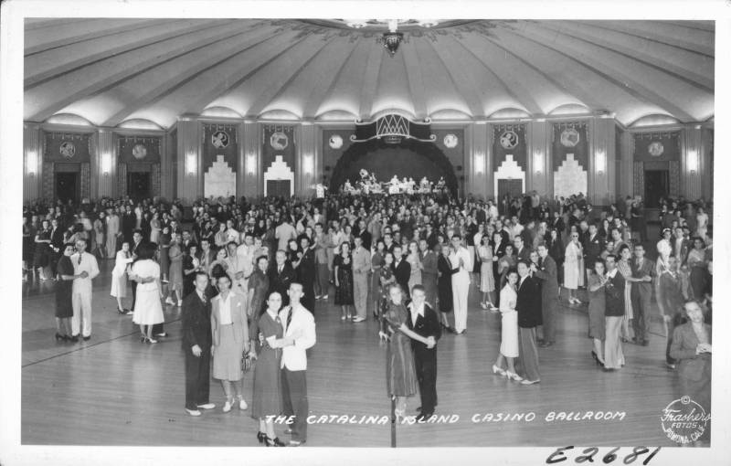
Dancers enjoy the Catalina Island Casino Ballroom in 1939. (Credit: Pomona Public Library)

The casino’s designers, Sumner A. Spaulding and William A. Webber, called for installing ramps instead of stairs to connect to the upper level in order to account for the faster movement of large numbers of people. The idea came from Wrigley’s ballpark in Chicago, Wrigley Field.

The building’s exterior was designed in the Moorish Alhambra style. Its interior furnishings and fixtures were done in the then-popular Art Deco mode.

The ballroom soon became one of the island’s premier attractions. Just about every major big band  enthralled dancers there, including orchestras led by Benny Goodman, Jimmy Dorsey, Kay Kyser (and his Kollege of Musical Knowledge), Harry James, Glen Miller, Artie Shaw, the  Count Basie Orchestra, and many others. 

Pop musicians also played the Casino’s ballroom during the 1960s. British rock legends The Yardbirds played there on Aug. 23, 1966, during the short time that ace guitarists Jeff Beck and Jimmy Page were both still in the band. Page recalls on his Facebook page arriving at the island via seaplane and having to use unfamiliar amps rented for the gig.
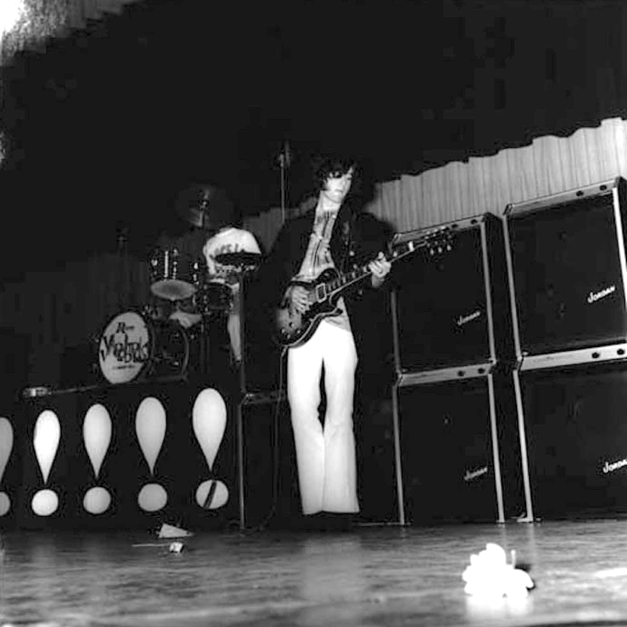
Jimmy Page plays guitar onstage with the Yardbirds on the Catalina Casino ballroom stage in this Aug. 23, 1966 photo. (Credit: Jimmy Page Facebook page)

Hard rock band Blue Oyster Cult played there on Aug 21, 2006, and rock revivalists Rival Sons played a live-streamed event there in 2021 during the pandemic.

After 90 years of operation, the movie theater closed for regular screenings in 2019 due to low attendance. It still hosts film festivals and special events.

The Casino itself, still the largest building on the island, remains open for visitors for touring, and also holds holiday events and other celebrations.
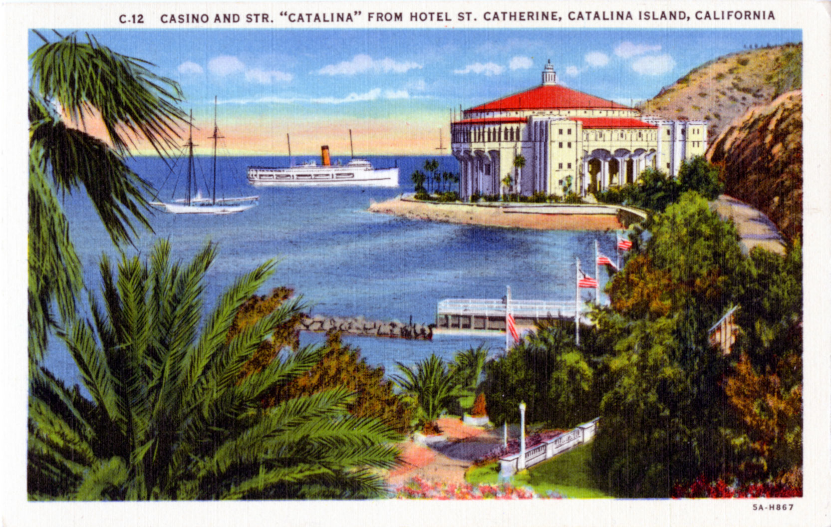
Undated postcard shows the Catalina Casino as seen from the Hotel St. Catherine in the Descanso Canyon shoreline area. (Credit: Pepperdine University, Special Collections and University Archives)

Sources:

“Avalon Theatre Owner Blames Streaming Services for ‘Upside-Down’ Attendance,” by Rebecca Rubin, Variety, Dec. 12, 2019.

The Catalina Story, by Alma Overholt, Catalina Island Museum Society, Inc., 1962.

Daily Breeze archives.

Los Angeles Times archives.

Islapedia website.

Redondo Reflex archives.

“The Sad Story of Sugar Loaf Rock,” by Eleanor McCrackin, Postcard History website, Aug. 26, 2021.

Wikipedia.
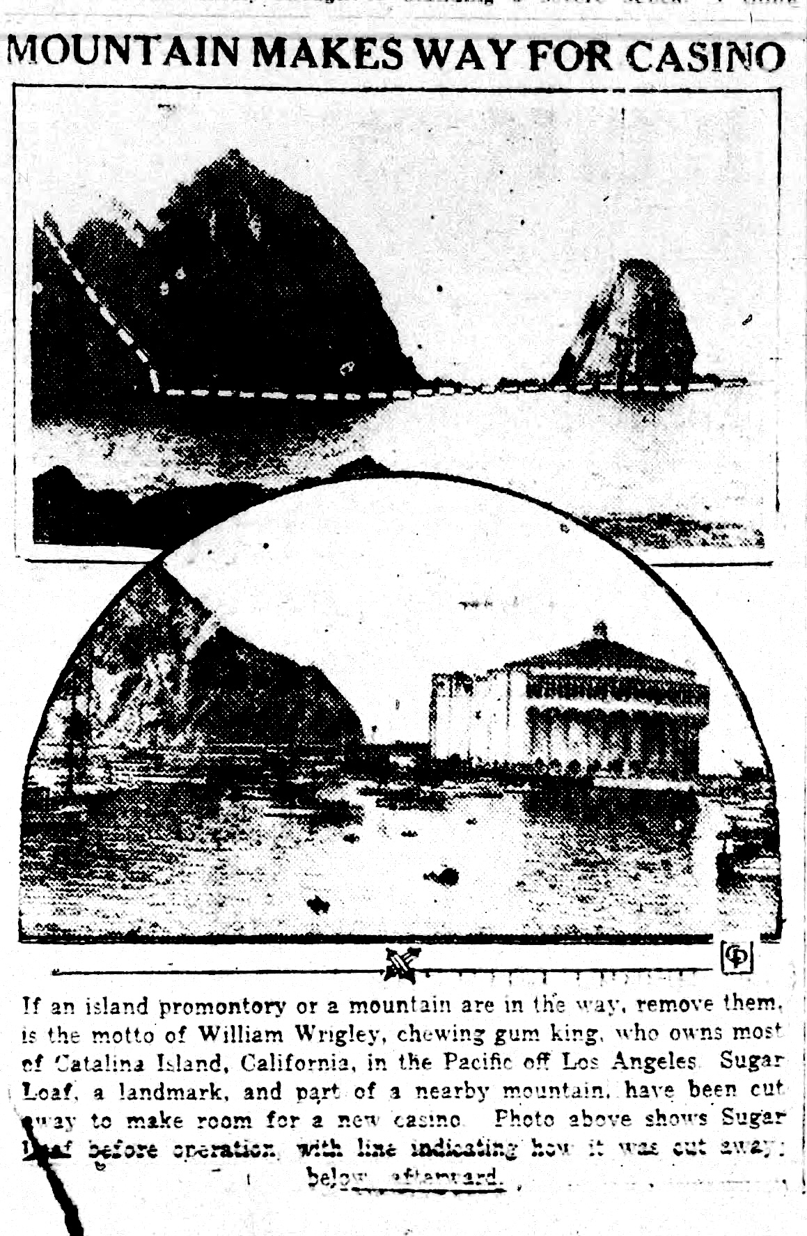
Daily Breeze, July 9, 1929, Page 4. (Credit: Daily Breeze archives)
Redondo Reflex ad, July 19, 1929, Page 4. (Credit: Redondo Reflex archives)

Douglas Aircraft’s plant in El Segundo played a key role in World War II

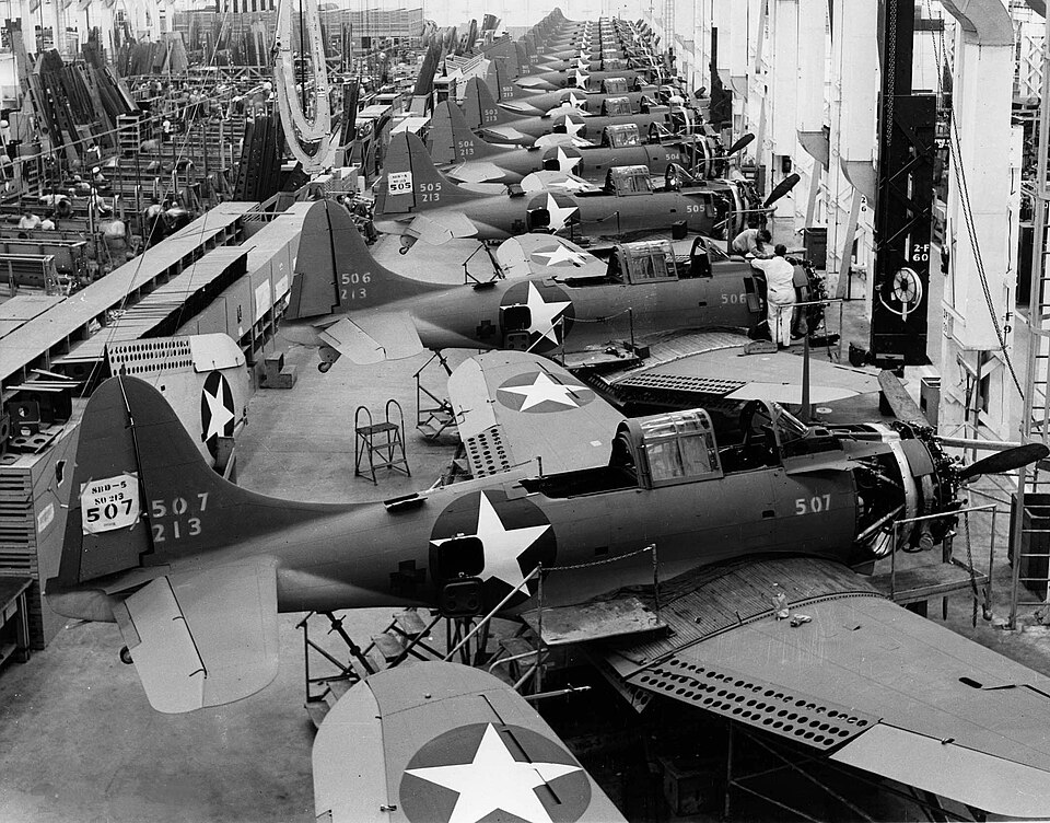
SBD-5 Dauntless dive bombers on the assembly line at Douglas Aircraft Company’s El Segundo plant in 1943. (Credit: U.S. Navy photo)

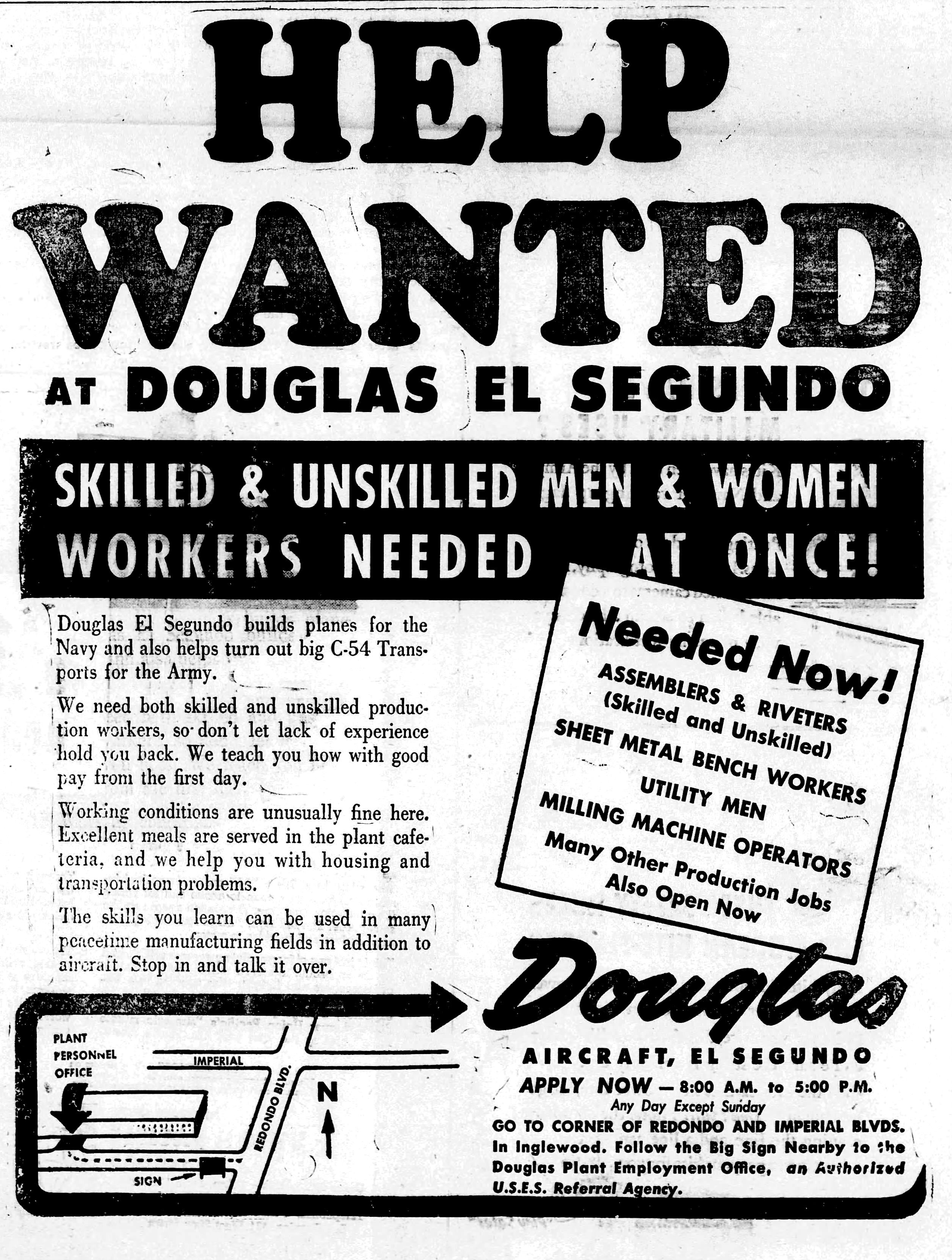
Aviation pioneer Donald W. Douglas is most often associated with Douglas Aircraft, the firm he created near Clover Field in Santa Monica in 1921. (Clover Field was later renamed Santa Monica Municipal Airport).

Born in Brooklyn, New York on April 6, 1892, Douglas was entranced with aviation from its earliest days. He dropped out of the U.S. Naval Academy in Annapolis in 1912 in order to pursue aeronautical engineering at the Massachusetts Institute of Technology (MIT). 

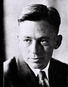
Donald W. Douglas. Undated. (Credit: Santa Monica Public Library Image Archives)

Just two years later, he became the first person at the school to earn a Bachelor of Science degree in Aeronautical Engineering. While still in his early 20s, he designed aircraft, including a U.S. Navy dirigible, for several different firms.

He formed his first company, the Davis-Douglas Company, in July 1920 with investor David Davis. Its mission was to develop the first manned aircraft to make a nonstop flight across the United States. 

The Davis-Douglas airplane, the Cloudster, was brought down by engine troubles during its June 1921 attempt, leading to the dissolution of the company. Davis pulled out of the venture, and Douglas carried on under the Douglas Aircraft Co. name at Clover Field in Santa Monica. (John Macready and Oakley Kelley made the first successful U.S. transcontinental flight in May 1923.)

A few miles south, aviation activity had begun ramping up at Mines Field north of the newly incorporated city of El Segundo, especially after the airfield with its crude oiled dirt runways was selected as the official site of Los Angeles Municipal Airport in 1928.

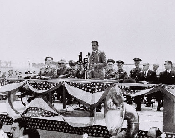
Donald W. Douglas speaking to the El Segundo division of the Douglas Aircraft Company. Undated.
(Credit: Santa Monica Public Library Image Archives)

The small Moreland Aircraft Co. opened up on land south of Imperial Highway at the airfield’s southern border in 1928, and the company built small training planes there from 1928 to 1931. In 1932, Douglas Aircraft bought Moreland and renamed it the Northrop Division of Douglas Aircraft after Douglas brought in another future aviation legend, Jack Northrop, who was then working for him, to run it.

Northrop designed two successful monoplanes at the El Segundo plant, the Gamma and the Delta. He would leave to form his own company in nearby Hawthorne in 1937, confusingly also  named the Northrop Co. The El Segundo plant was then renamed the El Segundo Division of Douglas Aircraft.

During the 1930s, the streets on the east and west sides of the El Segundo plant were renamed Aviation Blvd. and Douglas St., respectively.

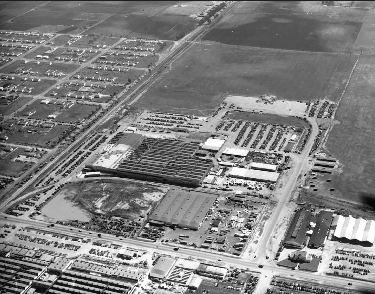
The Douglas Aircraft plant in El Segundo in 1942. Aviation Blvd. is at left, Imperial Highway at bottom, and Douglas St. at left. The future site of Los Angeles Air Force Base is undeveloped land, top. (Credit: The Boeing Company)

Back in Santa Monica, the flagship Douglas plant had broken through with the production of the DC-3 commercial aircraft, introduced in 1935. It was a huge success both commercially and militarily as the repurposed C-47 during World War II. The company would continue to produce DC commercial jets for decades following the war.

The onset of the war sent the Douglas plants into overdrive. The company opened a third plant in Long Beach which initially specialized in C-47 transport production, and later became one of three plants turning out the workhorse B-17 bomber. 

The El Segundo Douglas plant was retooled to produce fighter planes for the U.S. Navy. These were propeller-driven monoplanes capable of being launched from aircraft carrier decks. The most famous of these: the SBD Dauntless dive bomber.

The “SBD” stands for “Scout Bomber Douglas,” and the majority of them were produced at the Douglas El Segundo plant beginning in the mid-1930s. The Dauntless dive bomber, an extremely slow-flying plane by modern standards, is credited with greatly influencing the outcome of the war in the Pacific theater.

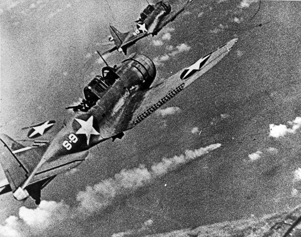
SBD Dauntless dive bombers from the USS Hornet approach the burning Japanese heavy cruiser Mikuma to make the third set of attacks on her during the early afternoon of June 6, 1942. (Credit: Naval History and Heritage Command website)

Four squadrons of Dauntless planes attacked the Japanese fleet at the Battle of Midway on June 6, 1942, sinking all four of the Japanese warships present, taking down three of them within six minutes. This naval victory essentially stopped the Japanese advance across the Pacific in its tracks, and gave the Allied forces their first major naval victory of the war.

Following World War II, Douglas Aircraft laid off approximately 100,000 of its wartime-peak 160,000 employees. But the business of aviation and aerospace research and production continued.

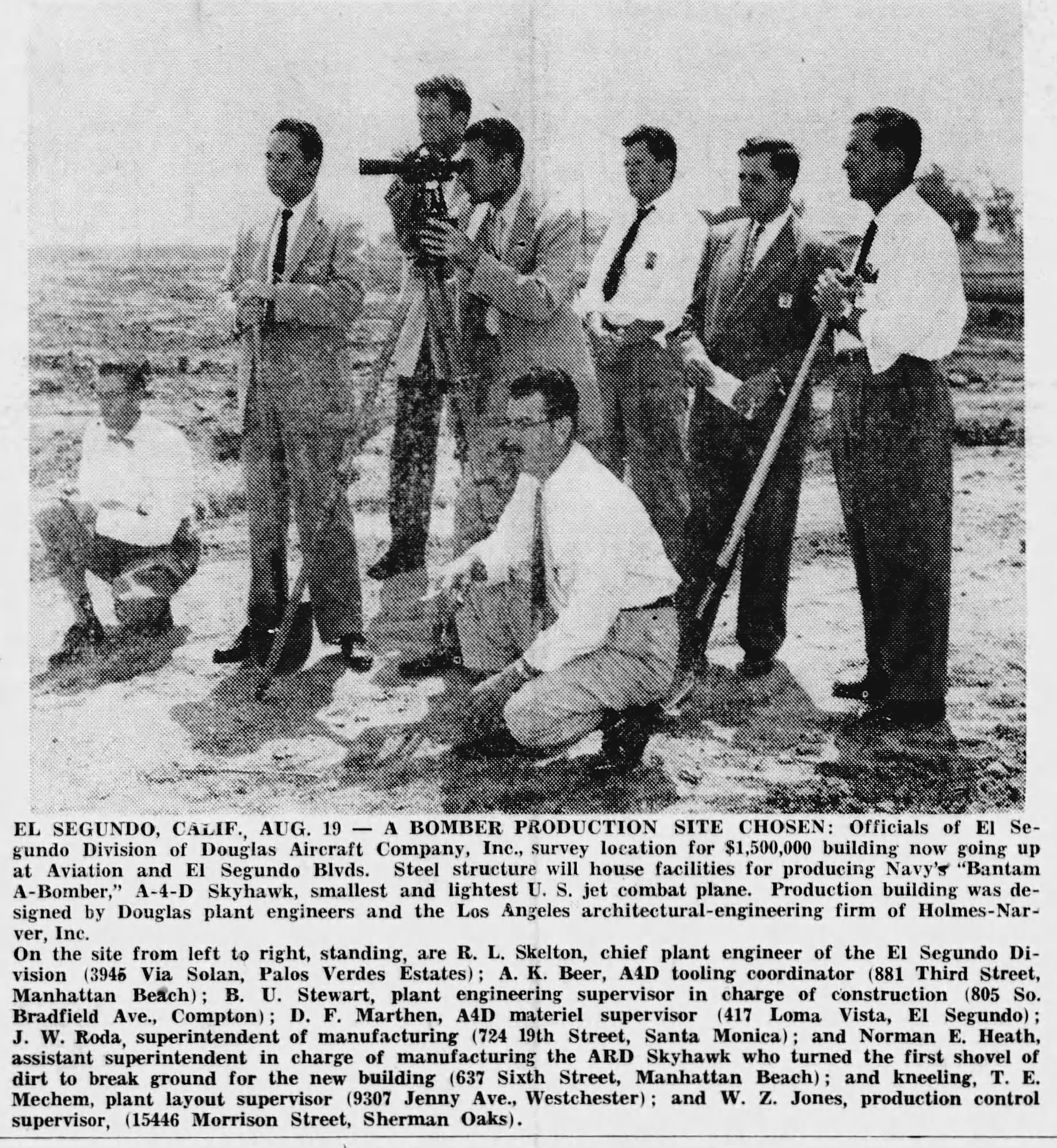
The company moved into jet aircraft, missile production and aerospace technology. Its A-6 Skyhawk fighter jet became a key weapon in the arsenal of the U.S. Navy and the U.S. Marine Corps during the 1950s and 1960s.

Commercial aircraft in the DC series resumed, with propeller-driven airliners giving way to jets,  beginning with the introduction of the DC-8 in 1958 to compete with the Boeing 707 jetliner.

Daily Breeze, Aug. 20,1954, Page 1. (Credit: Daily Breeze archives)

30 years of Douglas Aircraft production in El Segundo ended when the plant ceased its manufacturing operations in 1962. Its former site now contains a Northrop-Grumman plant on its north end, and the Los Angeles Air Force Base on its south end that fronts El Segundo Blvd.

In 1967, Douglas Aircraft merged with the McDonnell corporation to form McDonnell Douglas. Douglas Aircraft shuttered its Santa Monica plant in 1968. McDonnell Douglas merged with Boeing in 1997, retiring the final vestige of the Douglas name in the industry.

Donald Douglas died at the age of 88 on Feb. 1, 1981. The final former Douglas Aircraft plant in Long Beach closed in 2015.

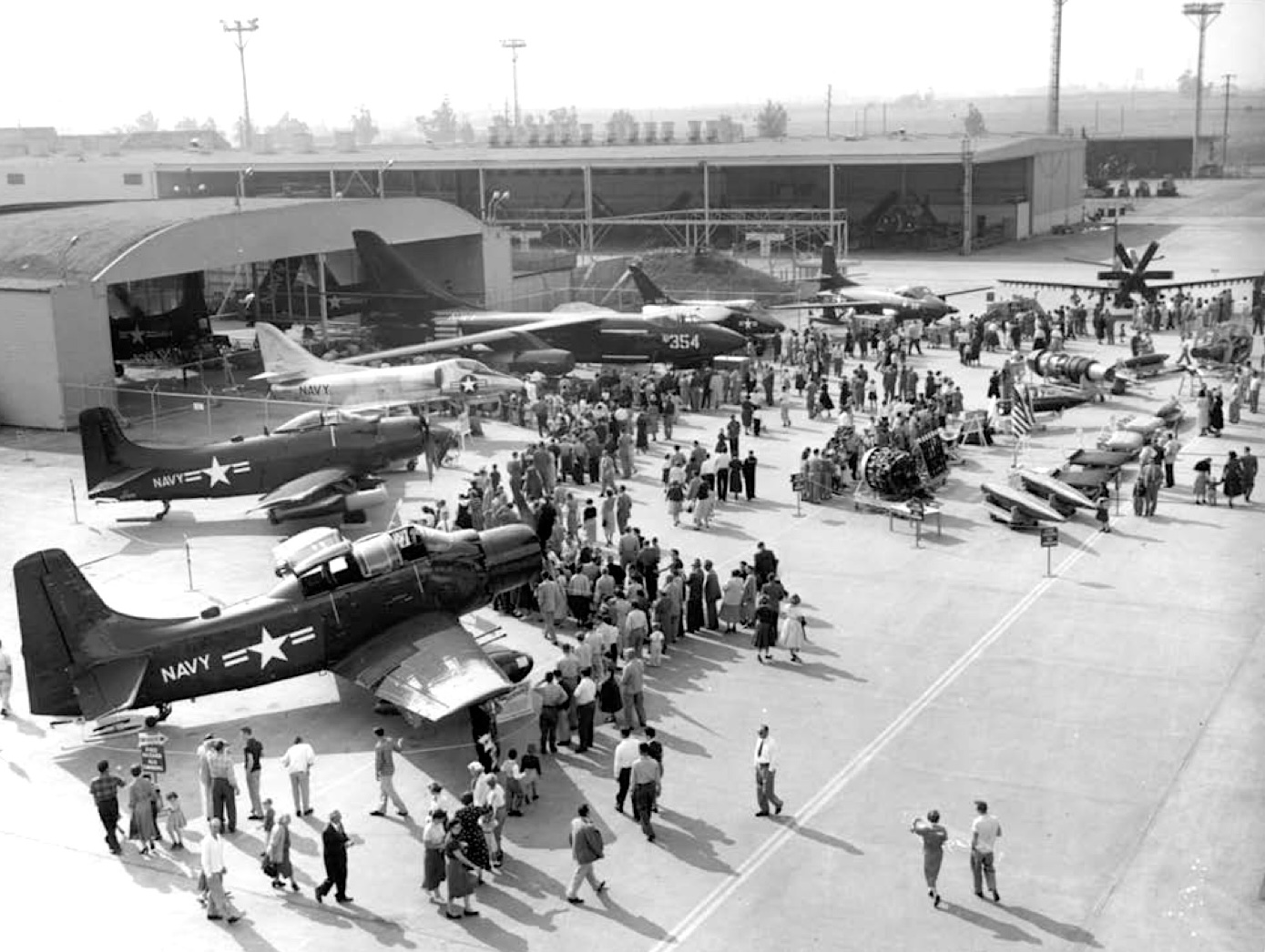
Open house at the Douglas Aircraft plant in El Segundo on Nov.. 14, 1954. (Credit: The Boeing Company)

Sources:

Daily Breeze archives.

“The Douglas Aircraft That Became Los Angeles Air Force Base,” by Robert Mulcahy, Los Angeles Air Force Base website, 2012.

El Segundo: Seventy-Five Years: A Pictorial History of El Segundo, California, by Eileen Curry Hunter, H2 Limited, 1991.

The Skyhawk Association website.

Wikipedia.
Redondo Reflex ad, Jan. 19, 1945, Page 4. (Credit: Redondo Reflex archives)

Those newfangled ZIP codes helped speed up mail processing and delivery

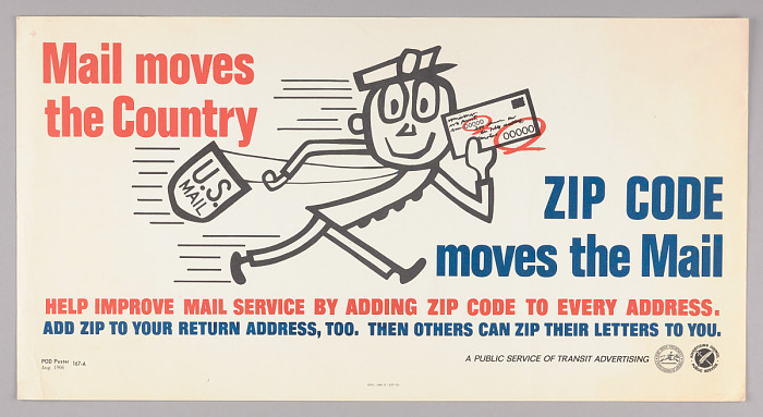
This Mr. ZIP poster from August 1966 was used on public transportation. (Credit: Smithsonian National Postal Museum)

These days, we’re all accustomed to using the ubiquitous five-digit ZIP code. But it wasn’t always so.

In fact, there were no postal codes in use at all up until thousands of U.S. mail workers left their jobs temporarily to join the armed services during World War II.

Post office managers had to hire and train inexperienced replacement workers. Combine that with the increased volume of wartime mail – long-distance telephone calls were prohibitively expensive then – and you have an increasingly inefficient postal system.

In May 1943, U.S. Post Office Department Postmaster Frank C. Walker introduced a partial postal zone system to speed mail sorting. One and two-digit codes were assigned to individual regions of 132 larger cities, allowing workers to sort large amounts of mail without needing detailed knowledge of city areas.

The codes followed the city names in the address. For instance, the Hollywood area of Los Angeles, was given zone number 28, so its city address line read “Hollywood 28, California.” Only larger cities were assigned the codes.

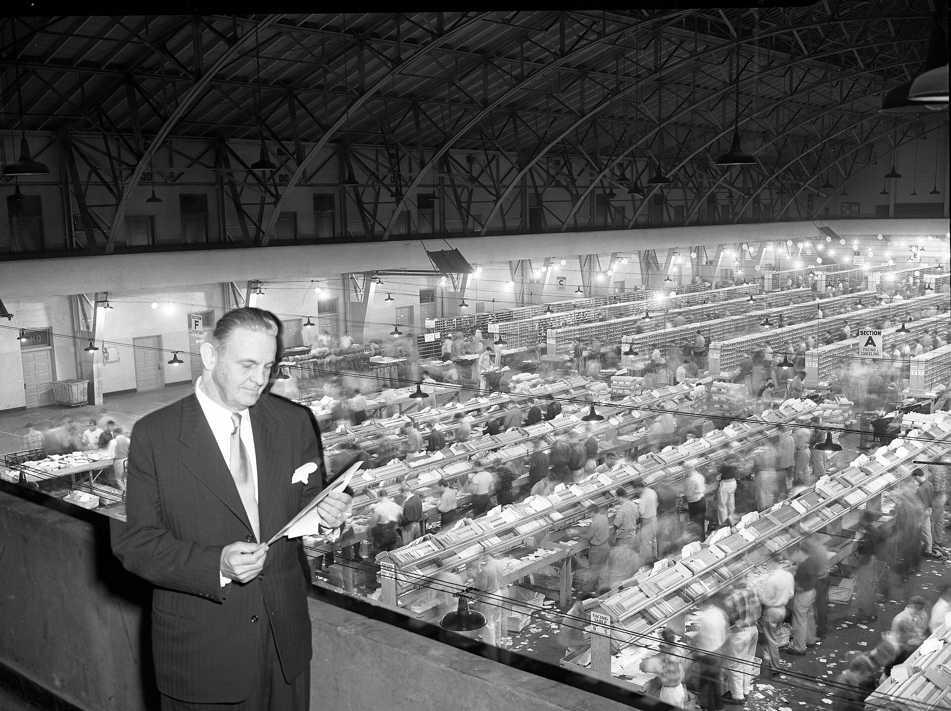
U.S. Postmaster Michael D. Fanning, stands in rafters above employees sorting mail by hand in a warehouse in Los Angeles, Calif., on Dec. 1, 1951. (Credit: Photo by Charles Poalillo, Los Angeles Daily News)

This rudimentary coding system worked for a while, but the postwar population explosion greatly increased the flow of mail. It became clear to J. Edward Day, appointed Postmaster General by President John F. Kennedy in 1961, that a universal system for all locations in the U.S. had become a necessity.

Day announced the adoption of the “Zone Improvement Plan” (ZIP) on Nov. 28, 1962. ZIP codes were based on a formula first  put forth by postal inspector Robert Moon in 1944. Moon proposed the five-digit format, with the first three numbers representing the regional processing area and the last two, the destination code.

The ZIP codes officially introduced by Day in 1963 varied slightly. The first number represents a large region of the country. The second two numbers are code for regional postal centers in that area, and the final two numbers, the code number for the mail’s final destination within the region.

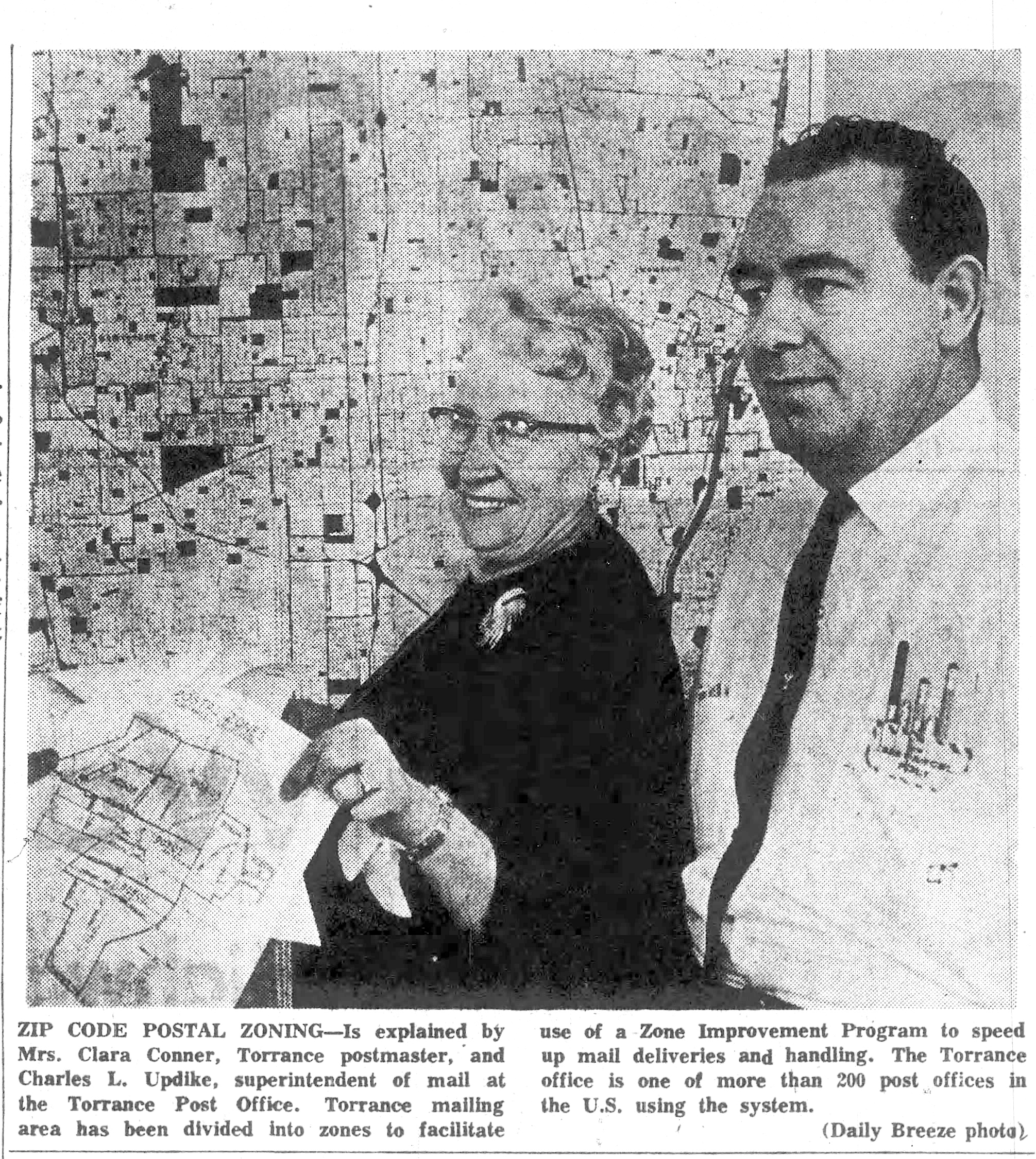
Torrance Postmaster Clara Conner announced that the city had been among more than 200 selected for early adoption of the new system.

Daily Breeze photo, May 30, 1963, Page 2. (Credit: Daily Breeze archives)

A promotional campaign was launched to convince everyone to use ZIP codes, beginning on the official start date of the program, July 1, 1963. Bulk mail users, which made up 75 percent of mail at the time, had no problem being convinced, as the codes greatly improved the efficiency of large-scale mailings.

The average American Joe and Josephine would take more persuasion. Some people felt that it was one more instance of the government increasingly treating citizens like anonymous numbers. 

This was understandable, since the ZIP codes mandate arrived as telephone companies were adding area codes and shifting from names for exchanges to all numbers and the use of Social Security and driver’s license numbers for identification had become ubiquitous.

Daily Breeze columnist Sam Stewart acknowledged as much in his column of July 18, 1963: “Like it or not, we are in an age of numbers. They are what identify us as individuals, not names.”

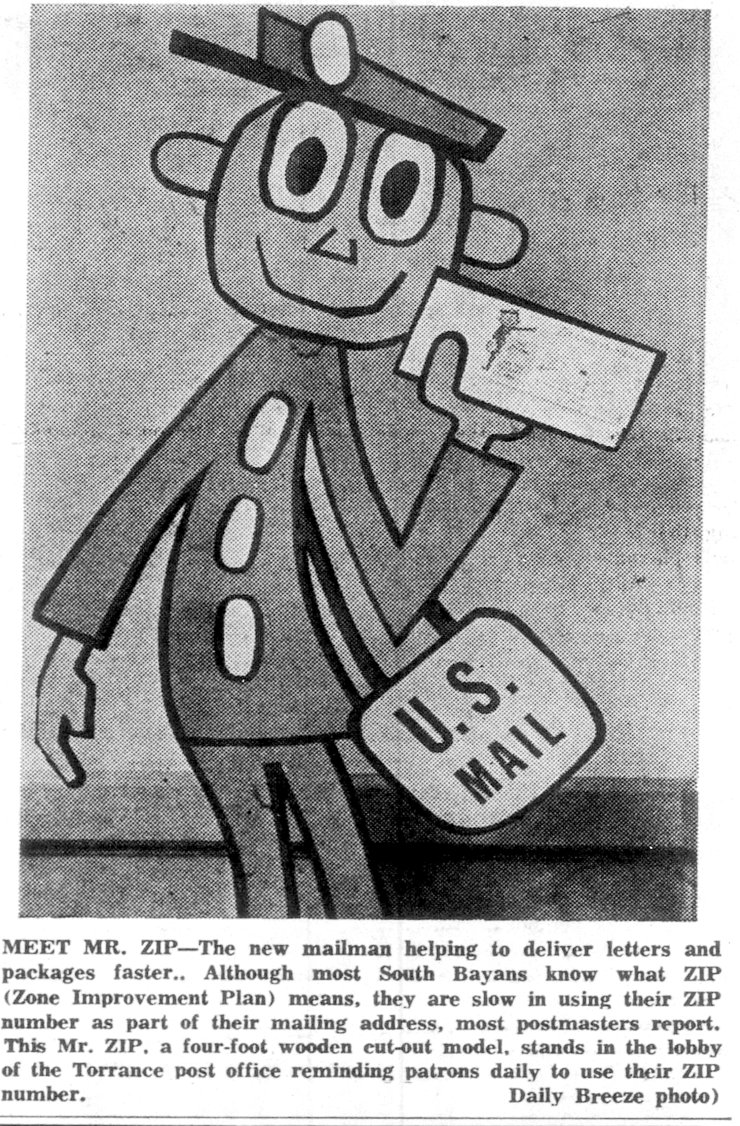
The promo campaign for ZIP codes included its own cartoon character, Mr. ZIP. Mr. ZIP appeared in ads and “in person” in the form of wooden statues installed in selected post offices.

Daily Breeze, July 21, 1963, Page 6. (Credit: Daily Breeze archives)

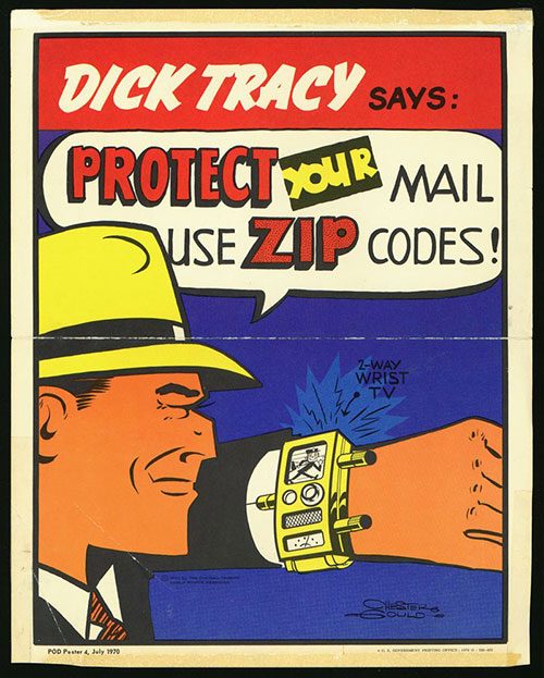
In addition, the national campaign included spots featuring the Ethel Merman recording of a pro-ZIP code song set to the tune of “Zip-a-Dee-Doo-Dah.” Later posters and ads featured Chester Gould’s comic strip detective Dick Tracy and Milton Caniff’s character Steve Canyon promoting the new postal numbers.

Postal authorities claimed that the use of ZIP codes would reduce delivery times for all types of mail by at least 24 hours by facilitating the widespread use of automated sorting machines to help speed mail to its destinations.

By the time July 1 rolled around, all local post offices in the South Bay and Harbor Area had received their numeric designations under the new system. 

Despite some pushback from users and occasional delivery foul-ups after the roll-out, the codes generally were accepted by most. Processing bugs were corrected, and more sophisticated machinery was introduced that could read the codes with increasing efficiency.

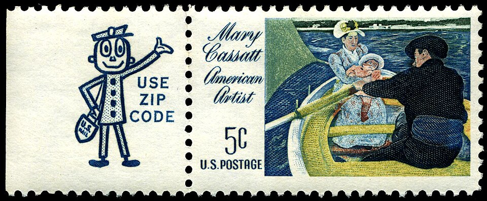
Stamps sold in U.S. post offices such as this 1966 example included ads promoting ZIP codes in the margins. (Credit: Wikimedia Commons)

The ZIP code promotional campaign continued. ZIP code 99701 was assigned for letters to Santa Claus, and the wildly popular Beatles announced in 1964 that their fan mail ZIP code was 10019. By 1965, even Smokey the Bear had a ZIP: 20252.

A Roper public opinion poll conducted by the Postal Service in 1969 found that 90 percent of those surveyed favored the use of the ZIP code system.

As more and more kinks were ironed out, the use of ZIP codes soon became an automatic part of using the postal system. In 1983, four-number extensions were introduced for even more precise mail delivery. They are more commonly used by businesses than residential senders.

The Mr. ZIP character was retired in 1983. By then, ZIP codes had become a necessity for a variety of purposes besides mail, including demographic data analysis, credit card fraud prevention, insurance risk assessment, and real estate sales.

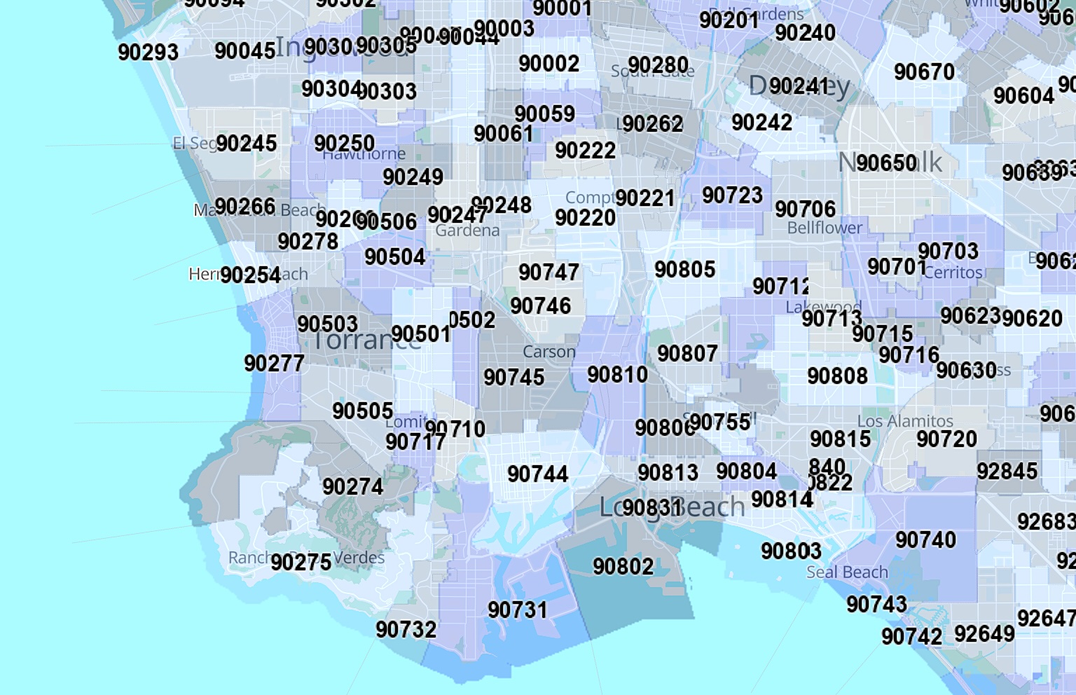
Present-day ZIP code map of the South Bay and nearby areas. (Credit: United States Postal Service)

Sources:

“Curator’s Pick – Dick Tracy and Mr. ZIP,” by Nancy Pope, Smithsonian National Postal Museum website, March 11, 2010.

Daily Breeze archives.

“Don’t Know ZIP? The list: 5 Surprising Facts about ZIP codes,” United States Postal Service website, July 24, 2018.

San Pedro News Pilot archives.

Torrance Press-Herald archives.

The Untold Story of the Zip Code, U.S. Postal Service Office of Inspector General, April 1, 2013.

July 1970 poster features Dick Tracy promoting ZIP code use. (Credit: Smithsonian National Postal Museum)

Juan Rodriguez Cabrillo explored the California coastline in the 1500s

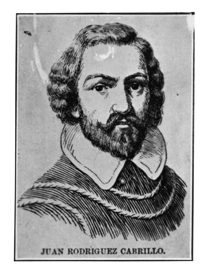
Juan Rodríguez Cabrillo. (Credit: USC Digital Library)

In the decades following the historic voyage of Christopher Columbus to America in 1492, Mexico underwent much exploration and development – not to mention financial exploitation – by conquistadors under the aegis of the Kingdom of Spain.

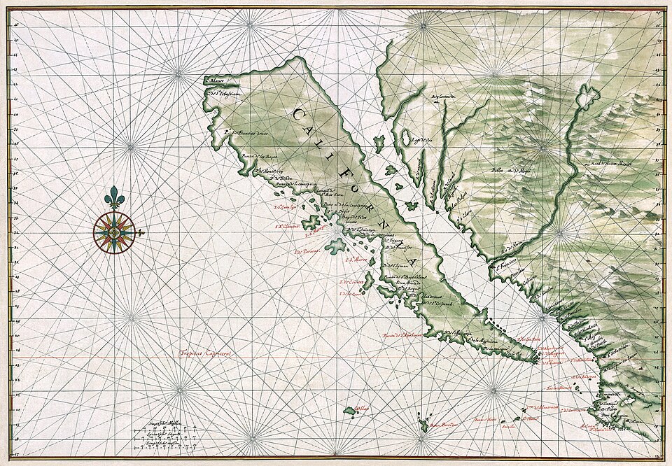
But Spanish and other European explorers knew very little about the lands along the coast north of Mexico. Alta California had not been charted or mapped; it originally was thought to be an island.

Spanish explorers discovered the southern tip of Baja California in 1533. Seeing waters on both sides of the land, they assumed that it was part of one giant island instead of a lengthy peninsula. Even after explorers sailed to the top end of the Gulf of California, the misconception persisted.

Circa 1650 map by Johannes Vingboons shows California as an island,. (Credit: Wikimedia Commons)

Born sometime between 1497 and 1500, Juan Rodriguez Cabrillo was a Portuguese adventurer who traveled to Havana as a young man. (His surname, added after his birth, is spelled “Cabrilho,” in Portuguese.) 

He initially served in a military role under Hernan Cortés, the Spanish conquistador who had conquered the Aztecs. Cabrillo later made a fortune through a gold mining venture in Nicaragua.

The Spanish government believed in the existence of the mythical Strait of Anián, a waterway that was thought to extend in some form from Alta California northward to Hudson Bay in Canada. If found, this would become a vital trade route connecting the Atlantic and Pacific oceans.

Anglo explorers would later call it the Northwest Passage during their search in the 19th century. Roald Amundsen made the first full passage by boat during his 1903-1906 voyage. Global warming has made the route less ice-bound in recent years.

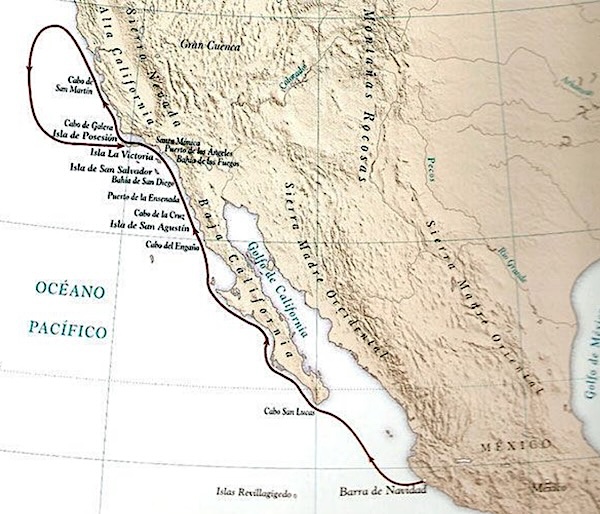
Undated map shows Juan Rodriguez Cabrillo’s sea route (dark line) up the California coast during his 1542 voyage. (Credit: Islapedia website)

Back in 1539, Cabrillo was commissioned by the Spanish government in Mexico to explore the Alta California coast and hopefully find the Strait of Anián.

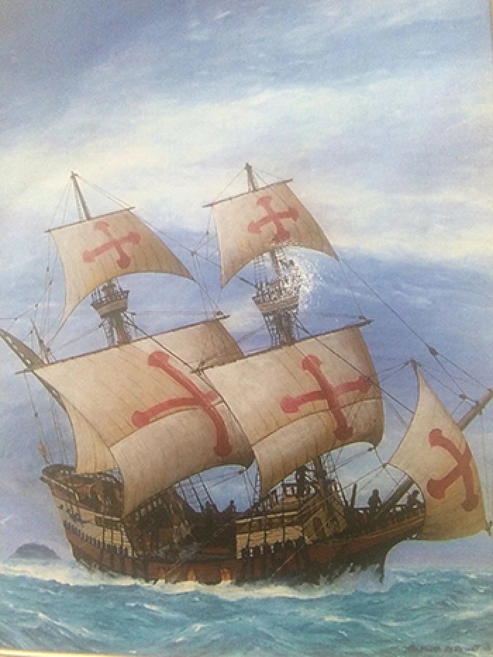
On June 27, 1542, he set out from mainland Mexico on a northern course along the western Baja California coast in command of three ships, the San Salvador, La Victoria and San Miguel. By late August, he had passed the point beyond which Europeans had explored the coast.

Cabrillo named the large bay into which he sailed on Sept. 28 as “San Miguel Bay” after one of his boats. We know it now as San Diego Bay. After a brief stop there, the boats continued northward.

An undated painting of Juan Rodriguez Cabrillo’s flagship, the San Salvador. (Credit: Image courtesy National Park Service)

On Oct. 7, he docked offshore at Santa Catalina Island. He named it “San Salvador” after his flagship, and named nearby San Clemente Island “Victoria,” after his third ship.

The next day, Cabrillo sailed toward the mainland and discovered San Pedro Bay, which he called “Baya de los Fumos,” the “Bay of Smokes,” ostensibly because of smoke coming from fires made by the indigenous Tongva tribes living there.

There’s no physical evidence that Cabrillo ever set foot on the San Pedro shore during his brief visit. The next day, the boats headed north into Santa Monica Bay and passed the rest of the Channel Islands, including uninhabited Anacapa and present-day San Miguel.

In subsequent days, the three ships continued north past Point Concepcion. By mid-November, they’d reached the Bay Area, but they missed out on San Francisco Bay itself, possibly due to fog or poor weather.

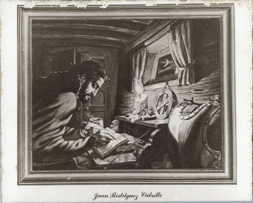
An undated drawing shows Spanish explorer Juan Rodriguez Cabrillo below decks on a ship, writing in a book with a feathered quill, a burning candle in front of him, a crescent moon in the window, and his breastplate at rest (right). Cabrillo was the first European to navigate the coast of present-day California (1542-1543). (Credit: Friends of the Malibu Public Library)

They turned around and headed back south, discovering Monterey Bay on their way down. The boats eventually returned to San Miguel Island for repairs and rest. 

Sometime near Christmas Eve, Cabrillo climbed off the San Salvador to help out his men  in a brief scuffle with Tongva attackers. He fell and broke a bone in either his arm or his leg, caught gangrene as result, and died on Jan. 3, 1543.

Though he is thought to have been buried on San Miguel Island, his remains have never been  found.

His discoveries were not widely heralded at the time – Spain was probably disappointed that he failed to find the Strait of Anián – but he has since been acknowledged as the first European to explore the California coast.

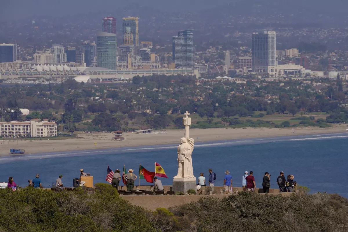
Visitors take in the view from the Juan Rodríguez Cabrillo statue at the Cabrillo National Monument at Point Loma overlooking San Diego Bay in 2022. (Credit: San Diego Union-Tribune staff photo)

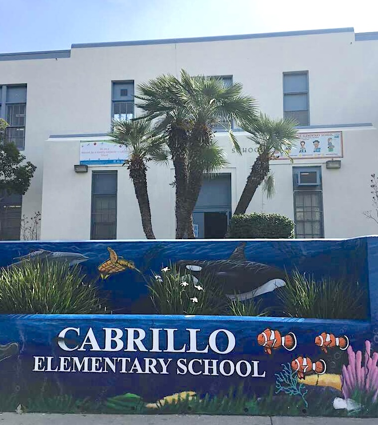
A major National Park Service monument to him stands atop Point Loma, overlooking San Diego Bay. It was first built in 1913 and has been much expanded since then. Many streets and schools in the San Diego area are named after Cabrillo. A smaller monument to Cabrillo can be found on San Miguel Island, where he died.

Long Beach’s Cabrillo High School was named for him, as were Cabrillo Beach, Cabrillo Avenue, the Cabrillo Marine Museum and Cabrillo Avenue Elementary in San Pedro.

A different Cabrillo Avenue became one of Torrance’s first streets, dating back at least to 1913, the year after the city was founded.

Cabrillo College in Aptos near Santa Cruz was named for him. Monterey Bay has Cabrillo Point, and a major portion of California State Highway 1 from Santa Barbara to San Francisco has been named the Cabrillo Highway.

Signage at Cabrillo Elementary School in San Pedro has a nautical theme. (Credit: Los Angeles Unified School District)

Sources:

“Cabrillo, Juan Rodriguez,” Islapedia.

Cabrillo National Monument website.

Daily Breeze archives.

“In Search of California: Juan Rodriguez Cabrillo and the Great Northern Mystery’s Lure,” by Hadley Meares, May 7, 2015, PBSSoCal website.

Los Angeles Times archives.

San Pedro: A Pictorial History, by Henry Silka, San Pedro Bay Historical Society, 1984.

Wikipedia.
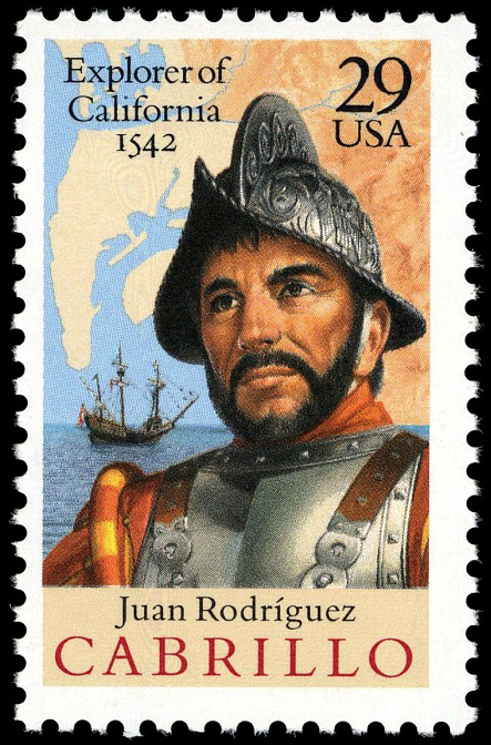
1992 U.S. postage stamp commemorates the 450th anniversary of Cabrillo’s voyage. (Credit: United States Postal Service)

How and when did the South Bay come to be known by that name?

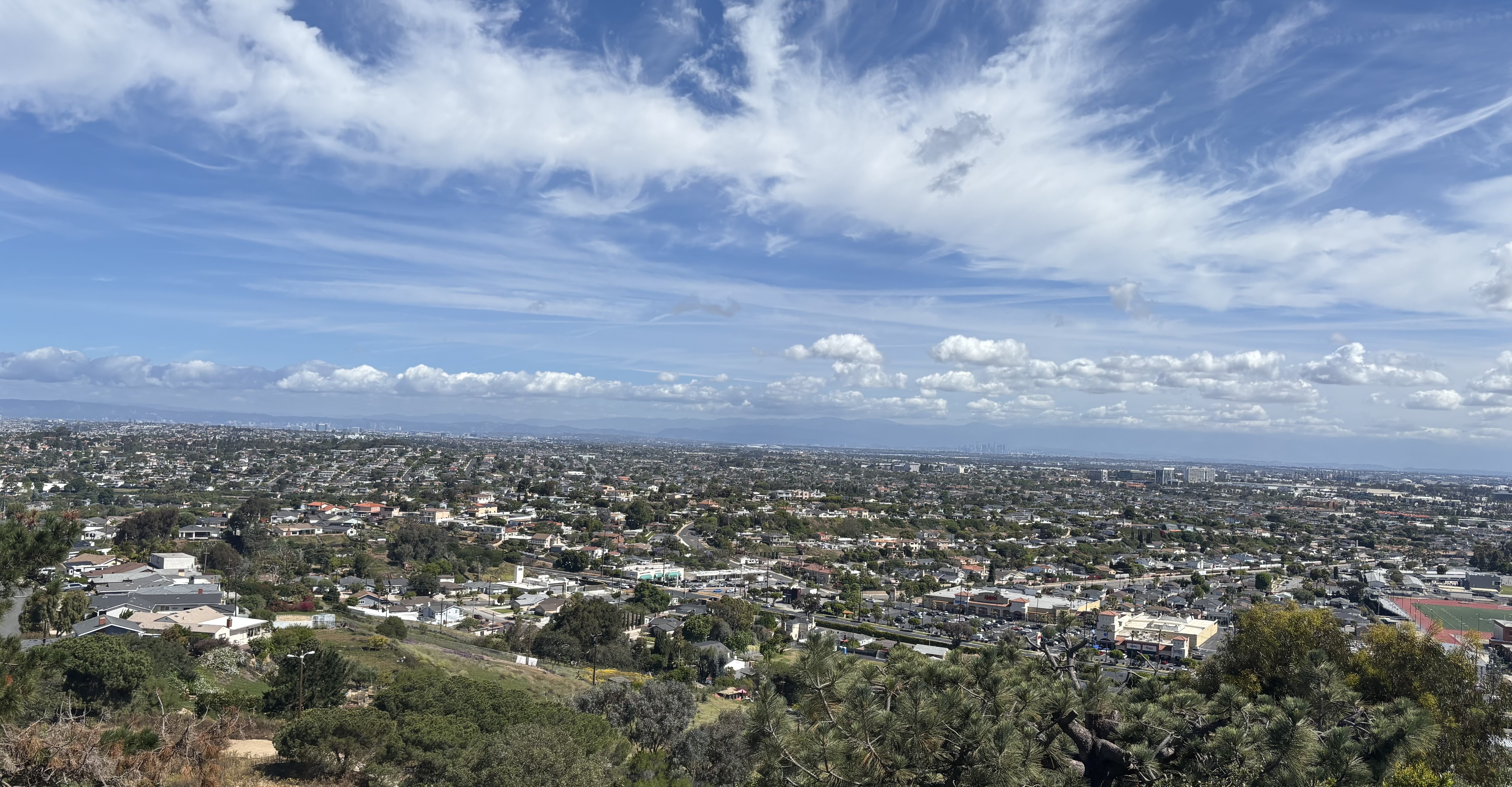
Looking north from Los Arboles (Rocketship) Park in Torrance at a portion of the South Bay. April 22, 2026. (Photo by Sam Gnerre)

Geography tells us why the chunk of coastal Los Angeles County land south of Ballona Creek became known as the “South Bay.”

The area from Playa del Rey down to the Palos Verdes Peninsula forms the lower half of Santa Monica Bay, hence the “South Bay” sobriquet.

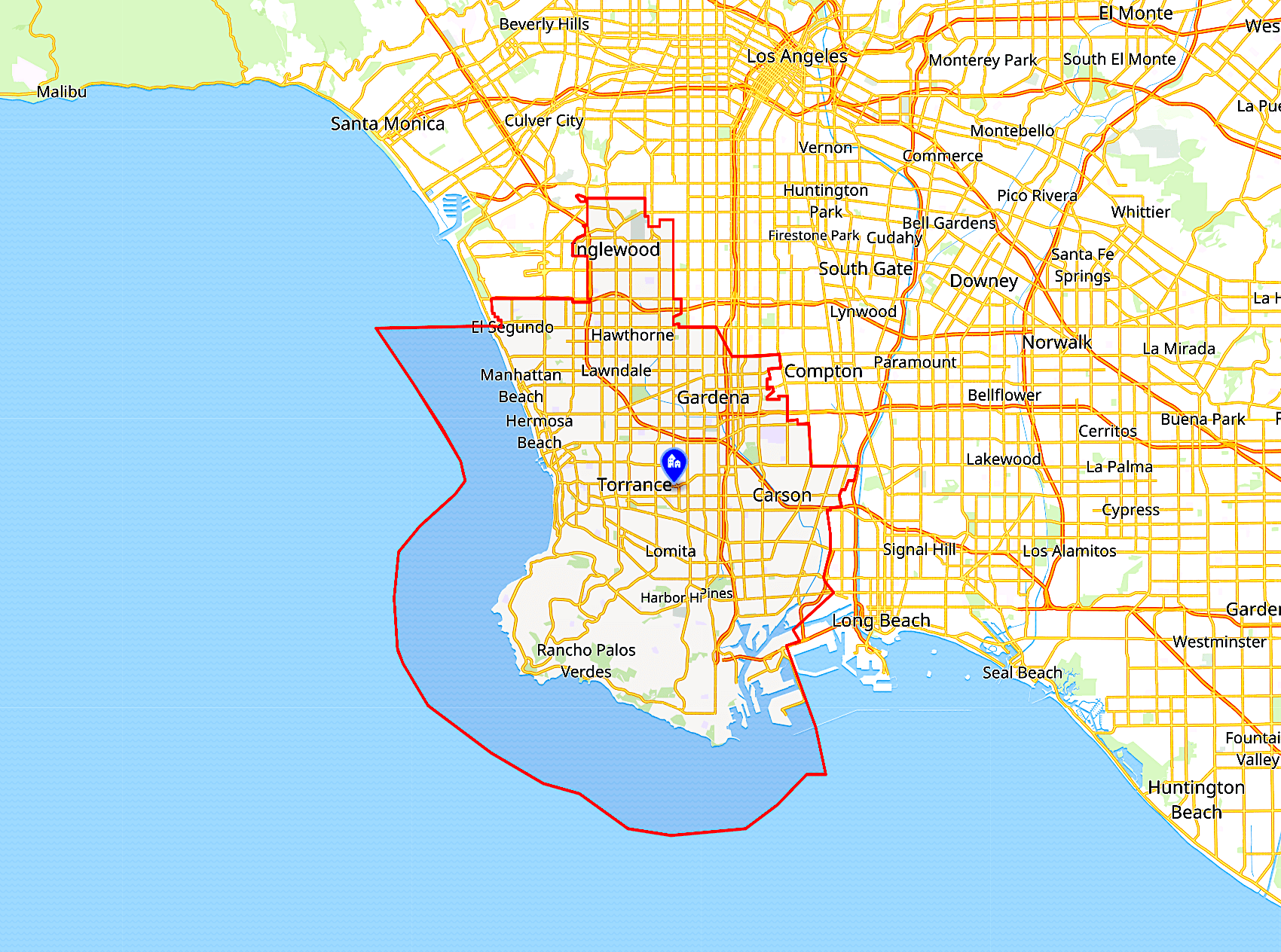
The South Bay’s boundaries are less well-defined than those of the upper half of the Bay. Purists insist that only the cities directly fronting the coast make up the South Bay, but over time the name has come to encompass nearby inland communities as well

This map shows one version of what makes up the South Bay (outlined in red), but omits Westchester and LAX. (Credit: Wikipedia)

The “when,” pinpointing the exact date and origins of the usage of the South Bay name, is more difficult.

Early mentions of the South Bay as a distinct area in newspapers are elusive. The comings and goings of a steamship by the name of the South Bay is all that turns up in the early part of the 1900s in most newspaper archives. 

Of course, the name may have been in popular usage if not in print, since multiple cities in the region were founded or incorporated before 1920. (These include Redondo Beach, San Pedro, Torrance, El Segundo, Wilmington, Hawthorne, Manhattan Beach and Inglewood.) But this is just speculation.

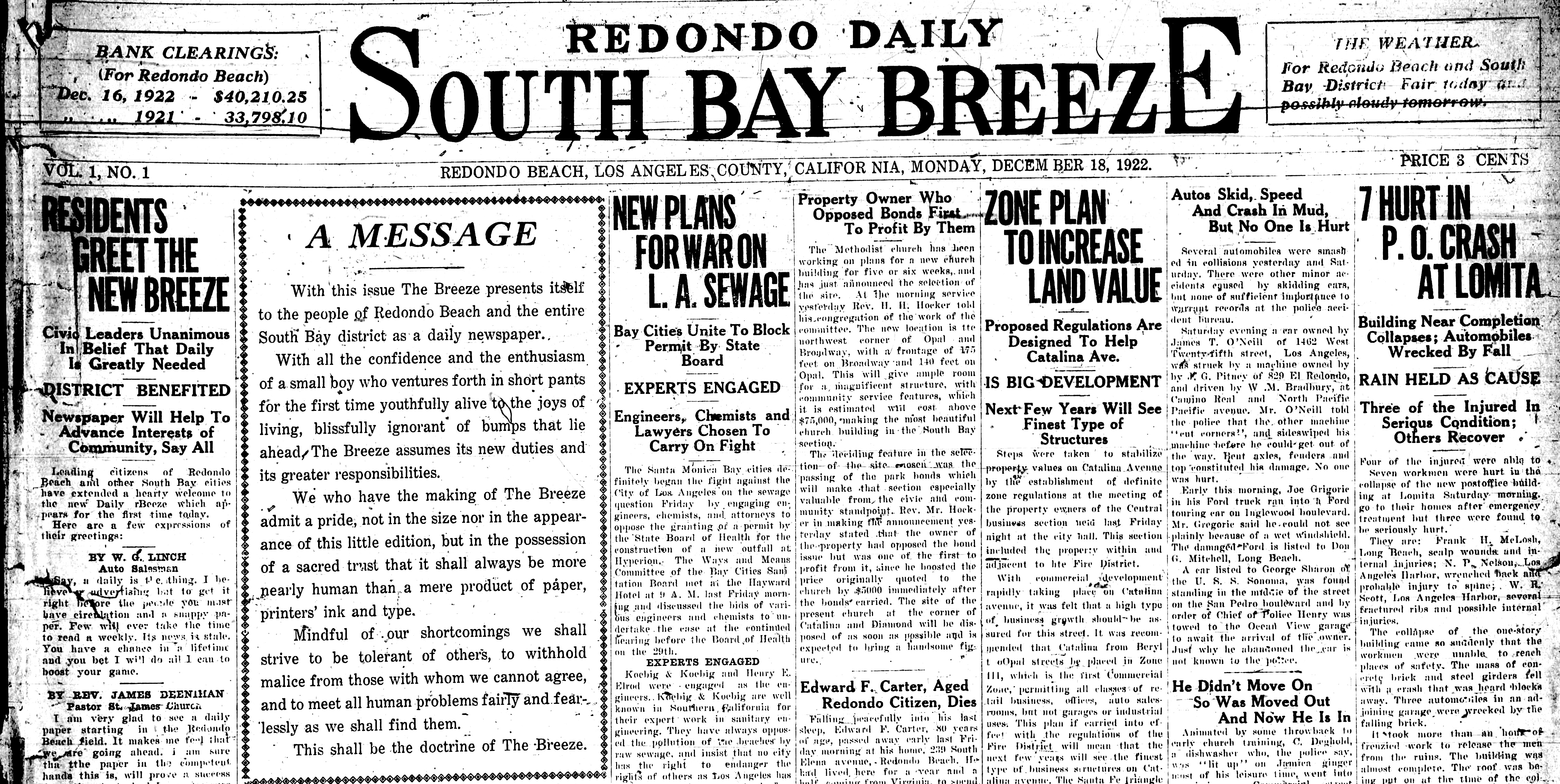
The Daily Breeze newspaper took great pains to carve out the South Bay as a distinct region when it announced its plans to cover more than just its home city of Redondo Beach in its edition of Dec. 18, 1922. 

On that day, the paper changed its name on its masthead from the Redondo Breeze to the Redondo Daily South Bay Breeze. It added separate editions earmarked with similar names for Torrance and the other South Bay cities. (It would physically move to Torrance in 1965.) The paper also changed from a weekly to a daily.

Partial front page of the “Redondo Daily South Bay Breeze” from Dec. 18, 1922. (Credit: Daily Breeze archives)

That rather ungainly mouthful of a name was pared down later in the 1920s to simply the South Bay Daily Breeze, and was officially listed as such in the local phone book beginning in 1931. It would retain that name for decades before becoming simply the Daily Breeze in 1974.

One of the earliest references to the South Bay as an entity in the Los Angeles Times is a Hermosa Beach Chamber of Commerce ad from March 20, 1923. The paper’s earlier references to the “South Coast” refer not to the South Bay, but to beachfront communities in Orange County.

The San Pedro-Wilmington area is sometimes referred to as part of the South Bay, but is more commonly known as the Harbor Area, due to the opening of the Port of Los Angeles there in 1907. The term “South Bay and Harbor Area” includes the entire region. 

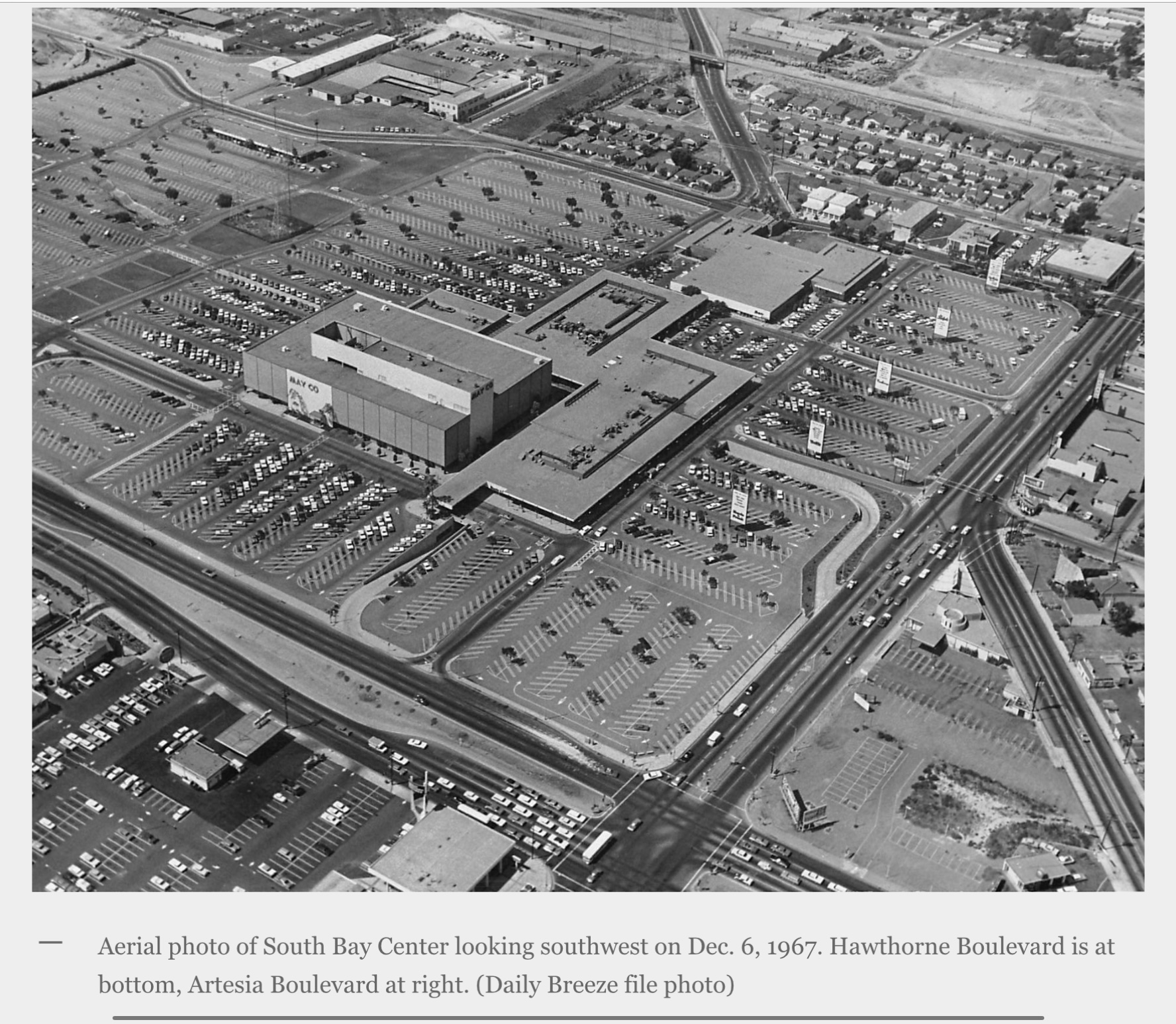
South Bay Center in Redondo Beach is one of several businesses with “South Bay” in its name. It opened in 1958, and became the “South Bay Galleria” when it was converted into an indoor mall in 1985.

The name “South Bay” is by no means unique to the southwest Los Angeles County region to which locals refer. Nor was it the first area so named.

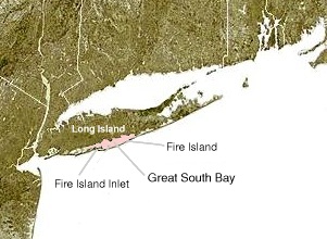
Equally or even more well-known South Bays are located along North America’s coastlines. One of the most well-known adds a qualifier. The 45-mile-long Great South Bay is a shallow lagoon situated between Fire Island and Long Island in New York state.

Back over on this coast, the San Francisco Bay Area’s South Bay encompasses Santa Clara County and environs, including San Jose, Santa Clara and Palo Alto. Most of what is considered Silicon Valley is located there.

The “South Bay” appellation began being used more universally to describe that area in the mid-20th century, when technology began replacing agriculture as the area’s chief industry. It accelerated with the explosive growth of tech companies there in the 1990s.

The beige-tinted Great South Bay on Long Island. (Credit: Wikimedia Commons)

California has a third well-known South Bay in San Diego County. This area lies between the southern end of San Diego Bay and the Mexico border and includes Imperial Beach, National City and Chula Vista, among other cities.

Other South Bays exist in Florida (a city near Lake Okeechobee), Texas (a body of water south of Padre Island), and Massachusetts (a newly developed area near Boston).

Several other South Bays can be found worldwide, including ones in Hong Kong, Macau and Taiwan. Four of them even exist in mostly uninhabited Antarctica.

It may not be the only region so named, but Los Angeles County’s South Bay retains its own definite identity and characteristics that make the name instantly identifiable to residents and non-residents alike.

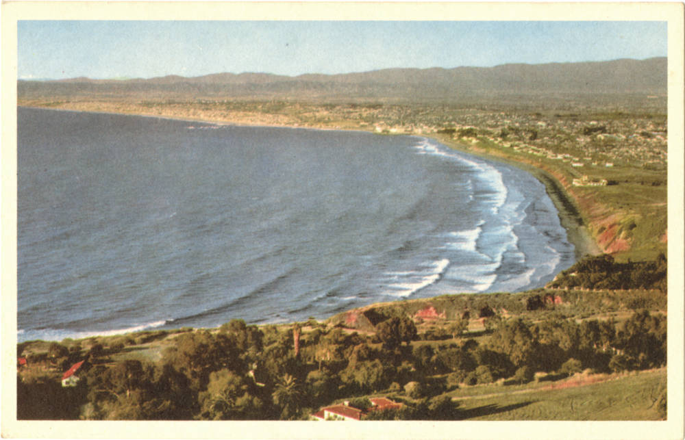
Los Angeles County west-facing beaches sweep northward from Palos Verdes Estates north to Santa Monica in this circa mid-1950s postcard. The Hollywood Riviera Beach Club is visible at far right., middle (Credit: CSUDH Digital Library)

Sources:

Daily Breeze archives.

Los Angeles Times archives.

Redondo Reflex archives.

“South Bay facts for kids,” Kiddle.co website.

Wikipedia.
Award-winning 1965 short film ‘Skaterdater’ showed South Bay skateboarders in action

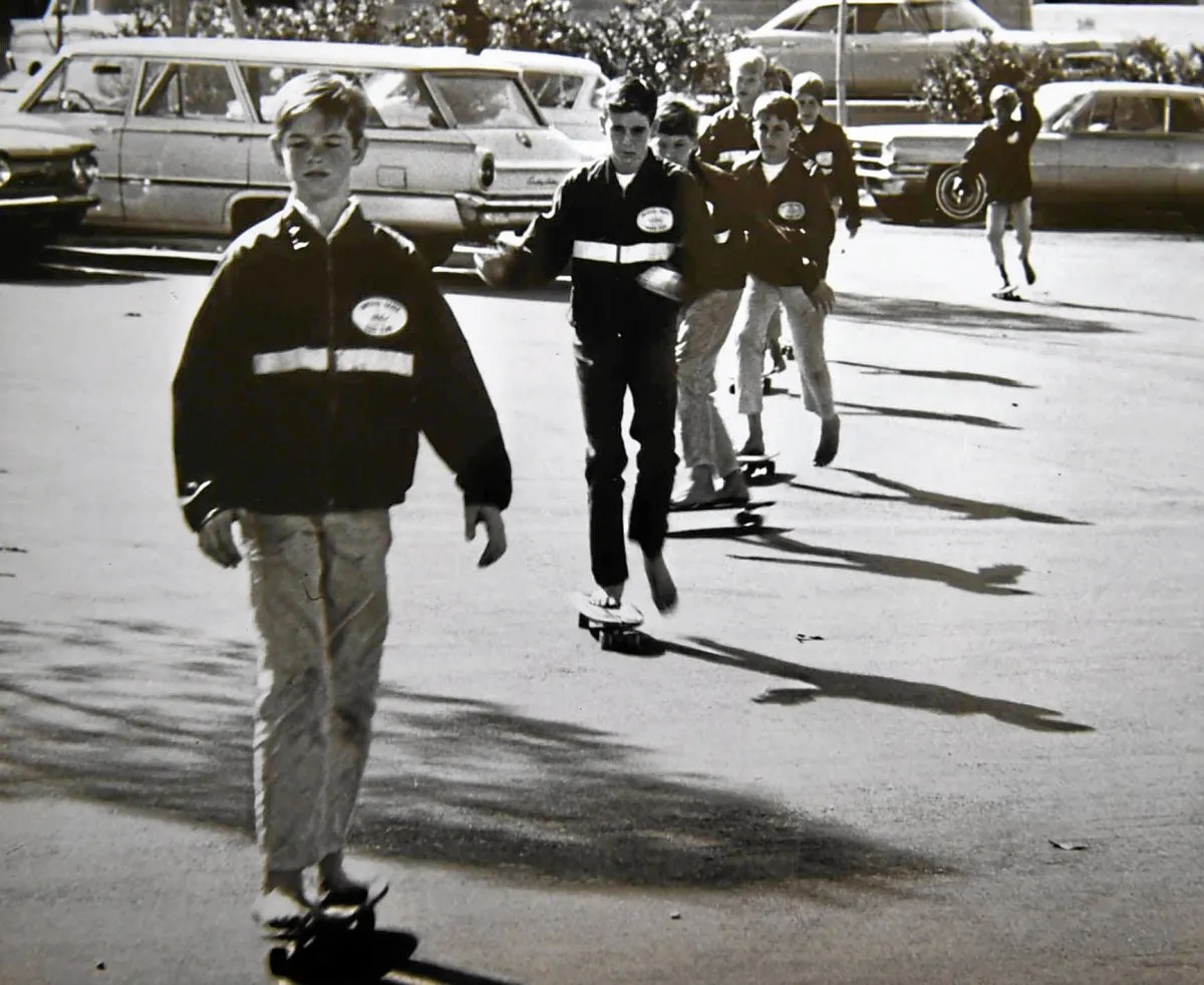
A still photo from the 1965 Academy Award-nominated short film “Skaterdater,” which features members. of the Imperial Skateboard Club of Torrance. (Daily Breeze file photo)

Skateboarding has been around longer than one might think.

Tony Hawk helped make the sport famous during the early days of the X Games in the late 1990s, but skateboards already had been around for a long time before that.

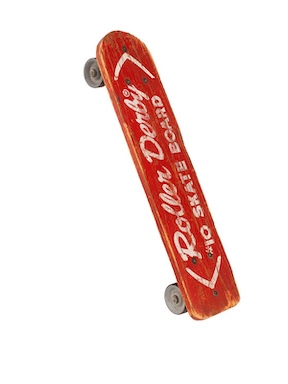
California surfers during the 1950s nailed roller skate wheels to wooden planks and began riding these homemade boards on paved surfaces to give themselves a land-bound activity to indulge in when the surf wasn’t up.

Roller Derby Skate Co. board, 1959.
(Credit: Smithsonian Institution, National Museum of American History website)

The sport gradually picked up momentum, and the first commercially available skateboards were produced and sold by The Roller Derby Skate Co. in La Mirada in 1959.

By the early 1960s, a variety of manufacturers were making the boards, often in the shape of miniature surfboards and not just planks of wood. With their superior design and construction, Makaha and Hobie brand boards became state of the art during this era.

As one would expect in a hotbed of surfing culture, the boards became extremely popular in the South Bay, with local newspapers taking note of the phemonenon in the early 1960s.

Emulating the well-established surfing clubs of the era, younger teens began to form informal groups devoted to skateboarding.

A pair of sixth graders at the now-closed Newton Elementary School in Torrance, Gregg Carroll and Gary Hill, liked the idea of having their own club with custom-made jackets and patches. They decided to form the Imperial Skateboard Club, the Imperials for short, and got several of their friends to join them.

Other members included Bill McKaig, Bruce McKaig, Ceilo Weislo, Gary Jennings, Mike Mel, and Rick Anderson. They specialized in performing various tricks on their boards, practicing their moves after school at nearby South High in Torrance.

They worked hard, and soon became proficient enough to consider entering in some of the earliest skateboarding events in Southern California. The first one they participated in was held at Lincoln Park in Santa Monica in the summer of 1964.

Its participants consisted mostly of older teens who were members of the Makaha and Hobie skateboarding teams. The Imperials didn’t win, but learned a lot about what it would take to become competitive in such events.

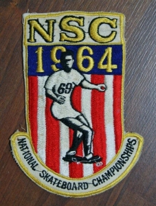
Souvenir patch from the 1964 Santa Monica Civic event.

In December 1964, the first National Skateboard Championships took place at the Santa Monica Civic Auditorium. The event was held on the indoor venue’s slick concrete floor.

The Imperials had been working on various moves and tricks at their daily practice sessions, and it served them well. Their headstands, handstands, jumps, nose riding and other fancy stunts impressed the audience and judges.

While Gregg Carroll was waiting to perform, UCLA film school graduate Noel Black approached him and told him of his plans to make a short film about skateboarding. Would the Imperials be interested in being its cast?

After further discussions, parental permissions were granted, and the project that would become “Skaterdater” was underway. (By the way, Carroll went on to win third place at the National event and fellow Imperial Mike Mel took first place.)

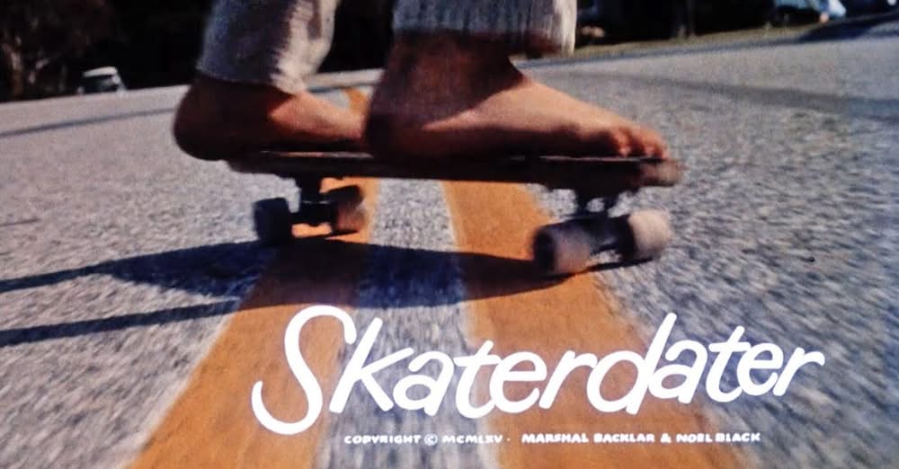
Main title from “Skaterdater.” (Credit: YouTube still)

Filmed in fits and starts at various South Bay and Harbor Area filming locations, the 18-minute silent short film took a year to complete. It tells a simple story of teen romance – boy meets girl, boy loses girl, then wins her back – with a skateboarding backdrop.

Local filming sites include scenes at Rolling Hills Plaza in Torrance, Malaga Cove Plaza in Palos Verdes Estates, Averill Park in San Pedro, various streets in Redondo Beach and a climactic final race down a hill at the southern terminus of Cypress St. in Lomita just north of the Cypress Hill Water Tower and the Rolling Hills Country Club.

All the actors were Imperials members, with the exception of female lead Melissa Mallory, a Westwood teen who was cast in the role by director Black. Mike Mel plays the lead character.

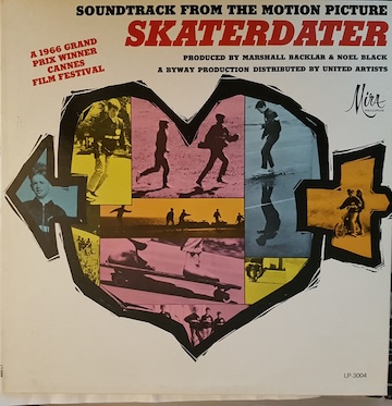
Soundtrack album from “Skaterdater.”

The completed film, generally acknowledged to be the first-ever skateboarding film, tells its simple story elegantly, thanks to Black’s direction and the superb photography helmed by Black’s associate, cameraman Mike Murphy. 

Hollywood music producers Mike Curb and Nick Venet produced the soundtrack, whose main theme, “Skaterdater Rock,” was performed by Davie Allan and the Arrows.

“Skaterdater” was nominated for, but did not win an Academy Award for best short film. However, it did win a prestigious Palme d’Or award for Best Short Film at the 1966 Cannes Film Festival.

It played in theaters along with screenings of “The Graduate” in England, and was shown along  with the James Bond film “Thunderball” at the Rolling Hills Theatre formerly in Rolling Hills Plaza (it’s now a Bev Mo store), the shopping center where the “Skaterdater” opening scenes were filmed.

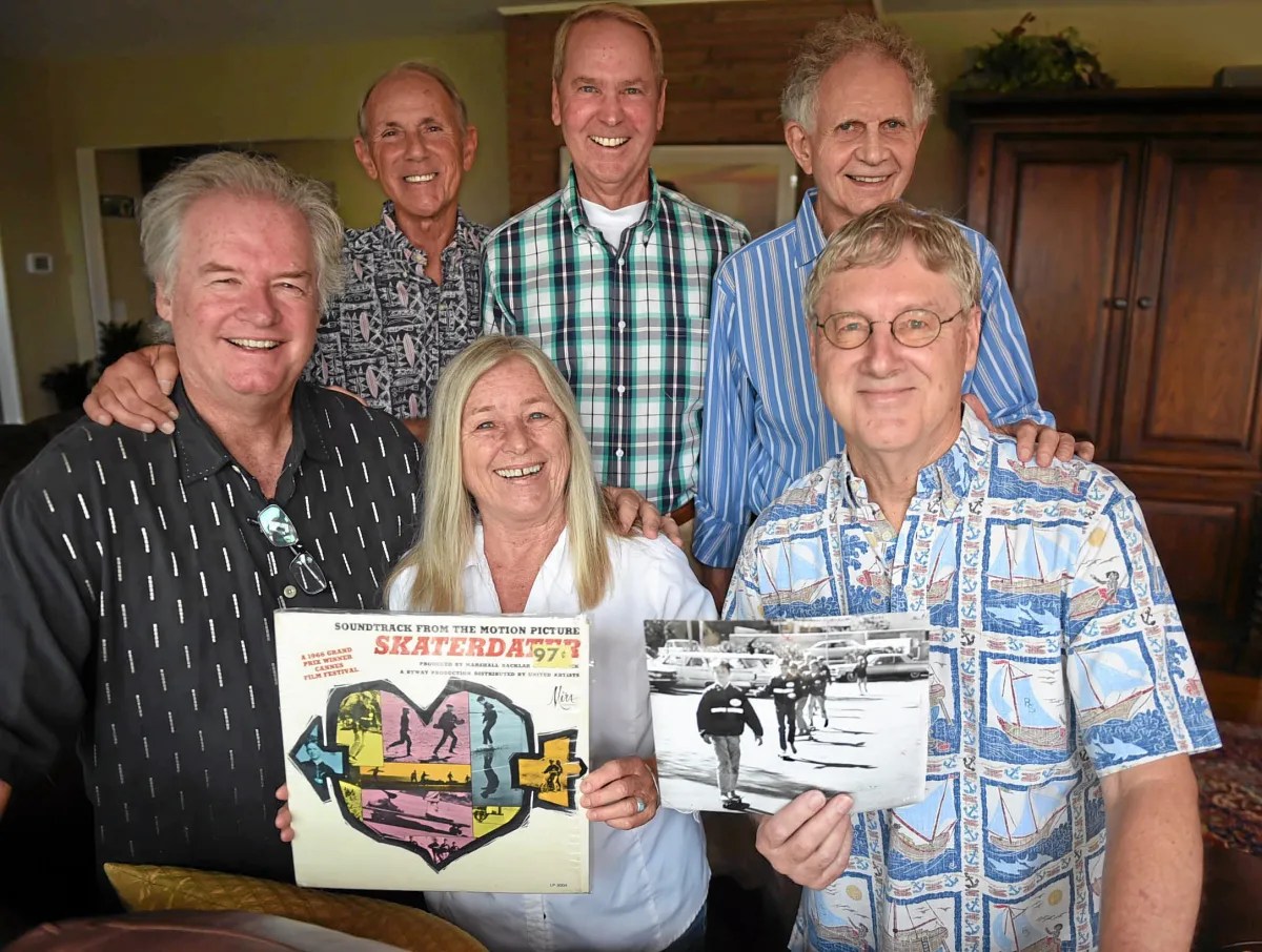
Back row, from left, Bill McKaig, Gary Jennings, Marshal Backlar, co-producer; front row, from left, Michael Mel, Melissa Mosley and Bart Jahn. The group reunited 50 years after making the film “Skaterdater,” shot on location in the South Bay. June 28, 2015. (Daily Breeze file photo)

Sources:

Daily Breeze archives.

Internet Movie Database.

Los Angeles Times archives.

“‘Skaterdater’: the Story of the World’s First Skateboard movie,” Surfer Today website.

Wikipedia.
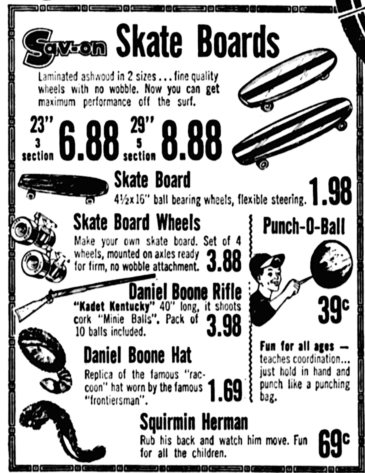
Skateboard technology has improved in this Torrance Press-Herald ad from Oct. 11, 1964, Page A-7. (Credit: Torrance Historical Newspaper and Directories Archive database, Torrance Public Library)

Lloyd Dennee moved from selling tires to selling televisions in the early 1950s

After graduating from Leuzinger High in Lawndale in 1934, David Lloyd George Dennee got a job working at the Continental Baking Co. in Beverly Hills.

Lloyd Dennee. Undated, circa late 1940s. (Credit: Dennee’s of Santa Ynez Instagram page)

He soon worked his way up from route driver to district manager. The ambitious Dennee wanted to run his own business, however.

He left Continental in 1944 to own and operate Dennee’s Hancock Oil service station at 913 N. La Brea in Inglewood.

In May 1946, Dennee entered into a partnership with Ray Fletcher to operate Fletcher and Dennee’s Goodyear tire sales and service store at 451 N. Hawthorne Blvd. in Hawthorne. He bought out Fletcher to become the store’s sole owner in 1948.

During this period, Dennee made a decision that would change his business and his life irrevocably. He had noticed the growing popularity of a new phenomenon: television. Demand for the big boxes with the tiny screens had been growing during the 1940s, but began to explode following the end of World War II.

On the face of it, the addition of the newfangled devices to his more traditional inventory of tires, auto parts and accessories in 1947 might seem odd. But Dennee had read the market well. The technology continued to improve, the sets became less bulky, and sales continued to rise.

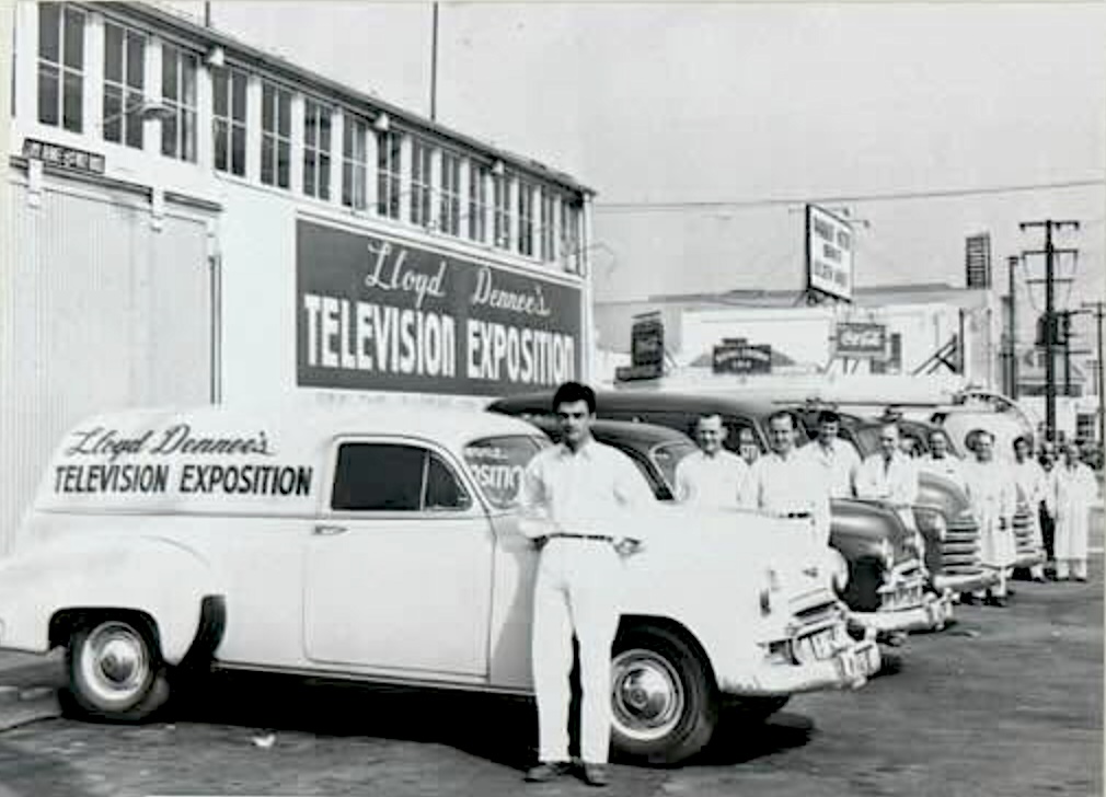
Lloyd Dennee’s Television Exposition mobile technicians pose by their service vans at the store. Undated, circa 1949-1950. Credit: Dennee’s of Santa Ynez Instagram page)

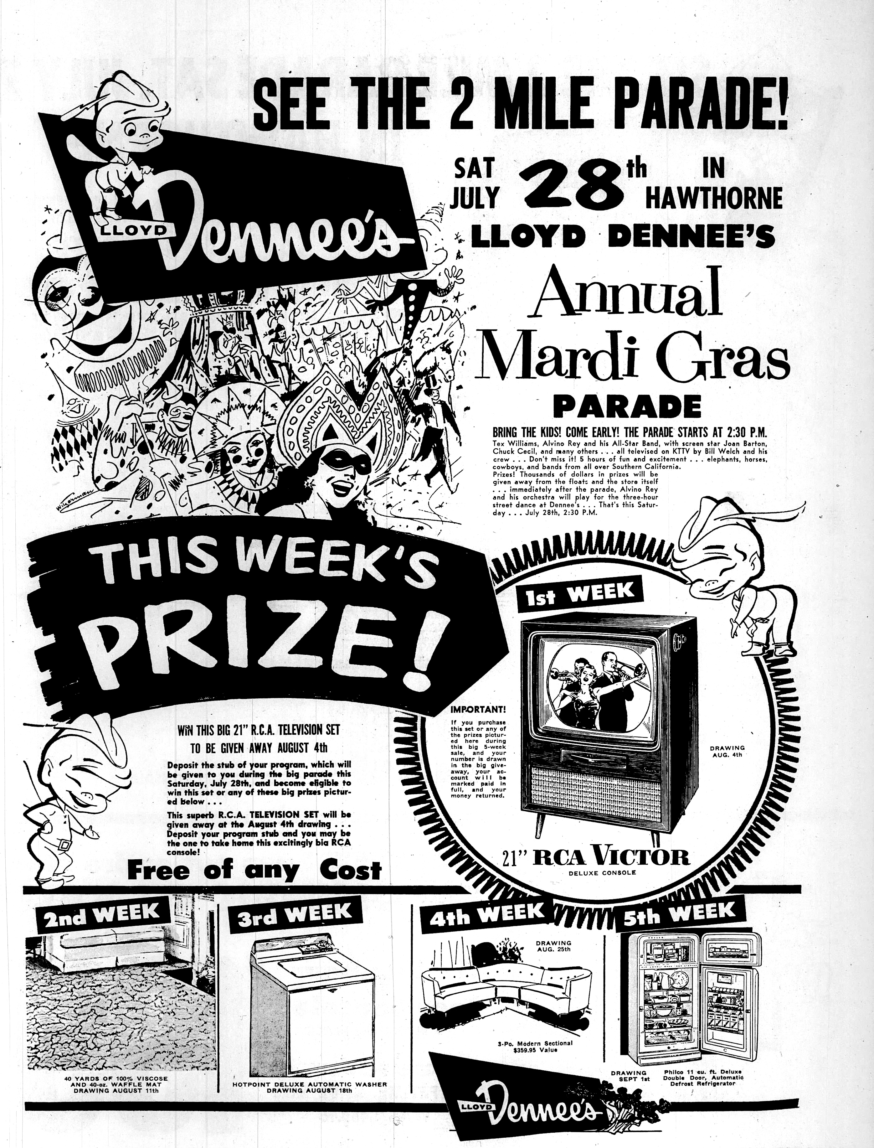
In June 1949, he opened a separate store strictly devoted to selling televisions. He used his flair for promotion to boost the opening of Television Exposition at 110 E. El Segundo Blvd. near Hawthorne Blvd. Dennee backed up his operation with a full staff and ten service trucks.

In addition to selling TVs, he also moved into large appliance sales: refrigerators, washing machines, stoves and other appliances. Since most of these items came in the color white at the time, he called the store he opened with extravagant fanfare at 364 N. Hawthorne Blvd. “Lloyd Dennee’s White House.”

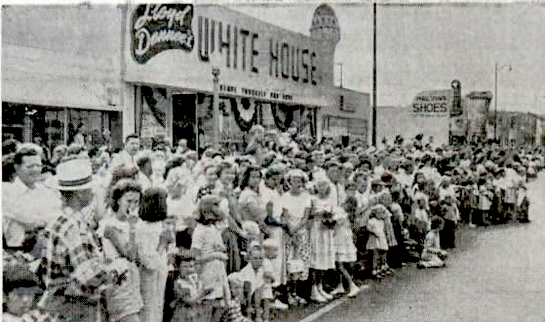
He turned its July 29, 1950, grand opening into a major public event, staging a full parade and enlisting entertainment stars such as singer Frankie Laine, starlet Randy Stuart and pro wrestling champion Baron Leone to appear. More than 25,000 people lined the streets of Hawthorne for the day-long event.

Part of the large crowd at the grand opening of Lloyd Dennee’s White House on Hawthorne Blvd. on July 29, 1950. (Credit: Dennee’s of Santa Ynez Instagram page)

Longtime Los Angeles area television personalities Stan Chambers and Bill Welsh helmed a TV broadcast of the spectacle on KTLA Channel 5, described as the first live show telecast from the city of Hawthorne.

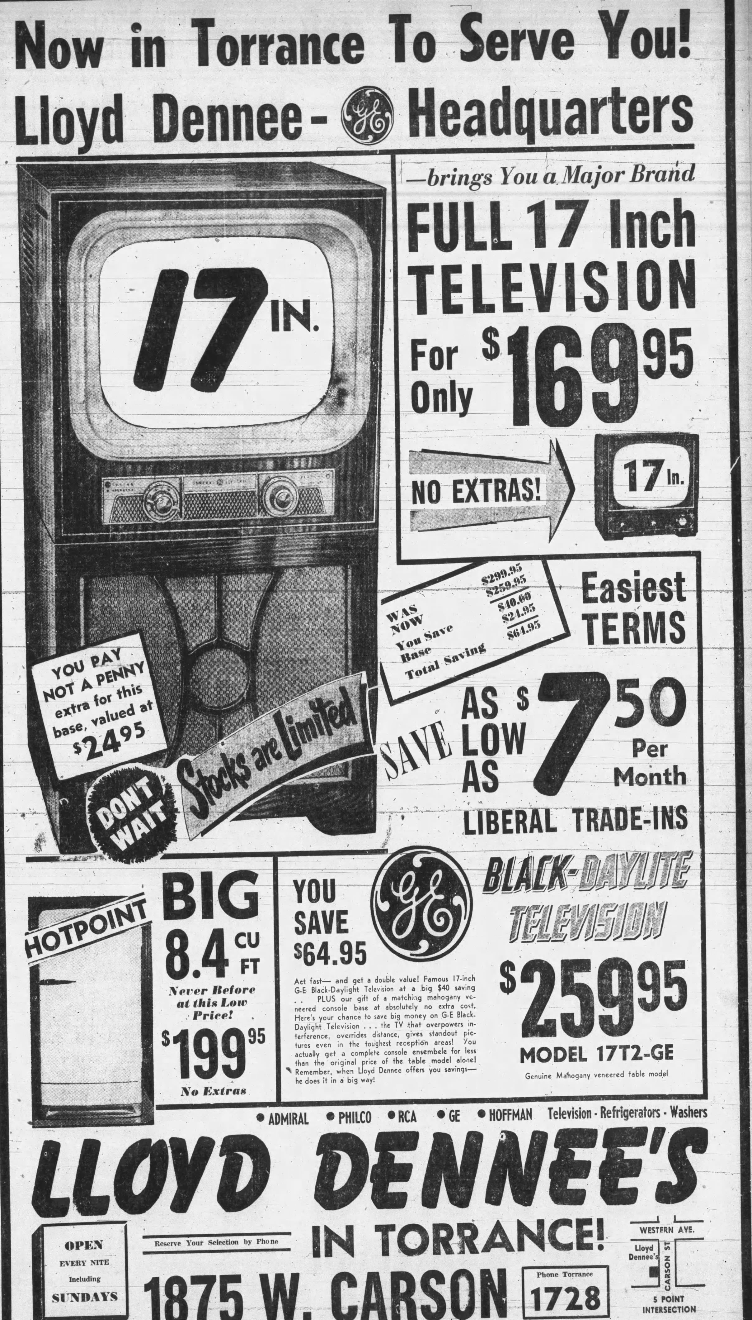
Dennee continued to grow his business during the early 1950s. By 1952, he’d opened “Manchester House” in Inglewood at 2112 Manchester Ave., and another branch in Torrance at 1875 Carson St., near the downtown “five points” intersection of Carson and Cabrillo Ave. 

He also opened a used merchandise store he called “Value Vault” in Hawthorne at 360 N. Hawthorne Blvd., next to his “White House.”

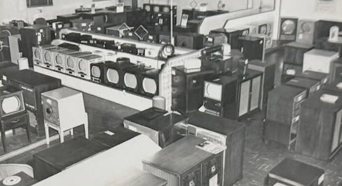
Interior view shows many TV sets on display at one of Lloyd Dennee’s stores. (Credit: Dennee’s of Santa Ynez Instagram page)

As the 1950s wore on, a variety of factors caused sea changes in the retail television business. More and more outlets began selling the sets, and the market began to reach saturation. Television set technology became more reliable, and larger retailers began to crowd out the smaller independent stores.

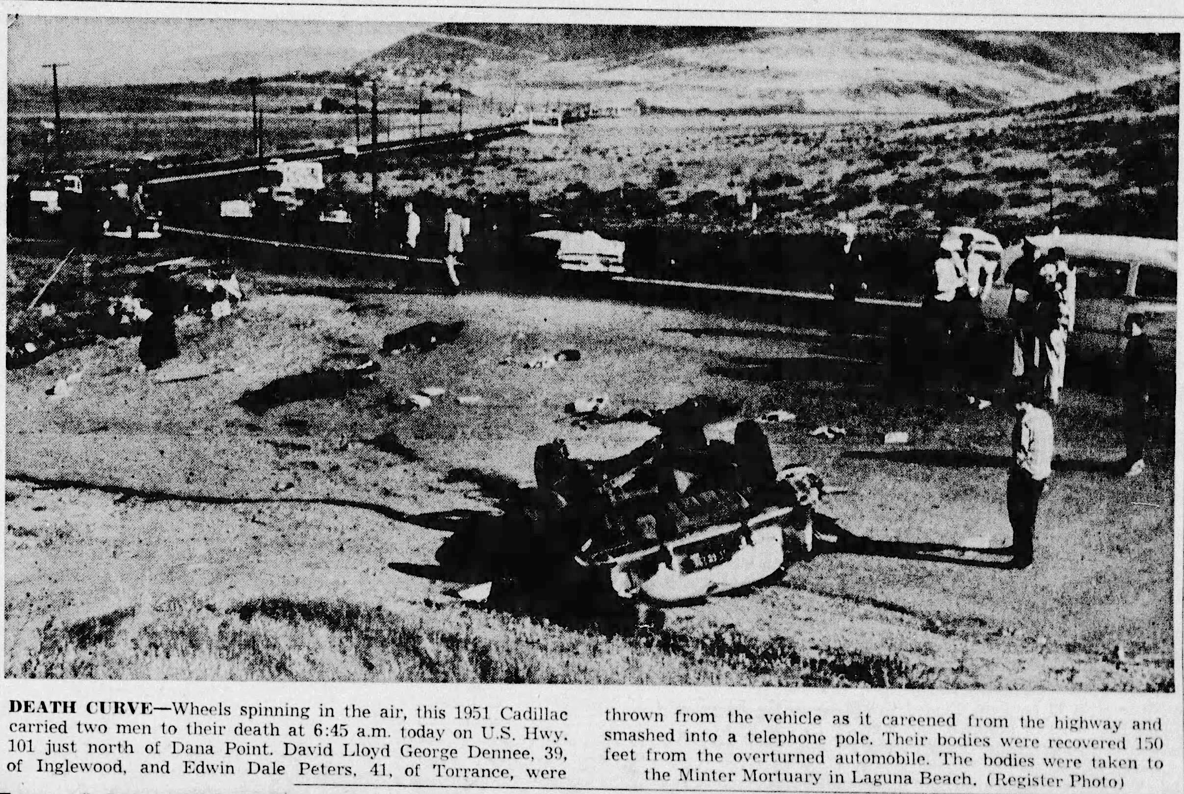
Lloyd Dennee’s outlets continued to do well, but a tragic accident shook the business on April 19, 1955. Dennee and Edwin Peters, manager of Dennee’s Hawthorne flagship store, were both killed when Dennee lost control of his 1951 Cadillac on a curve on Highway 1 between Laguna Beach and Dana Point.

The Register, April 19, 1955, Page 1. (Credit: The Register photo from Orange County Register archives)

The Dennee’s stores were in the midst of a major remodel at the time. Dennee’s wife Maxine took control of the business and saw the remodel through to completion. She also staged a major promotional gala in 1956 celebrating the revamping of the stores.

It was the last such massive celebration at the stores, which began transitioning into furniture and home furnishings during the next few years. The “Television Exposition” store and other locations eventually were shuttered.

In the 1970s and 1980s, Dennee’s Distinctive Furnishings was operating at 12814 Hawthorne Blvd. in Hawthorne. Lloyd Dennee’s son David was its president.

Currently, descendents of Lloyd Dennee own and operate Dennee’s of Santa Ynez, a successful furniture and interior design business in the community of Santa Ynez, northwest of Santa Barbara.

Daily Breeze ad, July 26, 1956, Page 9. (Credit: Daily Breeze archives)

Sources:

Dennee’s of Santa Ynez Instagram page.

Daily Breeze archives.

Los Angeles Mirror archives.

Orange County Register archives.

Torrance Press-Herald archives.

Daily Breeze ad, Nov. 8, 1951, Page 13. (Credit: Daily Breeze archives)

Longren Aircraft executive Hampden Wentworth’s successful career ended in tragedy

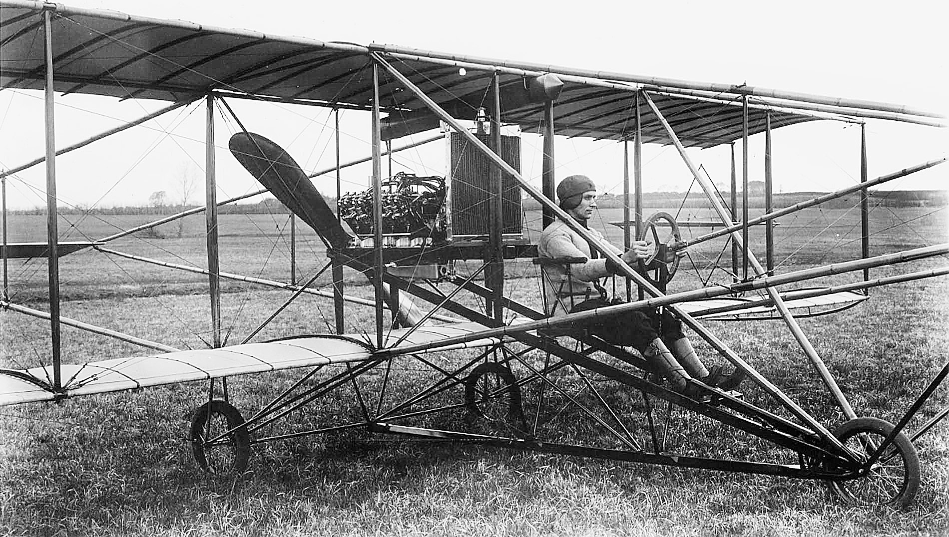
Albin Longren sits in the pilot seat of his first plane in 1911. (Credit: Wikimedia Commons)

Twenty-nine-year-old self-taught engineer and aviation pioneer Albin Longren made his first successful flight in a plane that he had built himself in Topeka, Kansas, on Sept. 2, 1911.

Inspired, Longren started his own company, and the Longren Aircraft Corp. began turning out planes. One of his most interesting creations was aimed at Kansas farmers: a biplane whose wings folded up for storage in a barn or garage.

Longren loved to fly, and supplemented his income through barnstorming exhibitions, popular in the early 1920s. He sold the planes his company built to the general aviation market and the military, but people weren’t as fired up to buy their own airplanes as he’d hoped. The company went bankrupt in 1926.

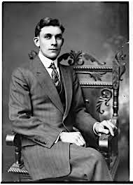
Albin Longren, undated. (Credit: Kansas Historical Museum)

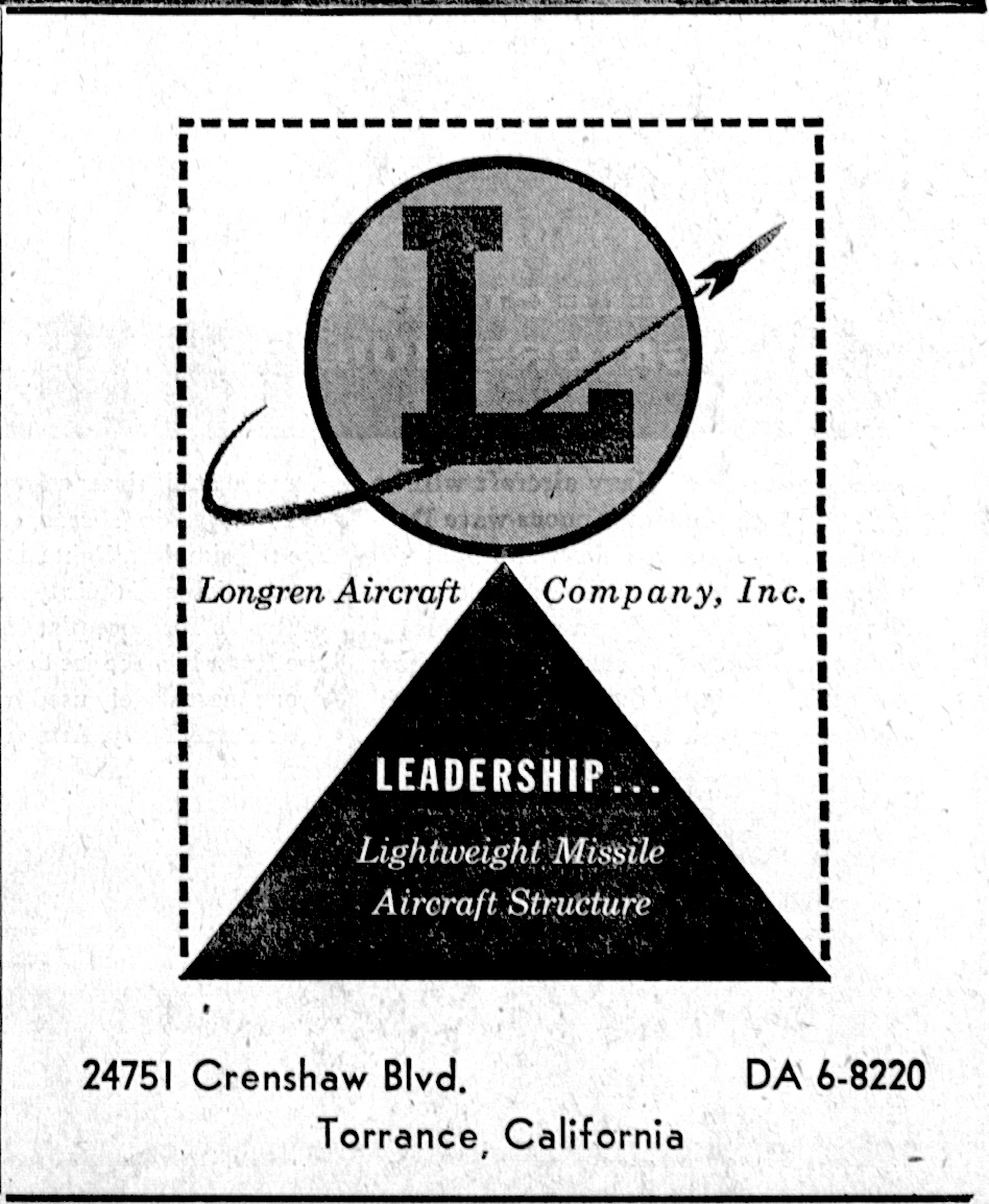
Longren scuffled around for the next few years. He worked for Clyde Cessna in Wichita during the 1930s, but was forced out in a corporate power play. By then, he had the financial means to restart his own company, and he decided to do so in Torrance. Longren Aircraft Co. Inc. opened for the second time in 1938 at its new location at 2576 Carson St.

This new iteration of the company focused its energy not on aircraft production, but on components, especially fuselages. Longren had developed a special technique of stretching aluminum and other materials into strong, uniform shapes that could be easily utilized in airplane construction.

Hampden Wentworth was born on Feb. 7, 1921, in Boston, Mass. The well-to-do Wentworths moved west to California when Hampden was a teenager.

Like Longren, he too had a lifelong love of aviation. He was barely out of his teens when he joined Longren Aircraft, but quickly rose to the rank of vice president and chief engineer. The company’s new focus made it a natural supplier for larger aircraft manufacturers such as Douglas, Boeing, Lockheed and Northrop, who were being kept busy by the onset of World War II.

Torrance Press, Aug. 18, 1955, Page 10. (Credit: Torrance Historical Newspaper and Directories Archive database, Torrance Public Library)

At age 23, Wentworth enlisted in the Navy, and was selected for cadet training in the Naval Air Corps academy in Berkeley, Calif. The entire staff at the Carson St. plant gathered to give him a sendoff in June 1944.

He was stationed at Pensacola, Fla., at the time he was discharged from service in May 1946. He returned to Longren as vice president, where his older brother, Chapman, was serving as president.

Albin Longren had remained with his Torrance company until 1945, when he retired to his ranch in northern California. He died at 68 in 1950. But his company continued to gain momentum.
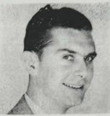
In the early 1950s, Hampden Wentworth was elevated from plant operations manager to company president. He led the company’s expansion plans when it began to outgrow its Carson St. location.

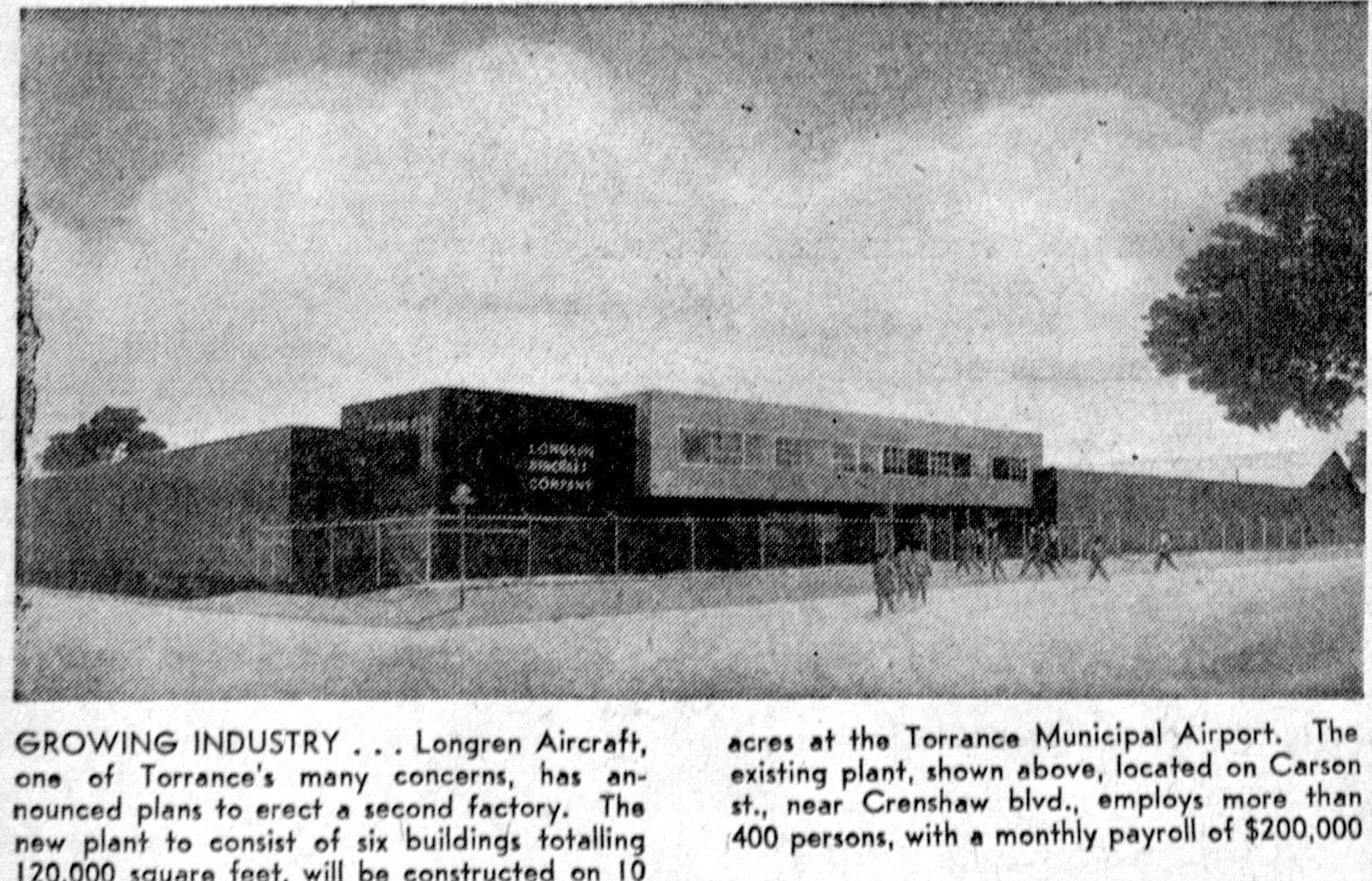
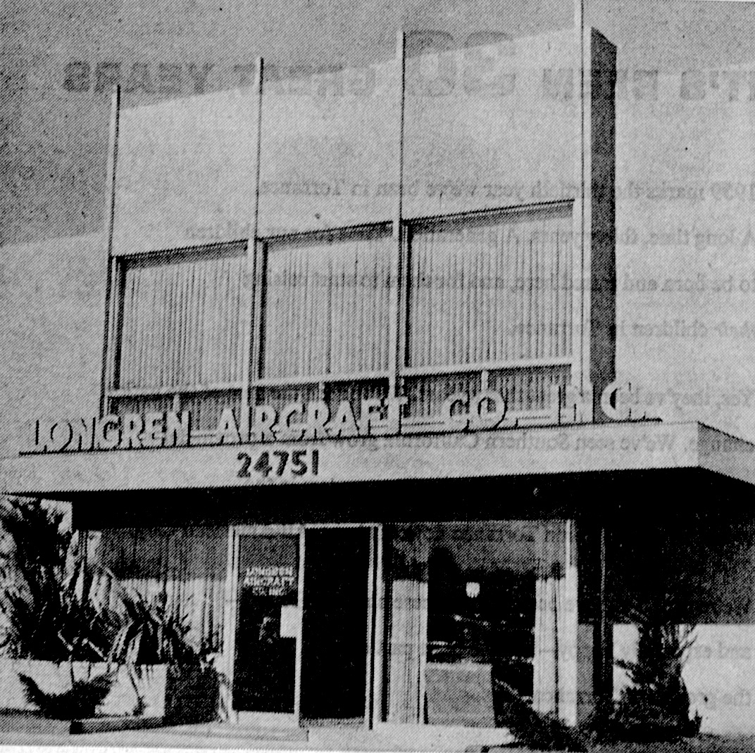
He negotiated the purchase of ten acres at the northeast section of the then-new Torrance Municipal Airport property for Longren’s new facility, which would be in addition to the Carson St. plant. The new plant, which opened in 1957, was located at 24751 Crenshaw Blvd., in the airport’s industrial section.

Longren Aircraft plant at Torrance Municipal Airport. Torrance Press, March 2, 1959, Page 16. (Credit: Torrance Historical Newspaper and Directories Archive database, Torrance Public Library)

Longren built on its wartime success by diversifying its product lines. It still manufactured airplane fuselages and other metal parts, but it also branched out into metal consumer products after the end of World War II.

Under Wentworth, it also grew because of his innovative management strategies. Not all companies in the 1950s had a complex profit-sharing plan for employees, gave them one three-day weekend every month and threw elaborate plant-wide holiday parties.

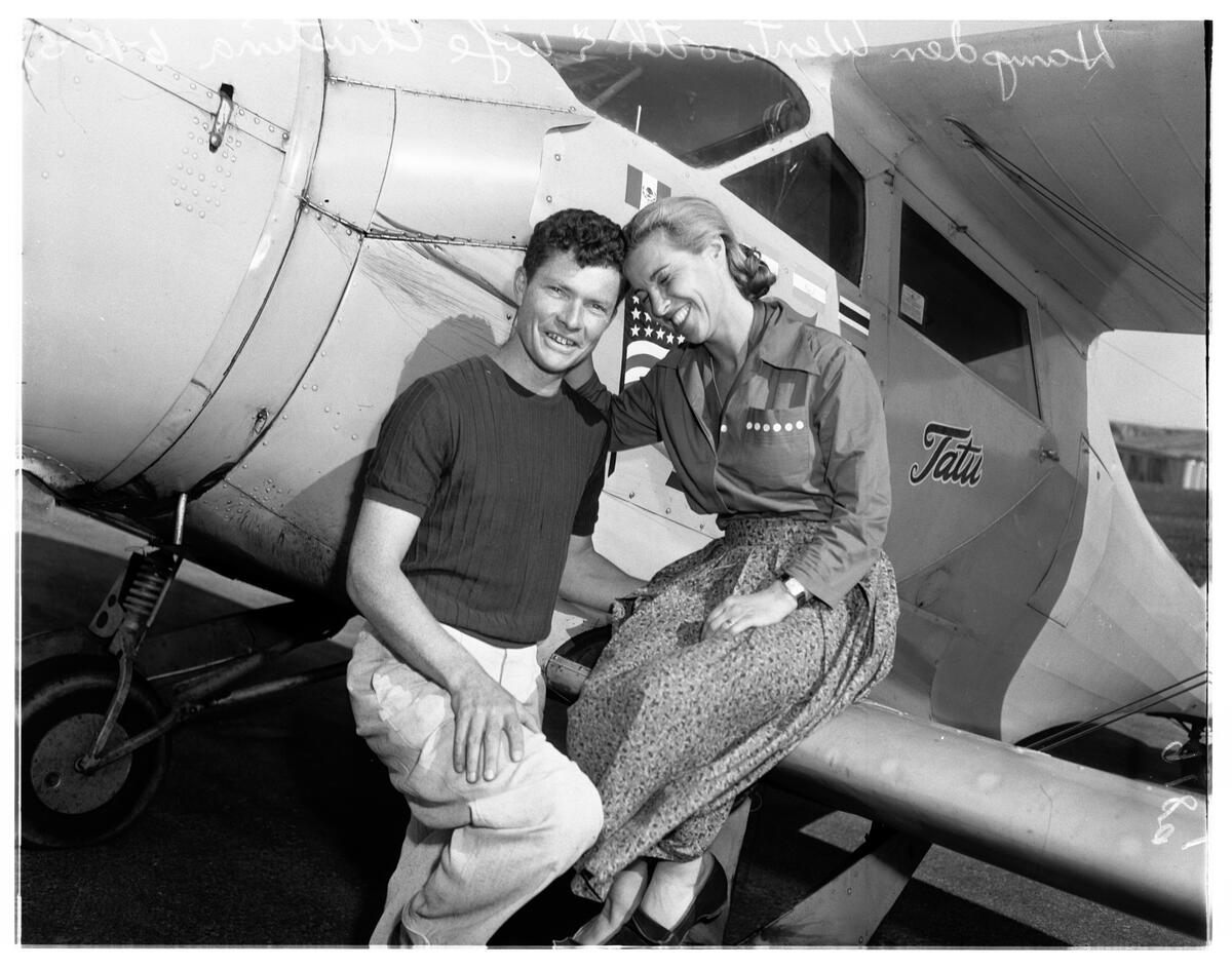
During all this time, Wentworth never lost his passion for flying. He and his wife, Christina – they married in 1947 – often left their Palos Verdes Estates home on Via Somonte for frequent globe-trotting trips in his plane. Wentworth had fully reconditioned and updated the 1939 Beechcraft 17B biplane once flown by aviator Jacquline Cochran.

On one such adventure in South America in 1951, the couple’s plane disappeared from radar screens when it had to make a forced landing on a farm in Bolivia due to mechanical difficulties.  They got the plane repaired and returned home safely.

Hampden and Christina Wentworth return from their Bolivia adventure. June 15, 1951. (Credit: USC Digital Library)

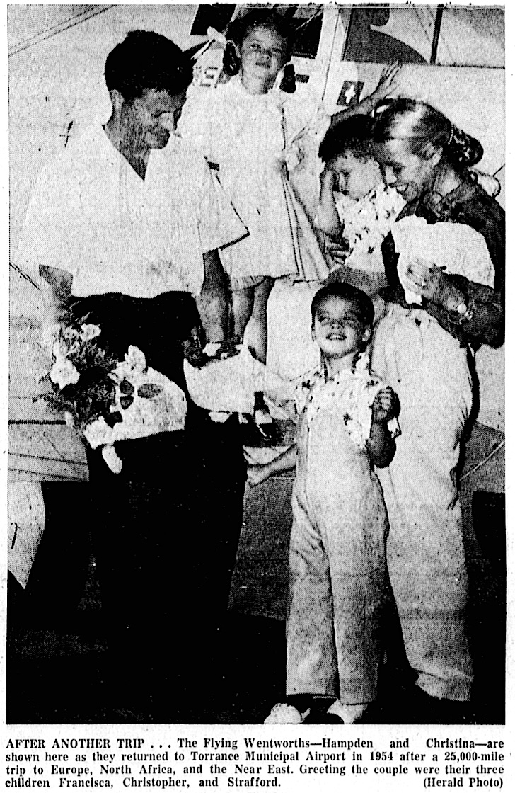
In 1954, they took a nine-week trip to Europe and the Mideast, which included them almost getting shot at by soldiers in Jerusalem before successfully identifying themselves.

In 1959, Wentworth, by then the company’s owner, successfully negotiated Longren Aircraft’s merger with Middletown, Ohio airplane parts manufacturer Aeronca Manufacturing Corp. Albin Longren’s company name was no longer, this time for good. Wentworth retired from the company and turned to stock trading and investments at the family’s new, larger home on Portuguese Bend Road in Rolling Hills.

On Feb. 2, 1960, the couple was returning from a Southwest U.S. trip when engine trouble during a snowstorm forced them to make a landing in the mountain town of Reserve, New Mexico. 

Though he was advised to wait until morning when the snow would have been frozen, Wentworth, in a hurry to get home, fixed the engine and decided to try to take off in the slushy snow.

The Beechcraft failed to gain altitude and ran into several fence posts and small trees before crashing into a hillside. The Wentworths died instantly. They left behind four children, Francisca, 8, Christopher, 7, Strafford, 5, and David, 3.

Wentworth had borrowed the aircraft, a Beechcraft biplane similar to his own, from Torrance City Council member Robert Jahn.

Torrance Herald, Feb. 4, 1960, Page 1. (Credit: Torrance Historical Newspaper and Directories Archive database, Torrance Public Library)

Sources:

“Albin Longren: The Aviation Pioneer You Don’t Know,” by Frederick Johnsen, General Aviation News website, March 28, 2025.

“The Birdman of Topeka,” by Giles Lambertson, Smithsonian magazine website, July 22, 2015.

Daily Breeze archives.

San Pedro News Pilot archives.

Torrance Press-Herald archives.

Torrance Press, March 2, 1959, Page 7. (Credit: Torrance Historical Newspaper and Directories Archive database, Torrance Public Library)

Dee Hardison’s stint as Torrance mayor was only part of her service to the city

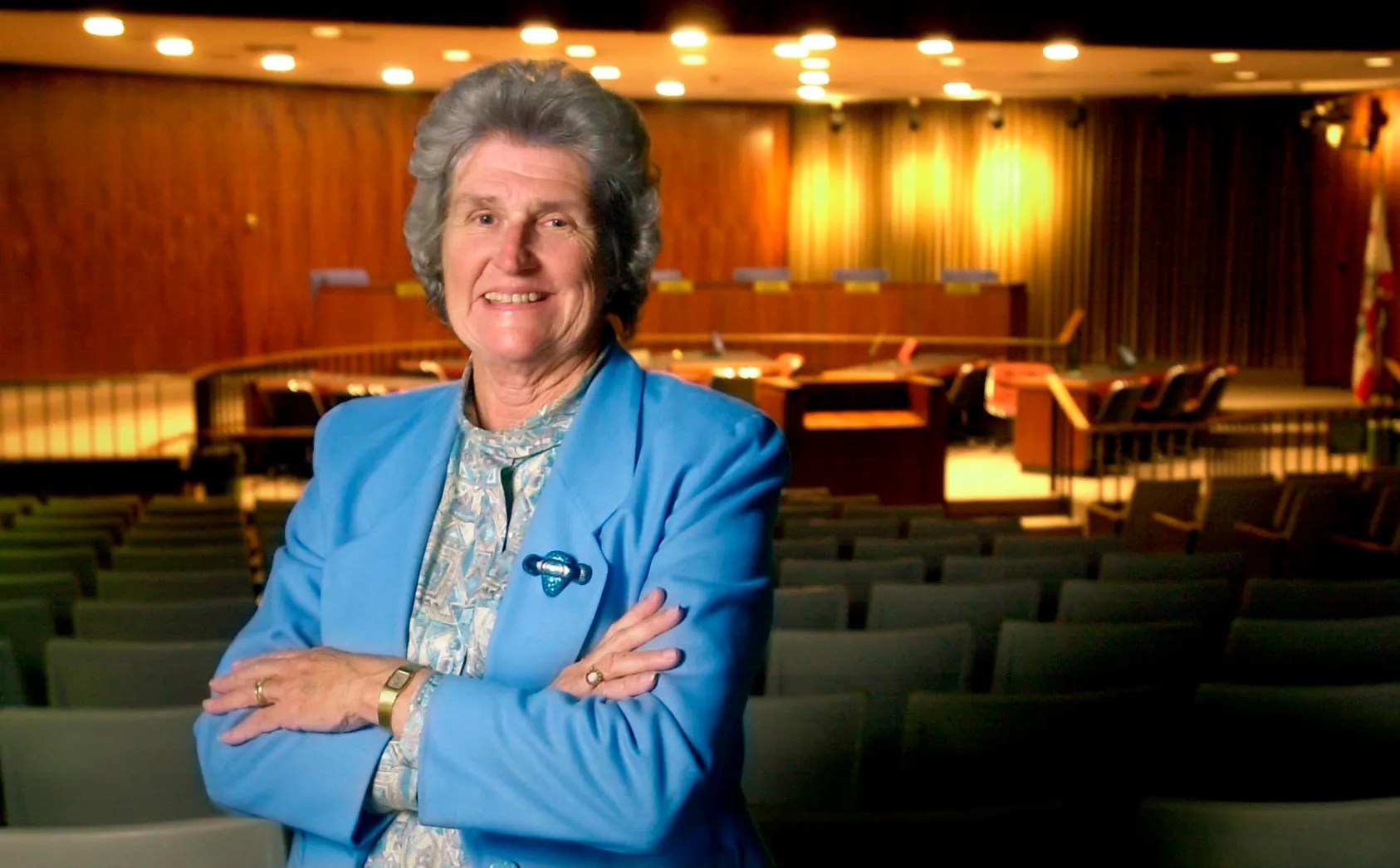
Dee Hardison, shown here in the Torrance City Council chamber, served as the city’s mayor from 1994-2002. Undated. (Credit: Daily Breeze staff file photo)

Dee Hardison became only the second woman to become mayor of Torrance when she won the office in 1994. She directly followed the city’s first female mayor, Katy Geissert, who served two terms from 1986 to 1994.

But Hardison achieved a whole lot more before and after her two productive terms as mayor.

She was born Delores June Grinton in Bellingham, Washington, on Jan. 22, 1938. She graduated from Western Washington University in Bellingham in 1960, and married Boeing employee Lowell Hardison following graduation.

She taught at Lincoln High School in Seattle for a time, then moved to Reno, Nevada with Lowell before settling in Torrance in 1967. At the time, the couple had two young children, Mark and Brad. The Hardisons were attracted to the city by the good reputation of its schools.

Hardison was pleased to hear that the city was planning to build a park near their home on 236th St. in southeast Torrance. The Kettler Knolls area had tons of postwar tract homes at the time, but not much in the way of green space for children to play in. 

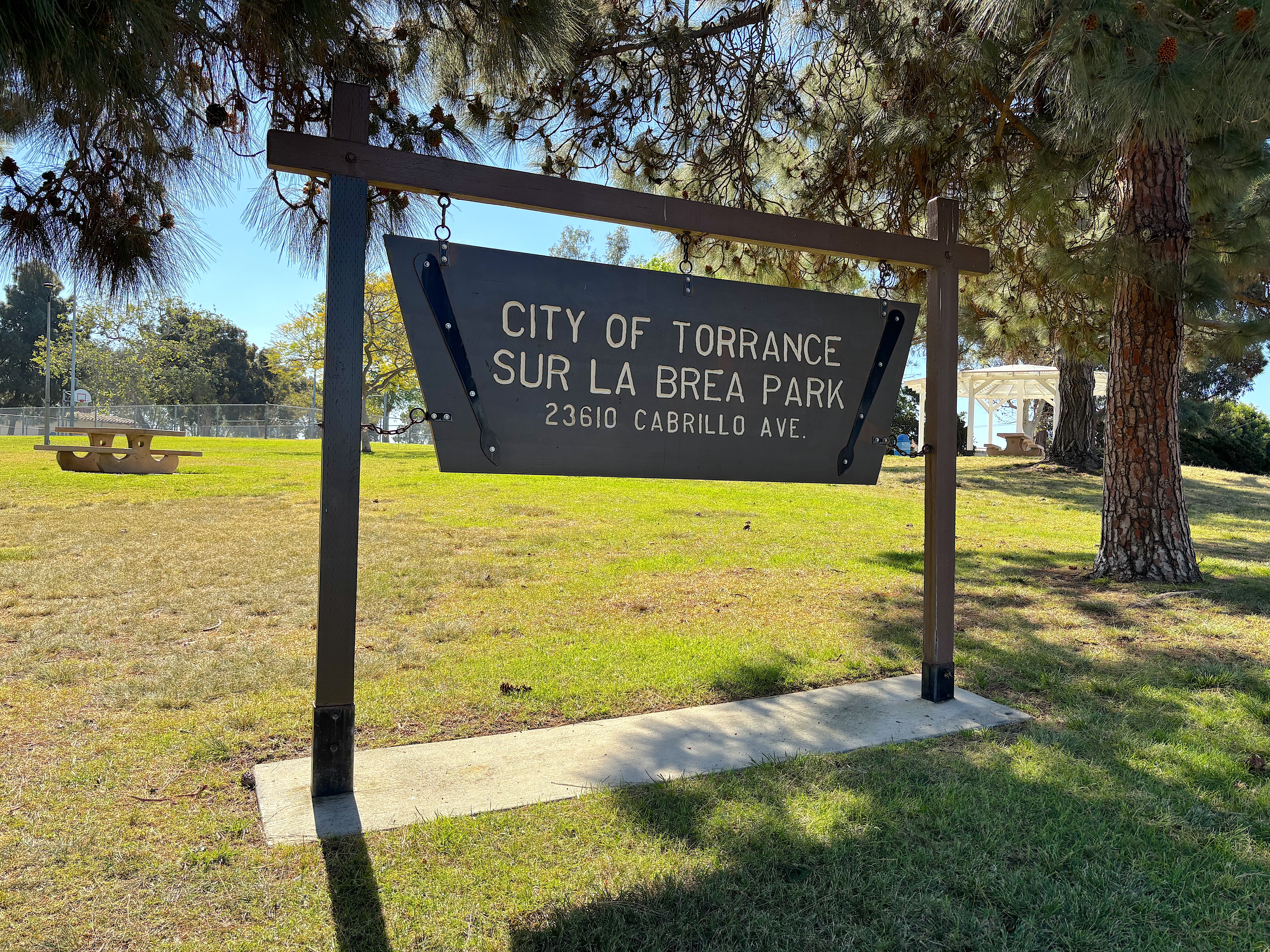
Sur La Brea Park in southeast Torrance. March 19, 2026. (Photo by Sam Gnerre)

But as time went on and no park appeared, the park seemed like more of a rumor than a done deal. The City of Torrance had begun planning the facility, which it eventually gave the name Sur La Brea Park, in the 1950s, but finding a place to put it took some time.

Lack of funds kept the city from acquiring any of the parcels it had been considering, and by the mid-1960s, those had been snapped up by developers. In 1965, all that was left were sites being worked by oil drilling firms that were unlikely to be used for housing.

The city put together two such parcels on Cabrillo Ave. between 236th and 237th streets. As an active member of the Southeast Torrance Homeowners’ Association, Hardison began actively prodding the city to get the 7.5-acre park built.

Construction began in 1973, and the park’s first dedication came in 1974. But the park was only partially completed. Sur La Brea Park finally opened completely in 1984.

Hardison’s successful activism on the park project led to her being asked to serve on Torrance’s Parks and Recreation and Planning commissions during the next ten years, all while she continued to teach physical education and special education for the Torrance Unified School District.

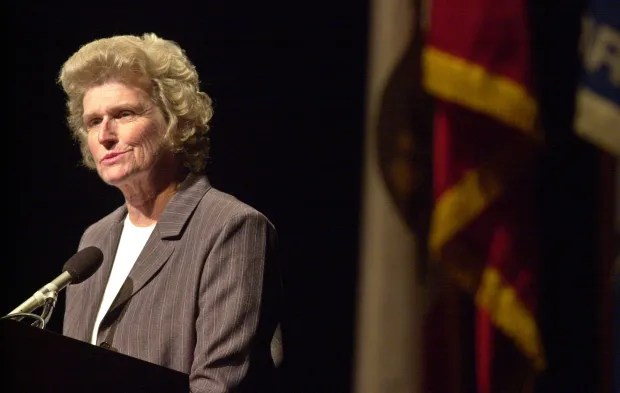
Torrance Mayor Dee Hardison eulogizes former Mayor James Armstrong during a service for the late city leader at the James R. Armstrong Theatre on Feb. 2, 2001. (Credit: Daily Breeze staff file photo by Scott Varley)

In 1986, she decided to parlay her experience by running for a seat on the Torrance City Council. She surprised longtime election observers by receiving the most votes of any of the candidates. This happened in the same year that Geissert became the city’s first female mayor.

After serving on the City Council for eight years, Hardison decided to run for mayor in 1994. Geissert termed out of office that year, having served her two terms.

The mayor’s race was a close one, with Hardison edging fellow council member Bill Applegate in the election on March 8, 1994. Applegate outspent Hardison, $37,000 to $27,682, with most of their money being spent on political mailers.

Mayor Hardison’s next eight years were busy and productive. Among her achievements were the creation of the Madrona Marsh Nature Preserve and the opening of the Nature Center there, a major expansion of the Torrance Civic Center Library (renamed for Katy Geissert in 1996), the building of the Torrance Veterans Memorial and the redevelopment of Old Torrance.

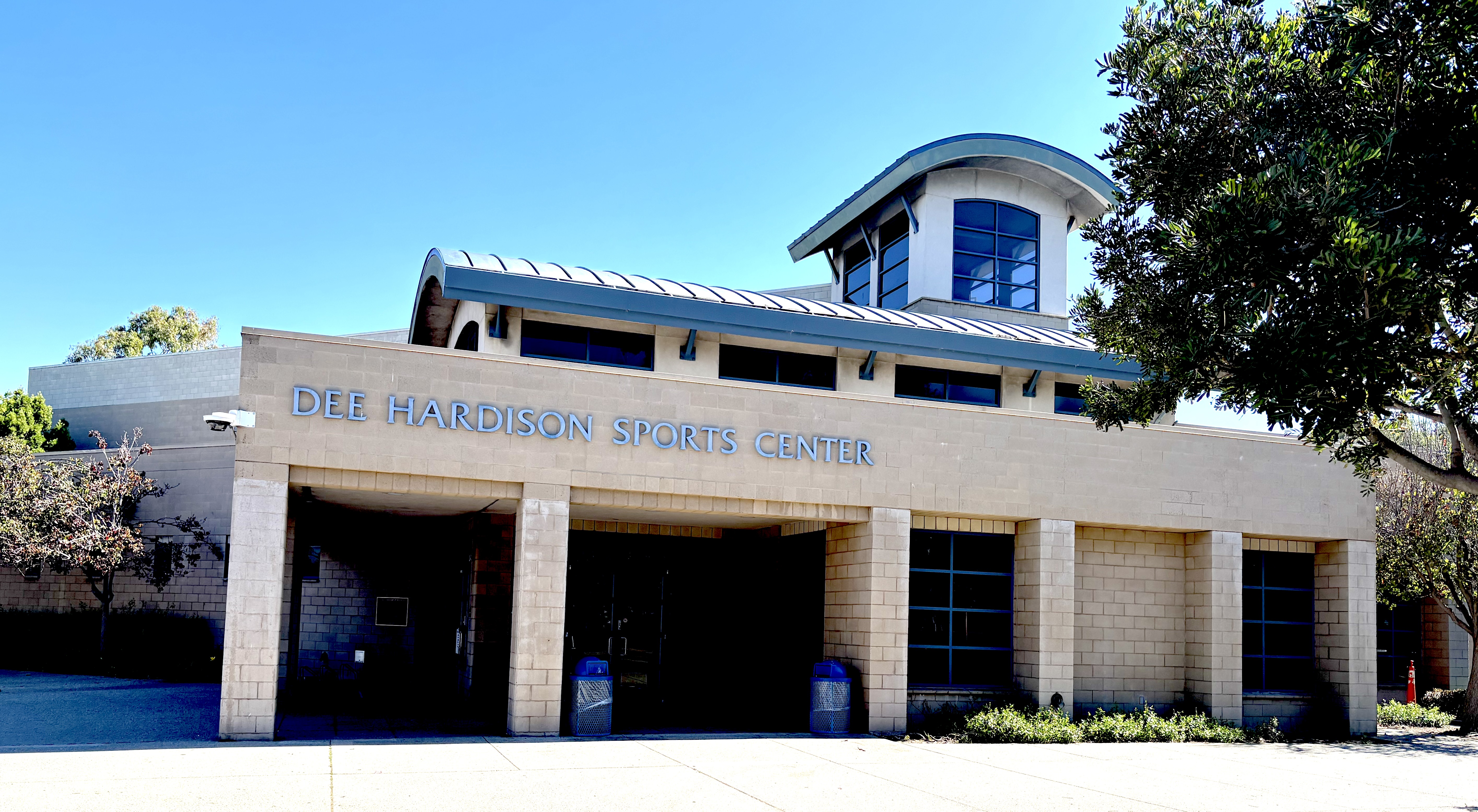
She also advocated for the establishment of the sports center in Wilson Park. It opened in 2000, and was renamed the Dee Hardison Sports Center in 2009 in her honor.

The Dee Hardison Sports Center at Wilson Park in Torrance. March 20, 2026. (Photo by Sam Gnerre)

She also found time to meet with her constituents. Here’s what she told the Daily Breeze she did following the Sept. 11, 2001, terrorist attack on the World Trade Center in New York City:

“I went over to the (Del Amo Fashion Center) for some reason . . . that day at the mall, I found that people wanted to talk.They wanted to know are we OK, are we safe? I spent the next couple of days just going to the mall.”

She continued her volunteer work on multiple fronts after leaving office in 2002. She served on the boards of the Torrance Cultural Arts Center Foundation, the Torrance Education Foundation, the Pediatric Therapy Network, Torrance League of Women Voters, the Torrance Blue Ribbon Committee on Ethics and the Torrance Performing Arts Consortium.

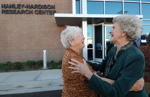
Former Torrance Mayor Dee Hardison, right, hugs friend Jacque Whited following the ceremony that dedicated LA BioMed’s Hanley-Hardison Research Center, at the Harbor-UCLA Medical Center campus. The facility honors longtime board members Joan Hanley and Hardison. Sept. 25, 2008. (Credit: Daily Breeze staff file photo by Scott Varley)

She also led the successful community outreach effort to keep Harbor-UCLA Medical Center open, and became an advocate for its prestigious research institute, LA BioMed. She even spent more than three decades working as a volunteer on the annual Torrance floats in the Tournament of Roses parade.

Her community awards and honors are too numerous to list, but include the city’s Jared Sydney Torrance Award and the Torrance YMCA Woman of the Year award.

On Aug. 24, 2017, Hardison suffered a stroke from which she never recovered. She died at 79 on Sept. 30, 2017.

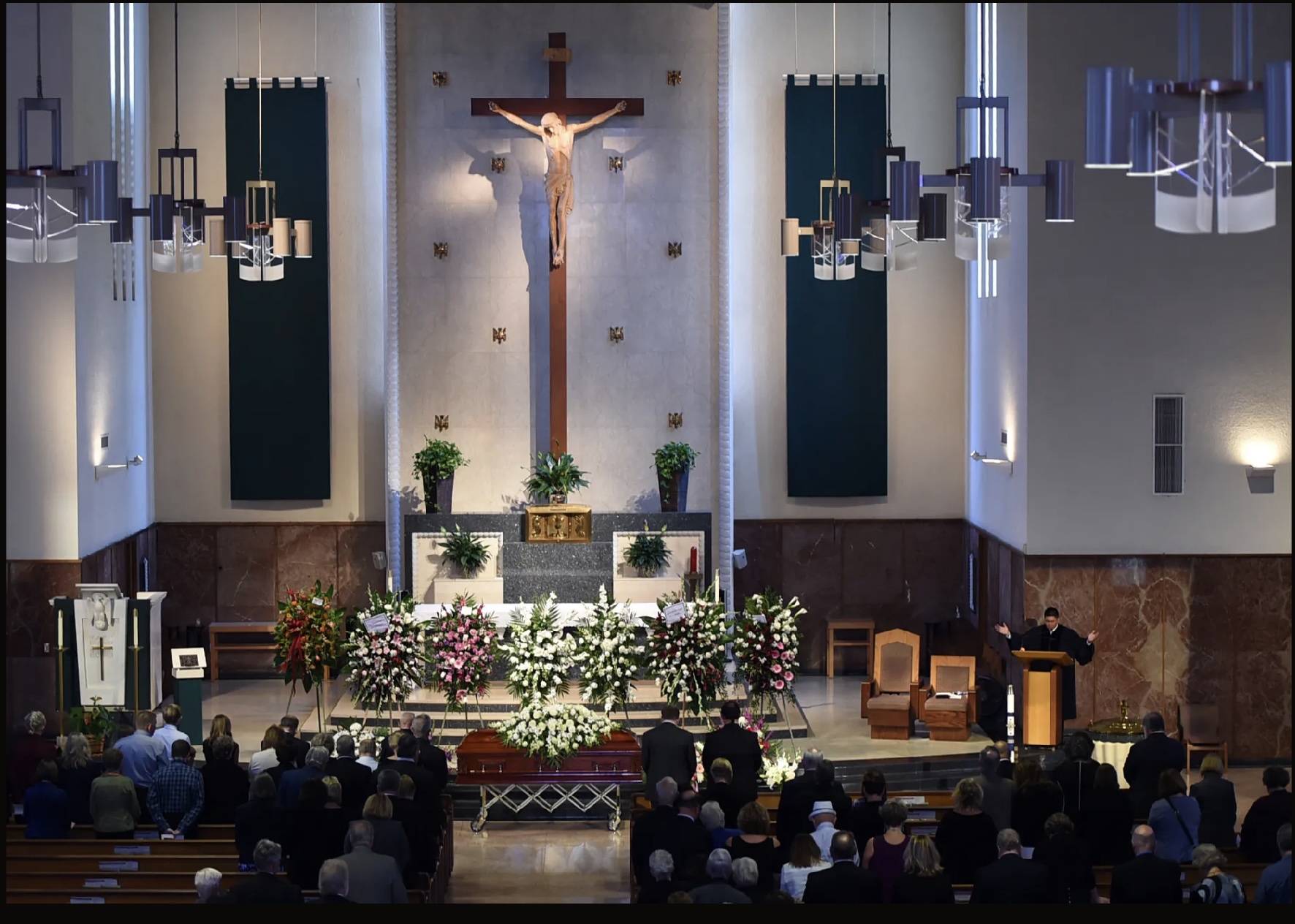
Her funeral service two weeks later had to be moved from her home church, St. Mark’s Presbyterian Church in Lomita, to St. James Catholic Church in Redondo Beach in order to accommodate all who wanted to pay tribute to her.

Rev. Billy Song speaks at the funeral service for Dee Hardison at St. James Catholic Church in Redondo Beach on Oct. 13, 2017. (Credit: Daily Breeze staff photo by Brittany Murray)

Sources:

City of Torrance website.

Daily Breeze archives.

Find A Grave website.

“Honoring the Life of Former Torrance Mayor Delores “Dee” Hardison,” by Rep. Ted Lieu, Congressional Record, Oct. 4, 2017.

The search for solutions to the perilous Los Angeles smog attacks of the 1940s and 1950s

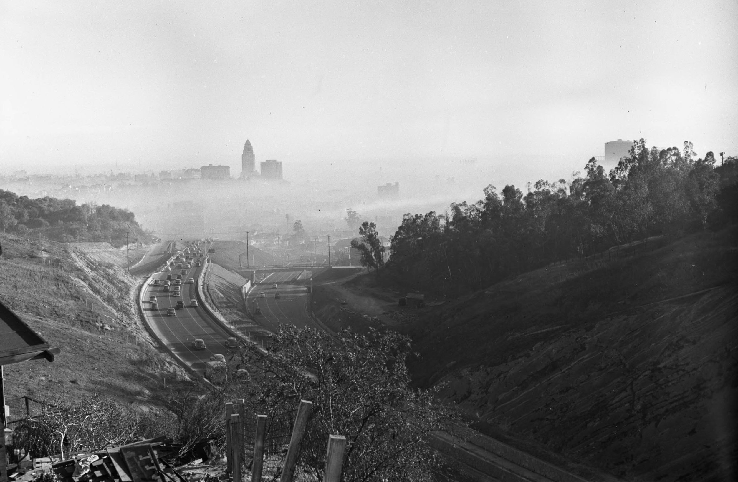
Looking down from the hills above the Arroyo Seco Parkway at Los Angeles City Hall and Civic Center buildings surrounded by smog on Jan. 13, 1948. (Credit: UCLA Library, Dept. of Special Collections)

It’s fair to say that the descent of suffocating grey clouds into the Los Angeles basin on the blazing hot day of July 26, 1943, caused unhappy sensations in the ever-growing metropolis beyond the burning eyes and painful breathing.

Denizens of the downtown area didn’t know who to blame for the new plague. Was it some nefarious new chemical weaponry being unleashed by our wartime foes? The buildup of toxic fumes from industrial plants? Sulfur fumes belching from outlying oil refineries such as Chevron’s in El Segundo and General Petroleum (later known as the Mobil Refinery) in Torrance?

All of these and several other possibilities would be investigated after the toxic clouds that came to be known as “smog,” a combination of smoke and fog, began to recur with increasing frequency and severity following the end of World War II.

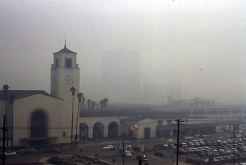
Looking southeast across Alameda Street towards Union Station on a smoggy day in September 1955. 
(Credit: Los Angeles Public Library Photo Collection)

Confusion over its source dogged early efforts to combat the sieges of bad air. Two months after the 1943 incident, city officials shuttered a Southern California Gas Co. plant just east of downtown that they were convinced was the sole source of the problem. It wasn’t.

If only solving the smog plague were that simple. Los Angeles County realized that a wider and more organized approach was needed to get a handle on the recurrent problem. In 1947, it formed the Air Pollution Control District (APCD), the precursor of the present-day Air Quality Management District (AQMD), to work on the county-wide problem.

The harder scientists and experts worked to understand and find some kind of remedy for the smog attacks, the more prevalent they seemed to become during the 1950s.

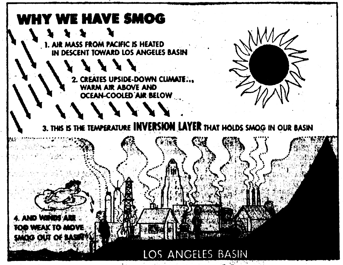
Torrance Herald graphic, July 11, 1957, Page 18. (Credit: Torrance Historical Newspaper and Directories Archive database, Torrance Public Library)

Despite glowing real estate ads in the Daily Breeze, Torrance Herald and other local papers declaring that properties for sale were located in “smog-free Torrance,” the South Bay and Harbor Area were not immune.

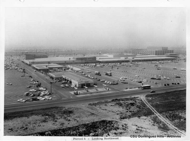
Severe smog conditions during the 1950s often caused flights coming into Los Angeles International Airport to be delayed or rerouted because pilots had difficulty seeing the runways through the smoky haze. 

View of Del Amo Shopping Center looking northwest shows heavy smog in the background. Circa 1962.(Credit: CSUDH Digital Archives)

Inversion layers that exacerbated smog alerts by trapping the airborne pollutants often blanketed the coastal areas. Though sea breezes helped somewhat, concentrations of pollutants still reached dangerous levels throughout the Los Angeles basin.

Downtown Los Angeles conditions were worse due to its surrounding geography, with hills and mountains trapping the smog into a smaller area and increasing its potency. 

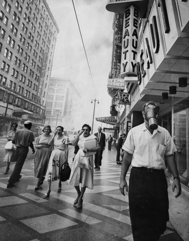
Unidentified man defies convention and eye-searing pollutants as he strolls down Broadway wearing a gas mask, as Los Angeles battles another smog attack on Sept. 19,1958. Women at left use handkerchiefs to wipe away tears. (Credit: Los Angeles Public Library Photo Collection)

Severe attacks occurred in 1949, 1951 and 1954, with the worst smog attack in the area’s history occurring on Sept. 13, 1955. Helped by intense heat and a particularly strong inversion layer, the ozone levels reached a record of .85 parts per million making that day still the smoggiest in L.A. history.

The 1949 smog episode alarmed the agriculture industry when it was determined that its pollutants completely killed a field of romaine lettuce and damaged other crops in the San Gabriel Valley in just 36 hours.

Everyone had a theory as to the cause of the air pollution plague, and more than one of them was right. A number of factors contributed. We’ve already mentioned the geography of the L.A. basin, rimmed by mountains and hills that trapped pollutants, especially when a combination of heat and the low clouds of an inversion layer were present.

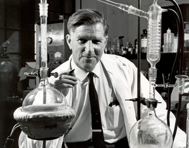
Caltech biochemist Arie Haagen-Smit, May 1961. (Credit: California Institute of Technology archives)

Aarie Haagen-Smit, a Dutch biochemist working at Caltech in the late 1940s, has been credited with proving that the sun reacting with automobile exhaust and industrial pollutants led to the formation of ozone. He spent years trying to convince pollution officials that the ozone was the main component of smog, which reached its highest levels on hot sunny days.

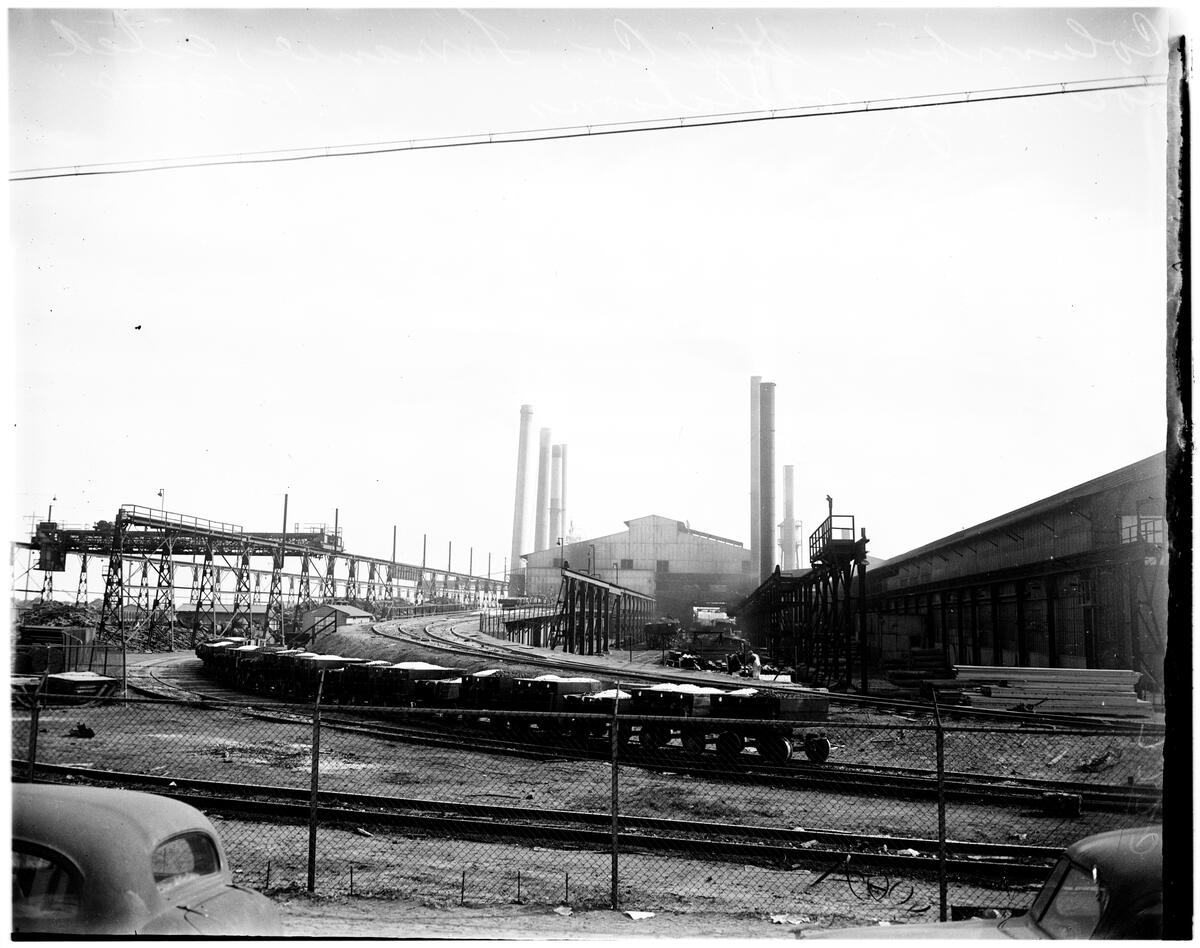
The airborne pollutants from a variety of industrial plants – refineries, steel manufacturers and the like – had very few restrictions on what they pumped into the air at that time. The APCD faced stiff opposition when it attempted to regulate the likes of Columbia Steel in Torrance, which eventually installed smoke abatement devices at the plant in 1949 after being cited.

Columbia Steel Co. at Torrance in 1948. The plant was cited for smog violations on Jan. 28, 1948. (Credit: USC Digital Library)

The postwar population boom also added to the problem. At the same time as the area’s suburbs grew exponentially, the city and county began phasing out its Red Cars and other commuter rail systems in favor of gas-powered cars and buses.

A residential incinerator burns trash in Los Angeles on July 1, 1957. All refuse burning in Los Angeles  ended on Oct. 1, 1957, when the Air Pollution Control District’s ban on incinerators went into effect. (Credit: Los Angeles Public Library Photo Collection)

Besides its growing reliance on the automobile, another practice in the greater Los Angeles area that contributed to the problem was the unchecked use of backyard incinerators for burning household, garden and backyard waste.

As a result, Los Angeles began to get its not-undeserved reputation as the nation’s smog capital. The barrage of negative publicity from the 1950s episodes helped to light the fire for more regulation.

Over the years, restrictions on industry, a ban on the use of backyard incinerators and improvements in automobile emissions technology slowly began to emerge. Air pollution continued to be a major environmental problem during the 1960s and 1970s, but the life-threatening episodes of the 1940s and 1950s have become less commonplace.

The Los Angeles area still frequently tops the American Lung Association’s annual list of metro regions with the most unhealthy air quality in the United States, as it did in 2025. But overall pollution levels have been significantly reduced. The last third-stage smog alert in the county occurred in 1974.

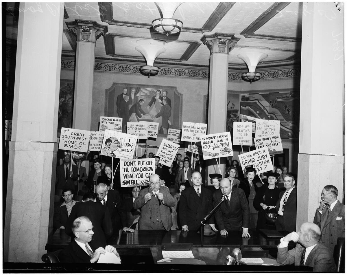
Smog protesters at the Feb 17, 1947, meeting of the Los Angeles County Board of Supervisors 17 February 1947. (Credit: USC Digital Library)

Sources:

Daily Breeze archives.

Los Angeles Times archives.

San Pedro News Pilot archives.

Torrance Press Herald archives.

Smogtown: The Lung-Burning History of Pollution in Los Angeles, by Chip Jacobs & William J. Kelly, The Overlook Press, 2008.

South Coast Air Quality Management District website.

Note: Thanks to Barbara Natanson for the story suggestion.

Torrance Herald ad, Feb. 26, 1959, Page 20. (Credit: Torrance Historical Newspaper and Directories Archive database, Torrance Public Library)

Is this your new site? Log in to activate admin features and dismiss this message
Log In