Zodys discount department stores set up shop early in Redondo Beach

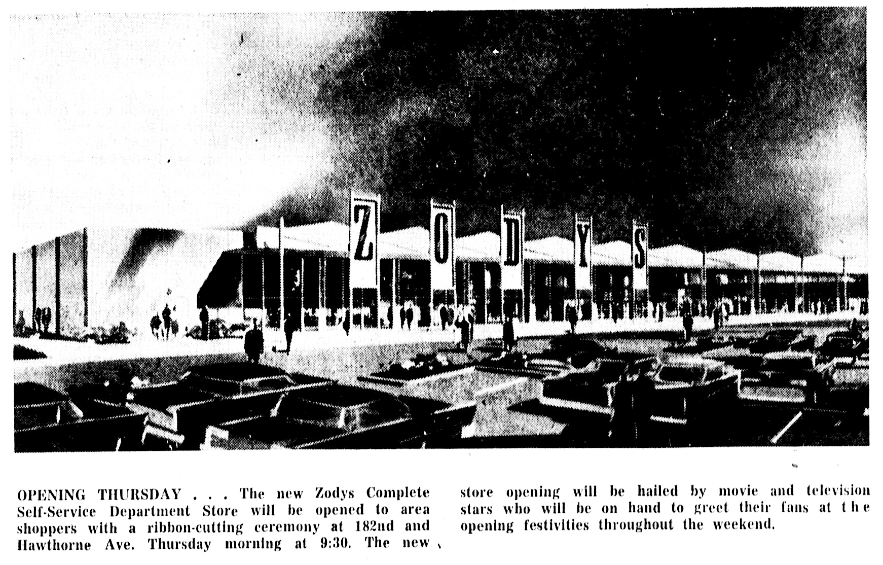
Torrance Herald, Oct. 30, 1960, Page 1. Artist’s rendition. (Credit: Torrance Historical Newspaper and Directories Archive database, Torrance Public Library)

The first South Bay History blog post I ever wrote way back in 2009 had as its subject the discount chain White Front, which opened a branch in Torrance in 1963.

But Zodys discount department store actually came to the South Bay first, opening in Redondo Beach in 1960. Younger readers are forgiven for not knowing about either chain, as both were out of business by 1986.

Zodys was an ambitious project launched in an attempt to take advantage of the suburban population explosion in the Los Angeles area during the 1950s. 
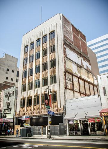
The former Hartfield’s flagship store in downtown Los Angeles in 2015. (Photo courtesy King’s Arch, from the Los Angeles Downtown News website)

Hartfield’s, a women’s clothing store in downtown Los Angeles, dreamed up the idea of a lower-cost, wider-ranging store during the 1950s, as its own stores began increasing in number and profitability.

Hartfield’s had been in its flagship location on Broadway since the early 1930s, and by 1943, had opened branches in Inglewood, San Pedro and Huntington Park. With the proliferation of suburban shopping centers in the postwar era, the fashionable Hartfield’s stores became more widely known.

In the late 1950s, Hartfield Stores began acquiring land for its ambitious plans to open a chain of huge stores that would sell not just clothes, but a wide variety of other goods at discounted prices. The chain was named Zodys, no apostrophe, after Zody Hartfield, daughter of the parent company’s owner, Leo Hartfield.

The very first Zodys opened with great fanfare on the southwest corner of Brookhurst and Chapman in Garden Grove on June 13, 1960. It was an immediate success, and plans moved ahead for the company’s second Zodys, this one to be built in Redondo Beach.

The Redondo site was just adjacent to the South Bay Shopping Center outdoor mall at 182nd St. and Hawthorne Blvd., just a couple of miles up Hawthorne from White Front. (The South Bay Shopping Center eventually evolved into the present-day South Bay Galleria indoor mall.)
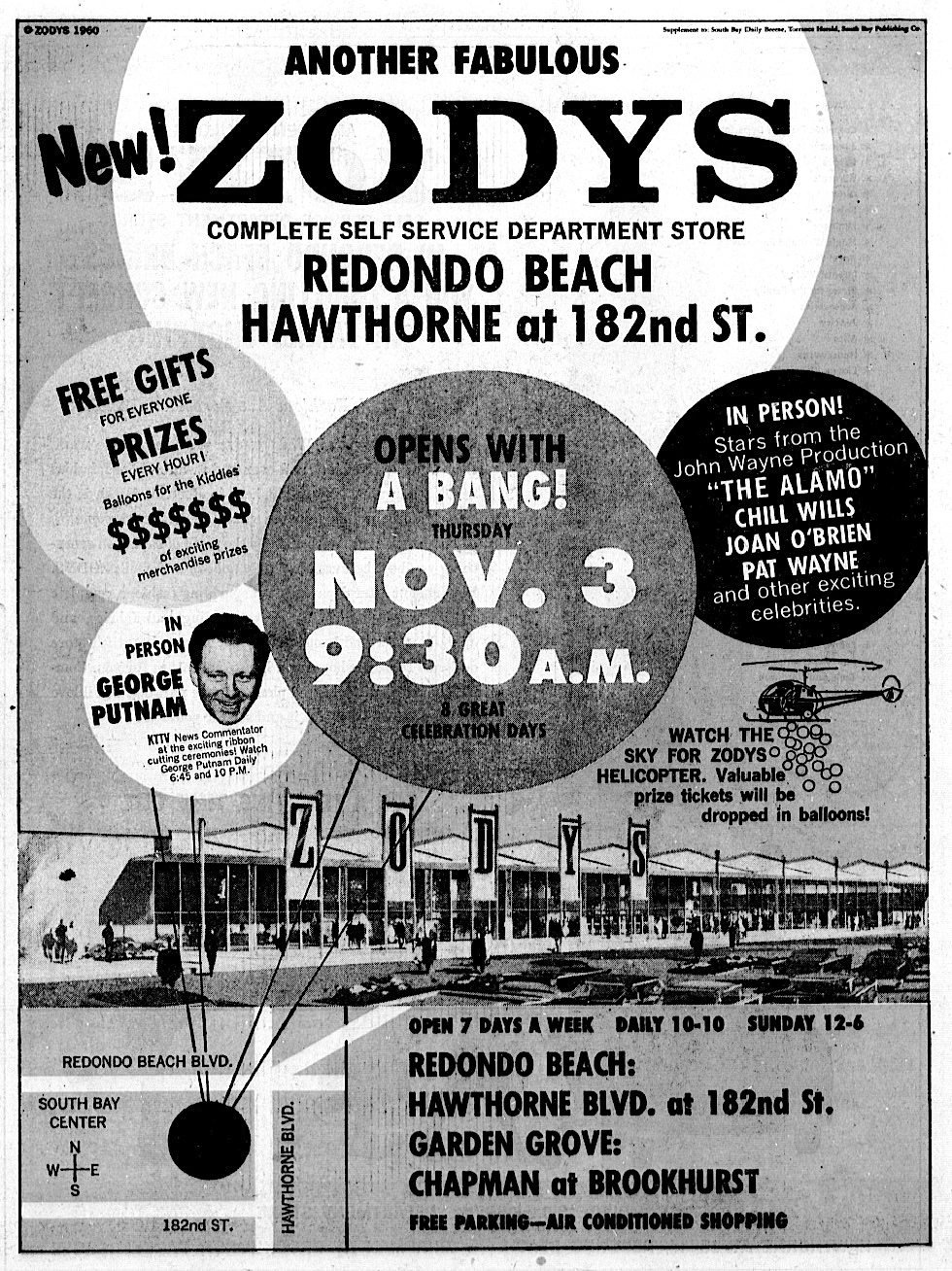
Torrance Herald, Nov. 3, 1960. (Credit: Torrance Historical Newspaper and Directories Archive database, Torrance Public Library)

The company went all out for the new store, staging a week-long grand opening celebration. Thousands of shoppers flooded the 74,000-square-foot store boasting dozens of different merchandise departments. 

No special membership was necessary to shop there, and the company also promoted the self-service nature of the operation and its huge parking lot built to accommodate hundreds of cars.

The store officially opened with a ribbon-cutting ceremony at 9:30 a.m. on Nov. 3, 1960. Among the celebrities present were Chill Wills and Joan O’Brien,two stars from the 1960 movie hit “The Alamo,” and KTTV television news personality George Putnam.
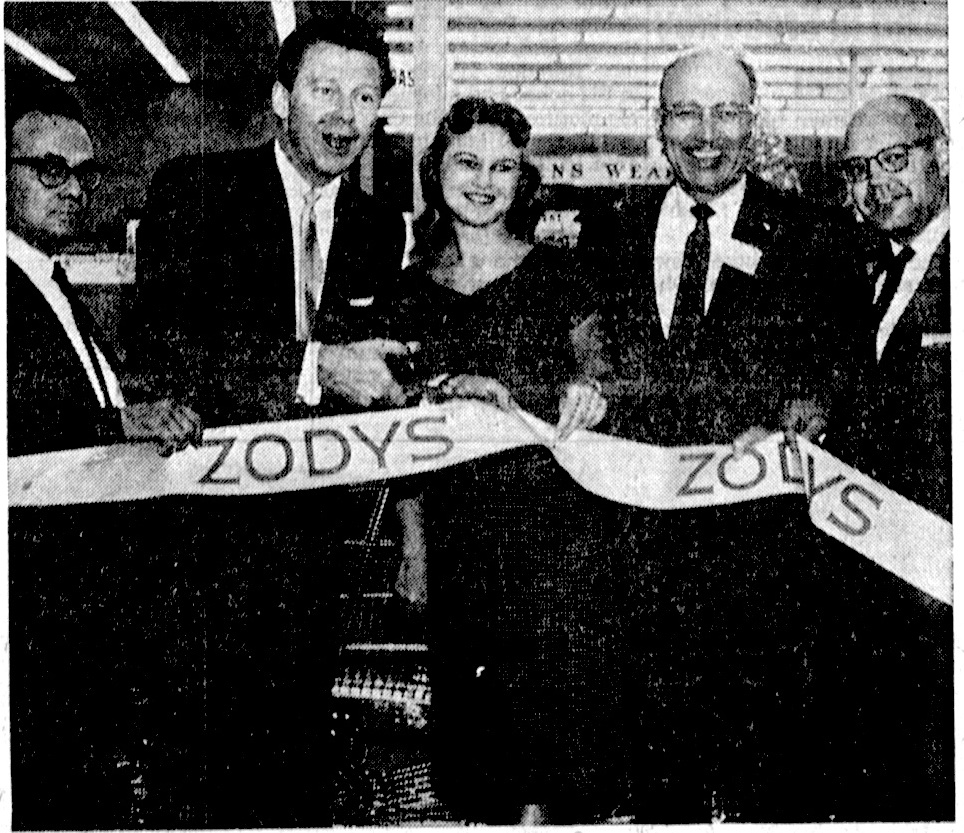
George Putnam, second from left, prepares to cut the ribbon as, from left, store manager Isidore Brown, former Miss Torrance Betty Baker, Torrance Mayor Albert Isen and Redondo Beach Chamber of Commerce manager Edward E. Just look on. Torrance Press, Nov. 6, 1960, Page A-3. (Credit: Torrance Historical Newspaper and Directories Archive database, Torrance Public Library)

More local celebrities would appear at the grand opening of the third Zodys in the Los Altos section of Long Beach, at Spring St. and the Los Coyotes Diagonal in Long Beach, in August 1961. Its Northridge store soon followed, opening that October.

In 1962, the parent company renamed itself Hartfield-Zodys. By the end of the 1960s, its Zodys division had opened 19 locations in Southern California, with plans to open at least 15 more.

Ground was broken in Feb. 1970 for the 21st Zodys store, this one located at 851 W. Sepulveda Blvd. on the northeast corner of the Sepulveda-Vermont Ave. intersection near the 110 Freeway. Though technically situated on unincorporated Los Angeles County land, it became known as the Torrance Zodys.

The $12 million facility was larger than most Zody’s, with 105,000 square feet. Designed by architect Daniel Dworsky and built by contractor Ralph Evans, It opened on June 21, 1970.
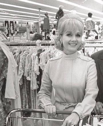
Movie star Debbie Reynolds shops at a Zodys store (location unidentified) in 1968. (Credit: Vintage Los Angeles Facebook page)

Zodys moved beyond Southern California for the first time with its acquisition of Yankee Stores in Flint, Michigan, in March 1972. After the purchase, it transformed them into Zodys stores. But the 1973 recession hit the chain hard and its 25 stores in Michigan and Indiana shut down in 1975. This caused Hartfield-Zodys management to file for Chapter 11 bankruptcy.

It would emerge from Chapter 11 in 1976, and even open some new out-of-state locations in Arizona and Nevada. But the recovery wouldn’t last long. The stores continued to struggle. Hartfield-Zodys, renamed HRT Industries in 1982, tried to stop the downward spiral.

But fierce competition from larger outfits such as Target and the country’s weakened economy led to the company filing for bankruptcy a second time in November 1982. This time, it would not survive. Zodys stores began closing in 1984.

Finally, in February 1986, HRT informed employees that all 32 remaining Zodys stores would be closed for good.

15 of the locations, including those in Redondo Beach and Torrance, were sold to Federated Stores, the parent company of the Ralphs supermarket chain. Ralphs transformed some of them into its new and soon-to-be short lived Ralphs Giant stores format.

The Torrance location at Sepulveda and Vermont became a Ralphs Giant, then operated as a regular Ralphs for a time before becoming Food 4 Less, which it remains today. The Redondo Beach location became and remains a Ralphs supermarket.
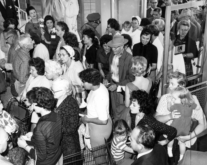
Shoppers pour in the front doors at the grand opening of the Zodys store in Northridge on Oct. 28, 1961.
(Credit: Los Angeles Public Library Photo Collection)

Sources:

Daily Breeze archives.

Los Angeles Times archives.

Torrance Press Herald archives.

“Hartfield-Zodys,” Wikipedia.

“Six Southern California Things We Will Never See Again,” The Southern Californian blog, Oct. 6, 2015.

“Zodys,” Groceteria website.

“Zodys,” Mall Hall of Fame website.
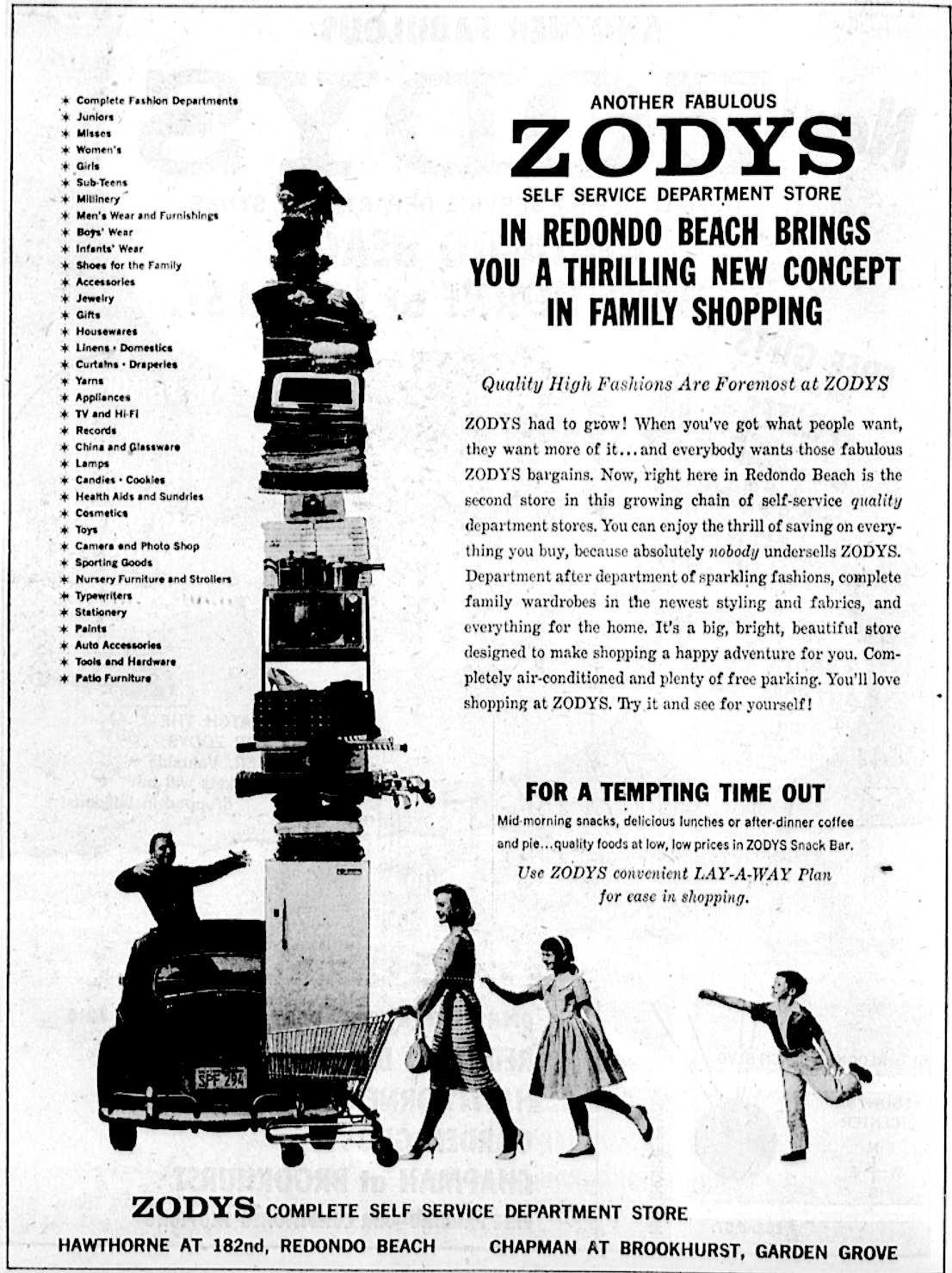
Torrance Herald, Nov. 3, 1960. (Credit: Torrance Historical Newspaper and Directories Archive database, Torrance Public Library)

Until 2023, a 1939 deluge was the last tropical storm to hit Southern California

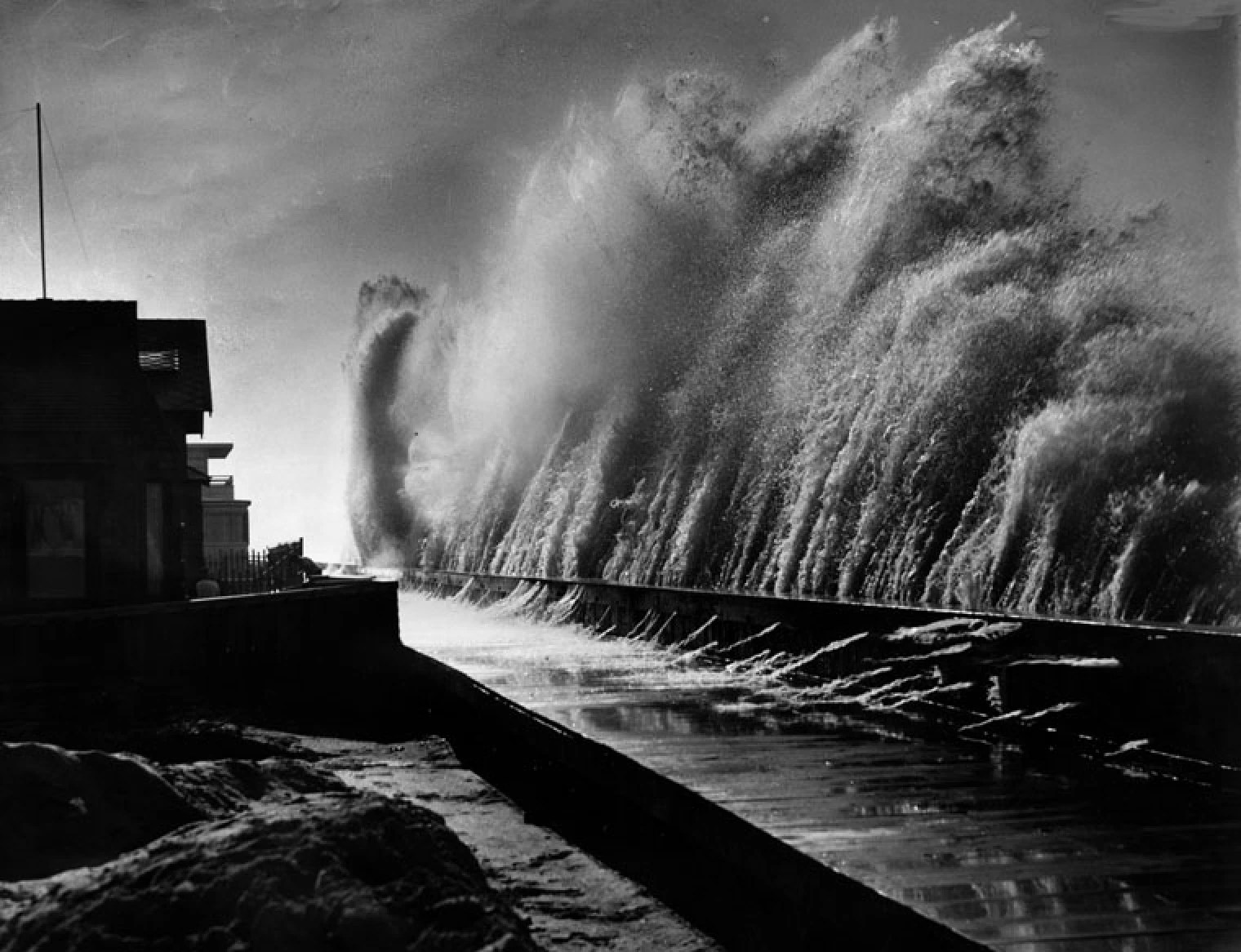
High waves hammer the sea wall in the 6000 block of E. Ocean Boulevard along the coast in Long Beach’s Belmont Shores area during a 1939 tropical storm. (Credit: Los Angeles Public Library Photo Collection)

The arrival of a full-on tropical storm in Southern California earlier this week marked the first such meteorological occurrence in the area in 84 years, so a look back at that 1939 storm seems fitting.

September 1939 was by all accounts a wild weather month in the southern part of the state. It began  with storms that wreaked havoc in the Imperial Valley, causing flooding that swamped farmlands and disrupted rail and auto traffic.

Next came a blistering heat wave in the middle of the month, with temperatures soaring well above 100 degrees beginning on Sept. 15 and lasting for the next ten days. Los Angeles reported a high of 106 degrees on Sept. 20, with Torrance and Harbor City reporting 104.

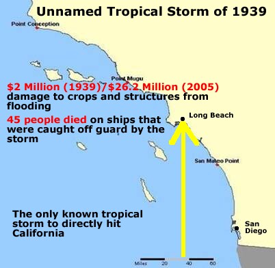
The 1939 tropical storm made landfall in Long Beach. (Credit: Wikipedia)

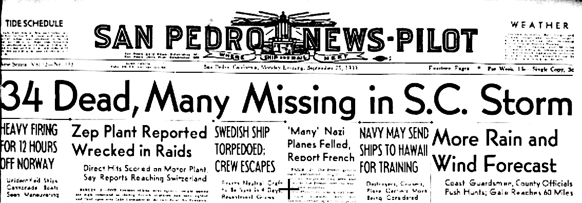
The arrival of a major storm on Sept. 25 at first was met with sighs of relief for causing the dissipation of the heat wave, which had caused approximately 90 deaths in the Los Angeles area.

In those days, weather forecasting was not as sophisticated as it has since become, so the magnitude of the upcoming event had not been impressed fully on area residents, many of whom failed to take the precautions they should have.

The storm came up from the south along the Baja California coast in Mexico and made landfall at the Long Beach coast in the early morning hours of Sept. 25. It brought high winds with it, topping out at 72 mph, along with heavy rain. 

The city of Los Angeles received 5.66 inches of rain. Torrance reported 5.48 inches, and Narbonne High School, 4.79 inches, with the Palos Verdes Peninsula recording 5.74 inches. Hard-hit areas like San Pedro and Long Beach didn’t report official rain totals immediately, probably because their gauges were knocked out by the high winds.

Officially, 93 people in the Los Angeles area lost their lives as a result of the storm, 48 on land and 45 at sea. 24 of the deaths at sea occurred when the ocean fishing boat Spray capsized in the ocean off Point Mugu, about eight miles south of Oxnard.

Another fishing boat, the 34-foot Nina, met the same fate nearby. The two people on board died, but the bodies of Noble Metzger and John Seaman of San Pedro would not be recovered until October 18.

The U.S. Coast Guard reported that as many as 34 boats were missing on the day after the storm hit, though all eventually were accounted for.

The high number of boats lost underscores the power of the storm’s high winds when it first hit land. The winds soon dissipated over land, but not before doing significant damage, especially to the south-facing beaches and harbors of Los Angeles and eastern Orange County.

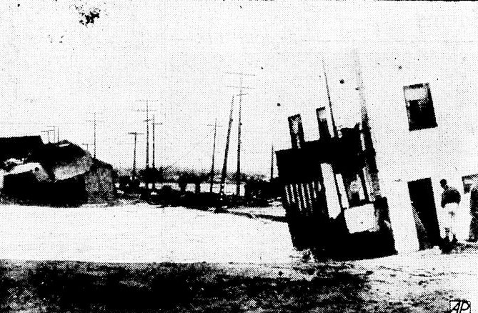
The open space between the house at right and the ones at left was once occupied by Belmont Shores homes washed into the sea in Long Beach by the 1939 tropical storm. San Pedro News Pilot, Sept. 26, 1939, Page 1. (Credit: San Pedro News Pilot archives)

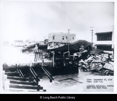
The most significant personal property damage occurred in Long Beach, where at least ten shorefront houses were swept into the sea and 30 more were damaged on the Alamitos Peninsula area of Belmont Shore.

To the west in San Pedro, the infrastructure damage was greater, as there were fewer homes situated directly on the coastline there. The port area took a heavy hit, however, and shipping activities came to a standstill. Power outages occurred in the port, all over the Harbor Area and on the Palos Verdes Peninsula, 

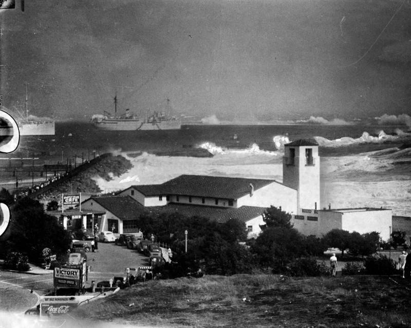
The damage was considerable. Pounding waves during high tides destroyed the boardwalk at Cabrillo Beach, and water inundated the bathhouse and the Cabrillo Marine Museum there.

After the storm subsided, it was determined that approximately one third of the beach’s sand had been washed away by high surf. City crews eventually needed to add 10,000 yards of sand to the outer beach to stave off further damage from high tides and surf.

Five yachts foundered at the California Yacht Club in Wilmington, though many more were saved. An early estimate put damage to the boats there at $100,000.

Powerful swells lash the breakwater near the Cabrillo Beach bathhouse in San Pedro, sending tons of water over the rocks. Naval vessels are seen sheltered in the bay. (Credit: Los Angeles Public Library Photo Collection)

The fence on the east side of the federal prison on Terminal Island was knocked down by large breakers, which also took out a portion of the road leading to the mainland. The warden quickly enlisted prisoners to help repair the damage to the fence.

Engineers estimated that 5,000 feet of the recently built harbor breakwater had been affected  by huge storm-driven wave surges, with 2,000 feet of it suffering very serious damage. Boulders weighing up to twelve tons had been knocked off the top of the breakwater, one section of which had been shifted a full four feet out of alignment by the storm.

The violent storm subsided quickly, but left a significant trail of devastation and wreckage. Damage estimates for the greater Los Angeles area reached $2 million, or almost $44 million when adjusted for inflation in 2023.

Among the weather records broken in September 1939 were those for the longest sustained heat wave, and for the most rain in the month of September, all of which fell in the 24-hour period after the tropical storm hit land. The storm’s 5.66 inches shattered the previous high total for rain in September set in 1919, when 1.29 inches fell in Los Angeles.

San Pedro News Pilot, Sept. 25, 1939, Page 1. (Credit: San Pedro News Pilot archives)

Sources:

“Has a Hurricane Ever Made Landfall in California?” by Nathan Masters, KCET website, Oct. 15, 2016.

Los Angeles Times archives.

Palos Verdes Peninsula News archives.

San Pedro News Pilot archives.

Torrance Press-Herald archives.

Wikipedia.

Damage to houses and wharf on the Alamitos Peninsula in Long Beach from the 1939 tropical storm. Looking west from 54th Place. Photo taken at 3:30 P.M. on September 25, 1939.
(Credit: Long Beach Public Library Digital Archives)

Finding out sometimes surprising truths about South Bay/Harbor Area street names

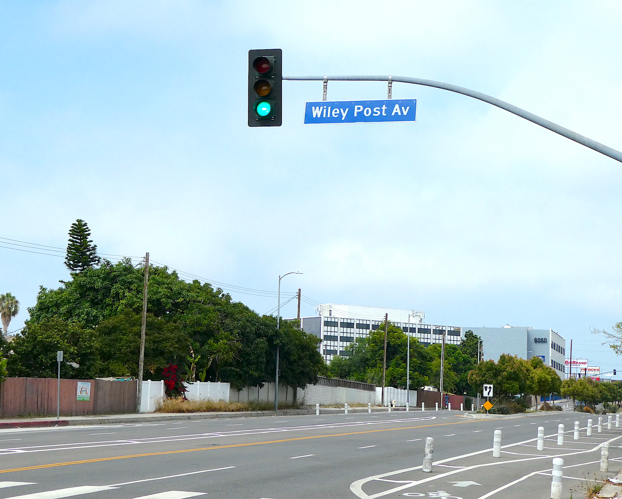
Wiley Post Ave. intersects with Manchester Blvd. in Westchester, above, looking west. (August 2023 photo by Sam Gnerre)

If you’ve ever driven through Westchester and wondered for whom Wiley Post Ave. was named, this column explaining a few South Bay/Harbor Area road names is for you.

It’s fitting that Will Rogers St. becomes Wiley Post Ave. north of Airlane Ave. in Westchester. Just as the community has linked the two streets, so history has inextricably linked the two Oklahoma natives for whom they’re named.

Rogers became an American legend as a newspaper columnist, folksy humorist and movie  star. He appeared in 71 films between 1918 and 1935, and over that span became one of Hollywood’s most popular entertainers.

Wiley Post also was very well-known during the same era. In an age when aviation was a popular obsession, Post reached an elite standing within the field by becoming the first man to fly an airplane solo around the world in 1933. Only Amelia Earhart and Charles Lindbergh had more renown among American aviators.

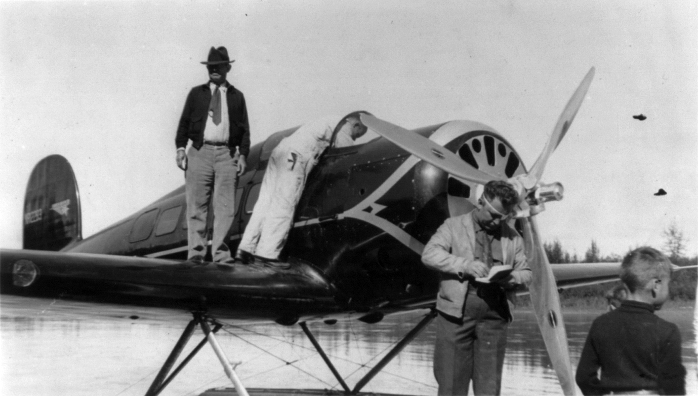
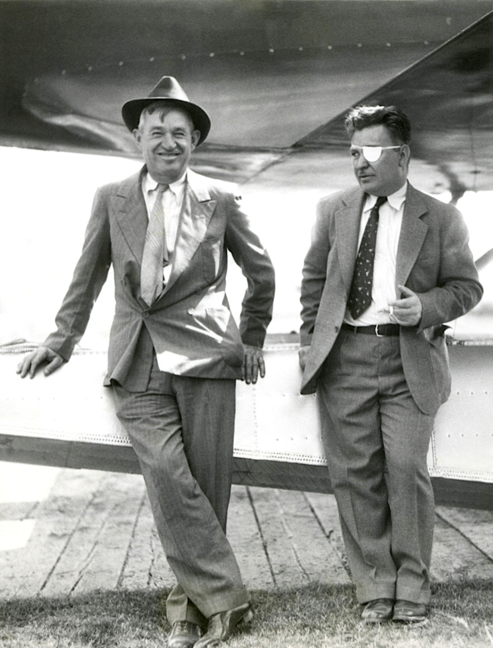
Will Rogers stands on the wing of their seaplane, with Wiley Post checking his notebook by the propeller, bottom, at Fairbanks, Alaska, in August 1935. Photo by Leonhard Seppala. (Credit: Wikimedia Commons)

Rogers had become a proponent of aviation, having caught the flying bug through his friendship with Lindbergh. He later became friends with Post and the two flew in a small plane to Alaska together. On Aug. 15, 1935, their plane crashed a few miles from Point Barrow. Both men were killed instantly, and their deaths mourned on newspaper front pages nationwide.

Among the hundreds of posthumous tributes to both was their sharing the name of a Westchester street, which the City of Los Angeles authorized in 1941.

Another Westchester street name story involves two roadways named for aviation figures, as many of the streets there were. Present-day Jenny Ave. just east of LAX was not named after a woman, as it turns out, but rather after the Curtiss Jenny airplane designed by Glenn Curtiss.

At first, the street was named Junkers Ave. after the German aircraft manufacturer, but the outbreak of World War II made that a problematic choice. So the city quickly renamed it Jenny Ave. in January 1942. 

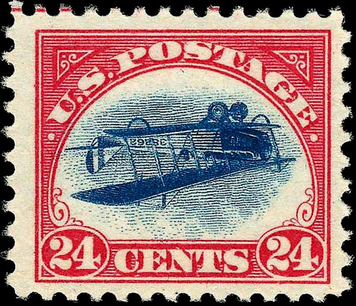
The Curtiss Jenny JN-4 “Jenny” biplane was the aircraft depicted in this famous 1918 U.S. postage stamp inverted center error. (Credit: Wikimedia Commons)

At the same time, it changed the name of Westchester’s Fokker Ave., named for Dutch-born aviation pioneer Anton Fokker, to Fleetwing Ave for the same reason. Germany famously used Fokker-designed planes during World War I, including the Fokker triplane flown by flying ace Baron von Richtofen, the “Red Baron.”

Down in Redondo Beach, the war also brought about a name change to Voorsanger Ave. in Redondo Beach. Its residents petitioned the city in October 1942 to rename it Bataan Road in honor of the then-recent epic three-month battle in the Philippines. It remains Bataan Road to this day.

Several major South Bay arteries are named after military figures. Rosecrans Blvd. was  named for Civil War Union Army Gen. William Starke Rosecrans, who later settled in the South Bay. 

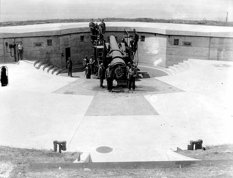
Army personnel pose for a photo at the gun emplacement Battery Leary-Merriam during firing practice at the Army installation at Fort MacArthur in San Pedro. Undated, circa early 1920s. A street near the site is named Leary Merriam Road. (Credit: Los Angeles Public Library Photo Collection)

Fries Ave. in Wilmington honors Amos Fries, an Army Corps of Engineers captain who came to the Harbor Area to supervise construction of the port’s breakwater in 1906.

And what of this trio of streets in the Fort Macarthur area of San Pedro, Osgood Farley, Leary Merriam and Barlow Saxton roads? The names come from the names of the fort’s onetime military gun emplacements built nearby to protect the coast from invaders. The street and battery names honor six prominent military officers from the early 1900s, two for each road.

Arthur MacArthur Road at the former military base takes its name from Lt. Gen. Arthur MacArthur, the father of U.S. Army Gen. Douglas MacArthur. His son later commanded American forces in the Pacific during World War II, including during the defeat at the Battle of Bataan, after which he famously, and accurately, predicted, “I shall return.”

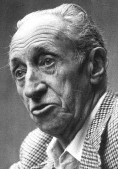
Harry Bridges

Labor leader Harry Bridges fought a different kind of war. After years of often-violent clashes with police and shipping bosses, the 1930s labor leader founded the International Longshore and Warehouse Union (ILWU) at the Port of Los Angeles in 1937. B Street in Wilmington was renamed Harry Bridges Blvd. in 1994.

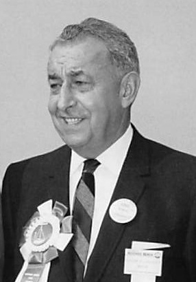
Politicians often have a hand in how streets are named. According to the fascinating L.A. Street Names website (must reading for those interested in this topic), former Redondo Beach mayor Bill Czuleger wanted to have a short street named for his daughter, Mary Ann, when he was still a councilman in the 1950s.

William Czuleger

Then-mayor Charles Wortham repeatedly vetoed Czuleger’s request, so the councilman slipped the request through the City Council while Wortham was on vacation. And that’s how Mary Ann Drive, a narrow alley between Fisk Ave. and 190th St., got its name in 1960.

U.S. Senator Stephen M. White had a highly visible street in San Pedro named for him for his actions as a politician. White advocated brilliantly for the adoption of the harbor at San Pedro to become the official Port of Los Angeles and cleared the way for that decision to become official in 1897.

He took ill and died in 1901. The community honored his memory by naming the street leading from Pacific Ave. to Cabrillo Beach Stephen M. White Drive in 1932. They also had a statue of him moved there from the downtown Los Angeles County Courthouse building.

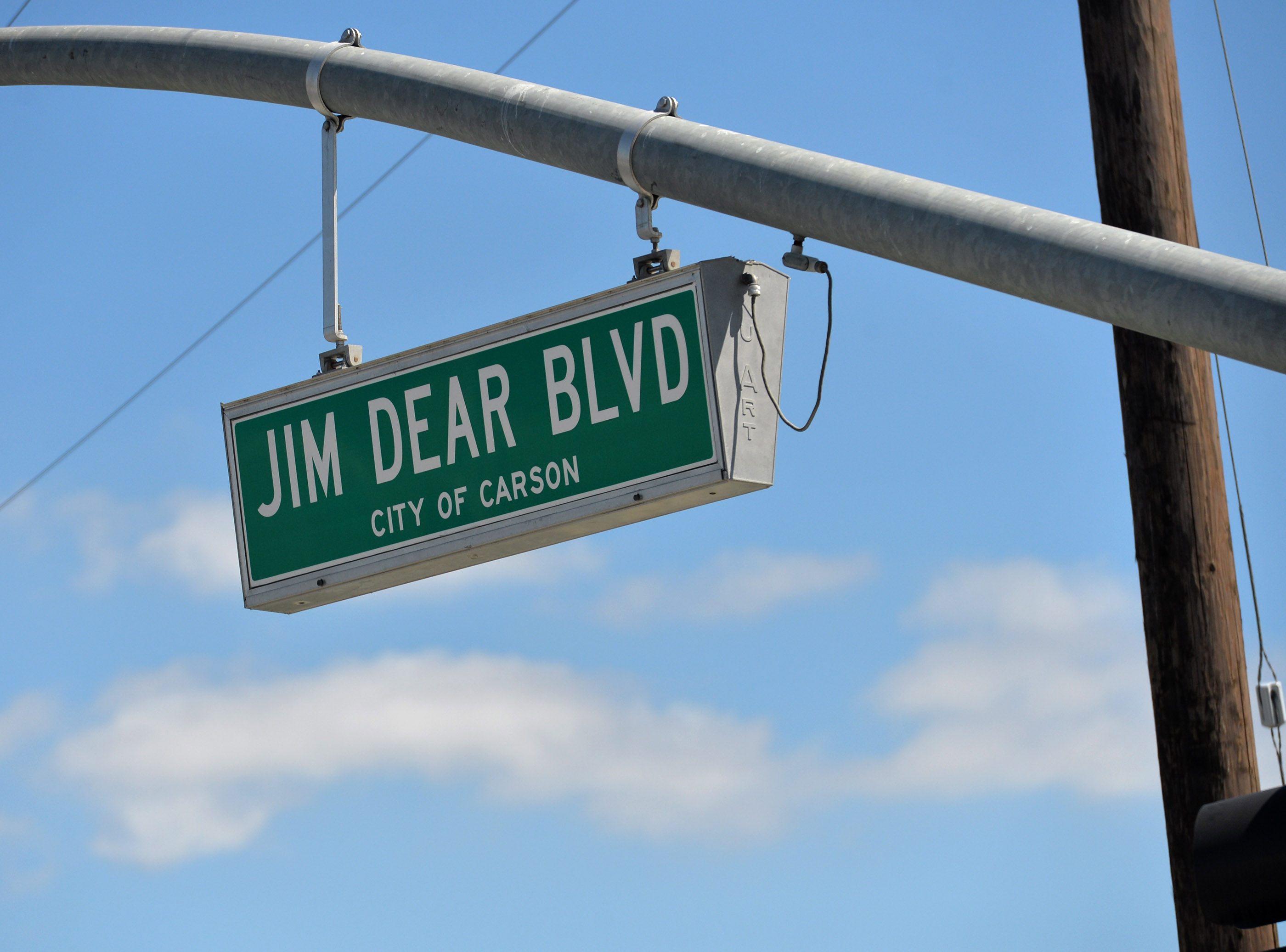
In 2013, former Carson Mayor Jim Dear had a street at the parcel in Carson once considered by the NFL as a stadium site renamed Jim Dear Boulevard. When Dear fell out of favor in city government, his name was removed from the street and it became Stadium Way. The NFL’s Rams and Chargers ended up building Sofi Stadium in Inglewood.

Jim Dear Blvd. became Stadium Way in Carson will after the Carson City Council approved the name change in July 2015. (Daily Breeze staff file photo by Robert Casillas)

Sources:

Daily Breeze archives.

L.A. Street Names website.

Los Angeles Times archives.

“Remembering Wiley Post and Will Rogers,” by Roger Connor, National Air and Space Museum website, August 6, 2013.

Will Rogers, left, and Wiley Post in Seattle before their fatal August 1935 flight to Alaska. Post lost his left eye in an oil rig accident in the early 1920s, making his achievements as a pilot even more remarkable. (Credit: International News Photos via Milwaukee Journal Sentinel website)

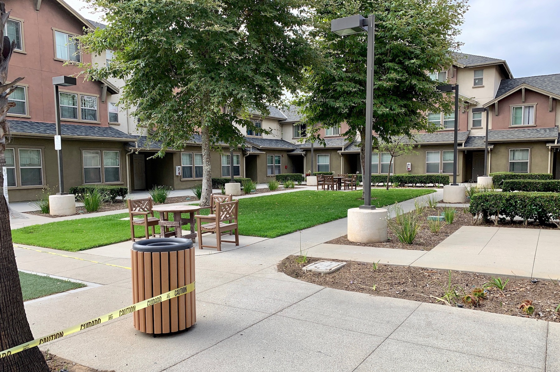
Changing the face of the Dana Strand housing project in Wilmington took decades

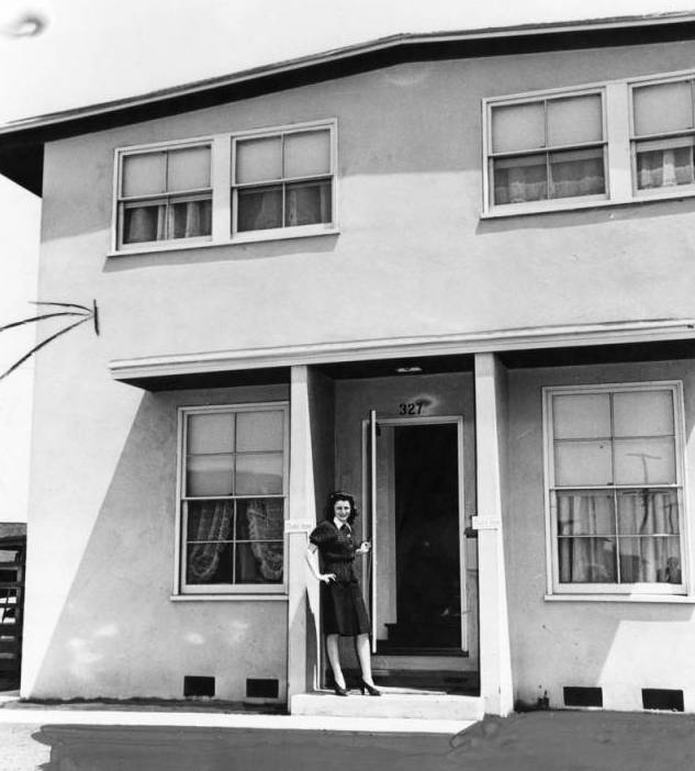
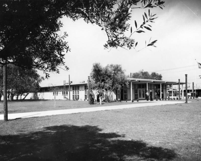
An unidentified woman poses in the doorway of her apartment at the Dana Strand Village housing project, circa 1942. (Credit: Los Angeles Public Library Photo Collection)

The Dana Strand housing project in Wilmington originally was among several such developments built by the federal government in the Harbor Area to provide homes for wartime defense industry workers in and around the Port of Los Angeles. Others included the Wilmington Hall complex, Normont Terrace in Harbor City, and Channel Heights and Banning Homes in San Pedro.

Even before World War II, the area’s growth as a nexus for defense industries, especially shipbuilding, had increased exponentially compared to the amount of places for the rapidly growing number of incoming defense workers to live.

The Pearl Harbor attack and America’s entry into World War II lit a fire under an already pressing need for more housing in the area. Construction on Dana Strand Village began on Feb. 23, 1942, just a couple months after Pearl Harbor. Architect Frederick Barlow Jr. designed it, and the Myers Bros. construction firm built it.

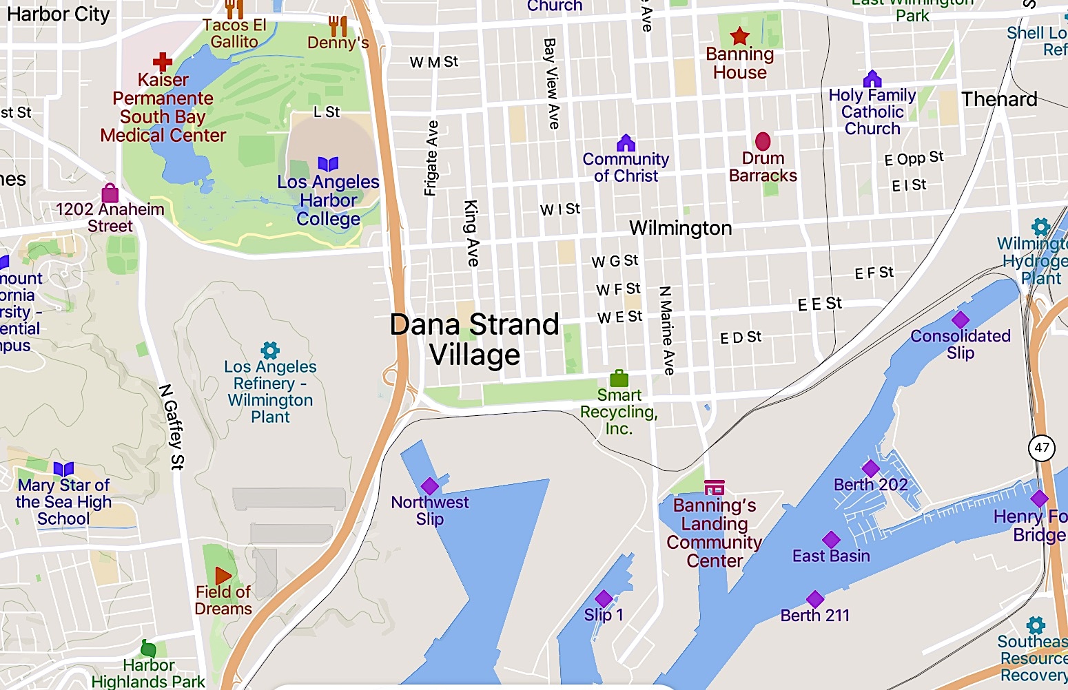
Modern map shows location of Dana Strand Village. (Credit: Mapcarta)

Dana Strand’s 384 units were erected on 20.7 acres of land along Wilmington Blvd. between C and D streets at a cost estimated at just over $1 million. 

It was dedicated along with the other projects at a combined ceremony in Wilmington on June 20, 1942. Such was the housing demand that by mid-July all the units had been claimed. Temporary units had to be added over the next couple of years.

Exterior view of the Dana Strand housing project’s main building circa 1942. (Credit: Los Angeles Public Library Photo Collection)

By the war’s end in 1945, the fate of the housing projects, including Dana Strand, seemed up in the air. Many of temporary structures added when the original units filled up during the war were destroyed and removed, but the original structures remained. 

Ownership of Dana Strand Village reverted from the military to the federal Public Housing Administration (PHA). There were rumors in February 1946 that the U.S. Navy would take it over after the government declared it surplus property, but that did not come to pass.

In October 1946, more than 200 residents gathered at the complex’s meeting hall to discuss forming a mutual ownership corporation that could make a bid to purchase the property from the PHA. Fifty percent of its residents signed a petition backing the plan.

In June 1947, the federal government set a price of $1.1 million to the new ownership group. Negotiations continued into 1949, when a splinter group opposing the sale appeared. Amid the confusion, the original group was unable to raise the money to make a good-faith payment required to continue the sale process, and the offer was withdrawn.

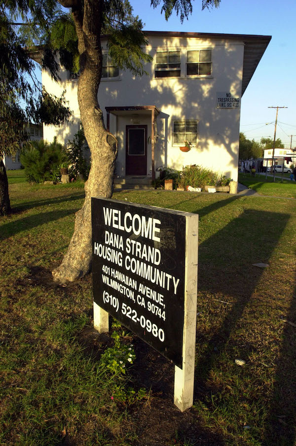
The Dana Strand housing project in Wilmington in 2001, shortly before it was demolished. (Daily Breeze staff file photo by Scott Varley)

The PHA maintained possession while rumors swirled that Dana Strand would be shut down and razed. Finally, in August 1949, the Los Angeles City Housing Authority (CHA) announced that it would buy the Dana Strand, Channel Heights and Normont Terrace projects. The transactions became final in 1950.

Over the next few decades, the CHA’s benign neglect of the projects led to their gradual deterioration. Channel Heights was sold to a private developer in 1955, who built new homes on the site, but the others continued to become more rundown as the years passed.

They also became notorious as havens for drug dealers and gang members by the mid-1980s. Often the street criminals weren’t residents of the projects, but used their large, unpatrolled grounds to conduct business. Shootings between rival East Wilmas and West Wilmas gangs became commonplace at Dana Strand.

The city of Los Angeles finally took an active role in tackling the problem in the mid-1990s. In 1996, HACLA, the Housing Authority of the City of Los Angeles (formerly known as the CHA),  announced a plan to tear down Normont Village and replace it with a new housing development. In 1999, the new Harbor Village opened.

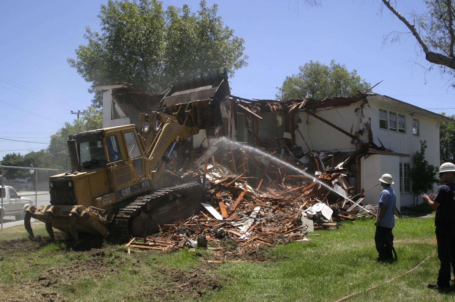
Demolition of the Dana Strand Village in Wilmington begins on Aug. 3, 2003. (Daily Breeze staff file photo by Chuck Bennett)

HACLA then turned its attention to the dire Dana Strand situation. In 2001, it announced plans to completely demolish the Wilmington project’s buildings and build new housing on the 20.7-acre site in four phases. The original Dana Strand buildings finally were razed in 2003.

Construction on the site began in 2005. The first three phases of what the city named the New Dana Strand Revitalization included a total of 336 senior housing, townhomes and rental units. They were completed in 2013. 

The fourth phase originally was planned to include 77 single-family homes, but HACLA decided to go with more apartments instead, citing the high demand for housing in the area.

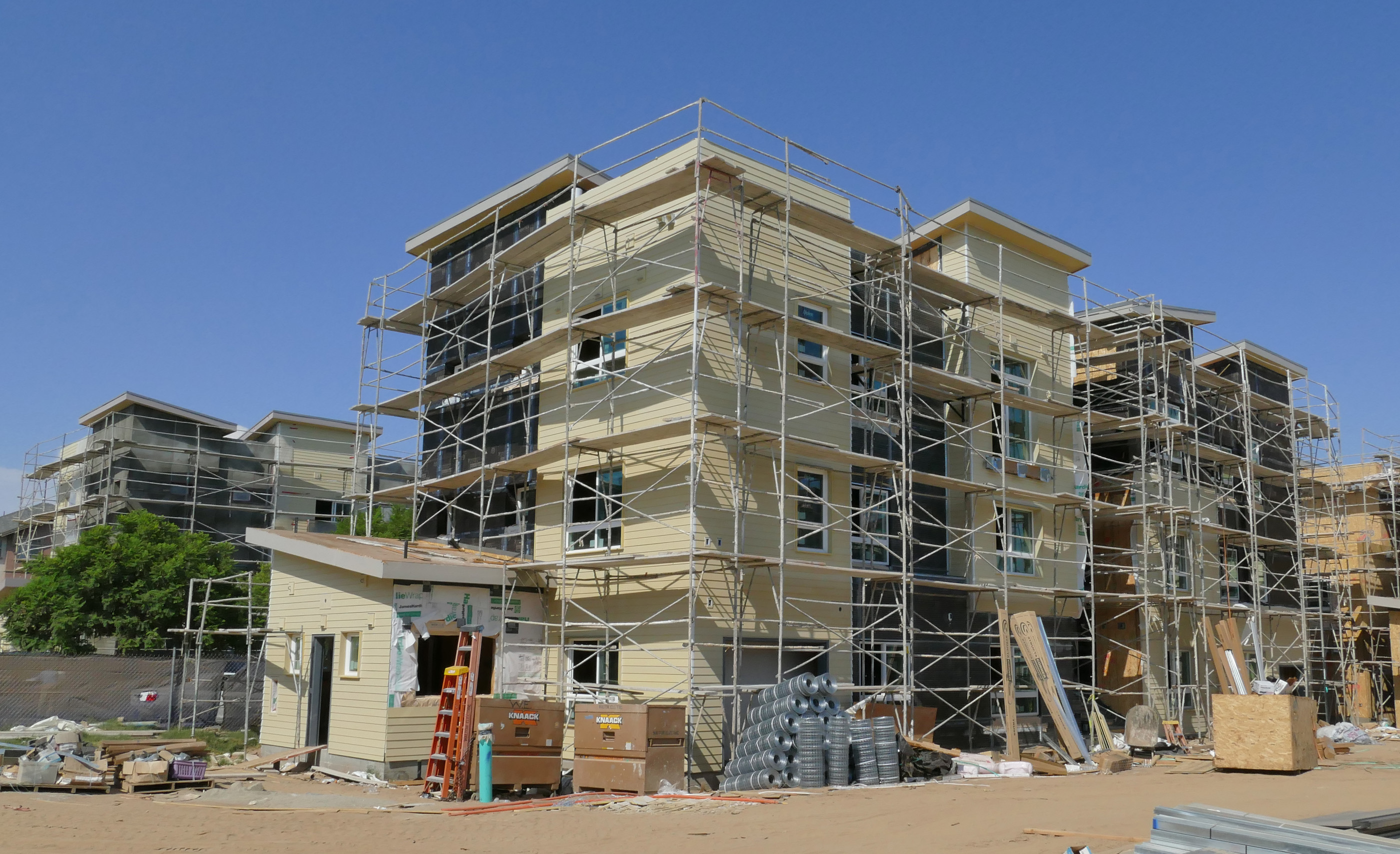
Construction of 176 apartments in the Vista Del Mar and Camino Del Mar sections of the rebuilt Dana Strand housing complex in Wilmington continues in this Aug. 31, 2017 photo. (Daily Breeze staff file photo by Robert Casillas)

Ground was broken for the final phase in 2016. It included the Camino del Mar and Vista del Mar developments, adding 176 more units to the complex. 18 years after the reshaping of Dana Strand was approved, the grand opening for its final phase was held on Sept.20, 2018.

In addition to its 512 total units, the complex now includes landscaped courtyards, play areas, a coin-operated laundry, on-site property management, a computer lab, after-school and summer programs, adult workshops and other community activities.

The townhomes section of the rebuilt Dana Strand Village. Undated photo. (Credit: Los Angeles Housing Department website)

Sources:

Daily Breeze archives.

“Final Phase of Dana Strand Development Breaks Ground,” by Steven Sharp, Urbanize Los Angeles website, Sept. 20, 2016.

“Garden Apartments of Los Angeles: Historical Context Statement,” prepared by the Architectural Resources Group for the Los Angeles Conservancy, October 2012.

Los Angeles Housing Department website.

Los Angeles Times archives.

San Pedro News Pilot archives.

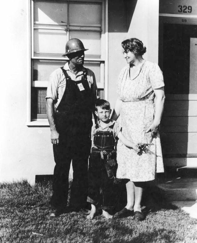
A shipyard worker with hardhat stands in front of his apartment at the Dana Strand housing project with his family, circa 1942. (Credit: Los Angeles Public Library Photo Collection)

Gearheads flocked to Tony Capanna’s Hot Rod City in Torrance in the 1960s

Tony Capanna, center, in the early days of Hot Rod City in Torrance. Torrance Press, May 11, 1961. (Credit: Torrance Historical Newspaper and Directories Archive database, Torrance Public Library)

The story of Hot Rod City in Torrance starts with one man: Anthony “Tony” Capanna.

Capanna, sometimes misspelled “Capana,” was born to Italian immigrant parents in Utica, New York, on June 14, 1921. They had arrived in the U.S. one year earlier, and moved to Los Angeles three years later, in 1924.

Tony Capanna attended Jacob Riis High School in Boyle Heights, graduating in 1939. While a student there, he became friends with Lowell and Kenny Lewis. One day, the car enthusiast brothers took Tony out to Muroc, near Edwards Air Force Base in the Mojave Desert, where high performance car drivers were chasing the land speed record on the area’s dry lake beds.

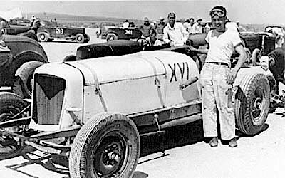
Tony Capanna poses with one of his early racing cars on a dry lake in the Mojave Desert, circa late 1930s/early 1940s. (Credit: Wilcap Co. website)

Capanna immediately became hooked on building and driving the souped-up machines that would become known as “hot rods” during the 1940s. He joined the Albata car club in 1939. Its members comprised a who’s who of racers tooling in search of faster and faster speeds across the dry lakes.

Automotive engineer Jim Harrell also joined the Albata Club in 1939. Capanna had spent many hours during the 1930s hanging around Harrell Engines, his Los Angeles shop, where he learned about building high-performance cars, knowledge he would use when starting his own business.

Looking to broaden his skill set as a car mechanic after graduation, Capanna took a welding class at Banning High School in Wilmington. Combined with his experience as a mechanic, he quickly landed a job with a shipbuilding firm in the defense industry, which was ramping up due to the growing war in Europe.

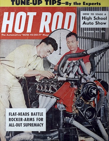
Tony Capanna, right rear in red shirt, watches as Ray Brown works on an engine. Hot Rod magazine, Nov. 1953 issue cover.

After the Pearl Harbor attack, he attempted to enlist, but his civilian status as an expert welder was deemed more important to the war effort. (He would later join the U.S. Navy Reserve in 1966 as a Chief Petty Officer.)

He worked for the next two years as a welder at the Pearl Harbor Naval Station in Hawaii. He arrived there a few months after the Japanese attack, but saw the devastation it caused firsthand.

He married his wife Ora in 1945 after returning from Hawaii to a job at the Long Beach Naval Shipyard. After she had their first child in 1946, Capanna quit competitive race car driving for good, not wanting to risk losing his life and leaving his children fatherless.

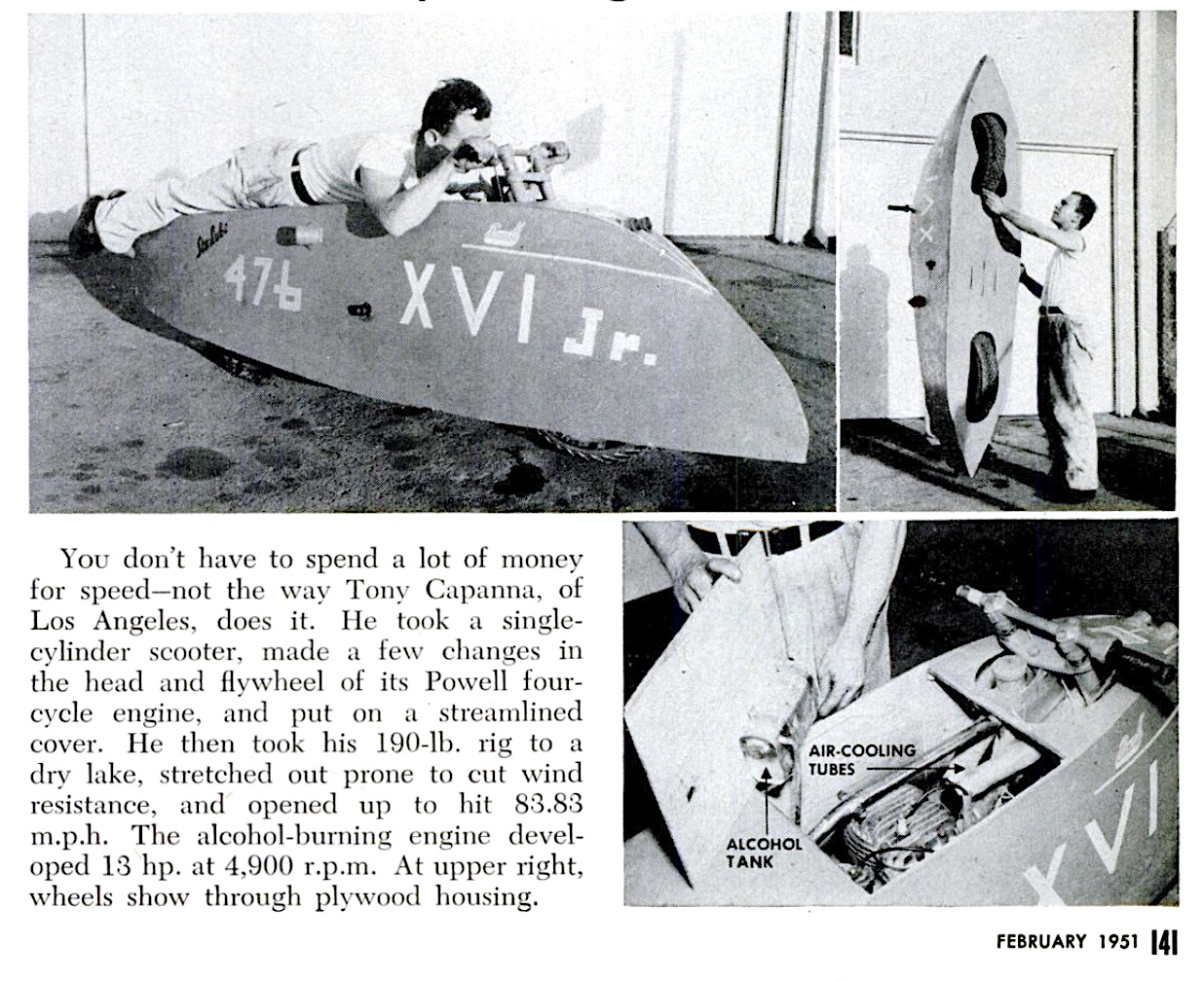
He worked for the Powell motor scooter company on Gaffey St. in San Pedro for a while,  before using the money he’d saved from his welding jobs to purchase enough equipment to open his own small machine shop next door.

He moved his business into a larger facility at 10215 S. San Pedro St. in South Los Angeles. He formed a partnership with auto equipment expert Red Wilson there, and the company became known as Wilcap, based on the beginnings of their last names.

Headline of photo essay: “Streamlined Scooter Speeds Along at More than 83 M.P.H.” Popular Science, Feb. 1951, Page 141.

He continued to experiment at the garage with high-performance race cars, often using nitro-based fuels. Twice he attempted to qualify race cars for the Indy 500 during the 1950s, without success. He found the whole process too costly, and never tried again.

The hot rod craze of the 1950s meant steady business for Wilcap. The ambitious Capanna pooled his resources and bought some land on the south side of Sepulveda Blvd. just east of Maple Ave. in Torrance.

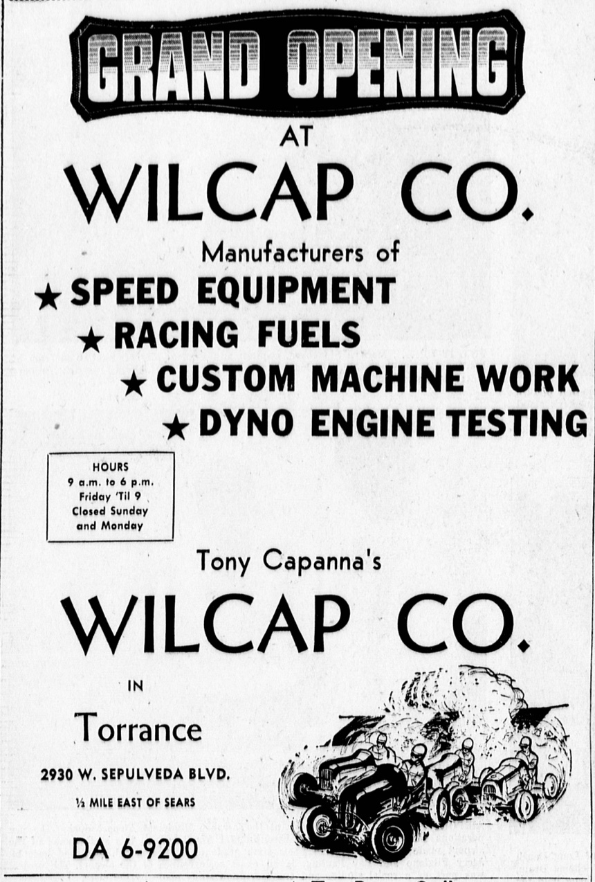
Ad publicizes the first shop to open at Hot Rod City, Wilcap Co.. Torrance Herald, July 10, 1960, Page 12. (Credit: Torrance Historical Newspaper and Directories Archive database, Torrance Public Library)

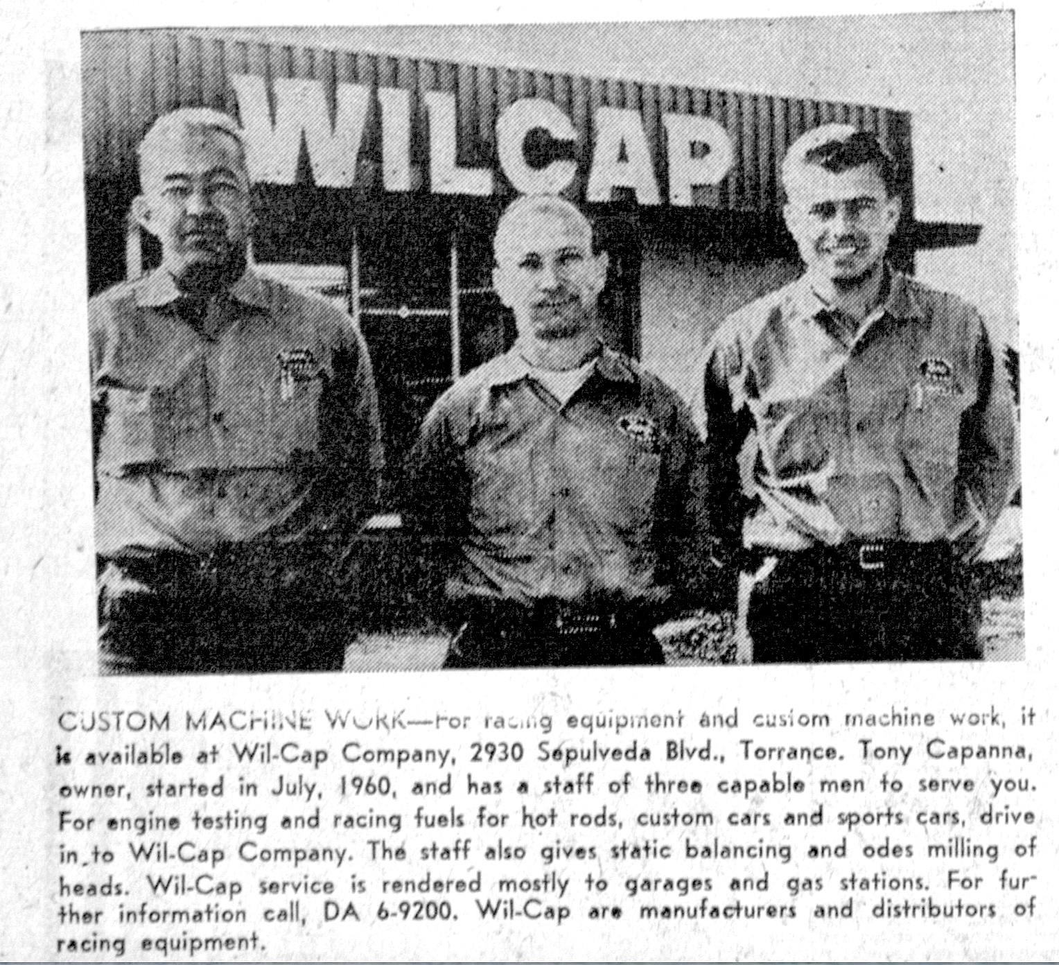
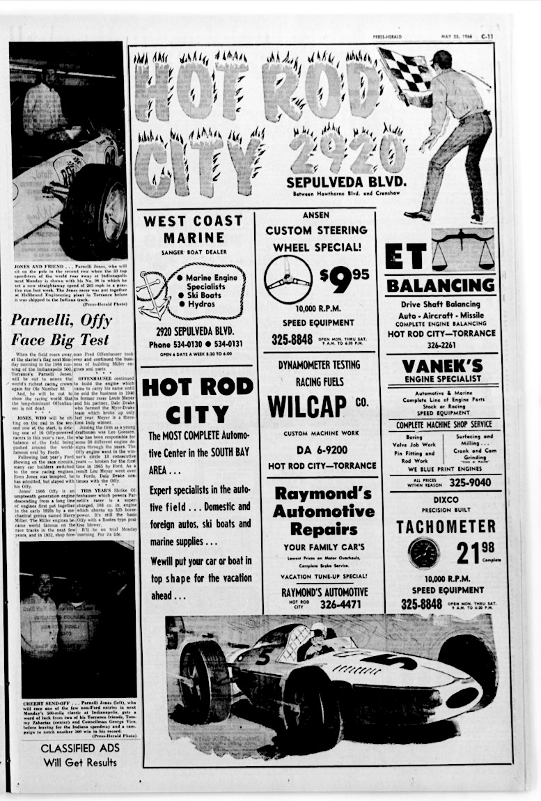
Wilcap opened its relocated operations to the location at 2930 W. Sepulveda on July 10, 1960. Capanna wanted to create a whole shopping center there dedicated to catering to the needs of high-performance car enthusiasts. He called it “Hot Rod City,” and soon Wilcap had been joined by a number of auto specialty shops such as 10,000 RPM Speed Equipment, Chet Herbert Cams and Vanek’s Engine Specialist.

Longtime Torrance resident Jeff Santiago remembers Hot Rod City fondly as a place where he and his teenage friends loved to hang out and learn about cars. He recalls that the various auto shops would give them free promo stickers and decals for STP, Pennzoil and other automotive products, prized booty for the young car racing fans.

Hot Rod City became a fixture at the site for the next 25 years. Capanna, who had been living  with his family at their home on Via Colusa in Palos Verdes Estates, decided to pull up stakes in 1985. He moved his family and the Wilcap business to Arroyo Grande on the Central Coast near Pismo Beach.

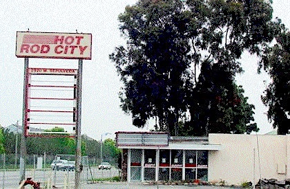
Undated photo circa mid-1990s shows abandoned Hot Rod City complex. (Credit: Wilcap Co. website)

He and his sons operated Wilcap successfully there for many years. He died in nearby Oceano, California, on Sept. 20, 2001. He was 80.

One of the honors he was most proud of was his induction as the first member of the Dry Lakes Racing Hall of Fame in 1992. The organization includes dry lakes specialists from Craig Breedlove to dozens of others who pursued the land speed record over the decades.

As for Hot Rod City, it closed down during the 1990s after Capanna had left. In 2001, it was announced that the site would become part of an enlarged parking area for the newly revamped Torrance YMCA just to the east of it. To paraphrase Joni Mitchell’s “Big Yellow Taxi,” they paved auto racing paradise and put up a parking lot.

One of the former Hot Rod City businesses still operates in Torrance. Hot Rod Performance, founded in 1987 at the Sepulveda center, moved to its current location at 1932 Del Amo Blvd. after Hot Rod City closed, and continues to operate there. Another, 10,000 RPM Racing Clutches and Billet Flywheels, founded by Ron Hammer in 1964, is now based in Lancaster.

After Capanna’s death, the family sold the Wilcap company to new owners, who continue to conduct business under the Wilcap name in Waunakee, Wisconsin.

Note: Thanks to Jeff Santiago for suggesting this story.

Torrance Press-Herald, May 25, 1966, Page C-11. (Credit: Torrance Historical Newspaper and Directories Archive database, Torrance Public Library)

Sources:

Daily Breeze archives.

Find A Grave website.
“History,” Wilcap Co. website.
Palos Verdes Peninsula News archives.

Torrance Press-Herald archives.

Musical Note: The “G.T.O.” group Ronny & the Daytonas wasn’t referring to Hot Rod City in Torrance specifically with this tune, but they could’ve been.

San Pedro High School is one of the South Bay/Harbor Area’s oldest

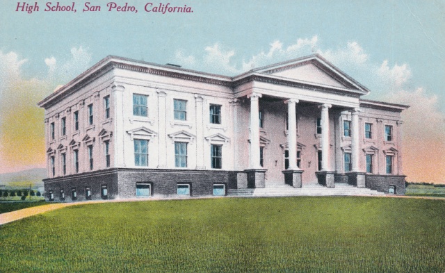
Postcard view of San Pedro’s first high school building circa 1906.

The idea of creating a new high school in the harbor town of San Pedro began to circulate in earnest in June 1902. Geography was a driving force. Parents in the growing settlement weren’t happy about having to send their high-school age children out of town to further their education.

The idea became a reality when the town’s citizens voted yes on a bond issue on the matter on May 20, 1903, passing it by a vote of 154 for, and 3 against. The bond money covered the establishment of a high school district, and school classes began in the fall of 1903.

It didn’t cover the construction of a new high school building, though. For its first three years, the high school operated on the second floor of 16th Street School. (It was renamed 15th Street School six years later when San Pedro became a part of the Los Angeles Unified School District, which already had a 16th Street School.) Classes took place at the same time as the elementary classes, which made for very crowded conditions.

Almost immediately, the community realized that a permanent school had become a pressing need. Discussion of potential sites began in 1905, after a second bond issue approving $40,000 for land acquisition and building construction had passed by a 414-72 vote in November 1904.

Various city landowners offered proposals, including land grant owner Mrs. Rudecinda F.S. de Dodson, John Gaffey, George Peck and others. Mrs. Dodson’s generous offer of five acres along Gaffey St. between 10th and 16th streets was accepted, and the new school was built there at 1221 S. Gaffey. It opened to students in 1906.

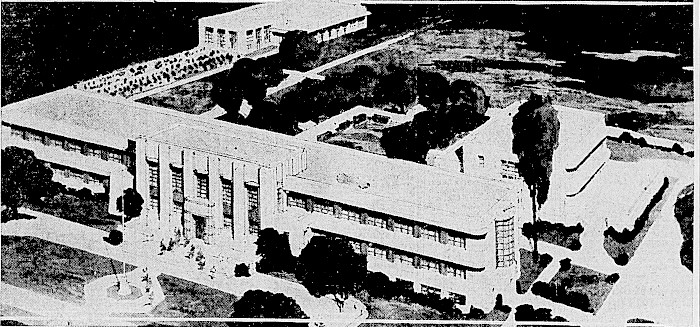
Rendition of the planned new 15th St. San Pedro High School by architect Bernard Kaufmann. San Pedro News Pilot, Dec. 29, 1934, Page 1. (Credit: San Pedro News Pilot archives)

The gleaming white building was a source of great civic pride – for a while. But San Pedro’s rapid industrial development following its selection as the port for the city of Los Angeles, which became official in 1909, led to an ever-larger influx of workers and their families with school-age children.

Overcrowding at the high school had become a serious problem by the early 1930s. The school’s principal, Juliette Pierce, told the San Pedro News Pilot in February 1932 that the school’s enrollment had increased from 107 students in 1916 to 1,259 in 1932.

Sites for a new school were scouted once again. A plot of land in the Vista del Oro section near Averill Park initially was proposed by the Chamber of Commerce, but that never came to pass.

All of this happened before March 10, 1933, the day the magnitude 6.4 Long Beach earthquake shook down buildings all across southwest Los Angeles County. The damage at San Pedro High School was significant.

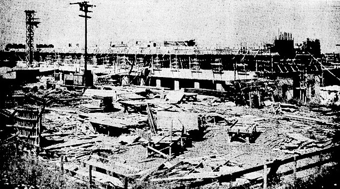
Rear view of the main San Pedro High School building under construction in May 1935. San Pedro News Pilot, May 5, 1936, Page 1. (Credit: San Pedro News Pilot archives)

Early in 1934, the Los Angeles Unified School District authorized $400,000 in funds to repair San Pedro High School. The community responded with a campaign aimed instead at building a new school, which leaders claimed could be done for not much more than that amount.

The organized campaign included a series of 11 separate reasons spelled out in 11 separate editorials on 11 separate days in the San Pedro News Pilot under the same headline, “Why San Pedro Should Have a New High School.”

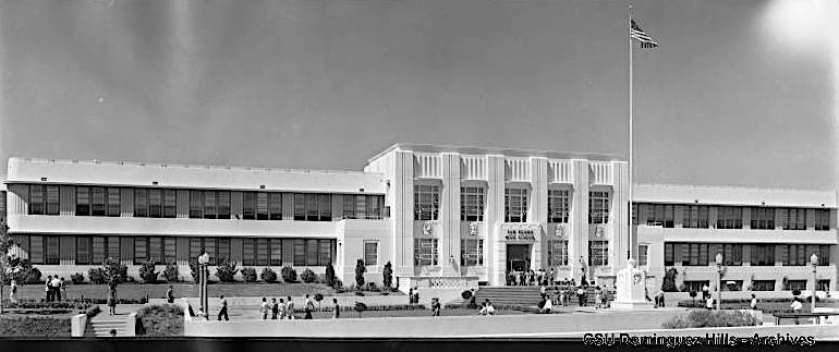
The San Pedro High administration building in 1941. (Credit: CSUDH Digital Archives)

It worked. On April 9, 1934, the LAUSD re-earmarked the funds as being for new construction, and by May it had purchased land for the new campus from the Dodson estate for approximately $69,000. The 17.5-acre site was located between 14th and 17th streets, just east of Leland Ave. and adjacent to Dana Junior High (later renamed Dana Middle School).

Noted Los Angeles architect Gordon Kaufmann, who had designed the Los Angeles Times building as well as parts of Hoover Dam, was hired to design the new school at 1001 W. 15th St. The construction firm of Easton & Nesser was hired to build the school in 1935. Additional funding for the project came from the federal Public Works Administration (PWA), a New Deal agency.

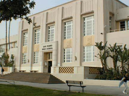
The school’s administration building in 2012. (Credit: San Pedro High School Facebook page)

The first concrete was poured at the site that December, and the new school opened its doors to students on Sept. 9, 1936. Two more Kaufmann-designed buildings, the gymnasium and auditorium, were added shortly afterward, and an additional new classroom building had to be added in 1938 due to overcrowding.

Overcrowding would remain a theme at San Pedro High over the years. Two years after the school celebrated its centennial in 2003, the problem had grown severe enough that discussions about building a new high school had begun.

The Los Angeles school board eventually decided to build a satellite campus on the Fort MacArthur military reservation to relieve the strain.

The school district had acquired the former Army property in 1979 from the federal government. The site had been used as an outdoor education center, a continuation school, an adult education site and for care facilities for rescued marine birds and mammals.

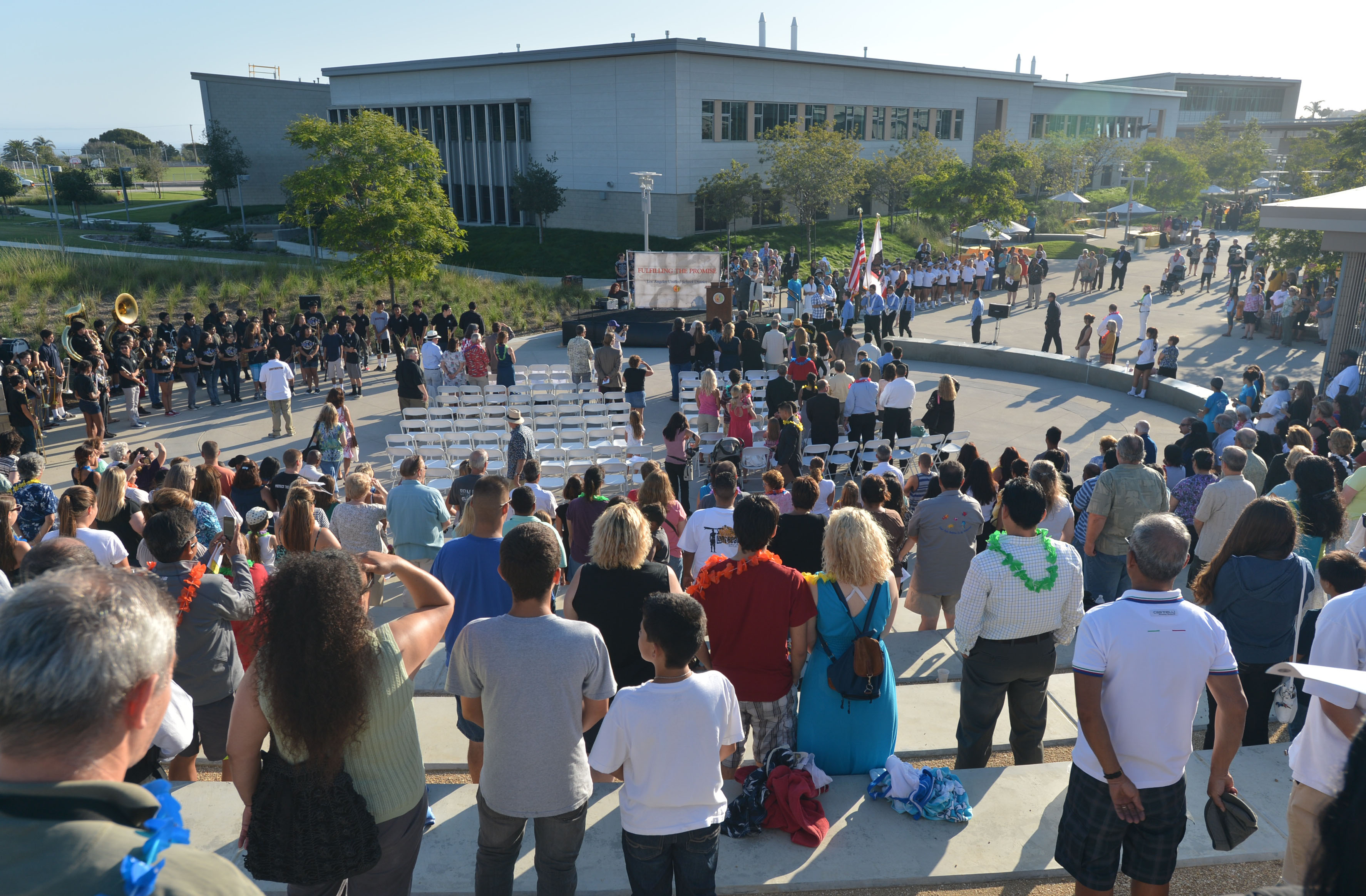
In February 2011, the Los Angeles school board voted unanimously to name the new San Pedro High annex near Fort MacArthur the John M. and Muriel Olguin Campus of San Pedro High School. It opened at 3210 S. Alma St. for the fall term of 2012, with room for about 800 students.

The John M. and Muriel Olguin campus of San Pedro High School was officially opened on Aug. 9, 2012. The dedication ceremony was held in the school’s outdoor amphitheater. (Daily Breeze staff file photo by Steve McCrank)

John and Muriel Olguin were San Pedro icons. He founded the Cabrillo Marine Aquarium and the couple was involved in many community groups and events. He died on New Year’s Day of 2011 at the age of 89.

Two buildings on San Pedro High’s main campus are protected historical landmarks: the Administration and  Language Arts buildings.

Another revitalization program there, the San Pedro High School Comprehensive Modernization Project, is currently in progress. The multimillion dollar remodeling plan has a 2025 expected completion date.

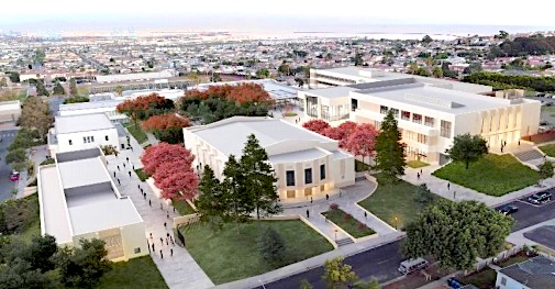
Artist rendition of the finished Comprehensive Modernization Project at San Pedro High School. The project is ongoing. (Credit: Central San Pedro Neighborhood Council website)

Sources:

Daily Breeze archives.

Los Angeles Times archives.

Los Angeles Unified School District website.
San Pedro: A Pictorial History, by Henry P. Silka, San Pedro Bay Historical Society, 1993.

San Pedro High School website.
San Pedro News Pilot archives.

“San Pedro Timeline,” San Pedro High School Class of 1973 website.
Wikipedia.

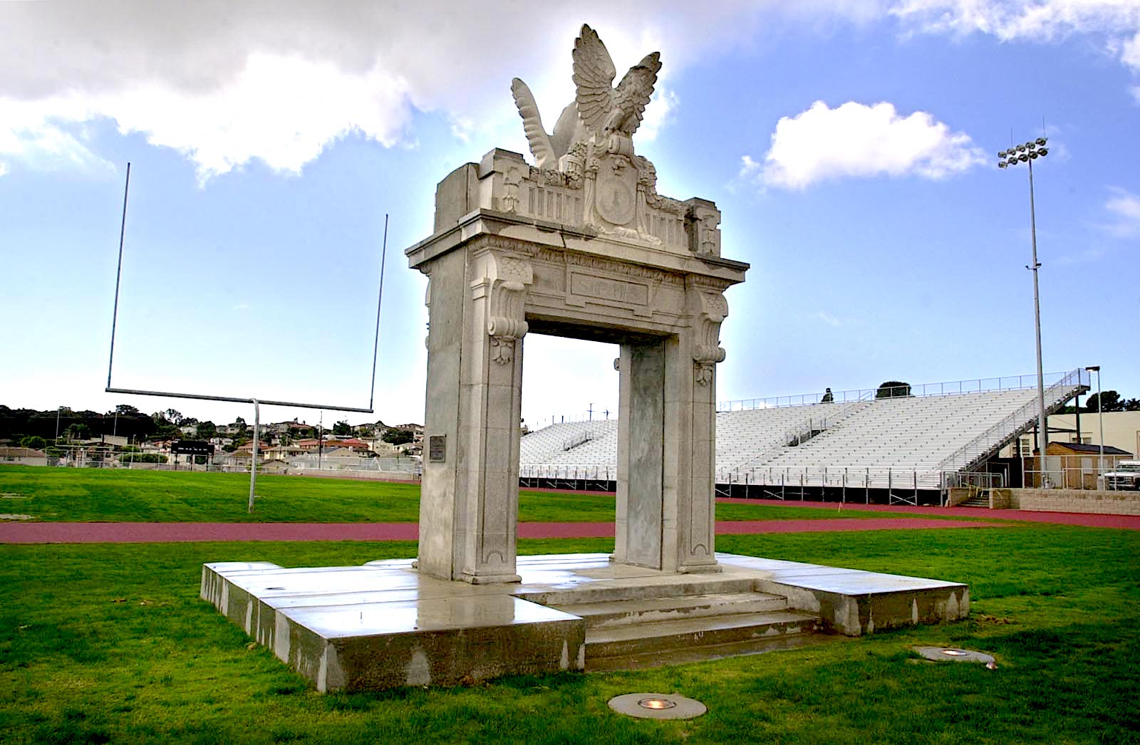
San Pedro High School’s Victory Arch, created in 1937, was relocated from the old high school to the school’s then-new Pirate Stadium for its opening in 2000. Graduating students traditionally walk through the arch to receive their diplomas, and football team members run through it following victories. Oct. 11, 2000. (Daily Breeze staff photo by Kim Haggerty Zylius)

California’s oldest lumber company has a big presence in Torrance

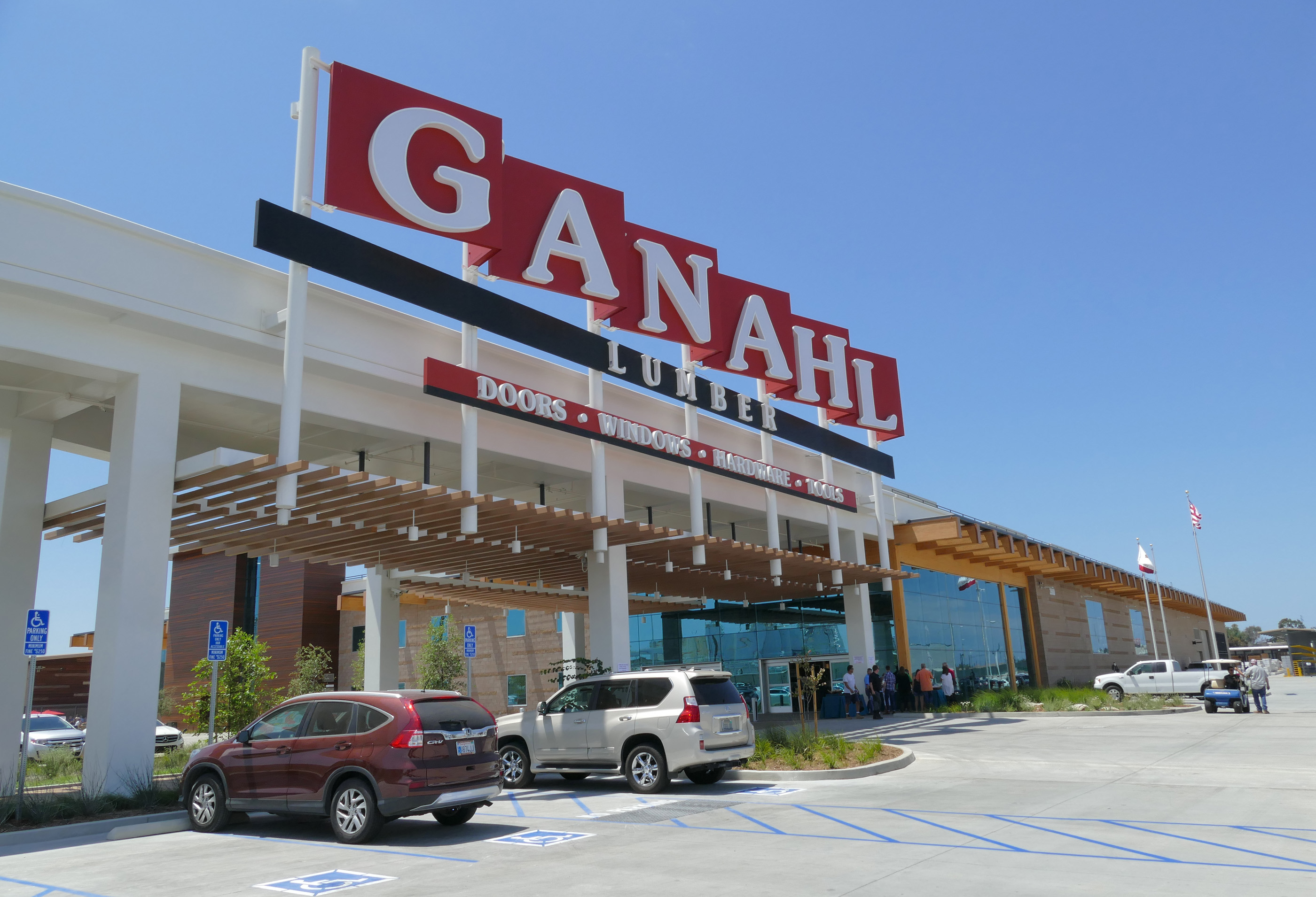
Ganahl Lumber opened its super-sized lumber yard in Torrance in 2017. (Daily Breeze file photo by Robert Casillas)

Perhaps you’ve driven by the mammoth Ganahl lumber yard on Del Amo Blvd. in Torrance between Maple Ave. and Crenshaw Blvd. It’s hard to miss.

But you might not know that Ganahl Lumber is owned and operated by the oldest lumber company in continuous operation in California.

Ganahl can trace its roots back to 1882, when the company, located at First and Alameda streets in downtown Los Angeles, was founded by former L.A. Mayor John Bryson. 

He sold it in 1884 to St. Louis lumberman Christian Ganahl, who was looking to expand his operation to the very much still-under-construction Southern California. (The present-day firm considers 1884 to be the date of its founding.)

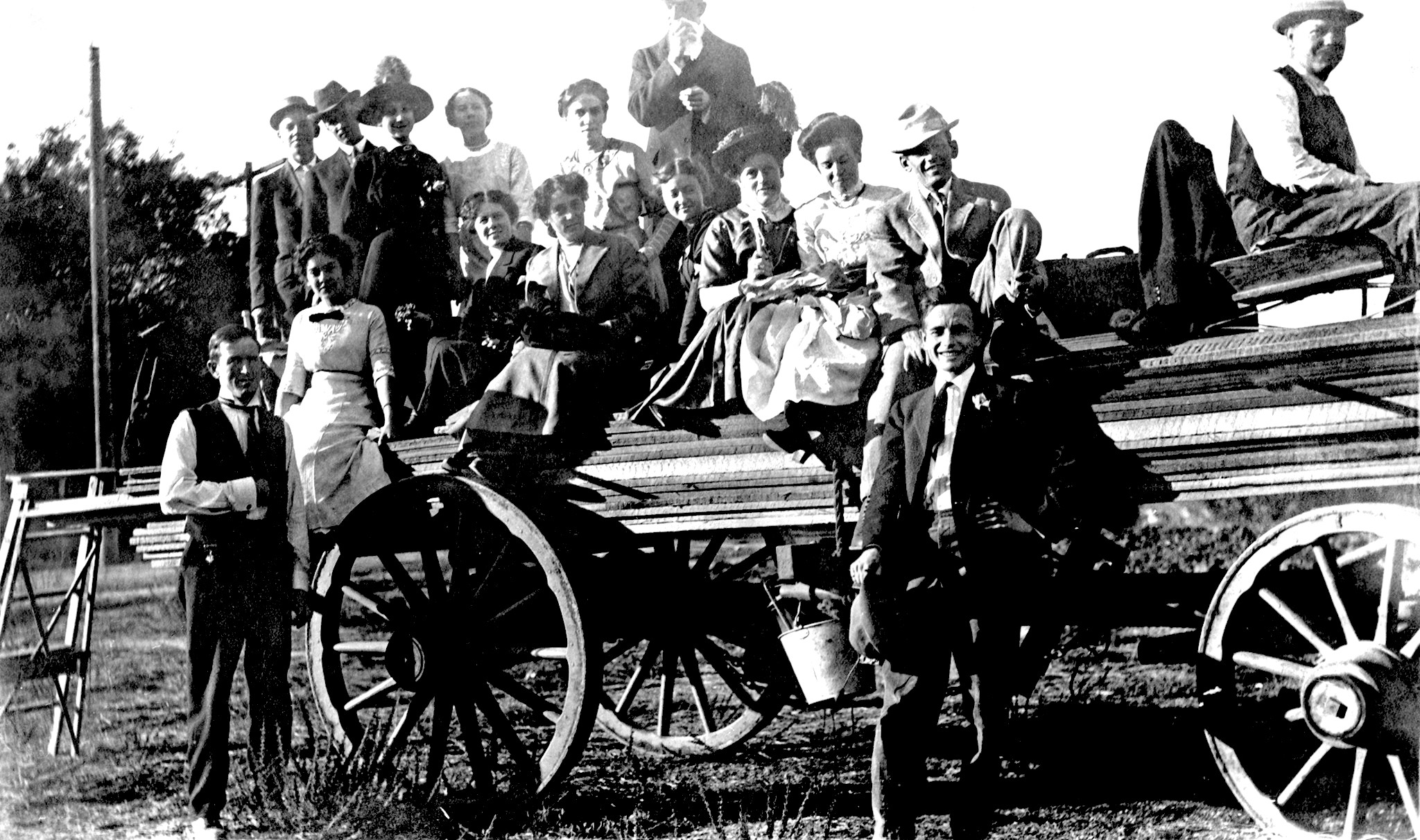
Members of the Ganahl family pose on one of the company’s lumber wagons in 1907. (Credit: Ganahl Lumber Facebook page)

Ganahl sold a share of the firm to investor John J. Schallert. For the first decade of its operation, the company was known as the Schallert-Ganahl Lumber Co. When Schallert died in 1895, the company changed its name to C. Ganahl Lumber Co.

Lumber was a huge business in the area in the late 19th century, when the need for construction materials was constant. Several lumber yards operated in Wilmington and San Pedro, receiving their goods from cargo ships docking in Los Angeles Harbor, which wouldn’t officially become L.A.’s port until 1909.

Once in the port, the lumber had to be hauled 21 miles north to Los Angeles. This was done by wagons drawn by horses and oxen, until the area’s first railroad, The Los Angeles & San Pedro, began operating in 1869.

By 1888, Ganahl had three locations in L.A. In addition to First and Alameda, yards were opened at Grand Ave. and Washington St. and, in East Los Angeles, at Hoff and Water streets.

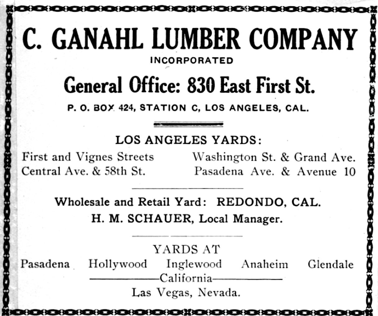
From Directory of the City of Redondo Beach, 1907 edition, Page 2. (Credit: Redondo Beach Public Library archives).

The company always believed in expansion. In 1904, it opened its branch in far-flung Anaheim in Orange County. By 1907, Ganahl had established ten locations in the greater L.A. area. Four were in the city itself, and had added South Bay locations in Redondo Beach and Inglewood. It also had a yard in Las Vegas, Nevada.

In 1928, Ganahl even opened a branch location in Lake Arrowhead, taking advantage of celebrities and others who spurred a mountain building boom there during the 1930s.

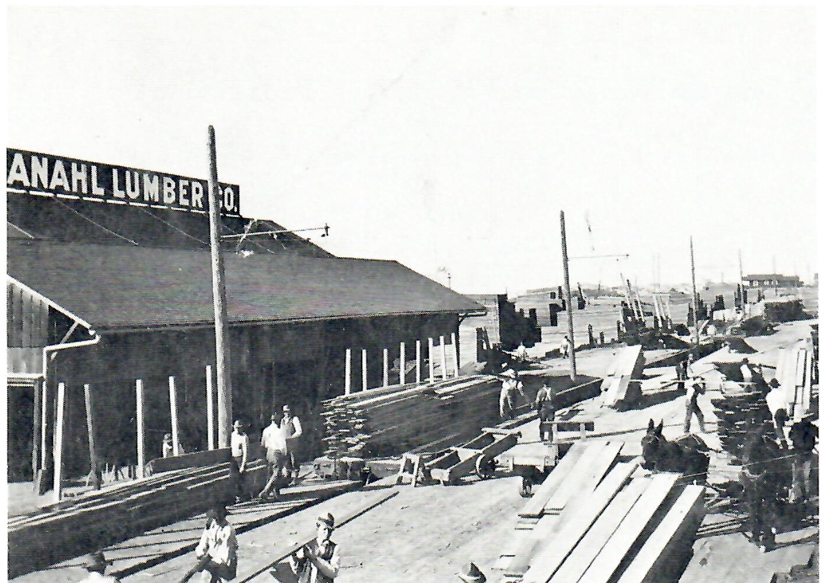
The Ganahl Lumber location in Redondo Beach. Undated photo circa early 1900s. (Credit: Redondo Beach Historical Society)

The Redondo Beach yard was located at Gertruda and Pacific avenues in an area that was reconfigured for the 1960s King Harbor redevelopment in the city. During its early days, steamships were still stopping at Redondo as it vied with San Pedro to become L.A.’s main port.

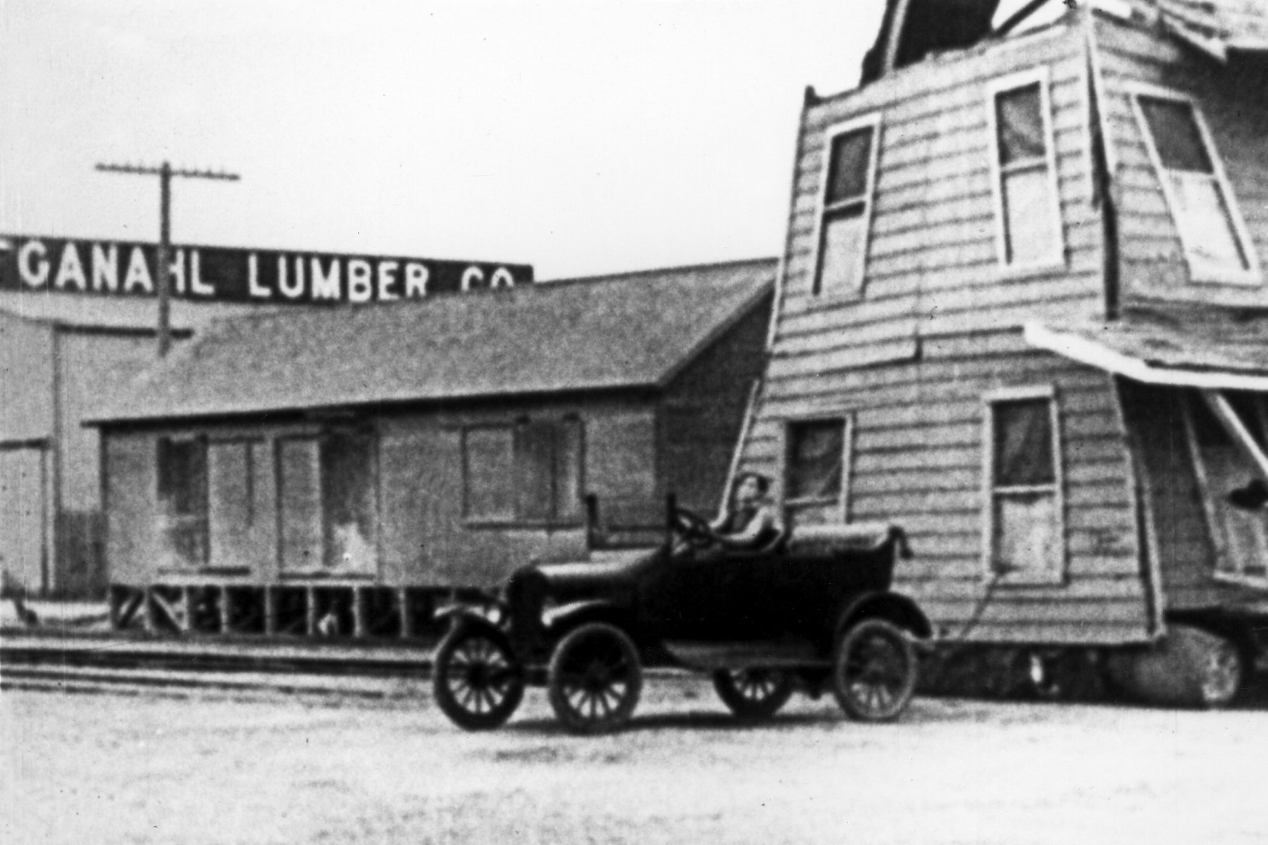
The Inglewood location on Eucalyptus St. north of Florence Ave. gained notoriety for its part in Buster Keaton’s 1920 silent short film “One Week.” The rail spur connecting Ganahl Lumber to the Santa Fe main line was used for one of Keaton’s most famous comic stunts, when the house he’s moving gets destroyed by a speeding train. The lumber yard’s sign is visible in the film.

Still from the 1920 Buster Keaton silent film “One Week.” Sequence filmed near Ganahl Lumber in Inglewood. (Credit: Ganahl Lumber Facebook page)

The firm’s founder, Christian Ganahl, died from bronchial pneumonia at his home on Grand Ave. in L.A. on Feb. 8, 1922. He was 86. His descendants continued to run the business, and do so still.

Both the Inglewood and the Redondo Beach Ganahl locations eventually closed. Business in Redondo Beach began tapering off in the 1940s, when rail transport replaced shipping. The empty former yard burned to the ground in the 1970s, and the land became the site of  Redondo Beach’s main post office. 

Ganahl eventually moved its headquarters to Anaheim and much of its business focus to Orange County. It returned to Los Angeles County when it opened a Pasadena branch in 2012.

The firm’s president, Mark Ganahl, told the Daily Breeze in 2017 that 75 percent of the company’s sales were going to construction firms building upscale homes in the South Bay and on the Westside. A need for a centralized South Bay location had become a necessity.

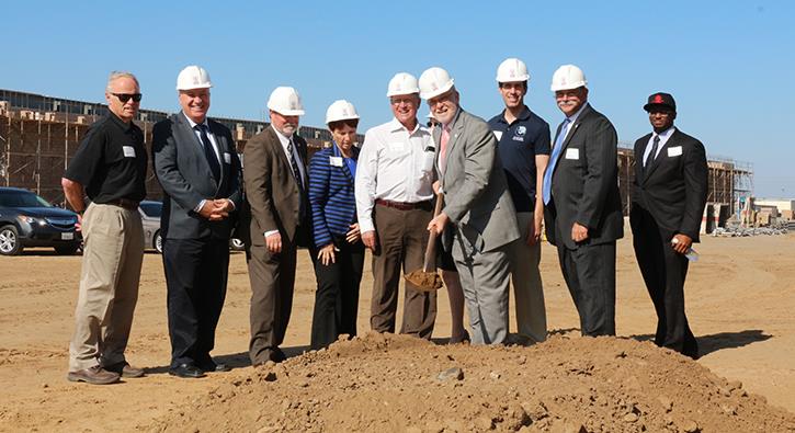
Torrance Mayor Pat Frey wields a shovel during the groundbreaking ceremony for Ganahl Lumber’s Torrance site, which opened in 2017. (Credit: Ganahl Lumber Facebook page)

 After two years of searching for a suitable site, Ganahl in 2015 announced plans to build its new Torrance location at 2600 Del Amo Blvd. between Maple and Crenshaw avenues, a stretch of roadway built in 2012 to connect Del Amo to Crenshaw.

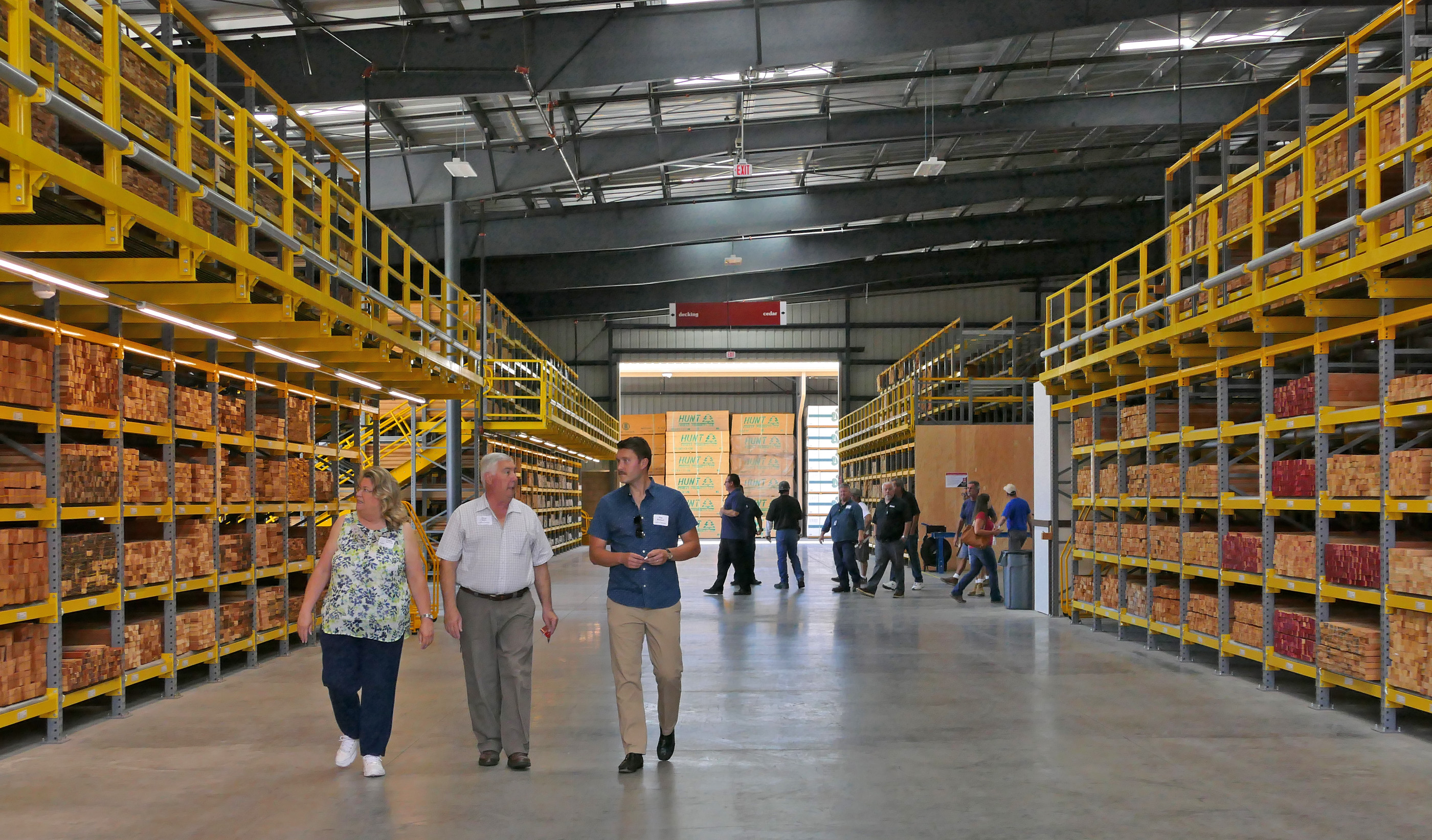
The new 18-acre lumberyard included an 86,000-square-foot building supply store, 40,500-square-foot lumber storage shed and 12,700-square-foot lumber milling shed on land that formerly was part of the Torrance Dow Chemical plant.

Ganahl also built a 775-foot-long rail spur connecting the yard to a nearby train line to facilitate its lumber deliveries and reduce the number of trucks needed to make them.

It opened for business on Aug. 4, 2017. Most of its customers are builders and contractors, though the company also serves retail consumers.

Guests tour the Ganahl Lumber location in Torrance prior to its 2017 grand opening ceremony. (Daily Breeze staff photo by Robert Casillas)

Ganahl now operates eleven lumber yards throughout Southern California after adding its first San Fernando Valley location with its 2022 acquisition of Northridge Lumber.

In addition to Torrance, Ganahl’s other locations are in Anaheim, Buena Park, Capistrano Beach, Corona, Costa Mesa, Laguna Beach, Lake Forest, Los Alamitos and Pasadena.

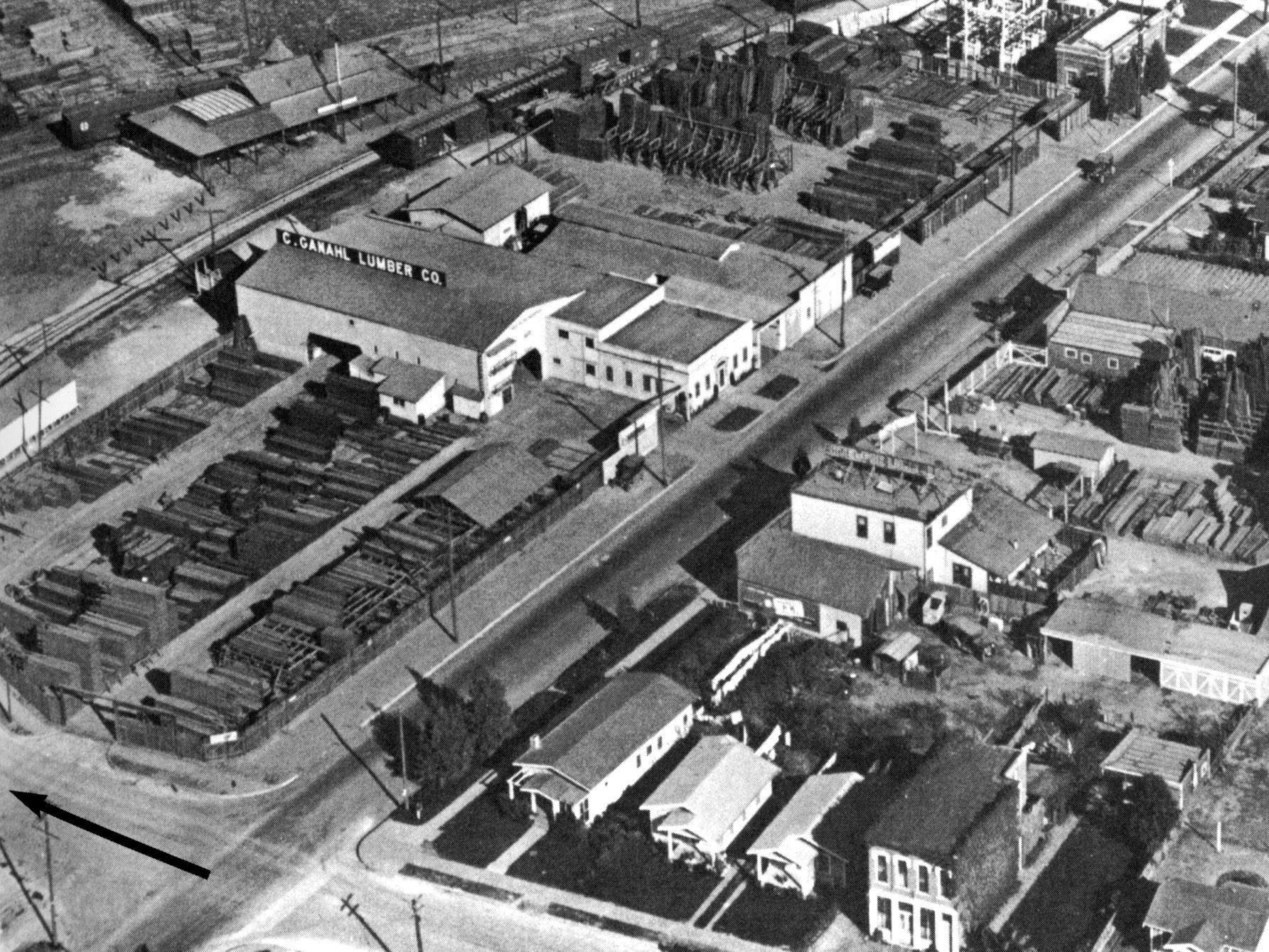
Undated photo shows the former C. Ganahl location on Avalon Blvd. in Los Angeles. (Credit: Ganahl Lumber Facebook page)

Sources:

“About Us: History,” Ganahl Lumber Co. website.
Daily Breeze archives.

Directory of the City of Redondo Beach, 1907 edition.

Los Angeles Times archives.

“Pioneer Lumber Dealers in Los Angeles,” by W.F. Montgomery, Historical Society of Southern California Quarterly, March 1942, University of California Press.

Redondo Reflex archives.

San Pedro News Pilot archives.

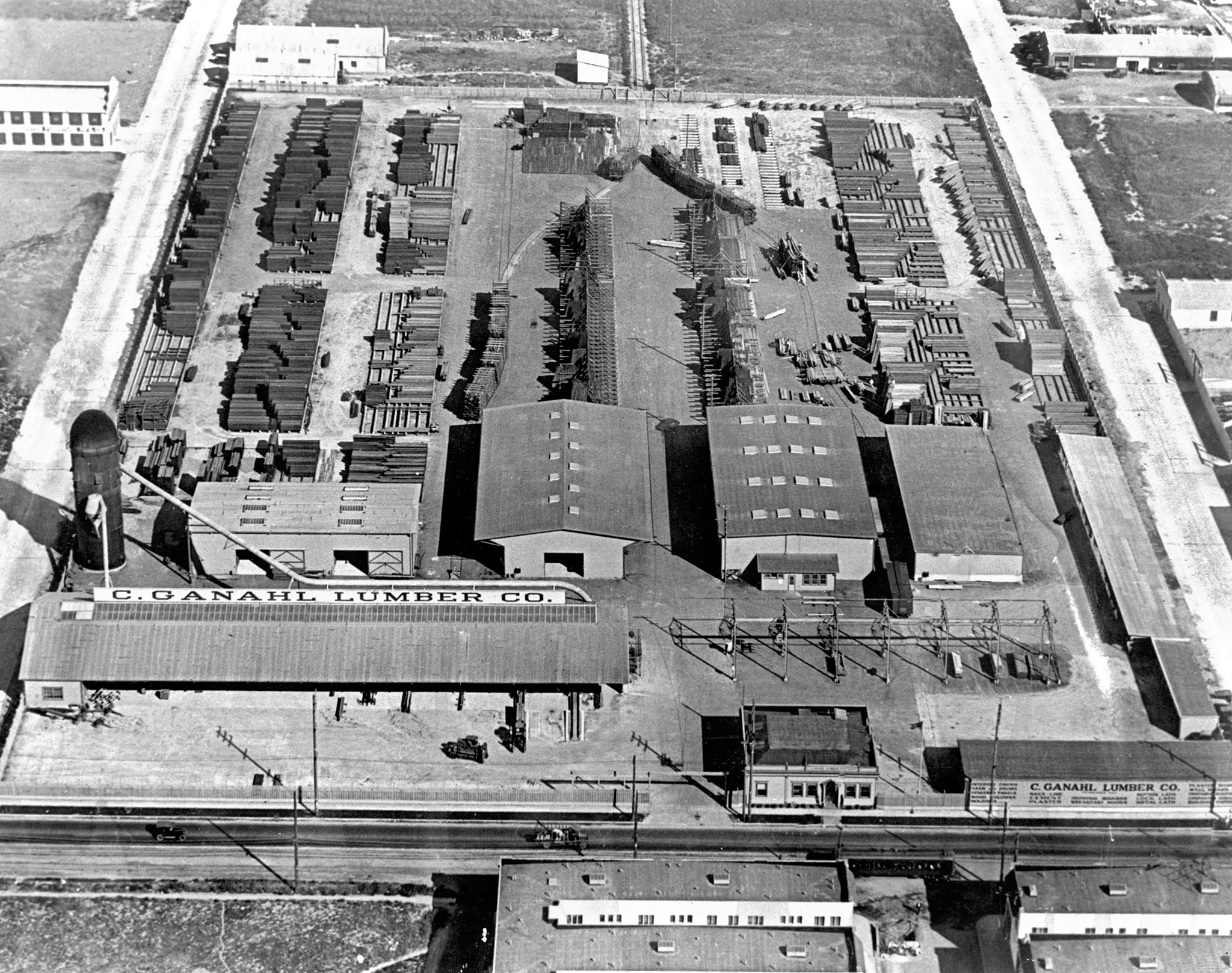
Undated photo of the Ganahl Lumber location in Inglewood. Train station is visible at top. (Credit: Ganahl Lumber Facebook page)

Rolling Hills Plaza shopping center has changed with the times many times since 1961

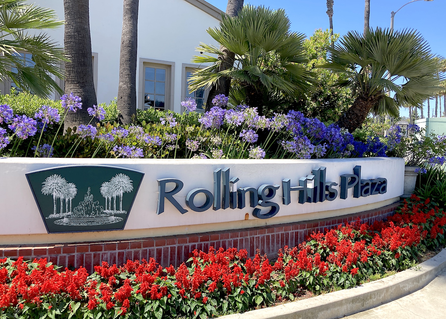
Crenshaw Blvd. entrance to the Rolling Hills Plaza shopping center in Torrance. (July 2023 photo by Sam Gnerre)

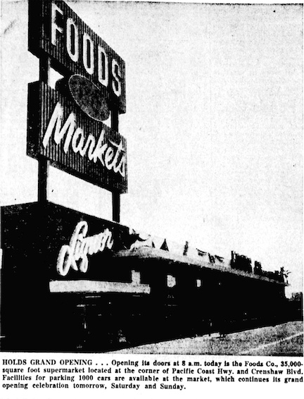
When the Foods Co. supermarket opened its doors on March 24, 1959, it became not only the largest grocery store in Torrance at the time, but also the first business to open on a large plot of land on the northeast corner of Crenshaw Blvd. and Pacific Coast Hwy.

It wouldn’t be the last.

At a luncheon at the Plush Horse restaurant in Redondo Beach, James Bower and Albert Levitt from the development firm Jefferson Co. announced the imminent opening of a new $15 million outdoor shopping center to be built on the 38-acre site in early 1961.

Torrance Herald, March 26, 1959, Page 1. (Credit: Torrance Historical Newspaper and Directories Archive database, Torrance Public Library)

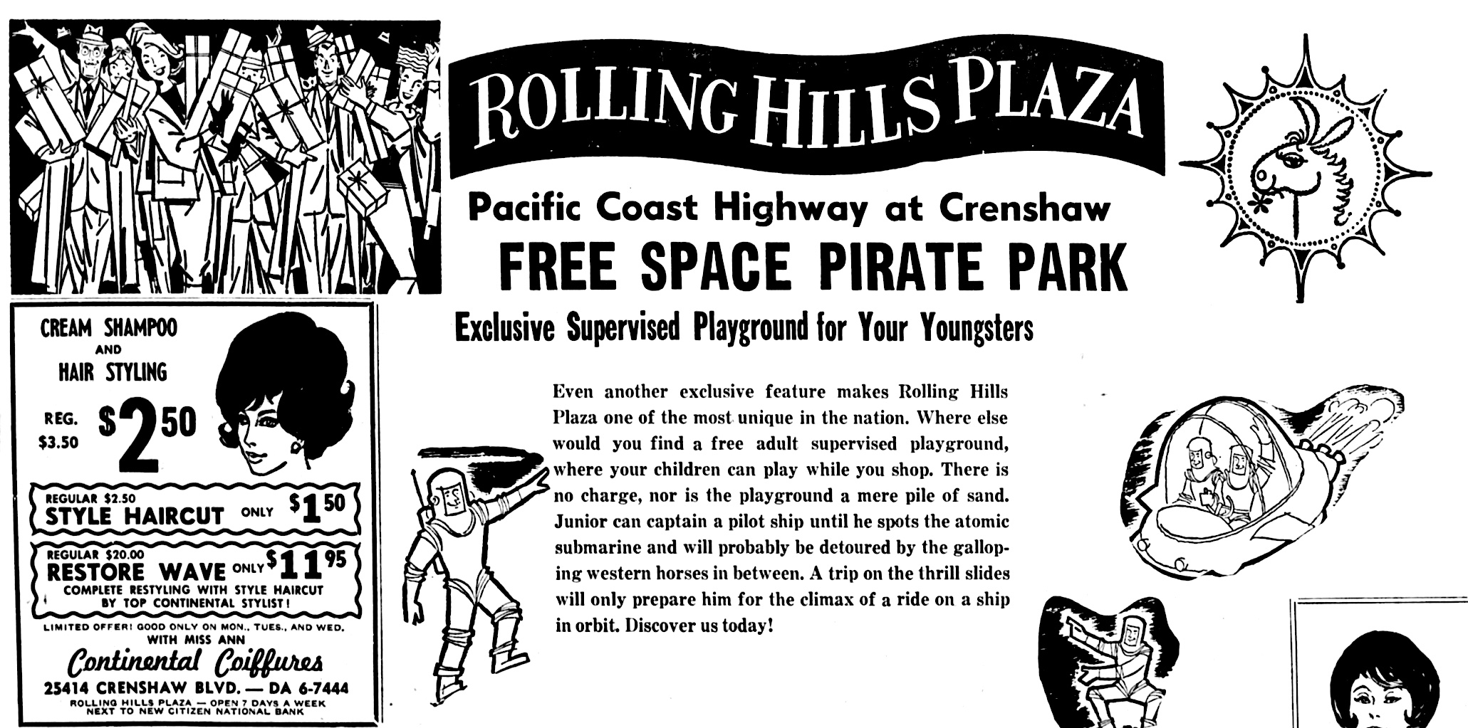
More than 40 stores planned to move into the new Rolling Hills Plaza, which would include the already-thriving Foods Co. These would include department stores, specialty shops, service stores and a supervised child-care center. This last feature had an appropriately 1960s-style theme and name: Space Pirate Park.

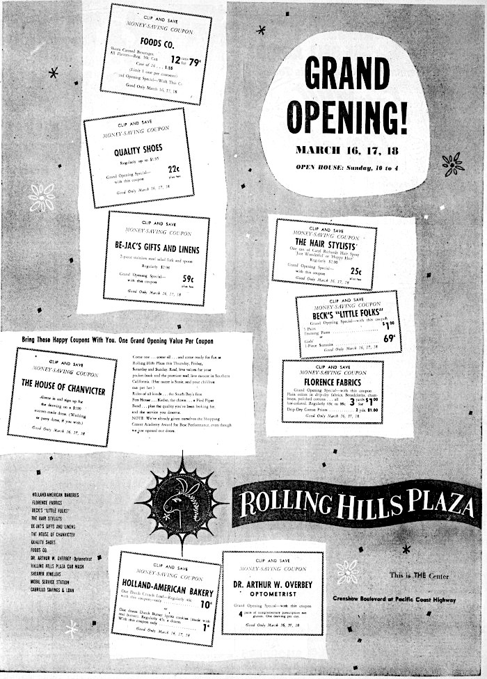
Grand opening ceremonies were held at the new complex on March 16, 1961. They included an appearance by the center’s mascot, Susie the donkey, who was given an award by Torrance Mayor Albert Isen in what seems in retrospect to have been an  unusually silly publicity stunt. Kedso the Clown also appeared at the ceremonies.

Among the initial stores to open: Beck’s Little Folks, Be-Jac’s Gifts, the House of Chanvicter bridal gown shop, Holland Bakery, Quality Shoes, an optometrist and a hair stylist. 

Portion of ad, Torrance Herald, March 21, 1963. (Credit: Torrance Historical Newspaper and Directories Archive database, Torrance Public Library)

The roster of stores would increase in 1962 with the opening of a Thrifty Drug, a J.J. Newberry variety store and branches of Citizens National Bank and Cabrillo Savings and Loan.

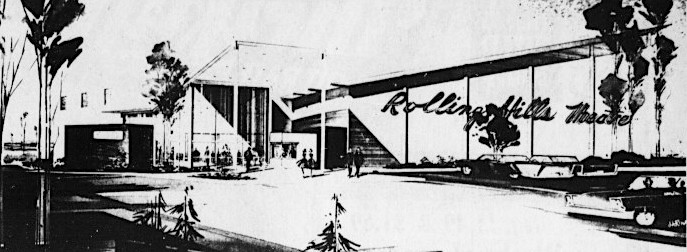
In late 1962, the Sterling theater chain broke ground for a key element of the center: The Rolling Hills Theater, a $500,000 state-of-the-art 1,000-seat single-screen movie palace. Its gala grand opening was held in October 1963.

Artist rendition of the Rolling HillsTheatre. Palos Verdes Peninsula News, Nov. 22, 1962, Page 7. (Credit: Palos Verdes Peninsula News archives)

The theater became the site of a senseless tragedy ten years later, when a robber killed four employees during a holdup there on Feb. 11, 1973. It closed in 1984. Two years later, the American Multi-Cinema (AMC) theater chain opened the Rolling Hills 6 multiplex there.

In 1977, the arrival of the huge Rolling Hills Plaza Racquet Club tennis and recreational sports facility changed the face of the Plaza. The $1.5-million center located on land north of the theater had 15 tennis courts, an indoor pool, eight racquetball courts, a spa, clubhouse, locker rooms and pro shop.

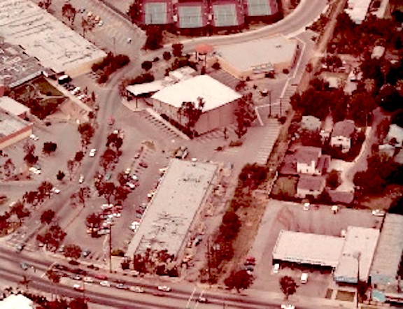
1984 aerial looking north from Pacific Coast Hwy. shows the Rolling Hills Theatre building with slanted roof, center, and tennis courts at the southern end of the Rolling Hills Plaza Racquet Club. (Daily Breeze file photo)

South Bay developer Norm La Caze purchased the Rolling Hills Plaza Shopping Center in 1984, and he immediately began an ambitious development program. It started with a redesign that spruced up storefronts with a more unified design theme and adding landscaping as well as more commercial space.

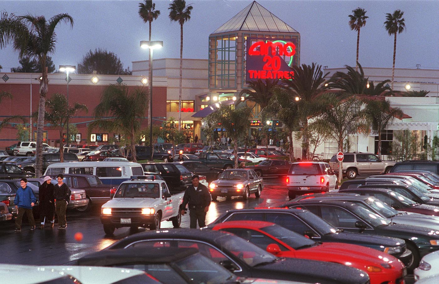
An even more major redevelopment took place at the shopping center beginning in 1996. By then, the Rolling Hills Racquet Club had been closed for two years. In the empty sports club’s place, the AMC chain would build a supersized new 20-screen theater complex, the Rolling Hills AMC 20. It opened in July 1997.

Cars search for a place to park on a Friday evening at Rolling Hills Plaza in 1998 shortly after the opening of the AMC Rolling Hills 20 complex. Feb. 7, 1998. (Daily Breeze file photo by Bruce Hazelton)

An additional 60,000 square feet of store building space would be demolished during the redevelopment program, and would be replaced by 64,000 feet of new retail space. Among the casualties was the local branch of the Fuddruckers build-your-own burger chain that fronted Pacific Coast Highway. It was replaced by a new Hollywood Video rental outlet.

A key anchor store came to the center in 1999, when Whole Foods Market moved into the former Ralphs grocery store on its western end near Crenshaw Blvd., where the original Foods Co. outlet had once stood.

Other retail stores came flooding in. Trader Joe’s, Rite-Aid, Tilley’s, Old Navy and a blur of restaurants including Islands, Rubio’s, Starbucks, California Pizza Kitchen and Macaroni Grill, among many others. A large 24-Hour-Fitness gym now occupies its southwest corner.

In more recent times, Old Navy became Bed, Bath & Beyond, itself recently closed due to the chain’s bankruptcy, while Rite Aid closed in 2015, its place taken by a Nike apparel store. A major kitchen fire closed Macaroni Grill that same year, and it became a StoneFire Grill restaurant.

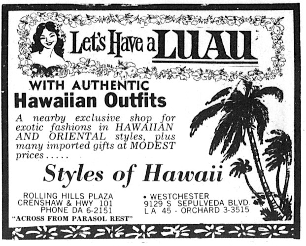
Amid the blizzard of changes at the center over the years, one small retail store remained a constant for decades. Styles of Hawaii had opened its first store in Los Angeles in 1959, selling Hawaiian shirts and other island apparel. 

Palos Verdes Peninsula News, Aug. 15, 1963, Page 14. (Credit: Palos Verdes Peninsula News archives)

In 1962, the store moved into the Rolling Hills Plaza Shopping Center, where it remained for the next 56 years, until its third set of owners, Linda Uyeda and her Hawaiian-born husband Kevin Ajinine, finally decided to close it.

Styles of Hawaii’s longevity proved to be an exception to the constantly evolving retail environment that surrounded it at the Rolling Hills Plaza.

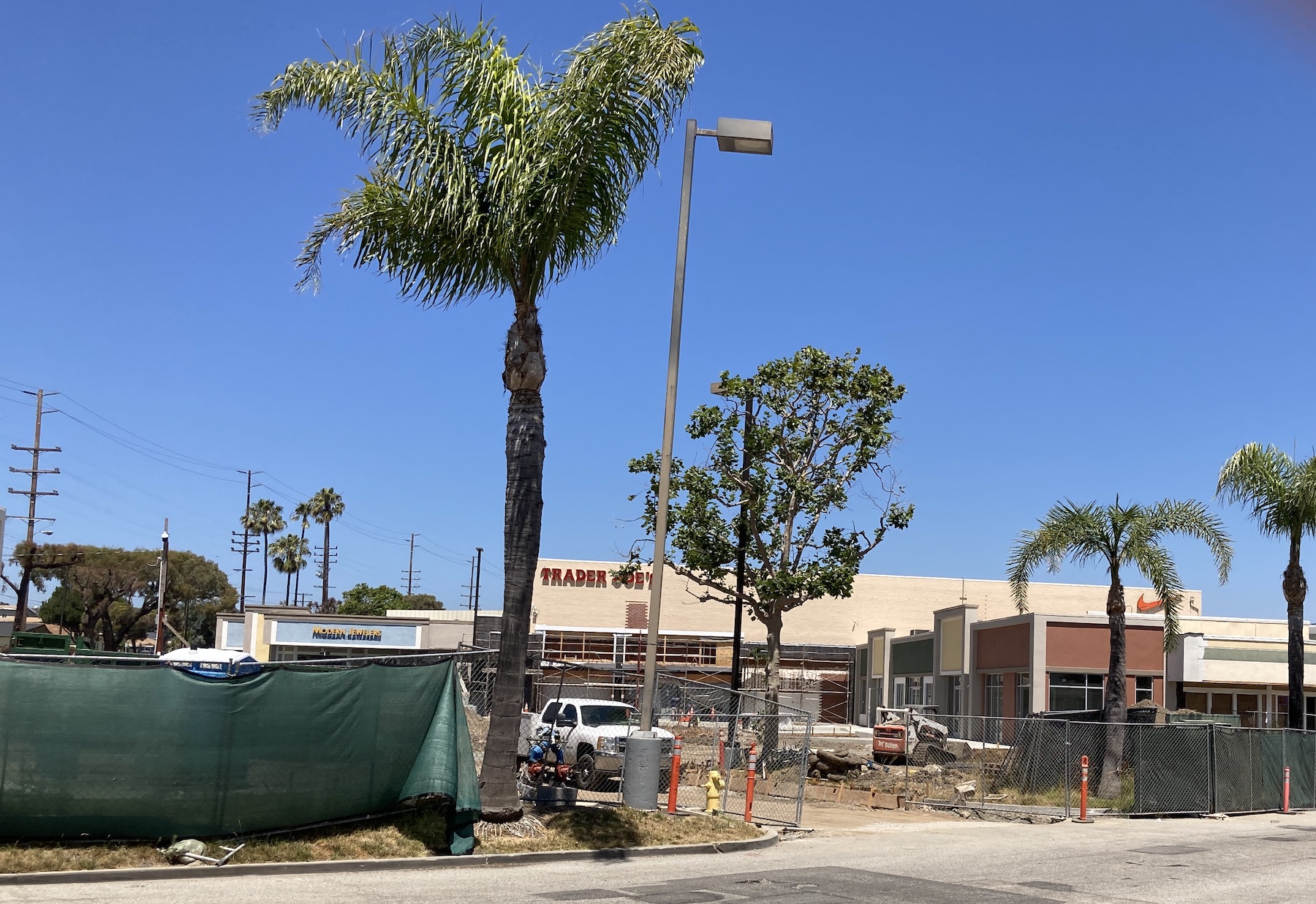
Construction continues behind Trader Joe’s at the Rolling Hills Plaza shopping center in July 2023. (Photo by Sam Gnerre)

Sources:

Daily Breeze archives.

Los Angeles Times archives.

Palos Verdes Peninsula News archives.

Torrance Press Herald archives.

Palos Verdes Peninsula News, March 16, 1961, Page 5. (Credit: Palos Verdes Peninsula News archives)

Reader comments:

July 18, 2023

Thank you so much for your article on the Rolling Hills Plaza, Spent many Sundays at the Rolling Hills theatre watching the latest Disney movies. But my fondest memories were of the Styles of Hawaii. My mother was born and raised on Oahu (civil service brat). It was one of her favorite places to shop. She would buy many gifts for our family, and sent many back to Hawaii to relatives.  We also enjoyed the new AMC 20 with my kids! She passed in 2007, but this article brought back many wonderful memories. Thank you so much. Aloha!

Dawn R. Breski

Shifting soil and landslides have been part of Palos Verdes Peninsula life for decades

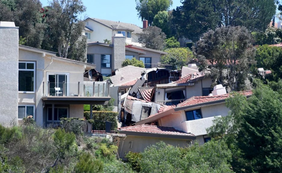
A landslide on Peartree Lane destroyed 12 homes and threatened several more in Rolling Hills Estates in July 2023. (Daily Breeze staff photo by Brittany Murray)

The July 2023 landslide that destroyed 12 homes and endangered at least 10 more on Peartree Lane in Rolling Hills Estates is a tragic but not unprecedented occurrence on the Palos Verdes Peninsula and nearby hillside areas.

The Peninsula once was an island surrounded by the Pacific Ocean. Its hills were formed by a seismic thrust roughly two million years ago. The waters north and east of it eventually receded, connecting the hills to the California mainland. 

The Palos Verdes Fault traverses the area; in 2022, seismic experts estimated it capable of causing a quake as high as 7.8 in magnitude. The unstable nature of the Peninsula’s geology has resulted in often-devastating landslides, some of which have been caused by earth movements that have been progressing for thousands of years. 

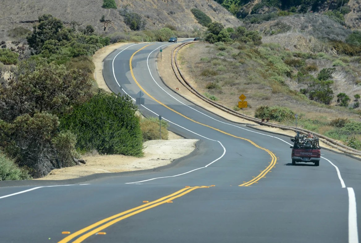
Palos Verdes Drive South snakes through the Portuguese Bend landslide area. The land is constantly moving, causing movement in the road’s pavement as evidenced by the numerous pavement patches and the undulations in the road. 2012 photo. (Daily Breeze staff file photo)

Geologists estimate that the Portuguese Bend landslide may be at least 5,000 years old. Road crews working on the extension of Crenshaw Blvd. southward noticed cracks in a road culvert above the upscale new Portuguese Bend Club housing development in August 1956.

The land was rapidly moving south, and the results were disastrous. Roughly 200,000 cubic yards of dirt gave way, eventually destroying 130 homes and portions of PV Drive South and Yacht Harbor Drive, the roadway inside the gates of the development. The one-time seaside paradise, opened with a star-studded gala just eight years earlier, would never be the same.

Residents won a $9.5 million judgment that claimed the Crenshaw roadwork exacerbated the slide. As a result, the southern extension of Crenshaw never was built; it ends just past Crest Road. To this day, the city of Rancho Palos Verdes spends a good portion of its annual budget repairing the ever-shifting surface of Palos Verdes Drive South in the area as a result of continual land movement.

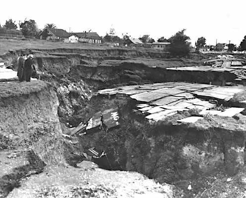
Two hundred tons of earth at Point Fermin look ready to topple into the sea at San Pedro following an earthquake. Feb. 17, 1941 photo. The area would later become known as Sunken City. (Credit: Los Angeles Public Library Photo Collection)

One of the earliest land movements to affect residents occurred at Point Fermin in San Pedro, just down the road from Portuguese Bend. Landowner and developer George Peck had begun building cliff-top homes on the site in the mid-1920s.

About a dozen homes had been built by Jan. 2, 1929, when engineers detected a movement of eight inches in cracks on the property  south of Shepard St., just east of the Point Fermin Lighthouse. Several houses ultimately were lost, with at least two believed to have fallen into the sea. 

A 1941 earthquake ended the possibility of erecting more houses in the area, and the rest of the planned development was never built. The abandoned area was cordoned off, and became the local landmark unofficially known as Sunken City.

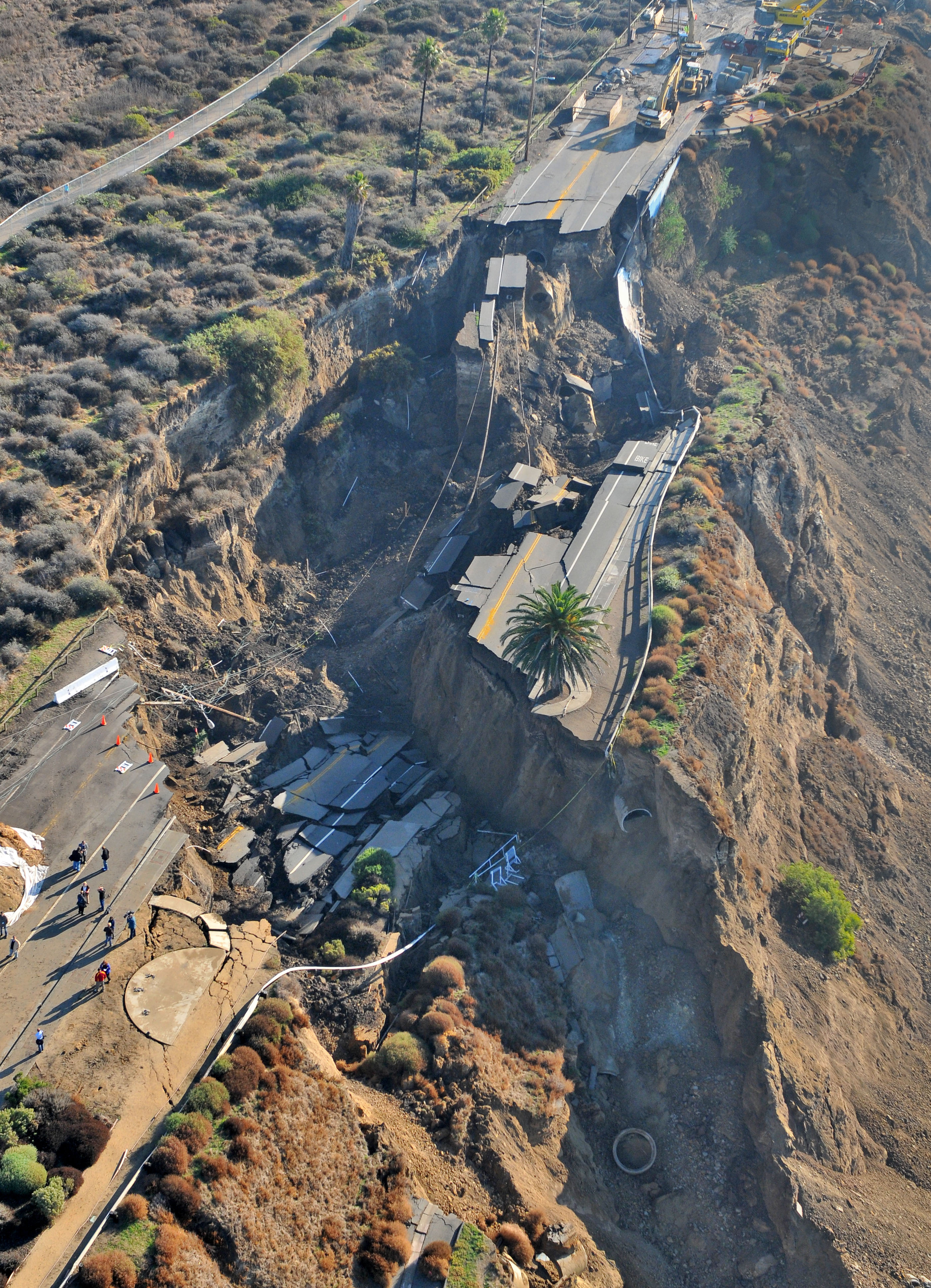
A major disaster occurred on Paseo del Mar a couple miles west of Sunken City on Nov. 20, 2011, when the White Point Landslide took down a huge chunk of the ocean bluffs and  completely destroyed 400 feet of the roadway. Fortunately, no one was injured and no structures damaged. Almost a dozen years later, however, the affected stretch of road has yet to be repaired.

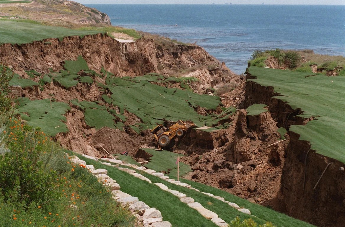
The 18th hole of the new Ocean Trails golf course in Rancho Palos Verdes collapsed due to a landslide in June 1999, just weeks before the course’s planned opening date. June 2, 1999 photo. (Daily Breeze staff file photo by Robert Casillas)

No one was injured during another landslide just up the coast at the under-construction Ocean Trails golf course in Rancho Palos Verdes on June 2, 1999. The slide, which completely destroyed the 18th hole, occurred just two weeks before the new course was slated to open. More than 80,000 pounds of earth slid toward the Pacific Ocean. 

All work had to be halted while the cause of the 16-acre slide was determined. Results were inconclusive, with engineers mostly pointing toward general instability in the area, which lies about half a mile east of the Portuguese Bend slide area. Donald Trump bought the course in 2009, renaming it Trump National Golf Course, Los Angeles.

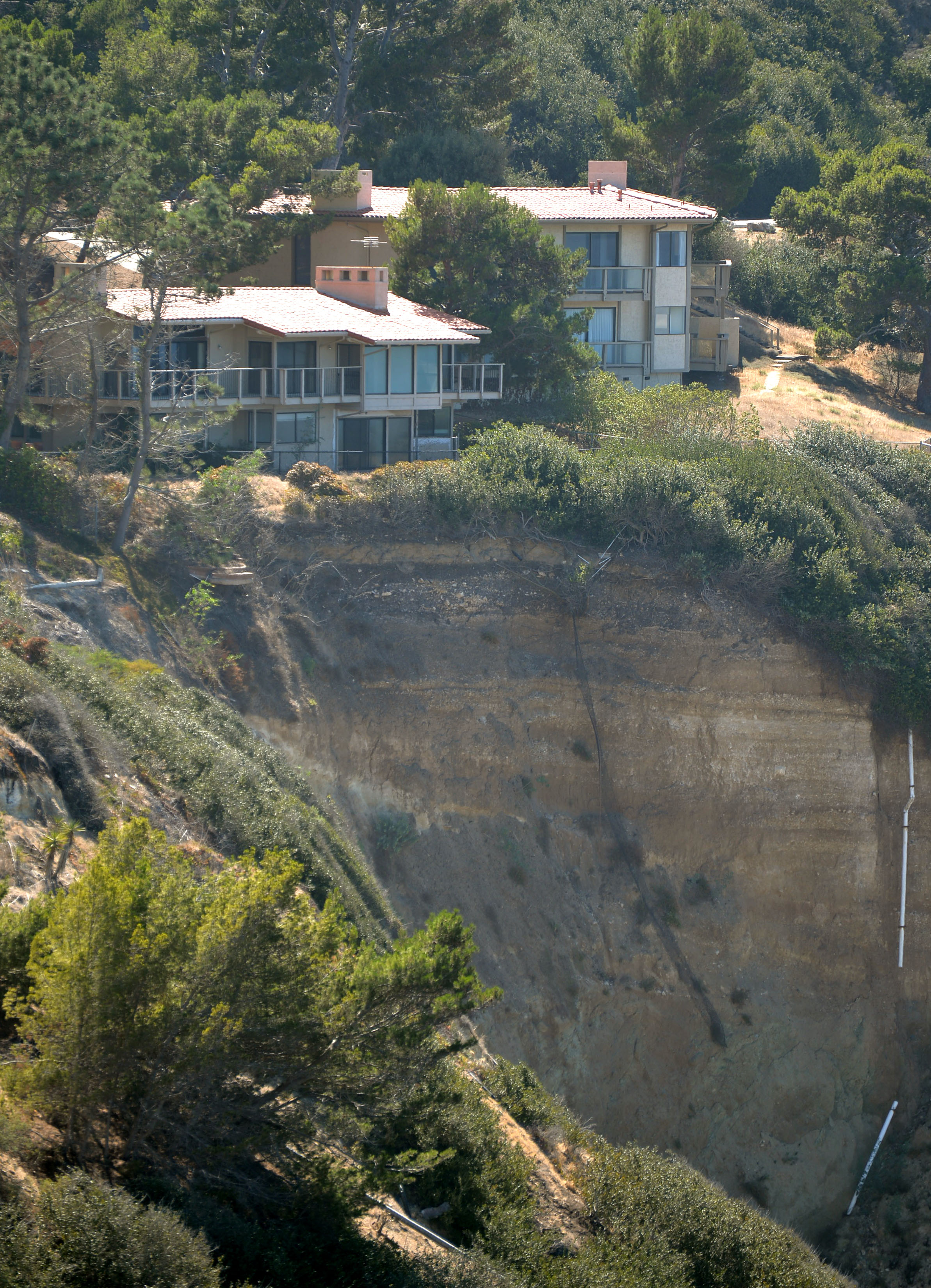
Smaller landslides on the Peninsula have had devastating results on houses in the area. A 1983 landslide in the Bluff Cove area of Palos Verdes Estates destroyed three houses and damaged several others. The city of PVE found the best resolution to the resulting lawsuits to be buying the seven damaged houses from their owners.

Houses that sit in the slide area above Bluff Cove in Palos Verdes Estates sit empty in 2013. The slide escarpment is in front of the homes. Oct. 1, 2013. (Daily Breeze staff file photo by Steve McCrank)

For several years, the city subsidized city employees, allowing them to live in the cracking structures to prevent vandals and squatters from occupying them. The seven houses finally were demolished in 2015 and the land converted to green space.

In 2005, a chunk of hillside in Rolling Hills fell 100 feet onto Poppy Trail, a curving street below. It blocked the road, leaving residents of eight multimillion-dollar homes stranded. It took years of lawsuits to straighten the situation out; in the meantime, the homeowners had to use four-wheel drive vehicles to navigate the slide.

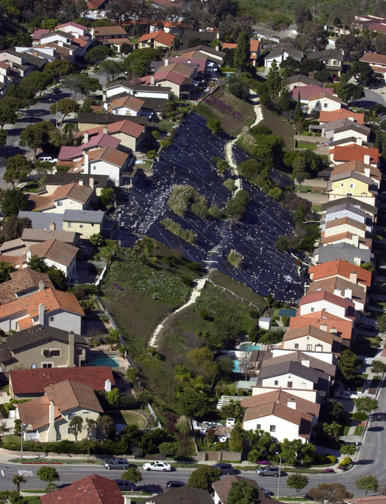
When the hillside began moving on Singingwood Drive and Carolwood Lane  in southern Torrance in March 2001, nearly two dozen homes were threatened. Several were evacuated, and the city declared a state of emergency regarding the situation. Heavy rains sent walls of mud into homeowners’ backyards, and it took months of shoring up the hillside by city workers to allay the threat.

An aerial view of the landslide area above Singingwood Drive, far right, in Torrance. Jan. 31, 2001. The black ground coverings, center, have been placed to help control the slide. (Daily Breeze staff file photo by Scott Varley)

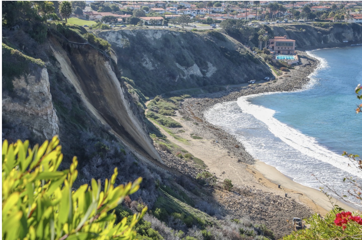
More recently, a 200-foot section of a Palos Verdes Peninsula hillside came crashing down onto Rat Beach on Dec. 9, 2022. The slide came down from an area near Rosita Place in Palos Verdes Estates near the city’s border with Torrance. Homeowners were evacuated temporarily, and the beach area was closed temporarily.

No one was injured, but an unoccupied Los Angeles County Beaches & Harbors truck parked below the cliff was battered by the onslaught, testimony to the dangers posed by geologic forces at work in unstable coastal hills.

A landslide sent rock and debris down onto Rat Beach, below, in December 2022. The slide, foreground, was located on the cliffside bordering Palos Verdes Estates and Torrance. Dec. 9, 2022. (Daily Breeze photo by Chuck Bennett/Contributing Photographer)

Sources:

Daily Breeze archives.

“Landslide Inventory Map of the Palos Verdes Peninsula,” by Wayne D. Haydon, California Geological Survey, 2007.

Los Angeles Times archives.

Palos Verdes Peninsula News archives.

A landslide on Paseo Del Mar below White Point Nature Preserve destroyed a 400-foot chunk of the roadway in November 2011. The roadway has yet to be repaired. Nov. 21, 2011 photo. (Daily Breeze staff file photo by Robert Casillas)

Frances M. Young cultivated the creation of the South Bay’s biggest garden

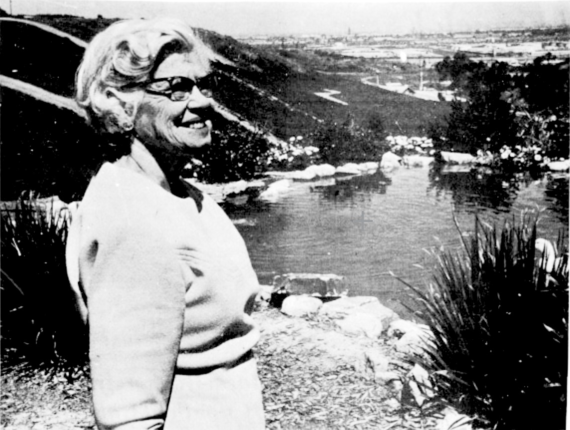
Frances Young admires the man-made lake at the South Coast Botanic Garden. Palos Verdes Peninsula News, June 8, 1969, Page 1. (Credit: Palos Verdes Peninsula News archives)

Frances Mason Young’s lifetime love of plants and gardening led her on a long and incredibly fruitful journey.

Born on Feb. 9, 1900, Young’s affinity for both stemmed from her childhood days roaming the woods near the family home in Memphis, Tennessee. 

After marrying her husband, Richard, a highway construction engineer, the couple spent the early days living in various rental houses in Arizona, Nevada and California before settling in Hermosa Beach in 1935.

At every stop, she adorned their surroundings with a wide variety of plants and flowers. Once the couple settled in Hermosa, Frances immediately joined the South Bay Garden Club.

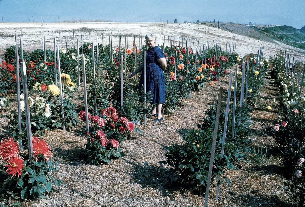
Frances Young stands in the first dahlia garden planted in 1962 at the South Coast Botanic Garden. (Credit: Pacific Horticulture website)

Their Second Street home became a well-known tour destination for aspiring gardeners. It was so popular she had to insist that visitors put their knives and scissors into a box before going in, to keep them from snipping too many cuttings and damaging her plants.

As an ardent gardening enthusiast, she paid frequent visits to the two major botanic gardens in the Los Angeles area, Descanso Gardens in La Canada and the Los Angeles County Arboretum in Arcadia.

In the days before the completion of the freeway system, it took much longer to get to those places, to her frustration. She told the Los Angeles Times in 1969 that, after one such lengthy commute to the Arboretum in the 1950s, “I got to thinking how ridiculous it was to have to travel that far to see an arboretum.”

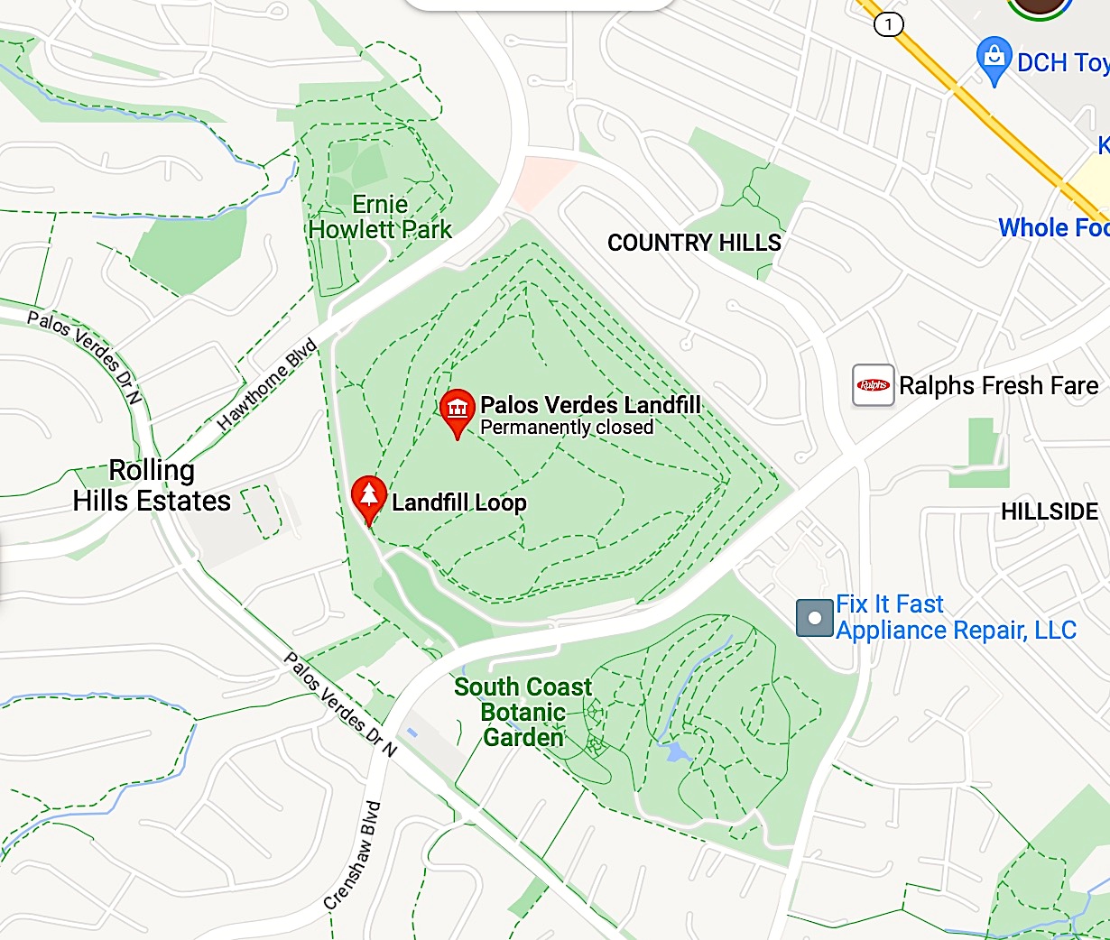
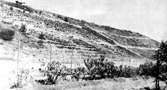
Much of the Palos Verdes Landfill remains undeveloped, above. South Coast Botanic Garden is at bottom. Unlabeled road at upper right of landfill is Rolling Hills Road. 2023 data. (Credit: Google Maps)

She set her sights on a piece of land that once had been a diatomaceous earth mine on the Palos Verdes Peninsula. In the early 1900s, the Dicalite Co. began harvesting the substance from a site near Crenshaw Blvd. and between Rolling Hills Road and Palos Verdes Drive North.

In 1929, open-pit mining began there, and in 1944, the Great Lakes Carbon Corp. purchased the site and began mining it intensively. By 1956, the mine had played out, and Great Lakes sold the land to Los Angeles County for $1.1 million.

The County long-range plan was to turn the site into a park, but first the decision was made to use it as a landfill before covering and converting it. The Palos Verdes Landfill operated on the site from 1957 through 1980.

The arduous job of planting a hillside continues in this Aug. 2, 1962 photo from the Palos Verdes Peninsula News. Workers can be seen on the embankment at middle right. (Credit: Palos Verdes Peninsula News archives)

Young, along with her South Bay Garden Club cohorts and a widening group of area gardening enthusiasts, began petitioning the Board of Supervisors, specifically Supervisor Burton W. Chace, in 1958 to set aside a portion of the landfill site for the development of a regional botanic garden.

After much cajoling and convincing, the County agreed to the idea, officially designating the 87 acres of the landfill on the east side of Crenshaw as the South Coast Botanic Garden on April 1, 1960. An estimated 200 people attended the dedication of the Garden on May 20 of that year, a ceremony which included the Garden’s first plantings, three gingko trees.

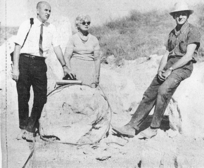
Frances Young, center, consults with SCBG Foundation VP Don Walker, left, and L.A. County landscape architect Paul Kasper, right, on where to put a boulder, bottom left. Palos Verdes Peninsula News, Sept. 27, 1967, Page 2. (Credit: Palos Verdes Peninsula News archives)

The County may have approved the plan, but it left most of the work of developing the new botanic garden to the South Coast Botanic Garden Foundation, the operating group founded in 1961 by Young and her gardening colleagues.

During 1961, the group planted approximately 40,000 plants they had acquired through donations from various sources, including the County Arboretum. The Foundation’s ambitious building plans included an information center and clubhouse, a weather station, comfort stations, an administration/library building and an auditorium.

Adding roads and structures to the garden proved problematic due to the settling of the landfill over the years. It was covered by only from three to five feet of soil, which led to unplanned dips on roads and trails and plumbing problems from pipes broken by shifting soil. 

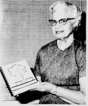
Frances Young poses with her cookbook. Palos Verdes Peninsula News, Nov. 26, 1969, Page 6. (Credit: Palos Verdes Peninsula News archives)

Young and her mostly volunteer support group rose to every challenge. By the time she retired as Foundation president in 1969, the only buildings yet to be built were the administration building and auditorium, and a stream and lake had been added to the grounds, in addition to thousands more plants.

That year, Young previously had a variety of rose named for her, and her locally published cookbook, Food, Flowers, Fancies, was issued. She was feted at a retirement ceremony in June 1969 that included the planting of three gingko trees commemorating her first such plantings at the garden in 1960.

Funding for the new administration building took several years, but construction on the one-story building finally began in 1975. The $868,000 structure included the auditorium, which was dedicated in 1976 after the project’s completion as the “Frances Young Hall of Horticulture.”

Through it all, she continued to live in Hermosa Beach, where she died at her home on April 8, 1978. She was 78.

The regional botanic garden that she worked tirelessly to bring to life continues to flourish, its plant population estimated to be in excess of 200,000. Its continued success stands as testimony to Frances Young’s vision and determination.

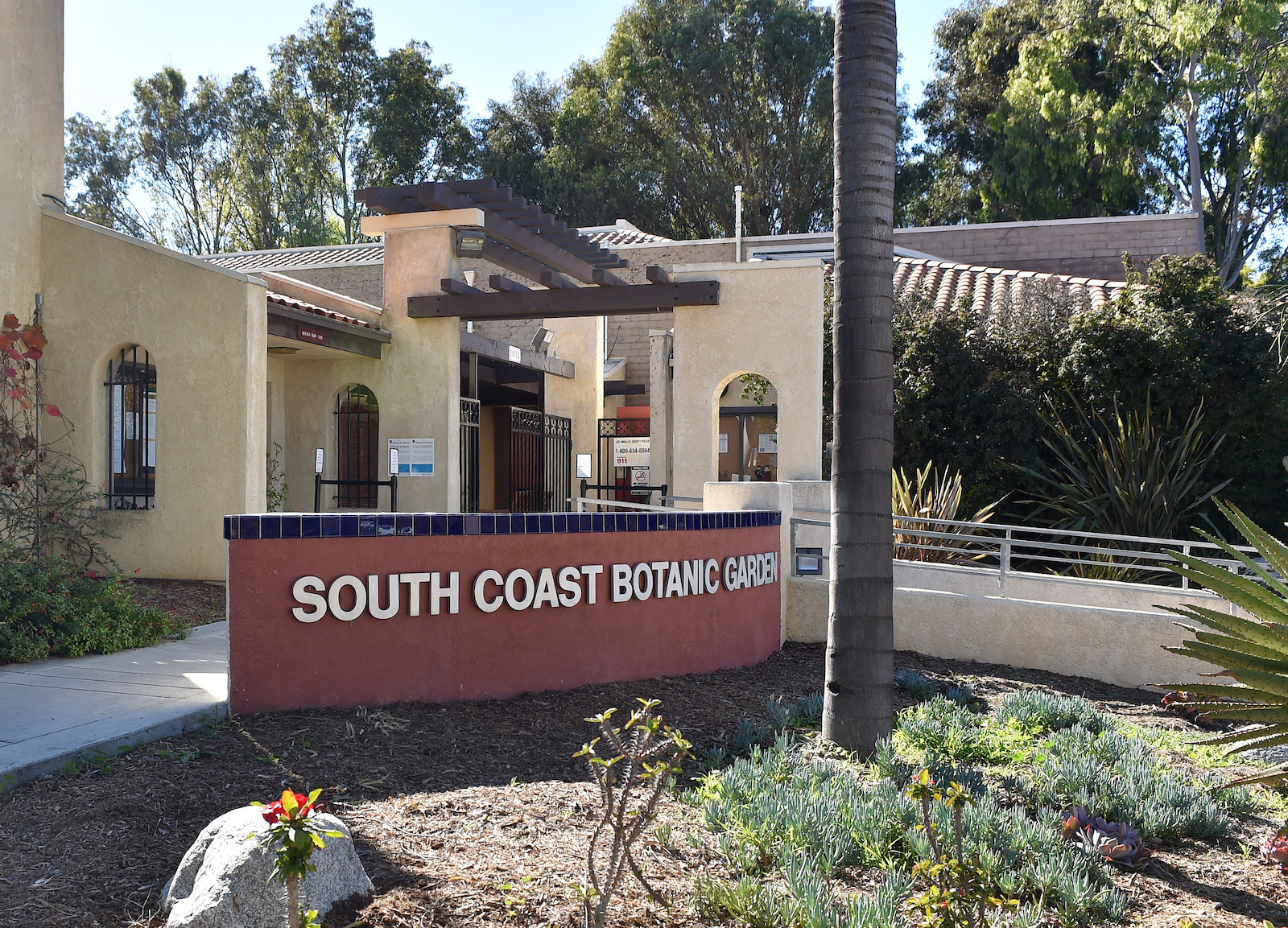
Entrance to the South Coast Botanic Garden on the Palos Verdes Peninsula. 2015 photo. (Daily Breeze staff file photo by Robert Casillas)

Note: The South Coast Botanic Garden is operated by the Los Angeles County Department of Parks and Recreation along with the South Coast Botanic Garden Foundation. It is located at 26300 Crenshaw Blvd, Palos Verdes Peninsula, CA 90274. For more information call 310-544-6815 or visit www.southcoastbotanicgarden.org.

Sources:

Daily Breeze archives.

FindAGrave website.
Los Angeles Times archives.

Palos Verdes Peninsula News archives.

South Coast Botanic Garden website.
“The South Coast Botanic Garden: From Landfill to Jewel of the Peninsula,” by Laurel Woodley, Pacific Horticulture website.
Torrance Press Herald archives.
A trumpet tree blooms at the South Coast Botanic Garden on March 19, 2018. (Daily Breeze staff file photo by Thomas R. Cordova)
Is this your new site? Log in to activate admin features and dismiss this message
Log In