Sculptor Felix Peano created his masterwork for the entrance to an Inglewood church

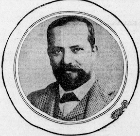
Felix Peano, 1905. (Credit: Los Angeles Herald archives)

Felix Achilles Peano’s rich, fascinating life in the arts began in Parma, Italy, on June 9, 1863. As a young man, he studied sculpture under the tutelage of the then well-known Italian artist Odoardo Tabacchi in Turin.

Peano (pronounced pee-ah-no) emigrated to New York in the 1890s after earning renown for his art works in Paris. While in New York, he designed the Lipton Cup sports trophy for Tiffany & Co. and Scottish tea magnate Sir Thomas Lipton.

IIn 1900, he accepted a post as an art professor at the University of California, Berkeley, teaching sculpture. While living there, he met writer Jack London while both were attending a public lecture. They became friends, and London ended up writing his most famous novel, The Call of The Wild, at Peano’s house in Oakland.
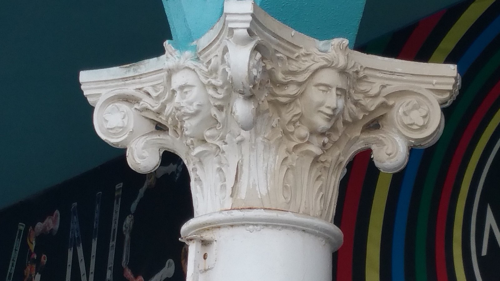
In addition to bridges and a deluxe villa, Peano also sculpted the capitals on columns in Venice. This one features the faces of Venice developer Abbot Kinney (l) and Nettie Bouck (r). The columns are still standing. 2016 photo by Safety Cap. (Credit: Wikimedia Commons)

Southern California real estate developer Abbot Kinney contacted Peano in 1905, offering him a job as architect/designer for his new development along the coast south of Santa Monica.

Kinney called his seaside project “Venice In America,” and enlisted Peano’s help to design it. He originally was slated to craft as many as one hundred of the development’s villas, but ultimately Peano was responsible for one villa. He did design a dozen of the bridges that crossed the development’s canals.
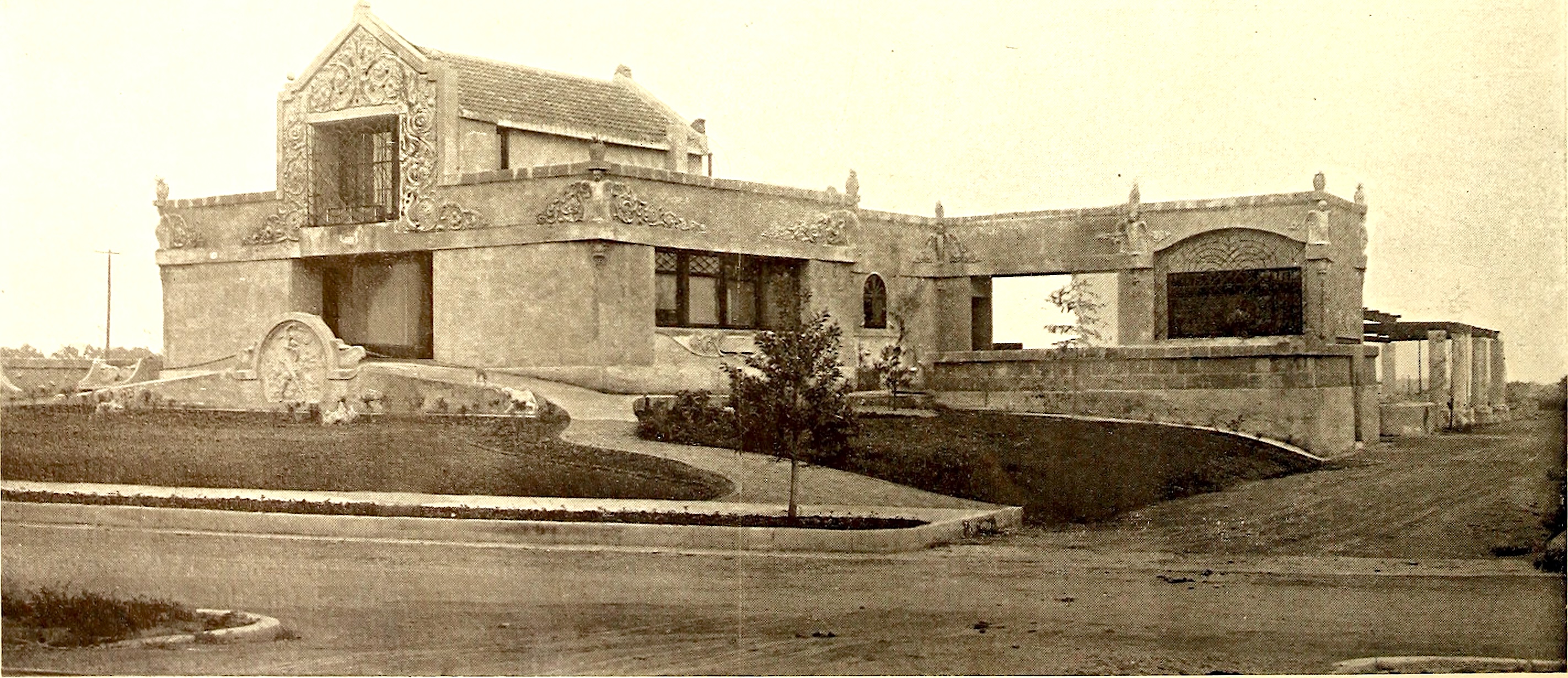
Felix Peano’s house on San Vicente Blvd. in Santa Monica in 1905. (Credit: Wikimedia Commons)

Peano also built a distinctive home for himself at 128 San Vicente Blvd. in Santa Monica. Known as the “Pompeiian House,” it became something of a local landmark at the time.

In 1914, he shifted his attention to the South Bay. That year, he received a request from the daughter of Inglewood founder Daniel Freeman, Grace Freeman Howland, commissioning him to create doors for the entrance of the under-construction Holy Faith Episcopal Church at 260 N. Locust St. in Inglewood for a fee of $85,000.

Creating and executing the massive iron doors, 10½ feet tall and 7 feet wide, would become his life’s work. Inspired by the famed baptistery doors finished in 1453 by Italian Renaissance sculptor Lorenzo Ghiberti entitled the “Gate of Paradise,” Peano would spend the next 34 years of his life working on the project he called the “Door of Life.”
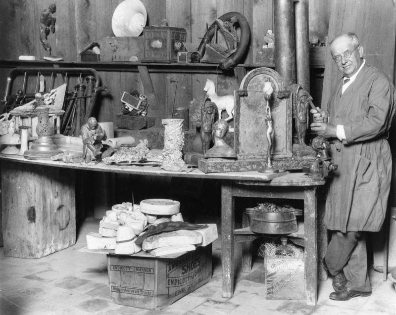
Sculptor Felix Peano at work in his studio at 484 Hawthorne Blvd., Inglewood, on July 13, 1927. (Credit: Los Angeles Public Library Photo Collection)

He moved from Santa Monica to Hawthorne after establishing a studio and foundry at 484 N. Hawthorne Blvd. in Inglewood where he could work on the “Door of Life” and other projects.

His eccentricity manifested itself in the new dwelling he built for himself in 1929 at 260 Freeman Ave. in Hawthorne. The lavish home became known locally as the “House of Surprises” for its ornate statues, carved marble columns and unusual features such as the underground tunnels connecting the main swimming pool to other smaller ones.

Passersby often stopped to gawk at the unusual edifice and its furnishings, some attempting to climb the fences and explore further. Police kept a close eye on Peano’s house for that reason. (Unfortunately, no overall photos of the house seem to have survived.)
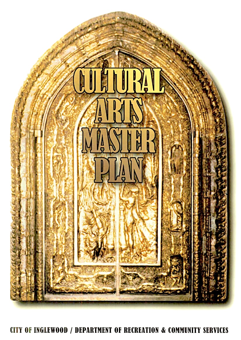
The cover of this June 1996 City of Inglewood publication, above, offers a rare look at Felix Peano’s “Door of Life” sculpture. (Credit: City of Inglewood)

The massive bronze doors that that Peano had made his life’s work were made of bronze and weighed two tons. Like Ghiberti’s earlier work, they were adorned with individual sculpted panels depicting biblical scenes. Following the style of the Italian masters, Peano’s depictions, such as of Eve in the Garden of Eden, contained unclothed human figures.

When the members of the church building council saw Peano’s work, they were outraged. He covered one such figure with long, cascading tresses, but that did little to mollify the committee. When they further demanded that he put some clothes on Eve, he flatly refused.

As a result, the doors were rejected. They never adorned Holy Faith Episcopal’s entrance. In fact, Peano never actually finished the doors. Discouraged and in poor health, he died from a self-inflicted gunshot wound in his Hawthorne home on Nov. 25, 1948.
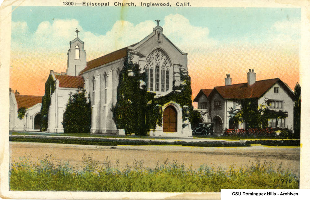
Circa 1920s postcard shows the doors of Holy Faith Episcopal Church in Inglewood, center, where Felix Peano’s “Door of Life” would have been installed had the church members approved the work. (Credit: CSUDH Digital Archives)

He believed in eugenics, the controversial process of improving the human race through genetic engineering, and left his Hawthorne home and $10,000 in his will to the Eugenics Society for  research “toward the creation of supermen.” 

Before he died, Peano had done much of his work at the Slauson Ave. foundry owned by his friend, Robert Haley. Haley enlisted Peano’s friend Jacob Pfeiffer, a bronze finishing expert, to help him complete the project after Peano’s death. 

The two of them worked on the “Door of Life” at Haley’s foundry, the Advance Aluminum & Brass Co. for several years before finishing the artwork in 1954, 40 years after work on it began. But the doors were so immense that no church could be found that would install them.
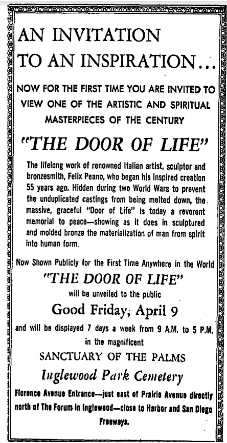
Los Angeles Times, April 10, 1971, Page A8. (Credit: Los Angeles Times archival database)

They languished in Haley’s foundry for years. They did go on public display, but only on rare occasions.

The doors were shown at the Los Angeles Home Show at the Pan-Pacific Auditorium in L.A. in June 1955, at the Sanctuary of the Palms at Inglewood Park Cemetery in April-May 1971 and at the Inglewood Bank of America branch on Manchester later in the 1970s.

The last publicly reported appearance of Peano’s artwork was at the Hawthorne Diamond Jubilee celebration in 1982, and, when last sighted in 1996, the doors were gathering dust at a foundry in East Los Angeles.
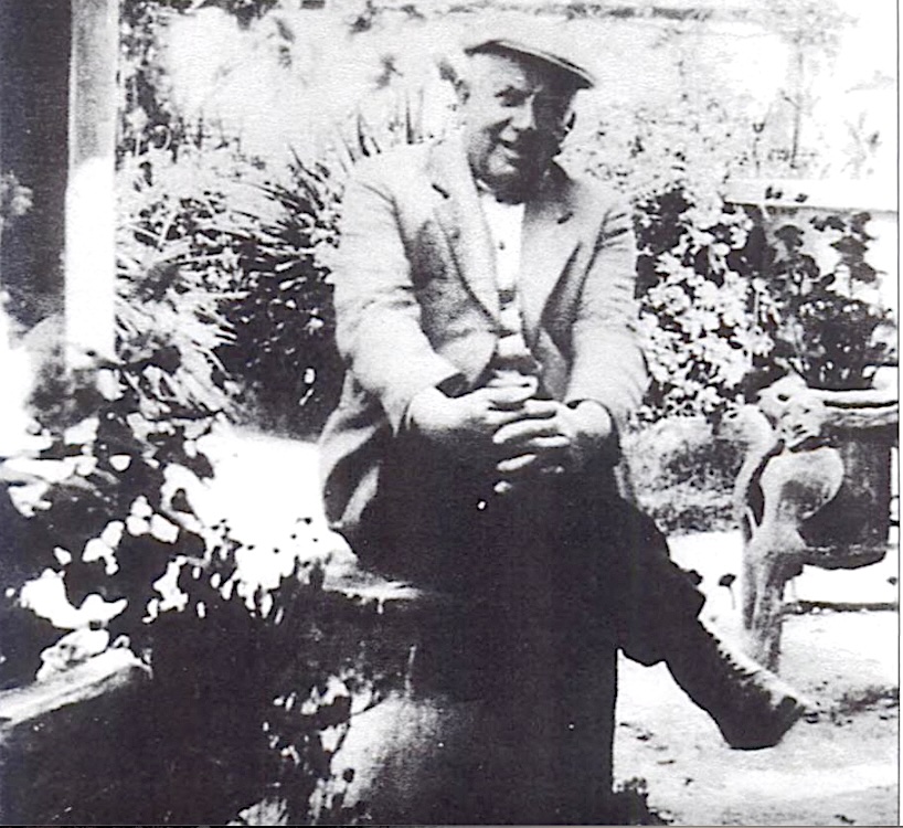
Felix Peano at his Hawthorne home in 1929. (Credit: Hawthorne, by Walt Dixon and Jerry Roberts, Arcadia Publishing, 2005)

Sources:

Cultural Arts Master Plan for the City of Inglewood, City of Inglewood Department of Recreation & Community Services, June 1996.

Find A Grave website.

Los Angeles Herald archives.

Los Angeles Times archives.

“Noirish Los Angeles,” SkyscraperPage website.

Wikipedia.
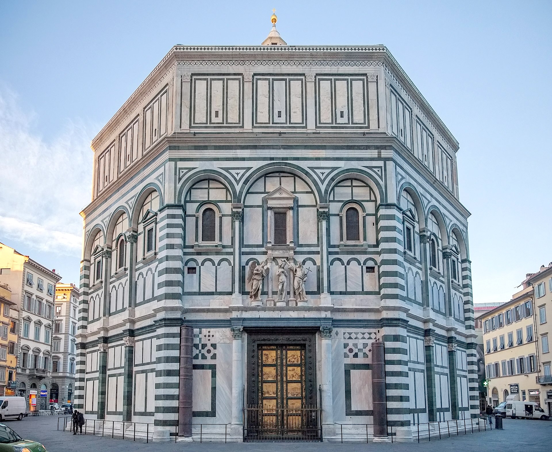
Peano’s “Door of Life” project was inspired by Lorenzo Ghiberti’s ornate doors, the “Gates of Paradise, ” that adorn the east side of the Baptistery of San Giovanni in Florence, Italy. (Credit: Wikimedia Commons)

Army general Amos Fries played a huge role in developing the Port of Los Angeles

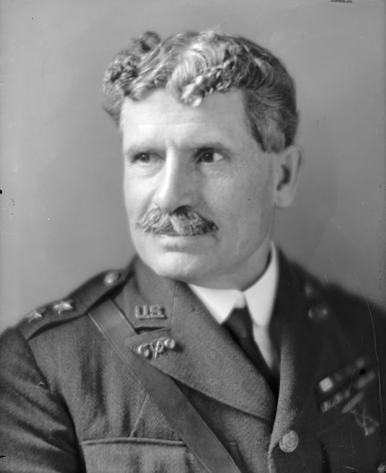
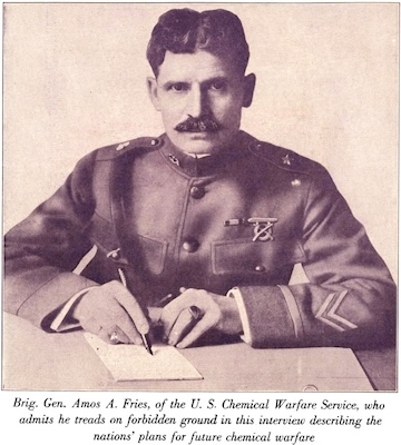
Amos Fries. Undated. (Credit: Library of Congress)

Amos Alfred Fries (pronounced “freeze”) was career Army all the way.

He was born in Viroqua, Wisconsin, on March 17, 1873. The family moved around a bit when he was young, first to Missouri and then to Oregon.

Fries was living in Oregon when he applied and was accepted to the U.S. Military Academy in 1894. He graduated from West Point in 1898, and joined the Army Corps of Engineers.

He served in the Philippines during the Philippine-American War in 1899 under the command of Captain John J. Pershing, who later commanded the American Expeditionary Forces (AEF) during World War I.

In 1906, the Corps of Engineers assigned Fries, now a captain, to replace Capt. Charles McKinstry as chief engineer of the Los Angeles district. His chief duty was to plan and help execute further development of the nascent Los Angeles Harbor, later to be known as the Port of Los Angeles.

It was no easy task. In these early days of the new harbor, conflict had arisen over who would govern it, public agencies or private interests. The debate raged over the “harbor lines,” the shape and design of the Harbor.

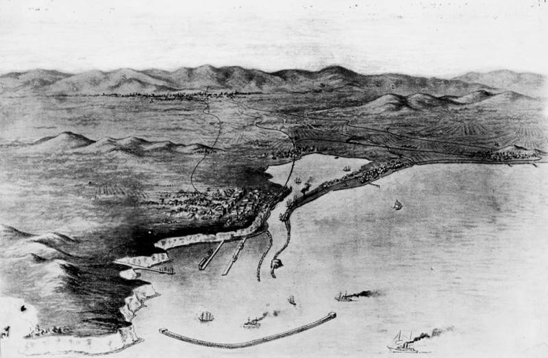
1899 map envisions how San Pedro harbor would have looked if plans at the time had become reality. (Credit: Los Angeles Public Library Photo Collection)

The outer harbor caused little controversy. Construction of a breakwater to protect it had begun in 1899, and would be finished in 1912.

Private shippers owned much of the property in the inner harbor, and were loathe to turn control of their facilities and land over to the government. They bickered constantly with the Corps of Engineers’ Harbor Lines Board, which had been established in 1903 in an attempt to quell the debate.

Into this tangle stepped Capt. Fries, and he wasted no time in coming up with a plan to bring public improvements to the inner harbor over the objections of the shipping firms. His efforts to create the framework for what would become a modern port helped clear the way for its success.

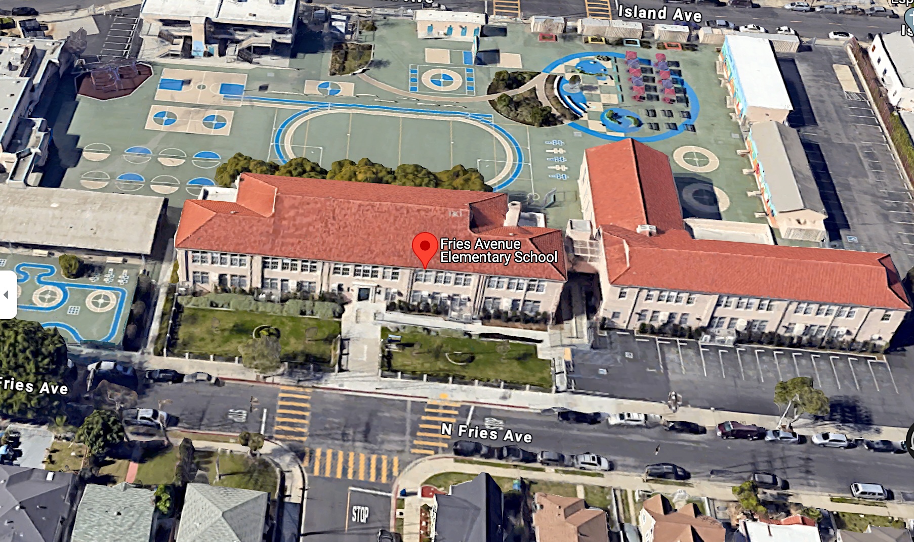
The city of Wilmington thought so, at least. On March 29, 1909, it renamed what was then an earlier version of C Street in honor of Fries. Fries Avenue it remains today, stretching from the Mormon Island docks north through the city. Fries Avenue Elementary School opened near Fries Ave. and M St. in 1923.

Fries Avenue Elementary School opened in 1923. (Credit: Google Earth)

Fries also began to feel that many of the painful birth pangs of the Port resulted from the provincial decisions made by local politicians in San Pedro and Wilmington. 

He offered increasing support to the notion of ceding complete control of the harbor to the City of Los Angeles, believing that its operation could be better managed by the larger government to the north.

His way of thinking added momentum to the plan to consolidate Wilmington and San Pedro into the City of Los Angeles, bringing them and the harbor under the larger city’s control.

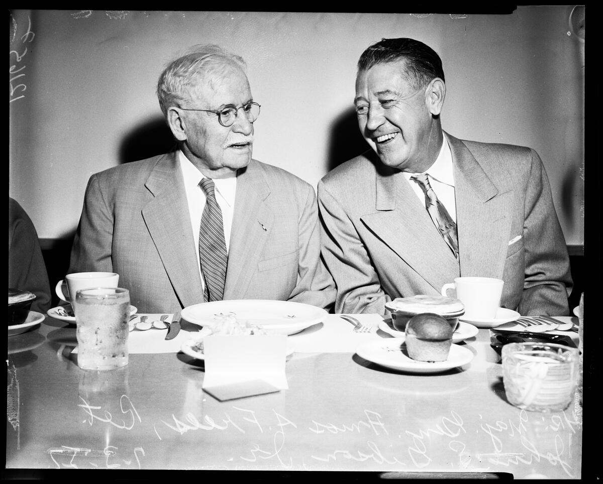
Retired Major General Amos A. Fries, left, and Los Angeles City Council President John S. Gibson Jr. at a luncheon in Los Angeles on July 3, 1957. Both men have streets in the Harbor Area named for them. (Credit: USC Digital Library)

This was achieved by convincing those cities to disincorporate and be reincorporated as part of Los Angeles in 1909. In order to conform to state law, Los Angeles had to connect the annexed areas physically to itself. In order to do that, the city purchased parcels to form a thin 16-mile strip of land stretching from its southern border down to the two small cities.

While prescient in hindsight, the views Fries expressed in the charged political atmosphere at the time did not endear him to all. He was summarily relieved of his duties in Los Angeles and transferred to a new position as head of the Army’s engineering school in August 1909.

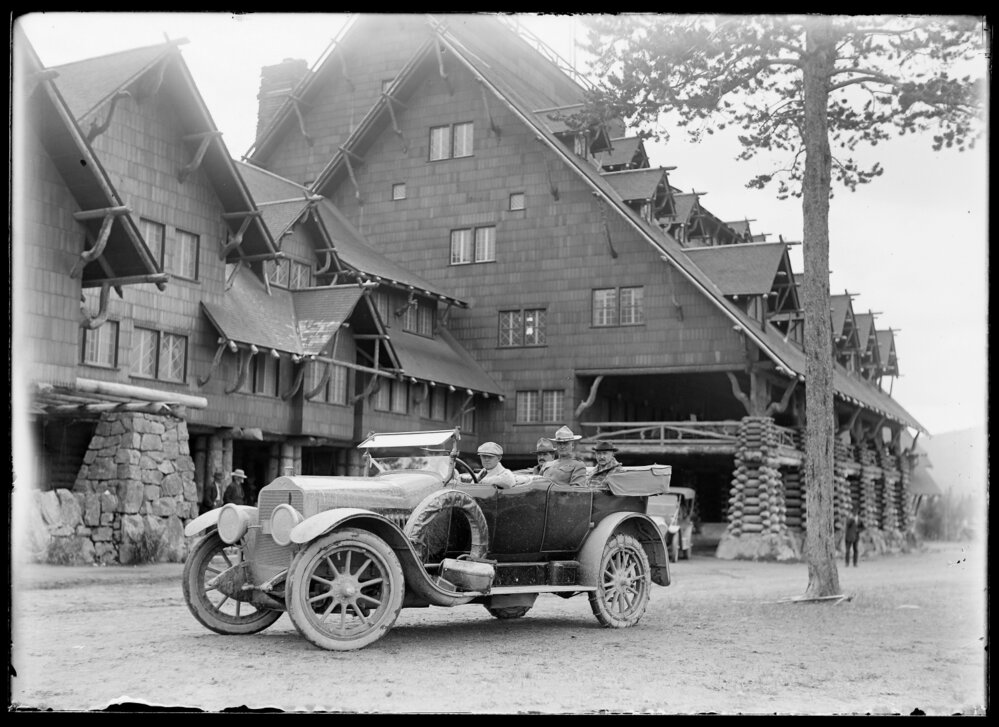
August 1915 photo of the first automobile through Yosemite National Park, with H.W. Child (front seat), Robert S. Yard (rear), Colonel L.M. Brett (rear center), Major Amos A. Fries (left rear) in front of the Old Faithful Inn. (Credit: Montana History Portal, Montana State Library)

In 1914, he was given a new post as chief engineer at Yellowstone National Park, where he supervised the revision of its infrastructure, adding and modernizing roads, bridges and other manmade features in the park.

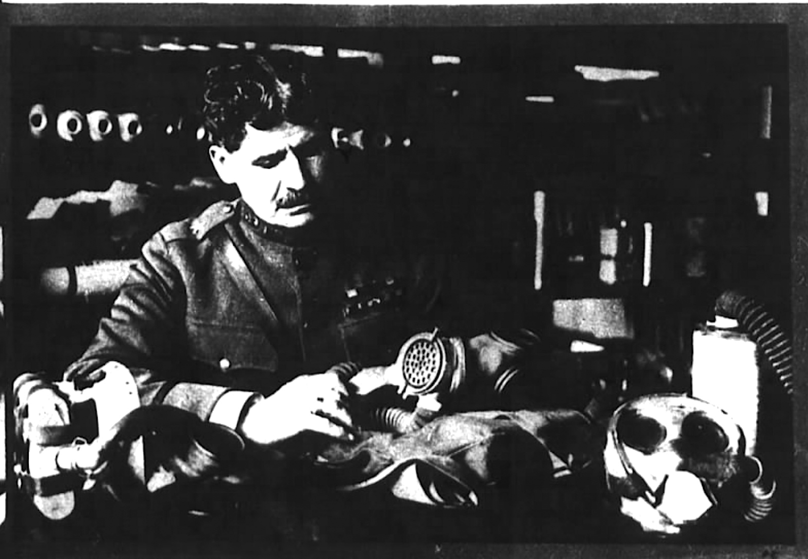
With the U.S. entry into World War I in 1917, Fries returned to combat duty. He fully expected to be assigned to an engineering post, but instead found himself heading the newly minted Gas Service Section of the AEF, a military unit formed in response to the growing use of chemical warfare on European battlefields.

The war ended in 1918, but the Army’s concern over chemical warfare didn’t. The Chemical Warfare Department became a permanent part of the Army in 1920, and Fries, now a brigadier general, was named its first head. 

(Credit: Reader’s Digest, Sept. 1923)

He served in that capacity until his retirement from the Army in 1929. He was promoted to the rank of Major General in 1925, and was awarded the Distinguished Service Medal for his efforts in the chemical weapons field. These included co-authoring the 1921 book, Chemical Warfare, with Clarence J. West (McGraw-Hill, 1921).

After his retirement, he moved to Gardena, where he built a home on land he had purchased during his days as chief engineer at the Port of Los Angeles.

During his retirement years, Fries became an avid anti-Communist, writing two self-published  books on the subject, Sugar Coating Communism: A Plea for God and Country, Home and Family (1930) and Communism Unmasked (1937). 

He grew increasingly suspicious of women’s societies and church groups, including the National PTA and the Daughters of the American Revolution (DAR), believing that they had links to radical groups and Communist leadership.

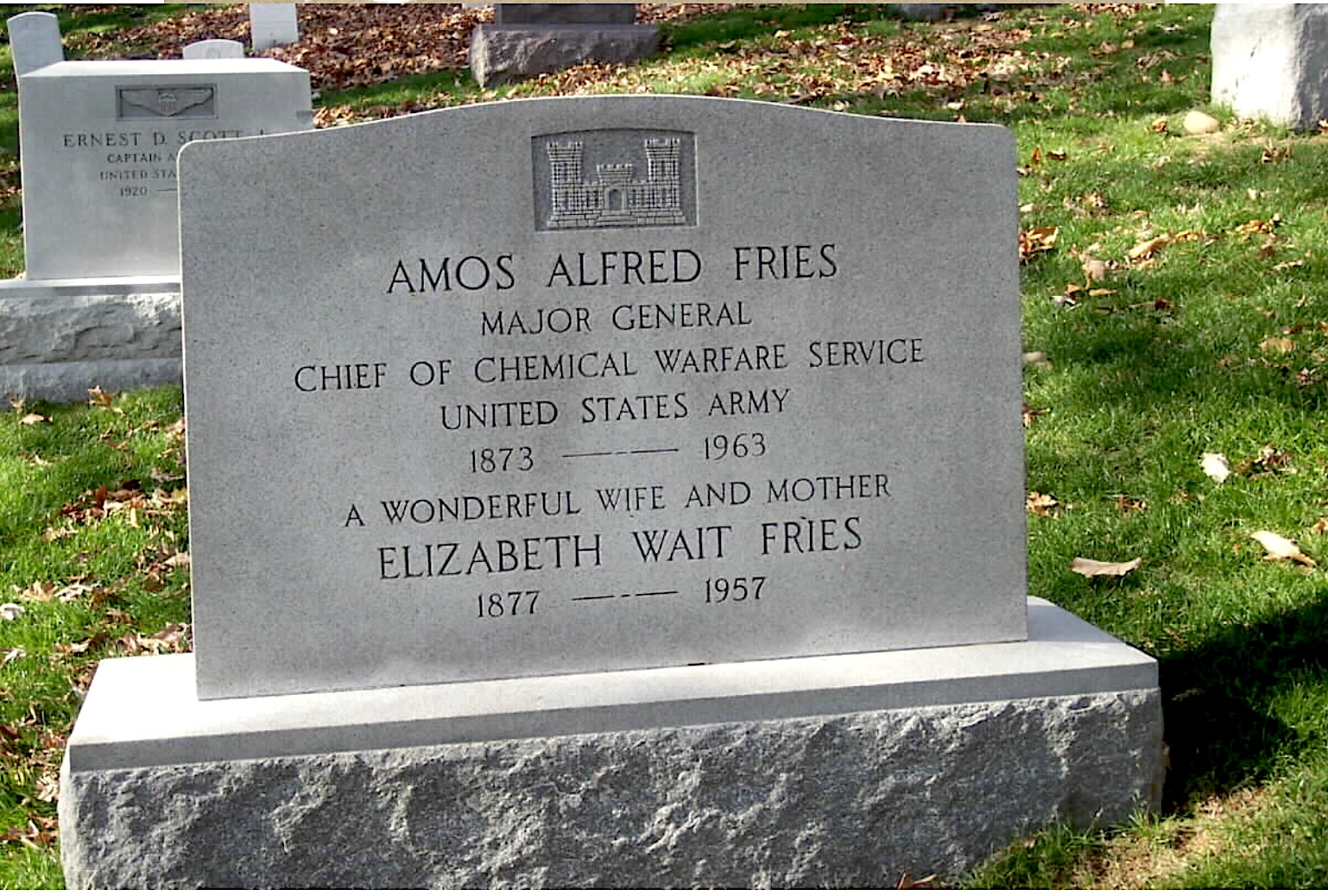
Amos Fries died at 90 on Dec. 30, 1963. He was buried at Arlington National Cemetery in Virginia.

Amos Fries headstone at Arlington National Cemetery in Virginia. 2019 U.S. Army photo. (Credit: Wikimedia Commons)

Sources:

Find A Grave website.

“Fries Avenue,” L.A. Streets website.

Los Angeles Times archives.

Port of Los Angeles: Conflict, Commerce and the Fight for Control, by Geraldine Knatz, Angel City Press and Huntington-USC Institute on California & the West, 2019.

San Pedro News Pilot archives.

Wikipedia.
Brigadier General Amos Fries inspects the latest in gas masks. April 1923 photo. (Credit: San Francisco Chronicle archives)

Louis C. Dart’s resourcefulness led to his renown as the “Hermit of Flotsam Castle”

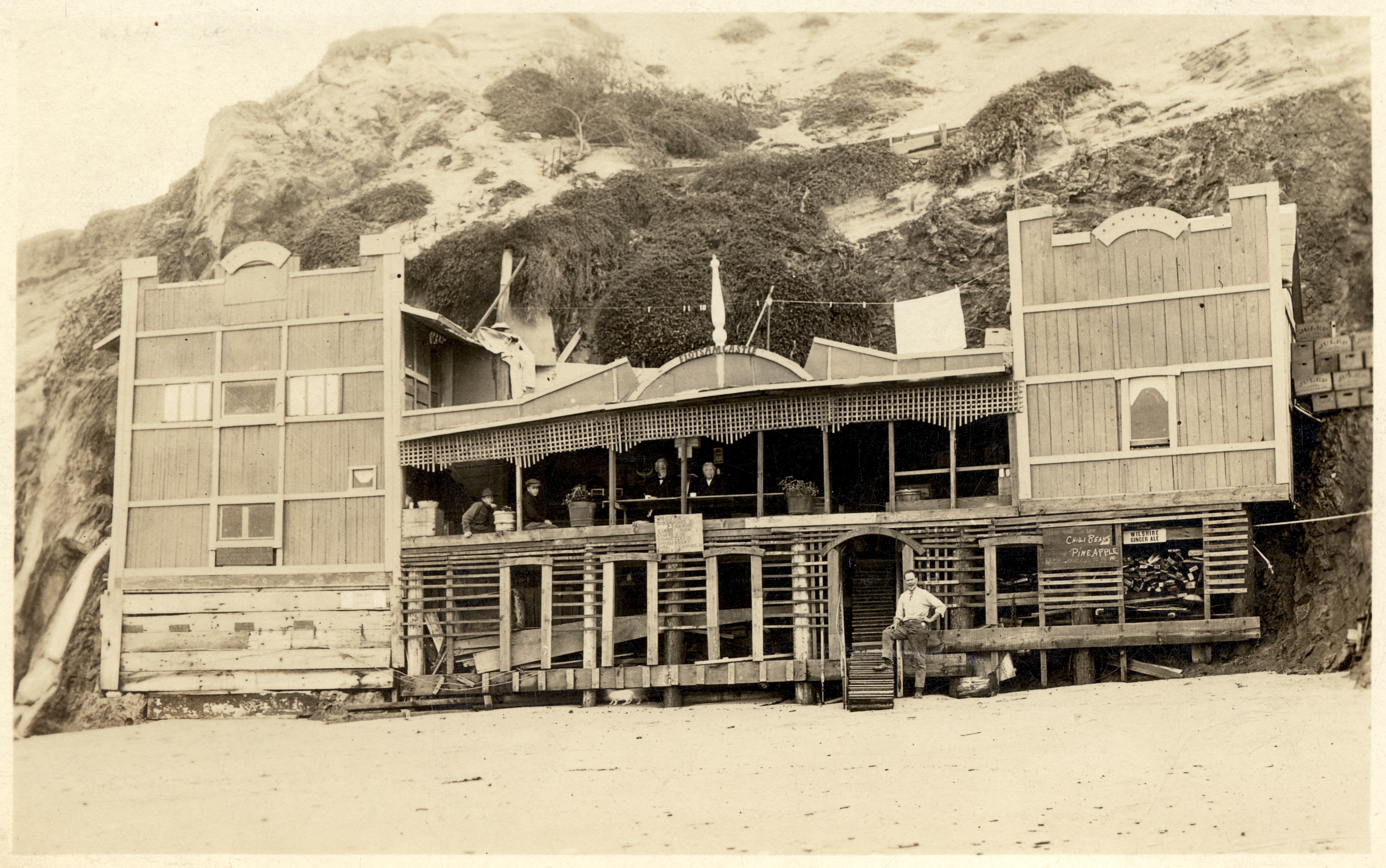
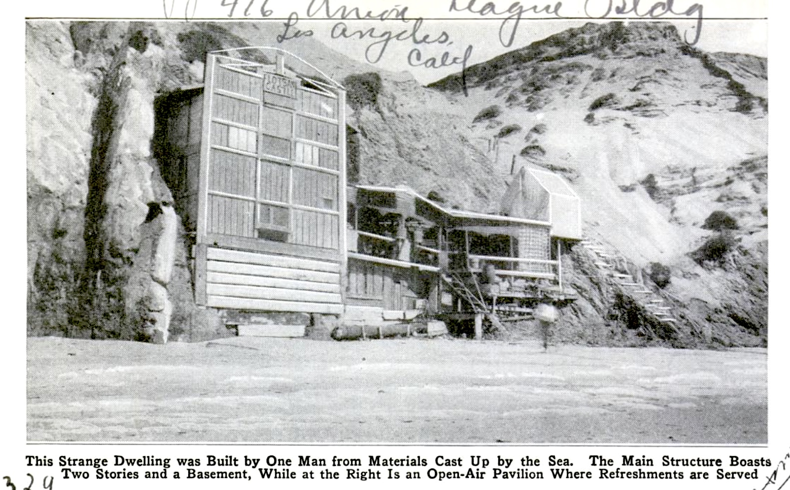
This 1923 postcard shows the Flotsam Castle built by Louis Dart at the north end of Malaga Cove. Man at bottom of stairs is unidentified.
(Credit: California Historical Society)

When I was working on the story on the origins of the name “RAT Beach” a few weeks ago, I noticed that some of the vintage photos of the area showed a striking-looking homemade structure built into the side of the cliffs on its northern end, near Torrance Beach.

A quick inquiry into its origin uncovered research by Dennis Piotrowski and Monique Sugimoto of the Palos Verdes Library District that told the story of the man responsible for the unique house. 

Louis Calvin Dart, the man who would become known as “The Hermit of Flotsam Castle,” was born in Missouri in 1859. He spent most of his early years in the Midwest, graduating with a law degree from an Iowa college and running a successful legal practice in Nebraska.

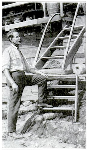
Louis C. Dart in 1922. (Credit: Popular Mechanics magazine)

Illness struck him down, though, and left him unable to continue as a lawyer. He later said that he had been diagnosed with Bright’s disease, a kidney ailment now known as nephritis, but that doctors had stopped treating him after he ran out of money.

He became a drifter, eventually finding his way to northern California where he worked as a cook in mining camps in the early 1900s. During the 1910s, he moved down to Southern California, where the beaches of the Palos Verdes Peninsula attracted the formerly rootless wanderer.

The story goes that a Spanish woman who worked on one of the local ranchos was gathering clams when she encountered the increasingly sickly Dart on the beach. After hearing about his physical ailments, she told him to drink water from a spring at the base of the rocky cliffs on the north end of Malaga Cove, which she believed had special healing qualities.

Dart followed the woman’s advice, living for a time only on a broth he fashioned from the spring water together with sea snails that were plentiful on the rocky beach. His new diet suited him, and his health improved significantly. He was now able to climb up the rocks and gather wild tomatoes that grew on top of the cliff to eat as well.

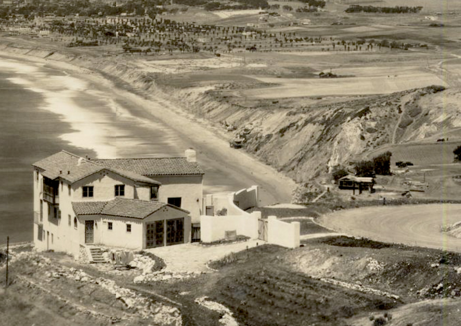
He decided that the beach life suited him, and began fashioning a crude shelter up against a hollow in the rocks at what is now the north end of RAT Beach, just south of present-day Torrance Beach. Hard and fast dates as to when he did this are unclear, but he probably started building there in 1918 or 1919.

This north-looking view of the Cheney residence located on Via del Monte in Palos Verdes Estates also includes Louis Dart’s Flotsam Castle on the beach, center rear. 1925 photo. (Credit: Palos Verdes Public Library Digital Archives)

His project received a huge boost when the 45-foot yacht Genevieve, which had been moored in nearby Malaga Cove, broke free from its anchorage during high winds and wrecked on the rocky shore on Thanksgiving Day, 1920. 

Its owners paid Dart five dollars to guard the boat overnight, and eventually allowed him to take wood and other scraps from the ruins. He sold $85 worth of scrap as salvage, a small fortune at the time, and used the rest of it on his home.

From this raw material, Dart began to rebuild his seaside shelter into something that more resembled an actual house up against the cliffs. The new improved structure attracted attention from locals and beachgoers, and the impromptu local landmark became known as “Flotsam Castle.”

Dart lived there with two pets, both called “Baby”: a guinea pig and a gray house cat. His two-story handcrafted home had stairs to an upstairs living room. Downstairs, there was a lunch room with a kitchen and a stove where he baked pies, thousands of them, that he sold to tourists. 

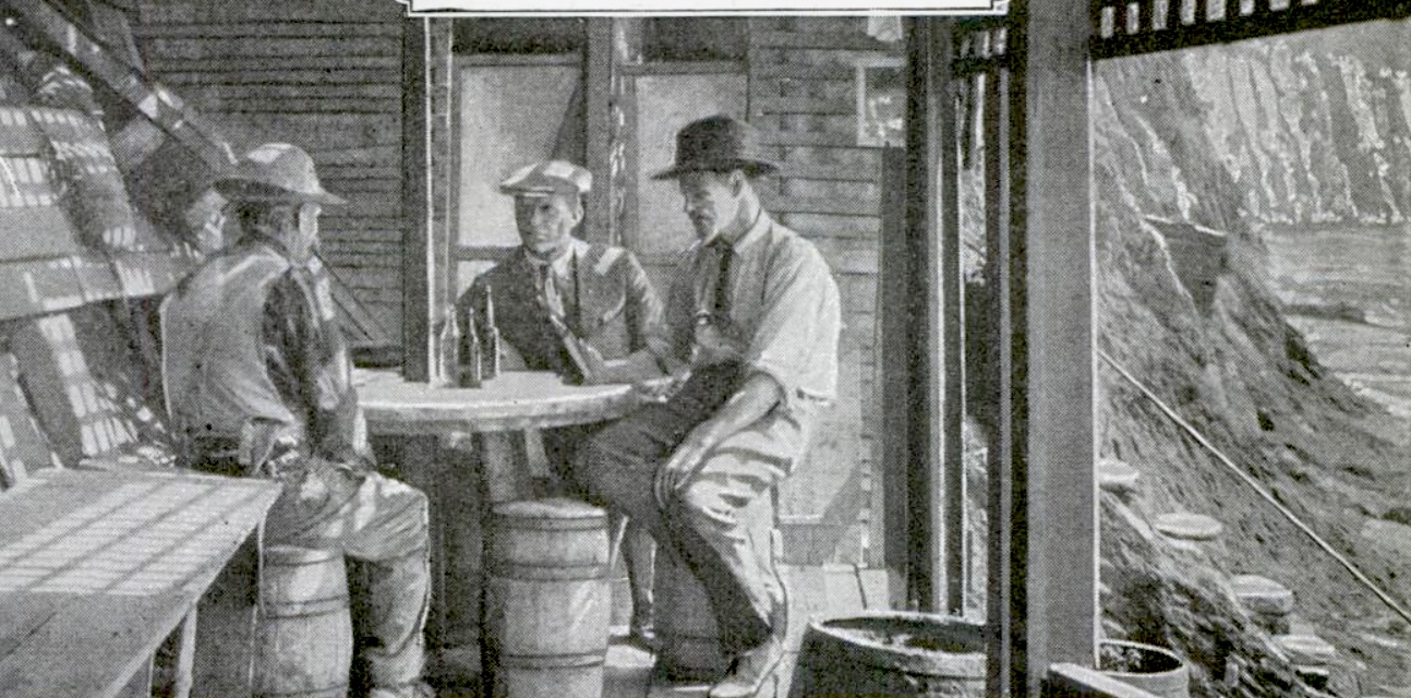
A 1922 photo shows the interior dining area at the Flotsam Castle with men sitting around a round table fashioned from a large wire cable spool. (Credit: Popular Mechanics magazine)

A large empty cable wire spool that had washed up on the beach formed one of the tables on Dart’s patio where they ate the pies on the house’s patio. He even kept sodas and drinks cold in a recessed niche he carved out of the cliff near the spring, whose waters cooled the hillside enough to create a natural ice chest.

Dart’s fame began to spread, and visitors came from all over the world to see his home. Stories about his creation began appearing in newspapers and magazines in the early 1920s. 

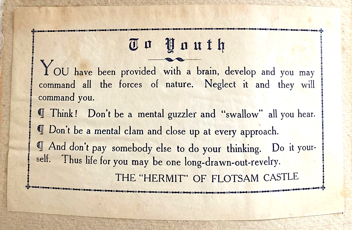
Dart also fancied himself something of a homespun philosopher, adorning his “Castle” with bromides and and axioms. “This building cost but little money but much work, without which life affords no satisfying kick,” read a sign hung near its front door. He also had pamphlets printed up with more of his philosophical musings.

It’s not clear exactly when Dart moved out of his abode. It may have been as early as 1925, but he definitely was gone by the late 1920s.

Los Angeles Times reporter Florence Haines, who had written a feature story on Dart in 1922, revisited the Flotsam Castle in early May 1930. She found it deserted. A man living in a neighboring beach shack informed her that Dart had moved away.

Excerpts from Louis Dart’s philosophical musings. (Credit: Beachcombing magazine website)

He’d left the beach for the Arlington area of Riverside, where he built a less-famous shack on a hill, but was forced to move when it was looted while he wasn’t home.

On May 11, 1930, a development company building homes in the Hollywood Riviera area of Torrance finally burned the abandoned Flotsam Castle to the ground.

Dart ended up in a rooming house in downtown Riverside, where he refused all efforts by friends and his family in Idaho to help him. He lived there on support from the county welfare agency until his death at 72 on March 3, 1932. He was buried in Riverside’s Olivewood Memorial Park cemetery.

The Flotsam Castle in 1922. (Credit: Popular Mechanics magazine)

Sources:

Daily Breeze archives.

Find A Grave website.

“Flotsam Castle,” by Maureen Megowan, Active Rain website, June 24, 2016.

“The Hermit Philosopher of  Malaga Cove and His 20-Cent Castle,”  by Dennis Piotrowski & Monique Sugimoto, Palos Verdes Library District website.

Los Angeles Times archives.

“Sea Furnishes Material for Queer Dwelling,” Popular Mechanics, August 1922, Page 222-224.

Torrance Press-Herald archives.

Tumultuous dockworker strikes helped to form, strengthen the ILWU

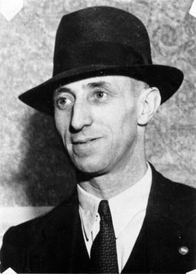
Harry Bridges in 1936. (Credit: San Francisco Public Library Photo Collection)

Waterfront labor leader Harry Bridges, whom we’ve written about several times, led the movement to unionize West Coast dockworkers when he formed the International Longshoremen’s Association (ILA) in 1933. 

After meeting stiff resistance in contract negotiations with the Waterfront Employers Association (WEA), which represented shipping company owners, the union voted to strike in May 1934.

A tumultuous, violent labor battle on the docks followed, during which four union members were killed, two in Los Angeles and two in San Francisco. The labor dispute continued throughout the summer, finally going to arbitration in October 1934.

The arbitration board’s ruling favored the union. They won not only higher pay, but improved conditions, including less onerous workloads and safer working conditions. It also allowed them to keep hiring halls, union-operated offices that provided labor to employers.

 As a result, the longshore union’s position was strengthened, and its down-to-earth leader who had come up working on the docks became the focus of the shipping companies’ ire.

They accused Bridges of being a card-carrying Communist, a charge which he would deny for the rest of his life. He did admit to not disagreeing with many of the philosophy’s principles, especially during the 1930s, and his use of the Communist Daily Worker publication to issue daily newsletters to union members during the 1934 strike certainly raised eyebrows.

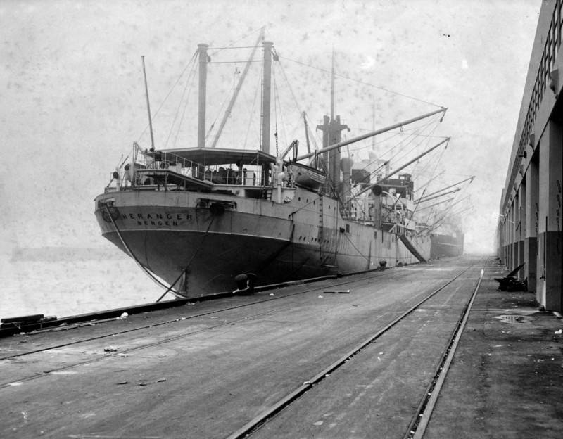
The S.S. Heranger and the S.S. India anchored alongside the docks in San Pedro with no longshoremen to unload them due to the ILWU strike. Sept. 3, 1948 photo. (Credit: Los Angeles Public Library Photo Collection)

The companies seized on the perceived links, repeatedly calling him a Communist. The federal government tried multiple times to deport Bridges, bringing cases against him in 1939, 1941, 1949 and again in 1955. The attempts were unsuccessful.

In 1935, a year after the strike, President Franklin Delano Roosevelt signed the National Labor Relations Act as part of the New Deal. The measure empowered the labor union movement in the U.S. by ensuring the right of private-sector workers to form trade unions, engage in collective bargaining and authorize strikes against employers.

In 1937, Bridges split off from the I.L.A., forming the International Longshoremen’s and Warehouse Union (ILWU). (“Longshoremen” was simplified to “Longshore” in 1997 in acknowledgment that the union counted other genders besides males among its members.)

World War II brought relative harmony to labor-management relations on the docks, as both sides worked tirelessly for the war effort.

FDR died in April 1945 as the war was winding down, and Harry Truman had become president. With the end of the war came new attempts to tamp down the union movement.

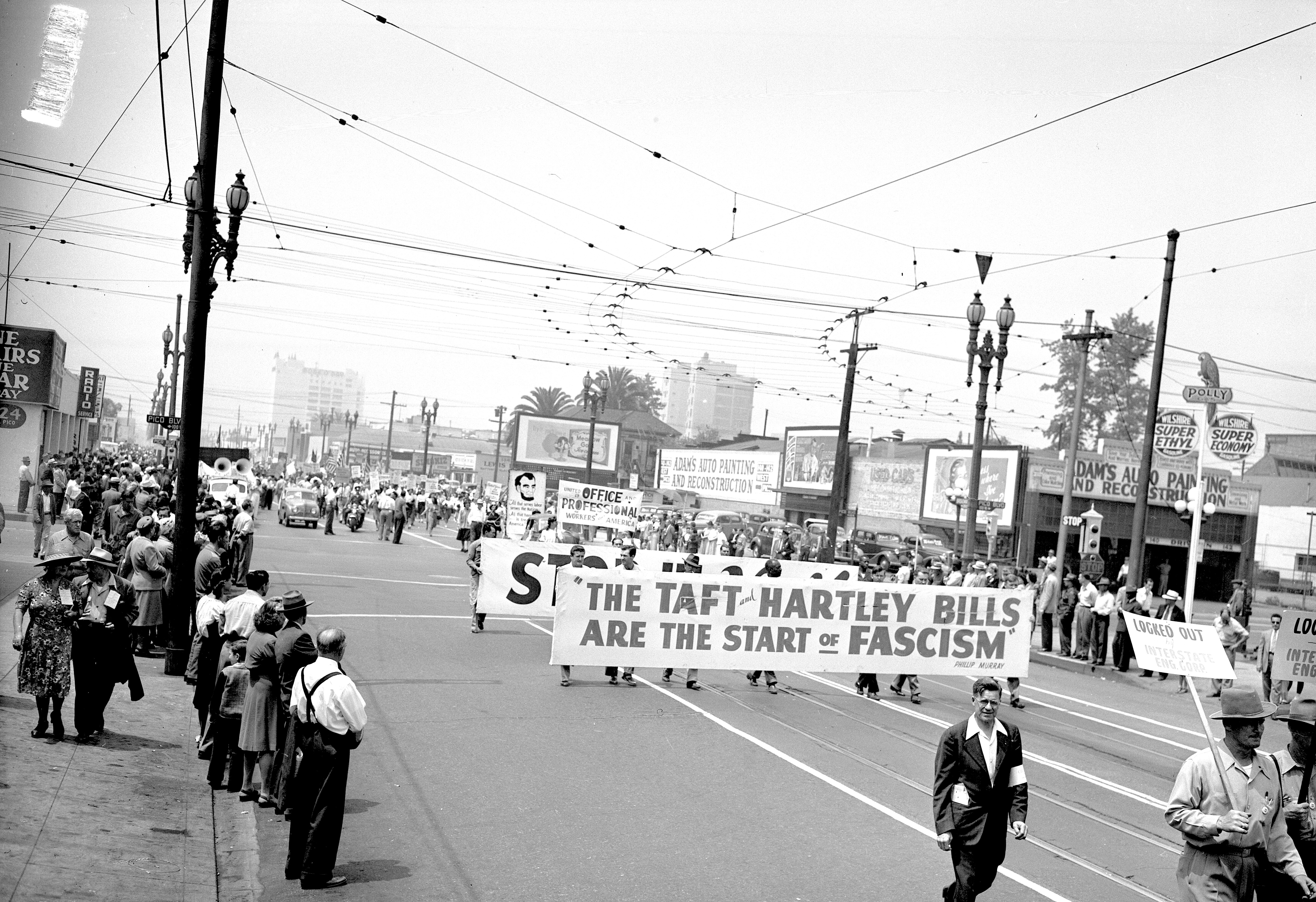
Members of various unions sponsored by the Congress of Industrial Organizations (C.I.O.) protest against the Taft-Hartley Act in a Broadway Ave. march in downtown Los Angeles on June 15, 1947. (Credit: UCLA Library Special Collections)

A postwar wave of large-scale union strikes followed, and Republicans in Congress, possessing their first majority since the early 1930s, decided the timing was right for legislation reining in the labor movement. Congress passed the Taft-Hartley Act to do just that, with many Democrats lending their support. President Truman vetoed it, but Congress overrode his veto and the measure became law in June 1947. 

The law banned certain kinds of strikes and boycotts, political contributions by unions, and “closed shops” which forced employers to hire union labor. Also, union leaders had to file an affidavit declaring that they were not members of the Communist Party, or any other group threatening to overthrow the government.

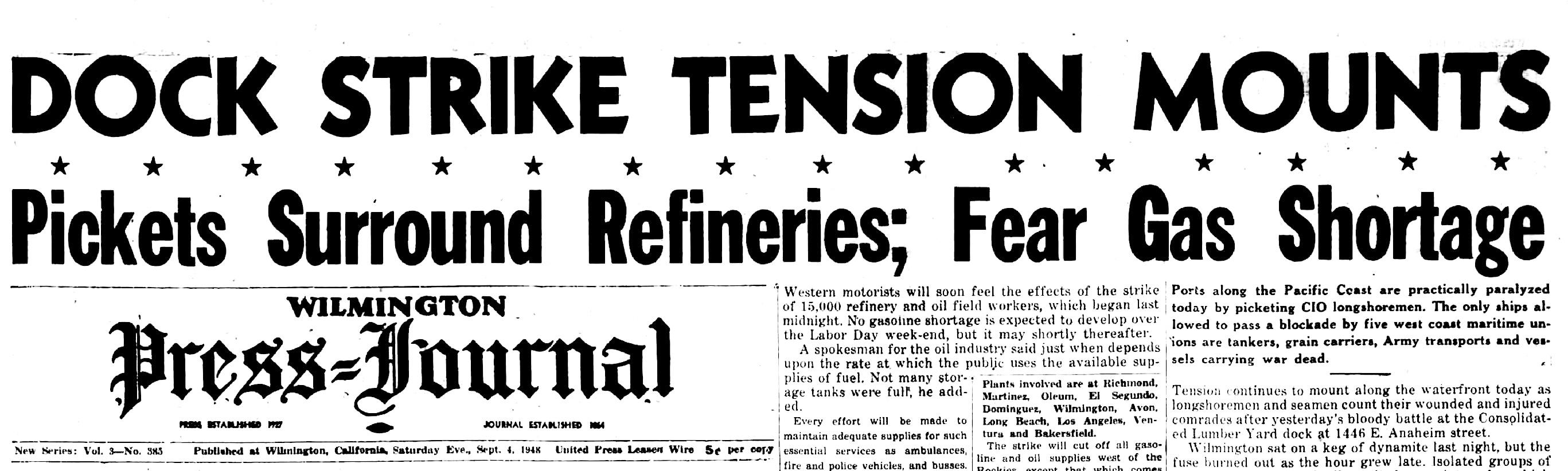
Wilmington Press-Journal, Sept. 4, 1948, Page 1. (Credit: Wilmington Press-Journal archives)

So, when the time came to negotiate a new labor contract in 1948, the WEA tried to invoke  the new Taft-Hartley provisions against Bridges and the ILWU. Their demand for an end to the union-run hiring halls alone was a deal-breaker for the union, whose members authorized a strike if the WEA didn’t rescind their demand.

They didn’t, negotiations broke down, and the ILWU officially went on strike on Sept. 2, 1948. Having failed at one Taft-Hartley tactic, the shipping companies decided to try another one: leaning hard on the anti-communist sentiments of the era. They refused to negotiate because union leaders had refused to sign anti-Communism affidavits as the new law required.

The strike was on. On its second day, violence broke out when non-union members attempted to unload the lumber ship Ronaldo, to the visible dismay of ILWU members. 

According to the San Pedro News PIlot, “Approximately 450 persons were involved in the dispute in which gunshots, clubswinging and knife-wielding figured.” Though dozens were injured, there were no fatalities.

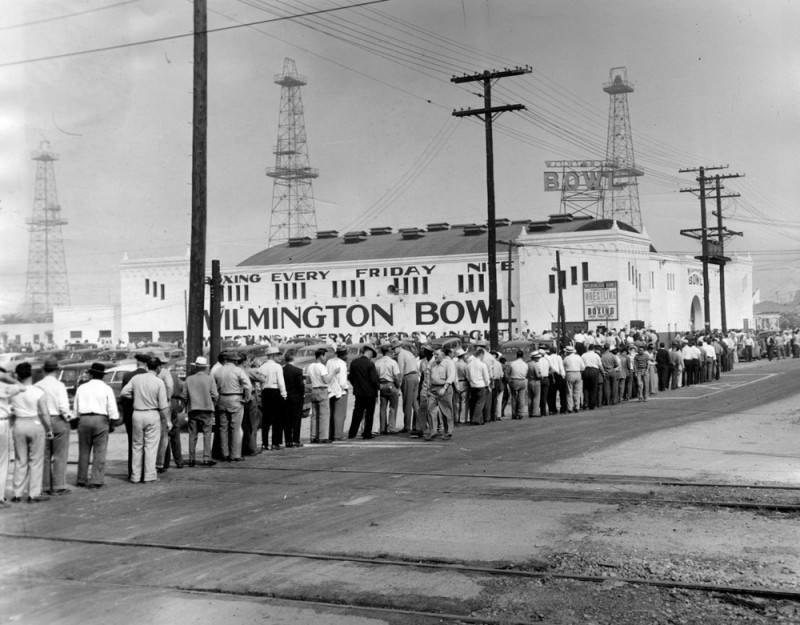
ILWU workers file into the Wilmington Bowl on Mahar Ave. for a meeting on the status of negotiations. Sept. 2, 1948. (Credit: Los Angeles Public Library Photo Collection)

As the strike dragged on, the WEA gradually began backing down from its demands, even changing its negotiators from hard-line anti-unionists to those more receptive to bargaining.

The 93-day strike officially was settled at noon on Dec. 3, 1948. Despite the initial posturing by the shipping company owners, the ILWU ended up getting most of what it asked for in its new contract. The union retained its hiring hall privileges, and also won increased wages and vacations and improved working hours.

In 1965, the Supreme Court struck down the Taft-Hartley provision requiring union leaders to sign anti-Communism affidavits.

Bridges went on to lead the ILWU until his retirement in 1977. He died in 1990.

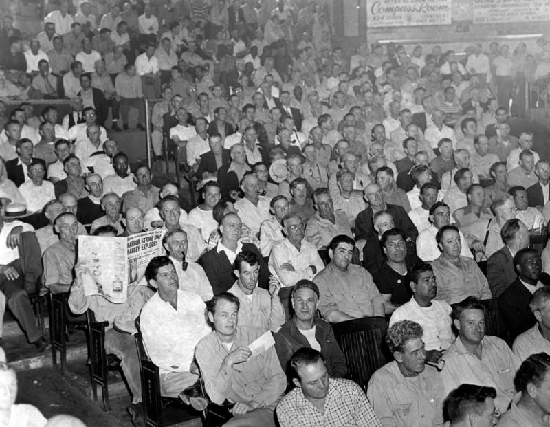
Photo of striking longshoremen attending a meeting at the Wilmington Bowl on Sept. 2, 1948. Note man on left reading a newspaper. Headline reads “Harbor Strike On! Parley Explodes.” (Credit: Los Angeles Public Library Photo Collection)

Sources:

Daily Breeze archives.

“Harry Bridges: Life and Legacy,” by Michael Reagan, University of Washington Waterfront Workers History Project website, 2019.

ILWU Local 19 website.

“Looking Back at the 1948 Strike,” International Longshore and Warehouse Union website.

Los Angeles Times archives.

San Pedro News Pilot archives.

Wikipedia.
Wilmington Press-Journal archives.

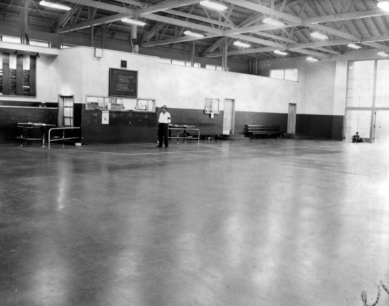
Photo shows the empty ILWU hiring hall at San Pedro after the 1948 longshore workers strike went into effect. Only Sergeant-at-Arms Oscar Larsen is on hand as the walkout paralyzes Los Angeles Harbor. Sept. 2, 1948. (Credit: Los Angeles Public Library Photo Collection)

How chinchillas from the Andes Mountains made their way to Lennox

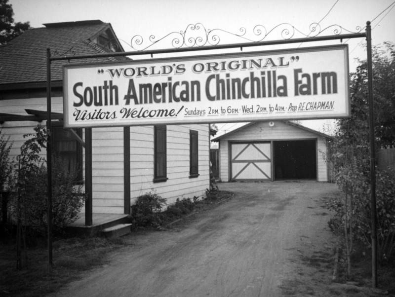
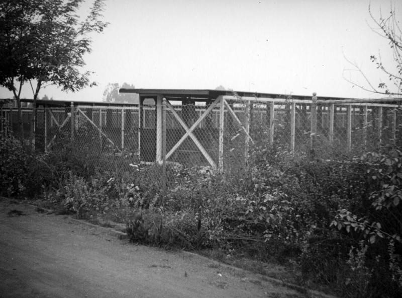
The chinchilla farm on 104th St. in 1937, three years after the death of its founder, Mathias F. Chapman. Chapman brought the chinchillas from the Andes Mountains to California. (Credit: Los Angeles Public Library Photo Collection)

The Chincha native tribe lived high in the Andes Mountains in South America. When Spanish explorers came upon them in the 1500s, they were intrigued by the robes they wore, which had been crafted from the skins of small furry animals found only high up in the mountains of Chile, Bolivia, Peru and Argentina.

The Spaniards named the animals, who were slightly larger than chipmunks, “chinchillas” (little Chinchas). They quickly realized the potential value of their pelts, which became highly desired once garments made from chinchillas were introduced into European high society.

Unfortunately for the chinchillas, it took as many as 150 of them to fashion a coat. As the demand for the expensive fur increased, the supply of animals began to be depleted. By the late 1800s, the animals hovered on the brink of extinction.

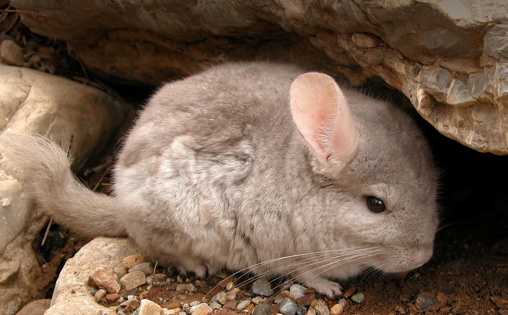
A chinchilla finds shelter at the San Diego Zoo. Undated photo. (Credit: San Diego Zoo website)

Chile, Peru and Bolivia finally signed a treaty banning the trapping of chinchillas and the exporting of their pelts in 1910, but by then, the cute little rodents had mostly disappeared from their native habitats.

In 1918, an American mining engineer, Mathias F. Chapman, traveled to Chile while working for the Anaconda Copper Co. While staying in a mountain camp, he purchased one of the now-rare animals from a Chilean man who had captured it.

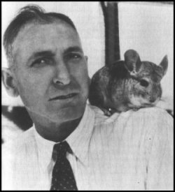
Mathias Chapman with Pete the chinchilla. Undated photo. (Credit: Sunset Chinchilla website)

Chapman was immediately taken by the chinchilla, and the idea of raising a herd of them to sell as pets appealed to him. Others had tried to get permission to take some of the animals out of Chile and failed, but Chapman was persistent and the Chilean government eventually allowed him to do so.

He formed a hunting party and went up high into the Andes in search of chinchillas for the next three years. He was able to keep 11 of them alive, eight males and three females. He’d studied other unsuccessful attempts to transport the animals, and determined that they had been removed too quickly from their high-altitude habitat. 

Instead, he brought them down from the mountains gradually, allowing them to adapt to lower and lower locations before finally taking them onboard a steamship for transport. During the trip, one chinchilla died and two were born. Chapman and the 12 chinchillas landed in San Pedro harbor on Feb. 21, 1923, the first colony of the animals to be brought into the United States.

He initially brought them to Los Angeles, where they stayed while a farm was being prepared in  Tehachapi, where he thought they might thrive. However, conditions in Tehachapi turned out not  to be ideal; among other problems, thieves stole half the new herd there, so he sought a new farm site back in Los Angeles.

A 1937 photo shows rows of chinchilla cages at the Chapman chinchilla farm located in what is now Lennox. (Credit: Los Angeles Public Library Photo Collection)

He built the farm on Los Angeles County land just southwest of the Inglewood city limits in the unincorporated area now known as Lennox, at 4957 W. 104th St. He custom-built their cages, experimenting with their type and size in order to find their most suitable living conditions.

His efforts were successful, and the farm thrived. The chinchilla population began growing fairly rapidly in size. Some of the animals were sold as pets, generally for around $100 each, but many were sold to breeders who were raising them for the production of the very profitable chinchilla fur products. 

Torrance Herald, Aug. 19, 1937, Page 7-B. (Credit: Torrance Historical Newspaper and Directories Archive database, Torrance Public Library)

Chapman died on Dec. 28, 1934 at 52. His son, Reginald, took over the operation, and opened it up to visitors, calling it the “World’s Original South American Chinchilla Farm.” It became not only a popular local tourist stop, but also the largest chinchilla farm in the world at the time.

Chinchilla farming began to catch on, especially in the years following the end of World War II. The value of the animals skyrocketed, with a pair of breeding animals selling for as much as $3200. Chinchilla shows became regular community events, and, in 1952, El Camino College even began offering classes in chinchilla raising.

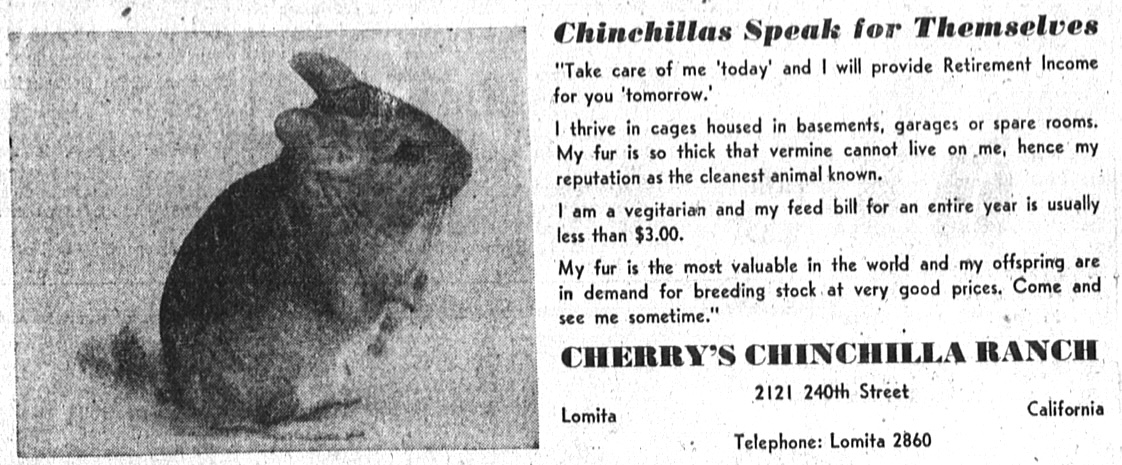
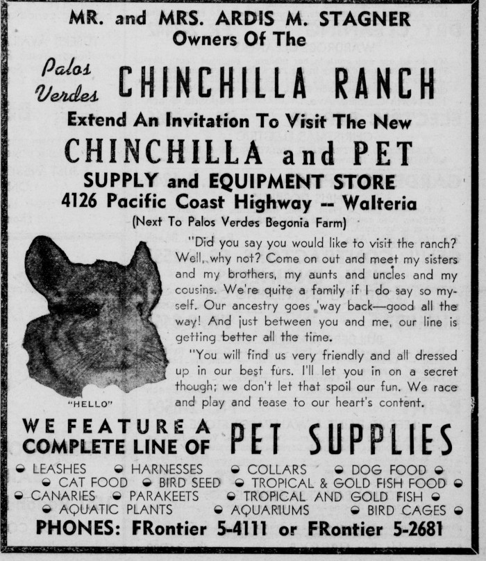
Farms started springing up all over the Los Angeles area. Several opened up in the South Bay and Harbor Area, including the Palos Verdes Chinchilla Ranch operated by Ardis Stagner in Walteria beginning in 1940, the Fur Farms (later Allied Furs)  in north Torrance, The Harbor District Fur Farm, Cherry’s Chinchilla Ranch in Lomita and many others.

In fact, by the early 1950s, chinchilla farms had become something of an investment craze, like uranium hunting. For every successful farm, though, there were many more that couldn’t make it work. 

The fad died down during the 1960s. By 1970, the Federal Trade Commission began issuing warnings about unscrupulous promoters selling the animals, falsely telling buyers they could be bred and raised at home easily for fun and profit. 

Torrance Herald ad, May 10, 1953, Page 15. (Credit: Torrance Historical Newspaper and Directories Archive database, Torrance Public Library)

Buyers often found that chinchillas weren’t as easy to raise as they had been led to believe, and require considerable time, money and facilities in order to thrive. In addition, zoning regulations in most cities prevent the raising of animals for commercial sale.

Chinchillas continue to be raised on commercial farms for the fur industry, and, despite restrictions and their scarcity, poaching of them in the wild continues.

Chapman’s original Lennox chinchilla farm closed in the late 1950s, and an apartment complex now stands on the site. 

Environmentalists and animal rights activists since have questioned whether his motives weren’t more strictly financial and exploitative than animal-friendly, but there’s little dispute that he was the first to bring the animals to the U.S. and breed them successfully in captivity.

Ardis Stagner opened a pet supply store that carried chinchilla supplies on PCH in Torrance. His farm was located at 3880 Newton St. Palos Verdes Peninsula News ad, March 8, 1951, Page 3. (Credit: Palos Verdes Peninsula News archives)

Sources:

“Chinchillas,” Humane Society of the United States website.

Daily Breeze archives.

Find A Grave website.

“History of the Chinchilla,” Darren’s Chinchilla Haven website.

Los Angeles Times archives.

Palos Verdes Peninsula News archives.

Torrance Press-Herald archives.

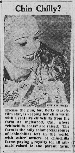
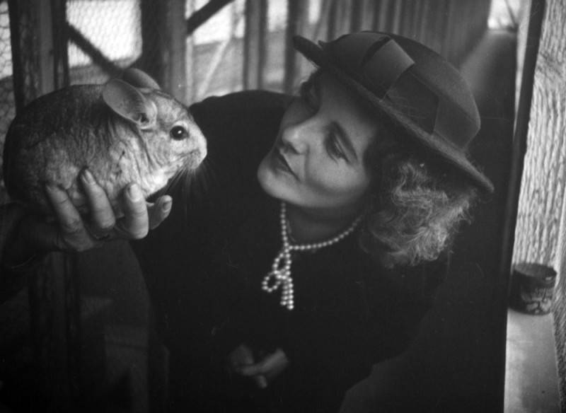
Wearing a hat and pearls, Ethel Schultheis holds up a chinchilla inside a pen at the Chapman chinchilla farm in 1937. Schultheis was the wife of photographer Herman Schultheis, who took the photo. (Credit: Los Angeles Public Library Photo Collection)

Moonstone Beach drew tourists, rock hounds, and profiteers to Redondo

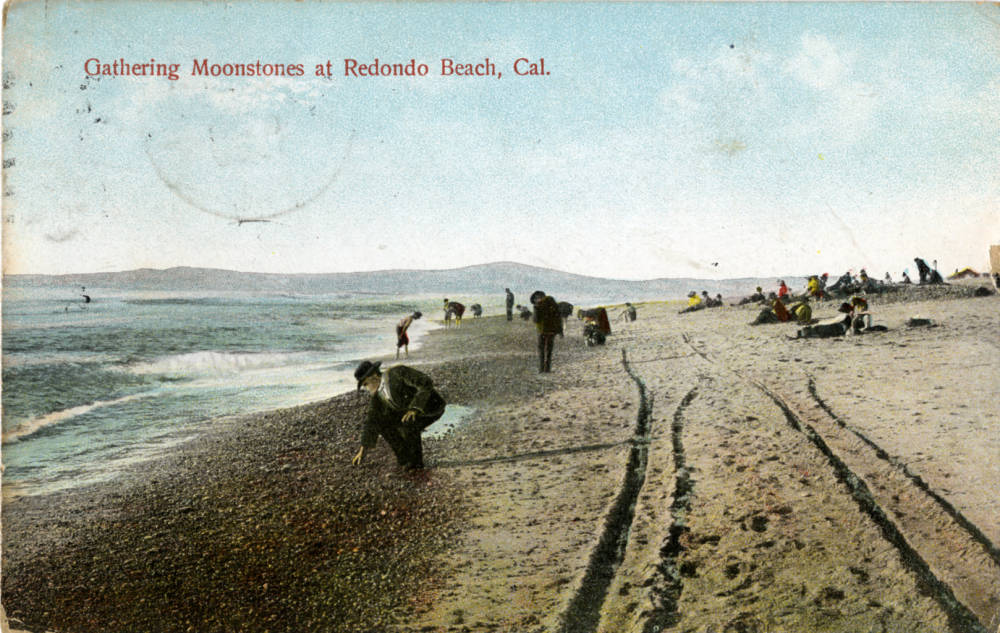
Men in suits and some youths are seen picking up moonstones while sunbathers enjoy Moonstone Beach in Redondo. Postcard dated Sept. 5, 1909 on reverse. (Credit: CSUDH Digital Archives)

Everybody seemed to love Moonstone Beach, one of the South Bay coastline’s most popular, if relatively short-lived, tourist stops on the Red Car railroad lines of the early 20th century.

I’ve mentioned the stretch of shoreline strewn with ocean-polished smooth stones that ran roughly from the southern Hermosa Beach border to just above the Redondo Beach pier in past stories, but it deserves a closer look.

The Redondo coast was wild and undeveloped when the city first began to be developed in the 1880s. The seas were rough in the era before dredging, breakwaters and harbors tamed it somewhat. Frequent storms washed heaps of rocks up from the depths onto the shore, sometimes in piles up to six feet high.

Examples of cut and polished moonstones. (Credit: DiamondBuzz blog)

By the late 1880s, the beach already had a reputation as a place to find the translucent semi-precious gemstones known as moonstones. They derive their name from their unusual sheen which has been compared to the glow of the moon. This phenomenon is called adularescence, after Mt. Adular in Switzerland, an area known as a source for the stones.

Moonstones, which belong to the feldspar family, are formed when two minerals, orthoclase and albite, combine via volcanic activity into layered stones, a process which gives them their distinctive luminescence. In addition to moonstones, stones of value that could be found washed up on the beach included agate, chalcedony, carnelian, amethyst, beryl, jasper and others. 

If some of those names sound familiar, it could be because Redondo Beach decided to name some of its east-west streets after the Moonstone Beach semi-precious gems in the late 1880s. (They threw in a few other precious gemstone names, too, including Diamond, Ruby, Emerald, Sapphire and Pearl.)

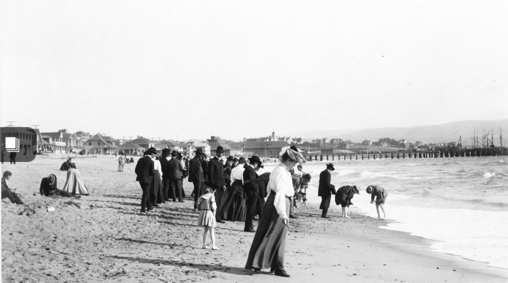
Moonstone Beach became a tourism phenomenon, especially once visitors began arriving at the seacoast town via the railroads connecting the area to Los Angeles in the 1890s. They began seeking out the semi-precious stones that could be found among the plentiful rocks, especially after storms.

A March 11, 1906 article in the Los Angeles Times detailed the activities of the moonstone hunters, who arrived in trainloads every day at the shore to do their searching. The desired stones weren’t as rare as precious  gems, but most of the finer ones could sell from $10 to $20, with exceptional examples bringing up to $100.

Beachgoers on the sand at Redondo Beach’s Moonstone Beach, circa 1900. (Credit: California Historical Society)

Local jewelers and lapidarists set up shop nearby, polishing and cutting the stones found by visitors. Some less scrupulous beach vendors sold ready-made stones of often-dubious quality  to those who lacked the patience to dig out the real thing.

The quantities of stones with value found on the beach began to diminish after the early 1900s. Some blamed the hordes of moonstone seekers for depleting the rocky deposits, which certainly attracted large numbers of people.

A more likely explanation points out the large amount of beach stones that were used in construction projects in the growing city, including for structures such as the 1907 Redondo Beach steam power plant.

Whatever the explanation, the stones began to disappear from Moonstone Beach, and the craze gradually died down.

Occasionally, a particularly violent storm or exceptionally high tides would bring new piles of stones to its shores. This happened in 1915, 1934, 1941 and 1951, bringing rock hunters out in droves to search through the new deposits.

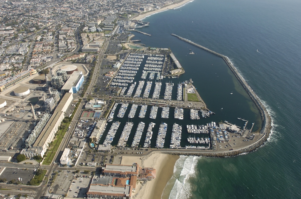
Aerial looking south shows configuration of Redondo Beach King Harbor and breakwater. Sept. 14, 2004. (Daily Breeze staff file photo by Scott Varley)

But it all changed forever during the 1960s. Redevelopment radically altered Redondo’s downtown during the creation of King Harbor. More importantly to Moonstone Beach, King Harbor and its breakwaters also changed the configuration of the shoreline. 

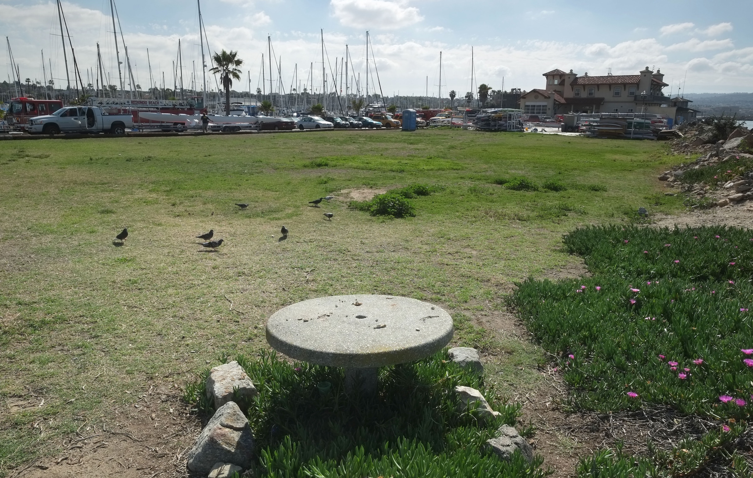
The natural conditions that led to the accumulation of rocks from the ocean onto its shores were no more, and, for that matter, neither was Moonstone Beach itself. The city of Redondo Beach memorialized the former beach by creating Moonstone Park, a small green space on a small spit of man-made land in King Harbor known as Mole B.

The patch of green grass on Mole B has become the source of controversy in recent years. The city’s plans to develop it in 2011 were scrapped, and the land remains undeveloped.

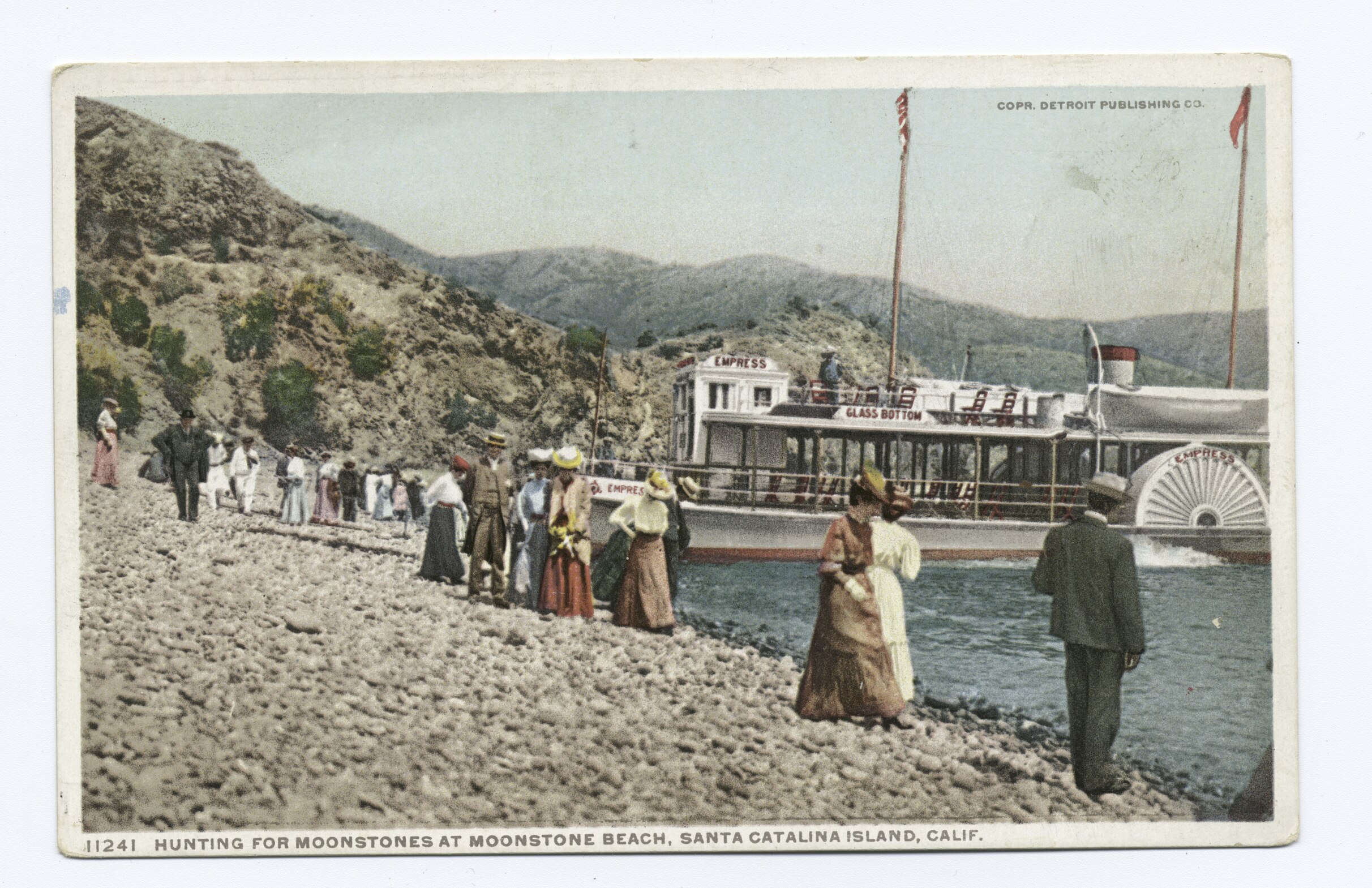
Redondo Beach wasn’t the only place in California to have a Moonstone Beach. Catalina Island’s Moonstone Beach, about four miles northwest of Avalon as the crow flies, reported that moonstones, opals and agates could be found on its shores as early as 1901. As a result, it had become one of the island’s most popular tourist spots at that time.

Postcard of Moonstone Beach on Catalina Island, circa 1907-08. (Credit: Wikimedia Commons)

Another popular Moonstone Beach is located in Cambria in San Luis Obispo County, just south of Hearst Castle. It still has its stones, but it turns out they’re not true moonstones, but the more common chalcedony, a variety of quartz. 

A fourth Moonstone Beach also exists in Humboldt County on the northern California coast, though it doesn’t appear to have actual moonstones on its shores.

Back in the late 19th and early 20th centuries, though, Redondo’s Moonstone Beach had more than enough moonstones to go around. For a while, at least.

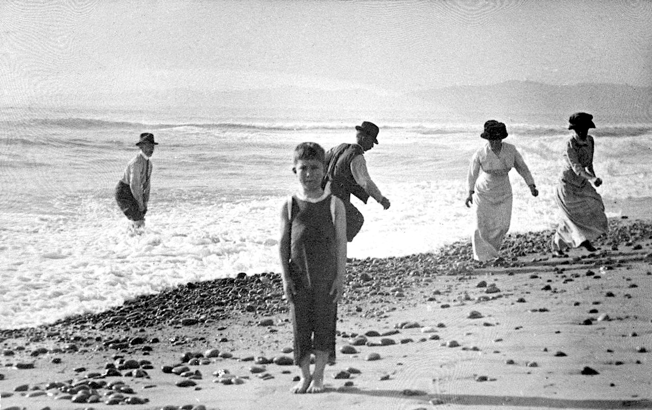
The Stanley family on an outing at Moonstone Beach near Hermosa Beach in 1914. (Credit: Tustin Area Historical Society)

Sources:

Daily Breeze archives. 

Los Angeles Times archives.

“Moonstone Properties and Characteristics,” Diamond Buzz blog, Dec. 27, 2022.

Old Redondo: A Pictorial History of Redondo Beach, California, by Dennis Shanahan, Legends Press, 1982.

Wikipedia.
Moonstone Park, with the Harbor Patrol Station and Lanakila Outrigger Canoe Club at Mole B in Redondo Beach on March 13, 2014. (Daily Breeze staff file photo by Steve McCrank)

Eye-catching brick buildings near Torrance High School have had multiple uses

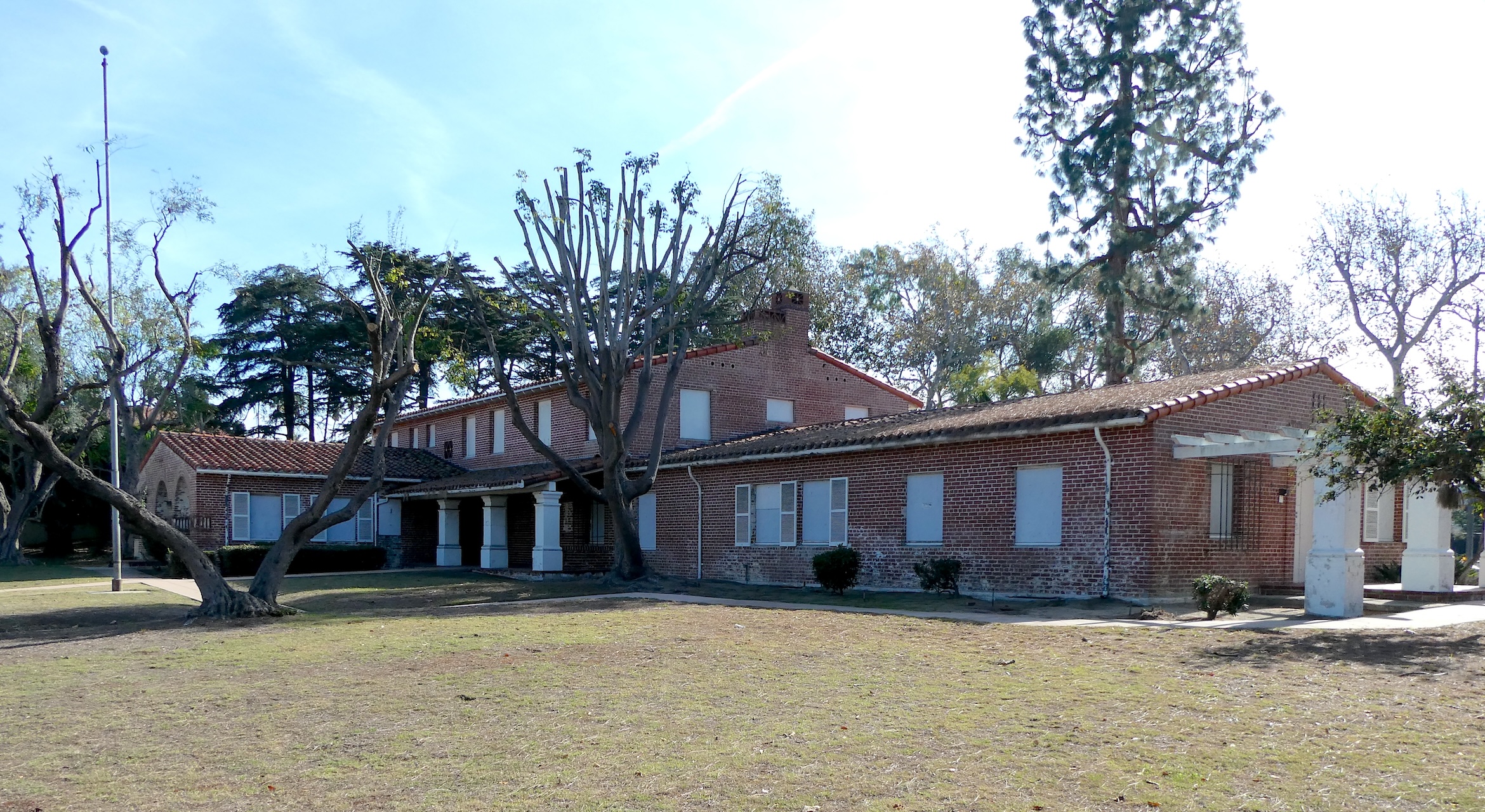
The former Torrance Health and Welfare Center building on Carson St. has been closed for more than 20 years. (December 2023 photo by Sam Gnerre)

Every day, thousands of cars pass by the southwest corner of Carson St. and Plaza Del Amo near where three distinctive brick buildings have stood for many decades. If, like me, you were curious about their origins, read on.

The city of Torrance and Los Angeles County owned the land on which they were erected. The parcels adjoin the northern portion of Torrance High School, another venerable brick structure whose main building was erected in 1917.

If you can identify all three of the buildings, you’re a local history whiz. It turns out only one of them is being used for the original purpose for which it was built, and only two of the three are currently occupied.

The currently unoccupied one at 2300 Carson is the furthest east of the trio, and also the oldest. The striking Mission Revival-style building cost $35,000 to build. It opened on Feb. 24, 1933, and housed the Torrance Health and Welfare Center.

The Torrance Health and Welfare Center on Carson St. in 1938. Torrance Herald, Sept. 15, 1938, Page 7. (Credit: Torrance Historical Newspaper and Directories Archive database, Torrance Public Library)

The public health center, which was run by Los Angeles County, was open not just to Torrance residents, but to citizens from other nearby communities as well. Any member of the public could avail themselves of its services, which were strictly diagnostic. The staff did not perform surgery, but referred such cases to other physicians.

The center served the communities for more than six decades, but by the 1990s, it had begun to show its age. In 1991, the county commissioned an engineering study which determined that the building as it stood was not up to code, and could not withstand a 6.5 earthquake.

The county could have leased the land to a developer to build a new health center, but the original building’s historical significance kept them from doing so. Instead, it was decided to pursue a new location for the center.

In the early 2000s, the old center was closed down and a new Torrance Health Center opened at 711 Del Amo Blvd. near Vermont Ave. on county land east of Torrance, where it continues to operate today.

Torrance Herald, Oct. 4, 1951, Page 1. (Credit: Torrance Historical Newspaper and Directories Archive database, Torrance Public Library)

The old building was boarded up and fenced off, and has remained so for the past 20 years.

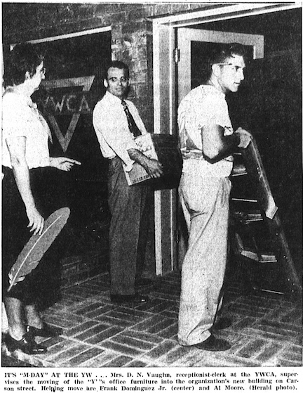
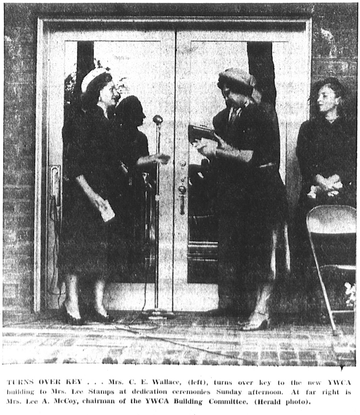
The second brick building at 2320 Carson came about as a result of a long fundraising campaign started by the Torrance Junior Women’s Club in the late 1940s. The group decided that the city needed to have its own Young Women’s Christian Association (YWCA); at the time, Torrance YWCA members had to join the San Pedro branch of the community organization.

Longtime downtown Torrance department store owner and community leader Sam Levy counted himself among the ardent supporters of the idea, and he helped convince the city to allow the group to use  land at the corner of Carson and Del Amo for its headquarters.

Only one thing: the prospective YWCA had to come up with the money. The $30,000 required  for the 24,000-square-foot brick building came from all manner of grants and donations, with a large chunk of it deriving from income from the Miss Torrance beauty pageant donated by the Junior Women’s Club, who ran the annual event.

Torrance Herald, Nov. 22, 1951, Page 1. (Credit: Torrance Historical Newspaper and Directories Archive database, Torrance Public Library)

The new building was dedicated on Nov. 18, 1951. The new YWCA gave Levy a lifetime membership in 1952 for his role in securing approval and funding for the nascent group’s new home.

Having succeeded in that project, the Junior Women’s Club turned to another one: the establishment of a scouting center and clubhouse in Torrance. A plot of land just south of the YWCA was made available, and, by 1954, architectural renderings had been produced and fundraising was underway.

Groundbreaking for the new center was held in February 1958. Building it turned out to be a community effort, relying on members of service organizations for much of the labor and materials.

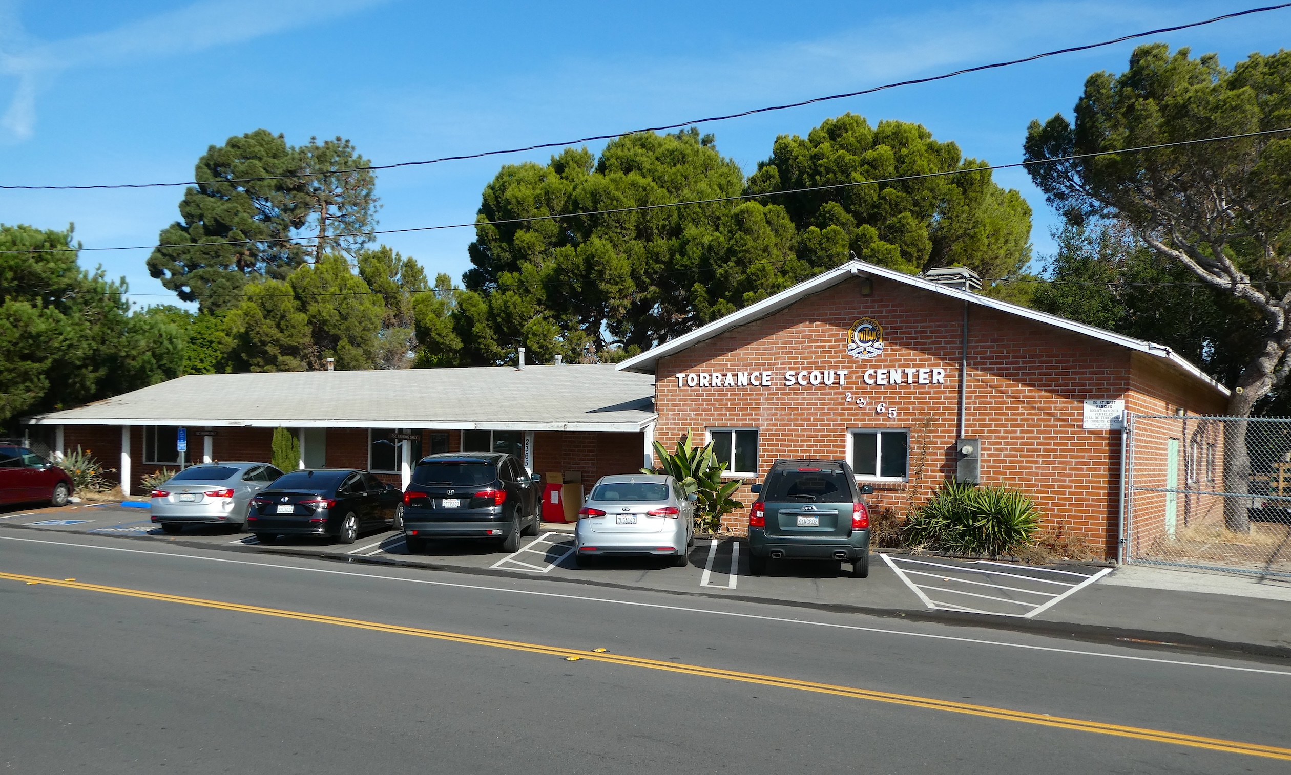
The Torrance Scout Center on Plaza Del Amo opened in 1951. (December 2023 photo by Sam Gnerre)

As a result, the building wasn’t finished right away. The Torrance Scout Center was dedicated four years later on March 11, 1962, and continues to operate at 2365 Plaza Del Amo.

That just leaves the one time YWCA headquarters building. The community women’s group was based there until it dissolved due to financial difficulties in the late 1990s. After its doors closed in March 1998, its members were assimilated into the renamed YWCA of the Harbor Area and the South Bay.

This left the city with two unoccupied brick buildings, but not for long. Five years earlier in 1994, the Torrance Youth Council, which represents students from all Torrance high schools, had approached city officials about establishing a permanent teen center in the city.

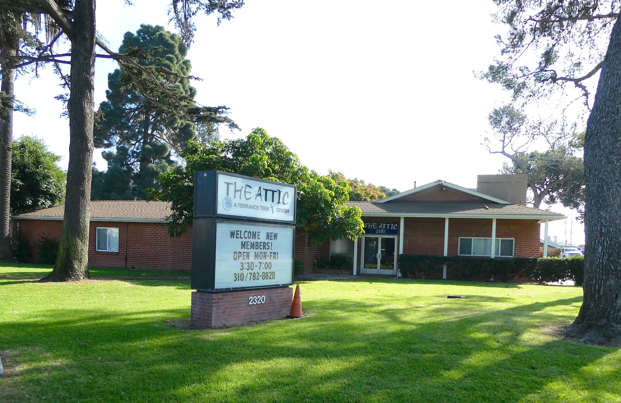
The Attic teen center opened to Torrance high school students at 2320 Carson St. in 1999. (December 2023 photo by Sam Gnerre)

The idea resurfaced after the YWCA left, and the city eventually agreed to use its old building to house a new teen center. The idea: to give high schoolers a place to hang out with their friends without worrying about getting kicked out.

The Attic teen center opened its doors on April 12, 1999, to 14-18 year-old students from all public and private high schools in the city, and it continues to do so. Annual membership costs $10, and the center offers a variety of special programs and events in addition to a place to chill out and relax.

On Sept. 28, 1966, the 2 1/2-acre park at Carson Street and Plaza Del Amo where the brick buildings are located was renamed Sam Levy Memorial Park.

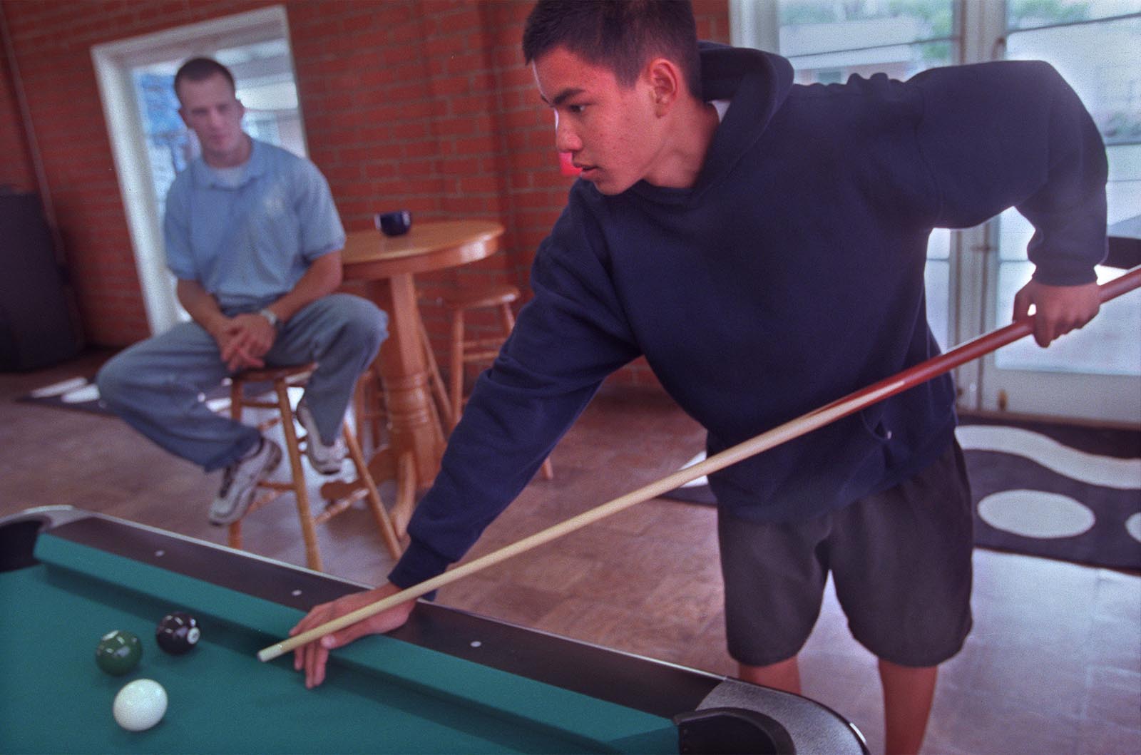
On the opening day of The Attic teen center on April 12, 1999, West High sophomore Thomas Phan plays pool while staffer Jason Minter looks on. (Daily Breeze staff file photo by Thomas Michael Alleman)

Sources:

The Attic website.

Daily Breeze archives.

Torrance Press Herald archives.

Behind the numerous theories about the origin of Rat Beach’s name 

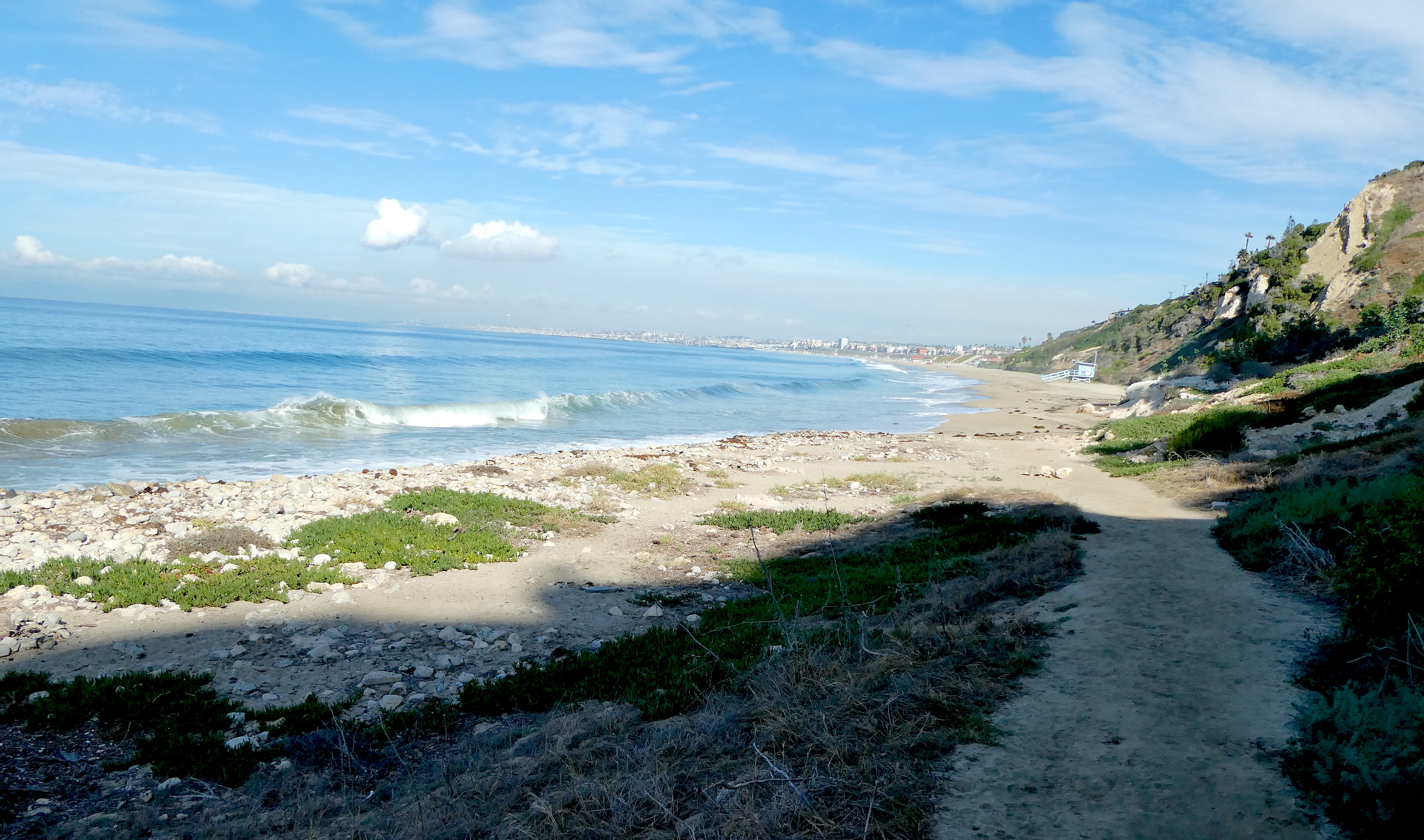
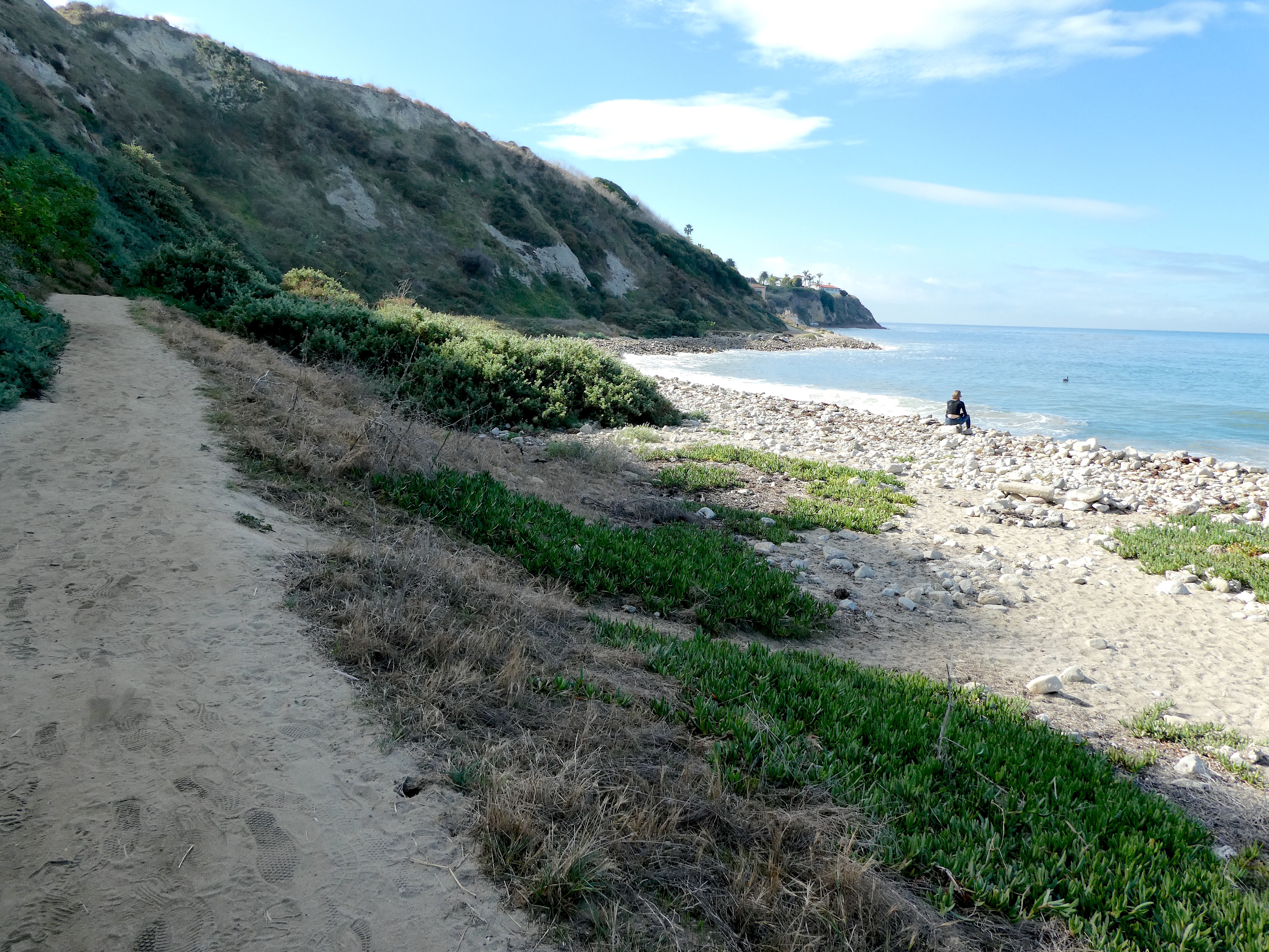
Rat Beach, looking north. Torrance Beach can be seen in the far distance, just beyond the green hills at right. (November 2023 photo by Sam Gnerre)

Explanations abound regarding the source of the name for the stretch of beach south of Torrance Beach commonly known as Rat Beach. 

Among the theories: “Rat” stands for “Redondo and Torrance.” Or it means “Right after Torrance.” The beach was named for the pet rat a surfer brought to the beach while he surfed, or for rats gathering at a drainage outfall near the beach, or rats who came ashore when the Dominator sank off the Palos Verdes Coast in 1961.

All of them have been posited as possible origins of a somewhat scraggly stretch of Los Angeles County beach just north of the Roessler Pool and the popular Haggerty’s surf spot.

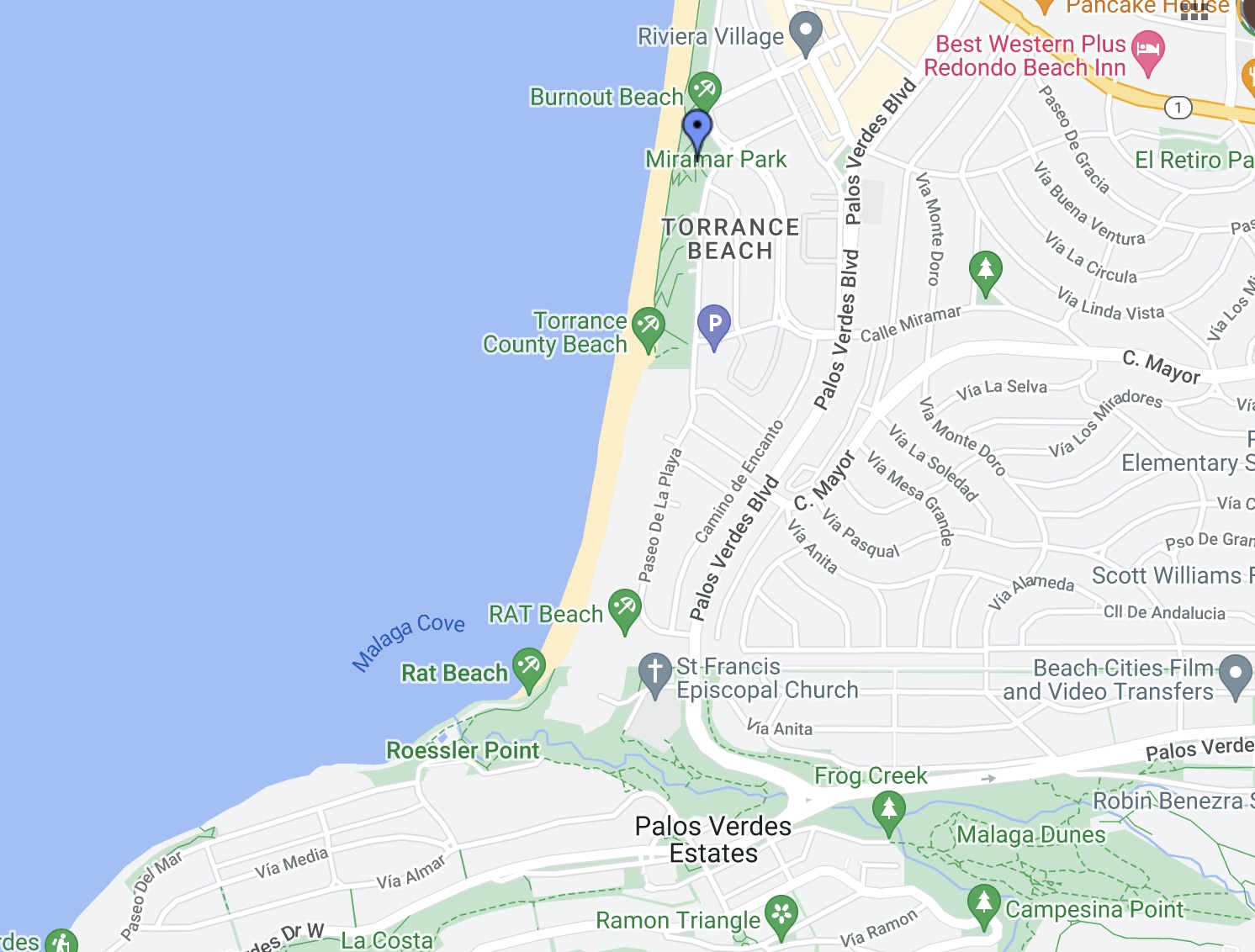
(Credit: Google Maps)

Before we get into the particulars of the name, let’s establish Rat Beach’s location. It’s often confused with Torrance Beach, a lovely white-sand stretch of beach that extends from Miramar Park on the north for just under a mile south to the northern edge of Malaga Cove.

Its location makes one of the explanations, that “Rat” means “Redondo and Torrance,” a less likely one, since Rat Beach, which extends south from Torrance Beach to Malaga Cove, does not adjoin Redondo Beach, almost a mile to the north. Torrance Beach lies between the two.

For years, the city Palos Verdes Estates claimed the area, referring to it as Malaga Cove Beach. A Dec. 31, 1937 editorial from the Palos Verdes Peninsula News demanded that the city take strict control of the beach in order to make it “an exclusive part of the Palos Verdes shores for the residents of Palos Verdes only.”

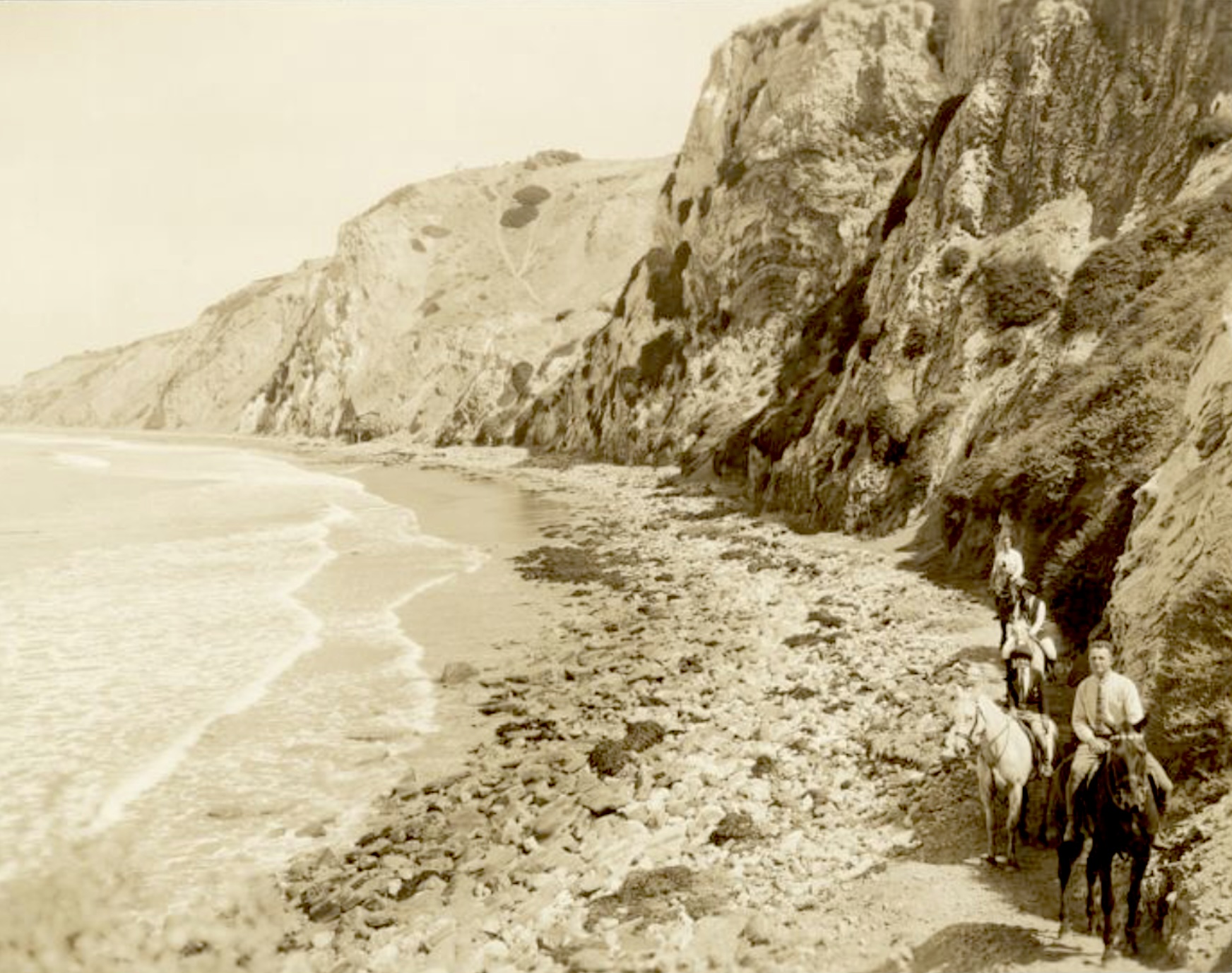
Rat Beach was known as Malaga Cove Beach when this photo looking northward was taken on Sept. 6, 1925. The riders, front to rear: Howard Harris Towle (a Palos Verdes Project developer), his wife, Gladys Towle, Reba Willis (manager of La Venta Inn) and George Bruner. (Credit: Palos Verdes Public Library Digital Archives)

The editorial bemoaned the incursions of rowdy outsiders onto the beach, and reported that boats near the Palos Verdes Swimming Club, located at Roessler Point, had been broken into and vandalized. It went on to demand that police step up patrols in the area.

The Rat Beach name came about decades later. 

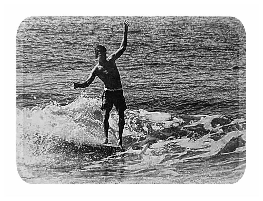
Perhaps the most colorful story concerning the name involves professional surfer Rick Irons. Irons, a member of the Haggerty’s Surfing Club in the 1960s, owned a pet rat that he used to bring with him when he surfed. He would leave it on the beach while carving up the waves, and his fellow surfers began calling the area Rat Beach in its honor.

Rick Irons at Rat Beach in the early 1960s. Photo by Peter Green. (Credit: South Bay Surf Clubs and Surf Teams Facebook page)

Irons later moved to Hawaii, earned his degree, and served as the editor of Surfing magazine for several years.

Another taller tale involving the name came about after the SS Dominator ran aground offshore near Rocky Point in Palos Verdes Estates on March 13, 1961. The freighter, which carried a cargo of meat and grain, had to be abandoned.

According to legend, after the wreck, a large colony of rats living on the cargo in the ship’s hold made their way ashore and infested the nearby coastline, resulting in the name. Rats are survivors, but this batch must have been excellent swimmers to make it onshore, and hearty travelers to make it from Rocky Point north to Rat Beach, a distance of more than three miles.

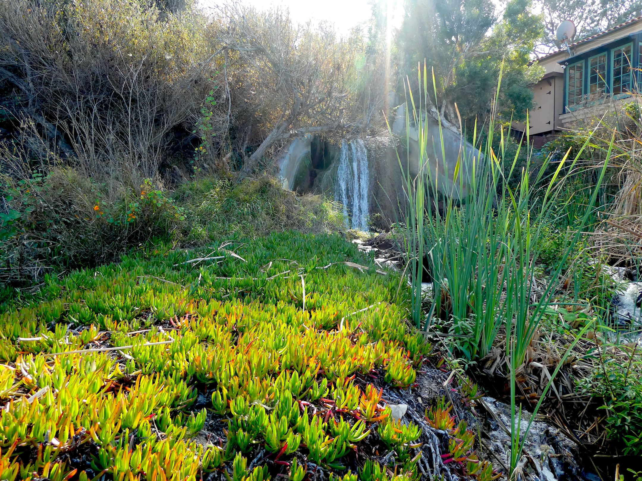
The Malaga Creek waterfall is located near the creek’s outfall to the ocean. (November 2023 photo by Sam Gnerre)

A third rat origin story has to do with Malaga Creek. The stream terminates with an outfall at the southern end of Rat Beach, in the rocky area near the present-day Palos Verdes Beach and Athletic Club. As the beach wasn’t always meticulously maintained, a colony of rats supposedly thrived in the brushy, rocky area where the stream met the beach. This led to the area being called Rat Beach.

Other explanations claim the name refers to the “ratty” nature of the beach, which was the object of regular clean-up efforts during the 1960s and 1970s, though this is also difficult to substantiate.

Okay, so what’s wrong with just calling the beach Rat as shorthand for “Right After Torrance”? Absolutely nothing. It makes perfect geographical sense. There’s just no clear origin story for that explanation, which seems to have derived from popular usage in recent decades.

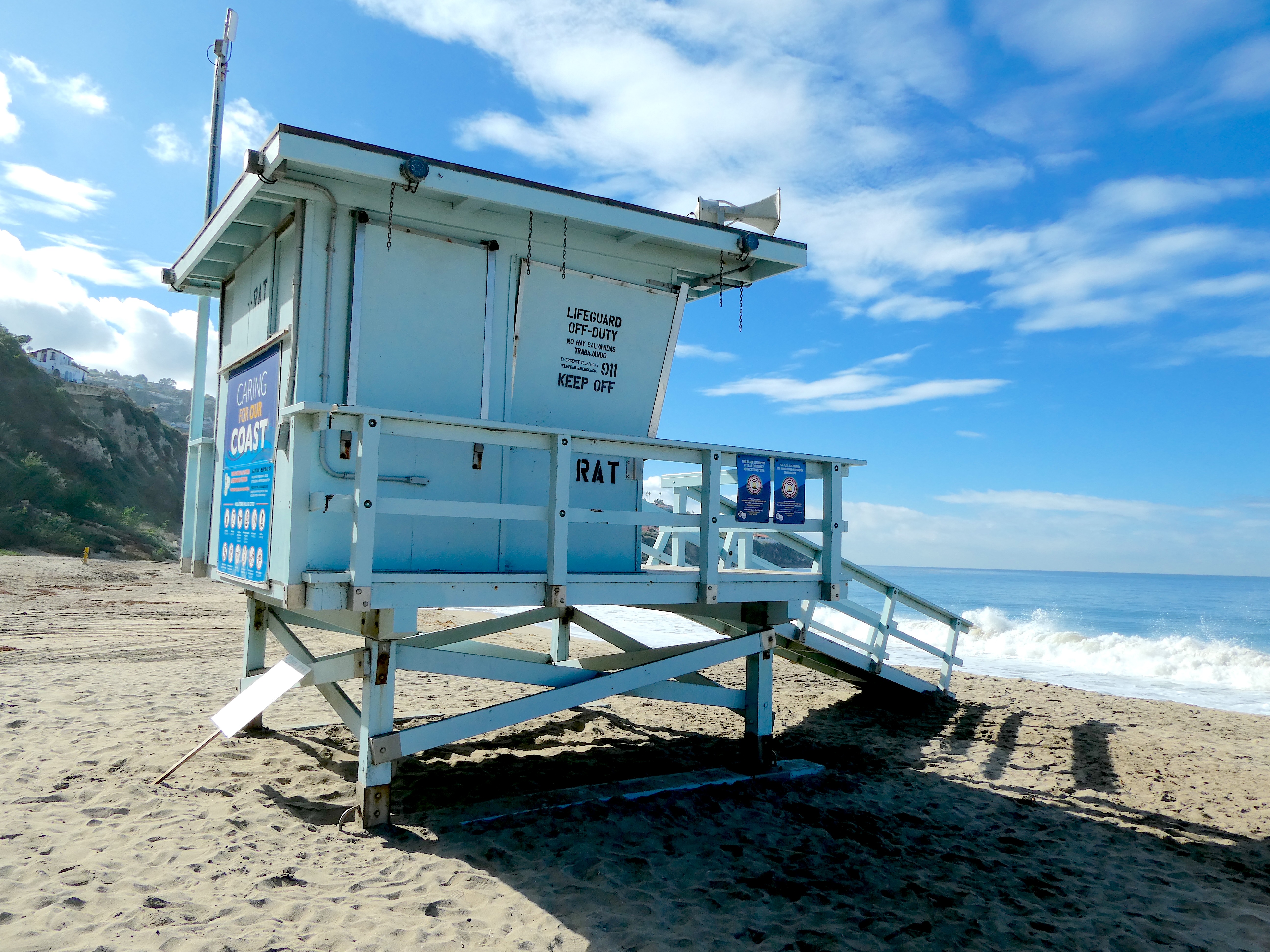
Los Angeles County Lifeguard station at the southern end of Rat Beach. View looking south. (November 2023 photo by Sam Gnerre)

The Manhattan Beach Brewing Company created an ale in its honor in the early 1990s called Rat Beach Red Ale. The microbrewery discontinued production of the beer in 2009, but another brewery in Torrance, Buzzrock Brewing Co., has since introduced a new Rat Beach Red Ale in tribute to the original.

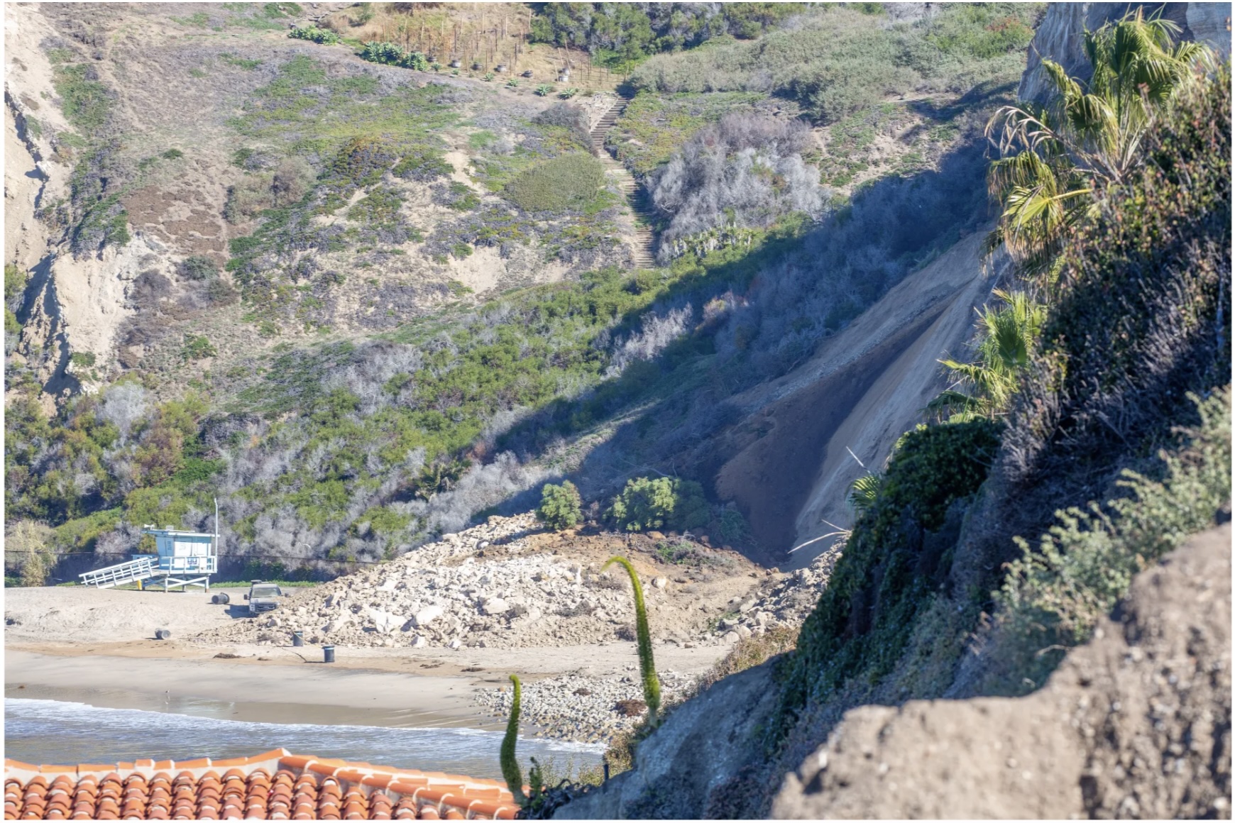
Rat Beach made the news twice in 2022. On Sept. 7, the beach was closed for about three weeks after a 10,000-15,000 gallon sewage spill near the Malaga Creek outfall. Then, on Dec. 9, a 200-foot section of hillside collapsed onto the beach. 

A landslide, center, sent rock and debris down onto Rat Beach in December 2022. The slide was located on the cliffside bordering Palos Verdes Estates and Torrance. Dec. 9, 2022. (Daily Breeze photo by Chuck Bennett/Contributing Photographer)

The landslide, part of a larger, unfortunate recent trend of land movement on the Palos Verdes Peninsula, resulted in the closure of the beach and the evacuation of several hilltop houses.

Rat Beach remains popular among local surfers and beachgoers, despite not having the scenic ambience or quality waves of other spots. It may not be beautiful, but it’s ours, with crowds kept low due to it being accessible only by a path leading down from a parking lot near the former Malaga Cove School.

We may not have been able to pinpoint the exact source of Rat Beach’s name, but it’s clear that the name itself is here to stay. I think I’ll go with “Right After Torrance,” which is as good an explanation as any.

Rat Beach’s sandy beach turns rocky at its southern end. Malaga Cove Trail is at left. (November 2023 photo by Sam Gnerre)

Sources:

Daily Breeze archives.

Palos Verdes Peninsula News archives.

“South Bay locals: Do you know where RAT Beach is?”, by Blake Lane, NewsBreak website, Aug. 26, 2023.

Note: Special thanks to Toni Sciacqua, SCNG Managing Editor, Digital, for the story idea.

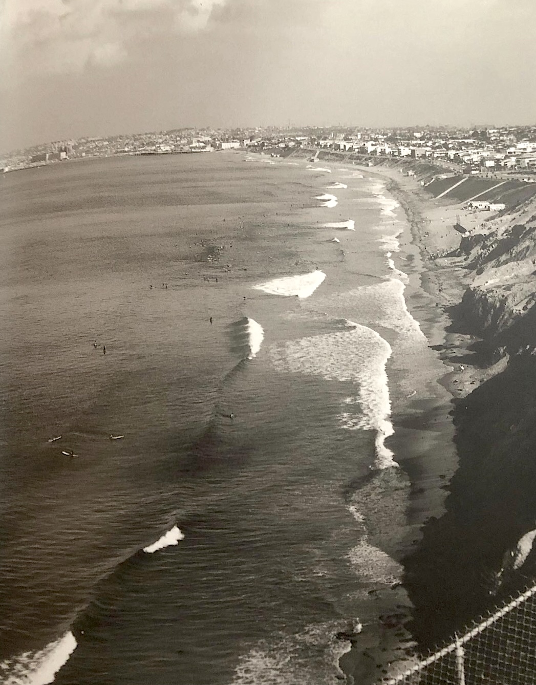
Rat Beach is at right in this view looking north to Redondo Beach in 1964. Surfers can be seen in the water waiting for waves . (Photo by Leroy Grannis)

After years of standing vacant, San Pedro’s courthouse transformation has begun

The long-shuttered San Pedro courthouse is surrounded by fencing on Jan. 26, 2022 in preparation for the start of demolition to begin on Feb. 9, 2022. (Daily Breeze staff photo by Brittany Murray)

The Harbor Area and the Palos Verdes Peninsula must’ve felt hard done by the 1961 announcement that a new Los Angeles County Courthouse branch building would be built in Torrance.

The entire South Bay/Harbor Area had been bereft of a large-scale courthouse for years. For major cases, attorneys and other involved persons would have to schlep themselves and their documents to the downtown L.A. courthouse, with some cases able to be handled at the county courthouse in Inglewood.

Ground was broken for the new courthouse in Torrance in 1964, and the building was dedicated on June 23, 1967.

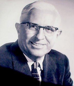
Burton W. Chace. Undated photo.

Fortunately, L.A. County Supervisor Burton W. Chace, who represented the Harbor Area, took note of the judicial deficiency. In late December 1966, he convinced the Board of Supervisors to give the green light for construction of a new satellite courthouse in San Pedro.

At the time, the only courtrooms in town were two small ones located in the San Pedro Municipal Building at 638 Beacon St.

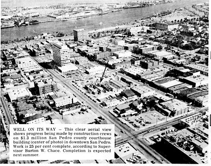
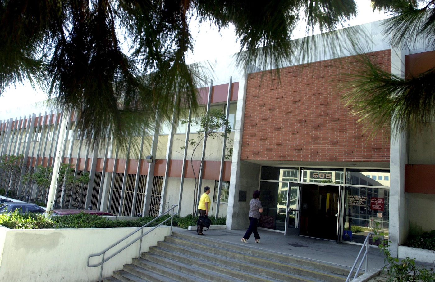
Eight bids were submitted for construction of the two-story facility to be erected on 1.75 acres at 505 S. Center St., between Fifth and Sixth streets. Coast State General Engineering Co. of Long Beach won the job with a low bid of $1.16 million.

Funding for the project came from the Los Angeles County Employees Retirement Association, with the county set to repay the debt over a 30-year period under terms of a lease-purchase agreement.

Palos Verdes Peninsula News, Oct. 1, 1967, Page 1. (Credit: Palos Verdes Peninsula News archives)

In addition to three municipal courtrooms, plans for the 42,655-square-foot facility included offices for the municipal court clerk, district attorney, public defender, probation department and the L.A. County Sheriff’s Department. Two of the three courtrooms were circular in design, the first such rooms in Southern California.
Supervisor Chace officiated at the groundbreaking ceremony for the new building, which was held on July 7, 1967. “The battle to bring modern, more efficient municipal court facilities to the San Pedro area has been difficult, but now the job is only a year away from reality,” he told attendees at a post-ceremony luncheon at the Pacific Trade Center building in San Pedro.
In reality, costs would rise to $1.3 million, and the courthouse would not be completed until early 1969.

Its grand opening ceremony on Feb. 28 of that year included speeches from California Supreme Court associate justice Marshall McComb, as well as from local pols John Gibson of the L.A. City Council and California State Senator Ralph Dills.

The San Pedro courthouse on Sept. 18, 2002, when rumors swirled that it might become a juvenile detention center. The rumors did not become reality. (Daily Breeze staff file photo by Branimir Kvartuc)

The court would go on to conduct its business without major incident until 1986, when reports of allegedly scandalous actions of its chief supervising judge, David M. Kennick, brought tension to the court.

According to San Pedro News Pilot reporter Russ Britt, “During 1986, Kennick was accused of favoritism in handing out court-appointed cases to private attorneys with whom he had financial and personal ties. Other accusations surfaced that Kennick sought sexual favors in exchange for judicial influence and asked a California Highway Patrol officer to ‘lose the paper work’ in a drunken-driving case against him.”

Kennick resigned on Jan. 1, 1987, and morale at the courthouse improved markedly.

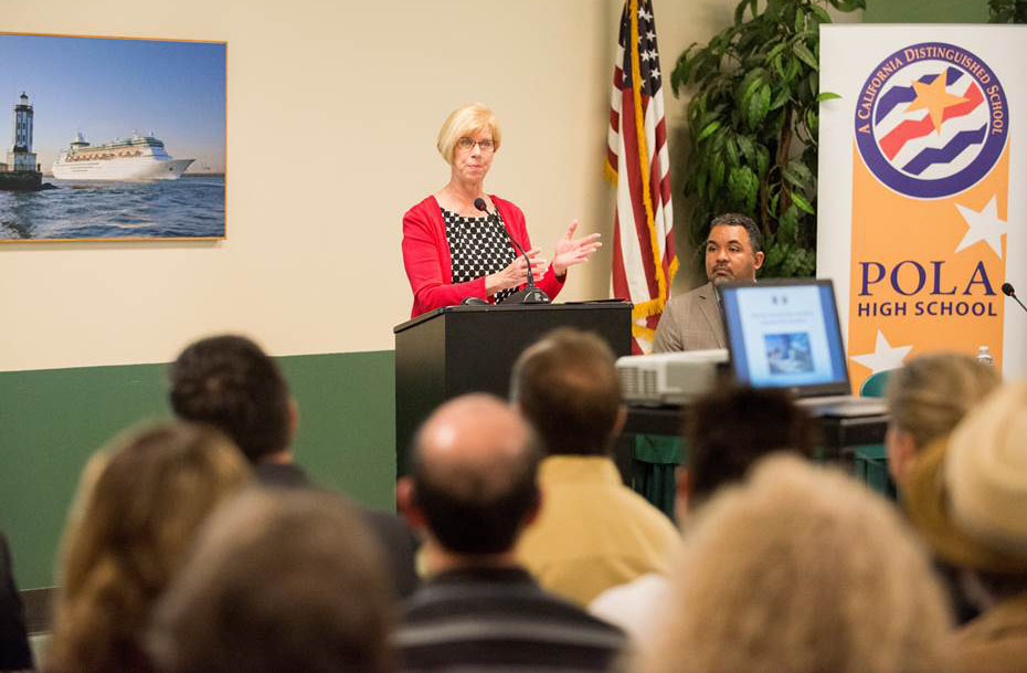
Supervisor Janice Hahn speaks as community debate opens with an April 2017 meeting over what to do with San Pedro’s closed courthouse property. (Credit: L.A. County Supervisor Janice Hahn’s Office)

The building remained vacant during the rest of the 2010s as the community debated what to do with the prime real estate on which it stood.

But by 2003, the court was beset by a new threat: county government budget cuts. Rumors about the cuts began spreading in late 2002. On April 14, 2003, adjudication of all criminal cases shifted to the Long Beach Superior Court, with San Pedro handling only civil cases.

The money saved came from the shuttering of the lockup facility at San Pedro, but the LAPD was angered because its officers had to spend more time commuting to a court further away from the area they patrolled.

Rumors also began to circulate that the county would close the courthouse entirely in order to further cut costs. The facility limped along for several more years until the budgetary ax finally fell in June 2014, when the county closed it permanently. All of its functions were transferred to Long Beach.

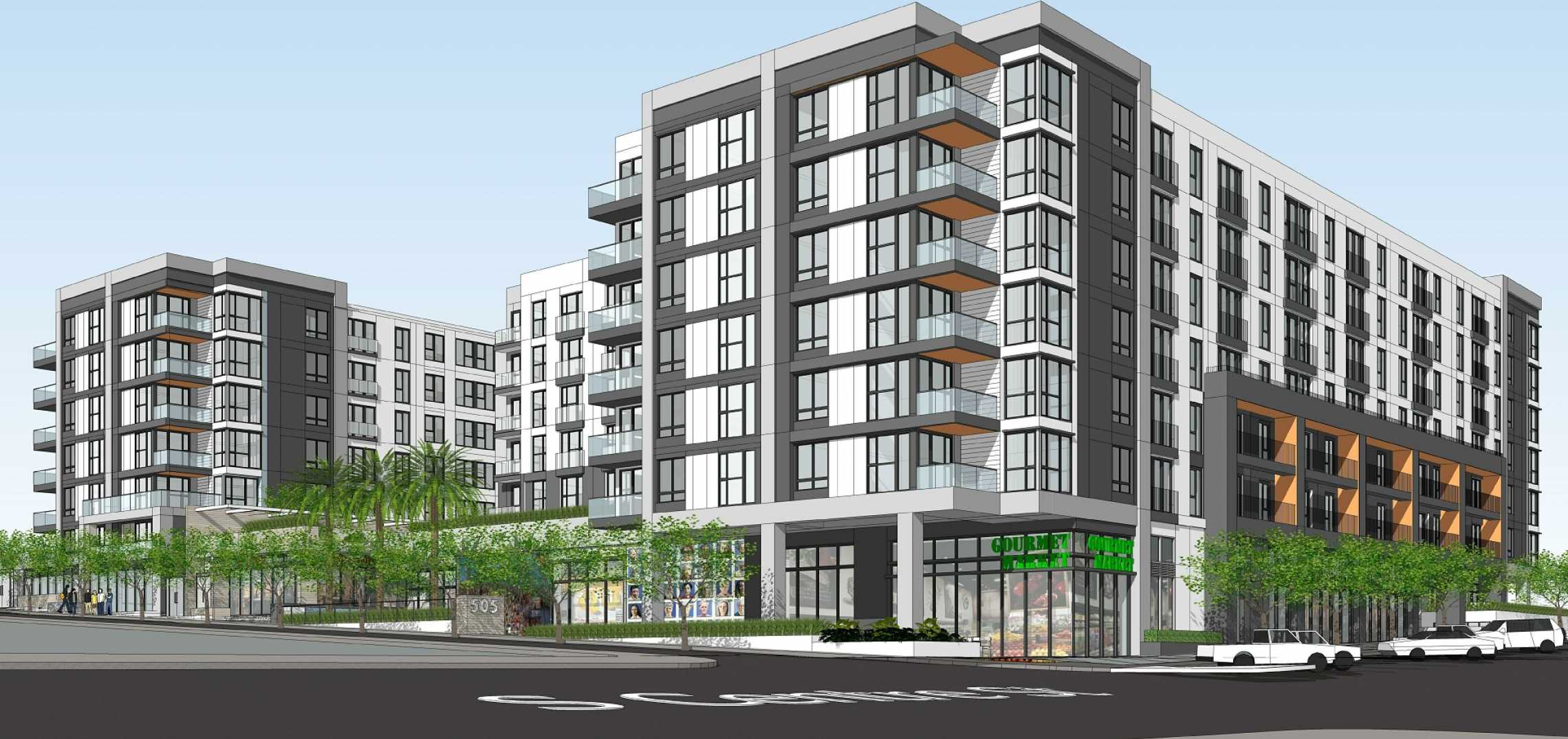
In February 2021, Supervisor Janice Hahn and Pasadena development company Genton Cockrum Partners announced plans for the construction of an eight-story mixed-use commercial-residential structure on the site.

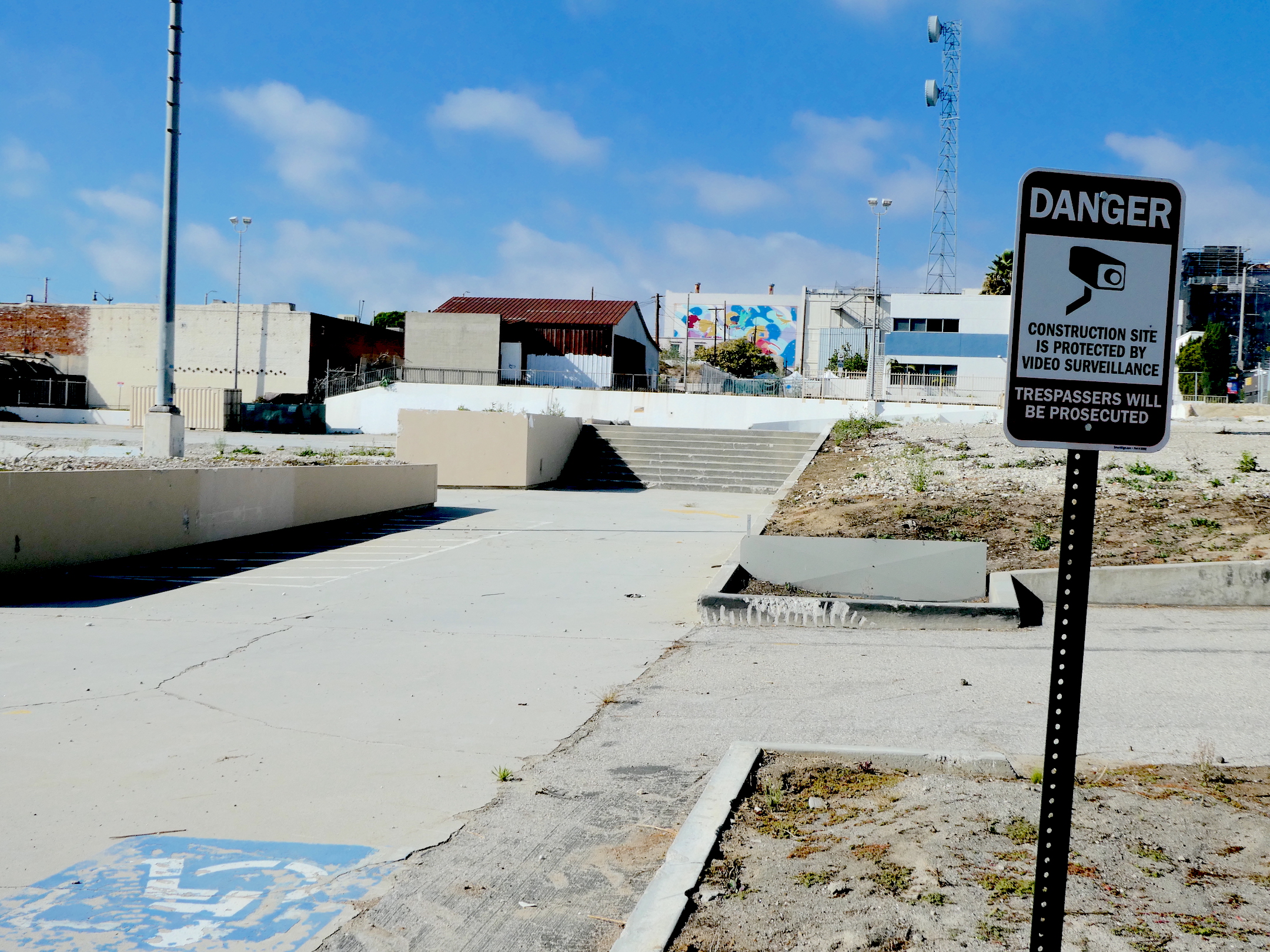
Demolition of the old courthouse began on Feb. 9, 2022. Construction of the new project, named Acqua Via, began in Fall 2023, and is expected to be completed in late 2025. It will include 300 apartments and ground-floor retail establishments, along with 500 underground parking spaces.

Artist rendition of the Acqua Via apartment complex currently under construction on the old courthouse site in San Pedro. (Courtesy Genton Cockrum Partners)

Sources:

Daily Breeze archives.

Los Angeles Times archives.

Palos Verdes Peninsula News archives.

San Pedro News Pilot archives.

Torrance Press-Herald archives.

The old courthouse steps, center, lead nowhere at the vacant 1.75-acre San Pedro site, which is slated to become an eight-story mixed-use apartment complex. Dec. 17, 2023. (Photo by Sam Gnerre)
Is this your new site? Log in to activate admin features and dismiss this message
Log In