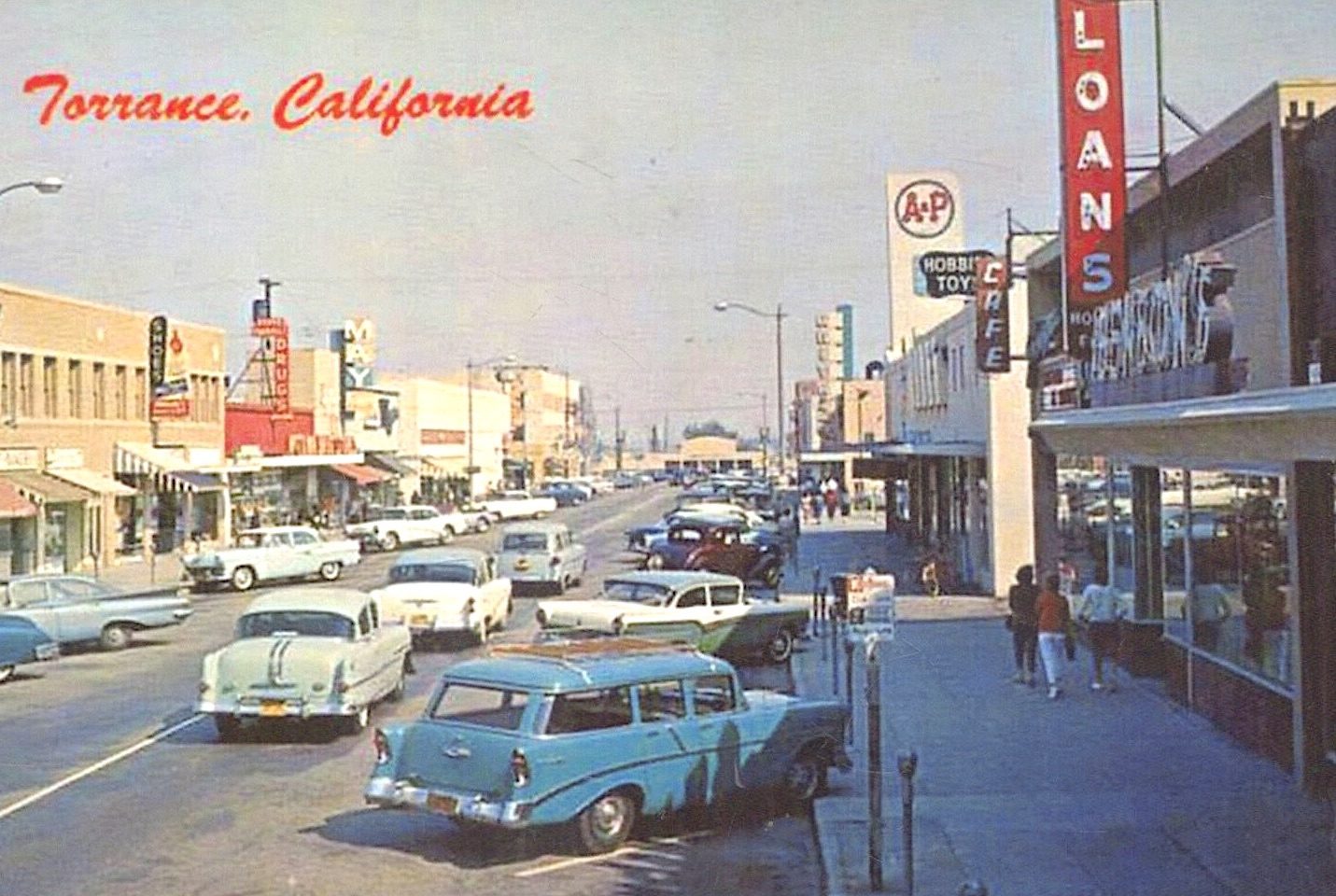
Present-day Carson was once known as Keystone

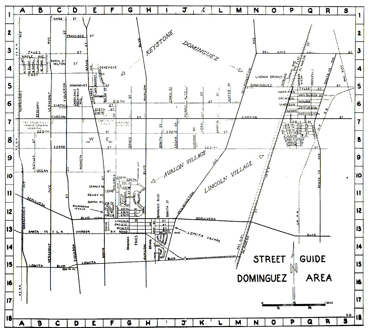
This 1952 street map from the Lomita Square Civic Association bulletin shows the various areas of what would become Carson, including Keystone, top left. Keystone was first settled in the early 1920s. (Credit: The History of a City … Carson, California, by Jack E. Jerrils, City of Carson, 1972).

The Keystone area as it exists today roughly encompasses a triangular portion of west Carson north of 228th St. and between the 110 and 405 freeways. (Some also identify the county area to the west between the L.A. city strip and the 110 as being Keystone as well.)

It’s a fairly small slice of the nearly 19-square-mile city, but the Keystone name actually predates Carson’s incorporation by several decades, and originally referred to the entire early settlement. Keystone wasn’t even its first name; early settlers who bought land from the Dominguez Estate Co. called it “Nestoria.”

The Dominguez Estate Co. was formed to manage the real estate from the Rancho San Pedro Spanish land grant owned by the Dominguez family. Its first sales were to small farmers, but it didn’t take long for residences to start springing up there as well.

Oil wells had begun to spring up in the Dominguez Hill area east of the residential portion of the settlement, where the Dominguez Water Co. already had established water wells by 1911.
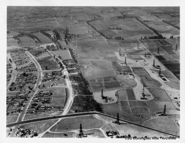
Oil wells abut housing development, left, in this 1931 aerial view of what is now Carson. (Credit: CSUDH digital archives)

The origin of the Keystone name remains unclear. Real estate developers began working the area west of Dominguez Hill in the early 1920s, and they initially identified the area as “Keystone Acres.” The earliest area to be subdivided was located between Figueroa St. and Avalon Blvd., and from 213th St. south to 228th St.

By the time of the publication of the first Torrance Directory in 1922, listings for the Keystone area were included, and its population was given as 351 persons. (By then, the “Acres” part of the name seems to have been dropped.) 

By mid-1922, the Keystone Chamber of Commerce had been formed and was holding regular meetings. It replaced the earlier Keystone Boosters Club; the building near the corner of 220th and Main streets where the chamber regularly met kept its name of Booster’s Hall for many years. (The now-empty building still stands.)

The pace of urbanization quickened during the boom years of the 1920s. Workers at the many local industrial plants in Torrance and the oil fields and refineries all around the area needed places to live. The opening of Carson Street School in 1927 served as an additional inducement to potential homebuyers.
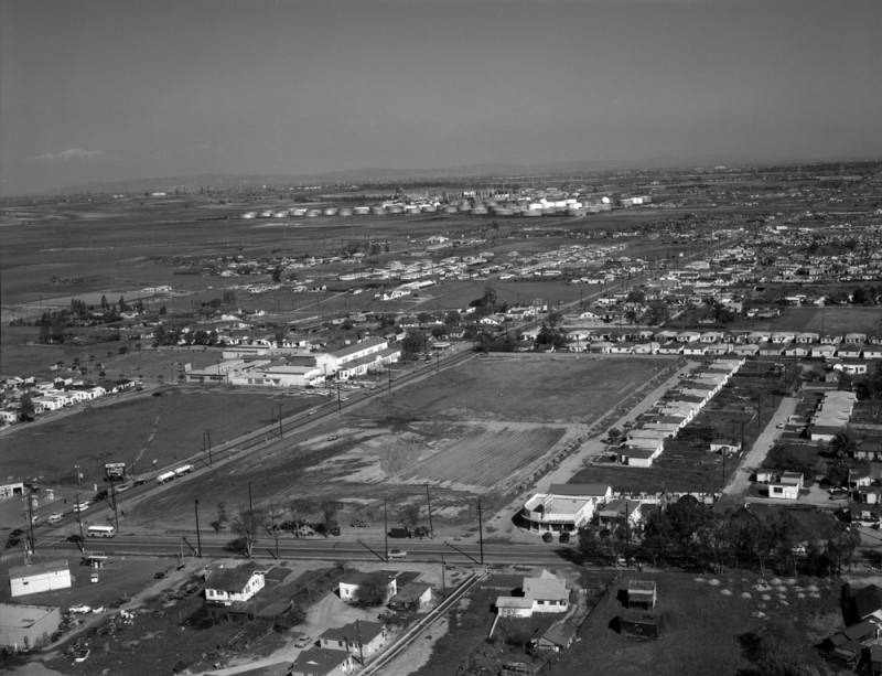
Aerial view of Carson and Main streets in Carson, looking northeast. Carson Street Elementary School is at center left, along Carson St. (diagonally, lower left to upper right); Main St. runs horizontally at forefront. Feb. 26, 1958 photo.
(Credit: Los Angeles Public Library Photo Collection)

A Torrance Herald article from 1928 trumpeted the area’s burgeoning development, announcing that the Keystone Building and Finance Corporation planned to build 225 homes in the area. The thinly veiled promotional piece detailed the availability of gas lines, electricity from a new Edison substation on Dolores St. and water from the nearby Dominguez Water Co. wells.

The article also touted the improvements to the mostly dirt roads in the area. Harbor Blvd., later renamed Main St., was already paved, being the main north-south artery from downtown Los Angeles to the Harbor Area. There were no freeways, of course, and parts of major streets such as Vermont, Figueroa and Avalon Blvd. had yet to be paved and in some cases connected to their northern counterparts.
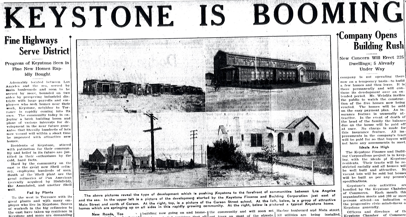
Torrance Herald, Aug. 16, 1928. (Credit: Torrance Historical Newspaper and Directories Archive database, Torrance Public Library)

By 1929, the population of Keystone was estimated to be 800 people.

Following the end of World War II, most of the street improvements had been completed, with the 110 Freeway through the South Bay/Harbor Area already on the drawing boards. Schools, churches, retail businesses and other establishments were thriving.

The Keystone-Avalon Chamber of Commerce had grown in size and influence, counting 90 members in 1950. Its members began searching for a name that would unite residents of Keystone, the Avalon Village housing development, and the industrial Dominguez area northeast of the main settlement.
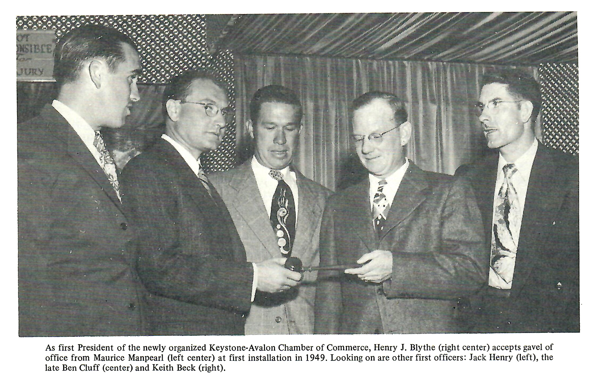
(Credit: The History of a City … Carson, California, by Jack E. Jerrils, City of Carson, 1972).

Its president, Harry Blythe, sent out a letter to members proposing different names that year. The 25 suggestions included Avalon Park, Carsalon, Normal, Santa Claus, Cabrillo, Defiance and Santa Rocha. But one name on the list would stick: Carson.
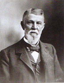
George Henry Carson. Undated file photo.

The proposed name honored the memory of George Henry Carson, the pioneering businessman and rancher who married land grant owner Don Manuel Dominguez’s daughter Maria Victoria in 1857. He went on to manage Don Manuel’s Rancho San Pedro and Dominguez Rancho properties for many years before his death in 1901.

With the news that the U.S. Post Office intended to build a branch office in the area, the chamber acted in early 1952 to establish Carson as the permanent name for the area. It changed its own name to the Carson Chamber of Commerce, and asked Rep. Cecil King to reserve the name for the new post office.

By 1954, Carson had become the official name for the area. It would be the beginning of a long drive toward cityhood, with leaders looking to consolidate its various pieces, Keystone, Lomita Square, Avalon Village, Victoria Park and parts of Dominguez into one entity.

Attempts by the city of Long Beach to annex a part of the Dominguez area then known as Davidson City in the eastern part of Carson in 1958 intensified the drive for incorporation.

Debate raged over the issue for the next 10 years. Finally, on Feb. 6, 1968, voters approved incorporation by a vote of 6,301 for to 3,394 against. Carson’s incorporation became official on Feb. 20, 1968. More than 600 people jammed the auditorium at Carson High School for the ceremonies.
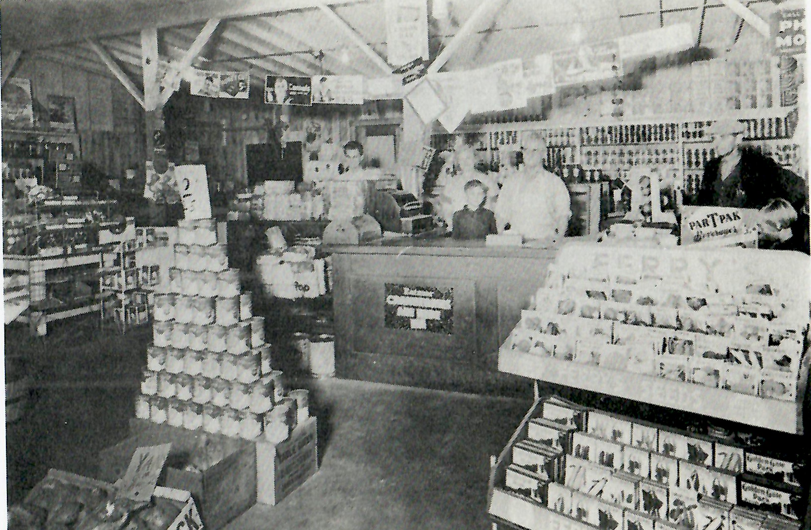
Hilpert’s Store at 22022 S. Main St. was an early fixture in the Keystone area. The Hilperts are behind the counter in this undated photo circa 1920s. (Credit: My Carson, Your Carson: A Picture Book of the Past and Present, by Charlotte Trejos, Trejos Literary Agency, 1987.)

Sources:

Carson, by Cindy Tino-Sandoval, Arcadia Publishing Co. (Images of America series), 2006.

Daily Breeze archives.

The History of a City … Carson, California, by Jack E. Jerrils, City of Carson, 1972.

My Carson, Your Carson: A Picture Book of the Past and Present, by Charlotte Trejos, Trejos Literary Agency, 1987.

San Pedro News Pilot archives.

Torrance Press Herald archives.
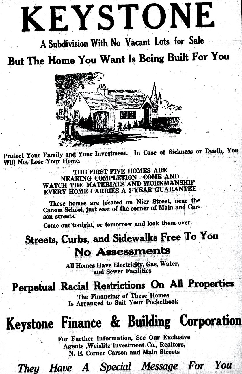
Torrance Herald, Aug. 16, 1928. The ad includes overt racial restrictions on potential buyers. (Credit: Torrance Historical Newspaper and Directories Archive database, Torrance Public Library)

Even without that period, the George F Canyon nature preserve is still wondrous

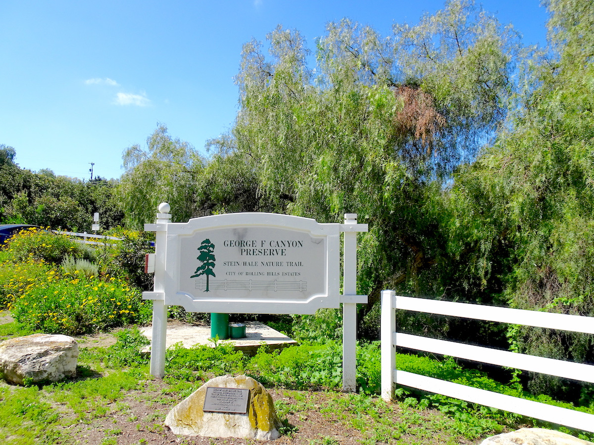
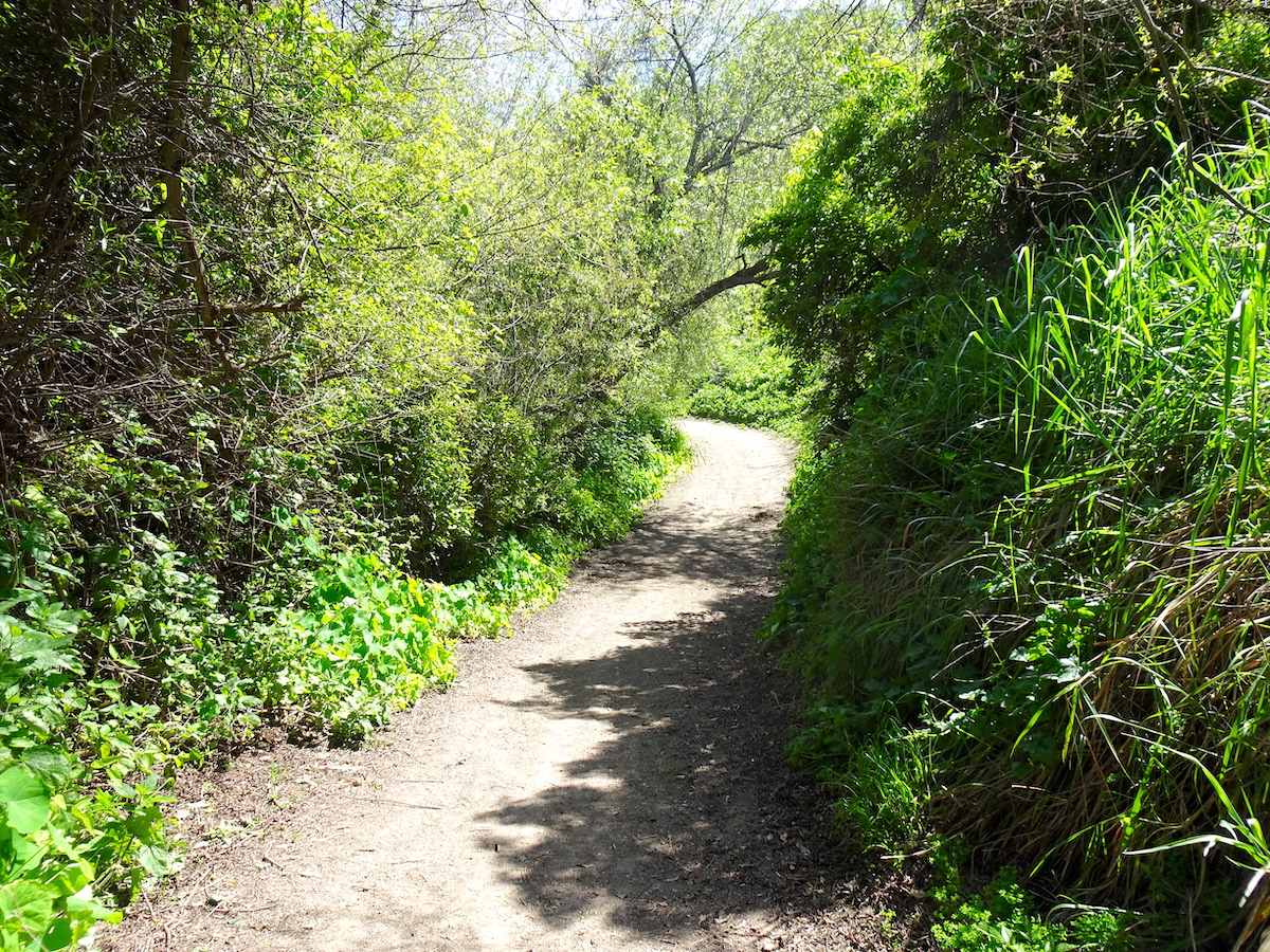
The trailhead at the George F Canyon nature trail in Rolling Hills Estates. April 2023. (Photo by Sam Gnerre)

No one knows definitively why George F Canyon, which runs west from Palos Verdes Drive East in Rolling Hills Estates to the Rolling Hills border, officially has no period after the “F” in its name.

In addition, no one seems quite sure as to whom “George F” refers. Several theories on both have been put forth. A Daily Breeze story from Feb. 17, 2011, offered two:

“Theory No. 1: Whoever transcribed the name on an early topographical map meant to honor George S. Bixby, an early rancher who once owned vast tracts of land in the area. However, for some unknown reason, the middle initial is an ‘F’ and the last name is missing altogether.

Theory No. 2: The canyon is named after George F. Vickery, a San Pedro rancher who once grazed cattle on the slopes of the Palos Verdes Peninsula.”

However it happened, the name has been used without the period since before any of the cities on the Palos Verdes Peninsula were incorporated. According to Torrance Herald issues dating as far back as 1922, George F Canyon, then undeveloped, was a favorite hiking spot for scouting groups, who used the area when testing their outdoor skills.

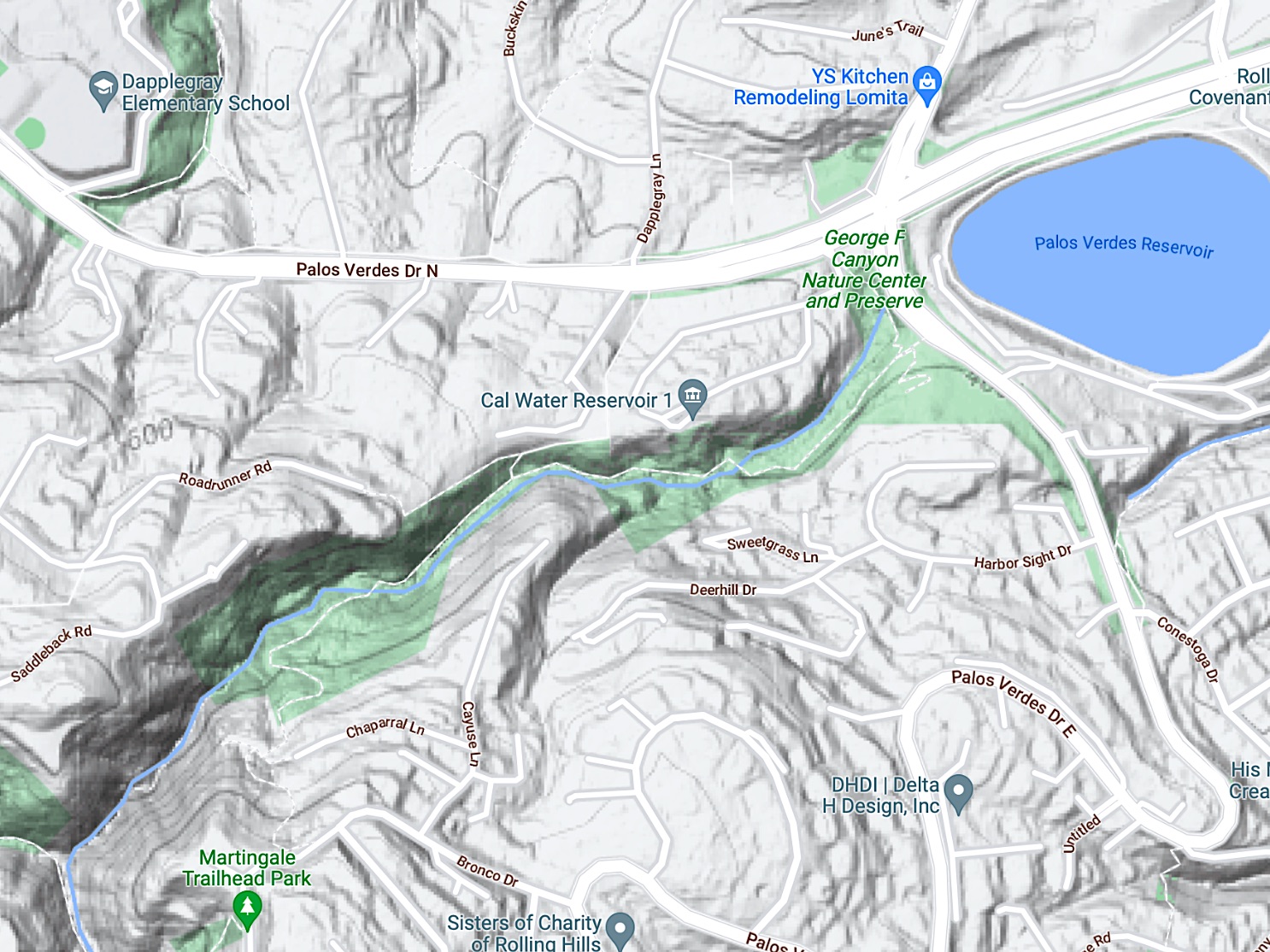
A natural stream runs through George F Canyon, shaded here in green. 2023 data. (Credit: Google Maps)

During the South Bay / Harbor Area oil boom of the 1920s and 1930s, at least 18 oil wells were drilled at various spots on the Palos Verdes Peninsula, including one in George F Canyon in 1937. Unfortunately, or fortunately, depending on your point of view, “Oil men reported they did not find the results encouraging,” according to the Palos Verdes Peninsula News.

In 1942, three Lomita boys hiking in the canyon found an unidentified skeleton after one of them saw a partially-buried shoe in a ravine in the canyon where grading work was being done. Authorities determined the man had been buried there for about 20 years and his death did not appear to be violent. He was never identified.

In May 1943, the Harbor Area Coordinating Council, a group of local civic organizations and leaders, proposed building a summer camp in the canyon to be used by youth groups. The plans never came to fruition.

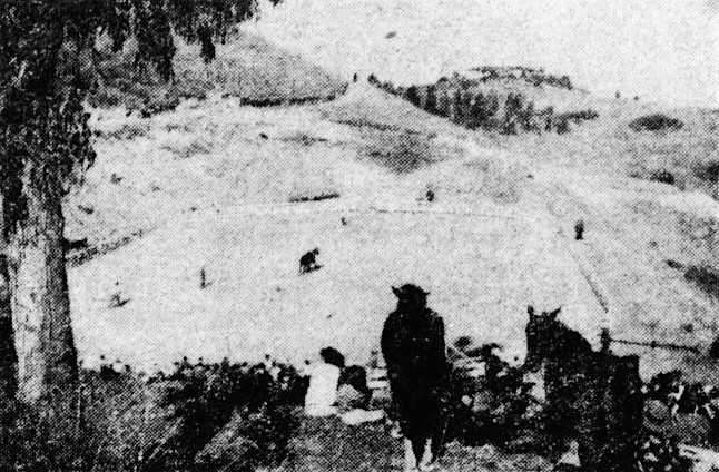
George F Canyon has always been popular with horseback riders on the Hill. In 1956, the Caballeros Riding Club built a riding circle near the western end of the canyon near Saddleback Road in Rolling Hills in order to take advantage of the then-newly revamped trail through the canyon.

The Caballeros Riding Club riding circle, foreground, with vegetation at eastern end of George F Canyon seen at upper right. Palos Verdes Peninsula News, Nov. 8, 1956, Page 29. (Credit: Palos Verdes Peninsula News archives)

Nature lovers and conservationists had long eyed the canyon as an area that needed to be preserved. In December 1982, the owners of the land, Robert S. Stein, Ronald S. Stein, Sandra A. Stein Haveson and Arthur D. Hale Sr., agreed to donate the land to the city of Rolling Hills Estates.

The city agreed to pay off the $70,000 mortgage on the land, and declared it open space for the purpose of transforming it into a nature preserve. The city also purchased an adjacent parcel of land along Palos Verdes Drive East to the Palos Verdes Drive North intersection from the Metropolitan Water District on which it planned to build a nature center, parking lot, and trailhead.

With help from the Palos Verdes Peninsula Land Conservancy, formed in 1988, the city began the process of restoring the area. On May 12, 1993, the George F Canyon Nature Walk was dedicated. It would later be renamed the Stein-Hale Nature Trail in honor of the canyon’s  former landowners.

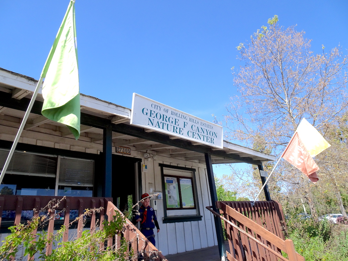
The George F Canyon Nature Center building opened in 1996. (April 2023 photo by Sam Gnerre)

In 1994, RHE residents passed a bond issue that enabled the city to build the $150,000 nature center and to hire naturalist Aileen Bevan from the PVP Land Conservancy, which had been put in charge of management and operation of the facility.

Bevan pointed out to Daily Breeze reporter Diana Chapman in 1996 that, unlike much of the Peninsula, the canyon contained mostly native plants, in addition to the only year-round aboveground stream in the area.

Wildlife is abundant. The area supports habitats for sparrows, warblers, Allen’s and Anna’s hummingbirds, skunks, opossums, raccoons, foxes and several other species. Over the years, volunteers have worked doggedly to remove non-native plants and restore native ones.

The canyon’s natural vegetation has been described as being a combination of riparian willow and coastal sage scrub types. (Riparian refers to the varieties of flora found on and near riverbanks.) The recent rainy season has led to exceptionally lush beds of greenery in the Preserve.

The Stein-Hale Nature Trail runs for about a mile through George F Canyon. (April 2023 photo by Sam Gnerre)

On June 1, 1996, the George F Canyon Nature Center opened on the southwest corner of Palos Verdes Drive North and PV Drive East. Its employees and docents regularly conduct  nature walks and hikes in the 51-acre Preserve. Hikers are not permitted on the grounds after dark, but the Nature Center does schedule regular moonlight walks as well.

In 2016, the PVP Land Conservancy added to the Preserve by acquiring an additional 15 acres at the canyon’s western end.

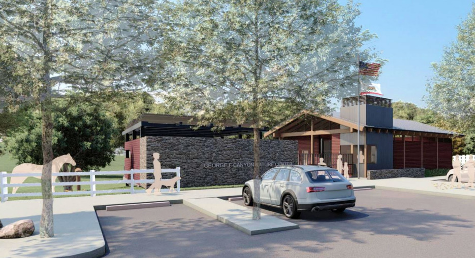
In recent years, RHE has been examining the possibility of replacing the park’s small Nature Center with a new and larger building. In September 2022, it announced that it will receive $1.2 million in state funds towards the building of the planned $2 million, 3,300-square-foot facility, which would include a large meeting room and a covered outdoor classroom space. Under the plans, the current Nature Center would be torn down.

The city also has earmarked some of its own funds to help pay for the new center. No timetable has been given for its construction and completion.

The George F Canyon Nature Center will receive $1.2 million toward construction of a new facility, it was announced in September 2022. (Photo rendition of proposed new center courtesy of Roesling, Nakamura, Terada Architects/Spurlock Landscape Architects)

Sources:

Daily Breeze archives.

George F Canyon Nature Center & Preserve brochure, Palos Verdes Peninsula Land Conservancy.

“George F Canyon Nature Center & Stein-Hale Nature Trail,” City of Rolling Hills Estates website.

Los Angeles Times archives.

Palos Verdes Peninsula News archives.

San Pedro News Pilot archives.

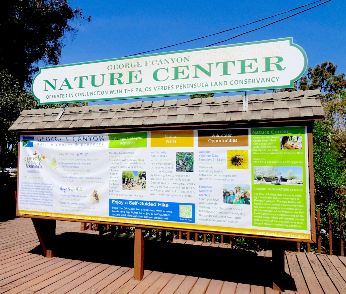
Information board at the Nature Center presents a variety of options to visitors. (April 2023 photo by Sam Gnerre)

How Torrance came to establish its own water distribution system

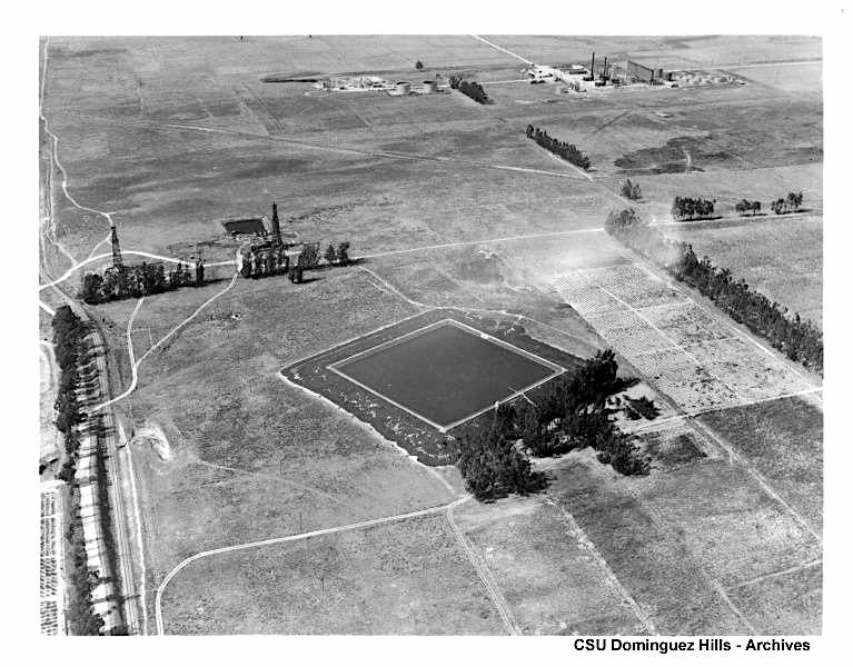
The Dominguez Water Company’s reservoir, center, and two of its water wells, upper left, at its main plant location near Dominguez Hill (in present-day Carson) in 1931. (Credit: CSUDH Archives)

Real estate developer Jared Sidney Torrance had a lot on his plate as he prepared to establish the city of Torrance in 1911. After his initial purchase of $3,500 acres of land from the Dominguez family, he needed to provide something, and fast, that both prospective residents and the large companies he hoped to attract to the new city couldn’t survive without: water.

Initially, the city hooked itself up to the Dominguez Water Company, which had formed in February 1911 as a division of the Dominguez Estate Co. The company was created not just to provide water to Torrance, but to all the communities and agricultural operations in the Rancho San Pedro area.

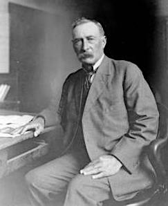
William Mulholland. Undated. (Credit: Los Angeles Public Library Photo Collection)

Dominguez Water began drilling water wells near Carson St. and Alameda Ave. in present-day Carson, just south of Dominguez Hill, and established Its main pumping plant there. The drilling operation was implemented under the supervision of William Mulholland, the chief engineer of the city of Los Angeles.

In addition to being the namesake for Mulholland Drive, he’s renowned for the Owens Valley water project that brought water from central California to Los Angeles, as anyone who’s seen the fictionalized version of him in the film “Chinatown” can tell you.

In order to bring its water to Torrance, Dominguez Water installed an eight-mile-long pipeline from its wells to the new city, and built a second reservoir. Miles of feeder lines from the main pipeline went out to homes and businesses. The private Torrance Light, Power & Water Co. was formed to manage the distribution of the water to customers.

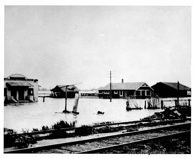
Various problems beset Dominguez Water in those early years. A major flood in February 1914 swamped the main pumping plant. A June 1924 Torrance Herald story detailed plans to eliminate the odor problems with the city’s water, which arose from years of vegetation growing inside the supply pipes.

Floodwaters swamp the main Dominguez Water plant and residences during the 1914 storms. (Credit: CSUDH Archives)

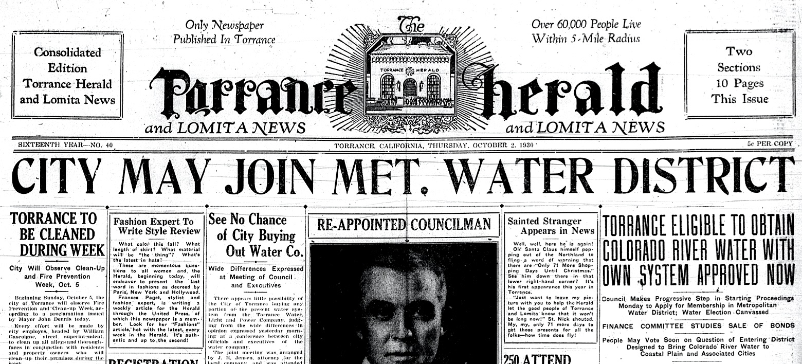
These and other problems led to higher rates for its customers, who were becoming increasingly exasperated by the late 1920s. At a key election held on Sept. 25, 1930, the citizens of Torrance voted overwhelmingly to call for a $400,000 bond issue that would allow for the city to set up its own water system.

In addition, the vote cleared the way for the city to join a cooperative venture that eventually would bring water from the Colorado River to Southern California. 

Post-election Torrance Herald, Oct. 2, 1930, Page 1. (Credit: Torrance Historical Newspaper and Directories Archive database, Torrance Public Library)

The venture, the Metropolitan Water District (MWD), became a reality in February 1931, and Torrance was one of the original 13 cities to join it. Its Colorado River Project took most of the 1930s to build. Torrance didn’t start receiving water from the MWD arrangement until 1941.

The city’s process of taking over management of its water operations was a gradual one. Another bond issue passed in July 1934 established Torrance Municipal Water District #1, and the city took over the operation of the Torrance Light, Power & Water Co. later that year. Dominguez continued to supply the water, while the new city department administered its distribution.

The Dominguez Water Co. took another hit when the 1933 Long Beach earthquake damaged much of its pumping equipment. By 1935, the company was facing insolvency. Its assets were sold back to the Dominguez Estate Co. in a corporate reorganization that stabilized it.

1931 map shows route of aqueduct and the cities, marked by stars, who were part of the WMD plan. (Credit: Historical Photo Collection of the Department of Water and Power, City of Los Angeles)

In 1936, Torrance fulfilled the wishes of its voters by forming its own Municipal Water Department, which took over some parts of the Dominguez Water operation in the city.

The city erected a new headquarters building, and began upgrading the water system. The newly revamped municipal water plant could produce 4 million gallons of water daily from its two wells. In addition, its engineers saw to the installation of the first chlorination system on the West Coast, which helped keep the water pure.

As the city grew, its water needs shifted overwhelmingly from mostly agricultural customers to industrial and residential ones. The city’s post-World War II population explosion – it grew from 22,000 residents in 1950 to more than 100,000 in 1960 – meant much greater capacity needed to be added to its water system.

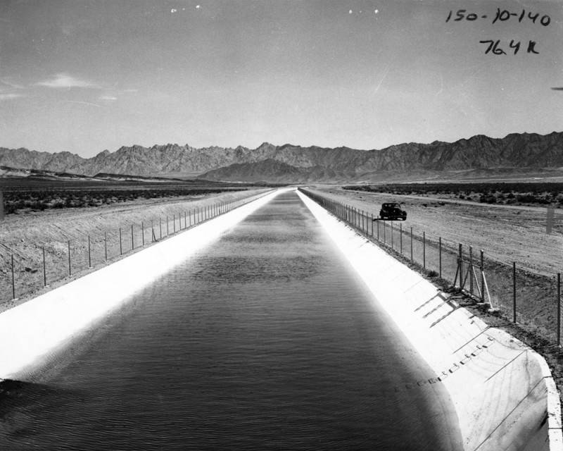
A car sits on a dirt road that parallels the Colorado River Aqueduct as water flows on its way to its termination point at Lake Mathews in Riverside County. Oct. 13, 1939. (Credit: Los Angeles Public Library Photo Collection)

In addition to hundreds of miles of new pipe, more reservoirs, tanks, and systems improvements had to be added. By the late 1950s, fresh water from local wells had become depleted and increasingly infused with salt water from the ocean creeping into the aquifers. This led to greater dependence on water from the Colorado River Project obtained through the MWD.

In the 1960s, the California State Water Project began the process of bringing more water to Southern California from a variety of sites in northern and central California via the California Aqueduct to supplement Colorado River water.

Now, several decades later, there is grave concern that the Colorado River water supply is drying up. In recent years, Torrance water officials have sought to lessen the city’s dependence on water from the MWD by expanding the capacity of its groundwater desalting equipment.

The Water Replenishment District of Southern California (WRD) held a ribbon cutting for the Robert W. Goldsworthy groundwater desalter, above, in Torrance on Feb. 6, 2018. (Daily Breeze staff file photo by Brittany Murray)

The desalter, provided by the Water Replenishment District of Southern California, will purify the salt-infused water that lies untapped in the South Bay’s Silverado Aquifer. About 90 percent of the city’s water still comes from the MWD, with the remainder coming from local groundwater sources.

The Torrance Municipal Water Department is headquartered at 20500 Madrona Ave., behind the gates in the city’s maintenance yard area. According to its web page, the department provides water service to 78 percent of the city’s residents and businesses.

Three other providers cover the needs of the remainder of the city: the MWD, the California Water Service and the Water Replenishment District. 

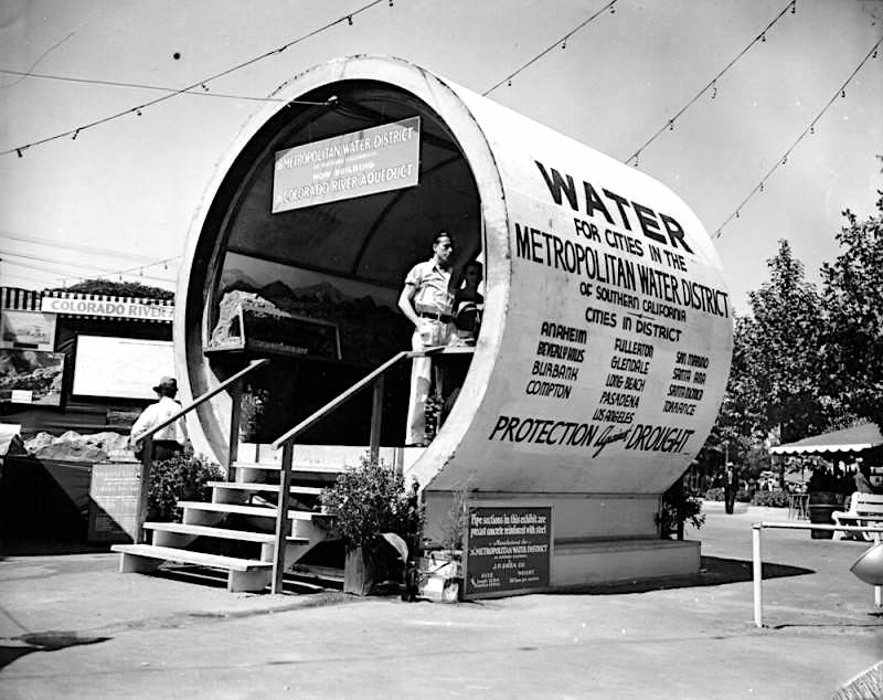
The Metropolitan Water District (MWD) set up this publicity booth made from a section of pipeline for its planned Colorado River Aqueduct, which will bring water to the cities in the district: Anaheim, Beverly Hills, Burbank, Compton, Fullerton, Glendale, Long Beach, Pasadena, Los Angeles, San Marino, Santa Ana, Santa Monica and Torrance. Photo circa 1930. (Credit: Los Angeles Public Library Photo Collection)

Sources:

“The California Water System,” California Dept. of Water Resources website.

City of Torrance CA Government Facebook page.

Daily Breeze archives.

Historic Torrance: A Pictorial History of Torrance, California, by Dennis F. Shanahan and Charles Elliott, Jr., Legends Press, 1984.

History of Torrance: A Teacher’s Resource Guide, Torrance Unified School District, 1964. 

Los Angeles Times archives.

Torrance Press-Herald archives.
Washington Post archives.
“Water Services,” City of Torrance website.

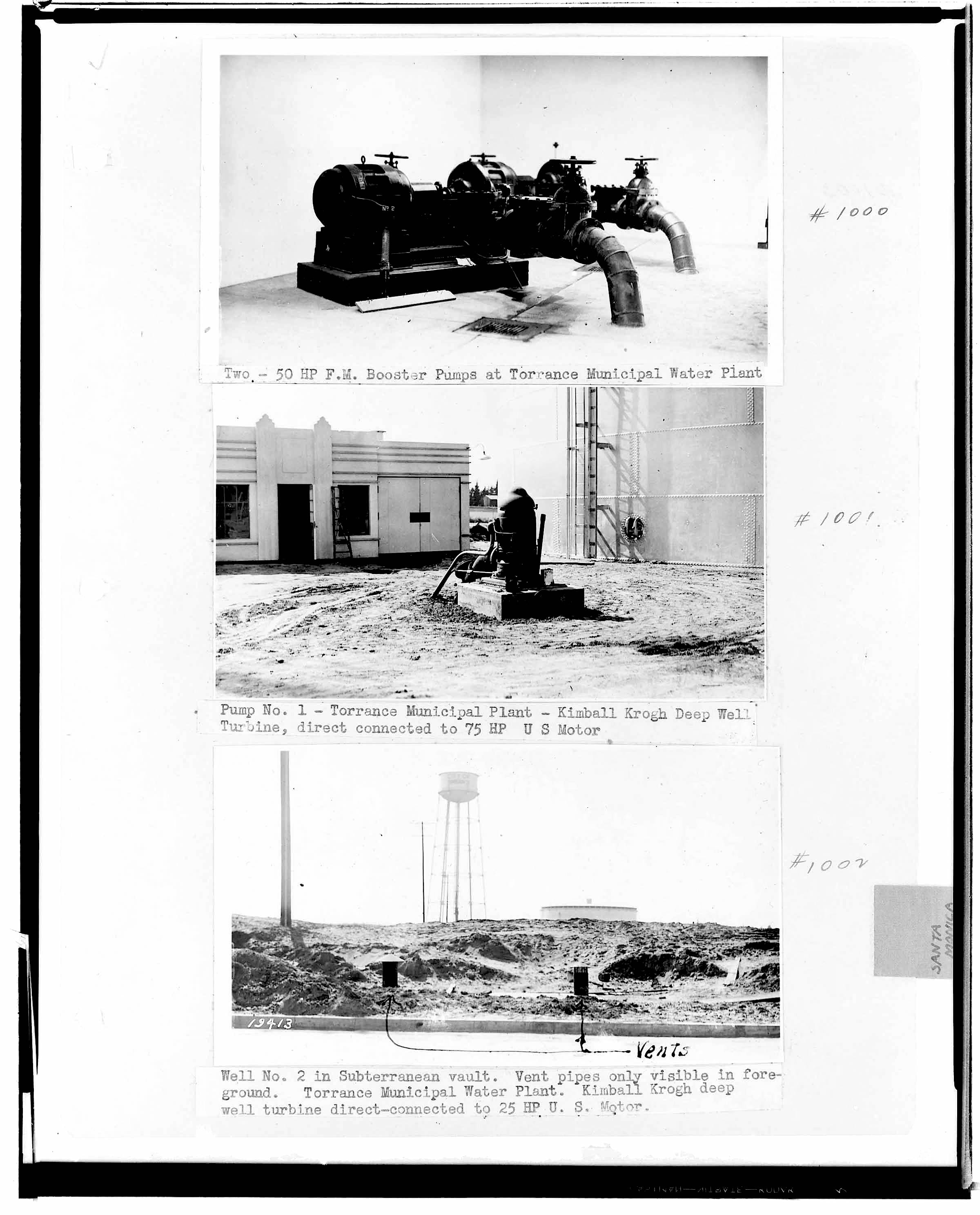
These three photos of the Torrance Municipal Water Plant from June 1936 are identified as coming from “Pumping Plants – page 31 of Laws Book,” according to the Huntington Library. (Credit: Huntington Library digital archive)

Rolling Hills Prep: More than an ordinary college prep school

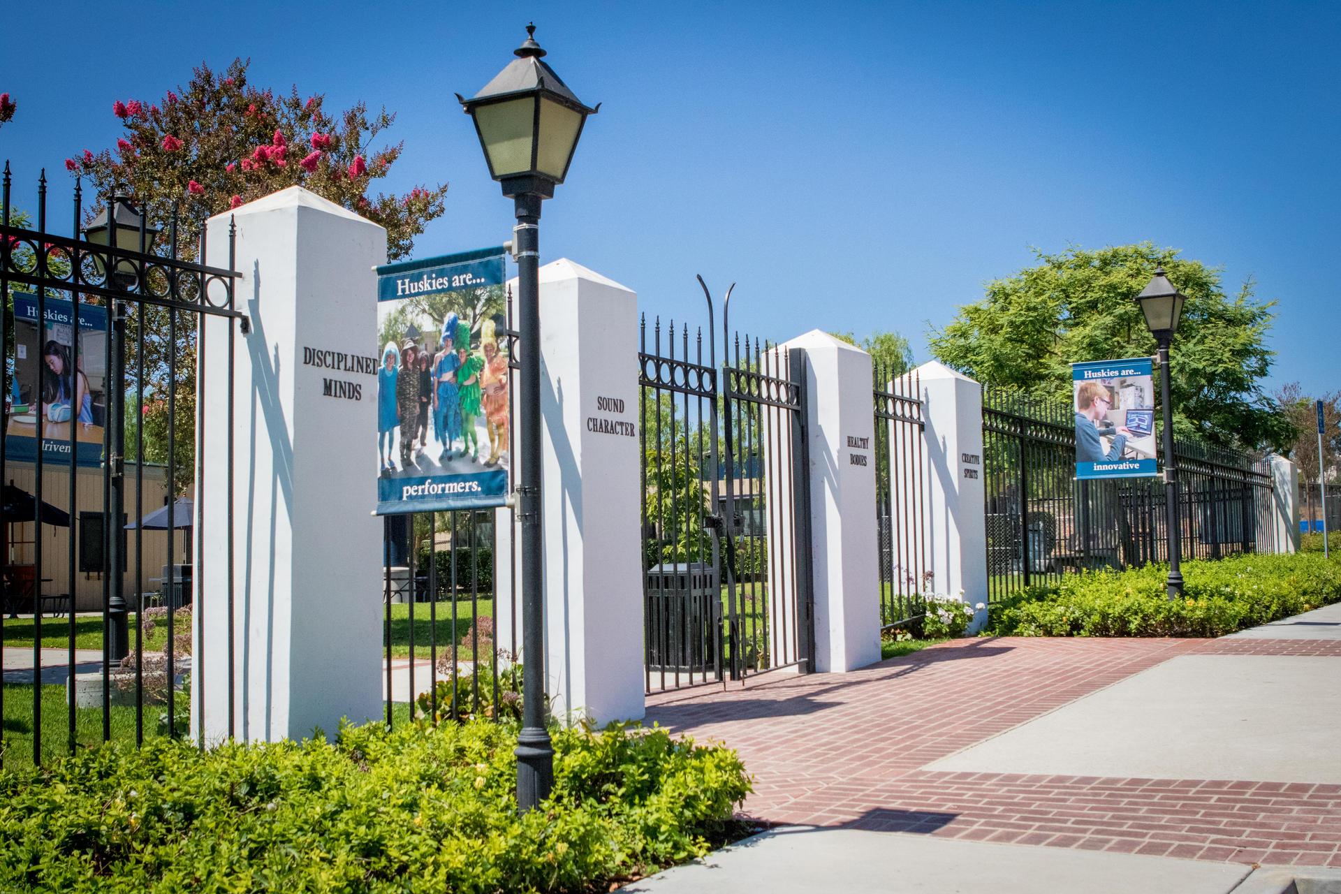
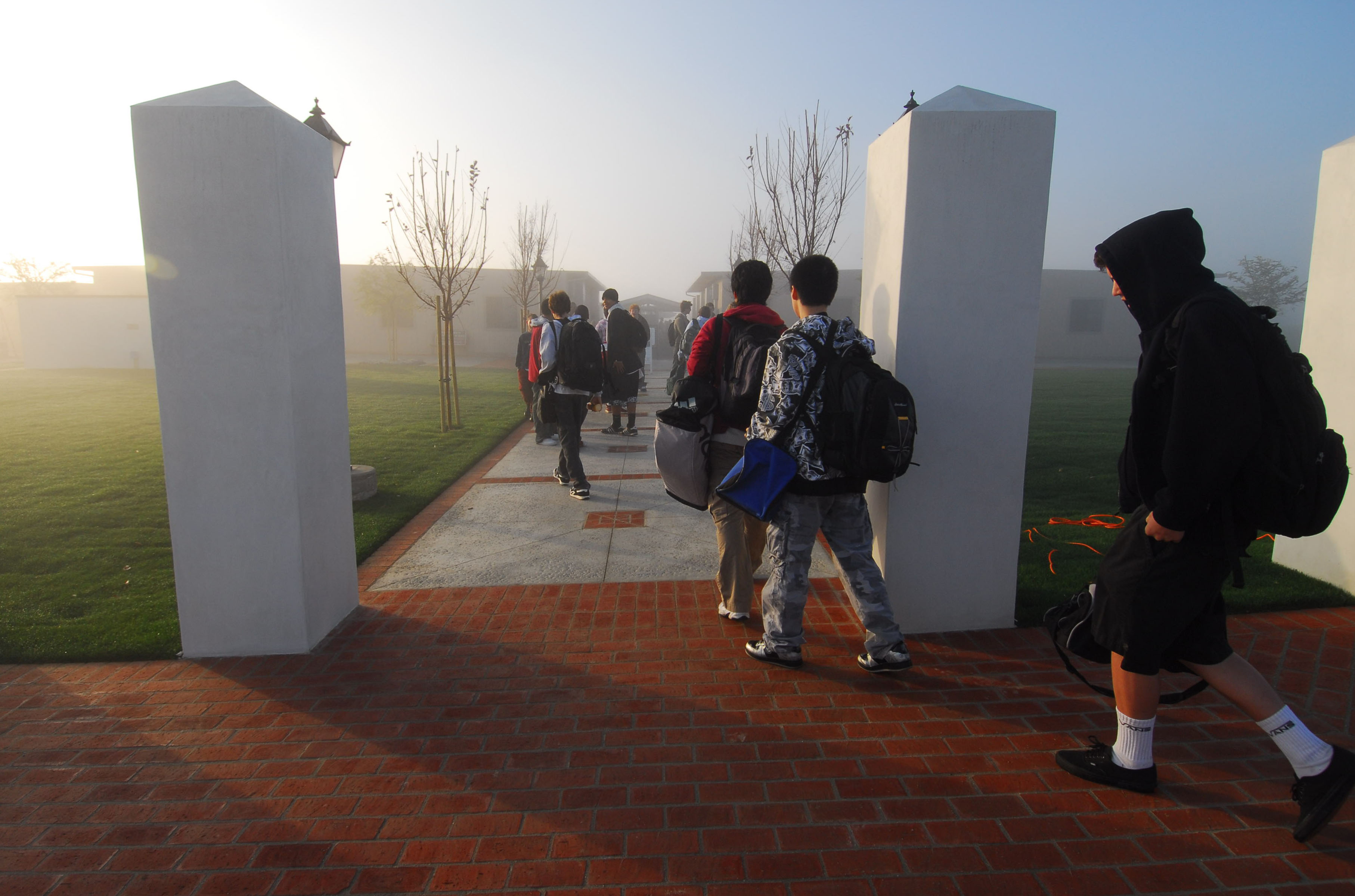
The San Pedro school’s four guiding principles adorn four pillars at its main entrance. (Credit: Rolling Hills Prep, REACH & Renaissance Schools website)

An institution such as Rolling Hills Preparatory, REACH and Renaissance Schools doesn’t just spring up overnight. Its evolution came about through a combination of creative vision and a lot of hard work.

Known informally as Rolling Hills Prep, the high school was founded by Evelyn Dawn in 1981. Dawn, who I wrote about in a 2022 post, had founded the Rolling Hills Country Day School in Rolling Hills Estates in 1961. (She died in 2000 at 93.)

Twenty years later, she took the next logical step and established a college preparatory high school. Rolling Hills Prep, a private, not-for-profit school, aimed at preparing students for college using creative, often individualized teaching methods.

For the small school’s first 11 years, classes were held at Rolling Hills Covenant Church. RHP’s attendance began growing during that span, and parents began asking for the school to incorporate middle school grades into its program.

As the school’s student population grew to more than 200 students, RHP’s leaders began the search for a permanent site for its campus. In the meantime, the school moved into larger quarters at the former Malaga Cove School. Opened in 1926, it’s the oldest permanent school building on the Palos Verdes Peninsula.

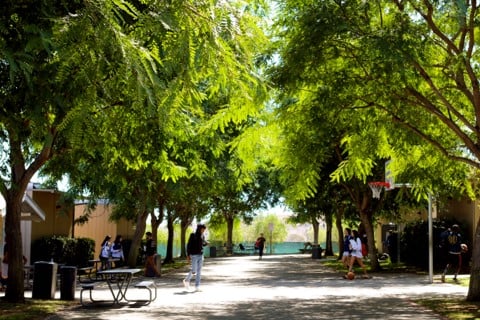
Trees line a walkway at Rolling Hills Prep in this 2021 photo. (Credit: Rolling Hills Preparatory & Renaissance Schools Facebook page)

By the early 1960s, it had become Malaga Cove Intermediate School. In 1991, the Palos Verdes Peninsula School district closed the school due to declining enrollment in the district,  opening up the space for RHP to relocate there. It began conducting classes on the campus, which now included students from 6th to 8th grade, in the fall of 1992.

RHP occupied 18,000 square feet of floor space. Two other tenants also moved into Malaga Cove at the same time: Peninsula Montessori School and the International Bilingual School. RHP agreed to pay the Palos Verdes Peninsula Unified School District $150,000 a year to lease the space.

In 1994, the school adopted its four guiding principles, which it calls the Four Pillars: Disciplined Minds, Sound Character, Healthy Bodies and Creative Spirits. In keeping with the principles, RHP also built a strong small-school sports program in addition to its academic offerings.

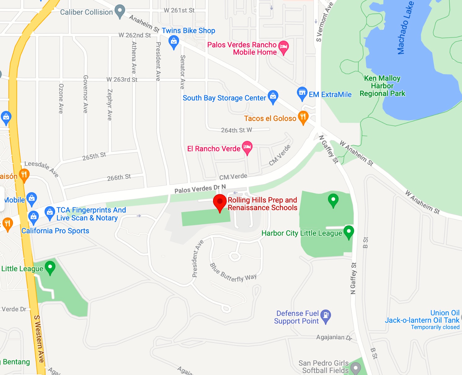
The Rolling Hills Prep schools complex is located on the northernmost end of San Pedro. 2023 map data. (Credit: Google Maps)

Its long-term plans to find a permanent school location received a boost in early 1998, when the U.S. Navy announced plans to declare about 150 acres in San Pedro as surplus land. The 1997 closure of its Long Beach Naval Station and Long Beach Shipyard had rendered the land, which contained two large military housing developments, unnecessary for the Navy’s needs.

RHP immediately applied to receive 28 acres of former Navy property located on the far northern edge of San Pedro, on the south side of the stretch of Palos Verdes Drive North between Western Ave. and Gaffey St.

In 1999, it was discovered that the site was a nesting area for the endangered Palos Verdes Blue butterfly. After three years of negotiating with the California Dept. of Fish and Game, school officials agreed to set aside some of the surplus land as a butterfly sanctuary.

In 2004, the land deal with the Navy became finalized. The school secured rights to almost 20 acres of former Navy housing for $1 as a public benefit conveyance, a fancy name for a government land transfer meant to improve the public good. 

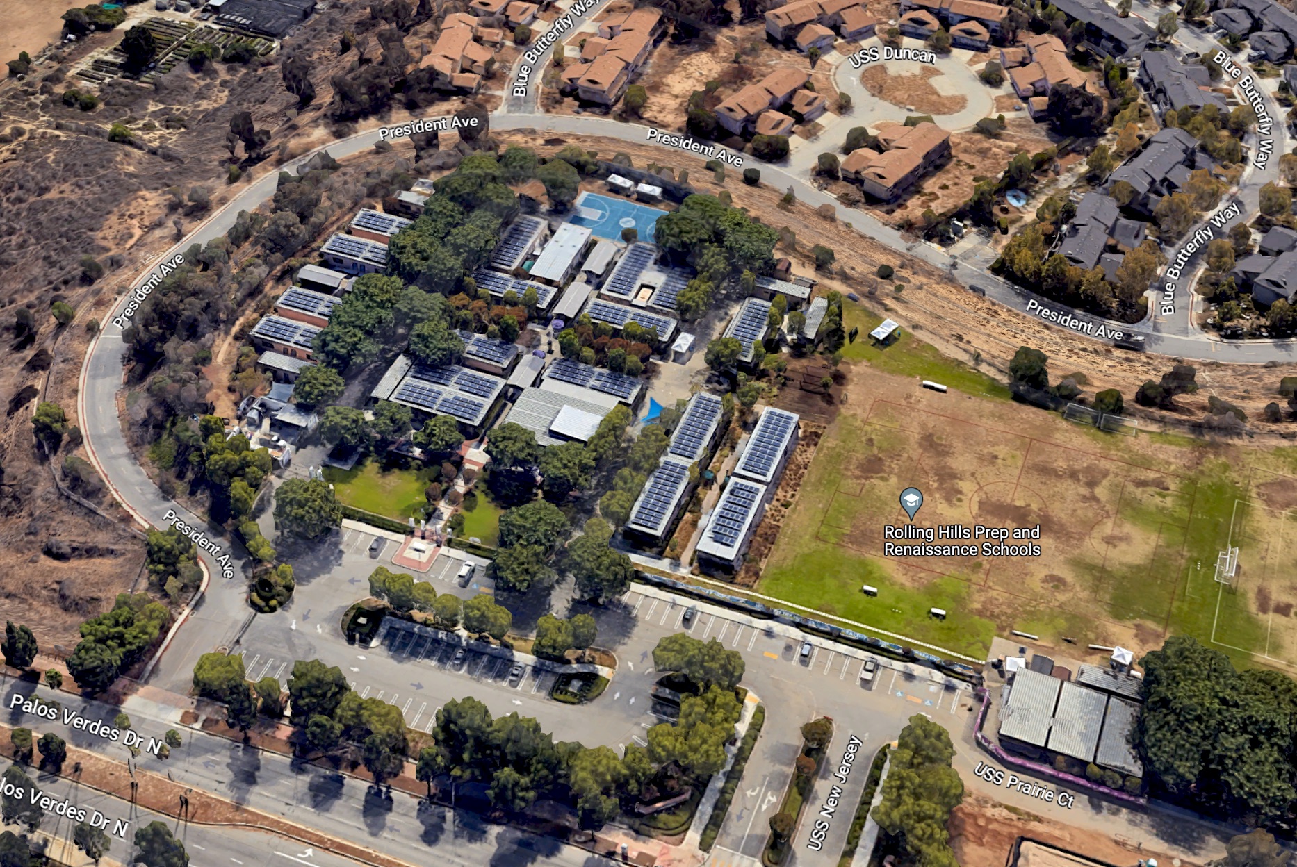
View of the Rolling Hills Prep campus looking south from Palos Verdes Drive North in San Pedro. 2023 image. (Credit: Google Earth)

In the fall of 2004, RHP added the Renaissance School for Arts and Sciences under the direction of Heidi Morris. The school works with students in grades 5-12 who have language-based learning difficulties such as dyslexia that keeps them from performing well in traditional school environments.

RHP began moving ahead with the planning and construction of the modern campus, with the idea of opening to students in October 2006. Unfortunately, a dispute with the city of Los Angeles over a water line to the school along with other minor construction delays caused the opening to be pushed ahead to 2007.

In the meantime, the school’s students had to move from the Malaga Cove site. Its landlord, PVPUSD, announced that it planned to transform the former school into its new district headquarters. (It opened in 2010).

Temporary quarters for the nomadic Rolling Hills Prep students were established at the Torrance First Presbyterian Church on Crenshaw Blvd. north of Wilson Park, while work continued on the permanent site.

Dane Koncan, project manager from Martifer Solar, shows the newly installed solar panels on the roof of the classrooms at Rolling Hills Prep in San Pedro on Nov. 15, 2012. 16 buildings on campus were outfitted with the panels. (Daily Breeze staff photo by Steve McCrank)

Over on Palos Verdes Drive North, the new school’s design features included solar-powered hot water, high-efficiency light fixtures, low-flow toilets and storm-water collection and reuse. Its landscaping would employ low-impact plants, such as creeping rosemary and olive trees, that wouldn’t require heavy watering.

The big day finally arrived on Feb. 6, 2007, when RHP and Renaissance students finally moved to their permanent campus.

In September 2019, the REACH school was added to the RHP campus. REACH offers  focused and personalized plans for elementary and middle school students who struggle with learning differences, with the aim of easing their transition into further education.

Through it all, the three schools continue to offer educational opportunities to a wide spectrum of students from grades 1-12, meeting the needs not only of college-bound students, but also of those students needing more individual attention to help them thrive.

Students file into Rolling Hills Preparatory School on Feb. 6, 2007, the school’s first day of classes at its new campus on former Navy property in San Pedro. (Credit: Daily Breeze staff file photo by Steve McCrank)

Sources:

Daily Breeze archives.
“History,” Rolling Hills Prep, REACH & Renaissance Schools website.

Los Angeles Times archives.
Palos Verdes Peninsula News archives.
“Rolling Hills Preparatory School Continues to Make an Impact on SoCal Students, Regardless of Learning Type or Ability,” southbay website.

Once Harbor City’s library branch closed, it took decades for it to reopen

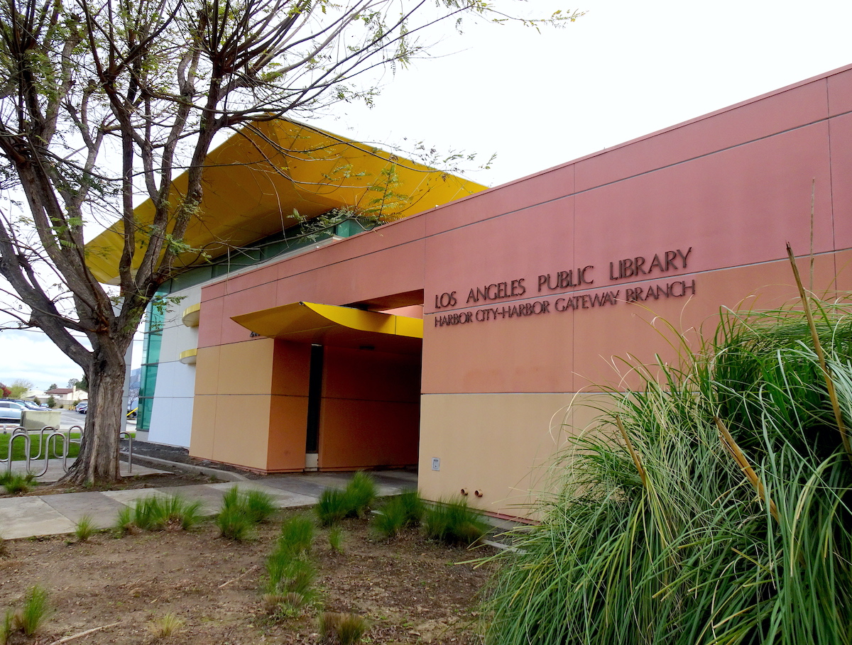
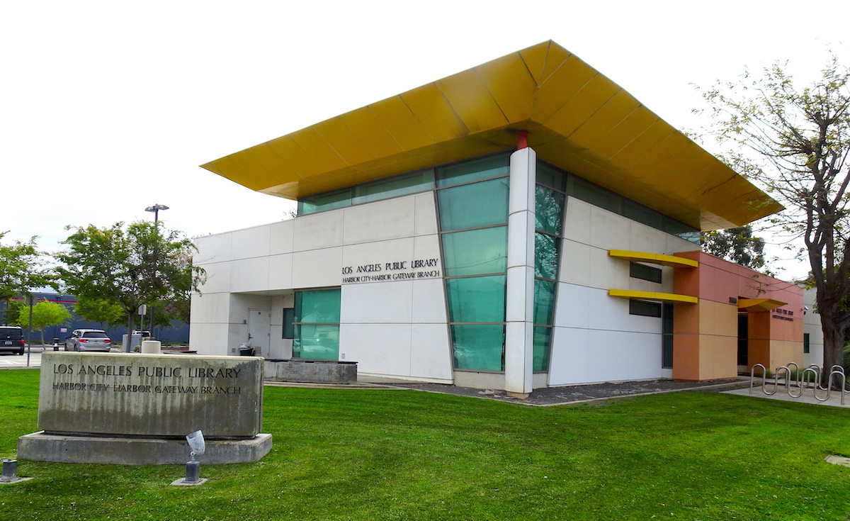
The permanent Harbor City-Harbor Gateway Branch of LAPL was a long time coming. (March 2023 photo by Sam Gnerre)

The first Harbor City public library came into existence just four years after lots in the area’s first subdivision went on sale in 1912.

On Feb. 21, 1916, the county of Los Angeles started a small library in the new community between Torrance and Wilmington. The library’s exact site remains unclear, other than that it was located in a local real estate office building. In July, the county passed management of the new branch to the city of Los Angeles, which already had established branches of its Los Angeles Public Library (LAPL) in Wilmington and San Pedro.

The San Pedro branch of LAPL was assigned to manage the Harbor City branch on Sept. 1, 1916, and Mrs. G.G. Todd was named the custodian of its 1,100-book collection. The new library was open on Monday, Wednesday and Friday afternoons.

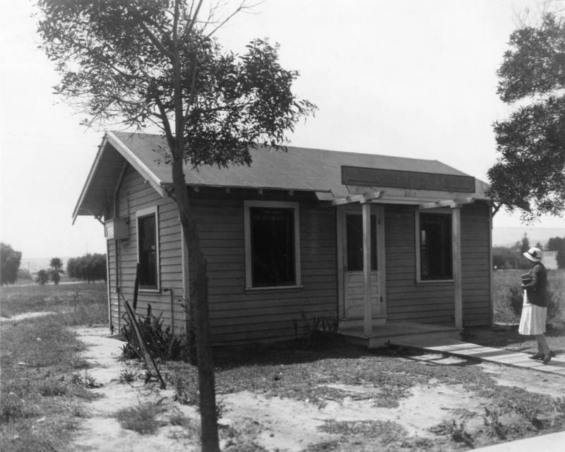
The first free-standing Harbor City branch of the Los Angeles Public Library on 253rd St. in 1928. (Credit: Los Angeles Public Library Photo Collection)

As the area grew, its residents made increasingly good use of the tiny library, and it soon began to outgrow its location. In March 1919, the area’s Chamber of Commerce called a large public meeting in order to form the Harbor City Public Library Association. Its purpose: to acquire land and secure funding to build a new library building.

It took five years, but the new library finally was built at 2216 253rd St., near Belle Porte Ave. The tiny 15–by-20-foot structure opened in 1924. 

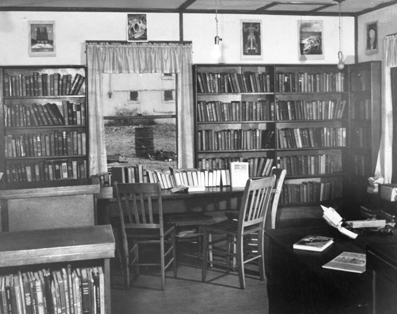
The cramped interior of the 253rd St. branch library in Harbor City. Undated, circa 1928. (Credit: Los Angeles Public Library Photo Collection)

In 1928, Mrs. Anna Milligan became its librarian. She told the San Pedro News Pilot in 1936 that when there were ten people in the building she hesitated to leave her chair for fear of disturbing some of them, but during all her years there, she had never complained about close quarters —nor of monotony.

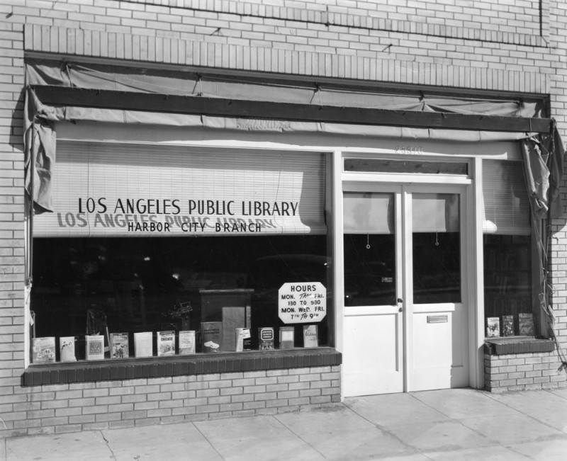
The library remained on 253rd St. until after World War II, when the LAPL bosses determined that a move to larger quarters was necessary. A larger storefront at 25318 Belle Porte Ave. was rented in 1948, and the Harbor City library branch occupied it for the next five years. 

This library branch on Belle Porte Ave. in Harbor City operated between 1948 and 1953. 1952 photo. (Credit: Los Angeles Public Library Photo Collection)

In library terms, it was known as a library station, which is much smaller than a full-sized branch. The community was promised that money for a full-size permanent branch library to replace the storefront would be in the city’s library department budget for the 1950-51 year. Unfortunately, the final city budget ended up not including that funding.

In 1953, a study by LAPL management indicated that 75% of the branch’s users were children. The minority number of adults using the library led LAPL to conclude that a different, less costly way could be used to serve the Harbor City residents who used it most.

In 1948, LAPL had  conducted a survey on the use of a new idea, bookmobiles, by libraries throughout the country. It found that by using bookmobiles, also called traveling branches, the library could cut down on building rental costs while still having the ability to expand service to a larger geographic area.

Therefore, it was decided that after the Harbor City branch library’s last day of service on Oct. 15, 1953, it would be replaced by bookmobile visits to area schools every other Monday from 2-4 pm.

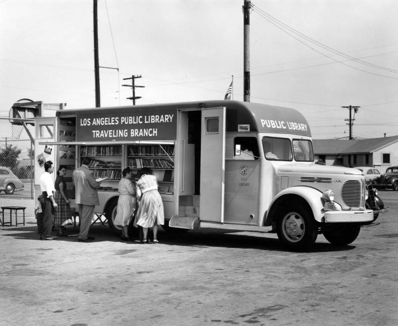
Adults visit an LAPL Traveling Branch bookmobile at an unidentified city park or school in 1955. (Credit: Los Angeles Public Library Photo Collection)

It may have been a victory for efficiency and statistics, but it left out those who needed the services of a permanent library, be they children or adults. San Pedro and Wilmington, the nearest LAPL branches to Harbor City, weren’t all that near.

Sadly, the community would be left without the long-promised library branch for the next 44 years.

The drive to resurrect the planned branch began with one person, Rochelle Bullock. In 1980, she organized a group of people to canvass area residents with petitions calling for the fulfillment of the 1950 promise.

Her work had some effect. When LAPL issued its master plan for branch management in 1988, the planned Harbor City  branch was on the list, but not near the top. Bullock redoubled her efforts, paying repeated visits first to L.A. City Council member Joan Milke Flores, then to her successor, Rudy Svorinich, to plead the case.

This storefront branch library in Harbor City opened in a mini-mall in 1997. Undated photo. (Credit: Libraries.org)

City budgets were lean during the early 1990s, but Svorinich put together a successful block grant proposal to the U.S. Department of Housing and Urban Development to fund the establishment of the new library.

Bullock died in 1995 at 79, before her dream could be realized. The new library opened on Aug. 7, 1997, in a 6,300-square-foot storefront in the Victory Center mini-mall at 1555 Sepulveda Blvd., right behind an Arby’s restaurant.

That facility, always a temporary solution, operated there for ten years. After funding was obtained during the early 2000s, a parcel of land was acquired at 24000 S. Western Ave., just north of Narbonne High School.

Construction began on a new full-size, free-standing branch library building on the site in 2006, and the $10 million, 14,650-square-foot Harbor City – Harbor Gateway Branch Library opened to the public on Feb. 1, 2007.

Open every day except Sunday, the modern branch offers dozens of computers to the public in addition to more than 60,000 books and other media, meeting and group study rooms and a large children’s department.

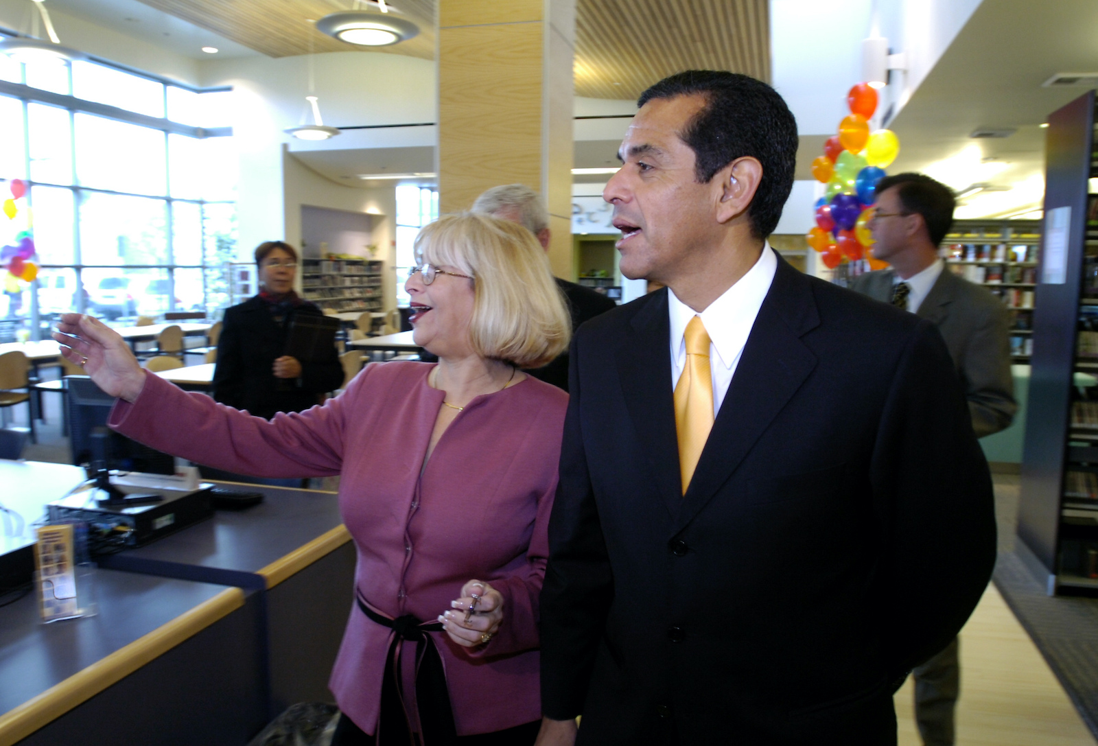
L.A. Mayor Antonio Villaraigosa tours the new Harbor City-Harbor Gateway Branch at its grand opening with city librarian Fontayne Holmes, left, on Feb. 1, 2007. (Daily Breeze staff file photo by Robert Casillas)

Sources:

Daily Breeze archives.
Los Angeles Times archives.
San Pedro News Pilot archives.

“Tribute to the Traveling Branch,” by Tiffney Sanford, LAPL blog, April 11, 2018.

The Harbor City-Harbor Gateway Branch of LAPL in March 2023. (Photo by Sam Gnerre)

Hard-working immigrants from Mexico transformed Torrance’s Pueblo neighborhood

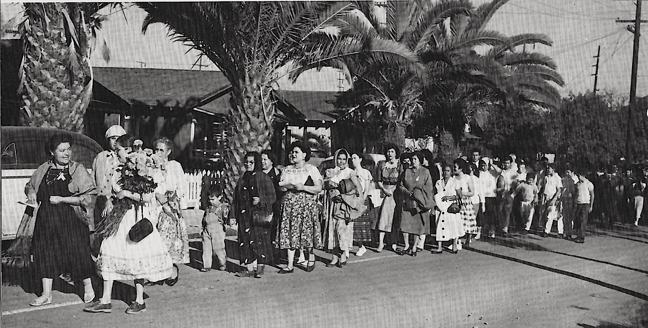
Mothers lead a procession down a narrow, two-lane Del Amo Blvd. in the Pueblo in this undated photo circa early 1950s. (Credit: Historic Torrance: A Pictorial History of Torrance, California, Legends Press, 1984)

Modest, well-kept suburban family houses line the four-lane stretch of Del Amo Blvd. between Crenshaw and Van Ness boulevards in Torrance. The area sports a community center, a new public park and other amenities.
But it wasn’t always like this. When the first immigrants from Mexico settled in the area in 1908, it was undeveloped, a low, marshy area dotted with eucalyptus trees. Standing water would collect there after the rains, and a thriving community of frogs called it home.
“La rana” is Spanish for frog, and that’s the name the area was given by its residents. At first, city officials referred to it somewhat condescendingly as “the Mexican Village,” and later it became known as the Pueblo.

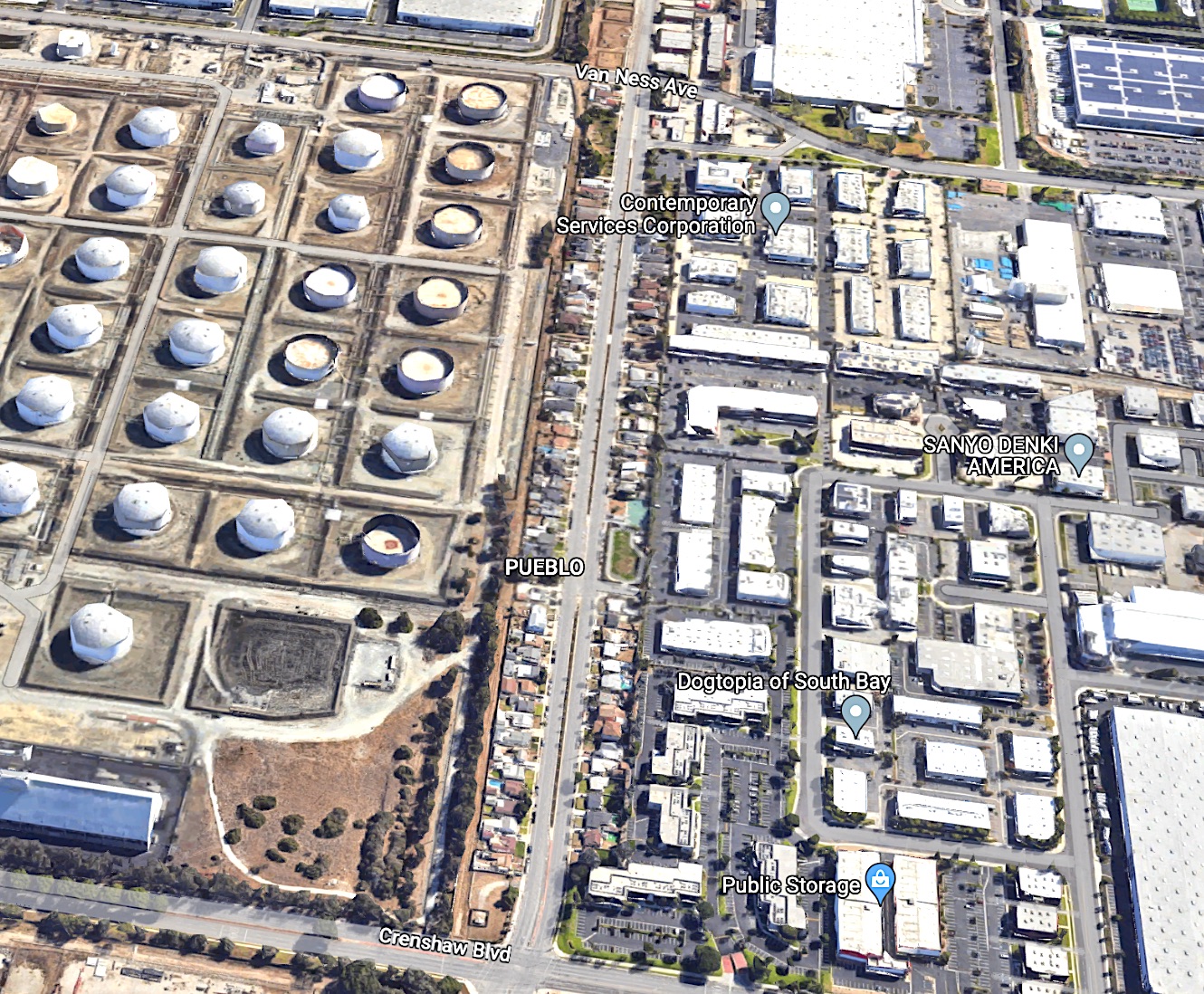
The Pueblo residential district along Del Amo Blvd, center, lies between Crenshaw Blvd. and Van Ness Ave. in Torrance. Once an isolated area, it’s now surrounded by industrial development. 2023 image. (Credit: Google Earth)

The immigrants who lived there came mostly from the state of Michoacán in western Mexico in search of a new life. They left behind a country torn by civil unrest that would culminate in the Mexican Revolution.

Their numbers would increase as Torrance began to develop its plan as a mixed industrial/residential city. Shortly after Jared Sidney Torrance founded the city in 1912, major industries began relocating there.

The Pacific Electric Railway company built its large maintenance shop there in 1911, and the  Union Tool Co.and Llewelyn Iron Works also built a plant nearby. Llewelyn would later become Columbia Steel in 1923, and then became part of US Steel from 1929 until the plant closed in 1979.

All three large plants were located between the Pueblo and downtown Torrance, and all needed to hire workers.

Torrance Herald, May 20, 1948, Page B-1. (Credit: Torrance Historical Newspaper and Directories Archive database, Torrance Public Library)

At first, Del Amo Blvd. was nothing more than a two-lane dirt road between Crenshaw and Arlington Ave. which at the time was itself a dirt road from Del Amo to 190th St. (This portion of Arlington later became Van Ness Ave. when that roadway was extended southward to Torrance.) 

The roughly one-half mile isolated stretch of road had no streetlights, curbs or sidewalks. Many of the immigrants lived in tents in the early days, and there was no electricity or sewage. Those niceties would not arrive for many years.

It seems that the new city had restrictions on how its land could be used and by whom. Its developers stipulated that “excepting in the Foreign Quarters, no portion of any of the property herein referred to  shall be sold or conveyed to any person other than that of the white or Caucasian race.”

The Pueblo and its residents fell under the “Foreign Quarters” provision, and its basic needs  were ignored by the city for years.

Torrance Herald, Dec. 1, 1938, Page 1. (Credit: Torrance Historical Newspaper and Directories Archive database, Torrance Public Library)

Torrance Herald stories referring to the area’s sewage problems began cropping up in the 1930s. A 1938 report in the paper revealed that the area still had no garbage collection services and remained unconnected to the city’s sewer system, its citizens forced to build and use cesspools.

In 1944, a committee was formed to address those basic needs, as well as residents’ requests for other services, including recreation facilities for their children. As a result of its recommendations, the Pueblo Center was opened in 1945 through the efforts of the Community Chest.

The tightly knit families living there continued to make the best of things. For many of them, social life revolved around St. Joseph’s Mission, a small church established in the Pueblo at 2314 Del Amo in 1920.

Torrance Press, Dec. 8, 1955, Page 24. (Credit: Torrance Historical Newspaper and Directories Archive database, Torrance Public Library)

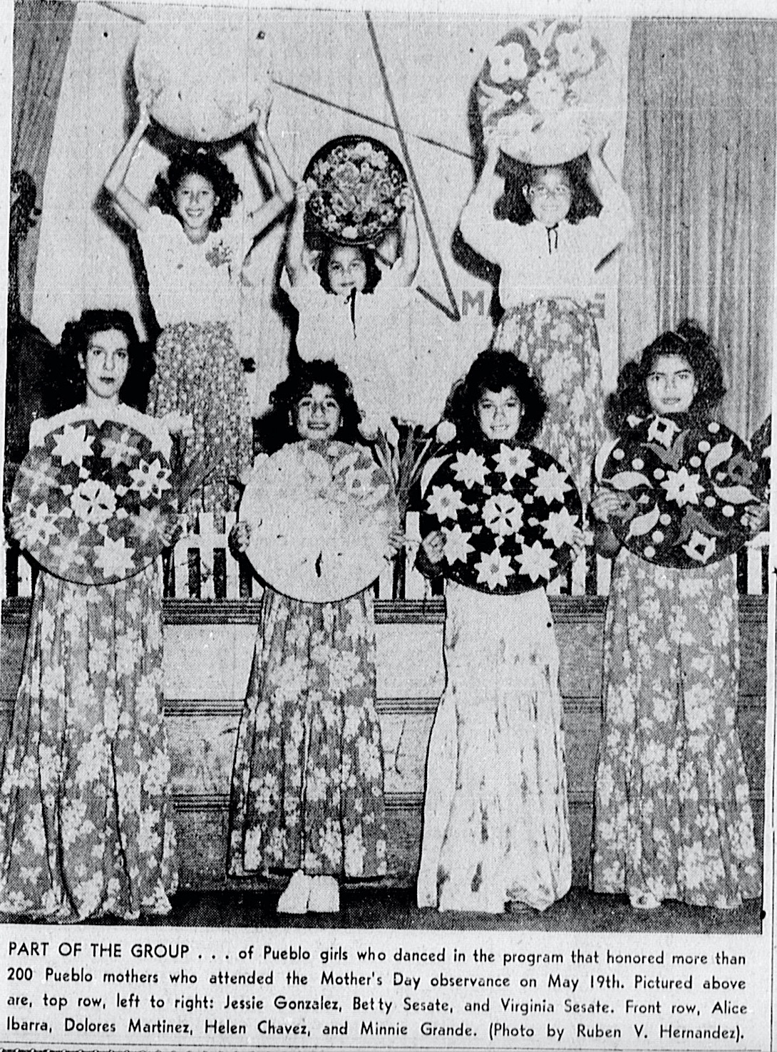
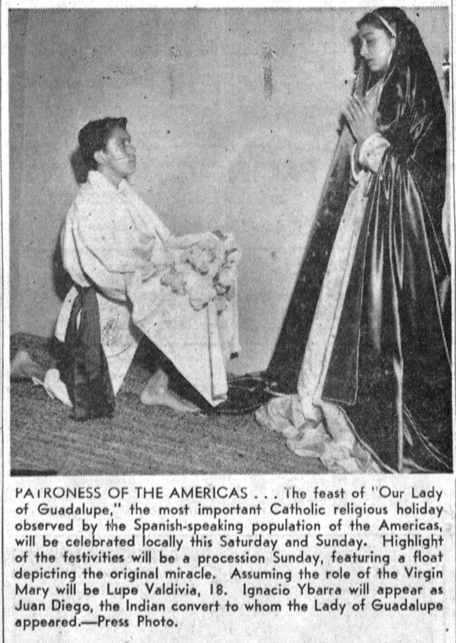
The church held heavily attended annual celebrations for Christmas, Easter, the May Crowning of the Virgin Mary, Mother’s Day and the Dec. 12 Feast of Our Lady of Guadalupe. Usually these included large parades and processions down Del Amo Blvd.

The church closed for good in 2000, and the building was razed a year later. Its members became part of Nativity Catholic Church in Torrance.

Pueblo residents often found themselves battling the area’s undeservedly unsavory reputation. Drugs and gang-related problems were a reality, but often exaggerated. 

A 1965 Torrance Herald story described a Torrance Police Dept. drug raid that caused an “unruly mob” to form with “sticks, rocks and ball bats.” The “near riot” lasted 45 minutes. In this case, the newspaper overreacted to an admittedly tense situation. It later turned out that the dangerous “ball bats” were in the possession of children returning from a softball game.

Eventually, garbage and sewage services came to the area. By the dawn of the 1970s, Del Amo even had been widened to a four-lane road with a median dividing strip, and the community had begun to succeed in beating back its once-negative image.

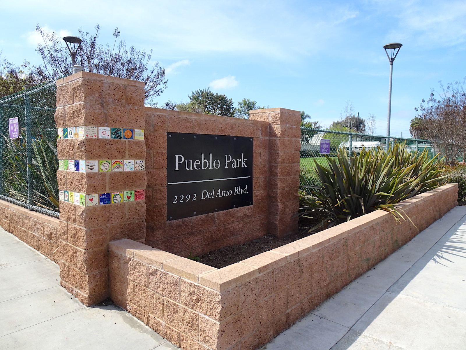
Pueblo Park opened in 2014. (March 2023 photo by Sam Gnerre)

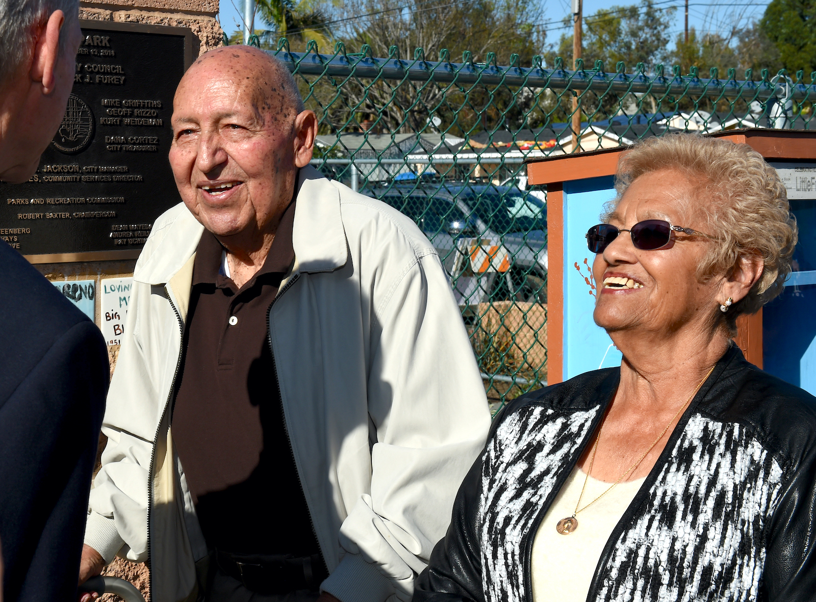
In 2014, Ruben Ordaz, who was born in the Pueblo in 1928, saw a dream of his come true when the city of Torrance dedicated Pueblo Park on Del Amo, built at a cost of $405,000. 

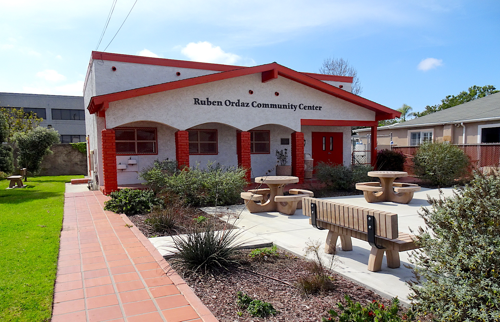
Ordaz had spent a lifetime working to improve life in the Pueblo. After his death at 87 in March 2015, the city renamed the community building in Pueblo Park the Ruben Ordaz Community Center.

Ruben and Irene Ordaz at the dedication of Pueblo Park on Dec. 13, 2014. (Daily Breeze staff file photo by Brittany Murray)

Sources:

Daily Breeze archives.

Historic Torrance: A Pictorial History of Torrance, California, by Dennis F. Shanahan and Charles Elliott, Jr., Legends Press, 1984.

Los Angeles County 1957 Street Atlas, Page 68, Thomas Bros. Maps, 1957.

Los Angeles Times archives.

Mexican Americans in Torrance, by Alice Duarte Solis, Arcadia Publishing Co. (Images of America series), 2018.

“Pueblo Park,” City of Torrance website.

The Ruben Ordaz Community Center is located a short distance east from Pueblo Park. (March 2023 photo by Sam Gnerre)

San Pedro’s Dalmatian American Club has its roots in the fishing industry

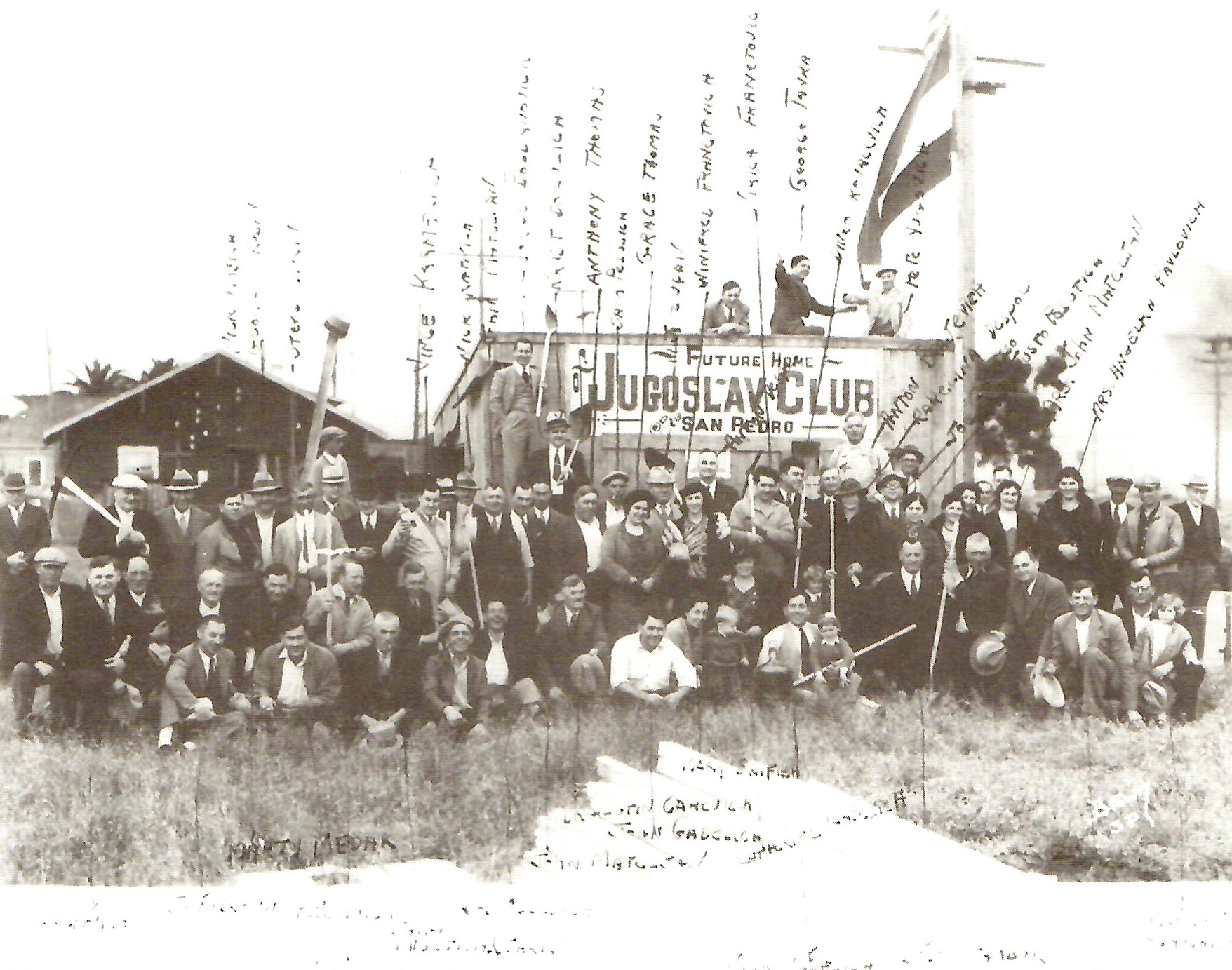
Members of the Jugoslav Club of San Pedro and their families at the groundbreaking for their new clubhouse in early 1935. (Credit: San Pedro: A Pictorial History, by Henry P. Silka, San Pedro Bay Historical Society, 1993)

When you mention Dalmatians to most people, they associate the word with the dog breed. The 1961 Disney animated feature “101 Dalmatians” brought the spotted canines, previously best known as fire station dogs, to wide popularity.

The breed is believed to have originated in the coastal area of modern-day Croatia known as Dalmatia. The name comes from the Dalmatae tribe which inhabited the area, and dates back to at least 100 B.C., when it was a Roman province.

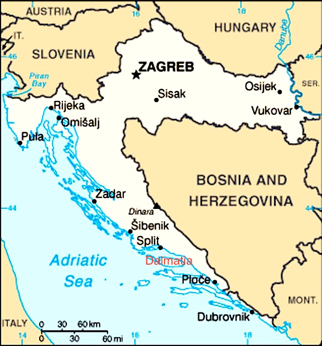
The coastal area stretches along the eastern banks of the Adriatic Sea from Montenegro on the south to Croatia proper on the north. It’s not currently recognized as an independent state, but as a distinct historical region of Croatia.

The whole of Croatia is shown in white. The Dalmatian coast stretches from the Montenegro border (abbreviated “Mont.” on the map) in the south to the area roughly between Zadar and Omisalj to the north. (Credit: Central Intelligence Agency)

The Dalmatian coast has stunning natural beauty. Some 79 islands and more than 500 islets lie just off its shores, and therein lies its connection to San Pedro. Fishing among the islands is one of the area’s major industries.

So, when abundant schools of sardines and tuna were encountered by early San Pedro fishermen, the word eventually spread to Yugoslav immigrants who came to America in the early 1900s in search of a better life.

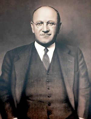
A portrait of Martin Bogdanovich, founder of San Pedro’s Dalmatian American Club, hangs inside the the club. (2006 Daily Breeze staff file photo by Steve McCrank)

They operated fishing boats in the waters off San Pedro, and established a vibrant ethnic community onshore. I wrote about one of that community’s most influential members, Martin Bogdanovich, in 2015, and mentioned his role in forming what would later become known as the Dalmatian American Club.

Bogdanovich founded one of the earliest and largest fish canneries in San Pedro, the French Sardine Co., in the Fish Harbor area of San Pedro in 1917. The company would evolve later into Star-Kist Tuna.

By 1926, an estimated 5,000 people of Slavic descent lived in San Pedro. In May of that year, 25 of its leading citizens held a meeting at Dr. Anton Sambuk’s office at 110 W. Seventh Street to form the Jugoslav Club. 

The group’s members also announced plans to build a Jugoslav Club building in San Pedro on land at 17th and Palos Verdes streets as its permanent meeting place.

They had been holding their meetings twice a month at Carpenters Hall on Ninth Street, the Knights of Columbus hall, and the Point Fermin Café in Point Fermin Park. 

At the May 1926 meeting, the group defined its aims as “threefold, to promote intellectual spirit among the members, to establish patriotic relations and to hold allegiance to the United States of America,” according to the San Pedro News Pilot.

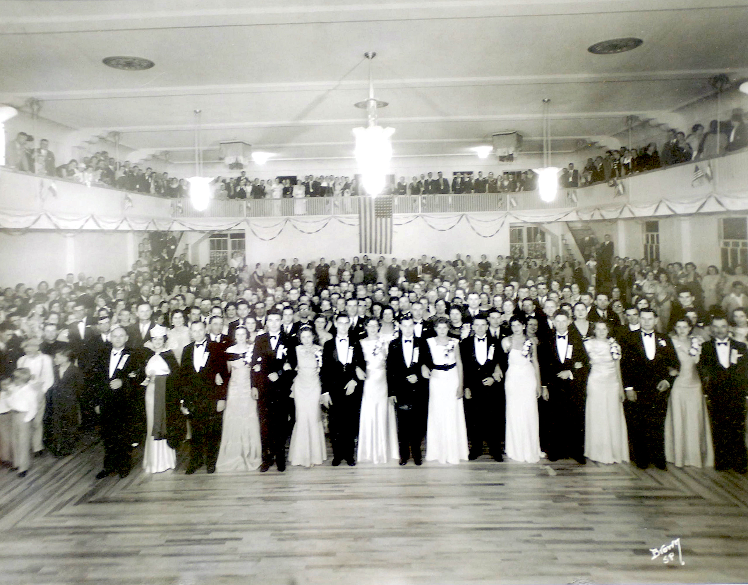
A 1935 photo of the ball celebrating the opening of the Dalmatian American Club at the building. (2006 Daily Breeze staff file photo by Steve McCrank)

For the next few years, the group held dances and other fundraising events to raise the money for the hall. The Jugoslav women’s auxiliary of the club, formed in 1932, also participated in the fundraising efforts. The goal: to raise $100,000 to cover both the cost of the land and the $35,000 in construction costs.

After seven years as its honorary leader, Bogadnovich was elected the group’s official president in 1933.

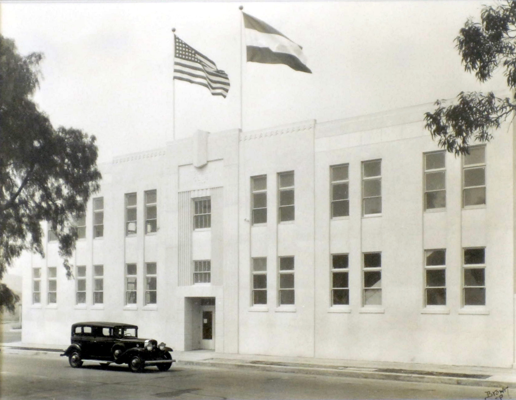
In December 1934, the Jugoslav Club announced its readiness to go ahead with the new structure. The two-story building would include a spacious auditorium that could 750 people, and its plans being drawn up by architect William F. Durr were just about complete.

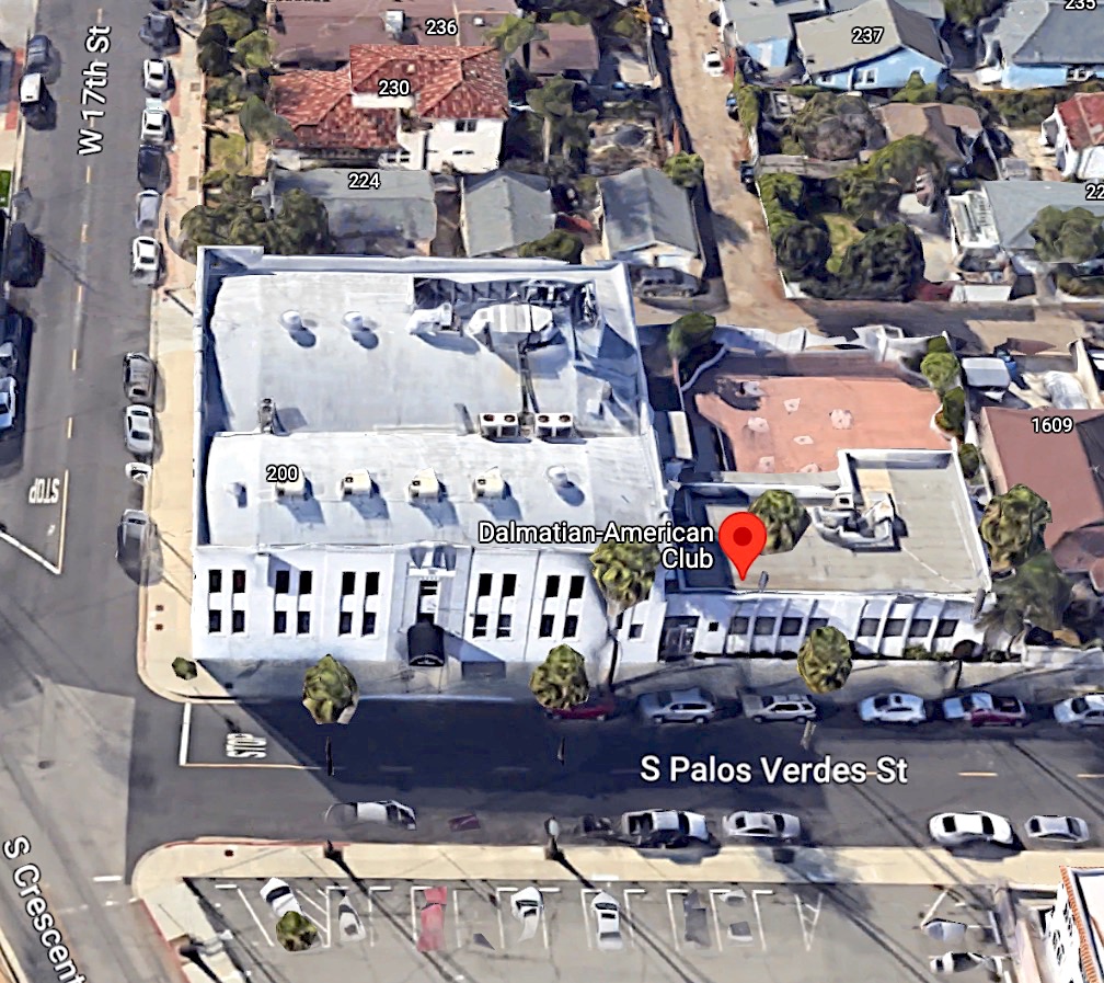
Ground was broken at 1639 S. Palos Verdes St. in early 1935. Construction continued through the spring and summer, and the club opened in August 1935. It quickly became the social center of the Dalmatian community, hosting dances, band concerts and other entertainments as well as meetings.

The Dalmatian American Club building in San Pedro, circa 1935. (2006 Daily Breeze staff file photo by Steve McCrank)

Bogadanovich continued to serve as the club’s president until June 18, 1944, when he died suddenly from a heart attack just as a club meeting on war bonds was about to begin. He was 61.

The San Pedro News Pilot estimated that more than 1,000 people attended his funeral and at least 300 cars participated in the procession to his grave at Calvary Cemetery in Los Angeles.

In 1949, club members decided to change its name to the Yugoslav-American Club. Its current name, the Dalmatian American Club, was adopted in 1992.

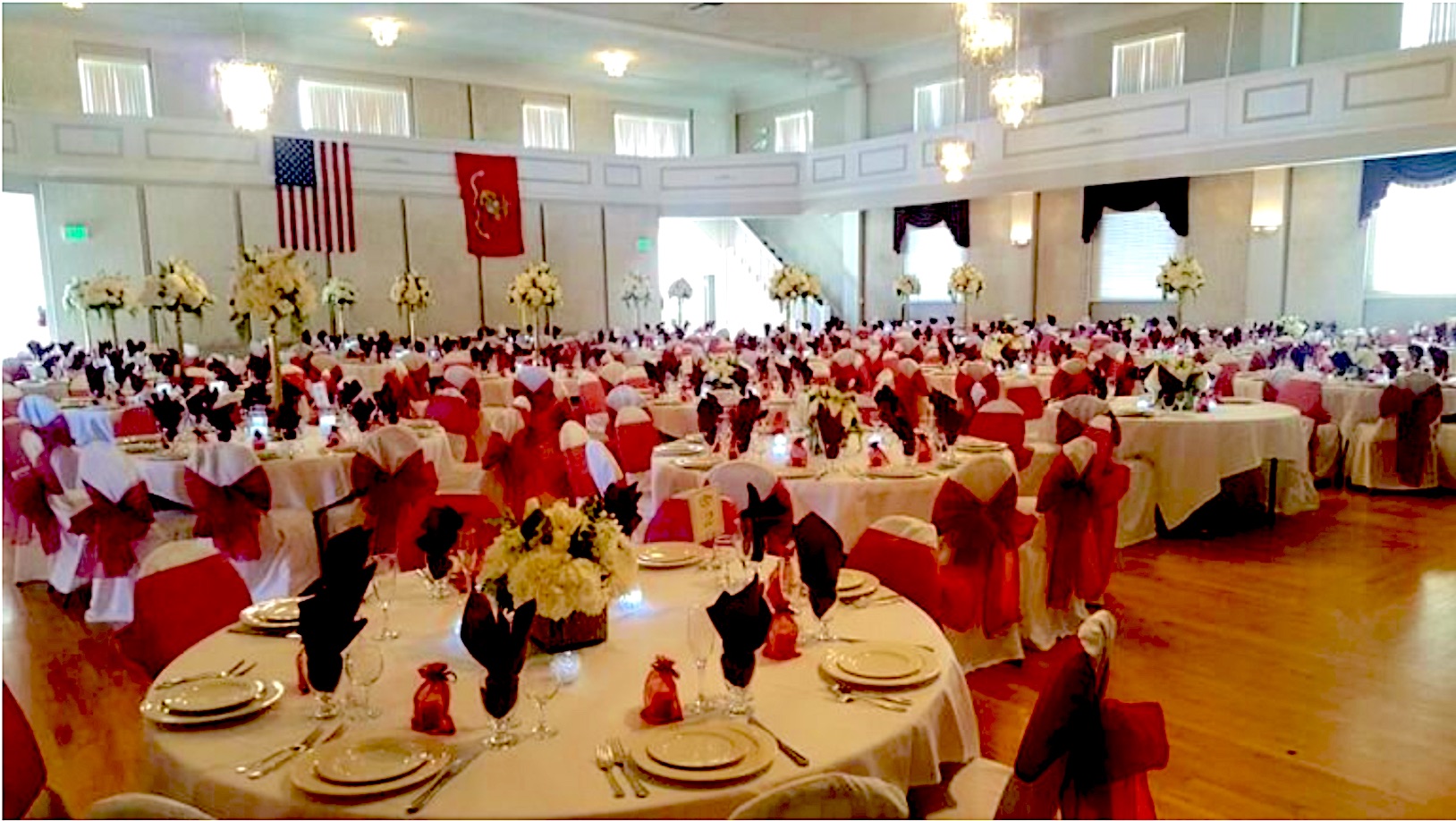
The Dalmatian American Club is often used for weddings and special events. Undated photo. (Credit: Dalmatian American Club website)

The breakup of Yugoslavia into separate countries from 1990-1992 meant the club could no longer lay claim to its all-inclusive name, and it needed to distinguish itself from the Croatian-American club founded in San Pedro in 1962. So the decision was made to honor the homeland of its founders by including Dalmatia in its new name.

One of the club’s best-known events is its monthly fish dinners, a tradition begun in 1964. Over the years, the fish dinners have attracted politicians, athletes and celebrities along with  members of the community. In addition to the monthly Friday fish feasts, the club now offers weekly Tuesday lunches.

The members of the Dalmatian-American Club have worked hard to keep the club operating in recent years, especially when faced with the financial stress caused by the COVID-19 epidemic. Thanks to their efforts, it has survived with its traditions intact as it closes in on the 100th anniversary of its founding.      

The Dalmatian American. Club in San Pedro. 2023 Image. (Credit: Google Earth)

Sources:

Daily Breeze archives.

Dalmatian American Club website.

“Hub of Hometown Hospitality: The Dalmatian-American Club Turns 95,” by Joshua Stecker, San Pedro Today website, April 29, 2021.

Los Angeles Times archives.

San Pedro: A Pictorial History, by Henry P. Silka, San Pedro Bay Historical Society, 1993.

San Pedro News Pilot archives.

Wikipedia.

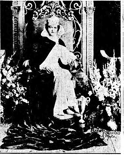
Katherine Kordich reigned as queen of the three-day festival celebrating the opening of the Dalmatian American Club held in September 1935. San Pedro News Pilot, Sept. 12, 1935, Page A2. (Credit: San Pedro News Pilot archival database)

Clifton Moore helped transform a fledgling LAX into a modern airport

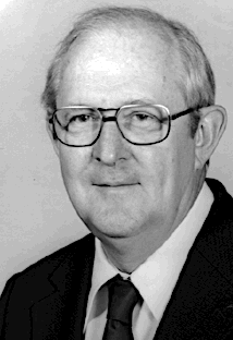
Clifton A. Moore. Undated photo.

One name consistently crops up when I write about the history and development of Los Angeles International Airport: Clifton Moore. He helmed LAX from 1968 until 1993, navigating the city’s aviation center through a period of transitions and upheavals.

Clifton A. Moore was born into a working class family in Jamaica Plain, a neighborhood in Boston, Mass., on Jan. 15, 1922. His father George worked as an electrician for the city of Boston.

After graduating from high school, Moore was offered admission to the Massachusetts Institute of Technology thanks to his prowess in math and engineering. He had to decline it because the family couldn’t afford it, even with the scholarship MIT offered.

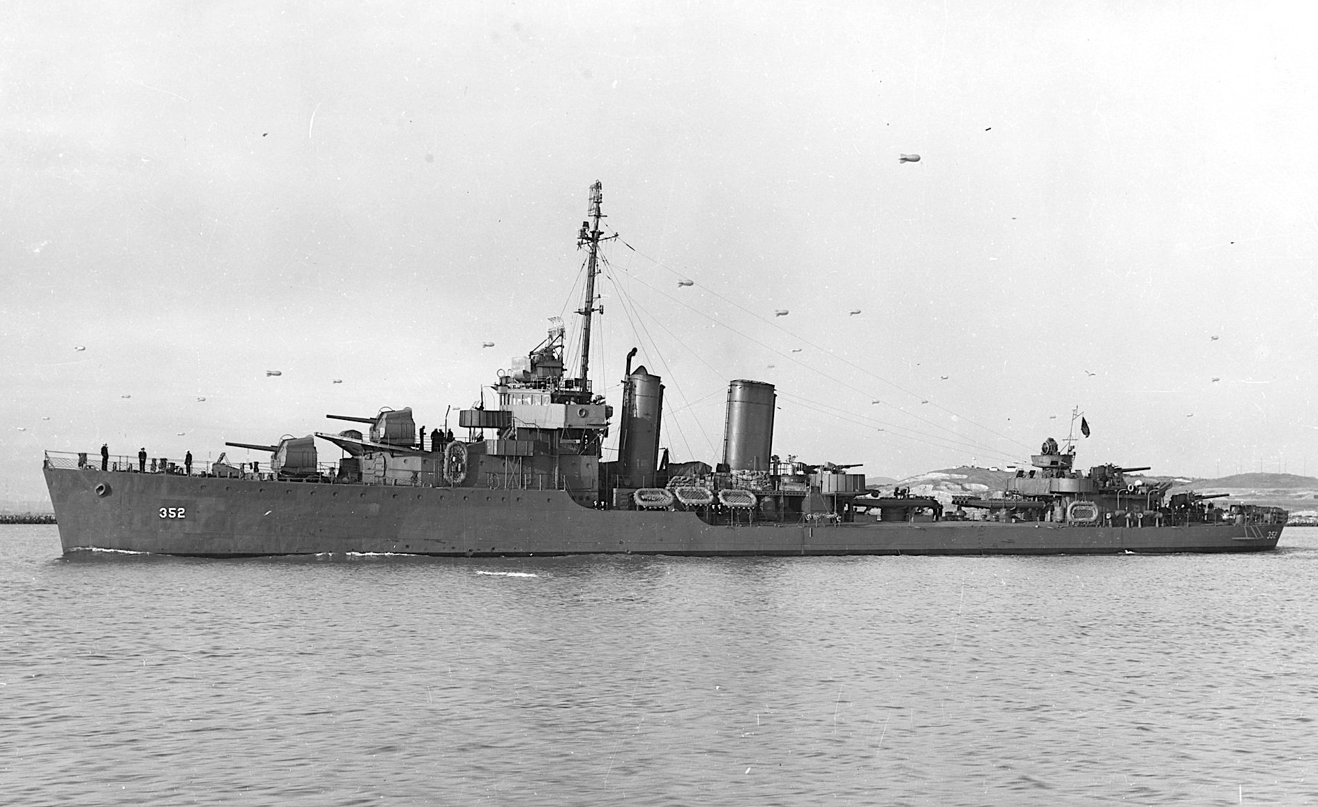
Instead, he enlisted in the U.S. Navy in 1940 as an electrician. On Dec. 7, 1941, he was stationed at Pearl Harbor onboard the destroyer USS Warden when it was suddenly strafed by bullets. Bombs then began falling. 

“I saw the planes come in,” Moore said. “I saw the first one, the second one. By the time the second one came in, we . . . recognized there was a problem,” Moore told the Daily Breeze in a 1992 interview.

The U.S. Navy destroyer USS Warden off the Mare Island Navy Yard, California, on Nov. 21, 1942. (Credit: U.S. Navy Naval History and Heritage Command)

The crew managed to get the ship moving, and it quickly headed out to the open sea, somehow without being hit. The ship it was moored next to, the USS Arizona, wasn’t so fortunate.

Moore flourished in the Navy, serving for four years during the war in some of its most dangerous Pacific campaigns. When he was promoted to the rank of chief petty officer at age 20, he became the youngest CPO in U.S. naval history up to that time.

He married his longtime wife Betty during the war. After he left the Navy, they settled in Los Angeles. He got a job as an electrician with the city of Los Angeles.

In 1946, one of his first tasks was to relight the Lindbergh Beacon, the red signal light on top of Los Angeles City Hall that helped guide plans toward the airport at that time. It had been deactivated during the war.

He and Betty moved to Culver City in 1949, where he served on the city’s school board during the 1960s. He worked as an electrician for the next 13 years.

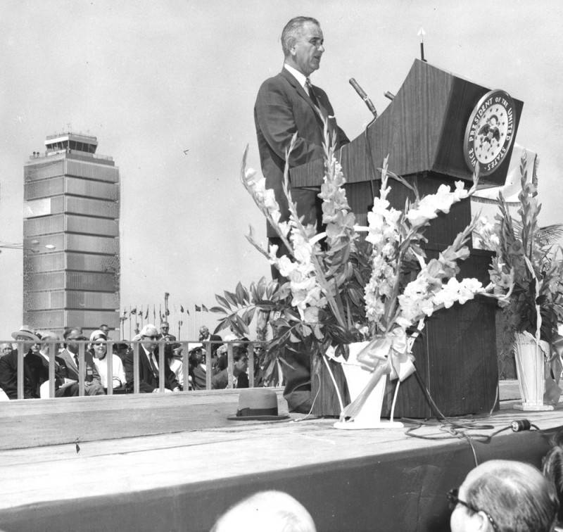
Vice President Lyndon B. Johnson speaks at the dedication for the remodeled LAX on June 25, 1961. (Credit: Los Angeles Public Library Photo Collection)

In 1959, he applied for and got a job with the Los Angeles Department of Airports as a building superintendent. He was put in charge of building the new terminals during the airport’s first major upgrade, which opened in 1961 with much fanfare, including a speech by then-Vice President Lyndon Johnson. 

What was once Mines Field, a dirt expanse with a few scattered buildings and oiled runways was on its way toward becoming a major airport, and Moore had positioned himself right in the thick of it.

He continued to rise in the Dept. of Airports hierarchy, becoming its deputy general manager in 1966. In 1969, he began his 25-year career as the executive director of the department, which would later become known as Los Angeles World Airports (LAWA).

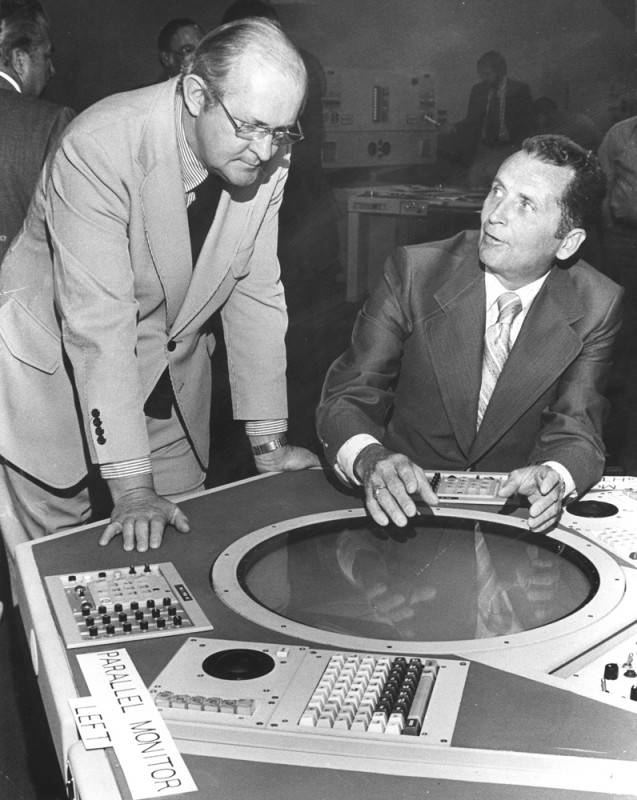
From left, Clifton A. Moore, L.A. Department of Airports general manager, and Arvin Basnight, western regional FAA director, preview the new radar system for LAX in 1973. (Credit: Los Angeles Public Library Photo Collection)

During the 1970s, the airport’s growing pains continued as its usage spiked upward. Moore began planning for another major revamp, this time spurred into action by the awarding of the 1984 Summer Olympics to Los Angeles in 1978.

The design included new terminals, including the Tom Bradley International Terminal, parking garages and a double-decked inner roadway loop. It was a complicated, often messy process that involved years of construction and traffic snafus.

But Moore pulled it off, and the remodeled airport handled the Olympics without a hitch.

During his tenure as airport director, passenger traffic increased from 20.5 million people in 1968 to 45.7 million in 1991.

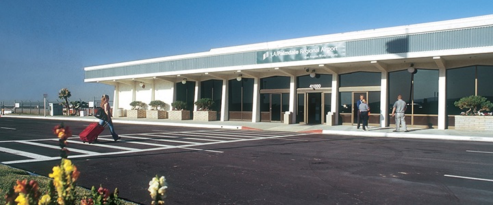
Not all of Moore’s projects developed as planned. He was a driving force behind the idea to develop a large regional airport in Palmdale during the 1980s, supervising the purchase of  7,750 acres of land for it. He envisioned a 71-mile rail line connecting Palmdale to LAX and saw it as an alternative to the perennially overcrowded main airport.

Palmdale Regional Airport has yet to become fully functional, despite Clifton Moore’s plans. Undated photo. (Credit: City of Palmdale website)

The plan never really got off the ground, so to speak. Moore and his wife even relocated to the Palmdale area from Culver City. Even though the Palmdale airport never became a reality, Moore did succeed in encouraging the concept of regional airports, utilizing Van Nuys and Ontario airports more than had been done previously.

Moore officially retired from his position as director of LAWA on Jan. 21, 1993. He served for a time as a paid consultant for LAWA following his retirement.

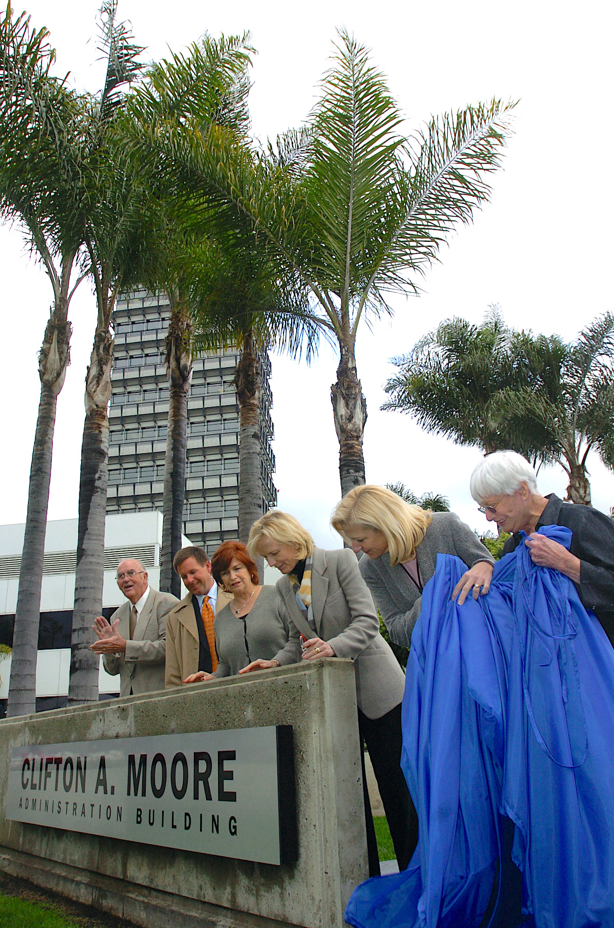
After the new control tower at LAX opened in 1996, LAWA decided to transform the old tower. Rather than tearing it down, the airport agency turned it into the Clifton A. Moore Administration Building, naming it in 2005 in honor of Moore and his years of service.

Clifton Moore, who had become known as “Mr. Airport” in Los Angeles and among the international airport community, died at 80 of undisclosed causes in a Lancaster hospital on April 2, 2002.

LAX administrators and widow Betty Moore, far right, unveil a new sign naming the LAX administration building at LAX after its former executive director Clifton A. Moore. February 2005. (Daily Breeze file photo by Branimir Kvartuc)

Sources:

“California Aviation Hall of Fame Inductees: Clifton A. Moore,” Museum of Flying website. 

Daily Breeze archives.

“International Aviation Leader Clifton Moore Dies at 80: ‘Mr. Airport’ Led Los Angeles Airports Department 25 Years,” LAWA website.

LAX: Los Angeles International Airport: From Lindbergh’s Landing Strip to World Air Center, by Tom Moran, CCA Publications, 1993.

Los Angeles Times archives.

Retired former LAX executive director Clifton Moore outside his Palmdale home in January 1999. (Daily Breeze file photo by Robert Casillas)

Torrance’s Shery High looks at continuation schools in a different light

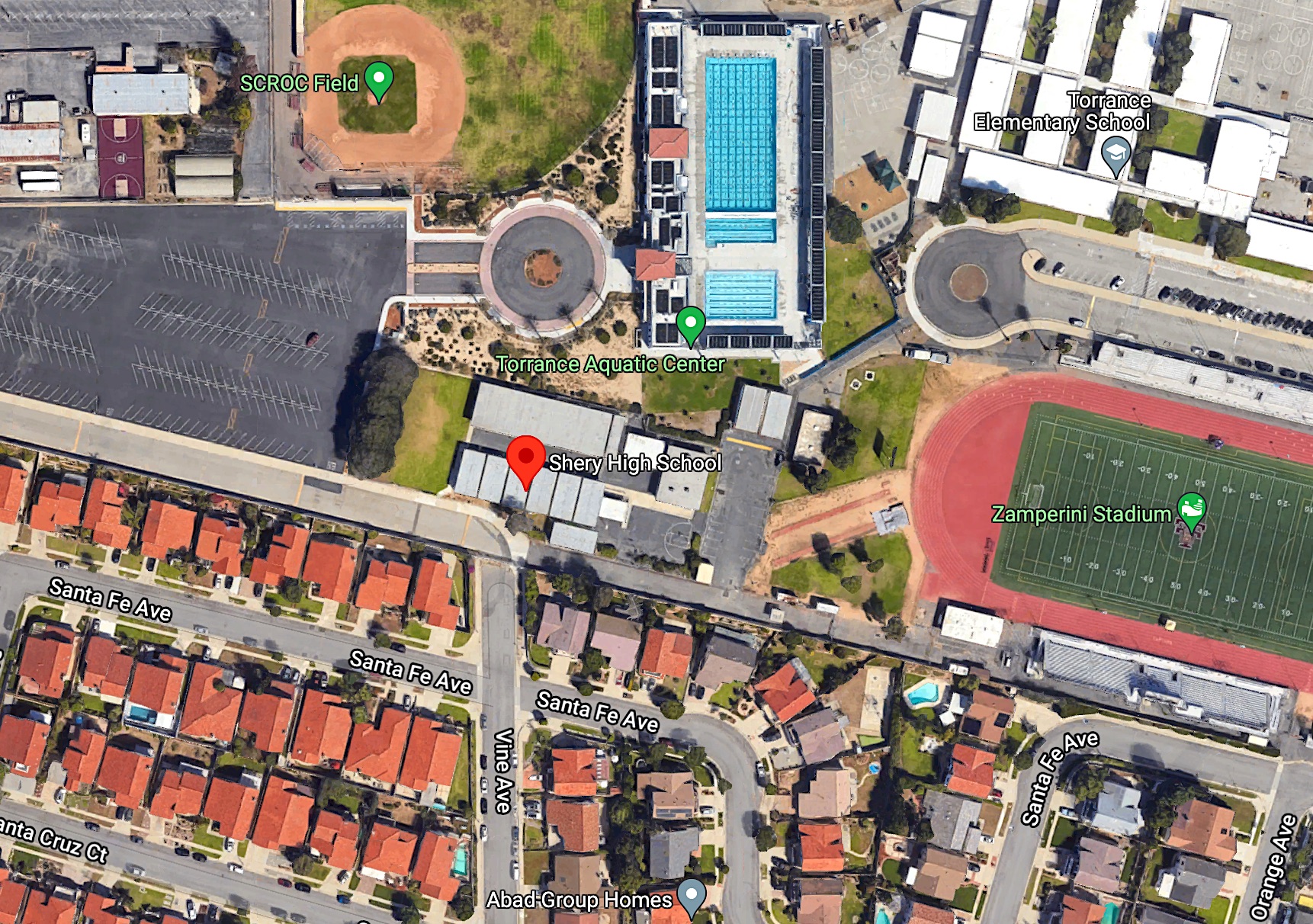
Shery High School’s modest campus is located next to the Torrance Unified High School Aquatic Center. 2023 image. (Credit: Google Earth)

Continuation high schools are much misunderstood. When I was in high school, they were known as the places where all the reprobates, drug users and ne’er-do-wells of every stripe ended up when traditional high school stopped being an option for them.

That was just a few years after California passed a law in 1965 mandating that public school districts had to offer an educational alternative to students who couldn’t fit into the mainstream high school for a much wider range of reasons than the obvious ones.

California already had passed a narrower law back in 1919 to make provisions for high school age teens who had to work to be able to continue to receive in education. The 1965 law broadened the range of students eligible for the continuation school to those unable to thrive in the standard school setting for behavioral, academic or other reasons. It took effect on Feb. 21, 1966.

(Torrance Unified School District, 2021 photo)

School districts had to scramble to conform with the new law. Torrance Unified began its continuation school program in February 1966 with 48 students. Classes were held on the Torrance and West high school campuses, and later as part of the district’s adult school. Howard C. Shoen was appointed as the school’s first principal; it was then known as “Continuation High School.”

Torrance opted to build a separate continuation high school in 1966 due to a couple of factors. First, land had become available from the U.S. Navy as part of the closure of its former Naval Supply Depot Annex on Crenshaw Blvd. in central Torrance. 

From this parcel, the city over the years carved out Wilson Park, Torrance High’s Zamperini Field athletic facility, the relocated Torrance Elementary School and the Southern California Regional Occupational Center (now known as SoCal ROC).

Shery High, center. The east end of SoCal Roc is at upper left. 2023 image. (Credit: Google Earth)

Second, the state offered more funding to those districts who built separate continuation school facilities.

As it turned out, the new vocational school that would become SoCal ROC was being planned at the same time as the continuation school. The proposal to build them near each other caused some controversy during 1966.

Board president Mrs. Kenneth E. Watts didn’t think the two schools should be built so close to each other. She felt the continuation school would stigmatize the vocational school so that both would be seen as places for problem students.

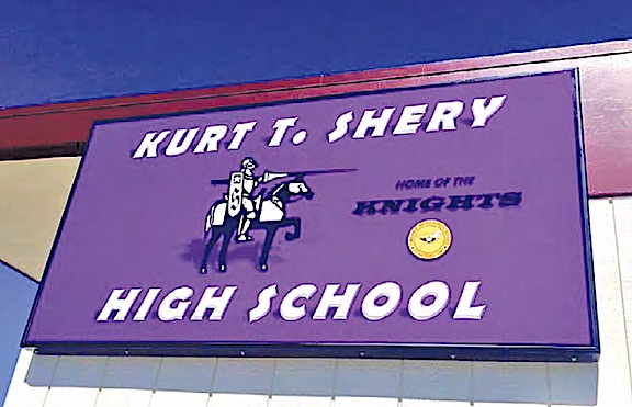
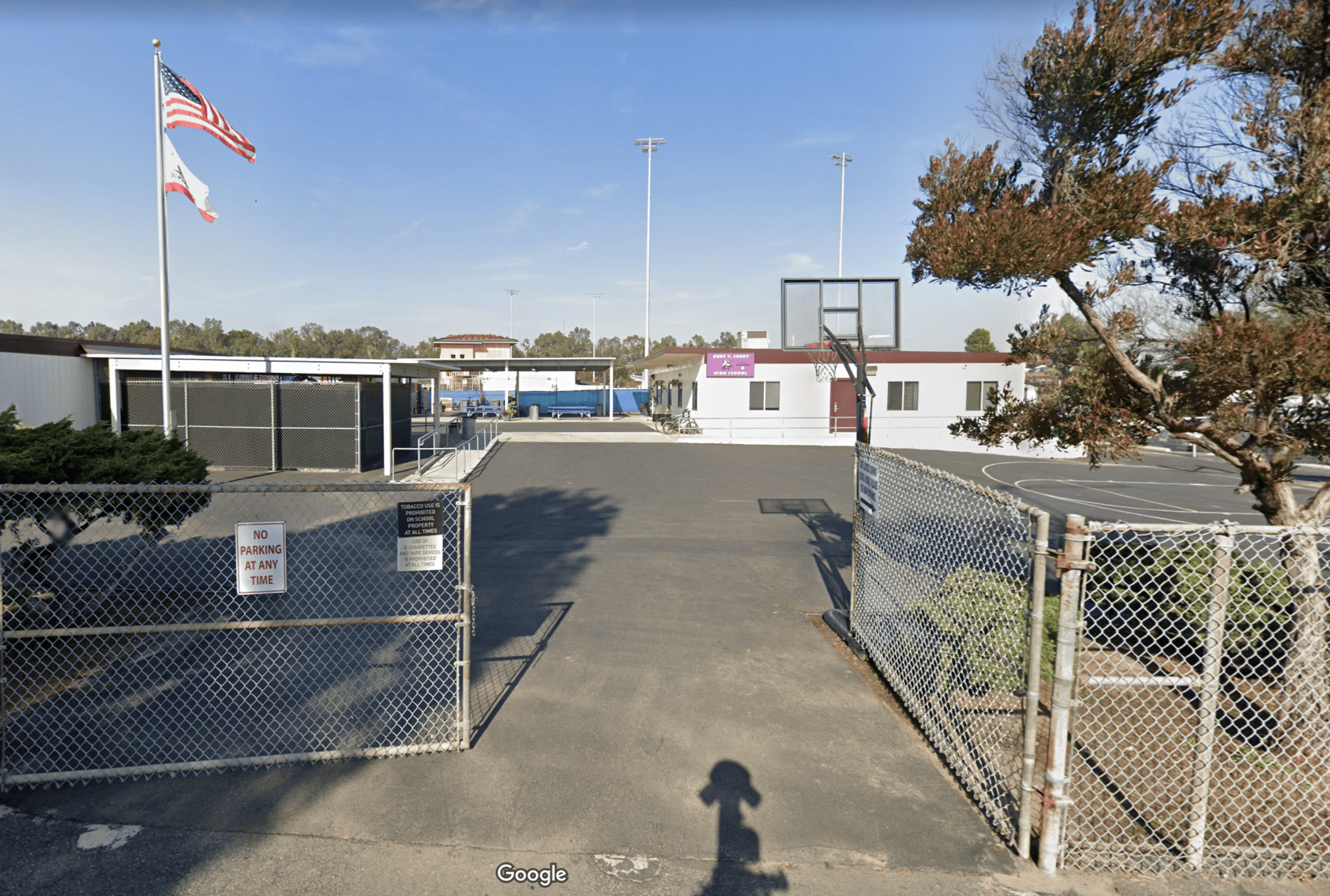
She was outvoted. The district’s fifth high school moved into eight portable bungalows at 2600 Vine St. Its official name became Kurt T. Shery High School when it opened for the first day of school on Sept. 13, 1967 to 70 students. By the third week, that number was 132. 

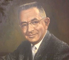
Dr. Kurt T. Shery

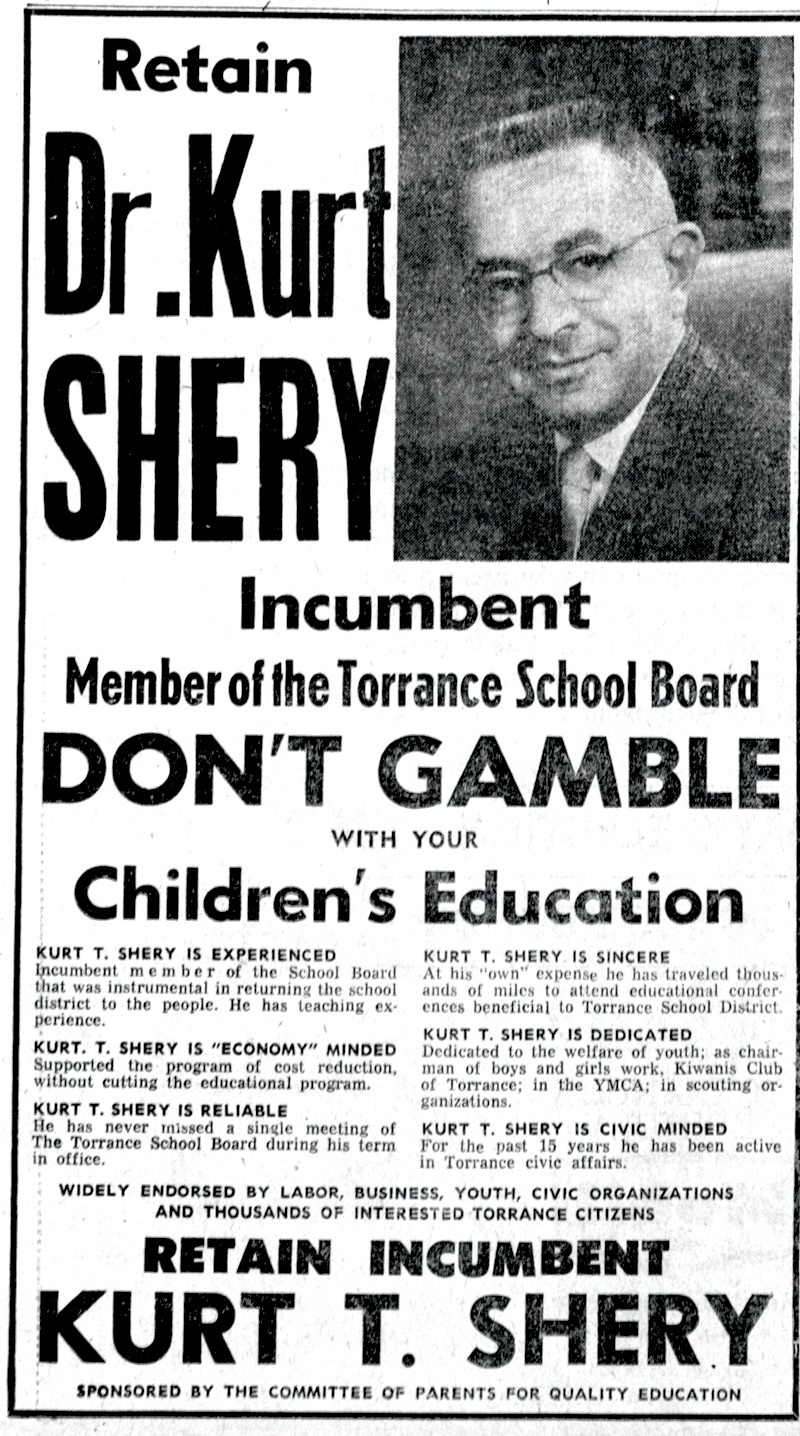
The school’s namesake, Dr. Kurt T. Shery, was a practicing physician with an office on Sartori Ave. in downtown Torrance. The father of two children, he retained a strong interest in education policy, strong enough to run for the Torrance school board in 1961.

He finished fourth, narrowly missing making the top three who won seats on the board. When  incumbent board member Clinton Cooke resigned after the election, Shery was appointed to take his place on the board in November 1961.

He would serve for six years. Less than two months after winning reelection to the board, Shery died on May 9, 1967, ten days after suffering a heart attack. The board voted to name the continuation school in his honor following his death.

The new school offered all the courses students needed in sciences, languages and the arts to get their high school degree. Class sizes were much smaller, and students could attend morning sessions, afternoon sessions, or both. 

They could work at their own pace, and were not competing with their classmates for grades. If students didn’t complete their work by the time they were 18, they were eligible to transfer to El Camino College to complete it.

The entrance to Shery High School in Torrance. 2023 image. (Credit: Google Earth)

During the late 1960s, dress codes were relaxed, and smoking was even allowed between classes. Clean beards and mustaches were allowed. Principal Shoen stressed good conduct and decency, telling the Palos Verdes Peninsula News in 1969, that he’d found that “if we don’t challenge the students too much, they don’t challenge the rules.”

Shery’s highest attendance came in 1975, when 263 students were enrolled. Generally the student population ranges between 125-200. Jamie Jimenez is the school’s current principal.

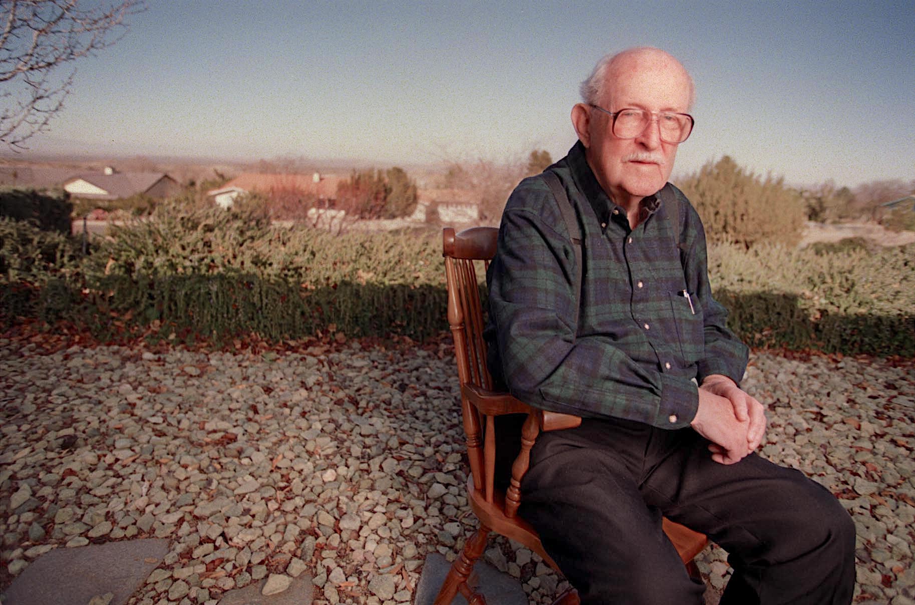
Barry Johnson, Shery High alumnus and lead vocalist of the popular indie rock band Joyce Manor, told me this recently when asked about the school from which he graduated in 2004:

“The students at Shery were a tougher crowd than at West High, but I made friends with people I normally wouldn’t have known. Shery allowed me the chance to graduate from high school at a time when my chances to do so otherwise were looking pretty bleak. Getting the diploma definitely boosted my self-esteem.”

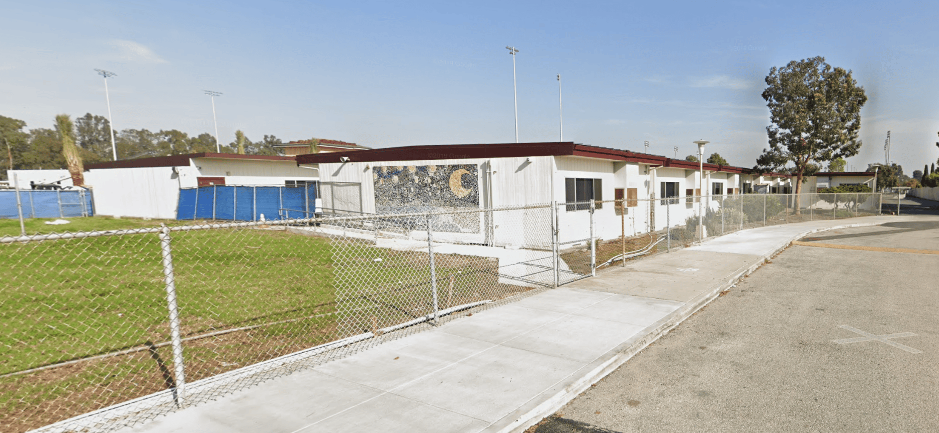
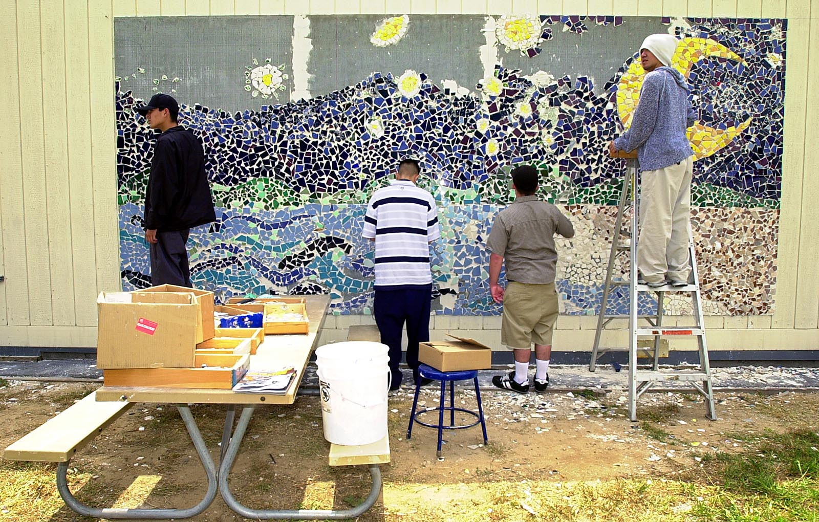
Shery High School students apply tiles to a mosaic based on Vincent Van Gogh’s “Starry Night” in June 2003. The art project was funded by a Pegasus Award from Exxon Mobil. The finished mural can be seen in photo at top of this post. (Daily Breeze staff photo by Kim Haggerty Zylius)

Sources:

“California’s Continuation Schools,” EdSource Research Summary, May 2008.

Daily Breeze archives.

The History of Torrance Schools, 1890-2000, by Thomas Rische, TUSD History Project, 2002.

Los Angeles Times archives.

Palos Verdes Peninsula News archives.

Shery High School website.

Torrance Press-Herald files.

Torrance School board campaign ad for Kurt Shery. Torrance Press, April 14, 1963, Page A-3.
(Credit: Torrance Historical Newspaper and Directories Archive database, Torrance Public Library)

SOUTH BAY / HARBOR AREA PUBLIC CONTINUATION HIGH SCHOOLS:

Angel’s Gate Continuation High School (LAUSD)

3607 Gaffey St.

San Pedro, CA 90731

(310)221-4600

Arena High (Alternative) School (ESUSD)

641 Sheldon St.

El Segundo, CA 90245

(310) 615-2650

Avalon High School (LAUSD)

1425 N. Avalon Blvd. (Banning High)

Wilmington, CA 90744

(310) 549-2112

Eagle Tree High School (LAUSD)

22628 S. Main St.

Carson, CA 90745

(310) 549-0970

Inglewood Continuation High School (IUSD)

441 W. Hillcrest Blvd.

Inglewood, CA 90301

(310) 680-5300

Kurt T. Shery High School (TUSD)

2600 Vine St.

Torrance, CA 90501

(310) 533-4440

R.K. Lloyde High School (CVUHSD)

4951 Marine Ave.

Lawndale, CA 90260

(310)263-3264

Moneta Continuation School (LAUSD)

17951 Budlong Ave.

Gardena, CA 90248

(310) 354-4951

Pacific Shores High School (MBUSD/REUHSD)

(Temporarily closed)

1223 Hermosa Ave.

Hermosa Beach, CA 90254

Patricia Dreizler Continuation High School (RBUHSD)

(Formerly Redondo Shores High)

1000 Del Amo St.

Redondo Beach, CA 90277

(310)798-8690

Patton High School (LAUSD)

24514 S. Western Ave.

Harbor City, CA 90710

(310) 257-4740

Rancho Del Mar High School (PVPUSD)

38 Crest Road West

Rolling Hills, CA 90274

(310) 377-6691

Redondo’s Beachbum Burt’s epitomized the laid-back restaurant vibe of its era

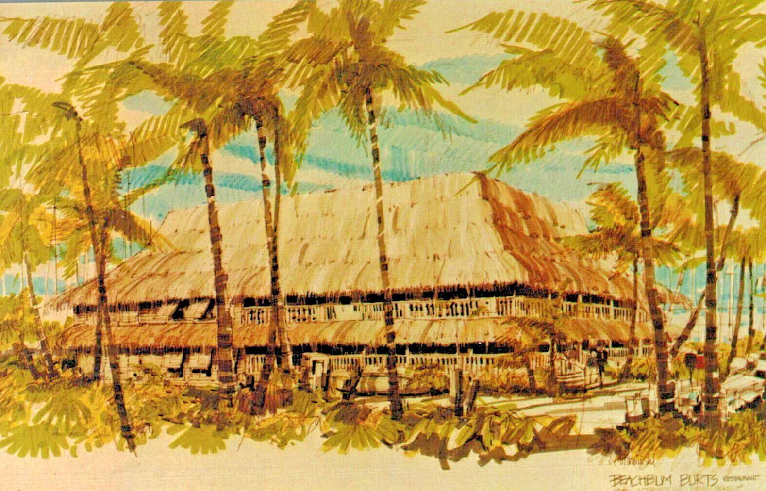
Undated postcard circa mid 1970s shows artist’s rendition of Beachbum Burt’s in Redondo Beach.

When it came to restaurants, Burt Hixson dreamed big, then delivered.

Born and raised in Los Angeles, Hixson signed on for a stint on a Norwegian freighter at age 17. He was determined to see the world, especially the South Seas and Asia, through the lens of a camera, spending every free moment overseas filming what he saw.

When he returned, he studied film at USC, where he learned to make documentaries while continuing his travels. He studied not only the places he visited, but also the lives of the people, including the foods they enjoyed.

In his late 20s, Hixson decided to follow his childhood dream of becoming a restaurateur. Even when first starting out, his plans were ambitious. He chose the newly developed harbor at Marina del Rey, which had opened in 1965, as the site of his first restaurant.

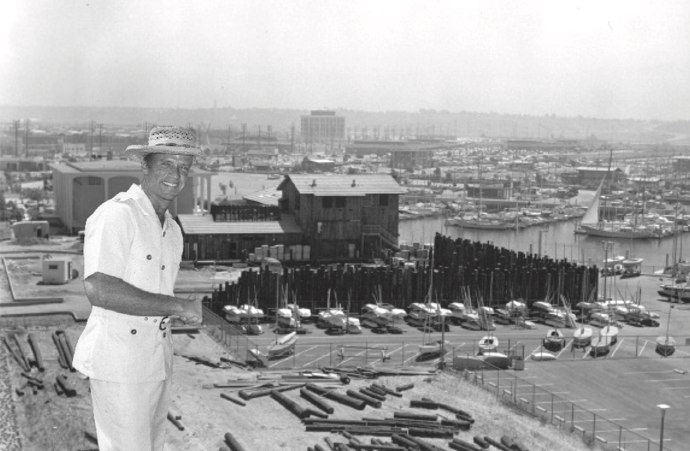
Burt Hixson stands in front of a photo of The Warehouse in Marina Del Rey under construction in 1979. (Credit: Marina Del Rey Historical Society)

Opened in late 1969, The Warehouse on Admiralty Way lives up to its name. The large building on the water was festooned with barrels, crates, fishing nets and other decorations gathered from the waterfront at San Pedro. Hixson’s travel photographs also graced its walls.

The restaurant was an immediate success, the first large-scale eatery to thrive at the Marina.

Hixson’s next idea brought him to the South Bay. He wanted to open another large restaurant on the water, this time with a wholly South Seas theme. He chose to locate it in the rapidly developing King Harbor area, which also had been opened in the mid-1960s.

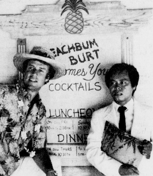
Beachbum Burt’s owner, Burt Hixson, left, with restaurant’s host, Timmy Thai. Palos Verdes Peninsula News, Dec. 13, 1979, Page 20. (Credit: Palos Verdes Peninsula News archives)

Beachbum Burt’s was built on the harbor at 605 N. Harbor Drive on a site with oceanfront views to its north and south. The large rectangular structure had 18,000 square feet of floor space. Hixson’s design aimed at creating the ambience of a grand tropical island estate. He reportedly invested more than a million dollars in the endeavor.

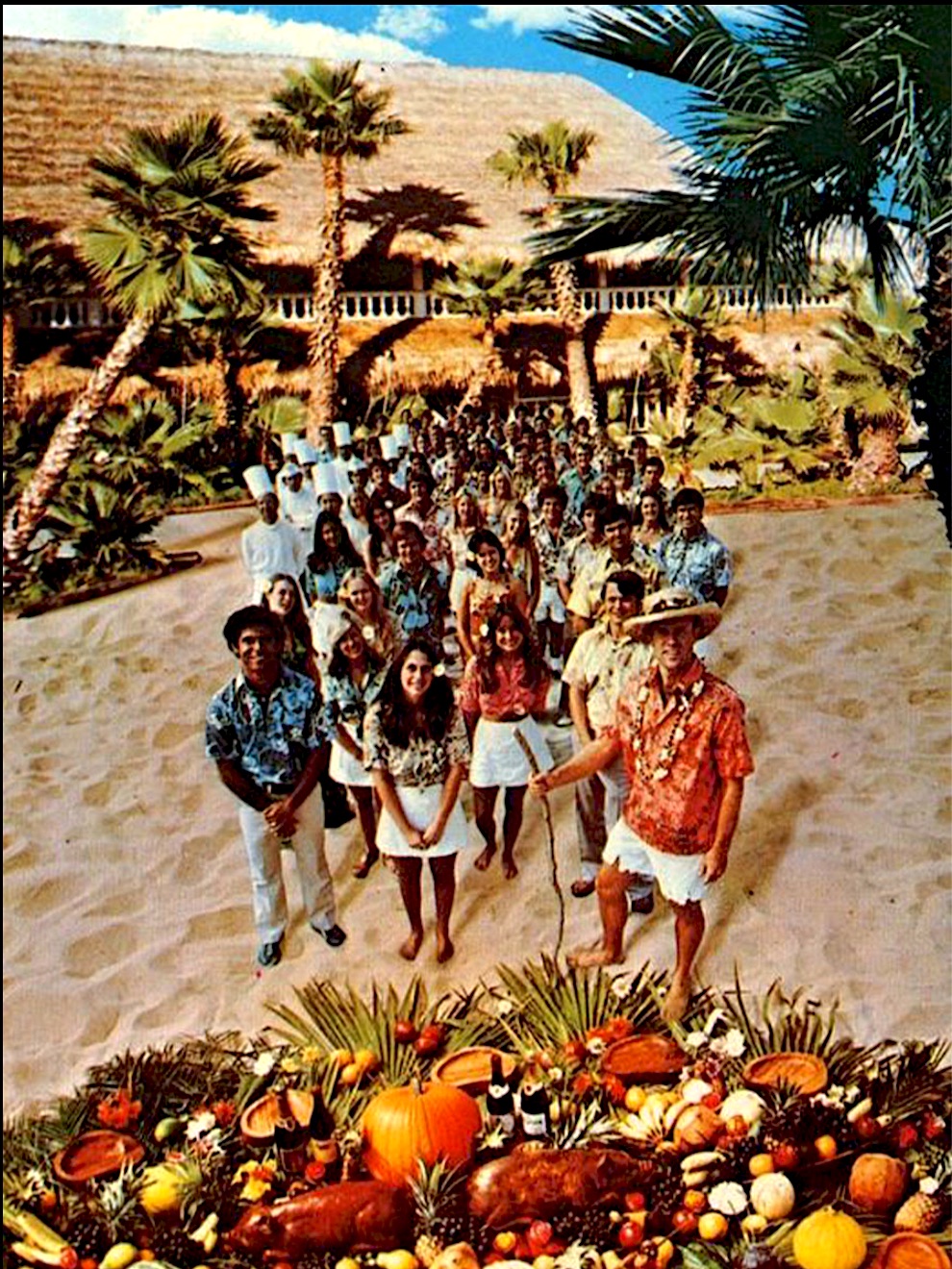
The 32-year-old restaurateur hired four Polynesian natives to assemble some 98,000 imported palm fronds into the building’s giant thatched roof by hand, a process which took 35 days. It took even longer than that after the Redondo Beach Fire Dept. informed Hixson that the leaves had to be coated in flame retardant chemicals due to the fire hazard they posed.

But what really made the roof unusual was its retractability. With the flip of a switch, the motorized covering could be opened wide, allowing customers to dine under the stars.

Hixson also decorated the spacious interior with various varieties of ornamental tropical foliage, along with more of his South Seas travel photographs. Wicker and rattan furniture furnished the two-level dining area. He also oversaw the exterior landscaping, which included native palms and fern plants.

Beachbum Burt’s opened in March 1974, staffed by nearly 100 employees clad in Hawaiian shirts. Its menu featured barbecued short ribs, ginger chicken, shrimp and a variety of other fish and seafood, teriyaki beef dishes and a distinctive peanut sauce created on site.

1978 postcard shows Burt Hixson, lower right front with lei, and many of his Beachbum Burt’s employees in front of the restaurant.

In 1977, the restaurant added a second retractable roof to the restaurant’s large bar area, this one made of fiberglass.

For entertainment, Hixson hired a variety of performers in keeping with the restaurant’s laid-back atmosphere. At first, he shied away from harder rock bands, preferring mellower folk rock and jazz sounds. 

When he somewhat reluctantly hired the John Brown Band in the late 1970s, though, the popular local group began to attract a younger and more raucous clientele to the restaurant.

Weekend nights and Sunday brunches drew large and spirited crowds to hear Brown, the rock band Legend, and other performers.

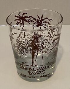
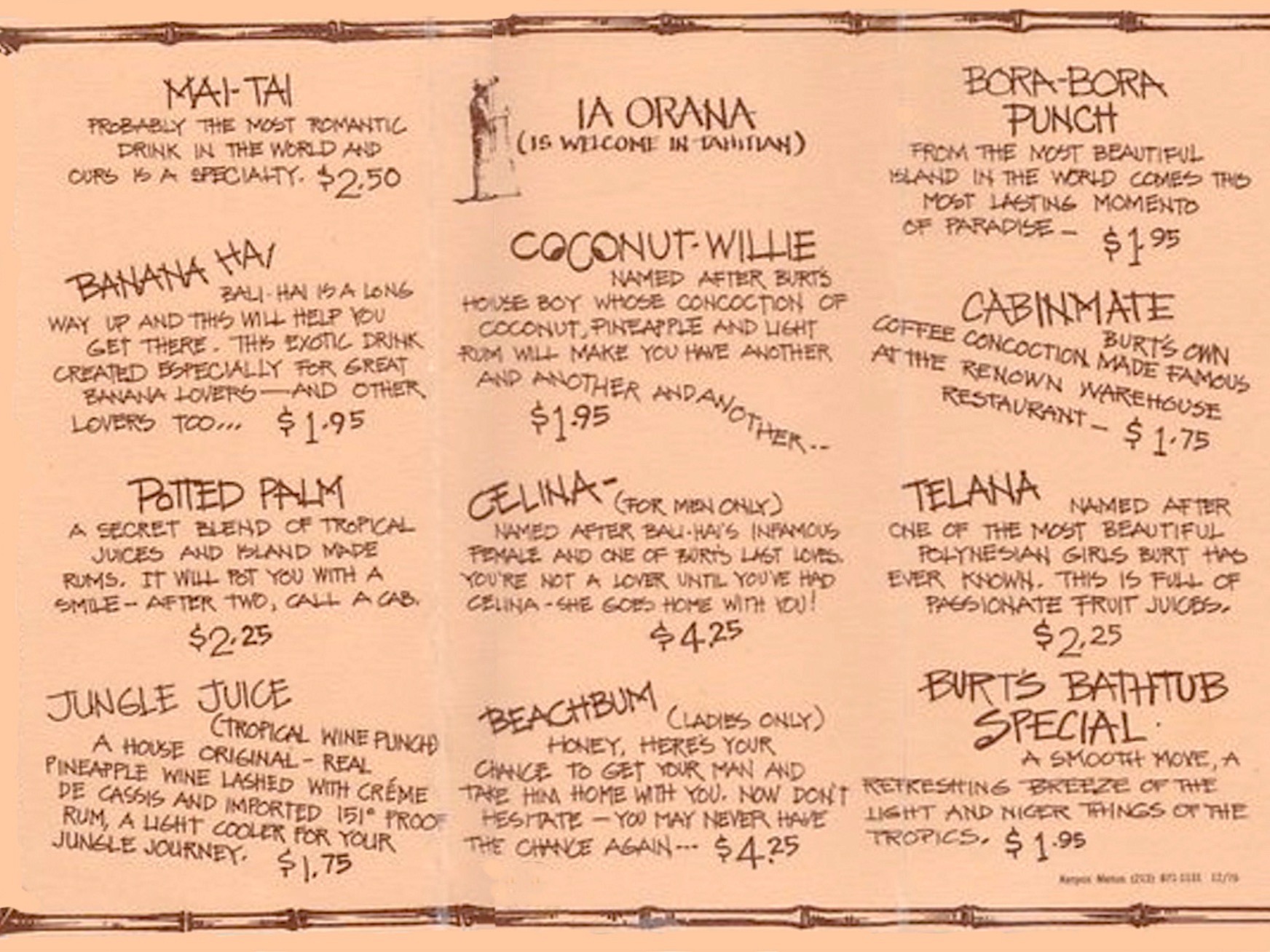
In a 2010 Easy Reader story, former bartender and beverage manager Richie Yarnold recalled the bar alone taking in as much as $13,000 on weekend nights during an era when beers cost 75 cents a glass. For $1.25, you could get not only the restaurant’s signature mai tai cocktail, but also keep the Beachbum Burt’s glass in which it came.

Hixson’s restaurant kept serving for more than a decade. The date of its closure is inexact; the last mention in print seems to be from a Sept. 19, 1985 Los Angeles Times event calendar listing.

After Hixson closed it, the Beachbum Burt’s building eventually was remodeled into the Cheesecake Factory restaurant which currently operates at the site. It opened in June 1988. Hixson, who had opened a second Warehouse location in Newport Beach in 1985, divested himself of the two restaurants in 1996.

He then moved to Mexico, where at last report he was co–owner of the exclusive Villa Verano and Puerto Vallarta Beach Club seaside resorts in Puerto Vallarta.

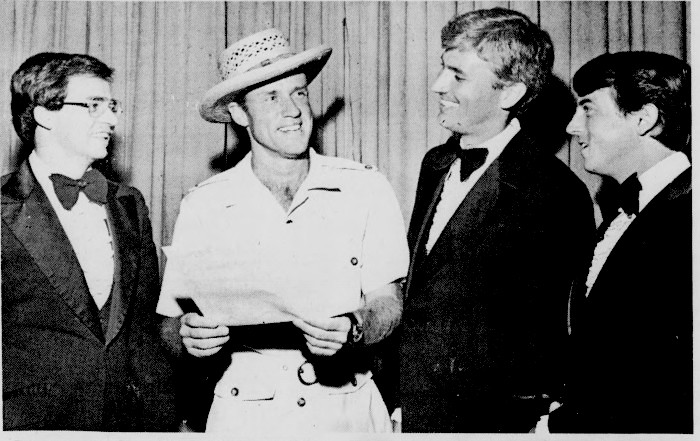
Burt Hixson, center with his trademark straw hat, accepts his award for “Restaurateur of the Year 1977-78” from the Los Angeles Restaurant Writers Association. Restaurant manager Ralph Dockery, left, and two other unidentified Beachbum Burt’s employees look on. Palos Verdes Peninsula News, April 20, 1978, Page 17. (Credit: Palos Verdes Peninsula News archives)

Sources:

“Beachbum Burt’s,” myTiki.life website.

Daily Breeze archives.

Easy Reader archives.

Los Angeles Times archives.

Palos Verdes Peninsula News archives.

“Warehouse Restaurant Celebrated 45th Year,” by David Maury, Marina Del Rey Historical Society journal, Vol. 3, Issue 3, Dec. 2014.

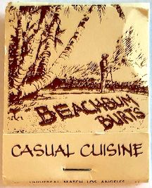
A page from Beachbum Burt’s bar menu. Undated. (Credit: myTiki.life website)
Is this your new site? Log in to activate admin features and dismiss this message
Log In