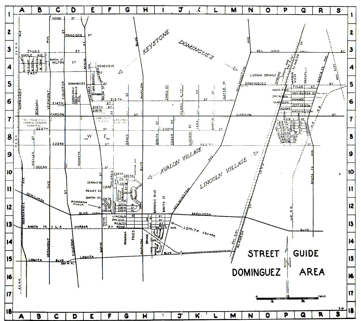
The Keystone area as it exists today roughly encompasses a triangular portion of west Carson north of 228th St. and between the 110 and 405 freeways. (Some also identify the county area to the west between the L.A. city strip and the 110 as being Keystone as well.)
It’s a fairly small slice of the nearly 19-square-mile city, but the Keystone name actually predates Carson’s incorporation by several decades, and originally referred to the entire early settlement. Keystone wasn’t even its first name; early settlers who bought land from the Dominguez Estate Co. called it “Nestoria.”
The Dominguez Estate Co. was formed to manage the real estate from the Rancho San Pedro Spanish land grant owned by the Dominguez family. Its first sales were to small farmers, but it didn’t take long for residences to start springing up there as well.
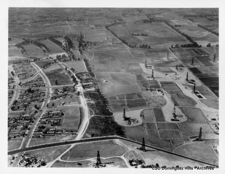
Oil wells had begun to spring up in the Dominguez Hill area east of the residential portion of the settlement, where the Dominguez Water Co. already had established water wells by 1911.
The origin of the Keystone name remains unclear. Real estate developers began working the area west of Dominguez Hill in the early 1920s, and they initially identified the area as “Keystone Acres.” The earliest area to be subdivided was located between Figueroa St. and Avalon Blvd., and from 213th St. south to 228th St.
By the time of the publication of the first Torrance Directory in 1922, listings for the Keystone area were included, and its population was given as 351 persons. (By then, the “Acres” part of the name seems to have been dropped.)
By mid-1922, the Keystone Chamber of Commerce had been formed and was holding regular meetings. It replaced the earlier Keystone Boosters Club; the building near the corner of 220th and Main streets where the chamber regularly met kept its name of Booster’s Hall for many years. (The now-empty building still stands.)
The pace of urbanization quickened during the boom years of the 1920s. Workers at the many local industrial plants in Torrance and the oil fields and refineries all around the area needed places to live. The opening of Carson Street School in 1927 served as an additional inducement to potential homebuyers.
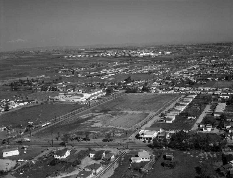
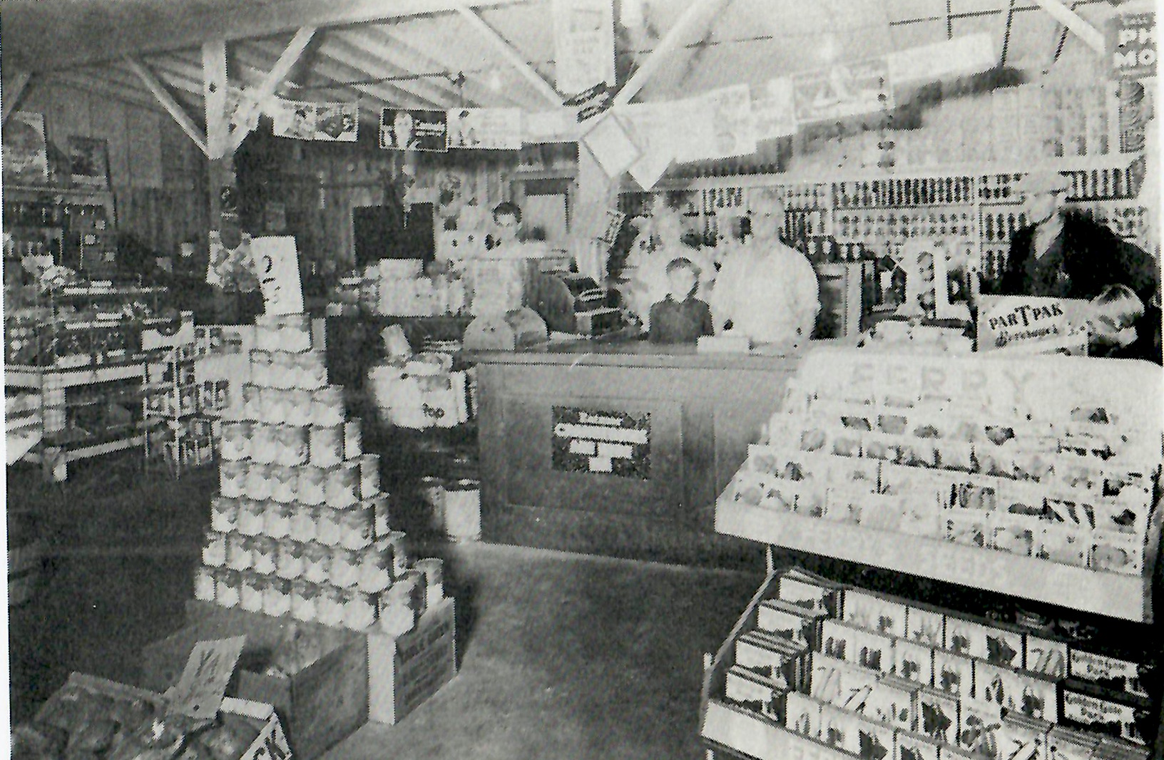
(Credit: Los Angeles Public Library Photo Collection)
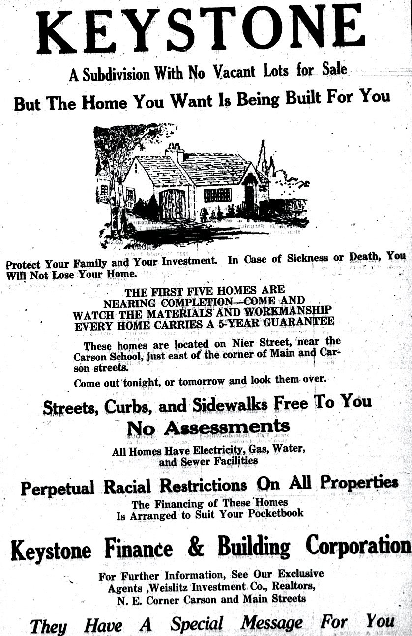
A Torrance Herald article from 1928 trumpeted the area’s burgeoning development, announcing that the Keystone Building and Finance Corporation planned to build 225 homes in the area. The thinly veiled promotional piece detailed the availability of gas lines, electricity from a new Edison substation on Dolores St. and water from the nearby Dominguez Water Co. wells.
The article also touted the improvements to the mostly dirt roads in the area. Harbor Blvd., later renamed Main St., was already paved, being the main north-south artery from downtown Los Angeles to the Harbor Area. There were no freeways, of course, and parts of major streets such as Vermont, Figueroa and Avalon Blvd. had yet to be paved and in some cases connected to their northern counterparts.
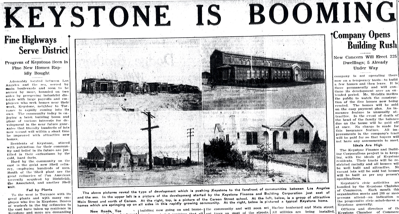
By 1929, the population of Keystone was estimated to be 800 people.
Following the end of World War II, most of the street improvements had been completed, with the 110 Freeway through the South Bay/Harbor Area already on the drawing boards. Schools, churches, retail businesses and other establishments were thriving.
The Keystone-Avalon Chamber of Commerce had grown in size and influence, counting 90 members in 1950. Its members began searching for a name that would unite residents of Keystone, the Avalon Village housing development, and the industrial Dominguez area northeast of the main settlement.
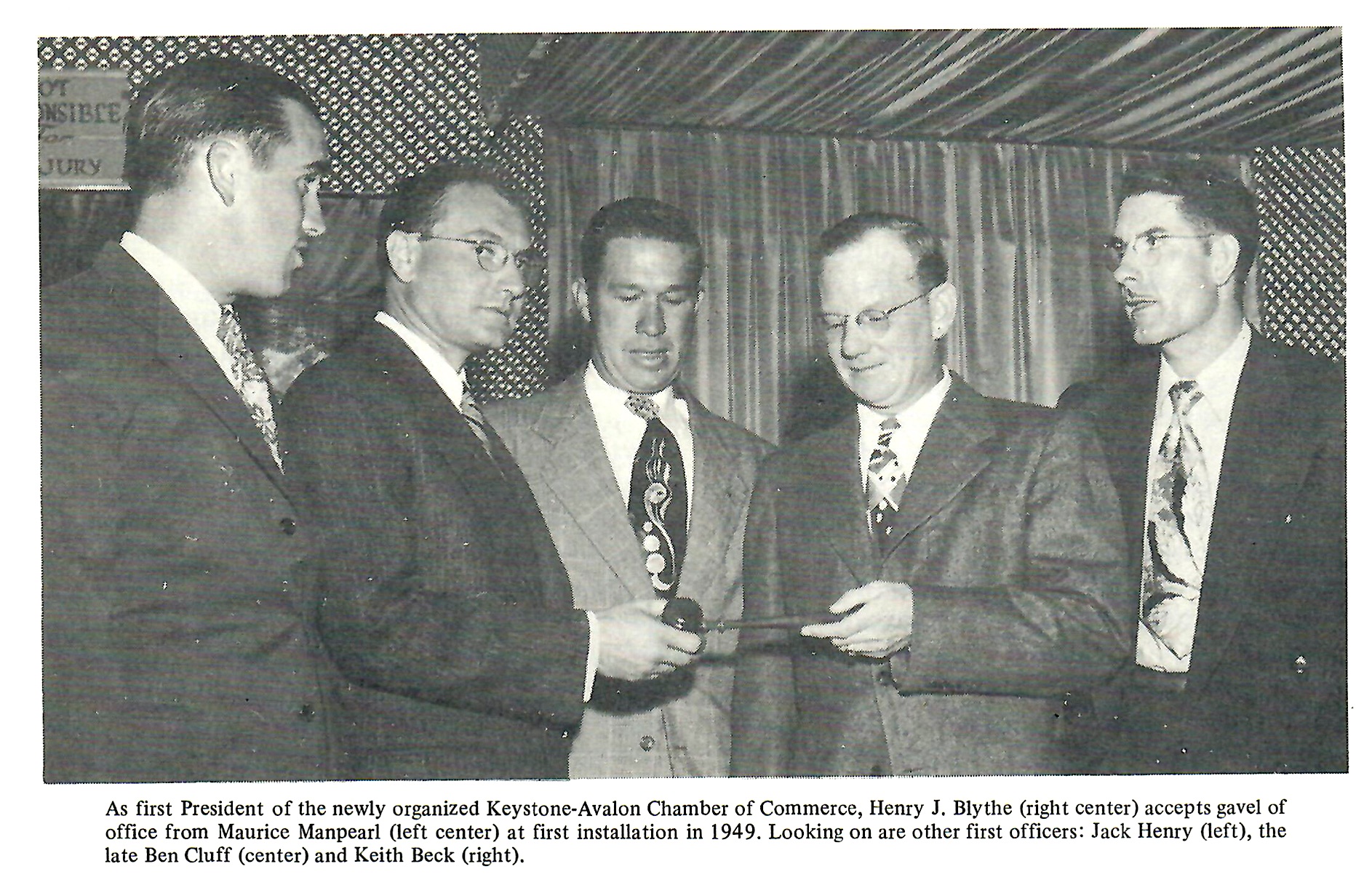
Its president, Harry Blythe, sent out a letter to members proposing different names that year. The 25 suggestions included Avalon Park, Carsalon, Normal, Santa Claus, Cabrillo, Defiance and Santa Rocha. But one name on the list would stick: Carson.
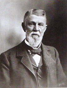
The proposed name honored the memory of George Henry Carson, the pioneering businessman and rancher who married land grant owner Don Manuel Dominguez’s daughter Maria Victoria in 1857. He went on to manage Don Manuel’s Rancho San Pedro and Dominguez Rancho properties for many years before his death in 1901.
With the news that the U.S. Post Office intended to build a branch office in the area, the chamber acted in early 1952 to establish Carson as the permanent name for the area. It changed its own name to the Carson Chamber of Commerce, and asked Rep. Cecil King to reserve the name for the new post office.
By 1954, Carson had become the official name for the area. It would be the beginning of a long drive toward cityhood, with leaders looking to consolidate its various pieces, Keystone, Lomita Square, Avalon Village, Victoria Park and parts of Dominguez into one entity.
Attempts by the city of Long Beach to annex a part of the Dominguez area then known as Davidson City in the eastern part of Carson in 1958 intensified the drive for incorporation.
Debate raged over the issue for the next 10 years. Finally, on Feb. 6, 1968, voters approved incorporation by a vote of 6,301 for to 3,394 against. Carson’s incorporation became official on Feb. 20, 1968. More than 600 people jammed the auditorium at Carson High School for the ceremonies.
Sources:
Carson, by Cindy Tino-Sandoval, Arcadia Publishing Co. (Images of America series), 2006.
Daily Breeze archives.
The History of a City … Carson, California, by Jack E. Jerrils, City of Carson, 1972.
My Carson, Your Carson: A Picture Book of the Past and Present, by Charlotte Trejos, Trejos Literary Agency, 1987.
San Pedro News Pilot archives.
Torrance Press Herald archives.