The 91 Freeway never made it quite as far west as originally planned

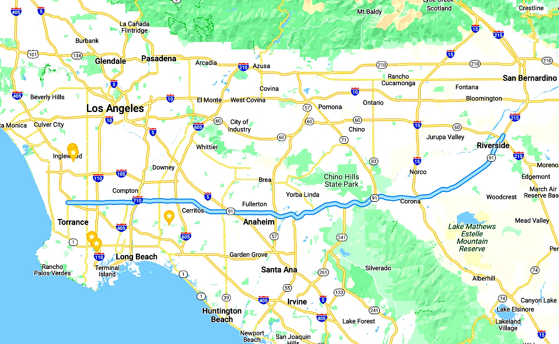
The 91 Freeway, highlighted in light blue, runs from the South Bay to Riverside. 2023 data. (Credit: Google Maps)

The first short freeways in the Los Angeles area, the Ramona east of downtown where the 10 Freeway runs now, and the Arroyo Seco Parkway running south from Pasadena, were hugely successful experiments built beginning in the 1930s.

Their popularity fueled much enthusiasm among civic planners, who proceeded to propose a massive system of 1,500 miles of freeways in the L.A. metro area. Only a third of them ever were built.

The 91 Freeway was among them. Work on the freeway began in 1965, but it had been on the drawing boards since 1946 and received approval from the California Highway Commission in 1955. (The agency would be consolidated and renamed CALTRANS in 1973.)

Its purpose? To provide a single roadway that would link inland areas – its eastern terminus would be in Riverside – all the way west to Highway 1, the Pacific Coast Highway, in Hermosa Beach.
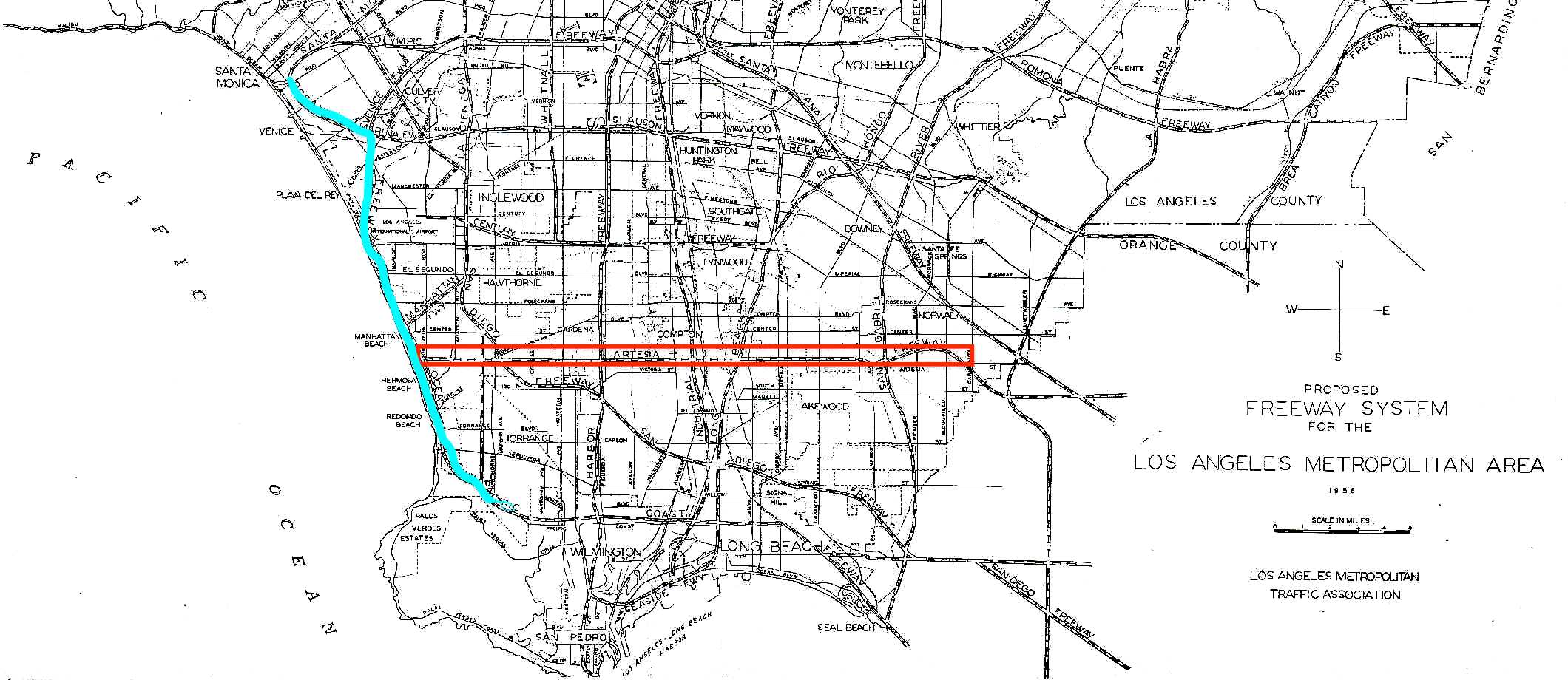
This 1956 Los Angeles Metropolitan Traffic Association map shows the various freeways planned for the county. The highlighted red box indicates the Artesia Freeway, while the light blue line shows the proposed Pacific Ocean Freeway route.

Did I mention that PCH was to be its western terminus? I did. In the original state highway plan, the 91 Freeway would have linked up with the proposed Pacific Coast Freeway. That roadway would have been an extension of the Ocean Freeway to be built through Santa Monica and Venice, following roughly the route that Vista del Mar currently takes along the South Bay coast.

A pretty tidy plan. Except that there was no way that coastal residents in any of the affected communities would allow either of those freeways to happen. Their serious opposition began after actual construction began on the 91.

Coastal cities banded together to denounce the plan, citing a laundry list of reasons: the high cost of land acquisition, loss of valuable beach property to the roadway, close proximity to the ocean, and limited value of the proposed roadway to north-south travelers. 
According to a 1967 Palos Verdes Peninsula News story, “the citizens of South Bay communities who might be served by the freeway are presently served by both San Diego and Harbor freeways and will be served by the Hawthorne freeway and that they do not require additional freeways.”

So much for the beach idea. State highway planners removed the Pacific Coast Freeway from its master plan in April 1967.

91 Freeway construction was well underway by 1970, when let–get-real meetings began to be held for reconsidering its western terminus. After nixing its coming to their town, Hermosa Beach had recommended extending the 91 just to Hawthorne Blvd., on the route for the Torrance Freeway that had been proposed in 1965.

The Torrance City Council debated this question for the next two years. In February 1972, Councilman George Brewster was the only member to vote against a resolution opposing building both the Artesia and Torrance freeways through the city.

In 1974, the Torrance Freeway plan was finally killed by CALTRANS. By April 1974, 91 Freeway construction had been completed west through to Wilmington Ave., though its interchange with the 710 Freeway in Long Beach wouldn’t be finished until later that year.

A Los Angeles Times story suggested that the final leg of the project, now slated to terminate just west of the 110 Freeway in Gardena, would be completed by late summer 1975. That prediction turned out to be laughably optimistic.
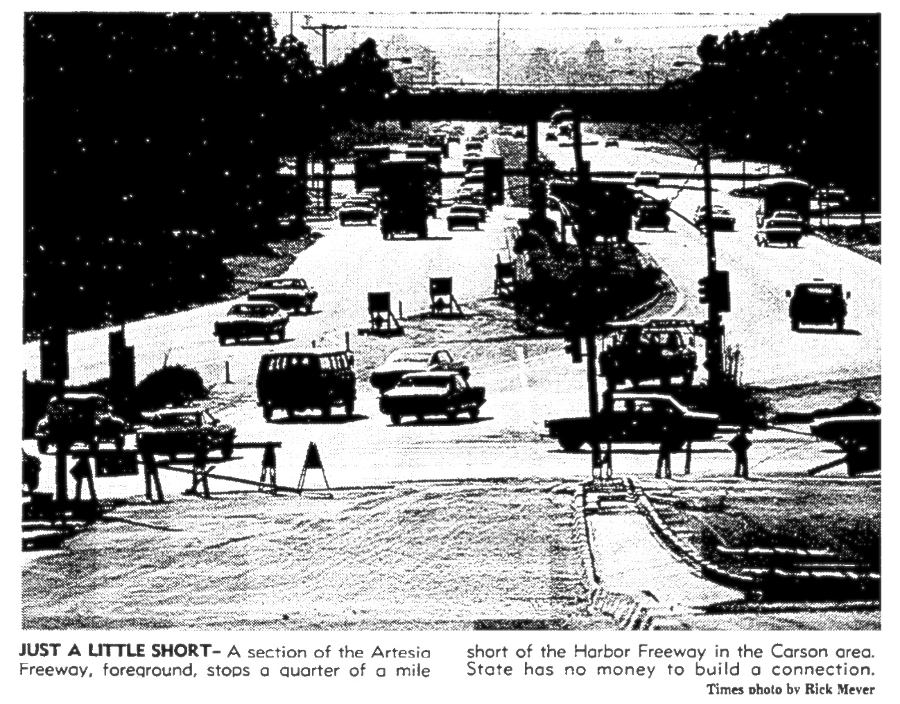
Los Angeles Times, Sep 14, 1975, Page B1. (Credit: Los Angeles Times archival database)

All new freeway construction had to be halted in late 1975 due to the state’s budgetary woes and the intransigence of Gov. Jerry Brown regarding the financing of further highway work. With no highway funds left to complete it, the 91 Freeway had reached within a quarter mile of its proposed interchange with the 110 Freeway, but could go no further.

So motorists wishing to connect to the new route from the 110 were dumped onto surface streets, and had to navigate traffic signals in order to make the connection to the 91. The predictable results: a nearly nonstop traffic snarl on the roadways between the two freeways.

The situation had worsened enough by 1977 for County Supervisor Kenneth Hahn to describe the junction to the Times as “the most dangerous two-block stretch in California.” But the wheels continued to move slowly on the project.

It took another five years for construction to begin. At least it only took three more years, instead of the four originally projected, to complete work on the freeway interchange. That finally happened in June 1985, a full decade’s worth of commuter misery since work on the project had halted in 1975.
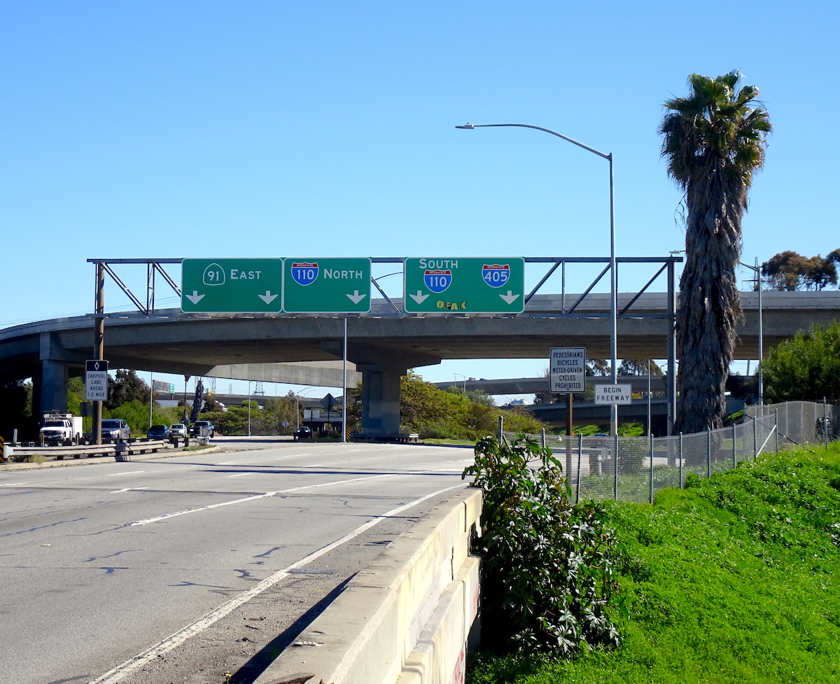
The 91 Freeway begins at the 110 Freeway interchange, just east of the Vermont Ave. and Artesia Blvd. intersection. (February 2023 photo by Sam Gnerre)

The 91 Freeway now stretches for some 56 miles, from its western terminus at Vermont Ave. in Gardena through Long Beach and Orange County, where it continues through the Santa Ana Canyon and eventually ends at the 60 Freeway in Riverside. 

While not a freeway, the section of Artesia Blvd. west from Vermont to PCH in Hermosa Beach remains a part of State Route 91, though the state had returned all control of the highway to the various cities along its path by 2003.

From Gardena to the 710 Freeway, its name is the Gardena Freeway. From the 710 to the intersection with the 5 Freeway in Orange County, its name is the Artesia Freeway; from there east to its junction with the 60 Freeway in Riverside, it’s the Riverside Freeway. But for most of us, it’s just “the 91.”
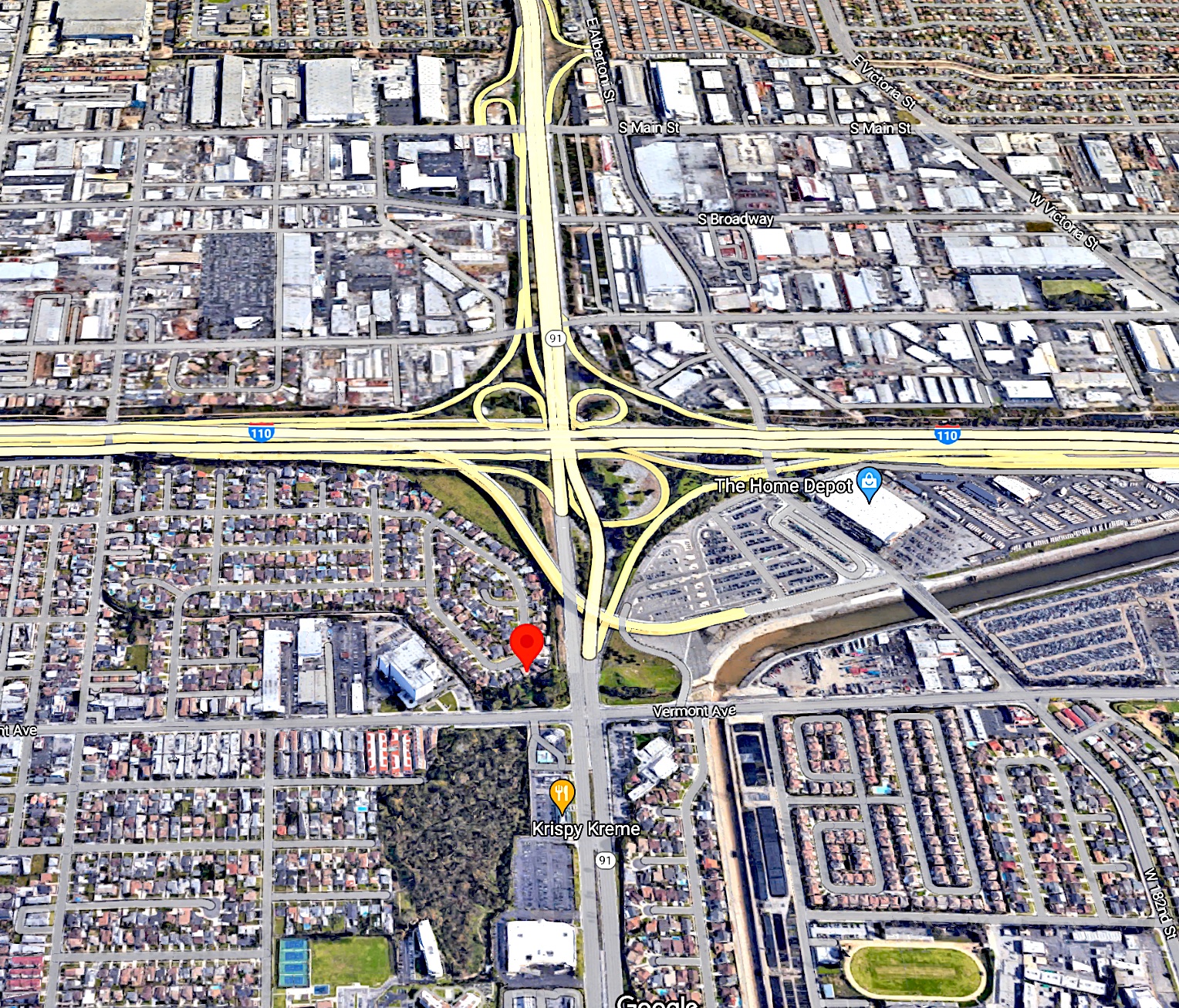
View east from the 91 Freeway origin. Interchange with the 110 Freeway highlighted in yellow. Gardena High School, bottom right. (Credit: Google Earth)

Sources:

Daily Breeze archives.

Freewaytopia: How Freeways Shaped Los Angeles, by Paul Haddad, Santa Monica Press, 2021. 

Los Angeles Times archives.

Palos Verdes Peninsula News archives.

“State Route 91,” California Highways website.

“SR-91: Artesia Blvd / Artesia Freeway / Riverside Freeway,” Southern California Regional Rocks and Roads website.
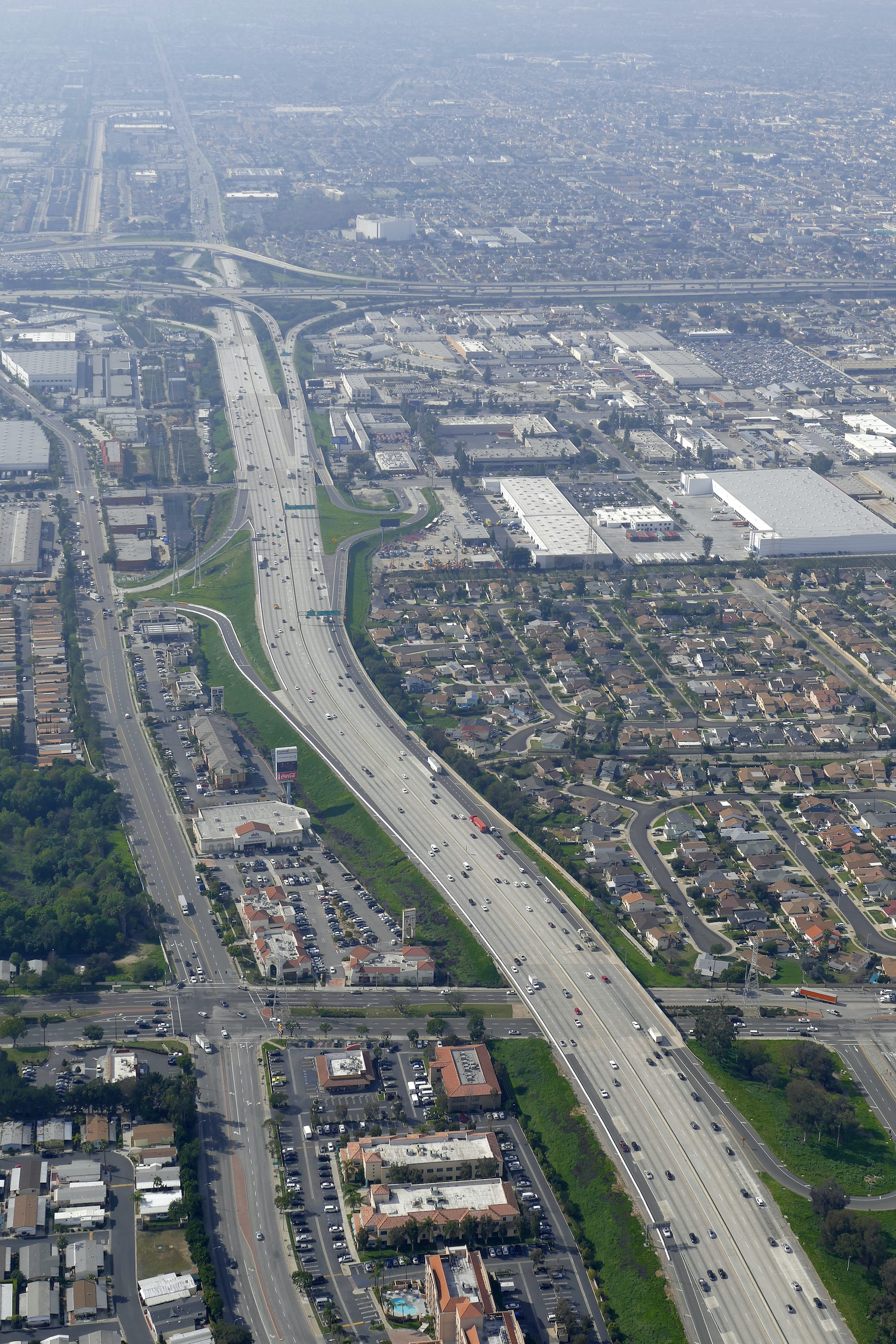
91 Freeway looking west toward the 110 Freeway interchange in February 2017. The continuation of Artesia Blvd. can be seen at top left, past the 110. (Daily Breeze file photo by Brad Graverson)

1941 “murder by mail” case with a San Pedro connection remains unsolved

The method used to kill John Kmetz could have come straight out of an old “Perry Mason” episode.

John Kmetz. (Credit: American Weekly, Nov. 30, 1941, p. 5)

The 54-year-old Kmetz, a landscape gardener for the Los Angeles Unified School District, received an unsolicited package at his home at 4549 E. Third St. in Los Angeles from the Herb Specialty Co. on Oct. 11, 1941. 

Kmetz had married his second wife, 33-year-old Esther Dockham, two months earlier on Aug. 18. His first wife, the mother of his two children, had died seven years earlier. Mrs. Kmetz told police that her husband’s daughter Lola Mae, 13, had brought the package, sent from an address in Hollywood, to her husband that day. 

It contained a small box with a bottle of 12 pills inside. An enclosed two-page typewritten letter signed by one “Dr. W.W. Mackelroy” claimed that a select number of people had been selected to try out this new “vigor restorative” medicine.

The Kmetzes initially laughed off the sales pitch, but on Sunday night, Mr. Kmetz decided it couldn’t hurt to try out the pills, which the letter had claimed would put “a spring in your step.” He took two of them and immediately began to feel dizzy. He died that night from a lethal dose of cyanide that had been put in the pills.

Esther stayed calm throughout the crisis, at one point asking the doctor she’d called to try and  save her husband’s life, “Do you think he’s dead yet?”

She was a former church school teacher who had lived off and on in a San Pedro tent house settlement in the 2800 block of Gaffey St. with Oscar Albertson and his wife, Eva. Esther quit her teaching job when she married Kmetz. 

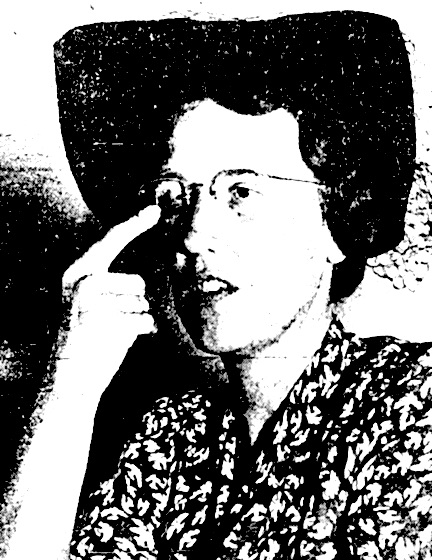
Esther Kmetz. Los Angeles Times, Oct. 17, 1941, Page 1-A. (Credit: Los Angeles Times archival database)

Albertson, 43, was an unemployed blacksmith who also served as a Seventh Day Adventist church elder. (John Kmetz also was a Seventh Day Adventist.) He and his wife first met Esther in 1935, and she began staying in a trailer near their tent house in San Pedro in 1938.

Police immediately began investigating the case, and their attention focused intently on Oscar Albertson. They suspected that he was in love with Esther Kmetz, and jealous of her new husband, though they had no concrete evidence that this was true.

After hours of questioning at a police inquest into the murder, Albertson was arrested for murder on Oct. 30, 1941. His first trial began on April 13, 1942.

Investigators traced the phony Herb Specialty Co. letterhead to a Santa Monica print shop, but could not pin down who exactly placed the order. Nor could they find any record that Albertson had purchased cyanide. 

They determined that the box in which the fatal pills came had been crudely fashioned from a vitamin pill box similar to one which Albertson had given Mrs. Kmetz in San Pedro during the summer of 1941, but could not directly prove that that exact box had been used to house the deadly pills.

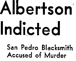
San Pedro News Pilot headline, Oct. 20, 1941, Page 1. (Credit: San Pedro News Pilot archives)

Much of their case arose from an incident that occurred a couple of weeks after John and Esther’s marriage, during which he was attacked by a man wielding an ax handle. He suffered no serious injuries. A patrol car later chased a speeding car nearby, which was found empty, except for clothes and possessions belonging to Oscar Albertson. 

Albertson was located three miles away in his underwear. He was never charged. Police later concluded that the poison pills were Albertson’s second attempt.

Two members of the jury disagreed and refused to vote for his conviction, and the trial ended with a 10-2 hung jury on May 30. The dissenting jurors felt the entire case hinged on circumstantial evidence which could not be proved, and that Albertson had no motive to commit the crime.

Undaunted, prosecutors immediately scheduled a new trial for Albertson to begin in July. Shortly after the trial began, they disclosed that Esther Kmetz had disappeared sometime following her last court appearance on June 1. They were unable to locate her. Ever, as it turned out; she was never found.

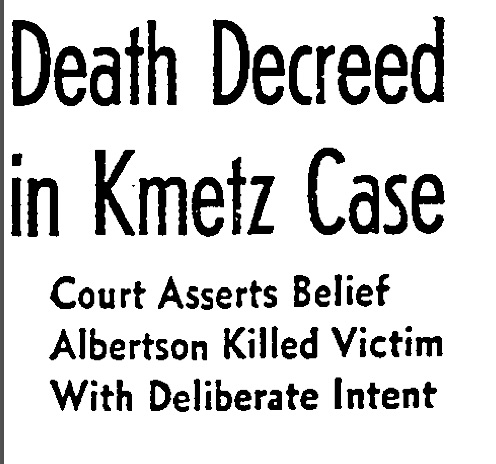
Los Angeles Times, Aug. 13, 1942, Page A-1. (Credit: Los Angeles Times archival database)

The second trial didn’t go well for Albertson. On Aug. 6, 1942, he was convicted of murder and sentenced to die in the gas chamber. His lawyers launched an immediate appeal. It wound through the courts until Jan. 19, 1944, when the California State Supreme Court voted 4-3 to overturn Albertson’s conviction. The grounds: insufficient evidence.

Albertson finally was released after more than two and a half years in custody on June 14, 1944. He had been incarcerated on death row at San Quentin for more than a year. His wife Eva died in 1949, but Albertson survived the trial and lived until 1983. He was living in Chino at the time of his death, and is buried in Inglewood Park Cemetery.

In retrospect, it’s curious that investigators never pursued the idea of Mrs. Kmetz as a possible suspect in the case, either before or during the Albertson trials. 

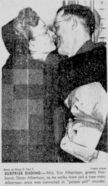
Los Angeles Times, June 15, 1944, Page 3. (Credit: Los Angeles Times archival database)

Her June 1942 disappearance also is hard to explain. She may have been freer to pull her vanishing act after the judge in the case removed her husband’s two children, Lola and her 16-year-old brother Raymond, from Mrs. Kmetz’s custody in January 1942 because of the trial. They were sent off to live with her late husband’s aunt in Norwalk, who had made the custody request.

According to the San Pedro News Pilot, the judge said that it had been revealed to him in closed chambers that the Kmetz household was “jittery, and there is constant fear.” Mrs. Kmetz volunteered to give each child one third of Kmetz’s modest $2,500 estate and keep the rest herself. She disappeared for good less than five months later.

The case was never reopened after Oscar Albertson was freed in 1944.

Sources:

Find a Grave website.

Los Angeles Times archives.

“Murder in the Mail – Podcast #80,” by Steve Silverman, Useless Information: Fascinating True Stories From the Flip Side of History blog, March 6, 2015.

“People vs. Albertson,” Justia US Law website.

San Pedro News Pilot archives.

Torrance’s founder envisioned the city as a home for both factories and their workers

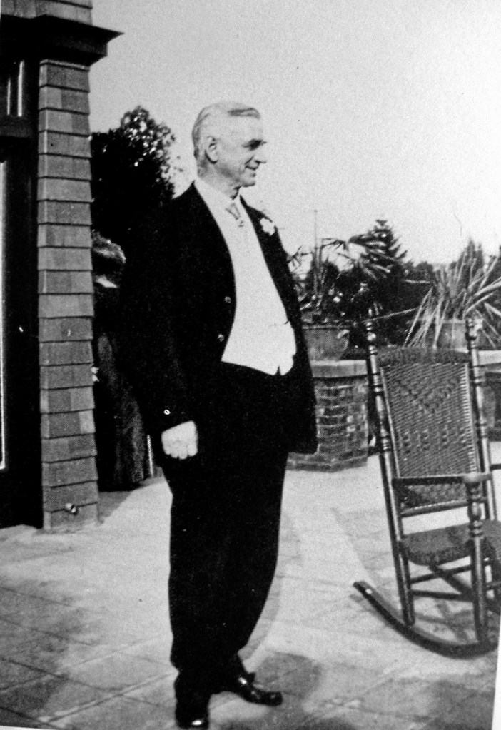
Jared Sidney Torrance at his South Pasadena home on Christmas Day, 1912. (Credit: Pasadena Star-News)

It might sound surprising to some that Jared Sidney Torrance never lived in the South Bay city that bears his name.

But Torrance, who was 59 when he founded the city in 1911, had no need to move there. He already was a wealthy businessman who lived in a mansion in Pasadena at the time.

He was born on Aug. 3, 1852, in Gowanda, New York, a small town south of Buffalo in the western part of the state. His father, Cyrenius, served as District Attorney for Erie County. He also was a businessman, owning grain and lumber mills.

Jared was one of six children, only three of whom lived to adulthood. Cyrenius himself died in 1888 after a long battle with tuberculosis. (His son would go on to donate to tuberculosis hospitals and sanitariums during his life.)

As a young man, Jared learned accounting and bookkeeping while working for his father. During his somewhat nomadic teenage years, he ran away from home at age 15, and got a job keeping the books for a Chicago firm that sold stoves.

He returned home after three years and attended Yale, graduating in 1875. He worked briefly as a law clerk in Chicago at his father’s urging. He later wrote in his unpublished 1916  autobiography, “I was glad, also, to quit the law, as I found the task of fighting out other people’s quarrels very distasteful.”

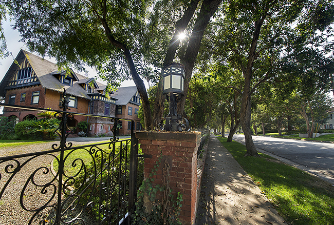
Built in 1902, Jared Sidney Torrance’s mansion at 929 S. Buena Vista St. in South Pasadena still stands. 2012 photo. (San Gabriel Valley News staff file photo by Walt Mancini)

He spent the next three years working as a tutor for the children of a wealthy German couple in Prussia before returning to Gowanda. Now nearly 30, he helped organize the Bank of Gowanda and a couple of other local banks. He was active in the community, but the lure of the West still enticed him.

He and his brother Lewis moved to California in 1887. They formed a real estate partnership and eventually settled in South Pasadena. He then left his brother’s firm and joined with W.D. McGilvray to form a new real estate firm. McGilvary and Torrance went on to make a small fortune selling property in the well-to-do suburb of Altadena, just north of Pasadena.

He married Annie Laurie Fowler in 1889, and the couple had two children. Sadly, one died at six months, and the other died in a Pasadena elevator accident at age eight. Four years later, Torrance’s wife also died.

Torrance also pursued a variety of other business interests. He became a founding member of the Los Angeles Stock Exchange when it opened in 1899. In the late 1890s, he established a relationship with the Union Oil Co. that would last for the rest of his life.

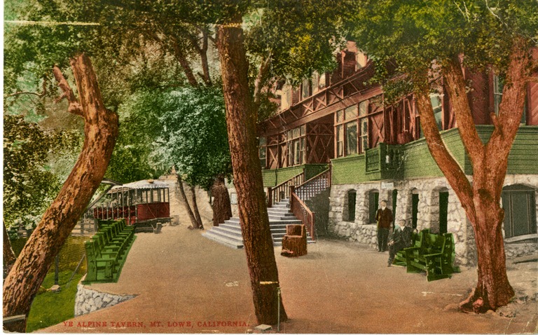
One of Jared Sidney Torrance’s many business ventures included the revamping of the once-posh Pasadena & Mt. Lowe Railway, which he assumed control of in 1897. He changed the resort’s focus from a playground for the rich to an affordable outing for middle class families. He sold the highly successful venture in 1899. Undated postcard shows the Alpine Tavern atop Mt. Lowe.

He became a vice president with Union Oil, and was on the board of directors of several related firms. These included the oilfield equipment manufacturing firm Union Tool Co., a connection that ultimately led to the founding of the city of Torrance.

The price of commercial land in Los Angeles had risen steeply in the early 1900s as the booming city was becoming a metropolis. Union Tool was looking to expand its Los Angeles plant, and Torrance the real estate man began looking to acquire cheaper land that was located closer to the new Port of Los Angeles in San Pedro.

He acquired 3,500 acres of land from the Dominguez family in two separate transactions totalling $1.53 million. Together with Pasadena banker John Cravens and banker Joseph Sartori, he formed the Dominguez Land Co.

Dominguez Land Co. sold the Union Tool Co. 25 acres, on which the manufacturing firm built an $800,000 plant. Torrance’s industrial development had begun.

Before founding the settlement in 1911, Jared Sidney Torrance had formulated a vision for the new city. It would combine large factories and industrial plants with affordable housing nearby for the workers who would staff the plants. He hired famed landscape architect Frederick Law Olmstead Jr. of Boston to lay out the details.

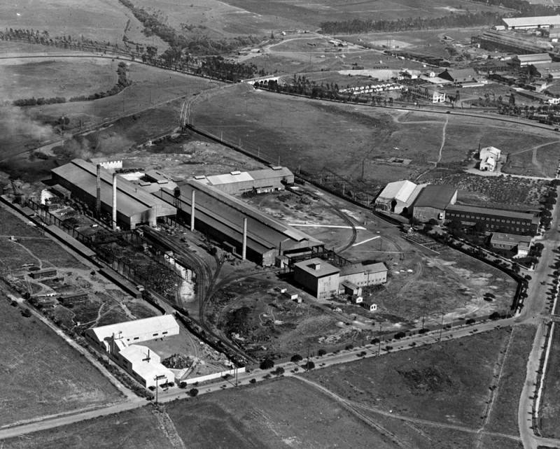
Undated photo circa early 1920s shows several industrial buildings in Torrance, including the Union Tool Co. (in foreground), Pacific Metal products (upper right in picture), and Hendricks Tin Co. (to right of viaduct). (Credit: Los Angeles Public Library Photo Collection)

The industries were located on the eastern end of town, with residential areas to the west. The prevailing onshore winds, the “daily breeze” if you will, would carry the byproducts of industry from factory smokestacks and workyards further east, away from the residents of the town. 

The Dominguez Land Co. made the founding of Torrance official with a declaration issued on Oct. 24, 1912. It spelled out the provisions of the planned town: the areas for businesses, homes and heavy industry were carefully defined, liquor was banned, and, regretfully, non-Caucasians were banned from buying homes. Curiously, cemeteries also were banned, a restriction that remains to this day.

A raft of companies flocked to the new settlement, including the Llewellyn Iron Works, the Hendrie Rubber Company, Pacific Metal Products and a variety of others. In addition, Torrance convinced the Pacific Electric Railway company to locate its huge maintenance facility in the city.

In 1914, Jared remarried, this time to Helena Childs of San Francisco. She became a major force in establishing Torrance Memorial Hospital after her husband’s death on March 29, 1921. Jared Sidney Torrance died from pneumonia just three weeks before the April 19, 1921 election that overwhelmingly approved the city’s official incorporation. He was 68.

His will contained provisions not only for family members, but also for funding the new hospital and for the establishment of the Torrance Public Library. He was cremated, and his ashes buried next to the graves of his wife and two children in his home town of Gowanda, New York.

In 1984, the city of Torrance established its highest citizen honor, the Jared Sidney Torrance Award, for exceptional and sustained public service to the city. A list of award winners can be viewed on the city’s website.
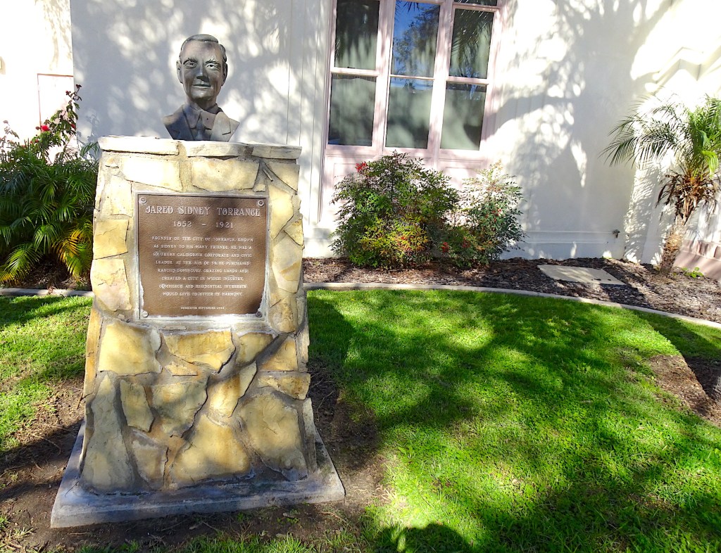
The city’s monument to founder Jared Sidney Torrance is located in front of the Torrance Historical Society building near the corner of Post and Cravens avenues in downtown Torrance. (January 2023 photo by Sam Gnerre)

Sources:

“Autobiography” by Jared Sidney Torrance, unpublished manuscript, 1916.

 Daily Breeze archives.

Historic Torrance: A Pictorial History of Torrance, California, by Dennis F. Shanahan and Charles Elliott, Jr., Legends Press, 1984.

History of Torrance: A Teacher’s Resource Guide, Torrance Unified School District, 1964. 

Los Angeles Herald archives.

Los Angeles Times archives.

San Pedro News Pilot archives.

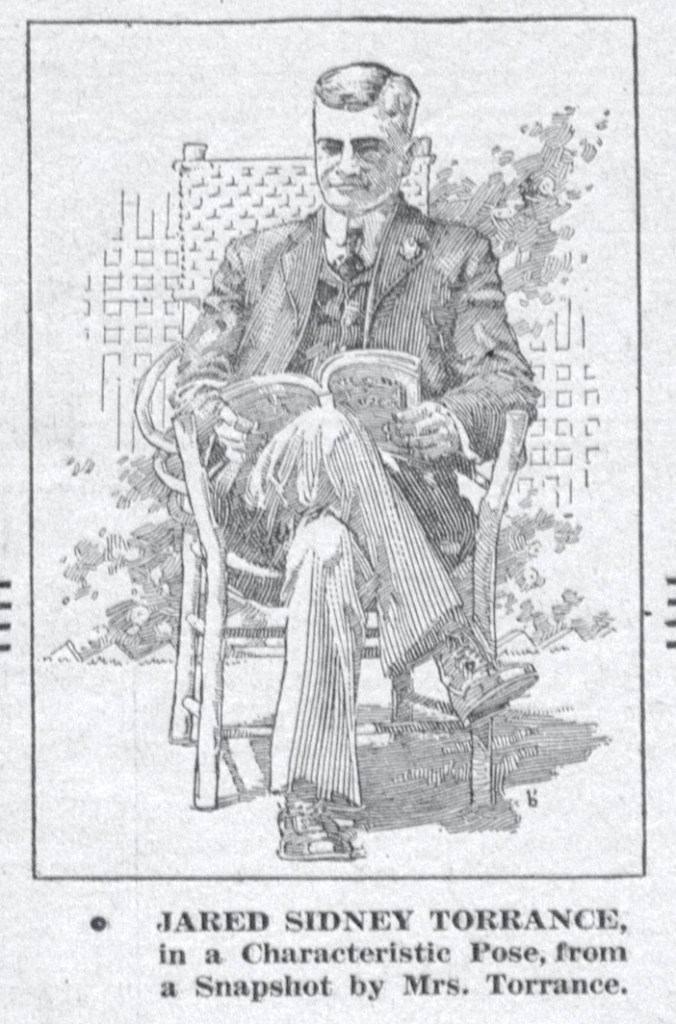
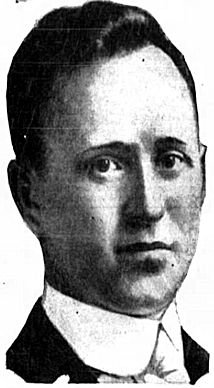
Drawing of Jared Sidney Torrance from the Torrance Herald special edition of June 25, 1936. (Credit: Torrance Historical Newspaper and Directories Archive database, Torrance Public Library)

That fancy “new”  international terminal at LAX is nearing its 40th birthday

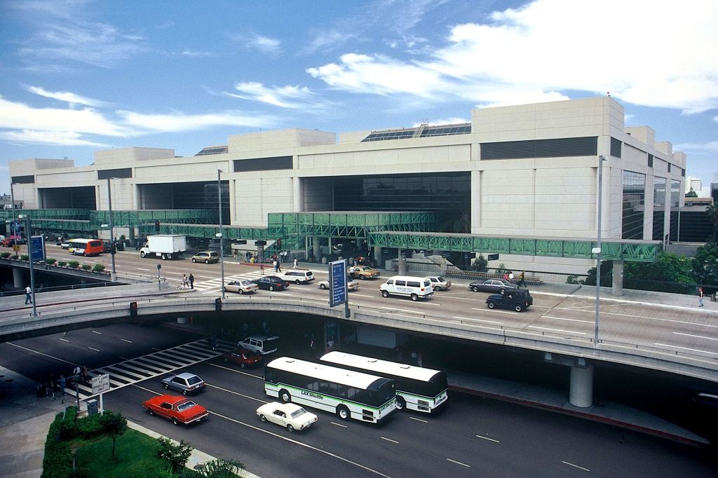
The original Tom Bradley International Terminal opened in June 1984. Undated photo. (Credit: LAX Facebook page)

At 1:47 p.m. on June 18, 1984, El Al Airlines Flight 6 to Tel Aviv by way of Chicago and Amsterdam left Gate 101 to become the first plane to use the new $123 million Tom Bradley International Terminal (TBIT) at Los Angeles International Airport.

Necessity forced the new building’s creation. International flights originally used Terminal 2 at LAX, which was built in 1962. (LAX opened in 1949.) In those days, there were smaller planes and far fewer international flights.

The arrival of jumbo jets such as the Boeing 747 at the dawn of the 1970s changed the equation. Larger jets meant more people flying longer distances needed to be accommodated at the airport. In 1962, 267,000 passengers flew internationally from LAX; by 1977, that number had reached 3.3 million.

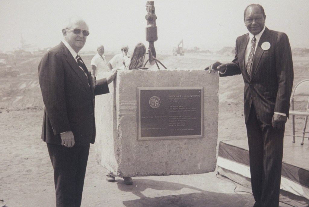
LAX Executive Director Clifton Moore, left, and Los Angeles Mayor Tom Bradley pose with cornerstone at the 1982 groundbreaking for the building that would be named the Tom Bradley International Terminal. (Credit: Flight Path Museum LAX website)

Terminal 2 had grown completely inadequate. Its customs facility, built in 1960, was half as large as needed, and incoming international passengers often had to wait on airplanes for an hour or more after they landed because of the backup at customs.

In 1978, both temporary and permanent solutions were proposed by the Los Angeles Dept. of Airports (now known as LAWA,  Los Angeles World Airports). The temporary solution: three giant inflatable “bubble buildings” installed next to Terminal 2 to help ease crowding and speed processing of international travelers.

The permanent solution: the construction of a new large international terminal at the airport concourse’s western end, where smaller local airlines operated at the time.

Those measures became just part of a major airport upgrade needed not only to bring the facility into the modern era, but also to do so in time for the 1984 Summer Olympics, which the city had been awarded in 1978.

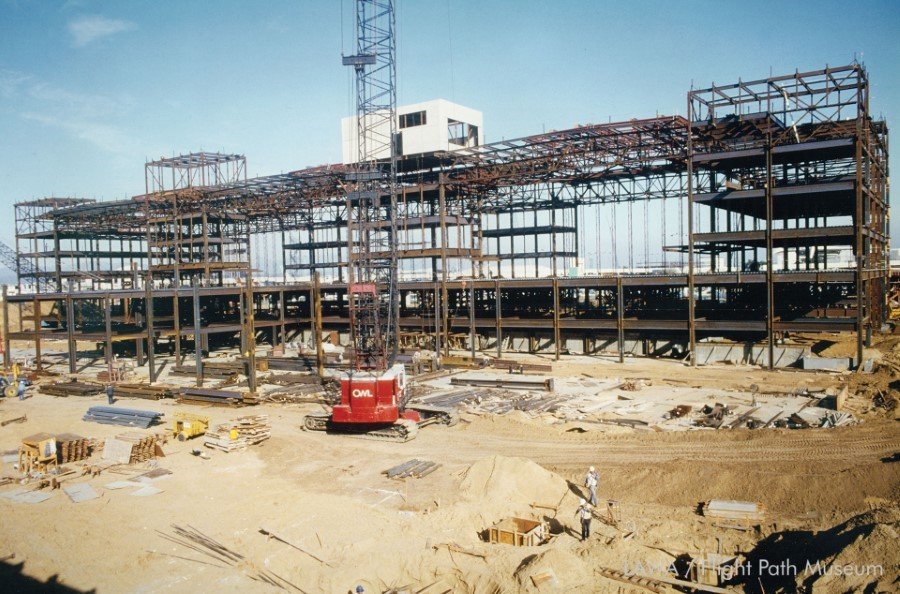
The new LAX international terminal under construction. Circa 1983 photo. (Credit: Flight Path Museum LAX website)

The $700 million plan included the addition of a new Terminal 1 to handle shorter flights, the  construction of an upper level to the roadway connecting auto traffic to the terminals and the addition of three multilevel parking garages to the interior of the airport loop. Airport officials had been planning the project since 1971.

Architects William Pereira, Daniel Dworsky, Benito Sinclair and John D. Williams teamed up to design the new facility. Mayor Tom Bradley, who served from 1973 to 1993, was an enthusiastic supporter of the renovation, hence the decision to name the international terminal after him in March 1984.

The building’s plans called for 858,000 square feet of floor space on five levels, with natural lighting from a 60,000-square-foot skylight, and would have the ability to accommodate as many as 7,000 passengers during peak hours.

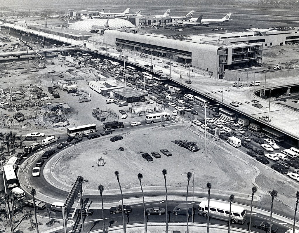
The Tom Bradley International Terminal under construction in 1983, top right. (Daily Breeze file photo)

Construction on the terminal began in the spring of 1982, with completion expected to take two years. The anticipated spring 1984 opening would be well in time for the Olympics, which were set to begin on July 28, 1984. On the down side, building double-decked roads, parking garages and two new terminals all  at the same time snarled traffic at the airport beyond belief for the next couple of years.

As the 1984 deadline approached, concern began to grow that the terminal might not be completed in time. A May 26 deadline had been set early in the year, but labor disputes and unexpected construction glitches caused some doubts.

Fortunately, a last-minute effort pushed the TBIT project over the finish line in early June, and its dedication was held on June 11, 1984. The ceremony signaled the end of the massive LAX renovations, and airport operations went smoothly during Summer Olympics.

Between then and now, the TBIT has undergone several major renovations of its own. In fact, the Airport Board of Commissioners approved not just a renovation, but a complete rebuild of the existing terminal in 2009.

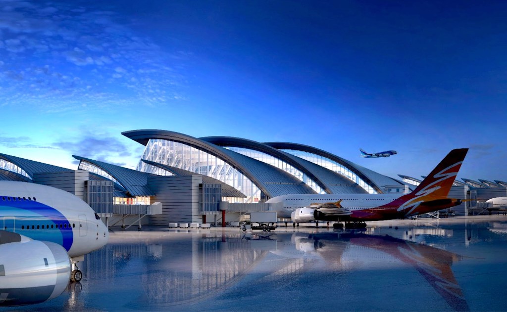
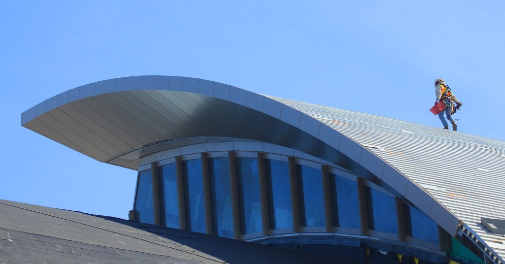
Undated post-2013 photo shows the current iteration of the Tom Bradley International Terminal. Its curving roofs are meant to evoke ocean waves.(Credit: LAWA)

The first portion of the newly rebuilt terminal, which cost just under $2 billion, opened in September 2013, with the second phase being completed in 2015. The updated terminal included expanded eateries and upscale shopping areas. Its huge main hall was named Villaraigosa Hall, after Antonio Villaraigosa, the city’s mayor from 2005-2013.

A related project finished in 2016, the construction of an indoor passageway structure between TBIT and Terminals 4-8 on the airport’s south side. A similar structure connecting TBIT to Terminals 1-3 on the airport’s north side is expected to be completed in late 2023. Both will improve the ease of passenger connections between domestic and international flights.

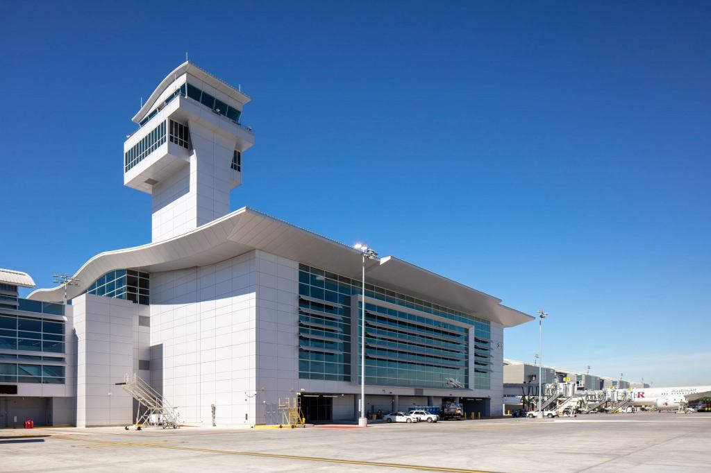
The West Gates Complex connects to the Tom Bradley International Terminal via tunnel. 2021 photo. (Credit: Los Angeles International Airport)

The next phase of TBIT enhancements includes the construction of additional gates. The first such building, the West Gates Complex, opened in May 2021 and added 15 new airplane gates, and additional shopping and eating options. The structure, also known as the Midfield Satellite Concourse,  connects to the main TBIT via a 1,000-foot underground tunnel with moving walkways.

The Midfield Satellite Concourse South is yet another extension of the TBIT that is still under construction, with completion expected in 2025. It will add an additional eight gates for international flights.

Soaring wave-like rooflines under construction at the Tom Bradley International Terminal in 2012. (Daily Breeze staff file photo by Brad Graverson)

Sources:

Daily Breeze archives.

LAWA (Los Angeles World Airports) website.
“LAX and the Buildup to the 1984 Olympics,” by Jean-Christophe Dick, Flight Path Museum LAX website, July 22, 2021.

“LAX Midfield Satellite Concourse South project takes a step forward,” by Steven Sharp, Urbanize Los Angeles website, Nov. 9, 2022.

Los Angeles Times archives.

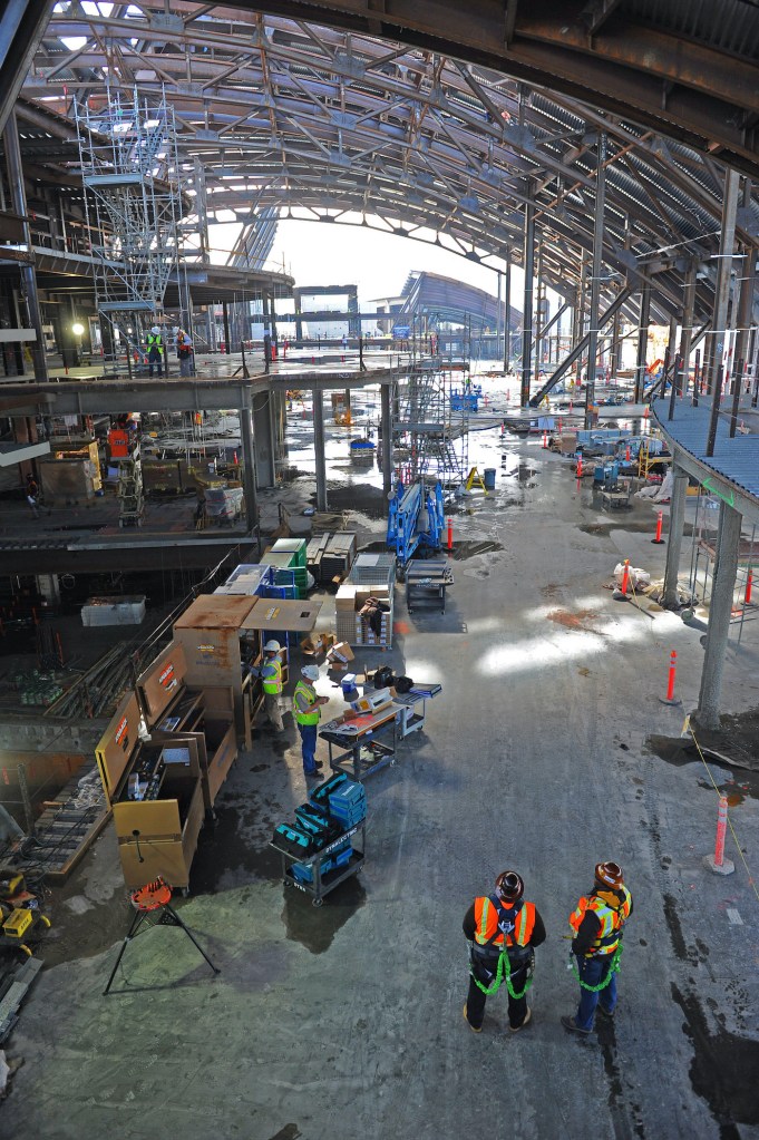
The central hall at the Tom Bradley International Terminal under construction. January 2012. (Daily Breeze staff file photo by Brad Graverson)

Tragic 1924 fire at Hope Development School in Playa del Rey led to reforms

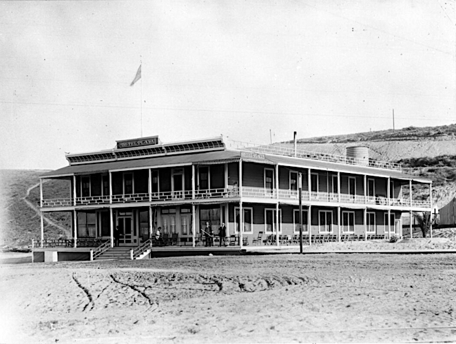
Circa 1905 exterior view of the Del Rey Hotel, then known as the Hotel Playa, in Playa del Rey. (Credit: USC Digital Library)

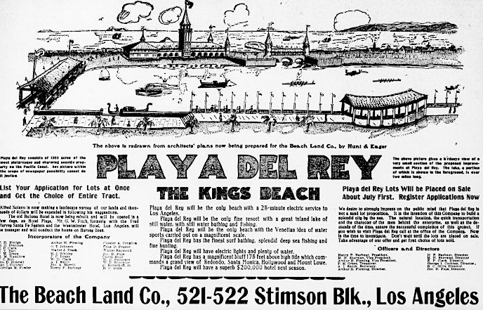
Developer Henry Barbour and his partners in the Beach Land Co. had high hopes for the area they named Playa del Rey (“the King’s Beach”) when he declared it open to prospective lot buyers on July 16, 1902.

The company wanted to build a full-fledged resort there, based around the arrival of the Pacific Electric Railway “red car” system that eventually would link all the beach cities from Venice to Manhattan Beach.

The plans included a resort hotel, a casino and a grand pavilion with a restaurant, bowling alley and large dance floor, all built around Del Rey Lagoon.

The Del Rey Hotel, as it eventually became known, opened in August 1904 as the Hotel Playa. The two-story, 40-room wooden structure that was built turned out to be much less grand, and successful,  than originally planned. Its builder/owner George Cook of Redlands sold it in 1905.

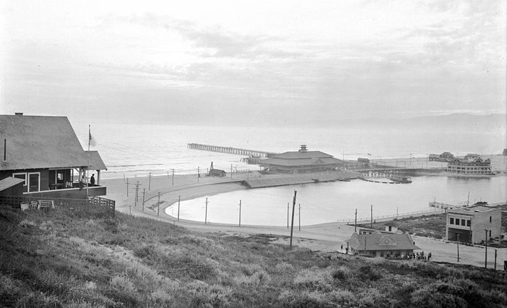
The Playa del Rey lagoon, with the Del Rey Hotel, upper right, Playa Del Rey Pavilion, center, and pier, in 1908. (Daily Breeze file photo)

The hotel had a checkered history in the ensuing years. In 1914, it became the Billows Hotel and Cafe. Under the management of Emma Shandley, the Billows became a house of prostitution. It was shuttered after an October 1917 raid and abandoned.

Starting in 1920, the now-dilapidated structure served briefly as low-cost housing for working women who couldn’t afford to rent elsewhere.

That arrangement was short-lived. In the early 1920s, Ione Conant leased the aging building  to house her new Hope Development School, a care facility for developmentally disabled young women. In April 1924, Conant gave over operation of the school to Mary E. Jacobs.

The Los Angeles County Welfare Commission gave Jacobs a temporary permit to run the school. They had qualms about the building’s safety, but could find no other place in the community willing to house its 38 young occupants.

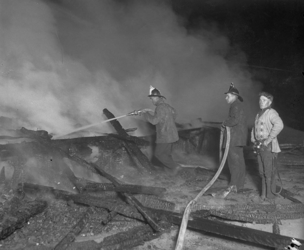
Firefighters douse the embers of the Hope Development School in Playa Del Rey on May 31, 1924. (Credit: UCLA Library, Dept. of Special Collections)

On May 31, 1924, Jacobs left the home to go consult with a judge in downtown Los Angeles. The lease on the hotel building had expired the day before, which meant her permit to run the school also had run out. She told the judge that she was actively seeking a new location.

She had left the school in the hands of her assistants, head matron Mrs. Drew Thomas and her assistant, Mrs. Anna Rodemaker. According to the Los Angeles Times account, it was Mrs. Rodemaker who first smelled smoke while knitting in her first-floor room shortly before 9 p.m. after all the students had been put to bed.

The room quickly filled with smoke, and she heard Mrs. Thomas call out from upstairs. Outside, two passersby spotted the burning building. Sylvester Vogel tried to summon help by blowing on a whistle. When none came, he jumped in his car and sped toward the nearest fire department in Venice.

Walter Curtis, a father of four young girls, raced toward the building and entered it. He attempted to save as many victims as he could, including, again according to the Times, a baby that he tossed out the window from the blaze that was caught by a couple outside that had come to the site of the fire.

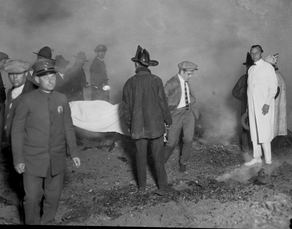
Rescue workers carry the covered remains of a victim of the fire at the Hope Development School for mentally disabled girls in Playa del Rey on May 31, 1924. (Credit: UCLA Library, Dept. of Special Collections)

There were no fire escapes on the wooden building, and Mr. Curtis’ rescue efforts ended when the wooden stairway he was using collapsed beneath him. (He survived.) By now, the fire department had arrived, but they could not keep the fire from burning the former hotel to the ground in front of  hundreds of spectators who’d gathered to watch.

Over the next few days, the magnitude of the disaster became clearer as 23 victims were identified. In addition to Mrs. Thomas, 22 of the school’s attendees had perished in the flames. A memorial grave marker for ten of the victims still can be seen at Inglewood Park Cemetery.

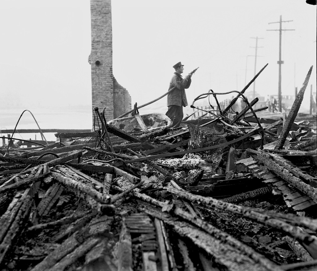
Charred remains of the Hope Development School in Playa del Rey. June 1, 1924 (Credit: UCLA Library, Dept. of Special Collections)

In addition to the lack of fire escapes and non-flammable stairs, the building had no alarm system or interior warning lights leading to escape routes. Nor did it have any working fire extinguishers. In its dilapidated state, it was a tinderbox, and its isolated location left it even more vulnerable.

It was also reported that several minor fires had occurred at the home  in the months leading up to the blaze. They were quickly extinguished at the time.

Two weeks after the blaze, 16-year-old Josephine Barthelemy, a resident at the school, admitted to setting it. She had gotten a hold of a match and, after everyone was put to bed, snuck down to the basement and lit a pile of kindling wood afire before returning to her room.

Barthelemy didn’t have the mental acuity to realize the gravity of her actions. She hoped that the resulting fire would free those at the school, which she hated. She later expressed regret that some of her fellow students had died. Because of her mental state, she was unable to be  prosecuted.

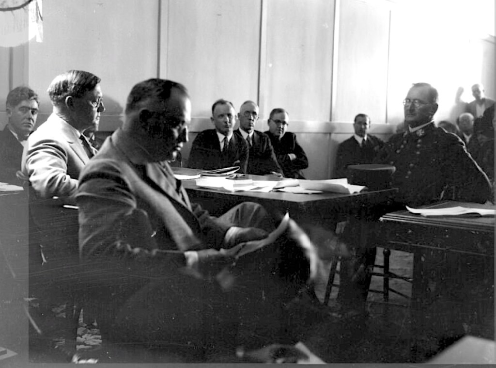
Coroner Frank Nance holds an inquest into the fire that destroyed the Hope Development School and killed twenty-three girls. Nance is seated at a table (2nd from left) in a light-colored suit. June 1924 photo. (Credit: UCLA Library, Dept. of Special Collections)

The fire sent shock waves through the city. A grand jury inquiry quickly convened and concluded that Hope Development, and several other similar small facilities it had investigated, needed to conform to stricter safety standards. It also urged that a larger care facility be established near Pomona to care for children similar to those who had perished.

Barthelemy was among the first admitted to the new Pacific Colony facility there, which opened in 1927. It evolved into the Frank D. Lanterman State Hospital and Developmental Center in Pomona, which served the needs of the developmentally disabled until its closure in 2015.

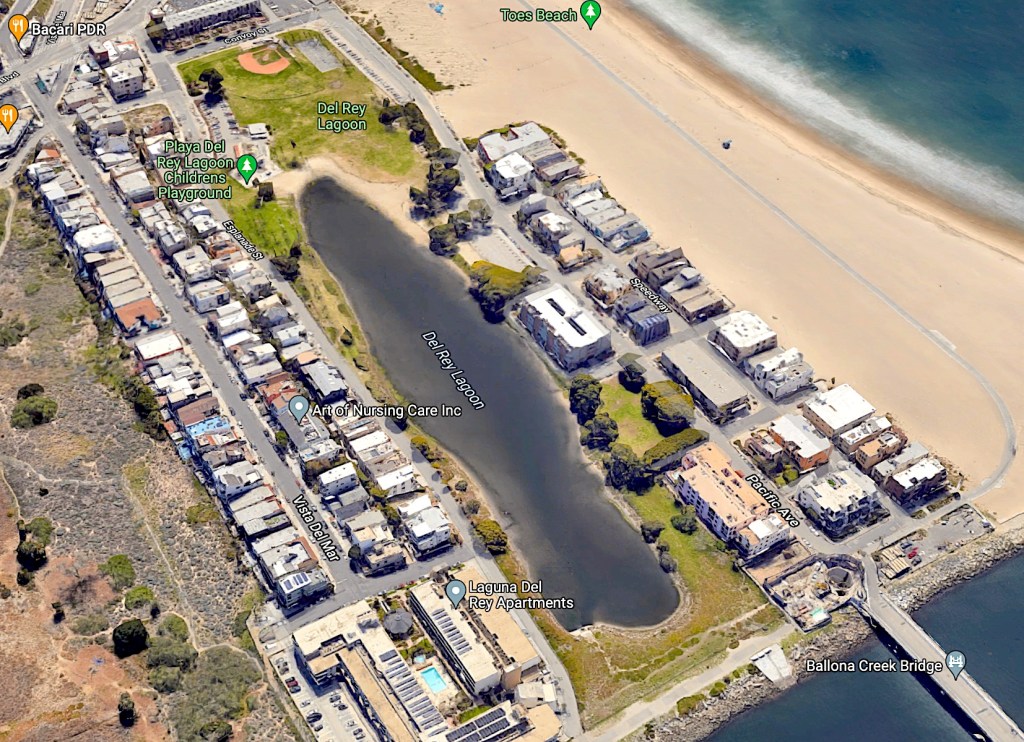
As for the one-time wannabe resort at Del Rey Lagoon, all signs of its ambitious past have disappeared, leaving just the lagoon itself, ringed by its surrounding multimillion-dollar homes.

View of Del Rey Lagoon looking south from Ballona Creek, lower right. 2022 image. (Credit: Google Earth)

Sources:

Daily Breeze archives.

Los Angeles Herald archives.

Los Angeles Times archives.

“Through the Viewfinder at the Playa del Rey Lagoon, Los Angeles, ca. 1904,” by Paul R. Spitzzeri, The Homestead Blog, Dec. 18, 2022.

“Victims of the Hope Development School fire,” Grave Spotlight blog.

Zillow.com.

Los Angeles Herald ad, June 22, 1902, Page 10. (Credit: Los Angeles Herald archives)

Exotic journeys start from the World Cruise Center at the Port of Los Angeles

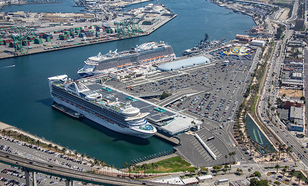
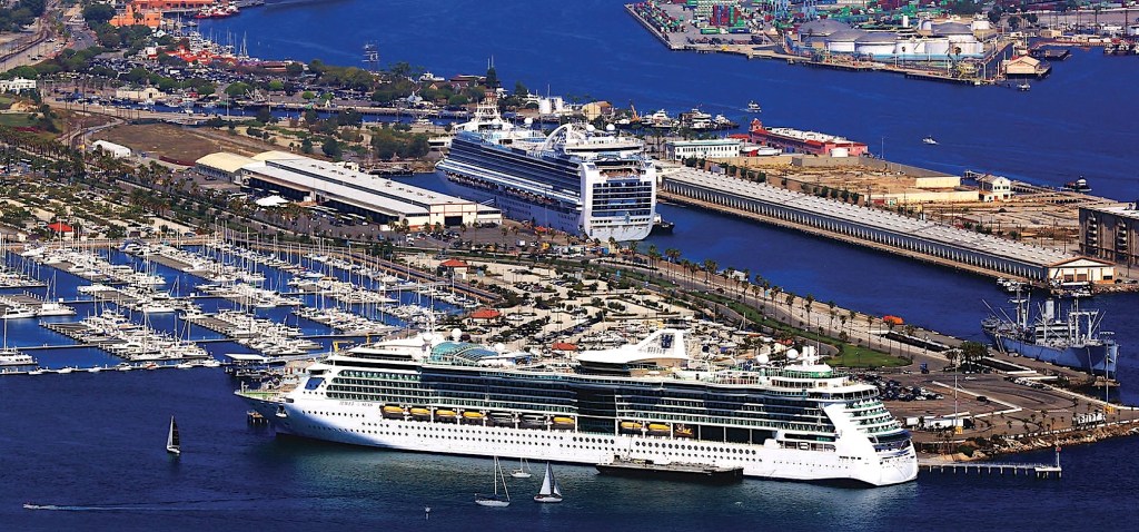
The World Cruise Center at Berths 91-93 in the Port of Los Angeles. The original terminal is the long building in foreground, with the 1988 terminal building to its right, rear. The blue building is a cargo facility. Undated photo. ((Credit: Waterfront Los Angeles website)

The World Cruise Center at the Port of Los Angeles is a sprawling, three-building complex near the western base of the Vincent Thomas Bridge that accommodates massive cruise ships that travel the world.

Its traffic is such that the Port is attempting to build an additional cruise ship berth in the Outer Harbor to handle the overflow and to serve larger ships.

Los Angeles Harbor has always had a pleasure cruise trade since the early 1900s, when ships carried passengers to Catalina Island. Completed in 1920, the Catalina Terminal on Water St. in Wilmington was one of the first facilities built specifically for tourist travel.

That same year, the Los Angeles Steamship Co. was founded, initially to offer passenger cruises from Los Angeles to San Francisco on its ships, the Yale and the Harvard, based at Berth 155. In 1922, the company began passenger service to Honolulu on its City of Los Angeles steamship.

Individual cruise line companies continued to operate from various berths at the Port, but there was no centralized passenger terminal.

By the 1940s, American President Lines had established one of the Port’s largest cruise passenger operations at Berths 153 and 154 on Mormon Island. But on June 22, 1947, the tanker ship Markay exploded while taking on fuel at the Shell Oil terminal at Berth 167 across the channel. Flaming fuel from the exploding ship raced across the 600-foot wide waterway to the APL terminal buildings, which were destroyed.

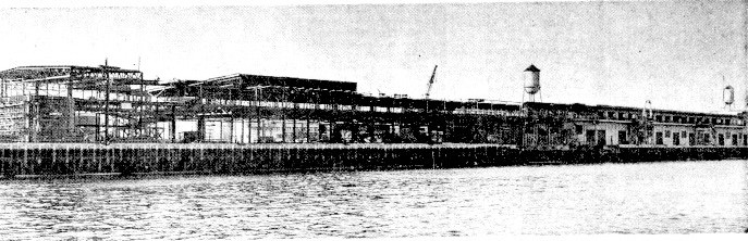
The new APL terminal at Berth 167 under construction in 1950. It was built to replace the facility destroyed in the 1947 Markay explosion and fire. San Pedro News Pilot, Jan. 5, 1950, Page 1. (Credit: San Pedro News Pilot archives)

APL responded by building a new $4.3 million terminal on the eight-acre site of the former one. The state-of-the-art buildings opened in 1950 and included the largest passenger/cargo terminal in the harbor.

APL’s terminal served the cruise lines for the next decade, but in 1958, the Port decided the time finally had come to build a central cruise ship terminal complex. The new $16 million complex would be constructed on a 50-acre site at Berths 91–93 on the main channel just south of the Vincent Thomas Bridge.

The gigantic main terminal was dedicated in March 1963, eight months before the opening of the bridge. The Port of Los Angeles owned the facility, but management and operations would be conducted by Consolidated Marine, a consortium of cruise ship operators, including APL and Pacific Far East Line.

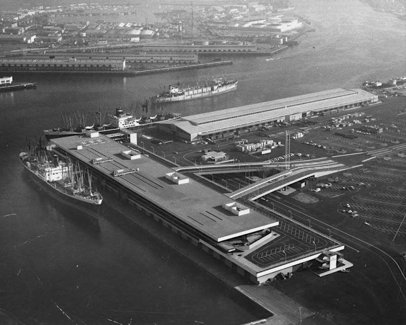
The Port of Los Angeles’ then-new combination passenger-cargo terminal occupies a 50-acre site on the harbor’s main channel in this March 19, 1963 photo. The building has cargo facilities on the first floor and passenger accomodations on the second level, reached by ramps, elevators, stairways and escalators. A second structure in the complex, seen in background, is a 1008 x 200 foot cargo shed, (Credit: Los Angeles Public Library Photo Collection)

The rectangular $4.3 million two-story building at 100 Swinford St. devoted its upper level for cruise travel operations, and its lower level for cargo. A spectators gallery was built on the upper level, along with two vehicle bridges up from ground level. The Berth 93 structure was remodeled and expanded in 2002.

The construction of the separate Catalina Sea and Air Terminal just north of it at Berth 95 in 1966 continued the process of centralizing passenger services in the Port. (Its current building on the site was erected in 2012.)

The 1980s brought about a cruise ship boom, fueled in part by television’s “Love Boat” and the cruise industry’s development of ever-larger and more luxurious ships, which resulted in a 400 percent increase in passengers in Los Angeles between 1979 and 1988.

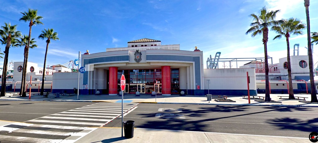
The Port responded by building a new $11 million passenger terminal just south of the original one. It opened on April 29, 1988, with the cruise ship Azure Seas as its first arrival. The new building, dedicated solely to passenger ships, had a friendlier and less industrial feel than its predecessor.

This World Cruise Terminal building opened in 1988. 2022 image. (Credit: Google Earth)

It was built through a cooperative lease agreement involving six companies: Princess Cruises, Admiral Cruise Line, Carnival Cruise Lines, Royal Viking Line, Sitmar Cruises and Cunard Line. (Carnival moved its operations from  the Port of Los Angeles to the Port of Long Beach in 2003.)

As cruise ships continued to grow larger in size, some limitations to the World Cruise Terminal began to appear in the early 2000s. It turns out the 185-foot-high Vincent Thomas Bridge is too low for some of the newer 200-foot-tall-and-higher ships to pass under in order to turn around when they leave port. Larger ships need to exit the area by going backwards, as the Queen Mary 2 had to do in 2006.

Port officials first confirmed that they had been looking at a proposal to create a new passenger terminal at the entrance to the Main Channel in 2003. They’re still discussing building the Outer Harbor Cruise Terminal twenty years later.

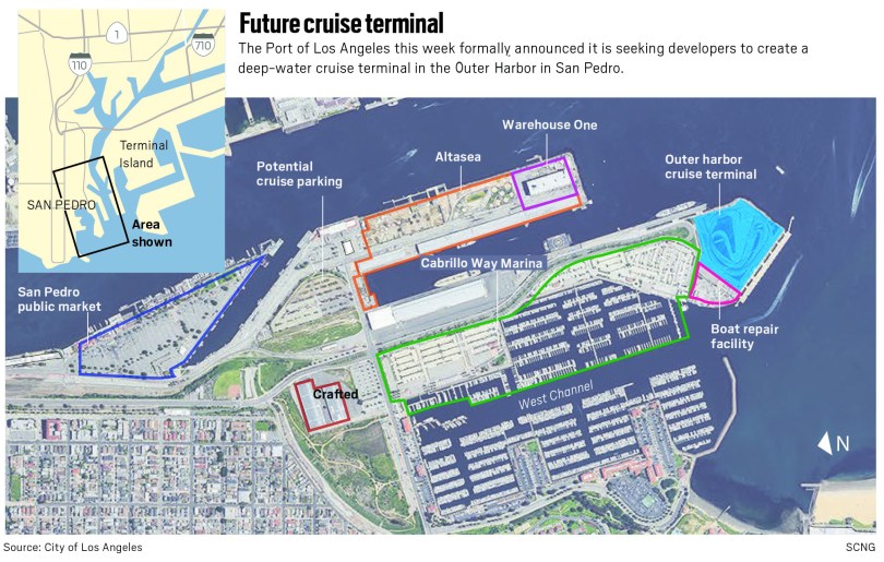
2019 graphic shows the location of the Outer Harbor Cruise Terminal. (Credit: City of Los Angeles)

The 13-acre site encompassing Berths 46 and 50 at 3011 Miner St. sits across the West Channel from Cabrillo Beach and Cabrillo Marina, and some in the community have complained that the giant ships that would moor there would mar the ocean views in the area.

Debate continued until 2020, when the arrival of the COVID-19 pandemic brought a sudden halt to cruise ship operations and further development of the Outer Harbor was tabled for two years.

The Port of Los Angeles still sees the Outer Harbor facility as a key part of its strategy to grow the cruise ship business. The cruise industry’s resumption of operations in 2022 probably will lead to further attempts to make the Port’s Outer Harbor plans a reality.

Undated photo of the proposed Outer Harbor terminal area shows a ship at Berth 46, foreground, and another at Berth 50, rear. (Credit: Port of Los Angeles)

Sources:

“Complete Guide to Cruising from the Ports of Los Angeles and Long Beach,” by Tanner Callais, Cruzely website, Nov. 8, 2021.

Daily Breeze archives.

Los Angeles Times archives.

“Must-Know Things About the Los Angeles Cruise Terminal,” CruiseHive website.
San Pedro News Pilot archives.

Waterfront Los Angeles / Port of Los Angeles website.
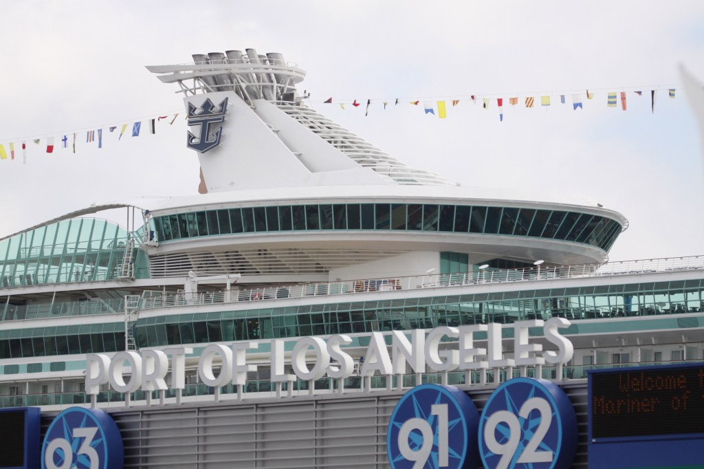
The Mariner of the Seas at the World Cruise Center in the Port of Los Angeles in 2010. (Daily Breeze staff file photo by Chuck Bennett)

The bubbling waters of Centinela Springs attracted early settlers to the Inglewood area

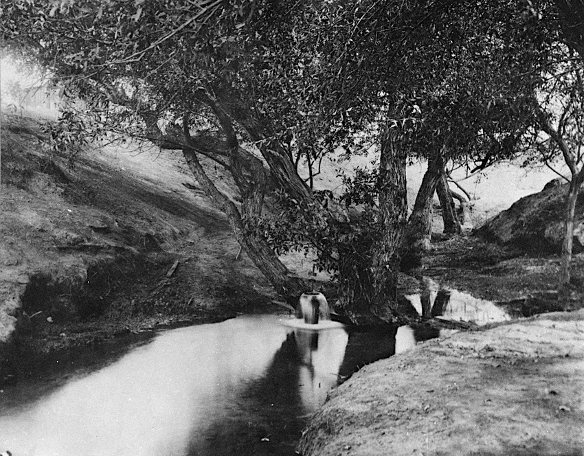
Undated pre-1900 photo of Centinela Springs in Inglewood. (Credit: Huntington Library)

The initial settlement of Inglewood was based on one substance: water. It came from the Centinela Springs, as the artesian springs later would become known. Artesian springs occur naturally when water rises through the surface of the land without the aid of a pump.

Members of the indigenous Gabrielina/Tongva tribe lived in the area before the arrival of Mexican settlers known as pobladores (translation: settlers) in the 1700s. Artifacts from the tribe were found on the land near the springs during the excavation to build the outdoor amphitheater at Centinela Park in the 1930s. (The park was renamed Ed Vincent Park in 1997, after the former Inglewood mayor.)

The pobladores came next, officially establishing a new village on the site on Sept. 12, 1781. The name Centinela comes from the Spanish word for “sentinel.” Some say the “sentinels” were the hills in the area, while others claim the name came from the men who watched over their herds, and the springs themselves, from those hills.

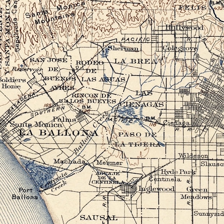
Ballona watershed USGS topographical map from 1900 shows the Aguaje de la Centinela, bottom center, and Centinela Creek running west from it.
(Credit: United States Geological Survey)

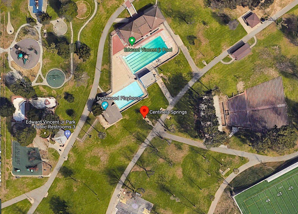
The late Inglewood historian Gladys Waddingham suggested that the springs originally covered a good-sized area of 55-acre Ed Vincent Park, with the largest spring located where the park’s swimming pool now sits. The waters collected into Centinela Creek, which ran west through present-day Westchester and Playa del Rey before emptying into the old Ballona Lagoon, where Marina del Rey now stands.

In the 1830s, Ygnacio Machado decided to build a farm near Centinela Creek, about two miles west of Centinela Springs. He applied for and received a land grant for the 2200-acre Rancho Aguaje de la Centinela (“Sentinel of the Waters”). This chunk of land containing the springs was carved out of Ygnacio Avila’s much-larger Sausal Redondo grant.

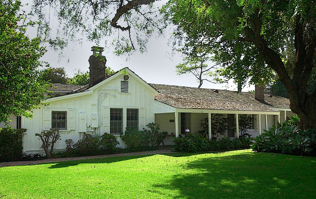
The farmhouse Machado built in 1834 became known as the Centinela Adobe. It still stands as one of the oldest structures in the South Bay, though the Dominguez Adobe in Rancho Dominguez does predate it by eight years.

The Centinela Adobe, built in 1834 by Ygnacio Machado, still stands and now houses the Centinela Valley Historical Society and its museum. It’s located two miles west of the Centinela Springs site. (2008 Daily Breeze file photo by Robert Casillas)

The Centinela Valley Historical Society and its museum currently occupy the Centinela Adobe at 7634 Midfield Ave. Its prior residents included Inglewood founder Daniel Freeman, who lived there before building his own mansion in Inglewood in 1888.

Centinela Springs became even more crucial with the formation of Inglewood, which Freeman founded in 1888. One of his first actions was to have wells dug to draw water from the springs to the new town. 

The move made the town self-reliant. Inglewood had no need to pay for water from outside sources such as the Los Angeles Metropolitan Water District; the springs provided most of the town’s water, and would do so for decades.

The site of the Centinela Springs monuments is marked in red, center. The original springs are thought to have been where the swimming pool now is located. The amphitheater can be seen at right. 2022 image. (Credit: Google Earth)

Inglewood was incorporated as a city in 1908. At the time, the springs were still privately owned. At one point, its owners apparently attempted to sell bottled water from them, going so far as to propose building a viewing area where visitors could see the water’s source up close. The plans never came to fruition.

As the town grew, its residents came to recognize the importance of Centinela Springs, both practically and historically. 

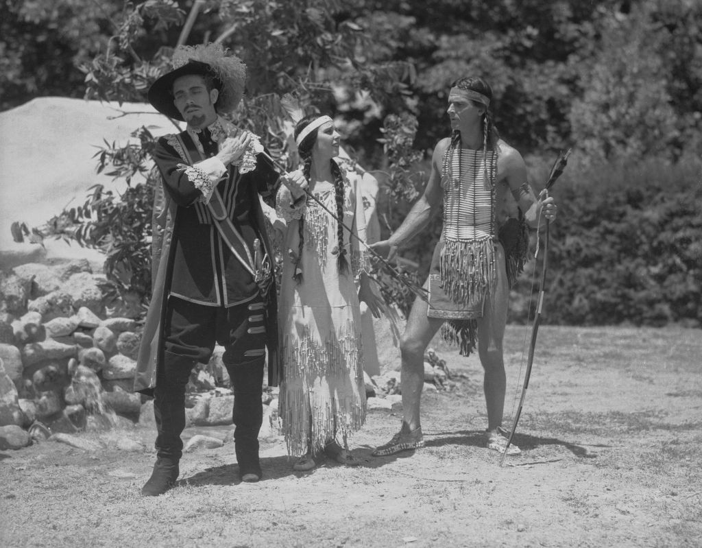
In October 1931, the city celebrated the springs with a new historical production held at the Centinela Park amphitheater. “The Romance of Centinela Springs” was the brainchild of A.E. Chamberlain of the Inglewood Chamber of Commerce, who co-wrote the musical pageant with J.L. Rosenberg.

Cast members Roy Winborn, Bonnie Emerie and Owen Evan rehearse for “The Romance of Centinela Springs” pageant held at Centinela Park in Inglewood. Aug. 12, 1935 photo. (Credit: UCLA Library, Dept. of Special Collections)

The production, a light operetta along the lines of the “Ramona” historical pageant first staged in Hemet in 1923 and still held annually, would become the centerpiece of the Centinela Days civic fiesta and was performed annually throughout the decade.

Paradoxically, as Centinela Springs became more celebrated, the town’s increased population began drawing more and more heavily upon the water source. By the 1930s, the springs no longer were robust enough to bubble to the surface. There still was plenty of water, but, by 1936, it was estimated to be at a level roughly 150 feet below ground.

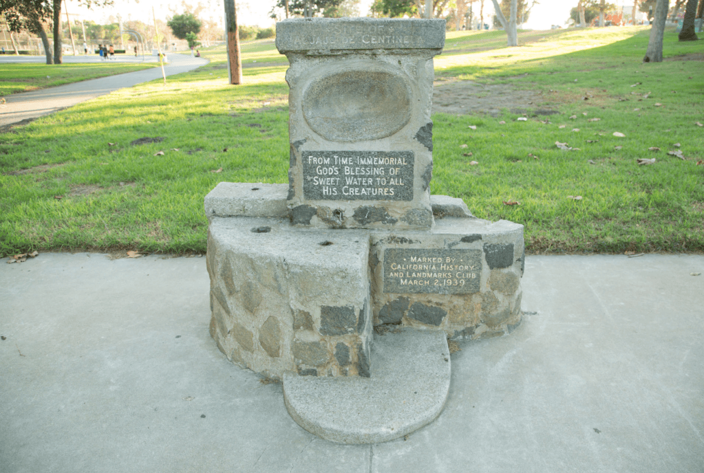
A movement arose to recognize the historic significance of the Centinela Springs site, and a marker was installed at a ceremony in Centinela Park on March 2, 1939. The monument was located a couple hundred feet from the swimming pool built ten years earlier that was thought to be on the site of the original spring.

Archibald Garner’s Centinela Springs monument. Undated photo. (Credit: Inglewood CA Public Art website)

It was designed by Archibald Garner, the same artist who created the “Centinela Springs”  wood carving depiction at the Inglewood Post Office building on Hillcrest Ave. in 1937. The new stone monument’s somewhat cryptic inscription reads, “From time immemorial, God’s blessing of sweet water to all his creatures. Marked by California History and Landmarks Club, March 2, 1939.”

Thirty years later, local historians and the city petitioned the state Department of Parks and Recreation office in Sacramento to grant Centinela Springs official landmark status. The state agreed to do so, designating the site as California Historic Landmark #363 on Oct. 9, 1970. 

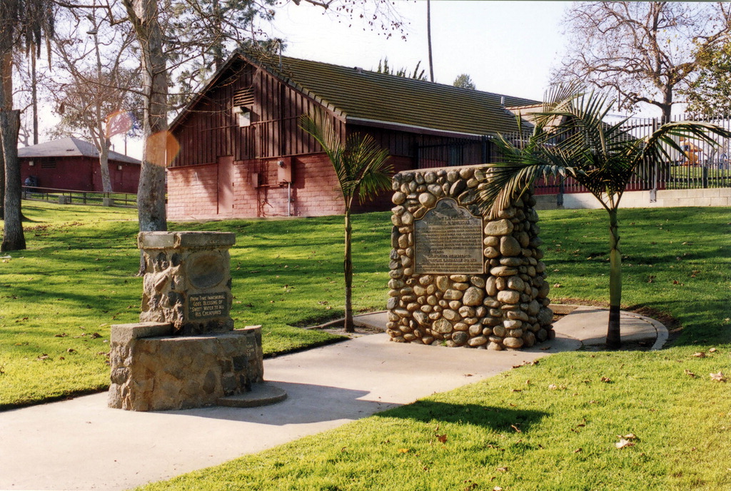
In October 1976, a more descriptive plaque detailing its historic significance was installed in the park, right next to Garner’s.

Inglewood had ceased being able to rely on Centinela Springs for its water independence two decades earlier. In 1949, the city joined the Metropolitan Water District of Southern California and the West Basin Water Association at the same time, effectively going out of the groundwater extraction business.

The two Centinela Springs stone monuments at Ed Vincent Park in Inglewood. The original 1939 monument designed by Archibald Garner is at left. 2008 photo by Lidia Kinoshida. (Credit: Inglewood Public Library)

Sources:

“Aguaje de la Centinela: Centinela Springs,” Inglewood, CA Public Art website.
Daily Breeze archives.

The History of Inglewood, by Gladys Waddingham, published by the Historical Society of Centinela Valley, 1994.

The History of Inglewood: Narrative and Biographical, by Roy Rosenberg, Arthur H. Cawston, 1938.

Los Angeles Times archives.

“Re-Indigenizing Spaces: How Mapping Racial Violence Shows the Interconnections Between Settler Colonialism and Gentrification” (Senior Thesis), by Jocelyn Lopez, University of California, Berkeley, Spring 2020.

“Water Works,” City of Inglewood website.
Wikipedia.

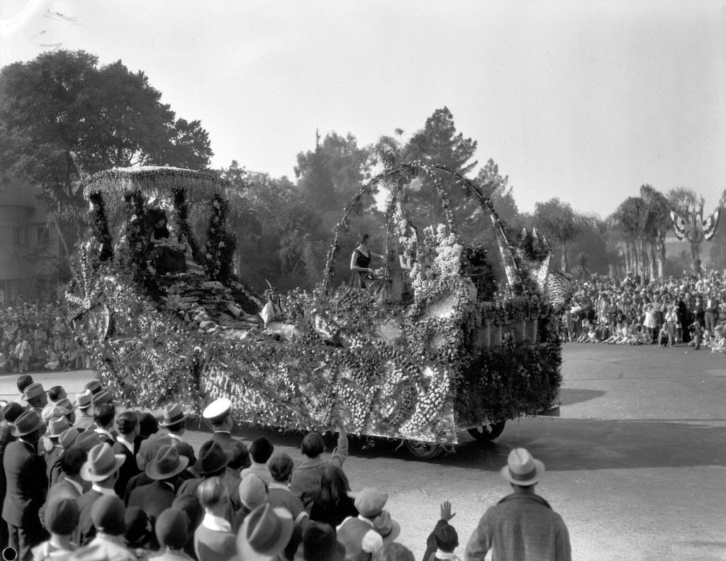
Inglewood’s Centinela Springs-inspired float in the 1930 Rose Parade in Pasadena, at the intersection of Colorado Boulevard and Orange Grove Blvd. (Credit: UCLA Library, Dept. of Special Collections)

At 60, West High is the newest of Torrance’s four main public high schools

The library building stands near the entrance to West High in Torrance. (December 2022 photo by Sam Gnerre)

Torrance High School, opened in 1917, served the city’s need for secondary education for almost four decades.

But, by the 1950s, the postwar baby boom made it clear that more high schools were needed. Desperately needed, as double sessions had to be conducted at many schools to handle the overflow of students. 

The Torrance Unified School District, formed when the city’s schools broke away from Los Angeles Unified in 1947, spent much of the postwar era working to fill the need.

The district succeeded in passing a succession of bond issues to finance the construction of more than thirty elementary schools and three additional high schools between 1949 and 1962. In the 15 years between the TUSD’s founding and West HIgh’s opening in 1962, the total number of students in the district had increased from 2,000 to nearly 30,000.

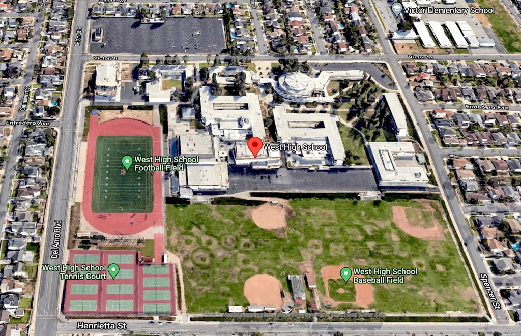
View of West High in Torrance, looking east from Henrietta St. Circular library at top center. 2022 image. (Credit: Google Earth)

It’s just speculation, but perhaps naming all those elementary schools left the TUSD out of ideas when it came to naming its high schools. North High was the first of the new ones, opening in 1955. It was followed by South High in 1957, followed by West in 1962. (One wonders if the district ever considered renaming Torrance High as “East High” to complete the directional quartet.)

In September 1957, the school district included funds to purchase a 40-acre lot in the Victor Tract as part of a $7 million bond measure. (The Victor Tract had been annexed by Torrance in 1956 after a tussle over the land with Redondo Beach.) The lot, bordered by Del Amo Blvd. and Victor, Henrietta and Spencer streets, was mostly vacant except for a few oil wells and  the Southwood Little League baseball field.

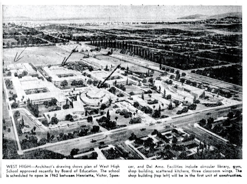
Black arrows point to first three buildings in West High School plan. Torrance Herald, March 20, 1960, Page 1. (Credit: Torrance Historical Newspaper and Directories Archive database, Torrance Public Library)

Architect Roy Donley was hired to design the new high school in May 1958. Donley was responsible for planning a number of Torrance schools, including Hickory and Towers elementary schools and South High.

After working with the district’s planning committee on the specifics, Donley’s West High design was unveiled in October 1959.The innovative “space age” plan (according the the Torrance Herald) featured classroom buildings located around a brick central school library, which was circular in shape.

Construction of the school was divided into three phases over a five-year period; it was built to  accommodate 3,000 students when completed.

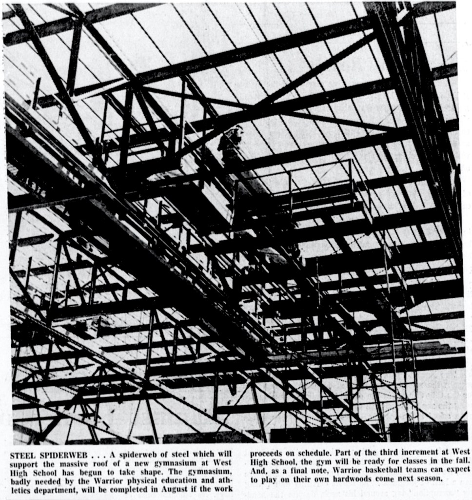
The Crown Construction Co. was hired to erect the $2.2 million first phase, which included just three buildings: the library, the first of three classroom wings, and a shop building. The shop building would double as a locker room until the school’s gymnasium was built as part of the second phase in 1964.

Torrance Herald, March 8, 1964, Page 3. (Credit: Torrance Historical Newspaper and Directories Archive database, Torrance Public Library)

The classroom wings all had modular construction, allowing them to be converted into small auditoriums. Overall cost for the new school was put at $5 million.

Another novel aspect of the school’s design was its approach to providing food to students. Food was prepared at a central facility, and delivered via mobile carts to three satellite dining areas around the campus.

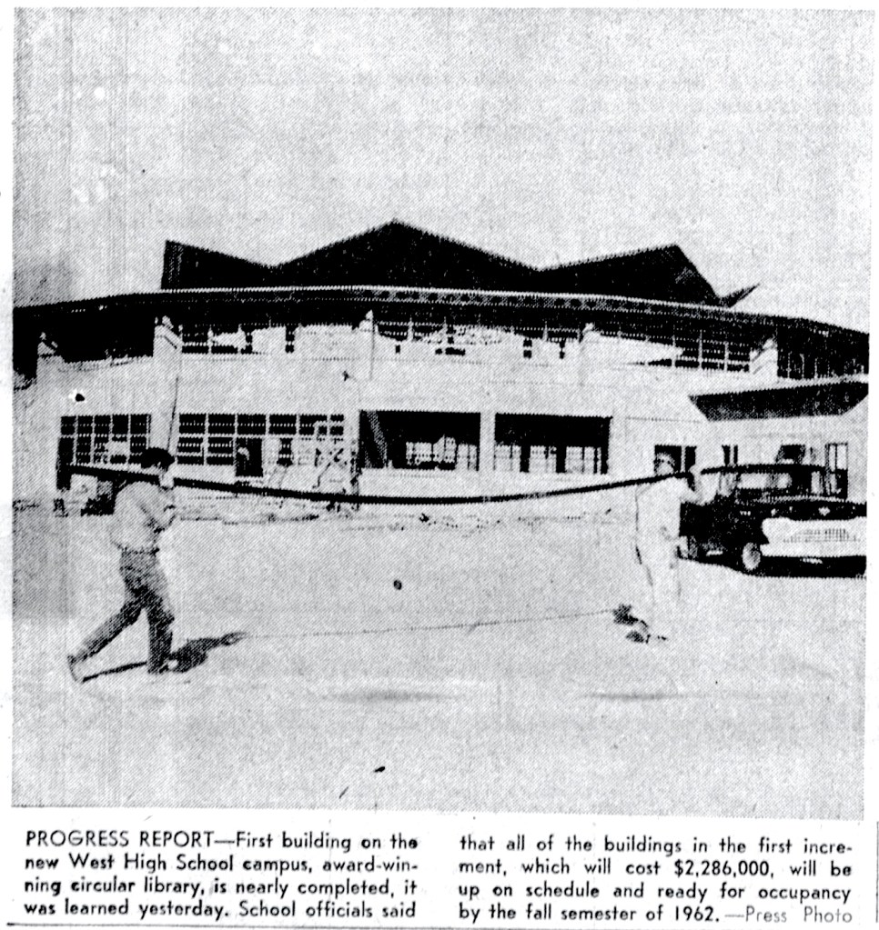
By April 1961, construction was underway on the new campus, with the cornerstone being laid by the Torrance Masonic Lodge that September. The steel frame for the round library building was finished in early November. Work on the first phase of the campus continued throughout early 1962.

Torrance Press, Nov. 15, 1961, Page 1. (Credit: Torrance Historical Newspaper and Directories Archive database, Torrance Public Library)

Robert Ford, formerly a junior high principal in Bellflower, was selected to be the school’s first principal. The school’s athletic teams would compete as the Warriors, and brown and gold were selected as its official colors.

Construction was completed in time to welcome the school’s first 1,052 students on Sept. 12, 1962. Students from all four years attended the new school. The teaching staff included 42 instructors, with an additional ten full-time non-teaching employees.

Dedication ceremonies for the new school were held in October, a month after the school opened. The keynote speech was delivered by TUSD Superintendent J.H. Hull. The school’s second and third phases were completed later in the 1960s.

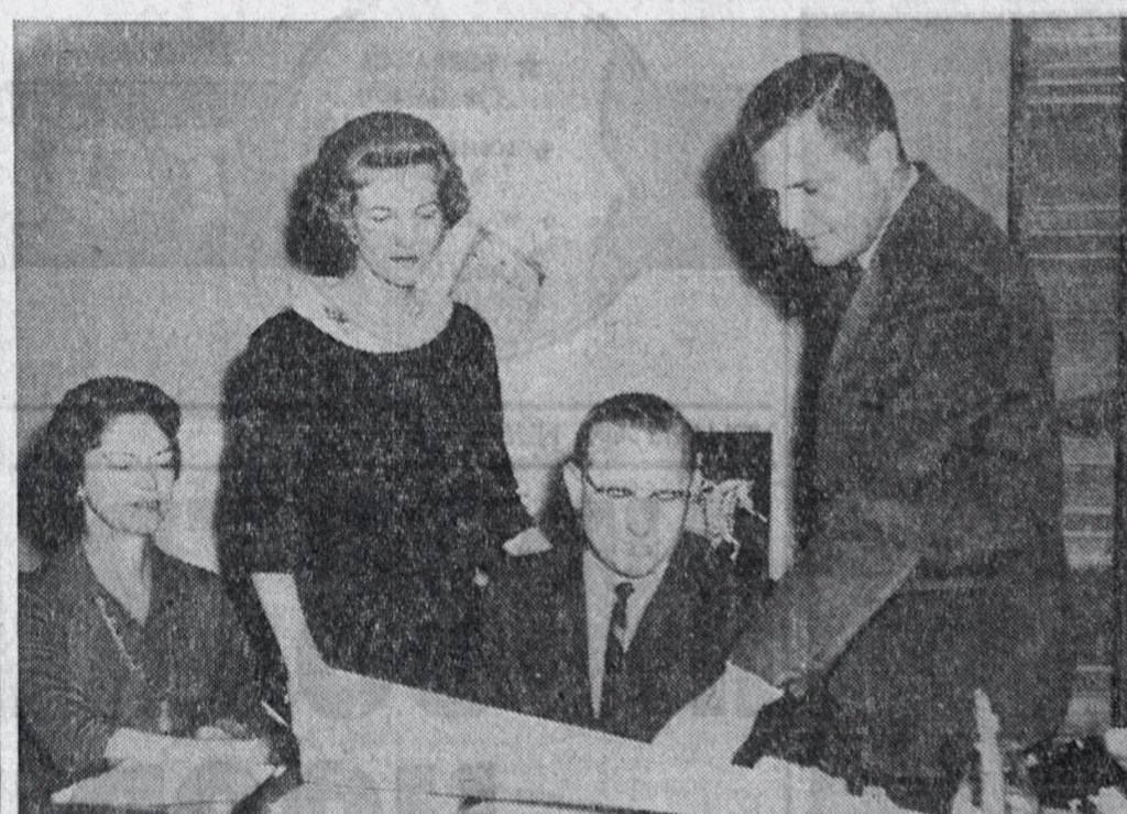
Administrative assistants Genevieve Rarmirez, left, and Ruth Bradley look on as West High Vice Principal Paul Hawkins, standing, points out detail in classroom utilization plan to Principal Robert Ford, seated. Torrance Press, May 2, 1962, Page A-2. (Credit: Torrance Historical Newspaper and Directories Archive database, Torrance Public Library)

School attendance reached a peak of 2,678 in 1976, and currently hovers around 2,000 students. West has been named a California Distinguished School five times, most recently in 2013. In 1984, it was designated a national Blue Ribbon School in addition to receiving the Excellence in Education award from the U.S. Dept. of Education. The school won the Los Angeles County Academic Decathlon in 2019.

West has won the California state championship in boys cross country twice, in 2017 and 2021. In 2011, the school renamed its football facility Fred Peterson Stadium, in honor of the late longtime football coach who won a CIF football title in 1982, and founded the school’s girls track and field program.

Well-known athletes who graduated from West include former El Camino College and BYU quarterback Steve Sarkisian, who later held the head football coach position at the University of Washington and USC, three-time Olympian volleyball player Paula Weishoff, and former Major League Baseball third baseman Sean Berry.

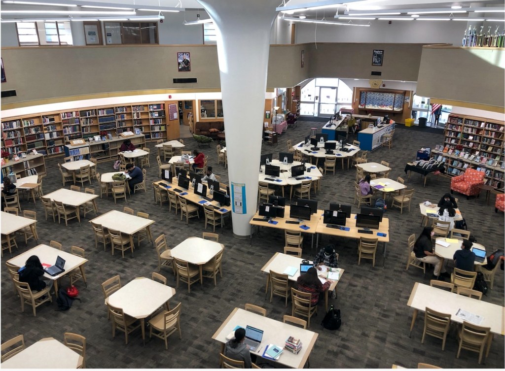
Undated photo shows the interior of the West High School library. (Credit: TUSD,: West High School website)

Sources:

Daily Breeze archives.

The History of Torrance Schools, 1890-2000, by Thomas Rische, TUSD History Project, 2002.

Los Angeles Times archives.

Torrance Press Herald archives.

West High School website.
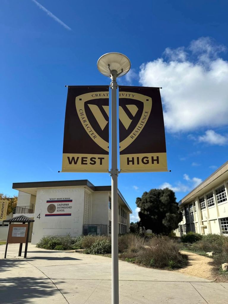
West High campus, December 2022 photo. (Credit: West High School Facebook page)

Note: Shery Continuation High School in Torrance, which opened in 1967, will be profiled in a future post.

El Segundo’s Candy Cane Lane has celebrated the holidays since 1949

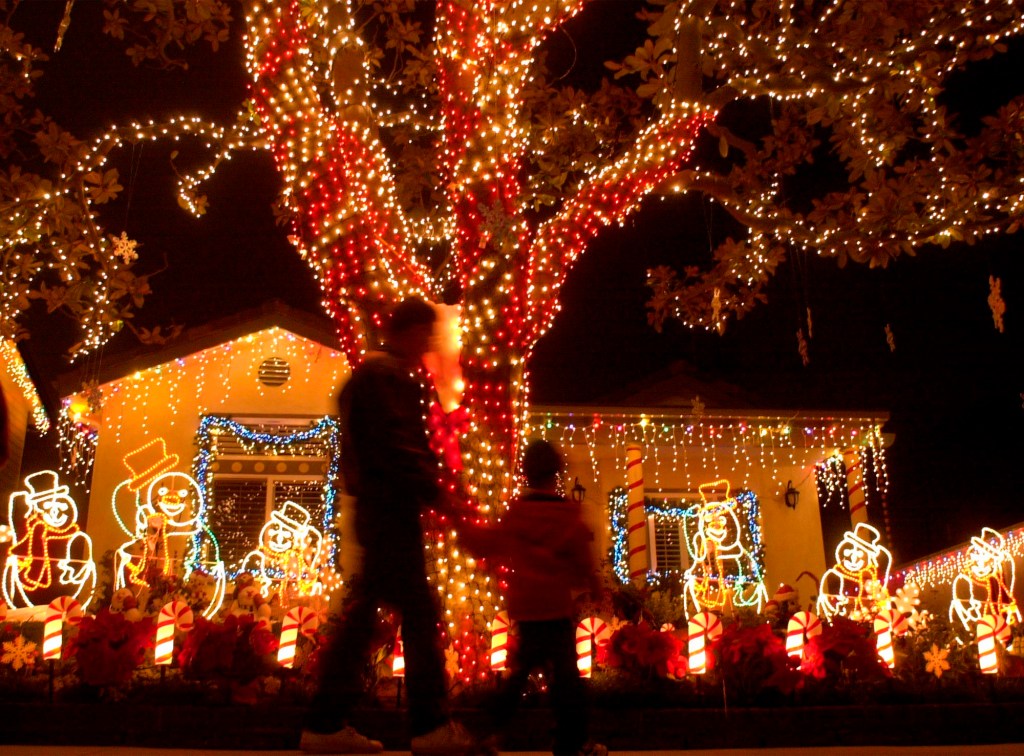
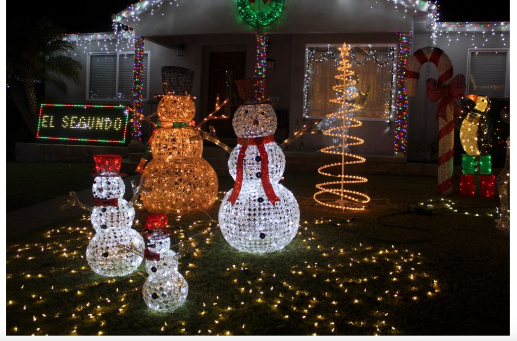
Visitors are treated to a light show at Candy Cane Lane on East Acacia Ave. in El Segundo. Dec. 14, 2002. (Daily Breeze staff file photo by Branimir Kvartuc)

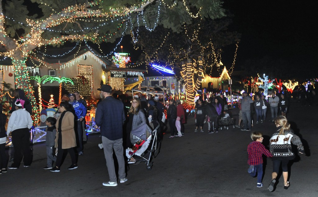
Torrance’s Sleepy Hollow Christmas lights and decorations displays perennially draw huge, traffic-stopping crowds to the city’s Seaside Ranchos area, and have done so since the early 1980s.

But they’re not the oldest neighborhood holiday displays in the South Bay. That distinction belongs to Candy Cane Lane, a cul-de-sac street in El Segundo with 26 houses on it.

The 1200 block of East Acacia Avenue in the city has been done up with Christmas finery ever since 1949, with two exceptions: a multiyear break that began in 1972 with the onset of the energy crisis, and 2020 festivities limited due to the COVID-19 pandemic.

In December 1949, shortly after the Acacia Avenue cul-de-sac segment was built and developed into single-family homes, resident Kenneth Bailey decided to plant a Christmas tree at the end of the street and decorate it with lights and ornaments. His communal tree inspired residents to band together and decorate their houses on the street.

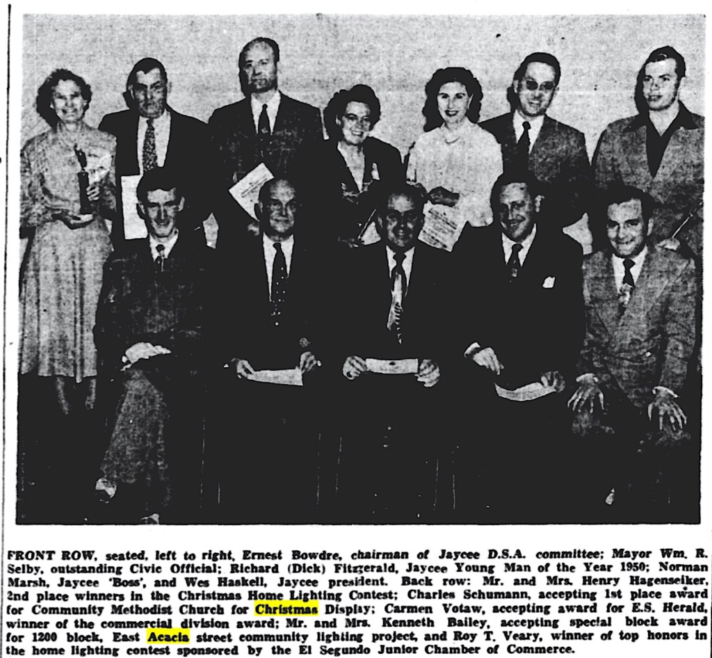
Mr. and Mrs. Kenneth Bailey, second row, second and third from right, at the Jaycees award dinner in 1951. The East Acacia Ave. community lighting project, which would later be renamed Candy Cane Lane, received a special block award in only its second year of existence. El Segundo Herald, Jan. 25, 1951, Page 1.(Credit: El Segundo Herald archival database)

Bailey’s decorated tree at the end of the block returned during the 1950 holiday season, with the inscription, “Season’s Greetings from the Neighbors.” He and his wife were present to accept a special award for the block from the El Segundo Jaycees at the group’s inaugural holiday decorations award dinner in January 1951.

Candy Cane Lane, which was referred to in some early news stories as “Santa Claus Lane,” continued to grow in popularity throughout the 1950s. Many houses on adjoining streets began participating in the decorating frenzy, and neighborhood fathers took turns dressing up as Santa Claus and handing out candy to visiting children.

Decorated home on Candy Cane Lane in El Segundo in December 2021. (Daily Breeze file photo by Michael Hixon)

After North American Aviation built its general offices just east of Candy Cane Lane in 1957, the company began sponsoring and decorating the now-traditional Christmas tree at the dead end of East Acacia. By 1961, the city of El Segundo reported that 11,311 cars had passed through the holiday display area.

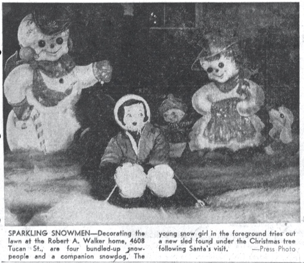
Seven years after El Segundo’s Candy Cane Lane began, one Torrance resident decided he liked the idea well enough to start something similar in his city. In 1956, Chuck Schoendienst fashioned an outdoor nativity scene on Toucan St., located a few blocks southwest of the intersection of Hawthorne Blvd. and 190th St. He followed that with themed displays every year for the next five years.

Torrance Press, Dec. 24, 1961, Part B. (Toucan St. is misspelled in caption.)
(Credit: Torrance Historical Newspaper and Directories Archive database, Torrance Public Library)

His fellow Toucan St. residents joined him in turning the small street into a winter wonderland. They decorated the houses and the street and dubbed it Candy Cane Lane. It drew enough attention to require traffic control, with the roadway being turned into a one-way street during the Christmas season to accommodate sightseers.

Apparently, the new tradition lost steam during the 1960s, as none of the area newspapers mention Candy Cane Lane in Torrance after 1962.

El Segundo’s Candy Cane Lane continued to thrive during the 1960s. But residents began to rethink the tradition with the arrival of gasoline shortages and the energy crisis in the early 1970s. In 1974, Candy Cane Lane went dark for more than a decade.

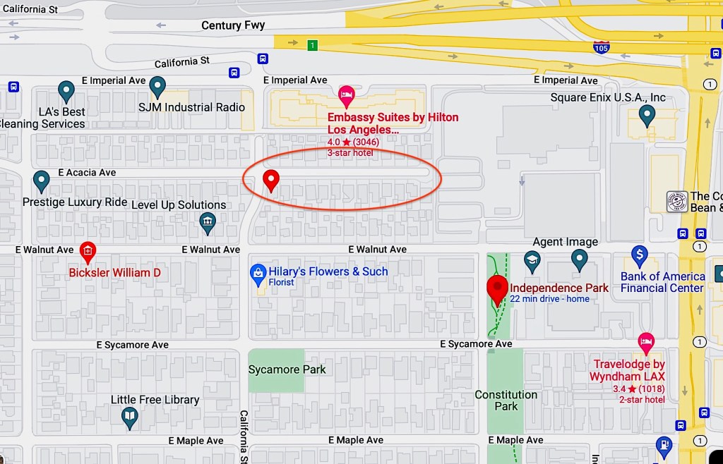
Candy Cane Lane, the 1200 block of East Acacia Ave. in El Segundo, is outlined with red oval. (Credit: Google Maps)

The tradition resumed in 1987, and has been going strong ever since. The light displays now feature LED bulbs, and East Acacia now is closed to automobiles. Visitors walk through the colorful holiday displays on foot instead of driving through in cars.

New residents moving to the street quickly learn of their responsibilities in upholding the tradition, and neighbors often work together to help each other with the lavish displays.

This year’s event runs from 7 to 11 p.m. nightly through Dec. 24.

People fill the 1200 block of East Acacia in El Segundo for the annual Candy Cane Lane displays on Dec. 21, 2018. (Daily Breeze file photo by Mike Mullen)

Sources:

“Candy Cane Lane!”, City of El Segundo website.
Daily Breeze archives.

El Segundo Herald archives.

“Lights, Snow and Santa,” City of Torrance website.
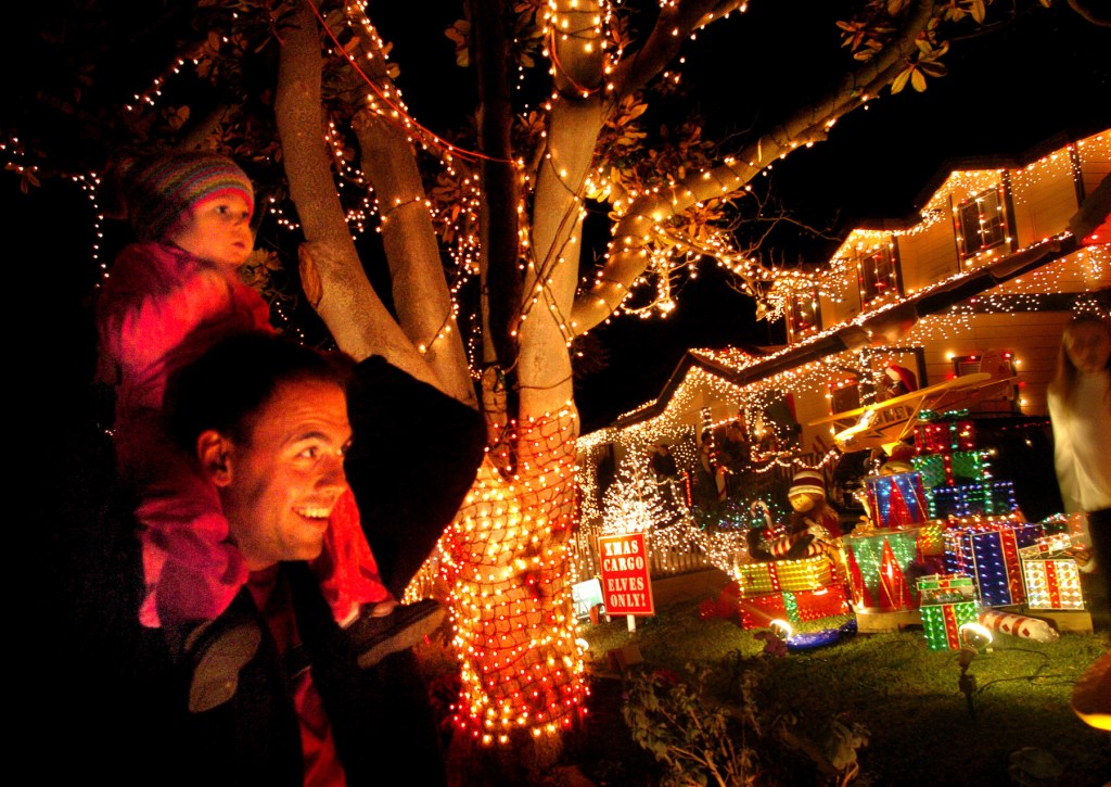
Steven Ijams holds his 15-month-old daughter Tanner, on his shoulders for a better look at the holiday light displays on Candy Cane Lane in El Segundo on Dec. 9, 2006 (Daily Breeze file photo by Bruce Hazelton)
Celebrated architect Robert Neutra designed wartime Channel Heights housing in San Pedro

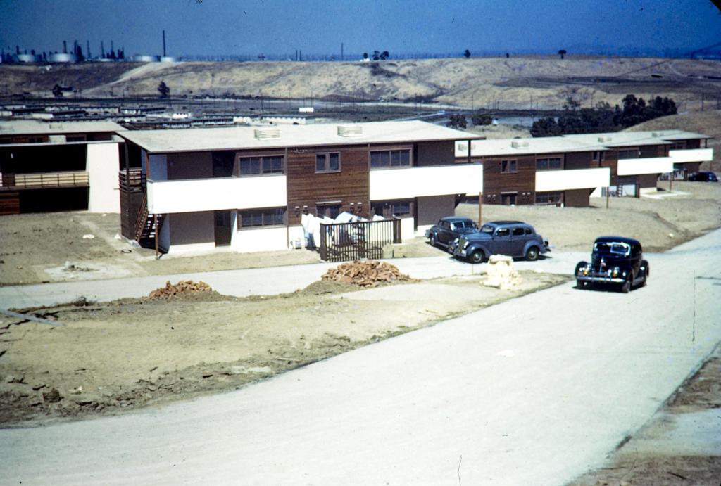
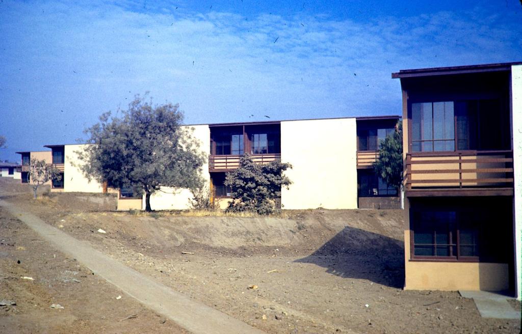
Two-story houses in staggered rows at the Channel Heights Housing Project (designed by Richard Neutra), in San Pedro. Landscaping is still a work in progress in this 1943 photo. (Credit: USC Digital Library)

San Pedro had become a major location for defense plants before the U.S. entered World War II. Major shipbuilding operations such as Los Angeles Shipbuilding and the government-sponsored California Shipbuilding had ramped up production to aid the Allied war effort.

The defense buildup had a ripple effect. More defense plants and increased production created a need for more workers, and those workers needed places to live that were closer to their jobs. San Pedro in the late 1930s didn’t have nearly enough housing options to accommodate them.

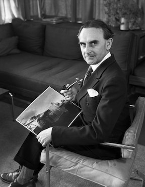
Richard Neutra in 1935. (Credit: Wikimedia Commons)

The need became even more acute following Japan’s attack on Pearl Harbor on Dec. 7, 1941, and the subsequent U.S. declarations of war.

Prior to the war, the federal government already had authorized the construction of several major housing projects in the Harbor Area to remedy the shortage. These included Normont Terrace and Harbor Hills in Harbor City, Wilmington Hall and Dana Strand in Wilmington, and Rancho San Pedro, Banning Homes and Channel Heights in San Pedro, the subject of today’s post.

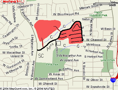
The Channel Heights Housing Project originally was scheduled to be built in Compton and called Amity Village, but wartime needs changed the plan. The amended project was laid out on 160 acres situated north of Peck Park and just east of Western Ave., with Channel St. connecting it to Gaffey St. on its eastern edge. The land was bisected by a canyon where a couple of horse ranches were located.

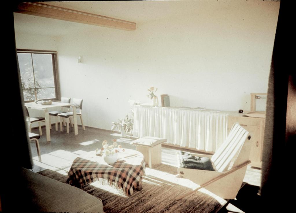
Interior of housing unit at Channel Heights has an open, airy feeling, using ambient light for highlights. 1943 photo. (Credit: USC Digital Library)

The contracting firm Baruch Corp. broke ground for the 600-unit project in early June 1942, looking to complete it by that October. Its architect, Austrian-born Richard Neutra, had studied under Frank Lloyd Wright and worked with Rudolf Schindler, and would go on to be an influential champion of the mid-20th century modernist style.

Neutra laid out the project’s sleek, low profile buildings on the canyon’s terraces, allowing for ocean views and ambient natural lighting. The units featured mostly open floor plans and about half of them were furnished, as many workers couldn’t afford to buy furniture.

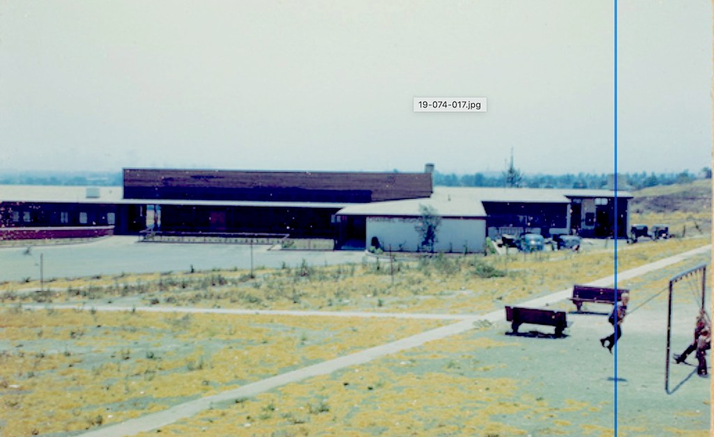
The project had its own small shopping center, and, in August 1944, construction of the Channel Heights Elementary School, also designed by Neutra, was approved. (The school was remodeled and renamed Park Western Place Elementary in 1957.)

Channel Heights Elementary School, undated photo circa mid-late 1940s. Playground at lower right. (Credit: UC Berkeley Environmental Design Archives)

As for the project itself, its 1942 completion was delayed due to the wartime shortages of building materials, a problem that was remedied when defense housing projects were granted special priority to receive them. It would be completed at a cost of $3.5 million in 1943.

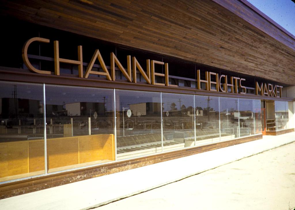
Channel Heights officially opened on May 18, 1943, when its first 40 units were made available to war workers and their families. By that August, all 600 units were occupied, a preschool (one of two) had opened, and the complex’s market was days from its grand opening.

The Channel Heights Market at the San Pedro housing project, shortly before its 1943 opening. (Credit: USC Digital Library)

It thrived during wartime, but the federal government, which continued to own the project after the war ended, seemed to have lost interest in its upkeep. Eventually, the government declared the project surplus property.

By March 1949, the Los Angeles City Council had begun looking into acquiring ownership of Channel Heights, where hundreds of families still lived. Its tenants had tried to purchase their units through mutual home ownership corporations, but lacked the funds to pull off the maneuver.

In 1950, the federal government transferred ownership of the property to the Los Angeles City Housing Authority. The CHA’s attempts to get federal funding to renovate the project failed, however.

During the early 1950s, the CHA tried and failed to convert the project into low-income housing. In 1954, the Chamber of Commerce strongly suggested that the U.S. Navy move personnel it was about to transfer from the East Coast to California into the now mostly-empty Channel Heights units, but the Navy chose to house them in Long Beach instead.

Architect and former Channel Heights resident Martin Horecka provided this map based on his memories of the project to the Channel Heights Housing Project website. The Channel Heights site is shaded red; the canyons are marked by “C’s.”

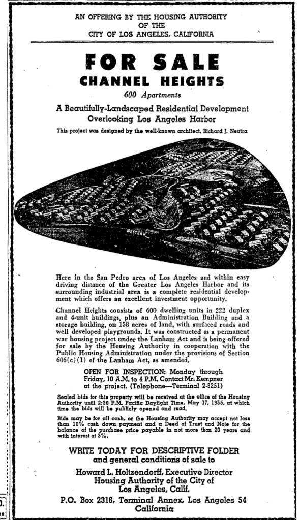
Finally, the CHA announced in January 1955 that it was closing Channel Heights for good, relocating the 263 low-income families still living there and putting the property up for sale to the highest bidder.

That turned out to be the Goldmar Corp., a Los Angeles-based developer who had offered $876,987 for the Channel Heights property. It was the beginning of the end. Goldmar ended up purchasing the property for about $1 million. It then invested $1.5 million in revamping the project into the Park Western Apartments, but later divested itself of the property.

That left the door open for various developers to transform the property piece by piece into various condo and townhouse developments along the newly completed streets Capitol Drive and Park Western Drive.

The last few tenants of the now-dilapidated housing project were evicted in 1981, and the final scant remaining traces of Channel Heights Housing Project were eradicated completely.

Richard Neutra went on to become an influential and highly successful architect. He died in 1970 at the age of 78. His architectural office in Silver Lake, the Neutra Office Building, has been declared a Historic Cultural Monument and is listed on the National Register of Historic Places. 

Terraced housing blocks at the Channel Heights Housing Project in 1943. (Credit: USC Digital Library)

Note: Thanks to reader Robert DuPree for suggesting this topic.

Sources:

“The Channel Heights Housing Project” website.

“Channel Heights Housing Project,” Neutra website.

Daily Breeze archives, especially “Designer’s housing finally faded away,” by Stephanie Walton, May 21, 2006, Page A4.

Los Angeles Times archives.

“Richard Josef Neutra, 1892-1970,” US Modernist website.

San Pedro News Pilot archives.

Los Angeles Times ad announcing the sale of the Channel Heights property, March 25, 1955, Page A-8. (Credit: Los Angeles Times archival database)

Is this your new site? Log in to activate admin features and dismiss this message
Log In