LAX’s Hangar One stand as the last link to the airport’s historic past

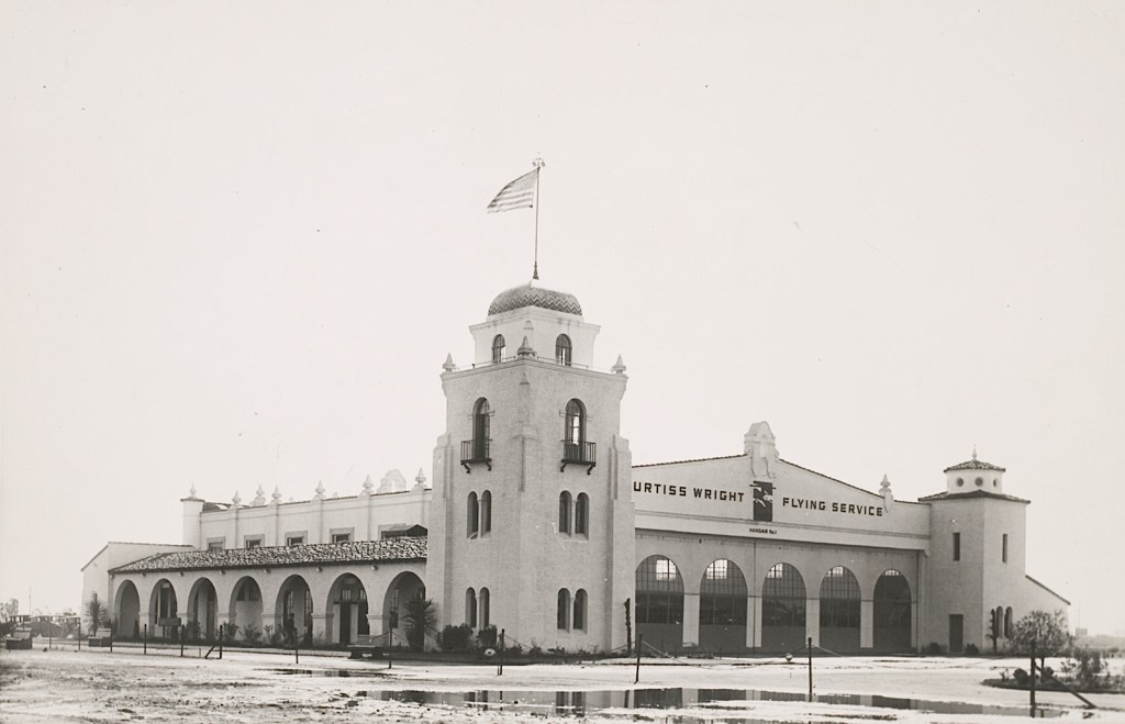
Hangar One at Los Angeles Municipal Airport, first occupied by the Curtiss Wright Flying Service. Circa 1929. (Credit:. Los Angeles World Airports)

Hangar One, the first building erected at Mines Field, now Los Angeles International Airport, has managed to survive as the last remaining link to the airport’s earliest days during the golden age of aviation.

Mines Field was named for real estate agent William Mines, who leased the former beanfield land to boosters of the airport. Mines also convinced them to push for the crude airfield to become the site of the 1928 National Air Races, one of the most popular sporting events of its day. The push was helped by publicity from an unexpected stopover at the field by Charles Lindbergh and Will Rogers in 1927.
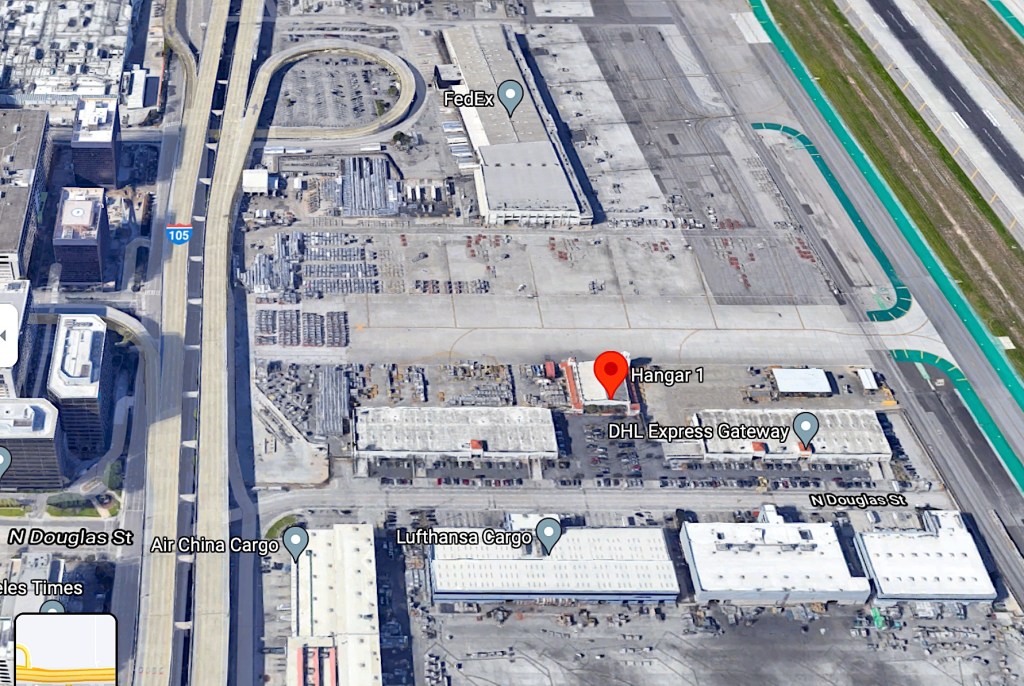
Hangar One’s location between the 105 Freeway, left, and LAX’s southernmost runway, right. 2021 image. (Credit: Google Earth)

Its selection for that overwhelmingly successful event that September led to Mines Field being chosen on July 25, 1928, by the City of Los Angeles as the site for Los Angeles Municipal Airport over two other contending locations. At first, most of the employees of the city’s new Dept. of Airports worked at City Hall in downtown L.A., as there was little office space at the airfield. 

The early aviation firm Curtiss Wright came to the rescue, enlisting the architectural firm Gable and Wyatt to design the $65,000 Spanish Colonial Revival building then known as Hangar No. 1. It was completed in June 1929. Curtiss Wright based its civilian flight school and many of its planes at the site.
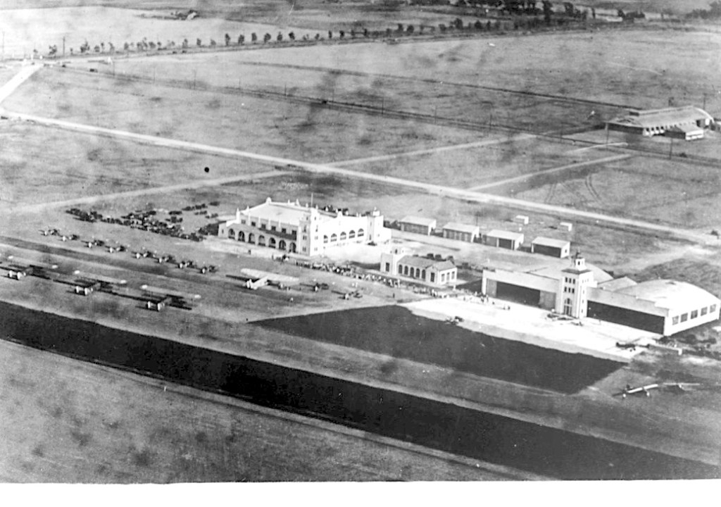
Aerial view of Hangar One, left, the original control tower, right, and various other buildings at Los Angeles Municipal Airport, circa 1930. (Credit: National Register of Historic Places)

Hangar One was the first permanent structure built at the airport, predating even the control tower, erected in 1930, and two other buildings built shortly afterward. Before the airport’s first control tower was built, takeoffs and landings were managed by a flagman signalling the planes.

Another hugely popular event took place later in 1929, when the gigantic German dirigible the Graf Zeppelin made a stop at Mines, attracting an estimated 300,000 spectators to the airfield on Aug. 26. The airship’s size dwarfed the Goodyear blimp; the Graf was over four times as long and twice as wide as modern blimps.
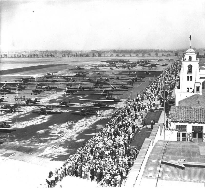
Crowds of people attended the dedication of the airport on June 7, 1930, held in front of Hangar One. Many planes can be seen parked on the runway. (Credit: Los Angeles Public Library Photo Collection)

The next big wingding at the airport was its official dedication as Los Angeles Municipal Airport, a two-day event held directly in front of Hangar One on June 7-8, 1930. 

Commercial passenger flights weren’t a part of its early operations; most of those flew out of Burbank and Glendale. Private pilots and flight schools provided most of the business, and parachute jumping also became popular during the 1930s. 
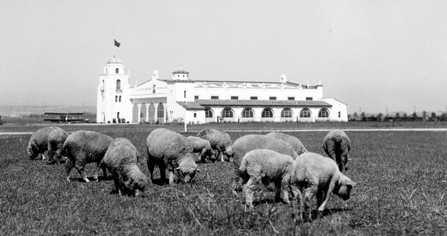
A herd of sheep graze not far from Hangar One at Los Angeles Municipal Airport. Undated, probably 1929. (Credit: Los Angeles Department of Water and Power website)

The U.S. Army took over the airport after the start of World War II, using camouflage to hide the Douglas and North American Aviation plants located there from potential prying airborne eyes.

Everything changed for the airport following the war. The Army returned control of the field to the Dept. of Airports, which immediately set about to make improvements based on a master development plan it had created in 1943.

A $12 million bond issue that passed in 1945 allowed for the building of temporary new structures for passenger terminals and administrative offices. Also, the airline companies had realized the importance of Los Angeles in their plans, and began building their own hangars onsite. 

The first commercial flight departed from the airport on Dec. 5, 1946. The airport officially got its new name, Los Angeles International Airport, on Oct. 11, 1949.
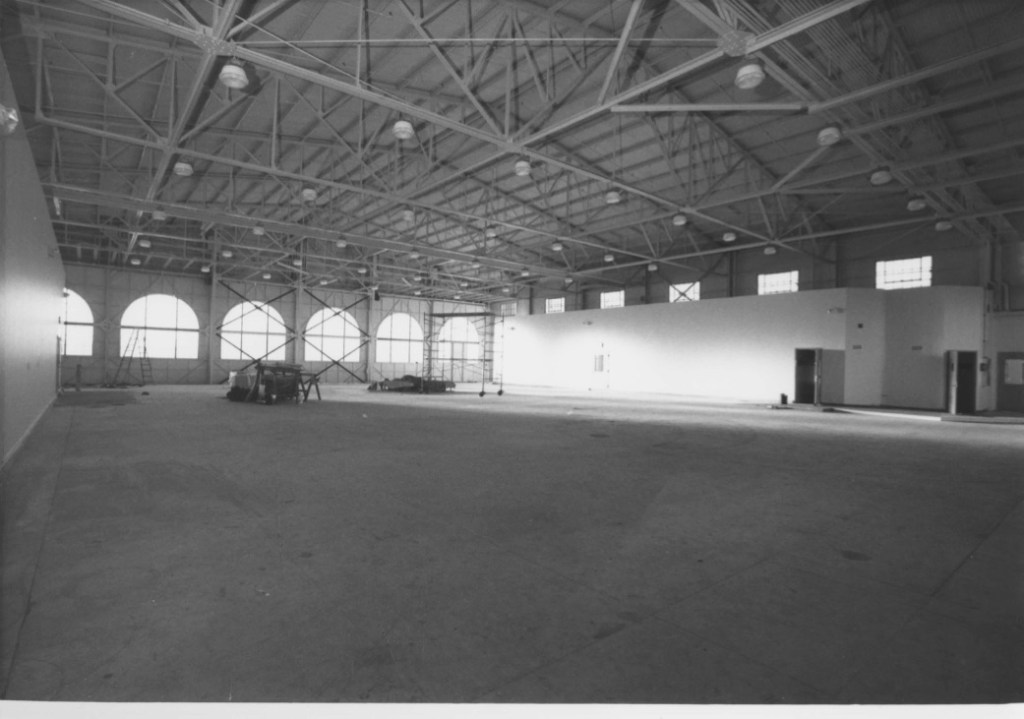
Interior of Hangar One, 1991 photo. (Credit: National Register of Historic Places)

All of these rapid changes took away functions that had been centered in Hangar One and the cluster of buildings surrounding it. Also, the planes were growing in size. When it first opened, the hangar could hold about 18 aircraft, but its capacity shrank with each new and bigger commercial airliner.

The building was leased to a succession of businesses, including North American Aviation, Rockwell International, Golden West Airlines and the helicopter passenger airline company Los Angeles Airways. 

By the early 1980s, the empty, now dilapidating building was padlocked and under threat of demolition, having been deemed unsafe for use a decade earlier. The airport’s first control tower already had been torn down in December 1974.
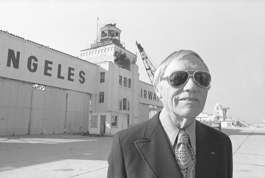
Longtime LAX employee Henry Bakes standing before the original airport tower at LAX as wrecking ball begins its demolition on Dec. 18, 1974. Hangar One can be seen in background at right. (Credit: UCLA Library Special Collections archives)

Initially, preservationists had called for the hangar to be moved to Westchester and transformed into an aviation museum, but the Dept. of Airports chose instead to begin a $2 million renovation of the building at its current site in 1990.

This allowed for new tenants to use the building, which had been designated as a Los Angeles Historic-Cultural Monument in 1966. In July 1992, the National Register of Historic Places recognized its significance as an aviation landmark, assuring that its future would be secure.

Though its address is listed as 5701 W. Imperial Hwy., the building actually sits on N. Douglas St., just below the DHL cargo facility. It’s currently occupied by the cargo services company Menzies Aviation.
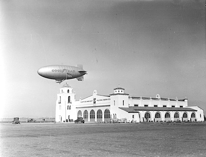
The Goodyear Blimp passing by Hangar One at Los Angeles Municipal Airport on Feb. 7, 1930. (Credit: California Historical Society via USC Digital Archive)

Sources:

“California SP Hangar One,” National Register of Historic Places.

Daily Breeze archives.

“From Point A to Point B: The National Air Races at Mines Field, Los Angeles, 8-16 September 1928,” by Paul R. Spitzzeri, The Homestead Blog, Sept. 15, 2018.

“LAX History,” Los Angeles World Airports website.

LAX: Los Angeles International Airport: From Lindbergh’s Landing Strip to World Air Center, by Tom Moran, CCA Publications, 1993.

Los Angeles Times archives.
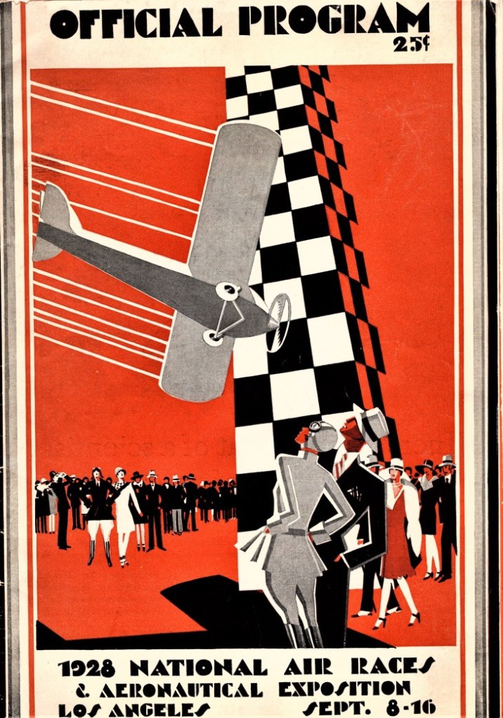
Cover of the official program for the 1928 National Air Races held at Mines Field. (Credit: The Homestead Blog)

Piecing together the construction of the 405 Freeway through the South Bay

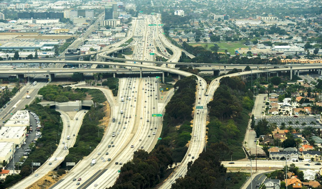
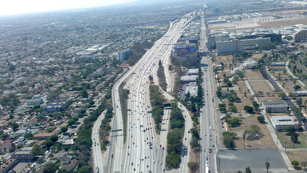
The 405 freeway looking north near LAX (upper left) in Los Angeles CA. Thursday, May 19, 2016. (Thomas R. Cordova-Southern California News Group)

Freeways figure so prominently in the everyday experience of most Southern Californians that it’s difficult to imagine the local landscape without them. The first Los Angeles freeway, the 110 in Pasadena, opened fully on New Year’s Eve, 1939.

Los Angeles city and county officials and the Automobile Club of Southern California had all conducted studies recommending a system of freeways, and the arrival of state and federal funds for the project in 1947 expedited roadway construction.

The South Bay/Harbor Area has four major freeways: the 110, 91, 105 and 405. Today we’ll look at how the 405, also known as the San Diego Freeway, came into being piece by piece.

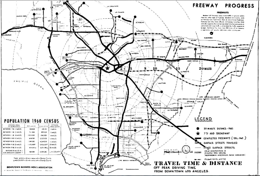
Undated map circa 1962 shows the status of the 405 (San Diego) Freeway at left. Solid lines indicate completed segments. Note the broken lines denoting unfinished segments between Culver City and Torrance. (Credit: California Highways and Public Works (Official Journal of the Division of Highways, Department of Public Works, State of California), March-April 1963 issue)

Unlike the more recent 105 (Century) Freeway, which opened as a complete finished roadway in 1993, the other three South Bay freeways opened in segments. In the case of the 405 Freeway, the segmentation caused controversy.

The initial segments of the 405 were built at its northern and southern legs, from Burbank Blvd. in the San Fernando Valley southward, and from Long Beach northward, in the late 1950s and early 1960s.

This, despite widespread agreement that the most dire traffic congestion in the Los Angeles basin was at that time occurring in and around Los Angeles International Airport, which had become increasingly crowded since its opening in 1949. The airfield was situated smack in the middle section between the two segments that were built first.

South Bay residents, particularly those in Westchester and Inglewood near LAX, expressed alarm. They formed the Inter-City Highway Committee to present a unified appeal to state highway engineers to rethink their priorities and begin building the 405 segments that pass through the South Bay. Other cities represented on the committee included Culver City, Torrance, El Segundo, Hawthorne and the beach cities of Hermosa, Manhattan and Redondo.

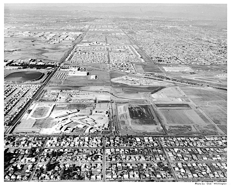
View north from Manhattan Beach Blvd. up Aviation Blvd. (left) before the construction of the 405 Freeway. Vacant land between houses at top right denotes freeway right-of-way, which curves right in photo to form what will become the start of the South Bay curve. (Credit: USC Digital Library)

By 1960, the 405’s northern and southern segments had been mostly completed, and the ICHC’s urgent admonitions to speed up freeway construction in the remaining middle section had been echoed by Los Angeles County Supervisor Kenneth Hahn. The area where the freeway was not being built at that time was in Hahn’s district.

State officials defended their methodology. “We try to build freeway links so they can be connecting to another freeway and put it into use immediately rather than put up disconnected structures,” state highway commission information officer Milton Stark told the Los Angeles Times in November 1959.

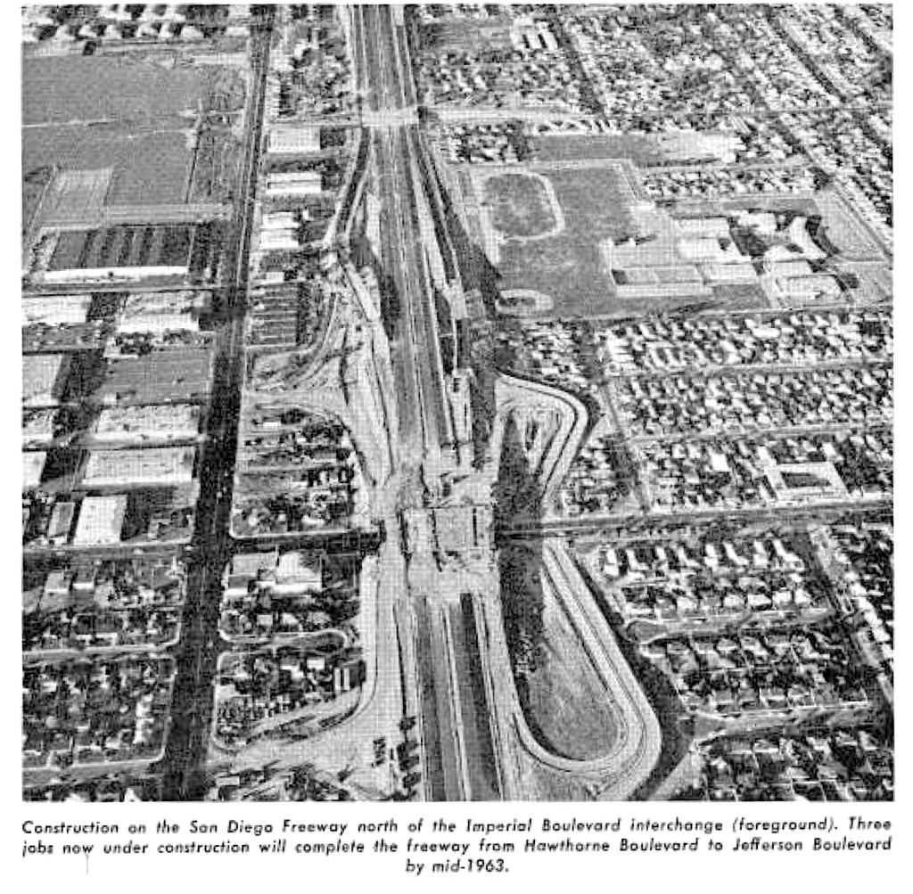
State engineers originally predicted that the 405 link through the South Bay would be completed by the fall of 1962. By March 1961, the freeway’s path had been cleared from Manchester Blvd. to the 110 Freeway at 190th St., but the only construction underway was an underpass being built near Manchester.

(Credit: California Highways and Public Works (Official Journal of the Division of Highways, Department of Public Works, State of California), March-April 1963 issue)

Over the next two years, however, the work would be completed. Here is a list of the South Bay 405 sections from north to south, and the dates they were completed:

  1. La Tijera to Jefferson Blvd, 1.5 miles. Completed: 1963.
  2. La Tijera to 137th St., 4.8 miles. Completed: 1963.
  3. 137th St. to Hawthorne Blvd., 2 miles. Completed: 1963.
  4. Hawthorne to Artesia Blvd, 1.1 miles. Completed: 1963.
  5. Artesia Blvd. to 190th St., 3.5 miles. Competed: 1962.
  6. 190th St. to Carson St., 2.9 miles. Completed: 1962.
  7. Carson to Alameda St., 1.9 miles. Completed: 1962.

The segment from La Tijera to Jefferson was the final one to be dedicated. The La Tijera ramps remained closed even after the roadway opened on June 10, 1963, thanks to ongoing protests from Westchester and Inglewood parents.

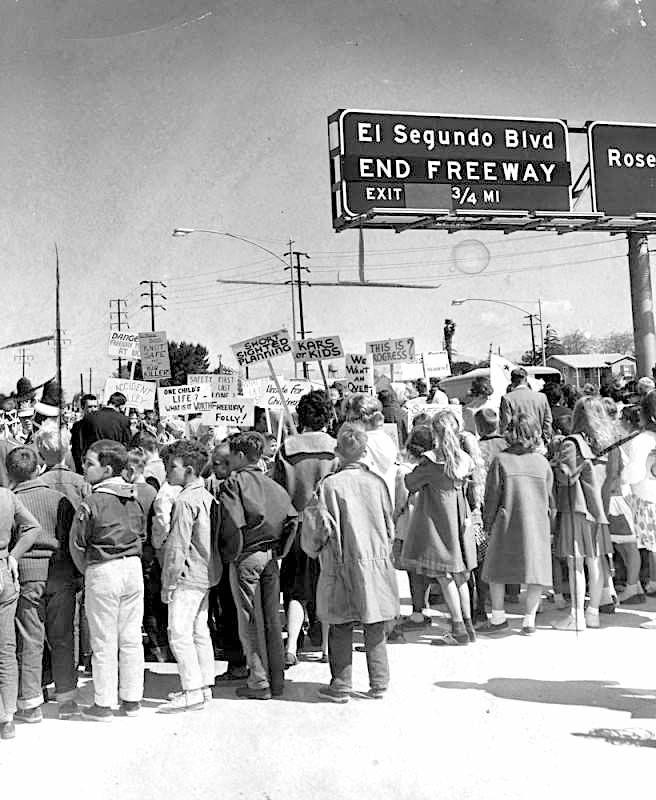
The picketers were parents demanding that officials live up to their promise to build a separate pedestrian bridge over the freeway at La Tijera to reduce the dangers of students from Osage Elementary at St. Jerome Parochial School having to cross the freeway bridge there on foot.

Mothers and pupils protest construction of the La Tijera off-ramp without the promised pedestrian bridge at the grand opening of the Lawndale-Hawthorne link of the 405 Freeway in April 1963. At least two such protests were held. (Credit: Los Angeles Public Library Photo Collection)

The highly visible protests reached Supervisor Hahn, who pledged that the county would make good on the promise, but, ultimately, a separate pedestrian bridge over the 405 Freeway at La Tijera would never be built. Instead, chain-link fencing approved by the Los Angeles City Council in 1964 is their only protection on the sidewalk from street traffic on both sides of the busy thoroughfare.

Other than that, the newly opened roadway then stretched for 41.8 miles, from the 5 Freeway in the city of San Fernando south to the 710 Freeway in Long Beach. The total cost of construction was $16.5 million, which amounts to nearly $150 million in 2021 dollars. By the end of the 1960s, it would extend through Orange County, and eventually provide a through link to San Diego.

Of course, the 405 Freeway has morphed from a traffic solution to a traffic nightmare over the ensuing decades. As the old joke goes, it’s called the 405 because traffic moves at 4 or 5 miles an hour. Whatever its foibles, though, it remains the longest freeway in Southern California, and the busiest freeway in the world.

The 405 Freeway looking south from Westchester, with Century Blvd. and LAX at upper right and 105 Freeway at top. August 2014 photo. (Credit: Wikimedia Commons)

Sources:

Daily Breeze archives.

Freewaytopia: How Freeways Shaped Los Angeles, by Paul Haddad, Santa Monica Press, 2021. (Covers not only the 405, but the history of all major freeways in the Los Angeles area.)

Los Angeles A to Z: An Encyclopedia of the City and County, by Leonard and Dale Pitt, University of California Press, 1997.

Los Angeles Times archives.
Palos Verdes Peninsula News archives.

Torrance Press-Herald archives.

Pupils from nearby schools join mothers in picketing dedication ceremonies for a new section of the 405 Freeway in April 1963. About 30 placard-carrying pickets suddenly appeared before the ceremony. The new freeway link extends from Lawndale to Hawthorne. (Credit: Los Angeles Public Library Photo Collection)

Additional comments:

Former Ventura County Historical Museum Library director Charles Johnson shared this Memory of the freeway’s construction:

“I had just arrived in Lennox in 1961 as they were building the 405. 
I had just moved from the Crenshaw / Imperial area of Inglewood, due east of Lennox, and was going to Felton.
My most vivid memory, after I wandered up on the freeway one weekend with my skateboard (age 11), was the entire stretch from Imperial to Century was covered in “Indian” rugs, which were being soaked by a watering truck that was up there, moving slowly up and down the line.—later learned this was part of the concrete curing process. It was quite a sight. Unreal.
Only other recollection was how often that stretch of road just to the east of the freeway came to be used for car races.
Only much much later, over fifty years later, when working on a history of the Freeway system in Ventura County, did I come to learn the entire project was financed at a level of 90% federal funds because President Eisenhower, after serving as a general during WWII, had been impressed by how quickly our troops could travel on Germany’s autobahn, so was able to go back to the US and sell this improved system of roads as a public safety issue (in case of attack). Of course it didn’t feel so safe to the largely impoverished folk who were summarily displaced for the “greater good” by the largest eminent domain project in California history.”

Richard Kistler remembers:

I, also, recall the world before the 405.  The old Lennox Little League field was taken out by the 405.  I think there was a trailer park near the little league field.

The 405 took out a dozen or so “mini-homes” west of Lennox High’s football field.  Eugene, a Navajo Indian and a class-mate, lived in one of these garage-size houses with his parents and three siblings.  I remember he took off his socks when he got home to “save them” for school.  It was one of the first times I ever encountered real poverty.

My cousin, Bob Wolfenden, used to ride go-carts with his friends on the unfinished 405 in Westchester.  The cops showed up and were about to roust them, when the cops discovered that my Aunt Agnes (Bob’s Mom) was riding go-carts with the kids.  They got off with a warning.  A simpler time.

Steve Thompson:

I vividly remember playing on the unopened lanes behind the high school. We (I think it was Dennis Kiser) would walk (and screw around) between Imperial and 104th. The photos clearly show how the freeway “ripped” through established neighborhoods.

Nissan Motor Corp.’s American headquarters stayed in South Bay for nearly half a century

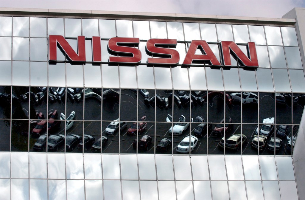
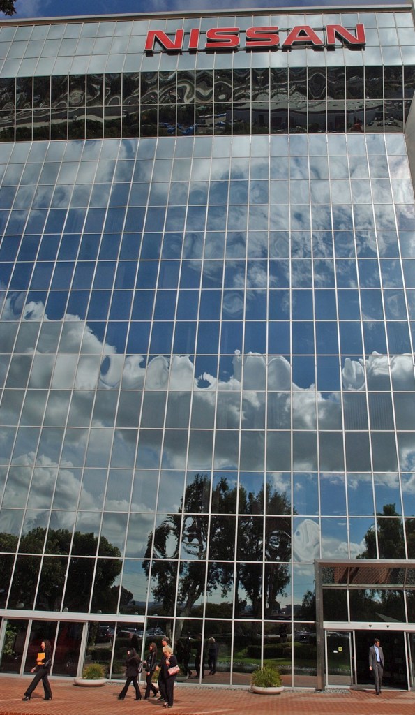
The glass facade of the Nissan Motor Corp. building in Carson mirrors employee vehicles in its parking lot on Nov. 2, 2005. (Daily Breeze staff file photo)

For several decades, three of Japan’s largest automakers — Nissan, Toyota and Honda —  based their American operations from headquarters offices in the South Bay.

I’ve written about Toyota, which moved its headquarters to 190th st. and Western Ave. in 1967, and Honda, which moved to Gardena in 1963 and to Torrance in 1984. That leaves Nissan, which had become the first of the trio to move to the South Bay by establishing its U.S. headquarters offices in Gardena in 1960.

By then, the company had been in business in Japan, under a couple of different names, since 1911. Its origin can be traced to the Kaishinsha Motor Works, founded by Masujiro Hashimoto. Its first model in 1914 was named the DAT, after the initials of the surnames of the company’s primary investors.

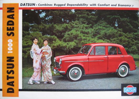
1958 Datsun brochure promotes the introduction of the Datsun 1000 to the American market. (Credit: John Lloyd, Cartype website)

In 1918, the company introduced a new model called the “DATson,” son of DAT. Its spelling later was changed to Datsun, which would remain the company’s car name brand for decades. The Nissan name came about during a 1934 corporate reorganization, formed by the abbreviation of Nihon Sangyo, the car manufacturer’s new holding company name, on the Tokyo Stock Exchange.

The company’s fortunes continued to increase as a result of its production of vehicles for the U.S. Korean War effort. After the war, Nissan began to look toward increasing its international presence.

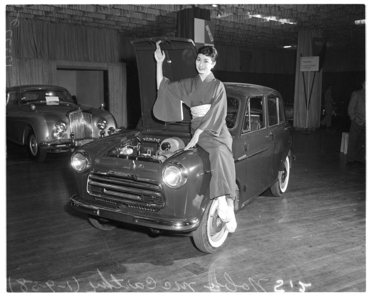
In early January 1958, Nissan sent its first autos to the U.S. Three models of the company’s Datsun 1000 compact car arrived at the Port of Los Angeles in early January 1958, on their way to being exhibited at the Los Angeles Imported Auto Show at the Shrine Auditorium.

Model Noby McCarthy poses with the newly imported Datsun 1000 at the Los Angeles Imported Auto Show at the Shrine Auditorium on Jan. 9, 1958. (Credit: USC Digital Library)

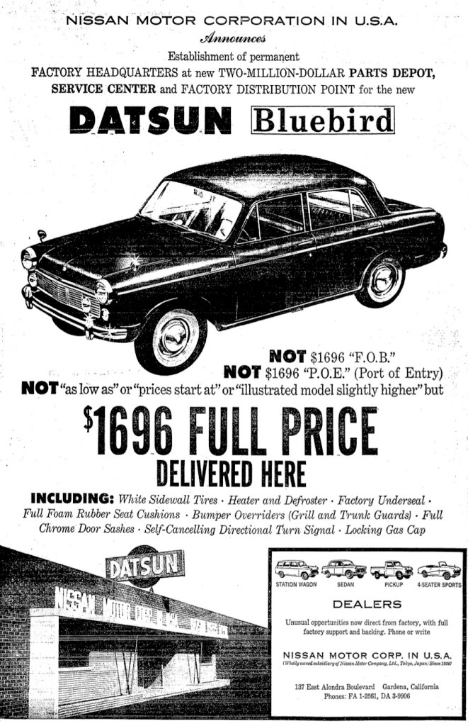
Two years later, the company established its first U.S. headquarters, Nissan Motor Corp. in U.S.A., at 137 E. Alondra Blvd. Sales grew steadily despite American consumers’ wariness of the smaller, more lower-priced autos.

Two new models introduced in successive years would become mainstays of the company’s sales in the 1970s: the Datsun 510 economy sedan in 1967, and the venerated Datsun 240Z sports car in 1969. The new models together with the arrival of the gasoline shortages during the 1970s helped to raise the sale of Datsuns to record levels.

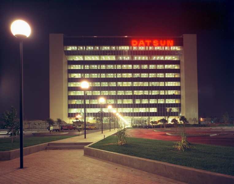
The Datsun sign lights up the night sky in this May 1972 photo taken at Nissan’s new U.S. corporate headquarters in Carson. Photo by Wayne Thom. (Credit: USC Digital Library)

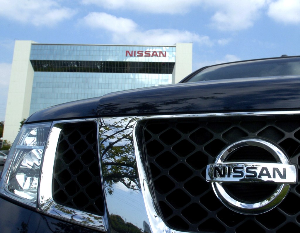
Business was so good in the U.S. that Nissan felt the need to expand its corporate headquarters. After a lengthy search, the company settled on an irregular 6.5-acre parcel of land at the southwest corner of 190th and Figueroa streets in Carson for its main building. It would become a local landmark, clearly visible from from the nearby intersection of the 110 and 405 freeways, 

The executive tower was built in the shape of a trapezoid, a symbol of good fortune in Japanese culture. The glass-walled 10-story structure with its unusual flared outcropping at the top cost $4.5 million to build. It was designed by Los Angeles architectural firm Kajima Associates and built by contractor William Simpson Co.

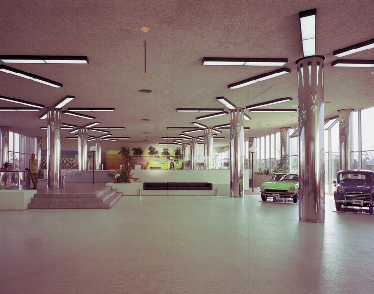
Interior view of Nissan’s new U.S. corporate headquarters in Carson in May 1972. Photo by Wayne Thom. (Credit: USC Digital Library)

The new facility was dedicated on May 11, 1972. It would grow to include nearby buildings across Figueroa, which later would become the site of a Kaiser Permanente health complex.

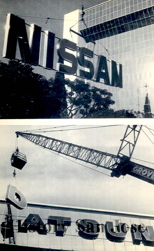
In 1981, Nissan’s parent company in Japan made a decision that cost millions of dollars in signage alone, and made many of its American dealerships unhappy. It decided to drop the “Datsun” name from its car models and dealer names, rebranding everything it produced as “Nissan.”

The letters from the old Datsun sign are removed from the company’s Carson national headquarters, bottom, to be replaced by a sign with the company’s new Nissan name, top on Dec. 2, 1984. (Credit: San Jose Research Library photo collection)

Dealers initially resisted, wondering why the company would change a brand name that had been built over decades, but the company’s leaders insisted. The rebranding became official in the U.S. on Oct. 1, 1984, when the company’s new 1985 autos were introduced, all bearing the Nissan name for the first time.

A few months earlier, Nissan began manufacturing small trucks at its new factory in Smyrna, Tennessee. Car manufacturing would follow there with initial production of the new Sentra model in 1984.

Just over 20 years later, in late October 2005, rumors began to circulate that Nissan would be vacating its Carson headquarters and moving executives to a new one in Franklin, Tennessee. Franklin is located just south of Nashville and a few miles east of the Smyrna plant.

Company employee vehicles, including this Armada, line the parking lot of Nissan headquarters in Carson on Nov. 2, 2005. shortly before the move to Tennessee was announced. (Daily Breeze staff file photo)

After initially denying the move, Nissan executives made the news official on Nov. 10, 2005, citing the high cost of doing business in California compared to Tennessee. By July 2006, the Carson headquarters building was mostly vacant, its employees now operating in temporary offices in Tennessee. (A new corporate headquarters building in Franklin opened in 2008.)

The Carson site didn’t stay vacant for long. In September 2006, Kearney Real Estate Co. purchased the entire Nissan property, which had grown to more than 41 acres, for an undisclosed amount. The company then portioned out its new holdings to a variety of businesses, rather than pursuing a single new occupant.

The most visible part of the property, the 10-story former headquarters building, went to tire manufacturing and distribution company Tireco Inc. Founded in Torrance as K.H.H. Enterprises in 1972, Tireco moved into the former Nissan headquarters in 2008, and its sign now shines atop the building just as first Datsun and then Nissan signs formerly did.

Nine years after Nissan left, Toyota announced it was moving its U.S. corporate headquarters from Torrance to Plano, Texas, a process it completed in 2017. That leaves American Honda in Torrance as the last remaining Japanese automaker with its U.S. headquarters in the South Bay.

Nissan’s U.S. headquarters building in Carson on Nov. 10, 2005. (Daily Breeze staff file photo)

Sources:

Daily Breeze archives.

“Datsun 1000 Sedan: 1958,” Cartype website.

Los Angeles Times archives.
Nissan USA website.

Tireco Inc. website.

Torrance Press-Herald archives.

Wikipedia.

Facade of Nissan’s U.S. headquarters in Gardena is shown at the bottom of this ad from from the Los Angeles Times, Oct. 21, 1960, Page C9. (Credit: Los Angeles Times digital archive database)

William Kerckhoff’s booming lumber business key to early development of San Pedro

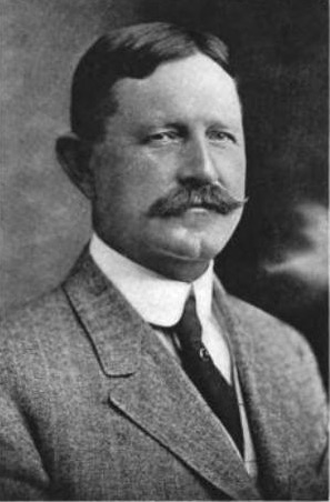
William G. Kerckhoff. Undated.

William Kerckhoff lived for most of his life in the Adams district of Los Angeles, but the lumber and shipping operations he established in San Pedro during the 1880s became an important factor in the Harbor Area’s growth. Kerckhoff’s greatest fame, though, came from his later pioneering involvement in the electric and gas utilities industry.

Kerckhoff was born in Terre Haute, Indiana, on March 30, 1856. His parents, George and Philipine, had emigrated from Germany in 1848 and settled in Indiana. At least, until George visited California on a camping trip in 1875. Impressed with the state’s possibilities, he had his son William scout out suitable places to live, and they settled on Los Angeles in 1878.

William then returned to Indiana, where he met and married his wife, Louise Eshman, in 1883. They returned to California, and settled at a house at Sixth and Main streets in Los Angeles before eventually moving to a mansion at 734 W. Adams Blvd.

Casting about for business opportunities, Kerckhoff heard about the J.G. Jackson lumber company in San Pedro. Jackson was looking for partners, and Kerckhoff and his associate James Cuzner bought in, forming Jackson, Kerckhoff and Cuzner. The new investors soon bought out Jackson and established the Kerckhoff-Cuzner Lumber and Mill Company.

Their timing was impeccable, as lumber had become a crucial ingredient in the building of Los Angeles and its suburbs. The company’s business headquarters was in downtown Los Angeles — a six-story building near Main and Sixth streets was built in 1907 — but the heart of its business was in its San Pedro lumber operation.

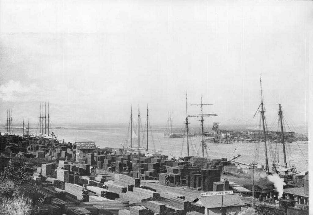
Cargo ships on the dock unload lumber at the San Pedro inner harbor, circa 1891. The Kerckhoff-Cuzner Mill and Lumber Company appears at center and left, with the W.H. Perry Lumber Mill Co. at bottom. (Credit: California Historical Society via USC Digital Library)

In addition to its mill, Kerckhoff-Cuzner built its own wharf dedicated to the shipping of lumber products. It obtained its raw materials by shipping them to San Pedro from its timber and mill holdings in the Umpqua River region of Oregon. It eventually would operate a small fleet of steamships, including the Pasadena, the first steamship in the U.S. to use oil for fuel.

The company’s operations were centered on Boschke’s Island (also known as Smith’s Island) in the San Pedro harbor on swampy land Kerckhoff-Cuzner had acquired in 1894. Eventually, the company would establish outlets throughout the Los Angeles area.

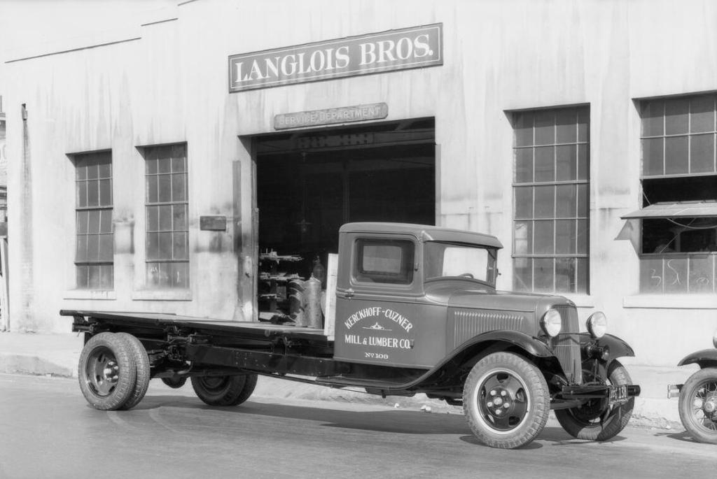
Kerckhoff-Cuzner, Mill & Lumber Co. Truck No. 109 is parked in front of Langlois Bros. in this 1933 photo. (Credit: USC Digital Library)

As business boomed, Kerckhoff began diversifying his interests. He was the first president of the Bank of San Pedro, which was founded in 1888. He also became involved with the utilities industry through the formation of the Azusa Ice and Cold Storage Co., which he formed in 1891. It provided ice to cool shipments of oranges via railroad to the rest of the country, and was powered by water-produced electricity.

Sensing the potential of hydroelectric power, Kerckhoff formed the San Gabriel Power Co., building a plant on the San Gabriel River in 1897 that brought the city of Los Angeles its first currents of hydroelectric power.

This led to a series of larger hydroelectric power projects involving dams in the San Joaquin Valley. Kerckhoff eventually became president of the Pacific Light and Power Corp., which would acquire City Gas Co. of Los Angeles. It would later be renamed the Southern California Gas Co. in 1910, with Kerckhoff at the helm.

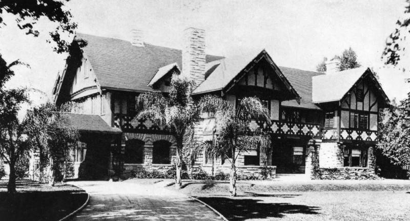
The Tudor revival style William G. Kerckhoff residence at 734 West Adams Blvd. in Los Angeles. (Credit: Los Angeles Public Library Photo Collection)

During his career, Kerckhoff held the presidency not only of the still-thriving Kerckhoff-Cuzner lumber firm and Southern California Gas, but also San Joaquin Light and Power, Fresno Farms and the South Coast Land Co.

Kerckhoff had partnered with landowner George Peck to acquire large chunks of land in San Pedro. Kerckhoff and Peck sold a 100-acre parcel to the U.S. government in 1910 for $249,000 for the building of Fort MacArthur in 1910. The Army base opened in 1914.

He was troubled by a bad heart in his later years, and began divesting many of his holdings in 1927. He died at home on Feb. 22, 1929, ten days after a heart attack left him unable to recover. In 1930, his estate was valued at $17.3 million.

In 1928, the Kerckhoffs had endowed the William G. Kerckhoff Laboratories of the Biological Sciences at California Institute of Technology (Caltech) in Pasadena. In addition, Caltech put his name on its Kerckhoff Marine Laboratory  in Corona del Mar.

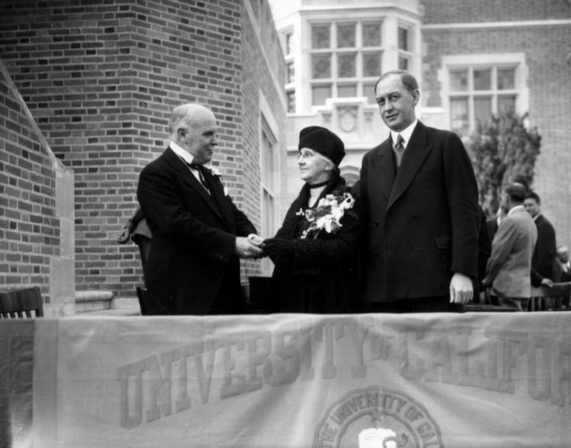
Dedication ceremony for Kerckhoff Hall, donated to U.C.L.A. by the estate of William G. Kerckhoff. Left to right: Gov. James Rolph, Mrs. Louise Kerckhoff and Robert Sproul, University of California president. Jan. 20, 1930. (Credit: Los Angeles Public Library Photo Collection)

Before his death, Kerckhoff directed his wife to donate the funds to the University of California for the construction of UCLA’s first student union building. Kerckhoff Hall, which still stands in the heart of the campus, was dedicated in January 1930, with Louise in attendance.

In her will, Louise also bequeathed the family’s Adams Blvd. mansion to USC, where it now serves as part of the Annenberg School of Journalism. She died on July 18, 1946.

The Kerckhoffs also underwrote the Max Planck Institute for Heart and Lung Research – W.G. Kerckhoff Institute and the Kerckhoff-Klinik hospital, both in Bad Nauheim, Germany.

Closer to his lumber industry roots, San Pedro’s Kerckhoff Ave. still exists today, three blocks east of Gaffey St., between 26th and 36th streets.

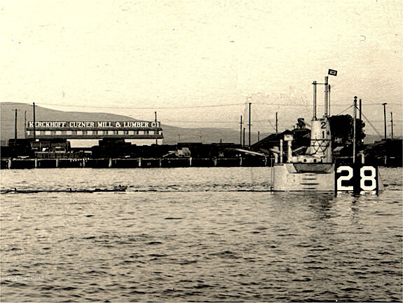
A USS H-1 submarine conducts a static dive near the West Basin in the Port of Los Angeles in San Pedro. The Kerckhoff-Cuzner Mill and Lumber Co. is at left rear. Circa 1917. (Credit: Los Angeles City Historical Society blog)

Sources:

“Historical Perspective: The Amazing Life of William G. Kerckhoff,” by Mike McCormick, Terre Haute Tribune-Star, Aug. 30, 2015.

“Kerckhoff, William George and Louise Eshman, House, South Los Angeles, Los Angeles, CA,” Pacific Coast Architecture Database (PCAD).San Pedro News Pilot archives.

Los Angeles Herald archives.

Los Angeles Times archives.
“Southern California,” The Timberman, June 1914, Page 53.

“William G. Kerckhoff,” Portraits and Biographies of the Progressive Men of the West, Press Reference Series, Page 348, 1915.

Wikipedia.

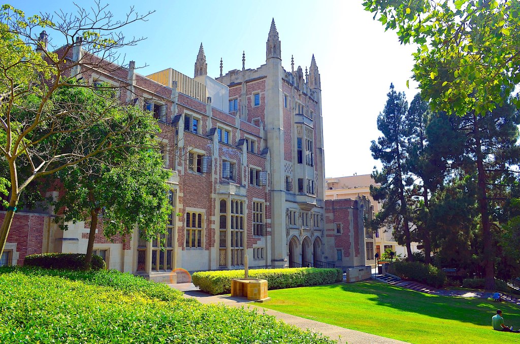
Kerckhoff Hall is the original student union building at UCLA. It is home to a coffeehouse and many student-run organizations, including the Daily Bruin campus newspaper. July 6, 2011. (Credit: Wikipedia, photo by John Lee)

The Dominguez Channel changed the face of a large swath of the South Bay/Harbor Area

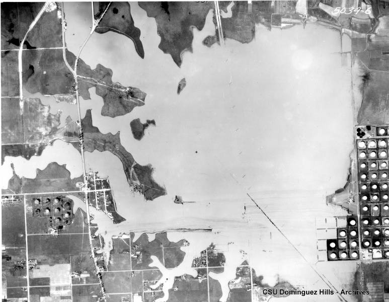
Aerial view looking north over Carson shows massive flooding over roadways and land in 1938. Oil tank farm at right. (Credit: CSUDH Digital Archives)

Up until about a hundred years ago, large bodies of standing water were the norm in low-lying parts of the South Bay and Harbor Area.

Natural wetlands covered good-sized portions of the area. The native Tongva tribes who lived in the area before the arrival of European settlers navigated the shallow backwater lakes, known as sloughs, in their canoes to get from place to place.

As first the Spanish and then the American settlers began to live on and develop the lands, they quickly noticed one thing: all hell broke loose in and around the many sloughs when it rained.

Two major sloughs affected the South Bay/Harbor Area. One of them, Bixby Slough, was situated about 4,000 feet northwest of the West Basin channel. It included, but was much larger than, present-day Machado Lake in Harbor City.

The other one originally was given the unfortunate name Nigger Slough in the 1880s. Finally,   the Board of Supervisorsin 1938  changed its name officially to Laguna Dominguez. It was located slightly farther north, stretching from the southeastern border of Torrance up to the area near Carson Street and Vermont Avenue and up to the southern borders of Gardena.

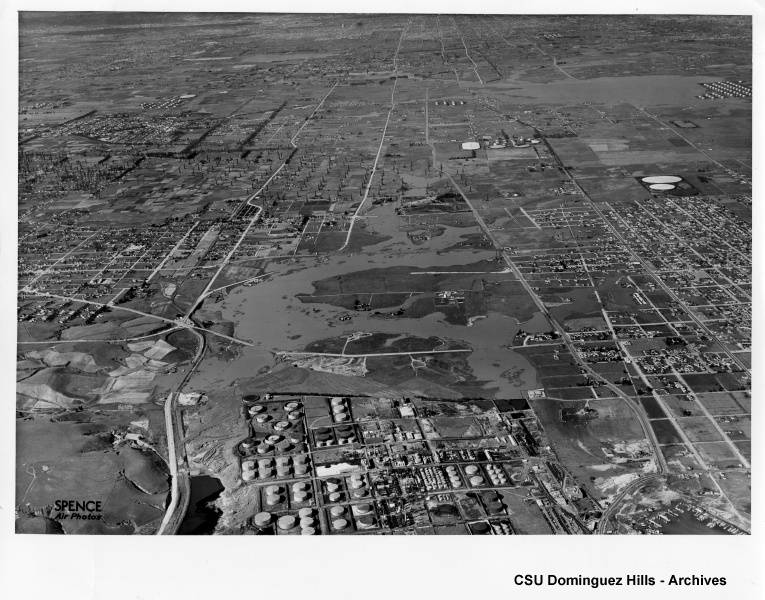
1941 aerial view looking north from the Wilmington area, with Bixby Slough in foreground and Laguna Dominguez Slough in upper right corner. Some flooding over roads and oil storage tanks can be seen. (Credit: CSUDH Digital Archives)

By the early 1900s, floodwaters from the sloughs during the rainy season made it considerably more difficult for modern settlers to build houses, drill for oil and generally just get around. The moisture in the swampy areas also proved to be a perfect breeding ground for mosquitoes and other pests.

The first efforts to begin to tame the sloughs started in the 1920s, but it would take almost half a century before the project was completed. In the meantime, the rain-swollen lakes in the affected areas remained a part of life, flooding roads and wreaking havoc during rainstorms.

In the 1930s, engineer F.M. Andreani even proposed that the city of Torrance use the existing waters to build a canal from the Port of Los Angeles to Torrance’s eastern edge, transforming it into a seaport. The idea turned out to be impractical.

After World War II ended, the need for land for residential development boomed, and Los Angeles County redoubled its efforts to complete its flood control plan for the area. 

Torrance Press, Nov. 13, 1963, Page A-5. (Credit: Torrance Historical Newspaper and Directories Archive database, Torrance Public Library)

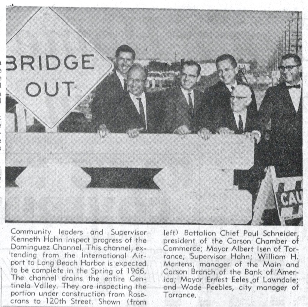
In 1952, newly elected Supervisor Kenneth Hahn, in whose district the Dominguez Channel was situated, found himself at the Leuzinger High gym in Lawndale where hundreds of residents had been evacuated after flooding following several days of heavy rain in a row.

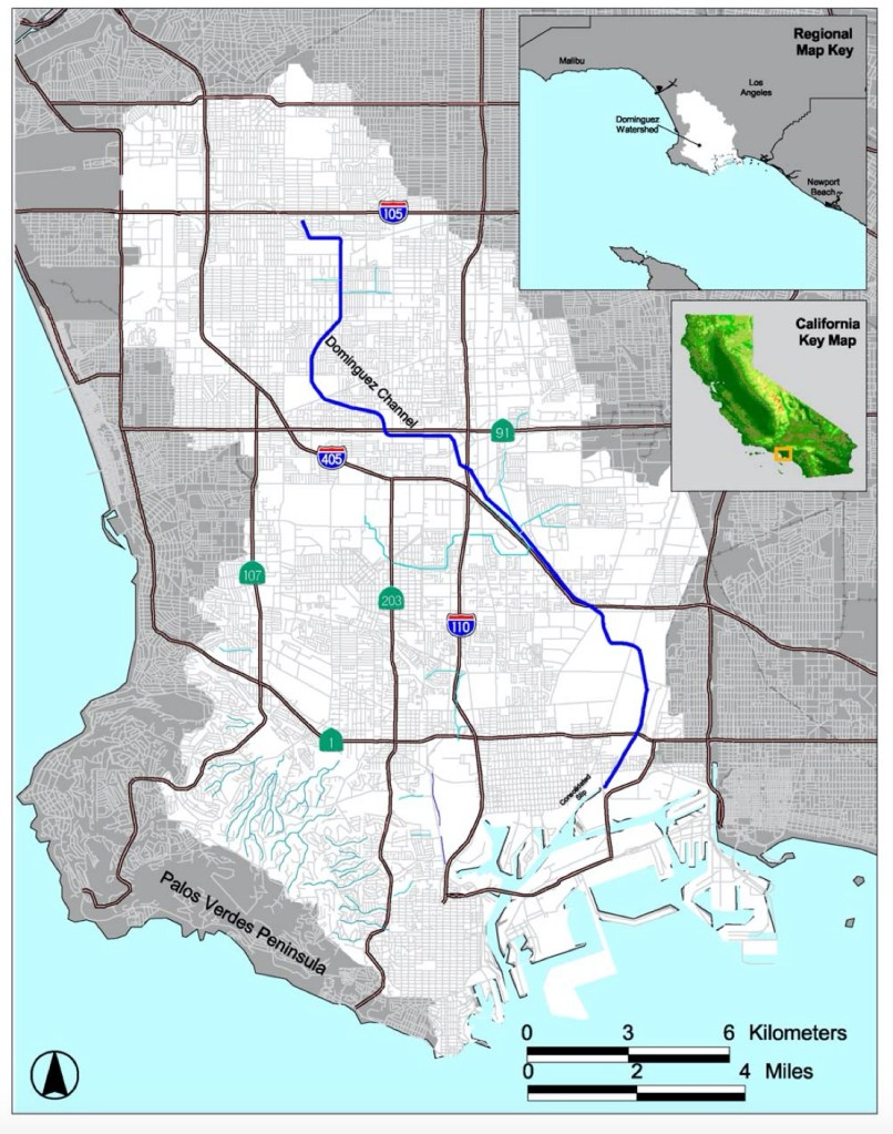
At that point, the channel was a patchwork of concrete embankments and boulder-lined dirt ditches. At Hahn’s urging, the county formulated a plan to build one continuous 15.7-mile channel into which multiple feeder tunnels and culverts would carry water runoff south to the Consolidated Slip in the East Basin of the Port of Los Angeles, and from there out into San Pedro Bay.

The path of the Dominguez Channel from Hawthorne to San Pedro Bay is delineated in blue. (Credit: “Dominguez Watershed Management Master Plan,” Los Angeles County Department of Public Works website)

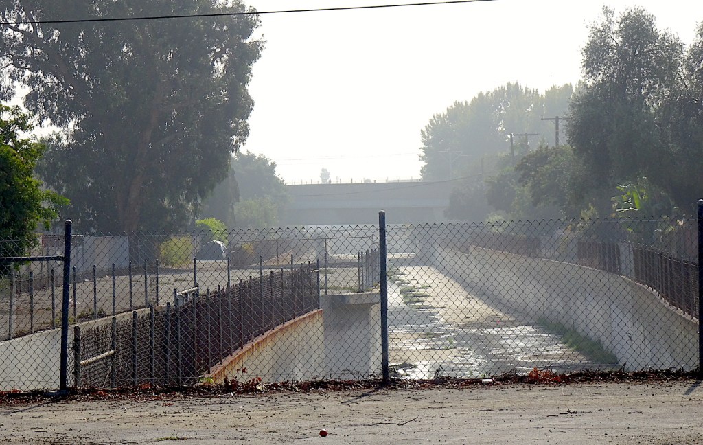
Under the plan, the Dominguez Channel would begin, as it does today, at 116th St. between Kornblum and Doty avenues in Hawthorne. From there, it skirts the eastern Hawthorne city limits, passes beneath a large parking garage at El Camino College and then wends its way through Gardena, Carson and Wilmington before emptying into the East Basin.

The flood control measures effectively served to, you’ll pardon the expression, drain the swamps. At the same time as work was beginning in earnest on the Dominguez Channel, the Bixby Slough area was being partially drained, with part of its waters eventually converted into Machado Lake.

 Both efforts not only reduced the rainfall problems, but also freed up more land for development. The county estimated in 1967 that clearing the sloughs added $500 million in valuation to the property tax rolls in the affected areas.

The Dominguez Channel begins just south of 116th St. in Hawthorne. November 2021. (Photo by Sam Gnerre)

A mostly dirt 2.5-mile section of the channel between Vermont Ave. and Avalon Blvd. was the final link in the chain. The problematic stretch flooded consistently during heavy downpours, especially during the 1956 rainy season.

On May 31, 1967, Hahn announced that the Dominguez Channel project had been completed with the construction of that final stretch. He noted in a 1969 Torrance Herald story that the piecemeal channel project had cost approximately $31 million, all of it locally funded without federal or state assistance.

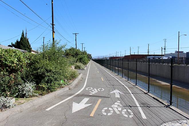
The Laguna Dominguez trail bike path runs alongside the Dominguez Channel through part of Hawthorne. (Credit: Photo by vikemaze, TrailLink website)

The concrete channel has few amenities, though the Laguna Dominguez Trail bike path runs along portions of the waterway in Hawthorne. Its design is strictly utilitarian; if it were to be built today, it probably would look considerably more environmentally friendly than it does now.

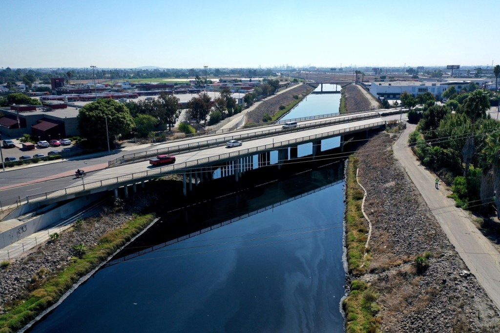
The Dominguez Channel became a focus of renewed concern in early October 2021, when residents began noticing a foul odor coming from the concrete waterway southward from where it passes through Carson.

County health officials grew concerned when the odor, caused by elevated levels of hydrogen sulfide, persisted despite efforts to dispel it. Though experts claim exposure shouldn’t result in adverse health effects, the chemical odor has caused nausea, headache and throat and eye irritation to nearby residents.

On Nov. 2, 2021, the County Board of Supervisors declared a local emergency in order to marshal more resources to fight the problem, as preliminary measures to remedy it have been ineffective.

Aerial photo taken using a drone shows the Dominguez Channel flowing through Carson. Oct. 21, 2021. (Credit: Dean Musgrove/The Orange County Register via AP)

Sources:

Daily Breeze archives.

“Dominguez Channel,” Los Angeles City Dept. of Sanitation & Environment website.

“Dominguez Channel, Los Angeles,” by Sergey Kadinsky, Hidden Waters Blog, Aug. 25, 2021. Note: Kadinsky’s post offers an excellent, detailed field guide to the Channel.

“Dominguez Watershed Management Master Plan,” and “Virtual Tour of Dominguez Channel,” Los Angeles County Department of Public Works website.

Los Angeles Times archives.
Torrance Press-Herald archives.

Douglas Aircraft’s plant near Torrance began as an aluminum mill during World War II

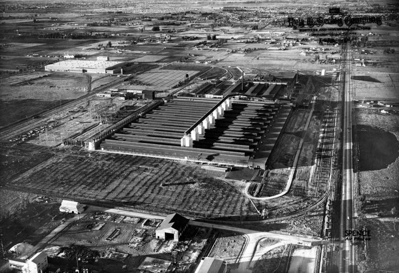
Aerial view of the Aluminum Company of America (ALCOA) plant just east of Torrance. Undated circa 1942-44.
(Credit: Los Angeles Public Library Photo Collection)

The Aluminum Corporation of America began as the Pittsburgh Reduction Company in 1888. Its founder, Charles Martin Hall, formed it after pioneering a new process of creating the then-rare metal, aluminum, from bauxite ore.

53 years later, the need for aluminum to build airplanes for America’s war effort brought the company, renamed the Aluminum Corporation of America in 1907, to the South Bay. (The company, nicknamed ALCOA for short, introduced its household aluminum foil product three years later in 1910.)

This banner front page headline announces the new aluminum plants near Torrance just before the Pearl Harbor attack. Torrance Herald, Dec. 4, 1941. (Credit: Torrance Historical Newspaper and Directories Archive database, Torrance Public Library)

Just three days before the Pearl Harbor attack that brought the U.S. into World War II, the company announced plans to build a major aluminum plant on 253 acres near 190th St. and Normandie Ave. in part of the Los Angeles “shoestring strip,” the area just east of Torrance now known as Harbor Gateway. Though the U.S. had not officially entered the war, wartime production already had been ramping up since the September 1940 passage of the Lend-Lease agreement to provide Allied powers with war resources.

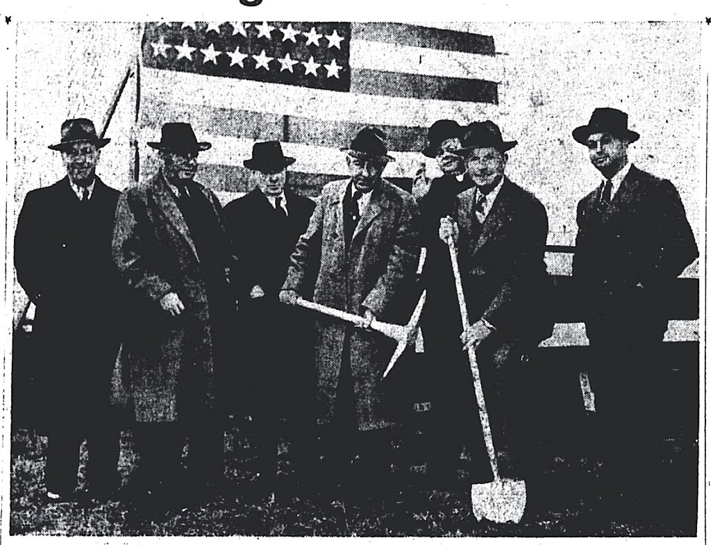
Eight days after the announcement, a groundbreaking ceremony for California’s first aluminum reduction plant was held. Money from the $24 million plant came through the government Defense Plant Corp., part of the New Deal Reconstruction Finance Corp. (RFC) agency, which then leased the plant to ALCOA.

Government officials from the Reconstruction Finance Corp,, Aluminum Corp. execs and a priest (third from right) at the groundbreaking ceremony for the ALCOA plant. Torrance Herald, Dec. 18, 1941, Page 1. (Credit: Torrance Historical Newspaper and Directories Archive database, Torrance Public Library)

The operation came online with the first pouring of the versatile metal in July 1942. By that time, the plant already had employed hundreds of workers. Production continued apace until Aug. 29, 1944, when the federal government ordered the factory shut down. Apparently it had performed too well by contributing to the overproduction of aluminum, and its 600 workers were needed for other wartime priorities such as shipbuilding and rubber production.

Just like that, ALCOA’s Torrance facility was idled. It would remain empty for the next eight years.

Enter Douglas Aircraft, founded by Donald Douglas in Santa Monica in 1921. During World War II, the company’s fortunes soared, and it had nearly 160,000 employees working for it. Looking for new markets following postwar cutbacks, Douglas looked to jet aircraft and missile production.

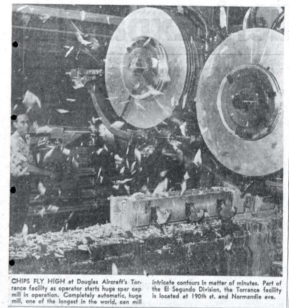
It had major plants in El Segundo and Long Beach, but was looking to expand production by adding another South Bay plant. The former ALCOA factory site was a natural choice. The deal was signed on April 23, 1952, with Douglas agreeing to rehabilitate the plant to fabricate airplane parts for the U.S. Navy.

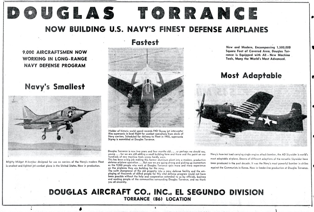
Torrance Press ad, Aug. 12 1954, Page 20. (Credit: Torrance Historical Newspaper and Directories Archive database, Torrance Public Library)

The company moved quickly, announcing on July 3 of that year that production had begun on jet aircraft for the Navy, including the F-4D Skyray, a supersonic interceptor plane launched from aircraft carriers. The Skyray was fast and maneuverable, and had recently had broken several airspeed records

In 1953, Douglas built a $1.5 million hangar and test building at LAX for aircraft built in its El Segundo and Torrance-area plants. The 15-acre site was located on the northwest corner of Imperial Hwy. and Sepulveda Blvd., not far from the then-new Sepulveda Tunnel under the airport’s southern runways, 25L and 25R. It was used to test the aircraft being turned out of the South Bay Douglas plants.

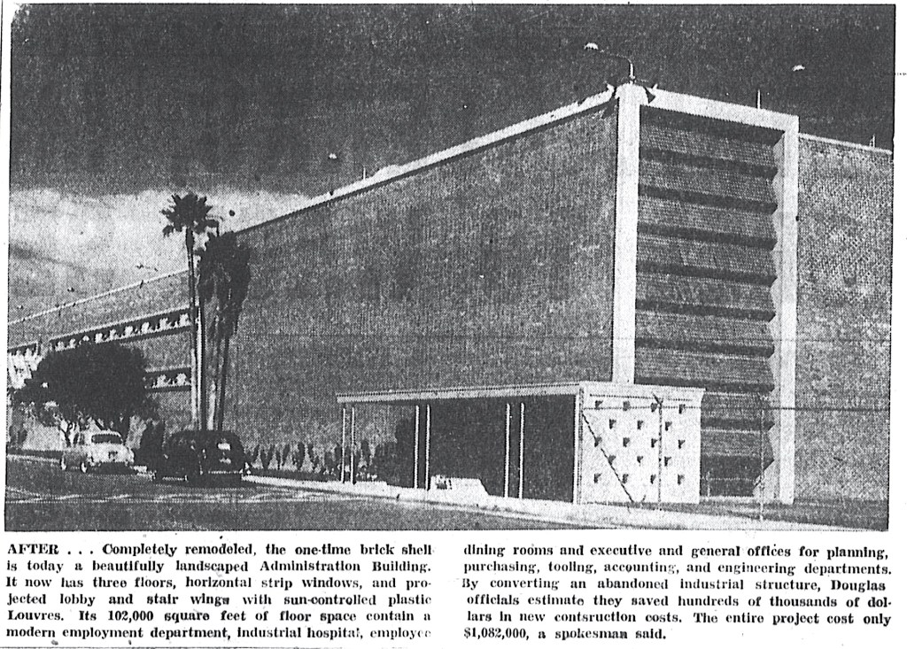
The newly remodeled administration building at the 190th St. plant. Torrance Herald, April 18, 1954, Page 2. (Credit: Torrance Historical Newspaper and Directories Archive database, Torrance Public Library)

By 1954, the 190th St. Douglas location employed more than 9,000 workers. It continued to thrive even when the company began shifting final construction of aircraft to its new plant in Palmdale in 1958.

In addition to jets, the company also began working on booster rockets for space flights in 1961. That same year, the El Segundo plant began to be phased out, with its employees transferred to the Harbor Gateway and Long Beach locations.

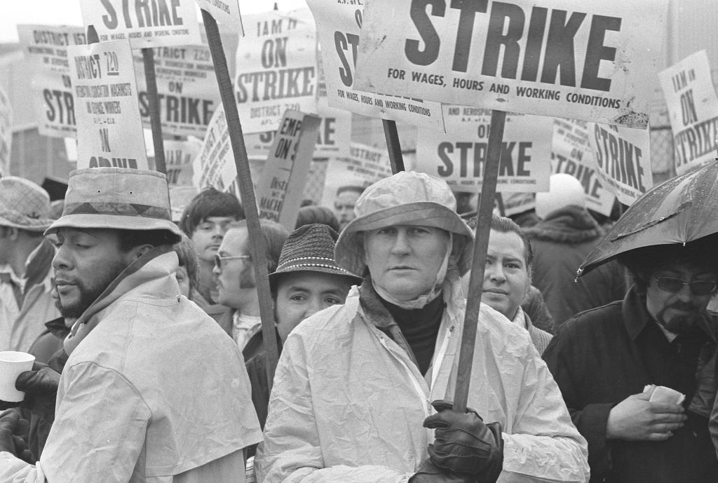
Machinist union members picket at the McDonnell Douglas Corp. plant near Torrance on Feb. 11, 1975. (Credit: UCLA Library, Dept. of Special Collections)

In 1967, Douglas merged with McDonnell Aircraft to form McDonnell Douglas, whose emphasis had turned more toward commercial aircraft. In 1969, production began on the DC-10 Airbus at the Harbor Gateway facility, though the bulk of its construction actually would take place at the company’s Long Beach factory, which by then had become its chief plane assembly site.

By 1979, a decade or so later, the company was battling the fallout over three deadly crashes of the DC-10 within six months. The company managed to recover from the negative publicity, and its 6,000 employees at the Harbor Gateway plant continued their work until the late 1980s, when the aerospace industry began to collapse financially.

Undated vintage Douglas Aircraft logo.

Worsening economic conditions in the industry led to McDonnell Douglas acknowledging in January 1990 that it planned to sell the 190th St. plant. Layoffs continued for the next couple of years, and in April 1992, the company announced that it would close the plant and move its jobs out of state.

That July, a Daily Breeze story reported that Robert Hood, president of the company’s  Douglas Aircraft unit, which included the Harbor Gateway plant, had sent a letter to its workers praising them for their “long record of excellent work.”

In the letter, Hood blamed the closing on overcapacity, poor worldwide economic conditions in the airline industry, the high cost of repairing and maintaining the 1940s-era plant and upgrading its obsolete equipment and the cost of complying with environmental regulations.

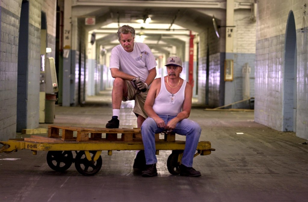
Charles Haynes III, left, and John Imperial, both warehouse operators since 1979 at the old McDonnell Douglas facility on 190th just east of Torrance were the last two employees to leave the old facility on June 4, 2000. Here they take a moment to pose in Building 2, which was originally a machine shop and later became a parts warehouse. (Daily Breeze staff file photo)

The 190th St. operation closed in May 1994, and its equipment was auctioned off. In 1996, McDonnell Douglas announced that it would sell the land to developers, who in turn planned to build a $35 million shopping center and industrial buildings on the site.

The last few remaining workers at what was essentially an empty warehouse left the building in June 2000, and soon after, the wrecking ball began to fall.

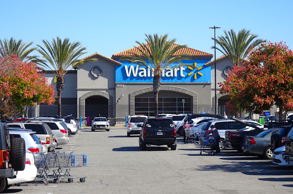
On June 15, 2005, the planned shopping center opened on the site. Its centerpiece? The South Bay’s very first full-size Walmart store.

The Walmart on 190th St. near Normandie in Harbor Gateway stands on the former ALCOA-Douglas Aircraft site. (October 2021 photo by Sam Gnerre)

Sources:

Daily Breeze archives.

Los Angeles Times archives.
“Our History (Timeline),” ALCOA website.

Torrance Press-Herald archives.

Wikipedia.

Torrance Press, April 28, 1958, Page 7. (Credit: Torrance Historical Newspaper and Directories Archive database, Torrance Public Library)

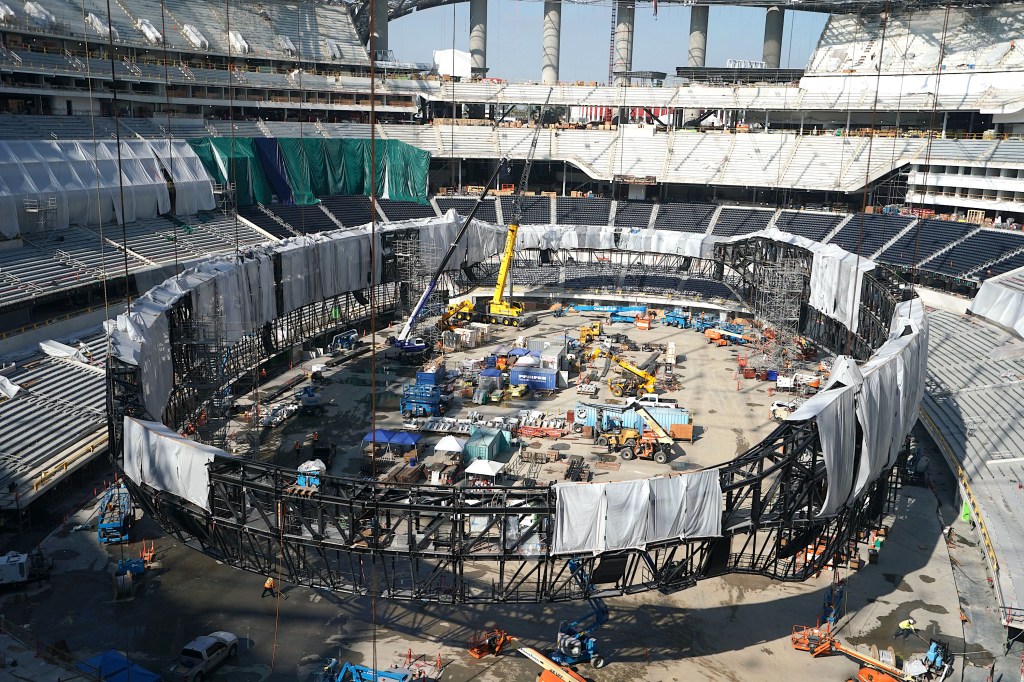
Inglewood’s transformative Sofi Stadium is the most expensive ever built

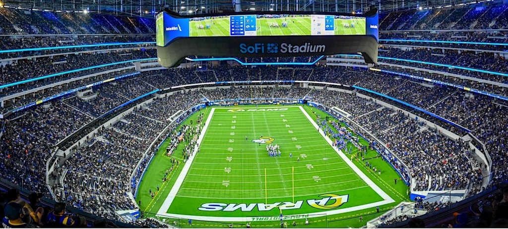
A full crowd cheers at SoFi Stadium for the Rams-Raiders preseason game on Aug. 21, 2021. (Daily Breeze staff file photo)

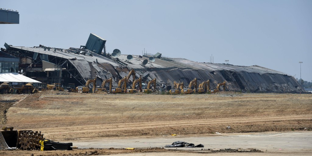
Consider this blog post part three of my history of the Hollywood Park site in Inglewood. Part 1 and Part 2 appeared in 2015, just after the main grandstand of the horse racing track Betfair Hollywood Park was brought down by implosion on May 31.

Earlier that year, on Jan. 5, St. Louis Rams owner Stan Kroenke had announced plans to build an NFL stadium on the site. A month later, the city of Inglewood approved the stadium plan, to be built on land Kroenke had acquired in 2014. The stadium plan was folded into a pre-existing commercial/residential development plan for the Hollywood Park site.

The grandstand for the historic Betfair Hollywood Park racetrack in Inglewood after it was imploded on May 31, 2015. (Daily Breeze staff file photo)

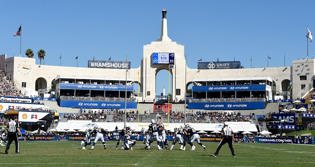
The Rams originally played in Cleveland from 1936-45, winning an NFL championship title in 1945. They moved to Los Angeles in 1946, where they then won another championship in 1951. They would play in the Coliseum for decades before moving to Anaheim Stadium in 1980.

After 14 years in Anaheim, the Rams moved to St. Louis, where they won the Super Bowl in 2000 with quarterback Kurt Warner at the helm. Kroenke bought the team in 2010. 

An agreement in the team’s lease deal with the city called for St. Louis to finance improvements at the city’s stadium. When the city balked, Kroenke began plotting his move back to Los Angeles.

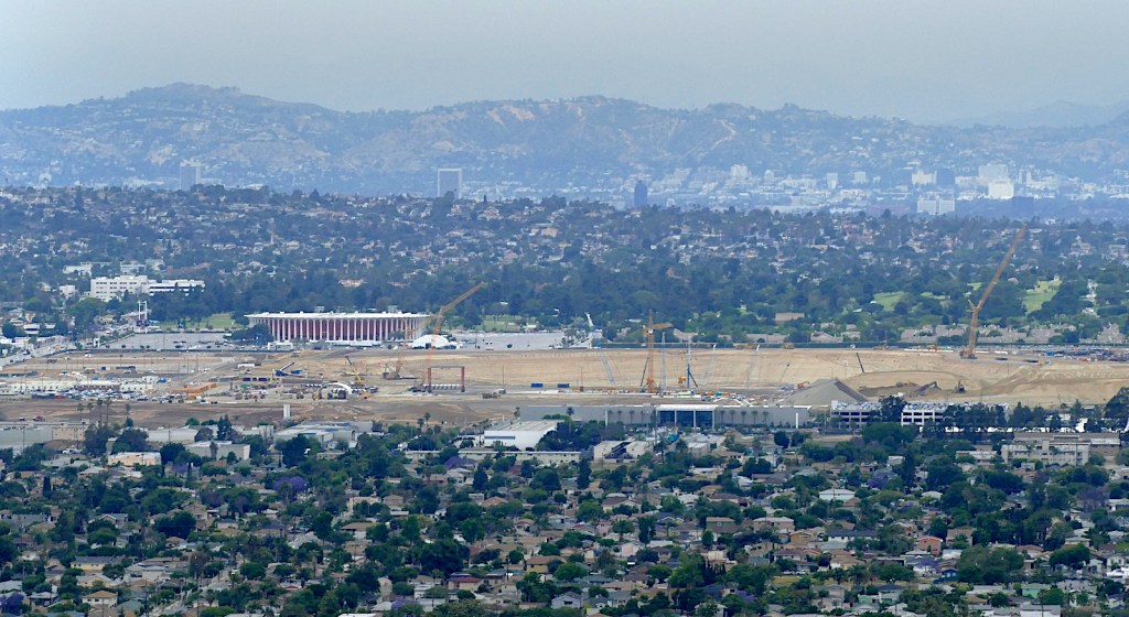
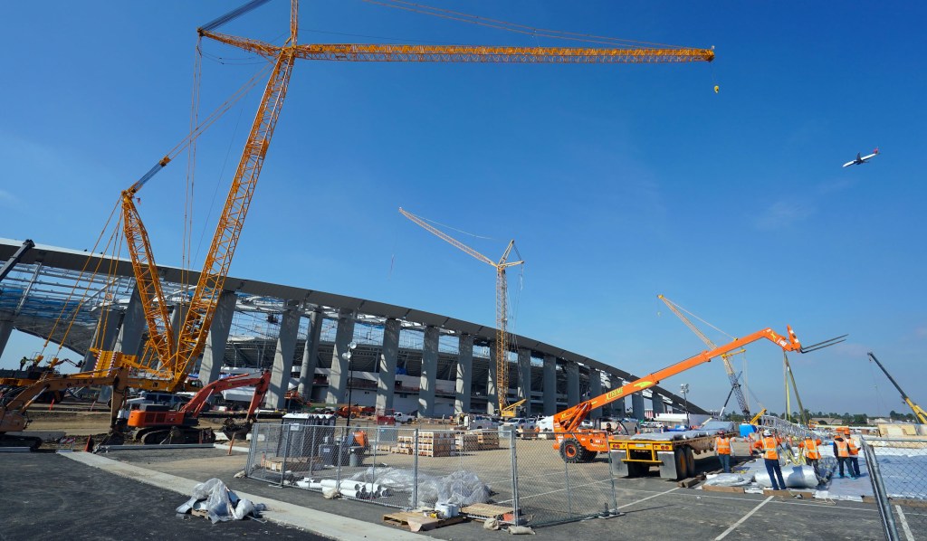
View looking north shows construction underway at the new stadium in Inglewood in May 2017. (Daily Breeze staff file photo)

At that time, rumors were floating around that the NFL’s San Diego Chargers and possibly the Oakland Raiders would be moving to a former toxic waste landfill site just off the 405 Freeway in Carson, pending league approval.

The two projects vied along with several others for the final endorsement by the NFL owners, with the Carson faction headed by former Disney executive Robert Iger. Two other competing plans included Farmers Field, Phillip Anschutz’s AEG plan to build a stadium at the downtown Convention Center, and a City of Industry proposal set forth by billionaire Ed Roski.

The back-and-forth battle behind the scenes lasted until January 12, 2016, when the NFL owners voted 30-2 to allow the Rams to return to Los Angeles and, eventually, Kroenke’s new Inglewood stadium.

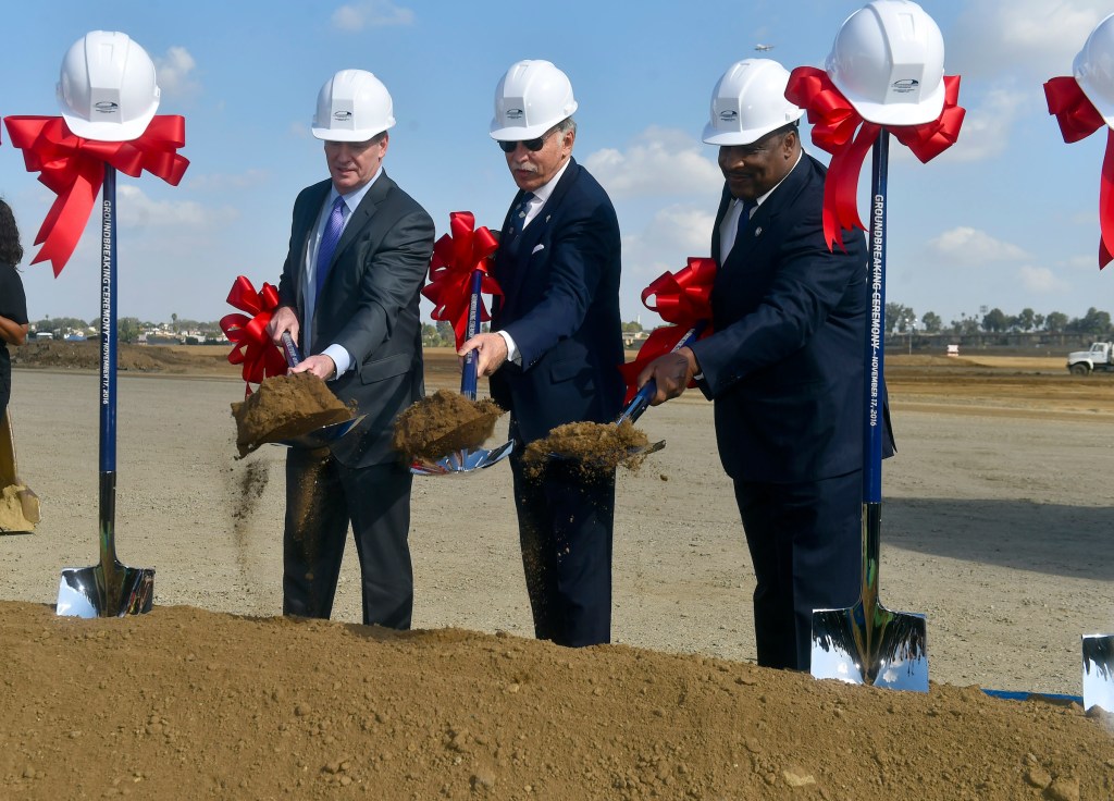
Originally, the plan was to play in the Coliseum for three years beginning in 2016, until the new 298-acre facility was completed in time for the 2019 season. Ground was broken for the project on Nov. 18, 2016, though grading work already had begun.

From left, NFL Commissioner Roger Goodell, Rams owner Stan Kroenke and Inglewood Mayor James Butts break ground on the Rams’ new stadium in Inglewood, CA on Nov. 17, 2016. (Daily Breeze staff file photo)

Several factors contributed to a one-year delay in the plan. Because of the stadium’s proximity to Los Angeles International Airport, much of it had to be built below ground level in order not to interfere with LAX’s radar and the flights of incoming planes.

In addition, FAA approval for the plan was held up for months until Kroenke agreed to build a separate $29 million radar system to eliminate interference with LAX radar operations.

Los Angeles Chargers quarterback Philip Rivers passes against the Los Angeles Rams in the second half of a NFL football game at the Los Angeles Memorial Coliseum on Sept. 23, 2018. (Daily Breeze staff file photo)

A 200-foot-deep hole needed to be excavated for that to happen. Unfortunately, the unusually heavy 2016-17 rainy season led to 60 days of rain delays. The rainwater would fill up the excavation site, which then would have to pumped out and dried before work could continue. As a result, the completion date had to be moved to 2020, and the Rams spent an extra year in the Coliseum.

Meanwhile, with the collapse of the Carson stadium deal, the Chargers and the Raiders were left in limbo. The Raiders eventually opted out of Los Angeles completely, gaining approval from the league in 2017 to move to Las Vegas. In 2020, they moved into their new $1.9 billion Allegiant Stadium there.

The Chargers cut ties with the city of San Diego when owner Dean Spanos announced plans in January 2017 to move to Los Angeles after the city’s voters nixed a proposed $1.6 billion financing plan for a new stadium. The team had played its first-ever season of pro football in Los Angeles in 1960, as members of the upstart American Football League (AFL). They moved to San Diego after one year, and stayed there for 56 seasons.

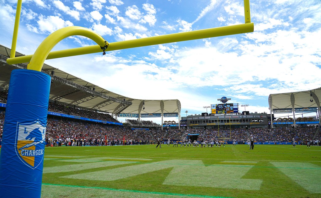
The Chargers play the Houston Texans at Dignity Health Sports Park in Carson on Sept. 22, 2019. (Daily Breeze staff file photo)

Their plan to share the new Inglewood stadium with the Rams also was set back for a year by the construction delays, and they ended up playing three seasons at the Dignity Health Sports Park (formerly the Home Depot Center) in Carson. The NFL okayed the unusual arrangement, even though the Carson stadium’s capacity of 30,000 was 20,000 less than the league’s minimum.

In September 2019, the online finance company Social Finance Inc signed a 20-year deal for the naming rights to the new facility, giving it its name of Sofi Stadium.

The Rams defeated the Dallas Cowboys, 20-17, in the first regular-season NFL game at Sofi on Sept. 13, 2020. What would have been a day of great celebration was muted by the COVID-19 pandemic; the game was played in a very beautiful but very empty stadium save for players and fan cutouts due to health restrictions.

Giant cranes sit in the parking lot ready to lift roof panel sections onto Sofi Stadium in Inglewood on Jan. 22, 2020. (Daily Breeze staff file photo)

The full celebration took place in 2021, when fans returned in person to celebrate the return of the Rams and Chargers to football before live crowds.

The construction delay cost Sofi Stadium its chance to host Super Bowl LV in 2021, in a deal that had been made with the NFL in 2016. But the league merely pushed the event ahead by a year, so that Sofi will be the site of Super Bowl LVI on Feb. 13, 2022.

In addition, Sofi will host the college football national championship game in 2023, as well as the opening and closing ceremonies of the Olympic Games in 2028. 

At a total cost of $5.5 billion, Sofi is the most expensive sports stadium ever built as of this writing.

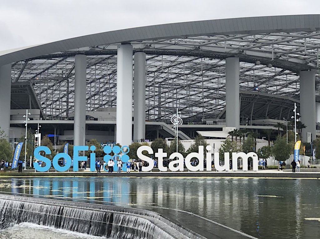
Exterior of completed Sofi Stadium, circa 2020-21. (Credit: Itinerant Fan website)

Sources:

Construction Disputes website.

Daily Breeze archives.

Los Angeles Times archives.
Wikipedia.

The giant Oculus 2-sided video board is assembled inside on the floor of SoFi Stadium in Inglewood on Jan. 22, 2020. (Daily Breeze staff file photo)

Balloon Route Excursion Co. trolley car tours included South Bay locations

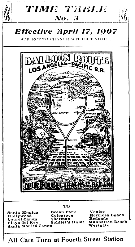
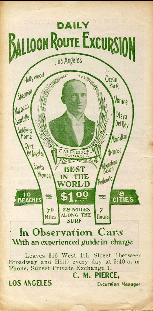
Cover of printed Balloon Route schedule. (Credit: Wikimedia Commons)

When I first began seeing references to the early 1900s tours operated by the Balloon Route Excursion Co., I assumed they were conducted using hot air balloons. I wondered how that possibly could have worked.

A closer look revealed that the company’s tours got their name from the balloon-shaped trolley car route that they took through Los Angeles, which were conducted most definitely on land, and not via balloon. 

The Balloon Route Excursion Co. was the brainchild of Henry Huntington’s Pacific Electric Railway Co., which introduced the service along its train lines in 1901. 

Developers and trolley pioneers Moses Sherman and Eli Clark, whose smaller  lines were bought up by the larger Pacific Electric that year, came up with the idea. Sherman would later develop a large chunk of the San Fernando Valley; Sherman Way and Sherman Oaks are named for him.

The pair had an ulterior motive for formulating an excursion route using several existing trolley lines through west Los Angeles and the lightly developed coastal South Bay: to show regular folks the allure of coastal Los Angeles and convince them to buy property along the way.

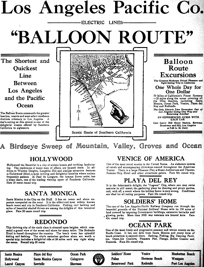
For just one dollar, riders could board the special excursion cars at 316 W. 4th St. in  downtown Los Angeles and spend the day visiting the advertised “10 beaches and 8 cities.” Tour guides led them to stops in Hollywood, west Los Angeles, Santa Monica, Playa del Rey, Redondo Beach and Venice before returning through Culver City to their point of origin downtown.

Undated postcard shows Balloon Route car in Venice. (Credit: KCET website)

Sherman and Clark did a fine job in putting the Balloon Route concept together, but the railway failed to promote the service adequately in its first couple of years, and ridership was light.

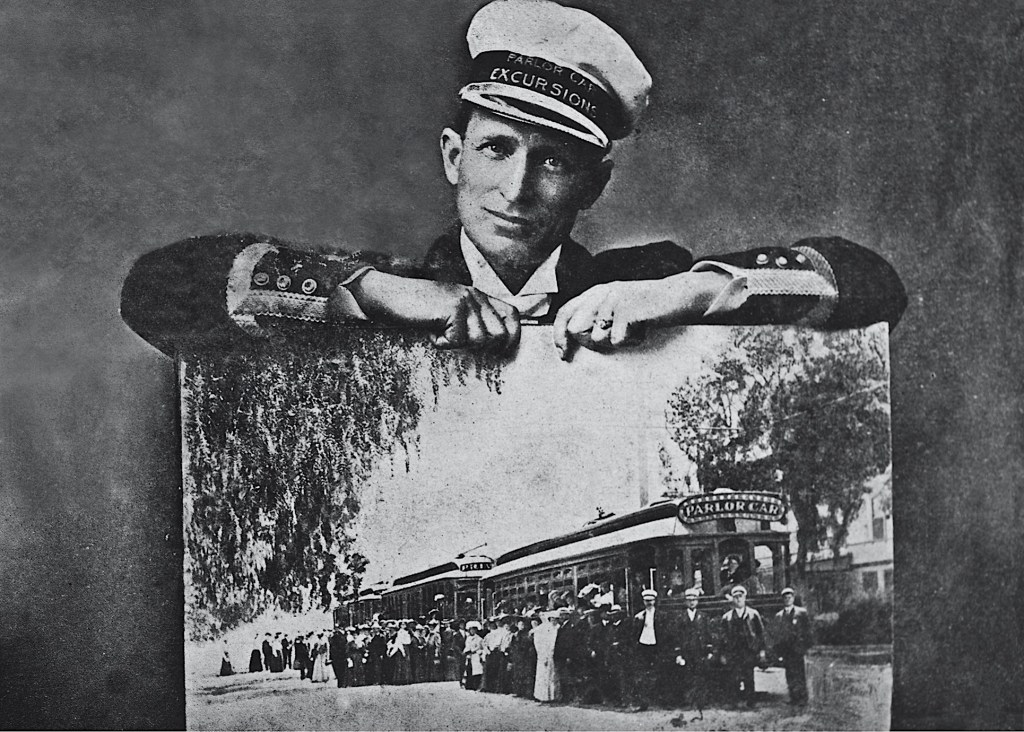
The company remedied that by hiring master marketer Charles Merritt Pierce, who took charge of the Balloon Route operation in November 1904. Pierce had operated horse-and-carriage tours to and from his Glen Avon Hotel in Hollywood before coming to his new job.

Charles Merritt Pierce poses holding undated photo of Balloon Route cars, tour guides and passengers. and personnel. (Credit: Courtesy of the Mount Lowe Preservation Society Collection, Pacific Electric Railway Historical Society)

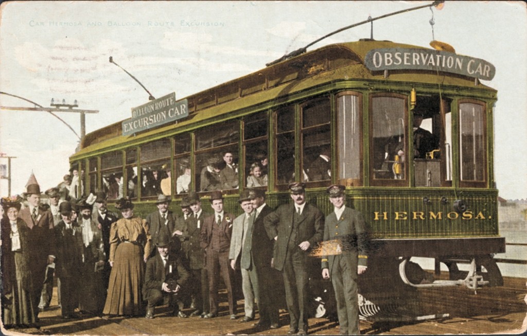
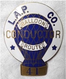
He threw all his considerable promotional talents into the job. He hired carefully vetted tour guides in specially designed Balloon Route uniforms to work in the trolley cars whose spartan interiors he had remodeled to make for more comfortable riding. He also hired professional ad men who made sure that flyers hyping the service got placed in local hotels, the Catalina steamship, and other tourist excursions. 

The Balloon Route’s popularity grew immediately. Additional train cars were added to handle the crowds, and, on peak summer days, thousands of tourists enjoyed the day-long ride.

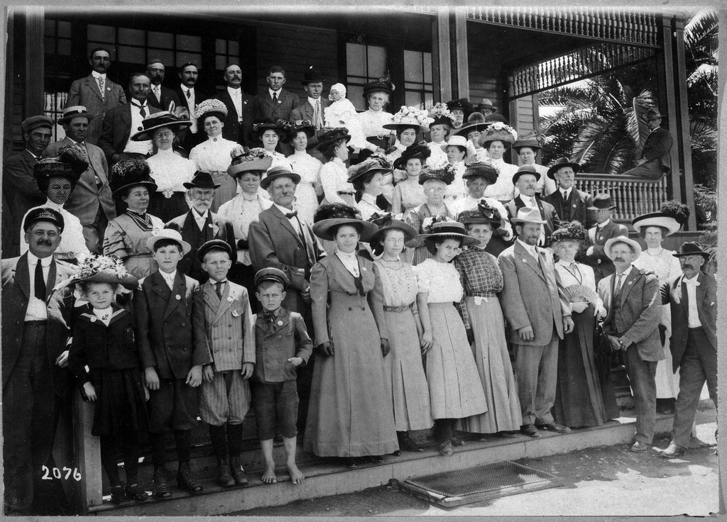
Passengers from a Balloon Route excursion outing pose for a group shot on the steps of the Sawtelle Old Soldier’s Home in West Los Angeles in 1910. (Credit: Placentia Library District)

The tour’s first stop was in Hollywood, where riders toured the house of then-prominent French artist Paul de Longpre. Next came a visit to the Sawtelle Old Soldier’s Home in West Los Angeles, on the site of the current Veterans Administration grounds, whose lushly  landscaped gardens made it popular among tourists.

From there, the trolley made two stops in Santa Monica, at the Camera Obscura and then at the Long Wharf, a 4,270-foot pier near Pacific Palisades that was removed in 1933.

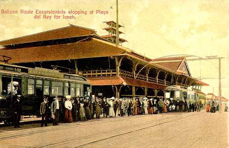
Balloon Route passengers arrive at the Playa Del Rey Pavilion in this undated postcard.

The South Bay stops came next, beginning with Playa del Rey. In 1902, developer Harry Barbour had opened a resort complex that would include a three-story pavilion, hotel, bowling alley and skating rink there. Balloon Route visitors could eat at the pavilion at a restaurant Pierce owned for 50 cents, as well as enjoying the other facilities.

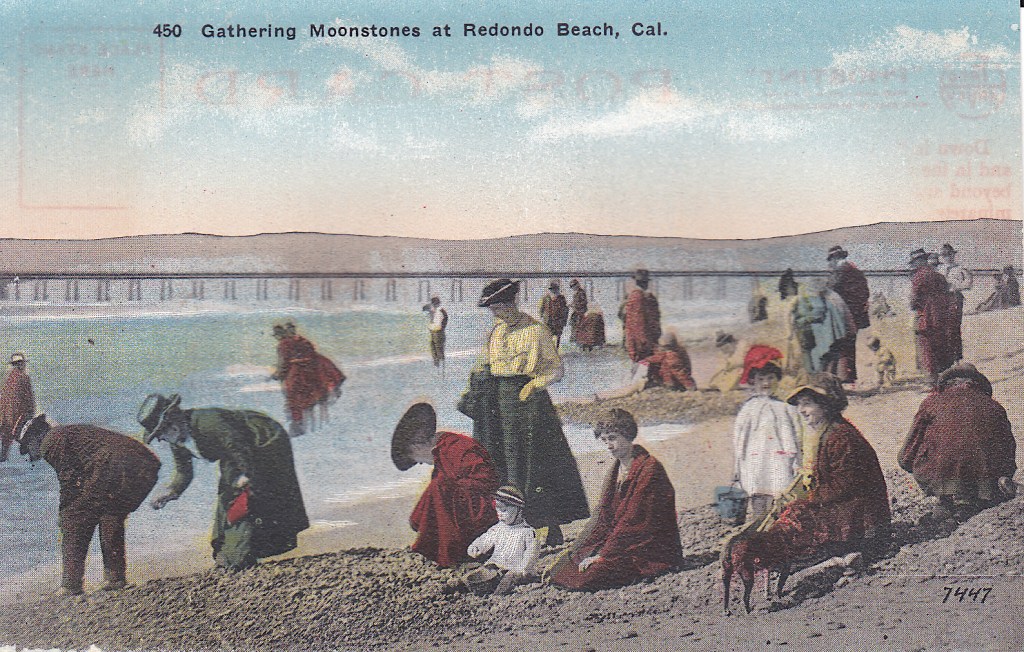
Two stops in Redondo Beach followed. First, riders would disembark at Moonstone Beach, a stretch of shoreline from roughly present-day Herondo Ave. south to Diamond St. The beach was named for the smooth feldspar stones washed up on its shores by the strong ocean currents in the area.

Tourists flocked to Moonstone Beach in the late 1800s and early 1900s to hunt for the desirable oval stones, which took on a lustrous beauty once polished by jewelers or lapidarists. Unfortunately, the stones began disappearing in the 1920s, gobbled up for use in construction projects. 

Visitors search for moonstones on Moonstone Beach in Redondo Beach. Postcard circa 1910. (Credit: Wikimedia Commons)

In the 1960s, the geography and geology of Moonstone Beach changed forever with the building of the massive King Harbor project. The city of Redondo Beach created Moonstone Park on Mole B in King Harbor to commemorate the former beach.

From there, tourists were transported to Redondo Beach’s Paseo de la Playa area, home of the Pavilion, saltwater plunge, and other amusements, and then to the lavish Hotel Redondo for a quick tour. The trolley then returned north to Venice and its seaside attractions, including an aquarium and roller coaster as well as shops and cafes, before finally heading back to downtown Los Angeles.

After building up the popularity of the Balloon Route operation, Pierce left the company in 1911, following the Pacific Electric merger with Southern Pacific. The new management took back operation of the many tourist trolley lines that Pierce had managed after the success of the Balloon Route, including the Seaside Route, which transported sightseers to San Pedro and the Harbor Area.

The rise of the automobile and the further development of roads and highways led to the gradual decline in popularity of the tourist trolleys, though they continued to operate for another couple of decades. The freedom of the open road made it possible to conduct one’s own tour.

Pierce remained in the sightseeing business for decades before his death in 1964 at 97.

Los Angeles Herald ad, Dec. 20, 1908, Page 107. (Credit: Los Angeles Herald digital archive)

Sources:

“The Balloon Route: A Tourist’s Trolley Trip Through Early-1900s Los Angeles,” by Victoria Bernal, KCET website, June 9, 2016.

“Charles Merritt (C.M.) Pierce and the Los Angeles Pacific Balloon Route Excursion,” edited by Ira L. Sweet, November 1955, Pacific Electric Railway Historical Society website.

Daily Breeze archives.

Los Angeles A To Z: An Encyclopedia of the City and County, by Leonard and Dale Pitt, University of California Press, 1997.

Los Angeles Herald archives.

Los Angeles Times archives.
Redondo Reflex archives.

Brochure cover, circa 1910. (Credit: Courtesy of the Mount Lowe Preservation Society Collection, Pacific Electric Railway Historical Society)

Time is running out for The Links at Victoria Golf Course in Carson

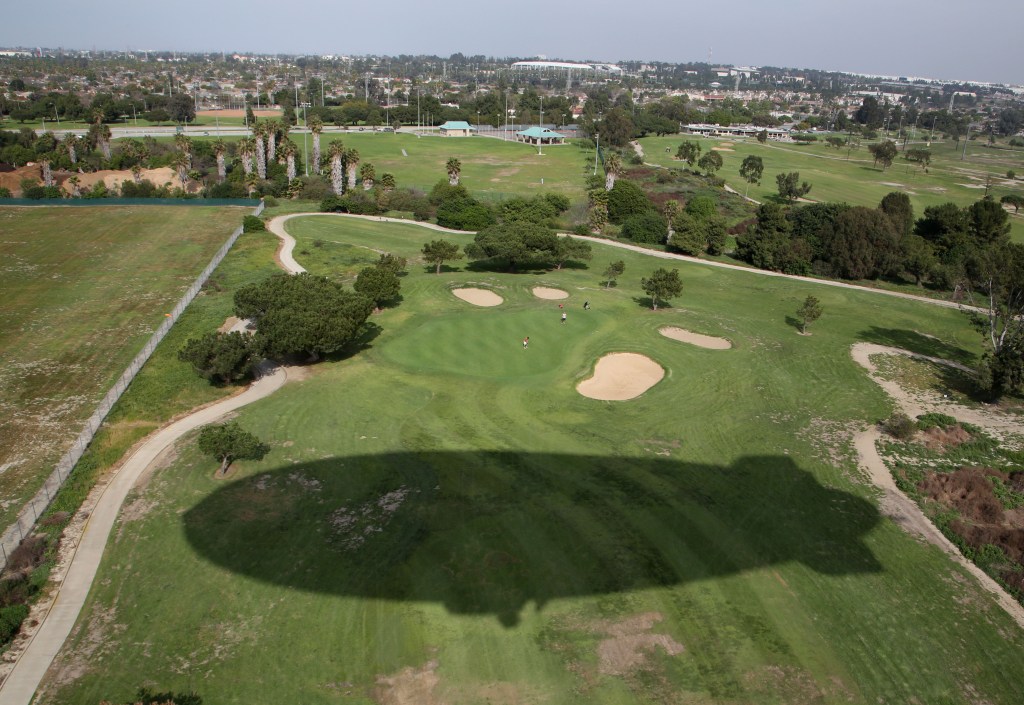
The shadow of the Goodyear blimp passes over The Links at Victoria Golf Course in Carson in 2015. (Daily Breeze staff file photo)

In 1966, The Links at Victoria Golf Course in Carson became the first golf course in the area to be built atop a former hazardous waste landfill.

The Los Angeles County Board of Supervisors began accepting bids for the new regulation 18-hole course on 177 acres of land in October 1964, and it opened to golfers in April 1966. Prolific Los Angeles golf architect William F. Bell designed the course.

Years earlier, on July 2, 1948, the County had authorized the Ben A. Kazarian Disposal Company to begin  operating a landfill accepting industrial and municipal waste where Victoria now sits. Landfill magnate Kazarian later changed the name of his firm to the Ben K. Kazarian Co., which became known informally as BKK.

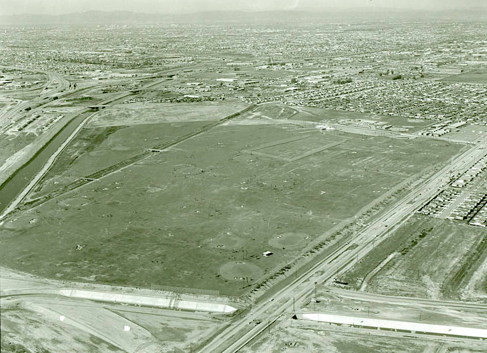
Aerial view looking northwest of the Victoria Golf Course in Carson under construction, circa 1966. Dominguez Channel and 405 Freeway, upper left. (Credit: Los Angeles County Library Digital Collections)

BKK would gain its greatest notoriety for operating one of the largest landfills in the state in West Covina for 33 years before its closure in 1996. In 2007, the city finally acquired the land after BKK shut the site, which had been accepting hazardous waste for years.

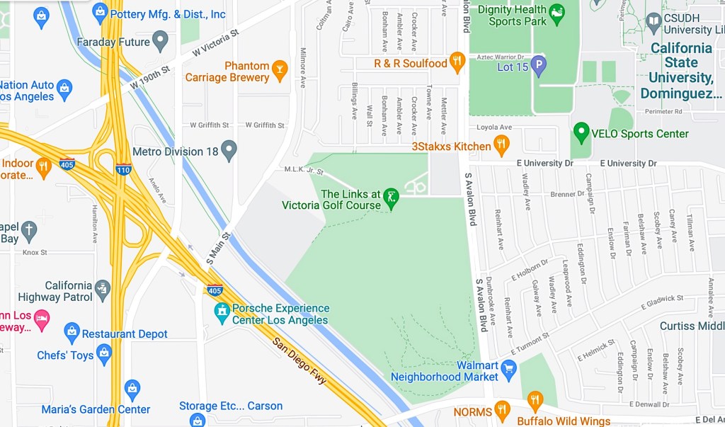
The BKK landfill on which Victoria Golf Course sits operated until 1959. It was bounded by M.L.K. Jr. St. (formerly East 192nd St.) on the north, Avalon Blvd. on the east, Del Amo Blvd. on the southeast, the Dominguez Channel on the south, and South Main St. on the west. In addition to the golf course, it included the land on which the Goodyear Blimp base operates.

(Credit: Google Maps)

Kazarain also operated the landfill south of the 405 Freeway that has remained undeveloped for decades after it closed in 1965. For years, an outlet mall was planned for that site, and construction actually began on it in 2019 before the deal fell apart. 

Before moving to Sofi Stadium in Inglewood, the Rams seriously considered building their new stadium there. The 18-hole, par-3 Dominguez Golf Course on the site closed in 2012 to make way for the Porsche Experience Center auto test track facility.

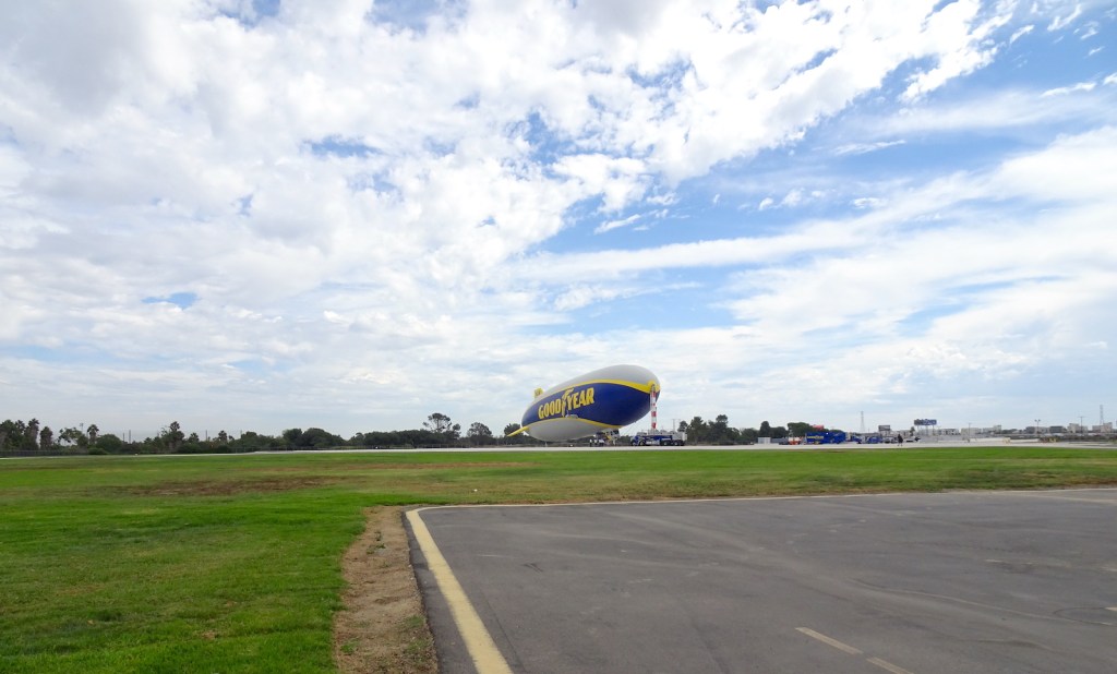
The Goodyear Blimp base port in Carson sits on the same former landfill as Victoria Golf Course. (October 2021 photo by Sam Gnerre)

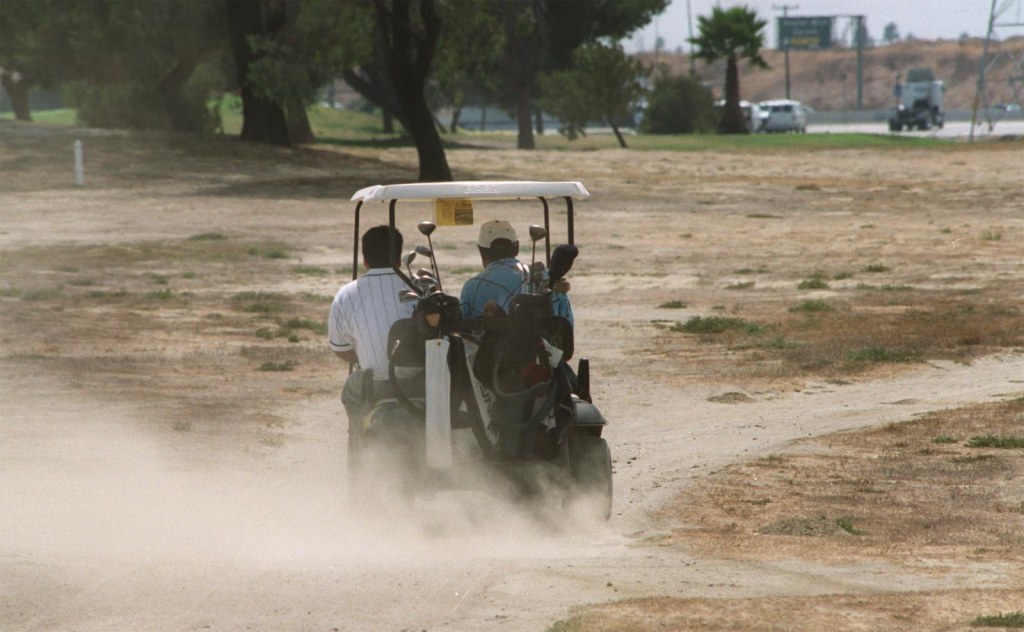
Across the freeway at Victoria, golfers began to notice that the grass in the fairways never seemed to fill in, and what little there was more brown than green. Sinkholes began to appear, resulting in a wildly uneven landscape. Los Angeles Times writer Fred Robledo noted in a 1993 story that the course “would be better served for use by all-terrain vehicles instead of golf carts.”

Golfers at Victoria Golf Course traverse a dusty and barren fairway in September 1999. (Daily Breeze staff file photo)

Its groundskeepers fought a losing battle against the underground elements for years. Golfers liked that they could almost always get a tee time at Victoria, but once on the ragged links,  their complaints would begin to increase.

Finally, in 1999, the County approved a major renovation at the struggling course, authorizing $7 million to add new layers of soil, improve fairways and landscaping, and refurbish its  buildings.

The remake was completed in March 2001. Both public officials and golfers felt that the newly renovated course would become one of the County’s most popular layouts due to the positive changes.

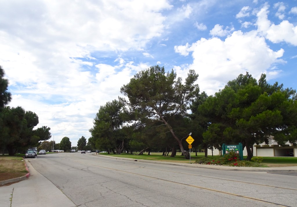
Road sign on MLK Jr. St. in front of Victoria Park directly across from Victoria Golf Course reads, “Rough Road, 20 MPH.” Its bumpiness has been caused by sinkholes formed as a result of the former landfill. (October 2021 photo by Sam Gnerre)

But problems stemming from the landfill beneath continued. In 2006, the California Dept. of Toxic Substances Control (DTSC) began monitoring in the area, including at nearby Towne Elementary School, to check for high levels of methane gas from the landfill.

Detectors had been placed at Towne in 1998 to monitor methane levels in classrooms after students and teachers complained about asthma symptoms, rashes and headaches. In 2007, the DTSC determined that methane levels in the area were safe.

Sadly, the golf course never could overcome its problematic playing conditions despite the 2001 makeover. It remained one of the County’s lowest-performing courses despite frequent changes in operating companies contracted to improve its fortunes.

In November 2017, County officials threw in the towel on Victoria. They began implementing a new plan to transform the course into a “state-of-the-art community recreational center,” according to Daily Breeze reporter Sandy Mazza.

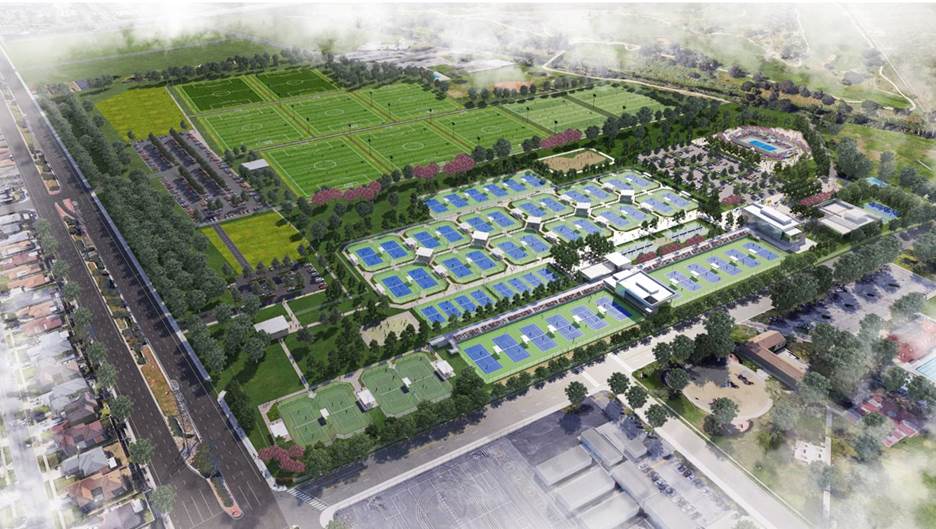
Details remained vague until 2019, when private equity firm head Doug Kimmelman announced plans for the proposed Carol Kimmelman Athletic & Academic Campus on the site, which would be the largest community tennis center in the western United States when completed. The center would be named for his wife, who died of cancer at 53.

A rendering of the proposed Carol Kimmelman Athletic & Academic Campus shows the planned layout, including up to 52 tennis courts, at the current site of The Links at Victoria Golf Course. (Credit: Courtesy of Kimmelman Foundation)

It became part of an overall transformative project that is expected to cost up to $100 million. The new facilities are envisioned to  include 62 tennis courts, eight soccer fields and a 25,000-square-foot, youth-focused learning center operated by the Tiger Woods Foundation. 

In November 2020, The Creek at Dominguez Hills development on the southern 94 acres of the site was added to the mix. It will have more than a half-million square feet of retail and restaurant space, a driving range, a 7-acre golf facility, a multi-use sports complex, a sky diving facility, an outdoor adventure park, a nearly 7-acre public park, and a sports health and wellness building.

The various projects slated to replace Victoria Golf Course are expected to take about three years to complete. The course remains open for now; no firm date for its closure has been announced. But its time is running out.

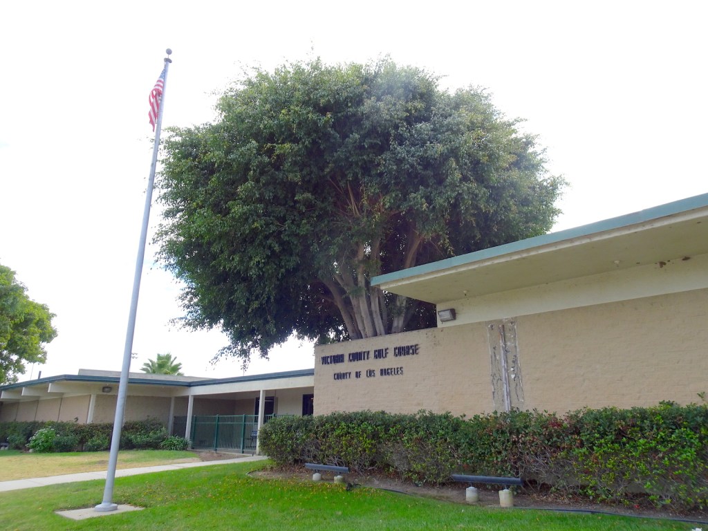
The clubhouse at Victoria Golf Course in Carson. (October 2021 photo by Sam Gnerre)

Sources:

Daily Breeze archives.

Los Angeles Times archives.
The Southern California Golf Guide, by Daniel Wexler, MTIII Golf Media, El Segundo, 2017.

Torrance Press-Herald archives.
“Victoria Golf Course,” Los Angeles County Dept. of Parks and Recreation website.
“Victoria Golf Course (Former BKK Carson Landfill),” Fact Sheet, California Dept. of Toxic Substances Control (DTSC), Feb. 2016.

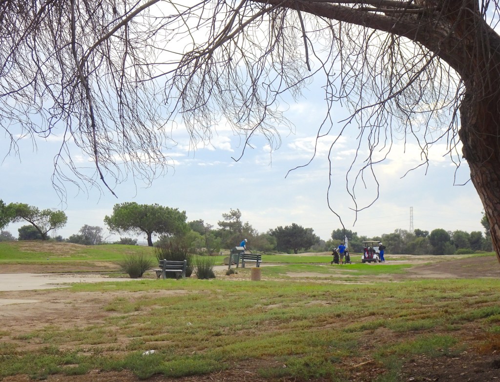
A golfer prepares to tee off on the 10th hole, center, while his playing partners look on at Victoria Golf Course. (October 2021 photo by Sam Gnerre)