The control tower at Los Angeles International Airport has come a long way since 1930

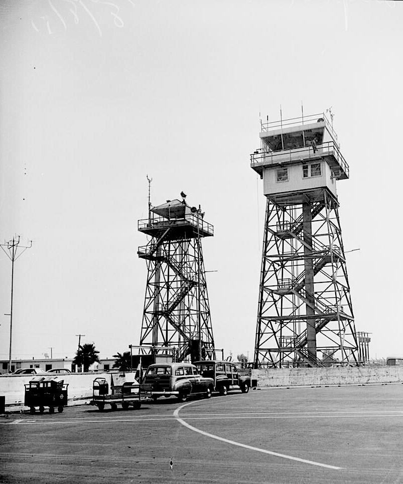
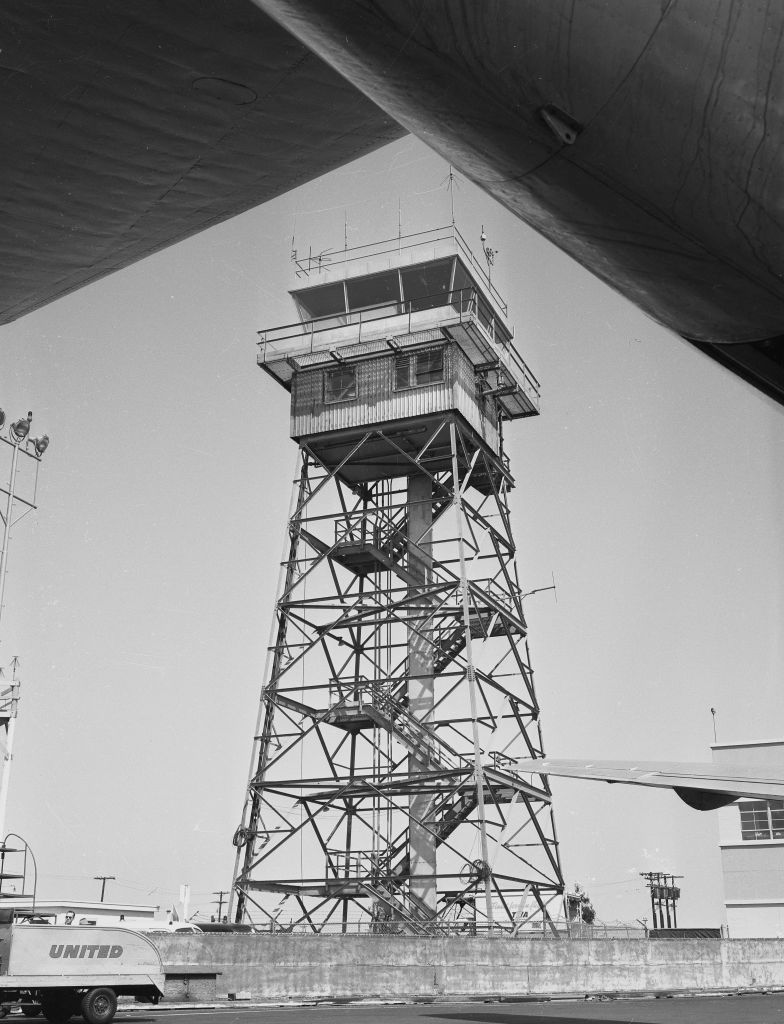
The new LAX control tower, right, rises higher than its predecessor, a former forestry station, in this photo from Aug. 8, 1951. (Credit: USC Digital Library)

Air traffic control didn’t pose a great challenge in the earliest days of Los Angeles International Airport. Then known as Mines Field, the facility was chosen to be the site for Los Angeles’ official airport in 1928.

In those days, the open field east of Inglewood had a couple of dusty dirt runways that turned to mud when it rained. The city built a new 2,000-foot runway using granite pieces and oil but had no steamrollers to tamp it down. So employees and airport users had to compact the surface by driving their personal cars back and forth over the length of the new runway.

The airport’s first permanent structure, Hangar One, didn’t get built until 1929. When two additional hangars went up next door in 1930, an observation tower was built in between them. The airport itself officially was dedicated as Los Angeles Municipal Airport in June 1930.
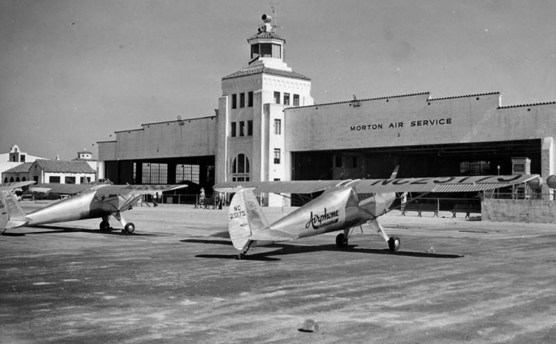
The first observation tower at LAX was built between two hangars in 1930. Undated photo circa early 1930s. (Credit: Los Angeles Public Library Photo Collection)

But, since most air-to-ground communications still were rudimentary at that point – many small planes did not have radio transmitters yet – manual signaling still was used. A person on the ground using red and white flags to signal pilots during takeoffs and landings sufficed for many years.

The airport’s first functional control tower appeared on the field during World War II, when the U.S. Army took control of the airport. The Army had repurposed the 54-foot-high steel frame structure with an observation cab atop it from its former use as a U.S. Forestry Dept. lookout tower.

But the postwar era would bring rapid change to Los Angeles Municipal Airport. In 1943, the city’s Department of Airports formulated a plan to transform the facility into a full-service modern airport, and those plans were acted on following the war.

Passenger terminals were added, and the airport’s first commercial flight took to the skies in 1946. It was given its current name, Los Angeles International Airport, in 1949. By this time, the need for a taller, more sophisticated control tower quickly was becoming evident.
LAX control tower, March 30, 1956. (Credit: UCLA Library, Dept. of Special Collections)

Funded by a combination of federal and local funding, a new 80-foot tower began rising from the ground near the old one in January 1951. Like its smaller predecessor, the new control tower had a steel frame base with an open stairway leading up to its cab. Air traffic controllers during this era had no choice but to get in some cardio while traversing those steps every day.

Unlike the 54-foot tower, the new tower’s cab had two levels: a top level for controllers, and a level directly beneath that to house the then-bulky radar equipment. The tower officially went into operation on Aug. 9, 1951. It cost $57,500.

It would remain there for a decade. But everything changed once again with another complete redesign of LAX, funded by a $59 million bond issue passed in 1956. Using the bond money over the next few years, new terminals were built, and the roadway was turned into a loop with a separate entrance and exit to smooth traffic flow. 
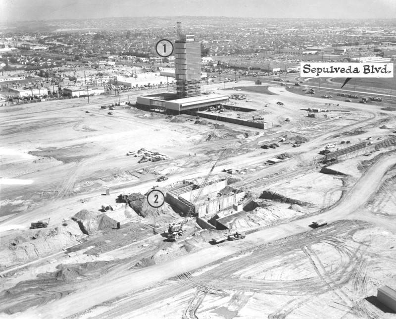
Work continues on the new LAX control tower (1) in this 1960 photo. A terminal also is going up (2). (Credit: Los Angeles Public Library Photo Collection)

This called for a different approach when it came to the control tower. Its location had to be moved into a new site at the entrance to the traffic loop, for one thing. In addition,  a lot more thought had to be put into its design and functionality, especially with the addition of updated navigational equipment.

A team of prominent Los Angeles architectural firms, including Pereira & Becket, Charles Luckman Associates and Paul R. Williams designed the revamp, including the tower. The construction firm of Chotiner & Gumbiner was hired for the entire project, and it subcontracted Empire Steel Buildings Co. to build the tower.

Construction on the new tower began in 1958 and it began operation in 1961, a year before the space-age Theme Building opened. The new tower was 12 stories high; at 162 feet tall, it was twice the height of its predecessor. 
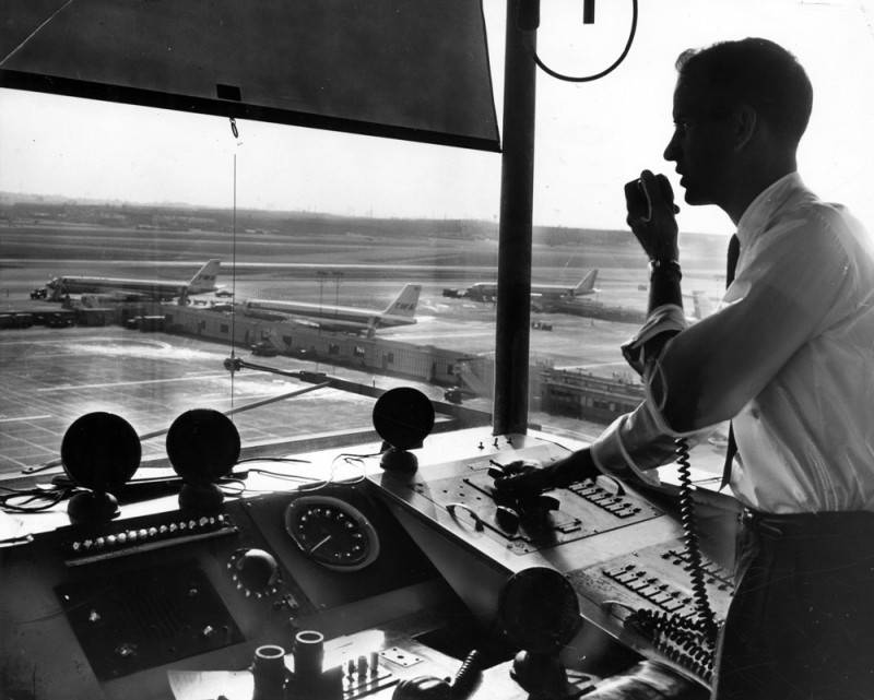
An air traffic controller at work inside the tower at Los Angeles international Airport. March 7, 1961. (Credit: UCLA Library, Dept. of Special Collections)

It was a fully enclosed building for the first time and included an elevator. In addition to housing controllers atop it in a greatly enlarged cab area, the building and a separate office building surrounding it also housed F.A.A. and airport offices. 

In 1965, the old 80-foot-tower was sold to Riverside International Raceway for $1 to be used at the track as an observation tower near the finish line. In 1974, the 1930 hangar building housing the original observation tower was demolished.
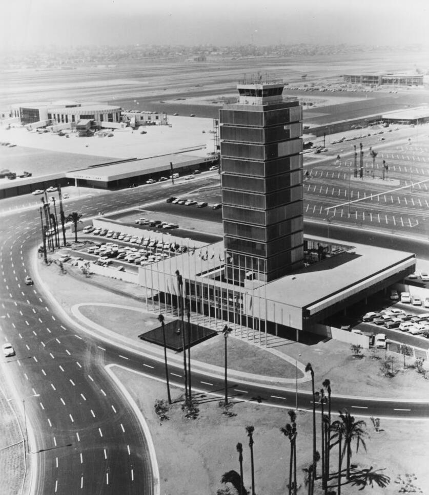
The completed LAX control tower in March 1961. (Credit: California Historical Society via USC Digital Library)

The 1961 control tower, which cost an estimated $1.4 million to construct, served the airport well for the next 35 years. Talk of replacing it began to surface with the opening of the large Tom Bradley International Terminal in 1984, which cut off a big chunk of the taxiing runways from view from the tower.

In 1991, a new control tower design was approved, after much dickering over its appearance. The F.A.A. suggested a plain design, but airport officials insisted on something with at least a little local flair to it. The approved design, by architectural firms Siegel Diamond and Holmes Narver, was meant to resemble a palm tree, with fronds dropping to its sides from the top.
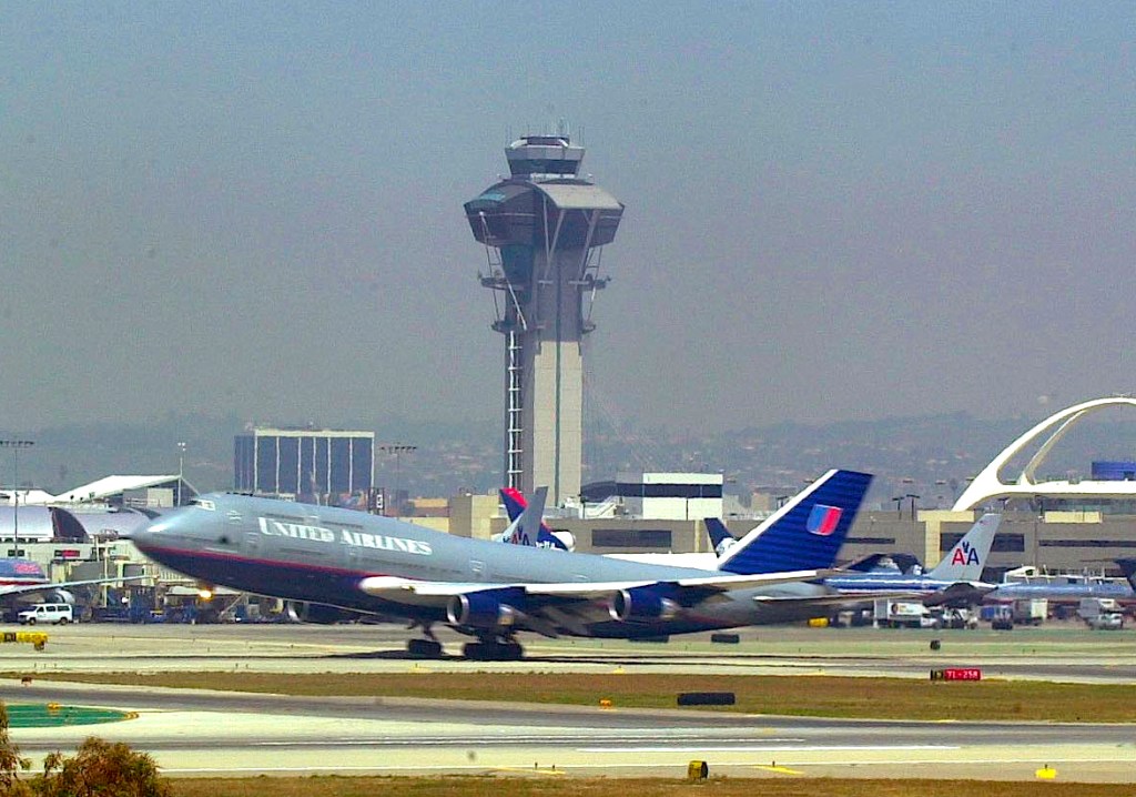
The current 277-foot-high LAX control tower rises above the landscape in this view north in 2001. (Daily Breeze file photo by Brad Graverson)

The 277-foot tower was 115 feet taller than its predecessor, and cost $22 million to build. It was dedicated on March 22, 1996, and went into operation a week later. As of this writing, there are no plans to replace it anytime soon.

As for the 1961 tower, it was originally slated to be used as a back-up. But in 1998, a $1 million renovation transformed the old tower into the Clifton A. Moore Administration Building for Los Angeles World Airports (LAWA), the city agency that oversees LAX, Ontario and Van Nuys airports.
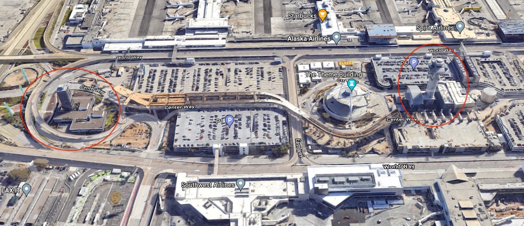
The current tower, circled in red at right, lies just west of the Theme Building at LAX. The former tower, now the Clifford A. Moore Adminstration building, is circled at left. 2022 photo. (Credit: Google Earth)

Sources:

Daily Breeze archives.

“LAX History,” Los Angeles World Airports website.

LAX: Los Angeles International Airport: From Lindbergh’s Landing Strip to World Air Center, by Tom Moran, CCA Publications, 1993.

Los Angeles Times archives.
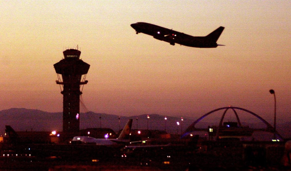
The LAX control tower looms at left as a plane takes off at LAX. (Daily Breeze file photo by Bruce Hazelton)

Suspect in 1935 murder case led authorities to Berth 146 in Wilmington

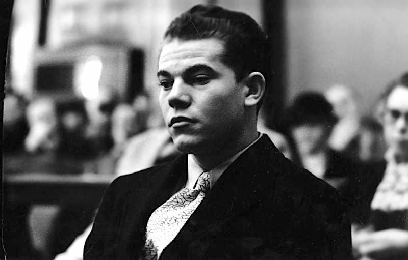
19-year-old Leroy Drake at his trial on charges of murdering his great-aunt and great-uncle by poisoning their coffee. Dec. 10, 1935.
(Credit: Los Angeles Public Library Photo Collection)

19-year-old Thomas Leroy Drake Jr. had lived with his great-uncle and great-aunt, Henry Steinheuer, 60, and his wife, Nellie, 50, in Long Beach since 1930. In 1935, the couple moved to a modest house on West 43rd St. in Los Angeles, in the Leimert Park Area.

Drake attended Long Beach City College for two years, where he was described as a brilliant and inventive science student who planned to attend Cal Tech. The religious young man also was president of the Christian Endeavor Society at the Long Beach church that he attended.

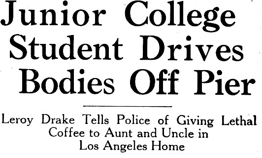
San Pedro News Pilot headline, Sept. 26, 1935, Page 1. (Credit: San Pedro News Pilot digital archives)

His studies centered on astronomy and engineering. While at LBCC, he constructed two telescopes declared by scientists to be remarkable Instruments, and had a patent pending on an Improved diesel engine carburetor, according to the San Pedro News Pilot.

But Drake also had a dark side. On Aug. 23, 1935, he stole a car in Long Beach and drove it to two different stores, where he forged checks on Henry Steinheuer’s bank account. He was arrested and charged with auto theft. (The forgery charges were dropped when Nellie Steinheuer paid restitution for the bad checks.)

News of their great-nephew’s crimes horrified the Steinheuers so greatly that, three days later, Henry Steinheuer filed a codicil to the couple’s will disinheriting Drake, who had been named beneficiary in the original 1930 document. Drake knew about the will, but not about the later codicil disinheriting him.

Drake planned his next far more serious crime carefully. He obtained a poison, cyanide potassium, along with several nonlethal chemicals from a plating works company, telling the clerk that he needed them for a copper plating job. He slipped the poison into Henry and Nellie’s regular cups of evening coffee on the night of Sept. 19 at their 43rd St. house. That night, they washed down pieces of cake with their lethal beverages. Nellie died first, then Henry. 

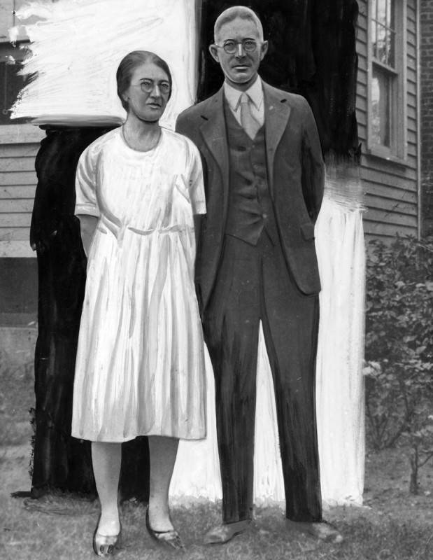
Nellie and Henry Steinheuer, circa 1931. Original photo was altered for publication in the Los Angeles Herald Examiner. (Credit: Los Angeles Public Library Photo Collection)

Drake disposed of the coffee cups and spoon in a neighbor’s trash can before leaving the house in the couple’s car. He decided to drive to the Long Beach residence of his fiancee, Veula Hayden. The couple then went to the movies, where they saw the romantic drama “The Dark Angel,” starring Frederic March and Merle Oberon.

After the movie, Drake took Hayden for a drive along the Wilmington waterfront area. She later testified that she realized he was scouting out potential places to dispose of the bodies. He then took her back home, and drove back to 43rd St.

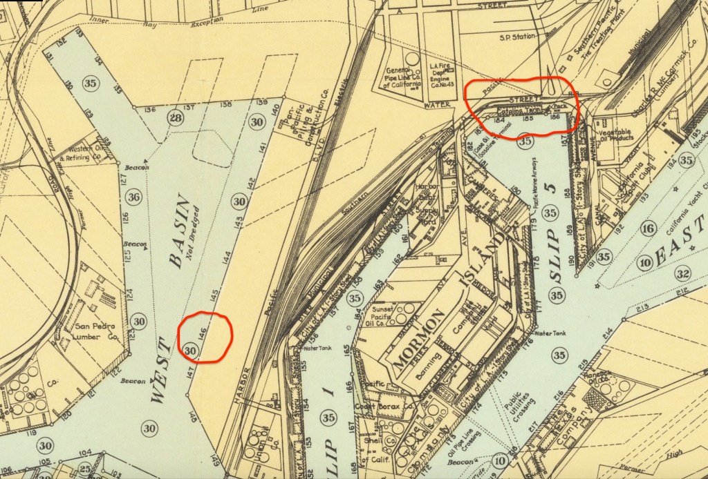
He loaded the Steinheuers’ bodies in the car, and drove back down to Wilmington. His first thought was to use the Catalina Terminal on Water St., then at Berths 184 and 185, but there were too many people there for him to do so without being spotted. Instead, he drove around a bit, stopping at the Grace Line terminal at Berth 146 along the West Basin.

Detail section from a 1929 Los Angeles Harbor Area map shows location of the Catalina Terminal, highlighted in red at upper right, and Berth 146, lower left red circle, where Drake ultimately disposed of the bodies. Many changes to the configuration of the port have been made since this map was created. (Credit: Barry Lawrence Ruderman Antique Maps Inc. website)

There, he started the car, put it in gear, closing the door as he hopped out, and watched it plunge off the dock into 35 feet of water. By the time he boarded the Pacific Electric streetcar for home, it was 3 a.m. the next morning.

When Long Beach radio store owner Louis J. Britain hadn’t heard from his clerk, Henry Steinheuer, for several days, he notified the police, who discovered that Nellie also was missing. Their suspicions concerning Leroy Drake were aroused when he told different and conflicting stories about the pair’s disappearance.

He eventually confessed to the killings, telling detectives that he had done it essentially for their own good, to save them from the humiliation that his August arrest had brought them.

He later led them to the Grace Line pier in Wilmington, where the car had sunk into the muddy bottom offshore. L.A. County Fireboat #2 docked offshore, and divers searched for several hours before locating the car. The bodies were brought up first, then the car was hoisted up from the harbor.

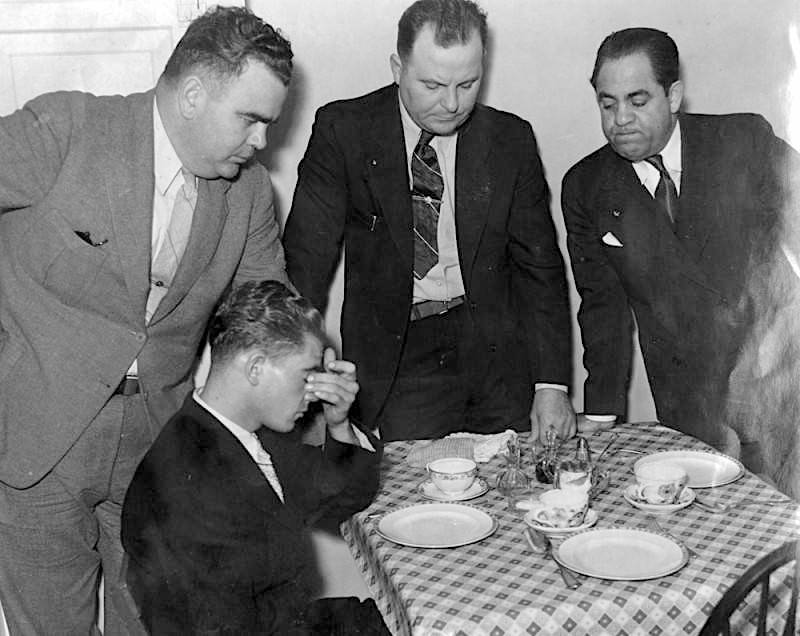
Re-enacting the dinner at which he poisoned his great-aunt and great-uncle, 19-year-old Leroy Drake is shown seated at the table where he put cyanide potassium in their coffee cups and then watched them die. Standing, from left, attorney Nate Friedman, detective lieutenant E. E. Slope and an unidentified detective. Sept. 26, 1935. (Credit: Los Angeles Public Library Photo Collection)

The Los Angeles Times recounted how police took him the next day to the 43rd St. house to re-enact the scene of the crime. “I thought God wanted me to do it,” he told them, showing them how he added the poison to the coffee percolator. At one point, he picked up his violin and played it for them.

On Sept. 27, the county grand jury indicted Drake on two counts of first-degree murder, and the district attorney announced that he would seek the death penalty. Drake first tried to plead not guilty by reason of insanity. Drake’s father, Leroy Sr., came in from New Jersey to present evidence of mental instability in the family tree, but Judge Joseph Vickers remained unswayed, denying the motion.

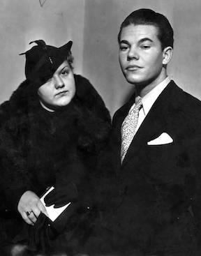
Veula Hayden, left, and Leroy Drake at the Los Angeles County Courthouse on Dec. 16, 1935. (Credit: Los Angeles Public Library Photo Collection)

The court heard testimony from Drake’s girlfriend Hayden, who testified that he gave no indication anything was amiss during their movie date on the night of the murder. Steinheuer’s employer Britain told the court that Drake had told him that Mrs. Steinheuer had killed her husband first, then herself, out of shame over Drake’s arrest and that he had disposed of the bodies to avoid publicly shaming them.

Drake’s story changed several times during the trial, but he always maintained he’d killed the Steinheuers out of love and not greed. Other observers believed that Drake was only after the older couple’s modest inheritance, noting that he’d attempted to gain control of the family bank account following the murders.

Drake surprised the courtroom when he abruptly changed his plea to guilty on Dec. 12, 1935, as part of an apparent last-ditch ploy to avoid the death penalty. It was successful. Five days later, Judge Vickers sentenced him to life in prison in San Quentin.

Vickers apparently spared him the death sentence because of “the court’s reasonable doubt as to whether the youth was sincere in the reasons he gave after he had pleaded guilty to both murders.” Perhaps he felt Drake was sincere when he said during testimony, “I loved them too much to let them suffer.”

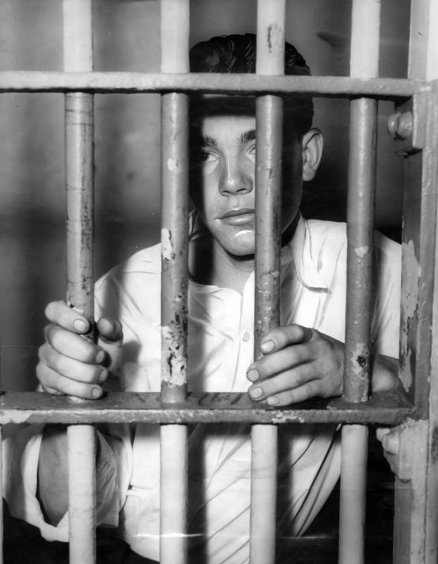
Leroy Drake is shown behind steel jail bars on Sept. 26, 1935 after confessing that he poisoned his great-aunt and great uncle and then sent their bodies plunging from a pier to the bottom of the harbor in a closed car. (Credit: Los Angeles Public Library Photo Collection)

Sources:

Calisphere.org.

Findagrave.com

Los Angeles Times archives.

San Pedro News Pilot archives.

The Forum has seen many changes since Jack Kent Cooke dreamt it up in 1966

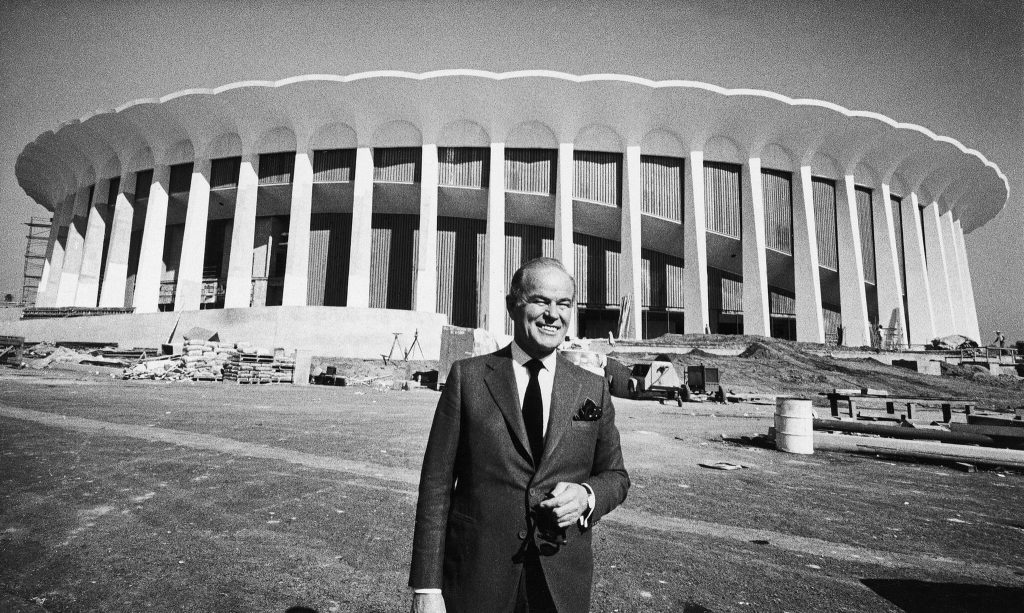
Owner Jack Kent Cooke outside the Forum in Inglewood, still under construction on Nov. 7, 1967. (Credit: Associated Press)

Recent news that the Korean automaker Kia has become the latest company to buy naming rights to the Forum in Inglewood gives us a fine opportunity to take a look back at the storied venue’s history.

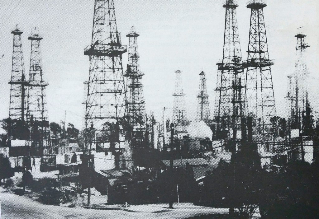
The southeast corner of Manchester Blvd. and Prairie Ave, just across the street from Inglewood Park Cemetery, was covered with oil wells after the drilling boom of the 1920s.

Undated photo circa early 1920s shows oil derricks along Praire Ave. near the present-day Forum site. (Daily Breeze staff file photo by Brad Graverson)

The wells eventually played out, and most of them were removed to make way for the Inglewood Golf Course, which opened in 1925.

Originally known as the Portrero Country Club, the golf course co-existed with a few remaining oil wells as unnatural hazards for many decades. The 18-hole course closed in 1963, when its owner, the cemetery to the north, decided to sell off its 120 acres for development. (Part of the development included a smaller nine-hole course.)

Sports tycoon and Los Angeles Lakers team owner Jack Kent Cooke purchased the westernmost 33 acres for just over $4 million in 1966. The mercurial Cooke’s dealings with the Lakers’ previous landlord, the Los Angeles Sports Arena, had grown bitter and contentious, and he was determined to build his own sports palace.

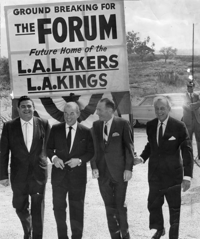
From left, Inglewood Mayor William Goedike, Jack Kent Cooke, L.A. Mayor Sam Yorty and architect Charles Luckman at groundbreaking ceremonies for the Forum on July 1, 1966. (Credit: Los Angeles Public Library Photo Collection)

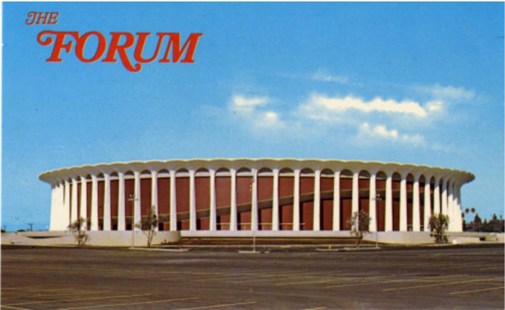
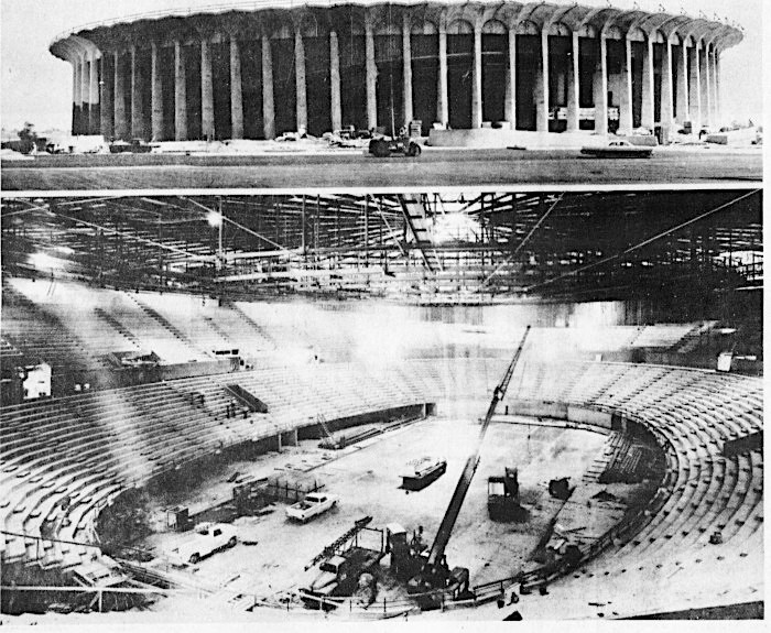
He held a groundbreaking for The Forum on July 1, 1966. Edward R. Jones Jr. of Charles Luckman and Associates became the project’s main architect. His design called for a circular 75-foot-high Roman-style building to be adorned by 80 white exterior columns, each one nearly 60 feet tall.

Shortly after the construction firm of C.L. Peck & Co. began grading the land on Sept. 21, Cooke sold radio, television and naming rights for the new arena to the Atlantic Richfield Co. for $12 million.

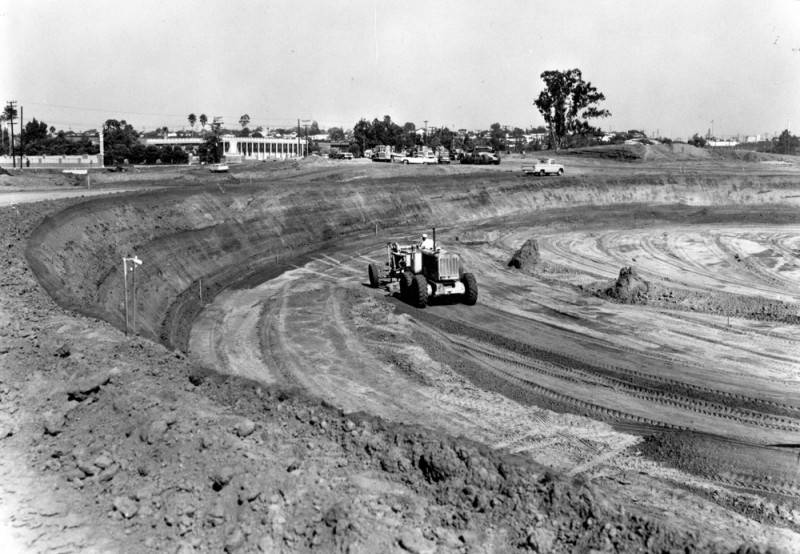
An earth-moving machine at the oval excavation site for the Forum at Prairie Ave. and Manchester Blvd. in Inglewood on Oct. 23, 1966. (Credit: Los Angeles Public Library Photo Collection)

Cooke announced that the Forum would be completed by December 1967, in time for its first event, an NHL game between the newly created Los Angeles Kings franchise and the Philadelphia Flyers. Initial estimates put the cost of construction at $7 million, but that would more than double before the Forum opened its doors.

Those doors opened on schedule. Canadian television actor Lorne Greene, Ben Cartwright from “Bonanza,” emceed the Forum dedication ceremony on national television, prior to the 1 p.m. start of the Kings-Flyers game airing nationally on CBS. (The Kings lost, 2-0.) Cooke proved his many skeptics wrong, as  the building proved successful from the very beginning.

Undated postcard circa early 1970s.

Cooke envisioned more for his new $16 million building, which he encouraged the media to call the “Fabulous Forum,”  than just major sports, however. In its first full year, 1968, it would also host tennis, boxing matches, track and field and auto racing. Non-sports events included the Home Show,  the Barnum and Bailey circus, the Ice Follies and, importantly, pop music concerts.

Soul legend Aretha Franklin became the first to perform in concert at the Forum, supported by the Sweet Inspirations and the Young-Holt Trio on Jan. 22, 1968. She was followed by concerts starring Tony Bennett, The Supremes, The Temptations, Cream, Joan Baez and the Doors. Cooke also announced that he held a guaranteed contract to bring the Beatles to the Forum for three nights in 1969, should they decide to return to live touring. (They didn’t.)

Prince performs at the Forum on Feb. 18, 1985, during his “Purple Rain” tour. He returned for 12 more shows in 2011. (Credit: Associated Press)

Concerts would prove to be a major part of the venue’s business over the years. The Rolling Stones first appeared there in 1969, as did Jimi Hendrix. The 1970s brought an avalanche of acts, including Led Zeppelin, Black Sabbath, Carole King and James Taylor, Yes, Bob Dylan, David Bowie and dozens more, establishing the venue as the place to play in the L.A. area for rock and pop’s most popular performers.

 A six-date stand by Prince in 1985 in support of his “Purple Rain” album helped launch the Minneapolis performer to superstar status. (He would return there in 2011 for 12 nights.)

Cooke sold the Forum to Jerry Buss for a then-record $67.5 million in 1979, with the Lakers and Kings as part of the deal. The Lakers drafted Magic Johnson in 1979, and would go on to win 10 championships over the next three decades. 

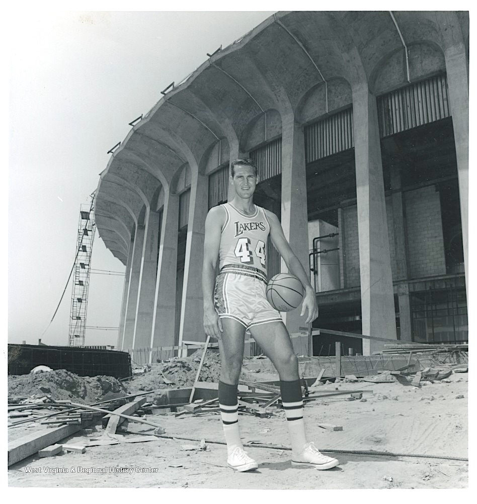
Los Angeles Lakers legend Jerry West poses outside of an under-construction Forum in 1967. (Credit: West Viginia & Regional History website)

Buss sold the Kings to Bruce McNall, who brought hockey’s greatest player, Wayne Gretzky, to the team in 1988. The Kings later would end years of frustrations by winning NHL titles in 2012 and 2014. Buss also sold the naming rights in a pioneering move in 1988, and the building’s official name became the Great Western Forum. (That deal expired in 2003.)

The building’s fortunes took a hit with the opening of the new Staples Center in downtown  L.A. (now Crypto.com Arena) in 1999. Both the Kings and the Lakers moved there from the Forum, along with the Los Angeles Clippers, who moved to Staples from the Sports Arena.

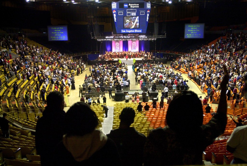
In late 2000, Faithful Central Bible Church, a 12,000-member megachurch in Inglewood, bought the faltering facility. It held regular religious services there until 2009, while also kept the Forum open for other business, including concerts, during that time.

.Worshippers at Inglewood’s Faithful Central Baptist Church use the Forum, former home of the Los Angeles Lakers, as their sanctuary in order to accommodate their numbers on Feb. 16, 2003. (Daily Breeze file photo by Branimir Kvartuc)

The Madison Square Garden Company acquired the aging arena in 2011 for $23.5 million, and over the next few years spent about $100 million on improvements, adding better lighting, seating, acoustics and updating its in-house video. 

Clippers owner Steve Ballmer’s plans to build a new arena across the street for his team to play in led to friction with MSG over its proximity to the Forum. Rather than continue the legal battle, Ballmer decided to buy the Forum from MSG for $400 million in 2020 in order to be able to build the new Clippers building without opposition. He plans to keep running the Forum as an entertainment venue. 

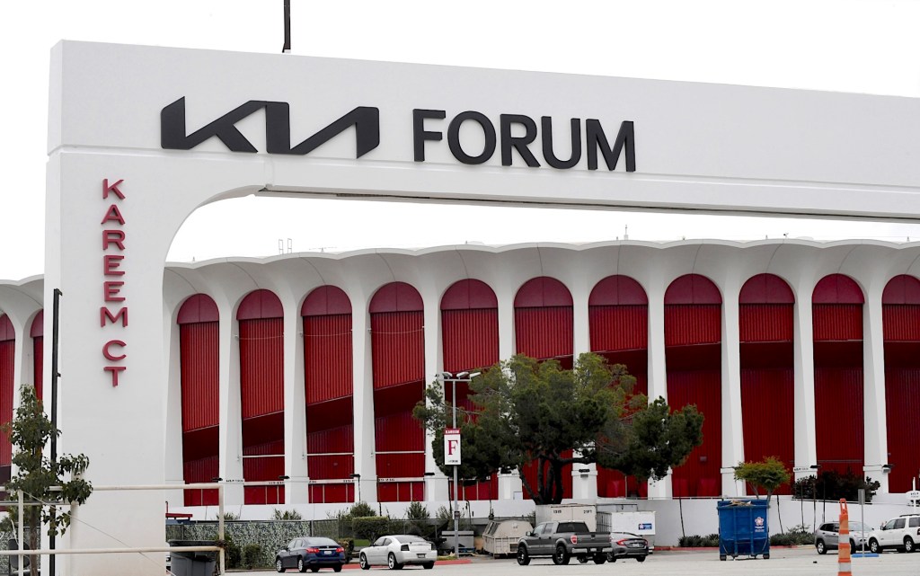
On March 30, 2022, signage went up indicating that the Forum had become the Kia Forum after Ballmer signed a naming rights deal with Korea’s oldest automaker. Financial details  of the deal have not been made public.

Cooke died of congestive heart failure in 1997, but his landmark building lives on. The Forum was added to the National Register of Historic Places in 2014.

The Forum in Inglewood has been renamed the Kia Forum, thanks to a naming-rights deal between the auto maker and venue owner Steve Ballmer. March 31, 2022. (Daily Breeze file photo by Axel Koster)

Sources:

Daily Breeze archives.

Los Angeles Times archives.
Palos Verdes Peninsula News archives.

Wikipedia.

Exterior and interior photos of the Forum under construction in late 1967. Palos Verdes Peninsula News, Dec. 27, 1967, Page 22. (Credit: Palos Verdes Peninsula News archives)

Pioneer developer George Peck established San Pedro’s first bank in 1888

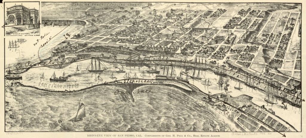
This 1892 San Pedro map by Bert W. Pierce shows original Bank of San Pedro building in the inset at its upper left corner. (Credit: Library of Congress)

George Peck saw the potential for development in the San Pedro harbor area while working as a conductor on the Southern Pacific railroad. In 1886, he decided to move there, building a house overlooking Timms Point.

The new settlement had begun taking shape in 1882, when the partitioning of the Sepulveda family land grant took effect. By the time Peck began living there, its first church, newspaper and several small businesses already had been established.

Sensing a major need that had yet to be met, Peck had the foresight to start up the town’s first bank in 1888. Articles of incorporation with $50,000 in stock capital were drawn up. The bank’s first board of directors included Peck, C.K. Drane, James Cuzner, G. Esleman, and William G. Kerckhoff.

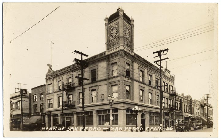
Undated post-1905 photo shows the Bank of San Pedro building with its distinctive clock tower at Sixth and Beacon streets. (Credit: California Historical Society)

The new bank building went up on the northwest corner of Sixth and Beacon streets, just up Beacon from Peck’s real estate and development offices. A new, larger building replaced the original structure in 1902.

In 1904, the successful bank’s leaders authorized the adding of a third story to the building, at a cost of $6,500. The third story included the bank’s highly visible clock tower, which would become an iconic local landmark.

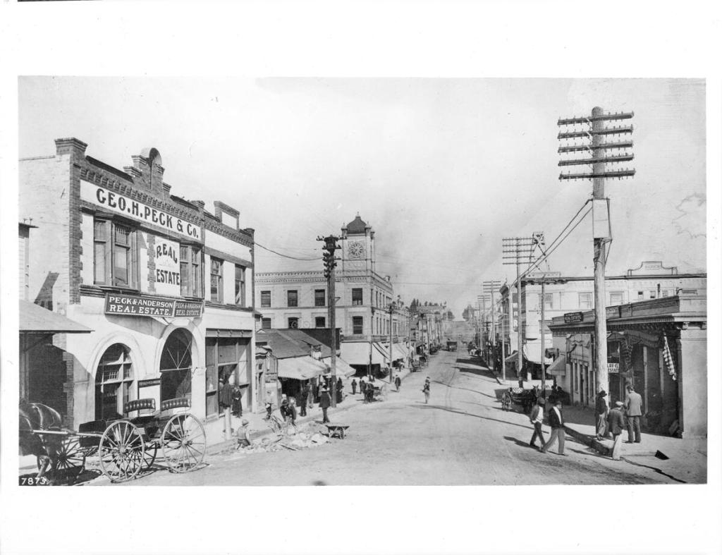
View looking north along Beacon St. in San Pedro, ca.1905. The Bank of San Pedro building with its clock tower is at center along the wide, unpaved street. The two-story brick shop of George H. Peck & Co. is pictured in the left foreground. (Credit: California Historical Society via USC Digital Library)

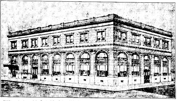
In 1911, Peck sold his interest in the bank to Pasadena banker Henry E. Sherer for $100,000. Under Sherer, the bank continued to grow and prosper throughout the early part of the twentieth century. During the 1920s boom era, the bank decided to build a new headquarters office at Seventh and Mesa streets. The original bank on Beacon would remain open as a branch office.

The new bank opened on June 13, 1927. The Myles Regan Construction Co. built the  structure, which was two stories high and included a basement, at a cost of $200,000. In addition to the bank, the building had several additional professional offices, which quickly were rented out.

Architect’s rendition of the new Bank of San Pedro main location at Seventh and Mesa streets that opened in 1927. (Credit: San Pedro News Pilot archives)

The bank’s initial $50,000 capitalization had increased tenfold to $500,000 by 1929, when the building’s full completion was announced that April. Unfortunately, the stock market crash that followed that October would seriously wound the high-flying institution.

Its fortunes flagged along with everyone else’s during the era, and, by 1933, it was becoming doubtful if the bank would survive. 

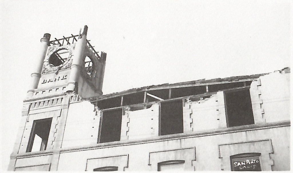
The clock tower and exterior decorations had to be removed from the Bank of San Pedro Beacon St. building for safety reasons following the 1933 Long Beach earthquake. (Credit: San Pedro: A Pictorial History, 1993)

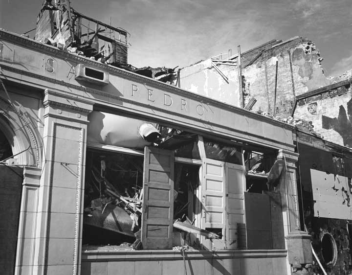
The Long Beach earthquake of March 10, 1933 didn’t help. It caused considerable damage in San Pedro, including to the clock tower at the original bank building on Beacon St. The clock tower had to be taken down for safety reasons, along with the cornices and ornamental features on the exterior.

By June 1933, a citizen’s committee had been formed to reorganize the troubled bank and attempt to placate its depositors. Its financial situation continued to worsen, and, less than a year later, the bank was no more. Bank of America purchased its remaining assets on April 25, 1934.

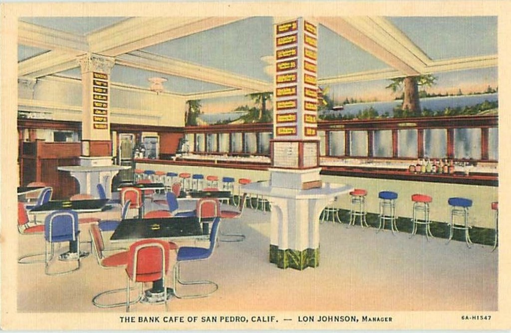
Over the years, many different tenants used both Bank of San Pedro buildings. Small shops and professional offices continued to be situated at both locations. The Bank Cafe occupied the ground floor of the original Beacon St. building during the 1930s, and a First Interstate bank branch was located in the Seventh and Mesa building as late as 1984.

Demolition of the original Bank of San Pedro building on Beacon St. is underway in this 1971 photo. (Credit: California Historical Society)

The Beacon St. redevelopment project approved in 1969 finally spelled the end for the original Bank of San Pedro building, which by then had been abandoned. The entire Beacon St. area, including the bank building, was cleared out completely in 1971.

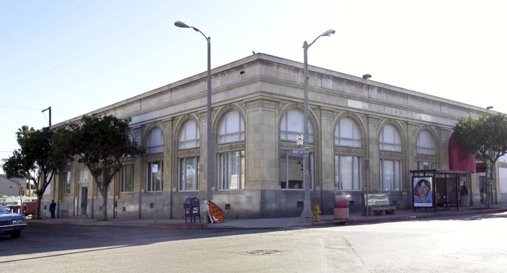
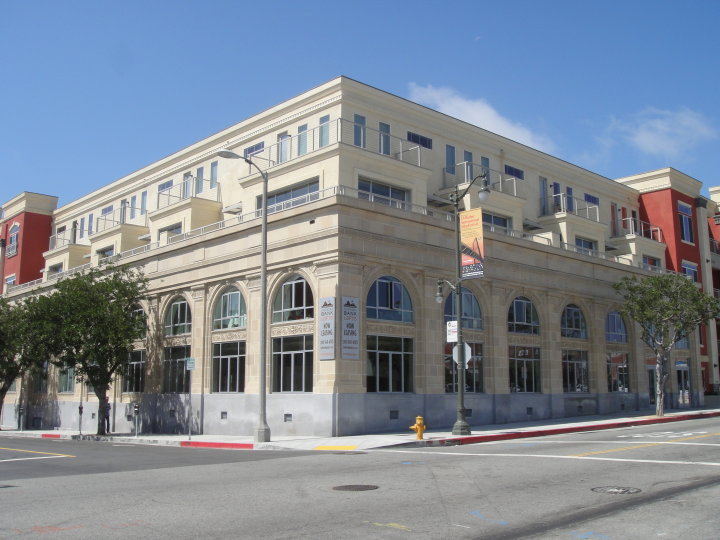
By the 1990s, the Seventh and Mesa building was mostly empty. In 2006, a $23 million project, the San Pedro Bank Lofts, was announced. It transformed the decades-old  building into lofts and living spaces, while keeping its original two-story facade. By 2010, most of the Bank Lofts units had been sold and were occupied.

The vacant Bank of San Pedro building on Seventh and Mesa streets in San Pedro in 2003. (Daily Breeze staff file photo by Kim Haggerty Zylius)
The completed and occupied San Pedro Bank Lofts in 2010. (Credit: San Pedro Bank Lofts Facebook page)

The Bank of San Pedro name resurfaced in 1974, 86 years after George Peck’s original institution opened. The new Bank of San Pedro opened at Eighth and Gaffey streets in 1975, but bore no other links to the original other than the name.

It prospered for several years, but problems began after the bank purchased the failed Princess Louise harbor-based restaurant ship in 1988. The ship sank mysteriously in October of that year, and the bank became embroiled in lawsuits afterward.

Regulators already had considered the bank “troubled” by 1987, and its fortunes continued to fall precipitously in the early 1990s thanks to ill-advised real estate loans and other operating losses. The state agency overseeing financial institutions closed the bank in July 1994.

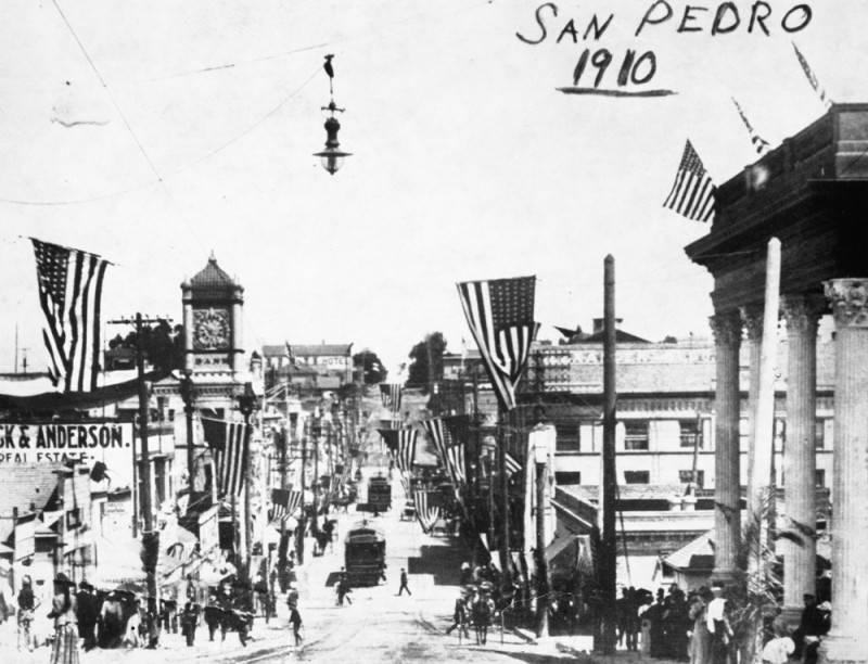
A 1910 view of Beacon St. in San Pedro, with streetcars on the track and flags festooning the poles and buildings. Bank of San Pedro clock tower is at left. (Credit: Los Angeles Public Library Photo Collection)

Sources:

Daily Breeze archives.

Los Angeles Herald archives.

Los Angeles Times archives.
San Pedro: A Pictorial History, by Henry P. Silka, San Pedro Bay Historical Society, 1993.

San Pedro News Pilot archives.

Undated postcard shows the Bank Cafe on the repurposed ground floor of the Bank of San Pedro building on Beacon St.

For a time, Dodgers baseball great Carl Furillo called Manhattan Beach home

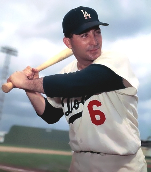
Carl Furillo. Undated publicity photo circa 1958-60.

During the last few decades, a number of Los Angeles-area sports stars from the Kings, Lakers and other teams have decided to settle in the South Bay’s beach cities. Carl Furillo, a standout player for the Brooklyn Dodgers, pioneered the idea when he moved his family to Manhattan Beach after the Dodgers came to Los Angeles in 1958.

Born in Stony Creek Mills, Pennsylvania on March 8, 1922, Furillo was the son of Italian immigrant parents. He left school early to pursue his baseball career. He eventually signed with the minor league team in Reading, then unaffiliated.

The Brooklyn Dodgers caught wind of the young outfielder with the rocket arm – his throwing ability earned Furillo the nickname “The Reading Rifle” – and were so determined to sign him that they purchased the entire Reading minor league franchise.

Furillo eventually made his way to the big leagues, playing his first game for the Dodgers on April 16, 1946. That season would be the first of many exemplary campaigns with the team for which he played for his entire 15-year career.

During Furillo’s tenure, the Dodgers won seven National League pennants, and World Series titles in 1955 and 1959. He was perennially among the league leaders in hitting, and baserunners learned not to challenge his throwing arm. He would narrowly miss attaining a lifetime .300 batting average, ending his career at .299.

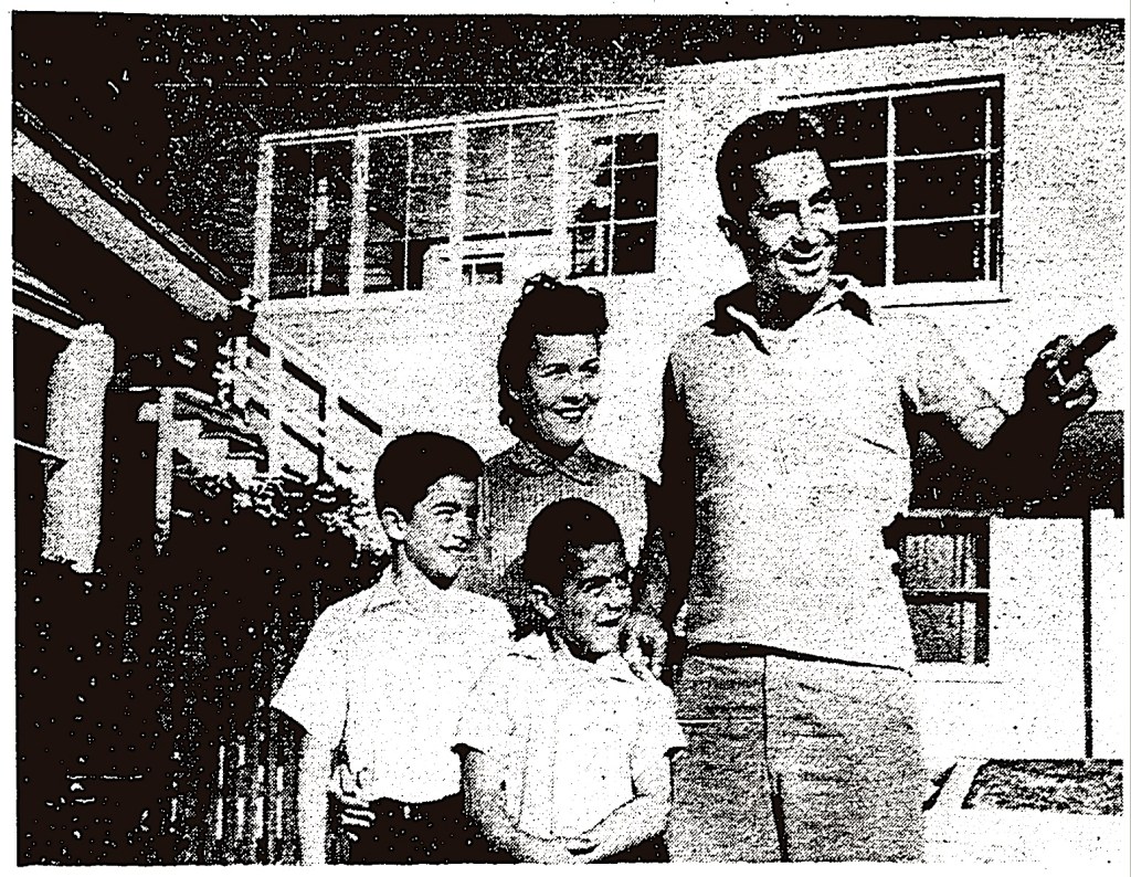
Carl Furillo, right, poses with his wife, Fern, rear, and two boys, Carl Jr., bottom left, and Jon, bottom center, in front of their house in Manhattan Beach. Los Angeles Times, Feb. 3, 1959, Page C3. (Credit: Los Angeles Times digital archives)

When the Dodgers left Brooklyn for Los Angeles in 1958, Furillo moved his wife, Fern, and their two sons, Carl and Jon, into a house with three additional apartments on Maple Ave. in Manhattan Beach’s tree district. He bought the house for $32,000 in October 1958. He quickly rented out the apartments, with teammate Joe Pignatano becoming one of his tenants.

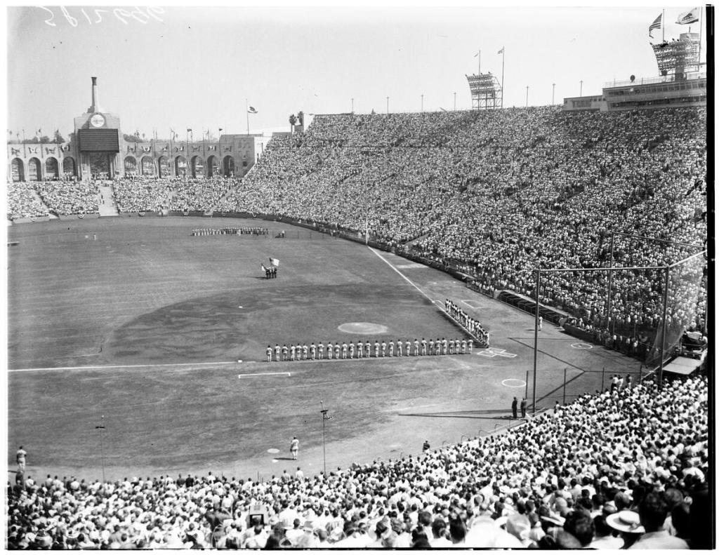
The Furillos would live in Manhattan Beach for the next three years. Though he was used only as a pinch-hitter during the L.A. Dodgers’ first World Series victory against the Chicago White Sox in 1959, he got the key hit in Game 3 to give the team a 3-1 lead they never relinquished.

The Dodgers and White Sox line up along the baselines prior to Game 3 of the 1959 World Series at the Los Angeles Coliseum.
(Credit: USC Digital Library)

Things took a turn for Furillo in 1960, however. In January, Dodgers general manager Buzzie Bavasi took a hard line with the outfielder during salary negotiations. By this time Furillo, then 38, was nearing the end of his career. Bavasi forced him to take a pay cut from $33,000 to $25,000 so that the GM could give young catcher John Roseboro a raise.

Furillo didn’t complain publicly. But matters got worse in April when he tore a calf muscle during the first week of the 1960 regular season. The Dodgers then demanded that he voluntarily retire at a reduced salary and without receiving his 15-year pension.

Furillo insisted on getting the amount he was due, and thus began a dispute with team management that would end up in court and result in his complete disassociation from baseball for decades.

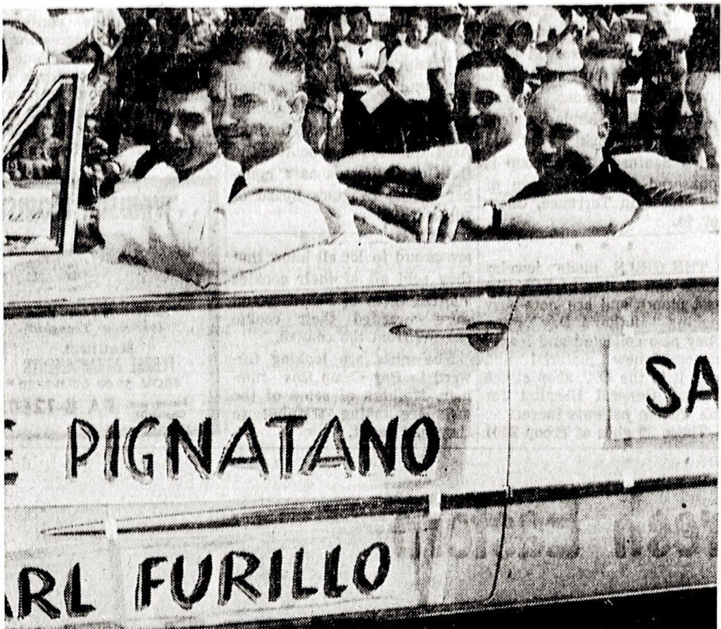
Driver and Torrance city council member George Vico chauffeurs Dodger players Sandy Koufax, front seat left, Carl Furillo, back seat left, and Joe Pignatano, back seat right, in the annual Torrance youth baseball parade. Torrance Herald, May 8, 1960, Page 9. (Credit: Torrance Historical Newspaper and Directories Archive database, Torrance Public Library)

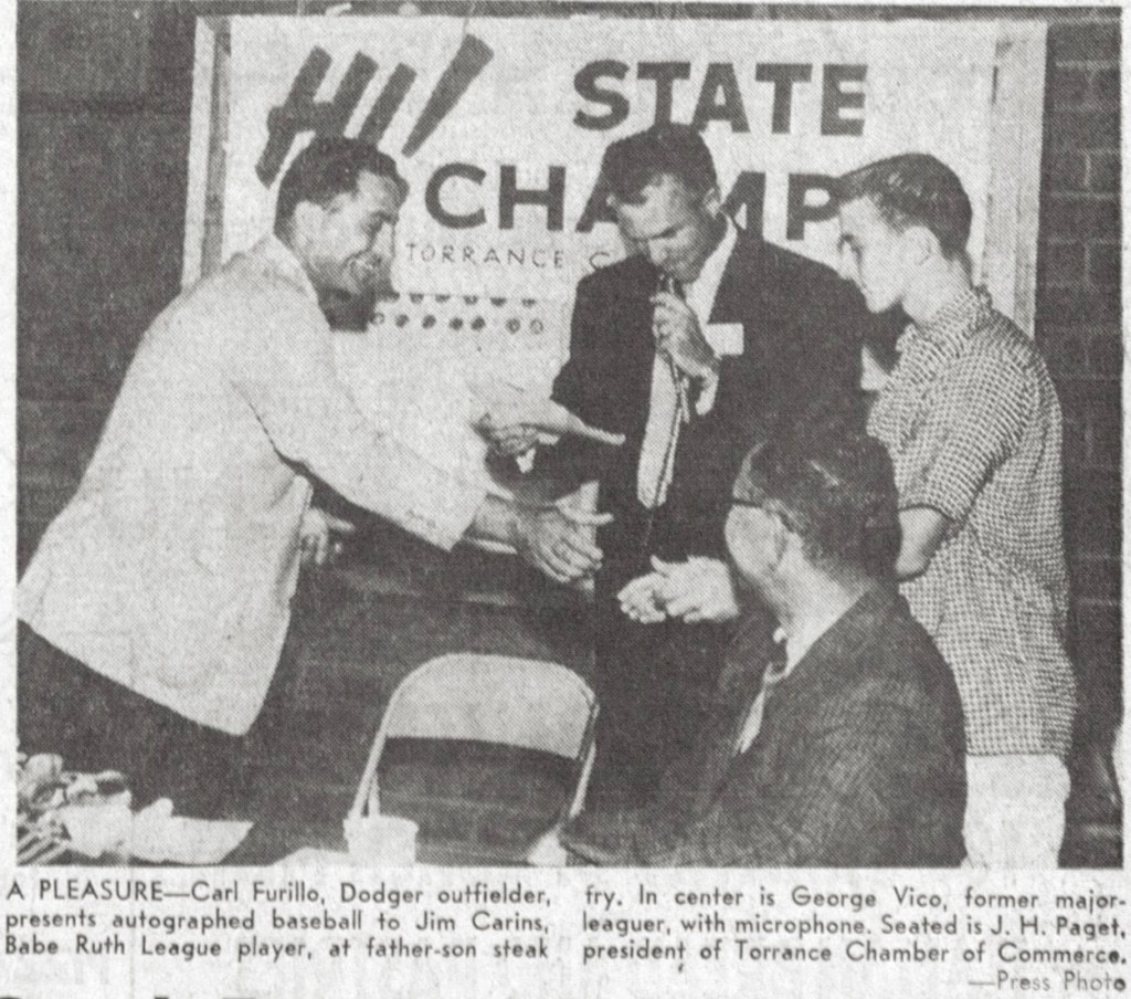
Despite the sudden turmoil in his professional life, Furillo continued to do his part as a representative of the team in the community, as he’d done all along. In October 1959, after the World Series win, Furillo appeared and spoke at a banquet honoring the Torrance Babe Ruth League state championship team.

Later, when newly elected Torrance city councilman and former Detroit Tigers baseball player George Vico reached out to Furillo to help boost the annual Torrance youth baseball parade 1960, his response was enthusiastic, especially considering his ongoing dispute with the team.

On May 7, 1960, Furillo brought not only himself, but also three other Dodgers to the Torrance Blvd. event. His tenant Pignatano, Chuck Essegian and future Hall of Fame pitcher Sandy Koufax appeared in the parade and participated in the subsequent festivities.

The results were remarkable. The Torrance Herald reported the next day that approximately 4,000 people attended the youth baseball celebration. A week later, the Dodgers officially released him from the team.

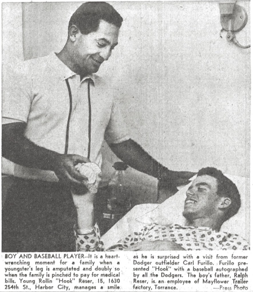
Furillo’s dispute with the Dodgers dragged on. He made another South Bay appearance in September, visiting former Babe Ruth player Rollin Reser in his Harbor City hospital room. Reser’s leg had been amputated after an accident on the baseball field.

Torrance Press, Sept. 22, 1960, Page 1. (Credit: Torrance Historical Newspaper and Directories Archive database, Torrance Public Library)

By June 1961, an increasingly frustrated Furillo had given up on reaching an agreement with the Dodgers. He put the Manhattan Beach house on the market and moved his family back to Pennsylvania. He also scheduled a meeting in New York with Major League Baseball Commissioner Ford Frick to discuss his plight.

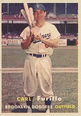
Furillo’s 1957 Topps baseball card.

Furillo claimed he not only had been wronged by the Dodgers, but also had been blackballed from other jobs. Applications for coaching and related positions he made to 14 different teams, including the new Los Angeles Angels franchise, had been turned down flat. Frick denied that Furillo had been blackballed, though no team would hire him.

Furillo sued for back pay, and won a judgment for $21,000, but he’d lost his appetite for anything having to do with baseball. He worked as an elevator installer at the World Trade Center, operated a deli, became a night watchman and held many other jobs.

In his later years, his bitterness toward the game softened. According to the New York Times, he became a regular staff member at the Dodgers’ Fantasy Camp in Vero Beach, Fla., where he joined other Dodger greats in reminiscing with fans.

He died in his sleep of an apparent heart attack at 66 in his home town of Stoney Creek Mills, Pennsylvania, on Jan. 12, 1989.

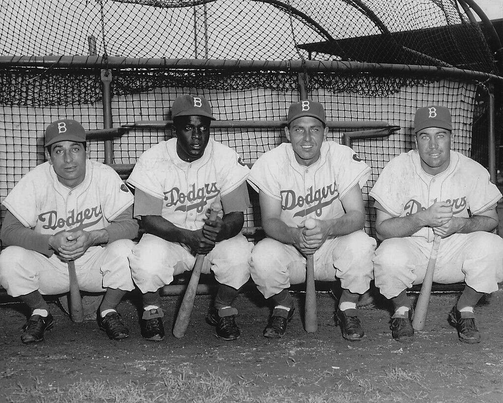
From left, Brooklyn Dodgers teammates Carl Furillo, Jackie Robinson, Gil Hodges and Duke Snider pose in an undated publicity photo circa early 1950s.

Sources:

Carl Furillo, Brooklyn Dodgers All-Star, by Ted Reed, McFarland & Co., 2014.

Los Angeles Times archives.
New York Times archives.

Torrance Press-Herald archives.

Wikipedia.

Torrance Press, Oct. 29, 1959, Page 1. (Credit: Torrance Historical Newspaper and Directories Archive database, Torrance Public Library)

Upscale Manhattan Village shopping mall replaces former Chevron tank farm

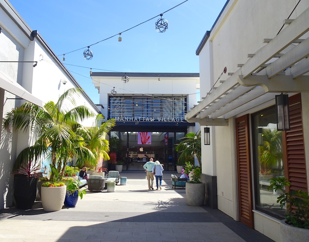
Decorative plants and benches line the entrance to the Manhattan Village indoor mall. (March 2022 photo by Sam Gnerre)

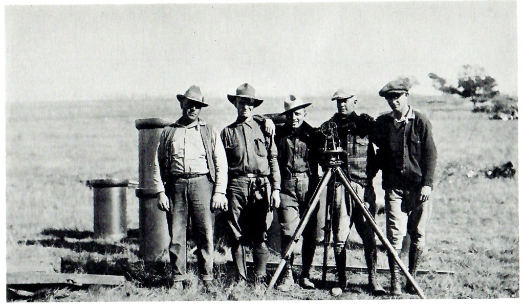
Frank Bennett was busy raising melons and lima beans on his El Segundo farm in 1911 when representatives from the Standard Oil Co. contacted him about buying his land.

The company needed to build a Southern California refinery to ease the load on its Richmond facility in the Bay Area. Bennett’s 840 acres fit the bill, giving the company an ideal location with room not only for a refinery, but also for a large tank farm for storage.

The team surveying farmer Frank Bennett’s land for Standard Oil’s new refinery in El Segundo poses for a photo in 1911. (Credit: El Segundo: Seventy-Five Years: A Pictorial History of El Segundo, California, by Eileen Curry Hunter, H2 Limited Publishers, 1991)

The oversized tanks would hold large amounts of fuel for steam engines and steam-powered ships. As more efficient and powerful methods of powering ships surpassed steam, the tanks suddenly became less useful. Eventually the tank farm became obsolete.

But that didn’t keep it from adorning 37 acres of the northeast Manhattan Beach landscape for the next half a century as the neighboring cities grew up and filled in around it.

Finally, in the early 1970s, Standard Oil, through its Chevron Land and Development Co. subsidiary, began exploring the possibilities of developing not just the tank farm site, but the entire 187 acres it owned in Manhattan Beach. It began studying proposals for the project in 1973.

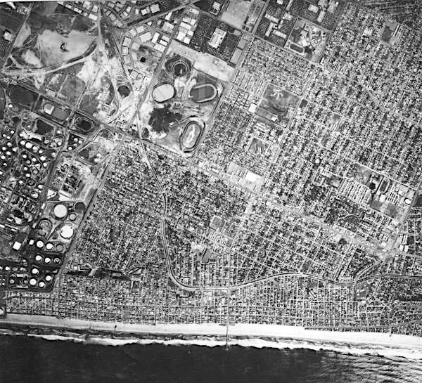
1973 satellite photo of Manhattan Beach shows the Standard Oil (Chevron) tank farm, the round and oval structures, center. The land later became the site of the Manhattan Village mall. (Credit: Manhattan Beach Historical Society)

As laid out in plans made with two developers, Alexander Haagen Development and Broadmoor Homes, the project, named Manhattan Village, would be split into four separate developments: 83 acres for residential housing, 39 acres for recreation space, 28 acres for a business park and the aforementioned 37 acres for a shopping and retail area.

That land, on the east side of Sepulveda Blvd. south of Rosecrans Ave., would become the Manhattan Village mall, developed by Haagen. Ground was broken in 1979, and its first phase, an outdoor section including a Ralphs supermarket, Sav-On Drug and several smaller businesses, opened in 1980.

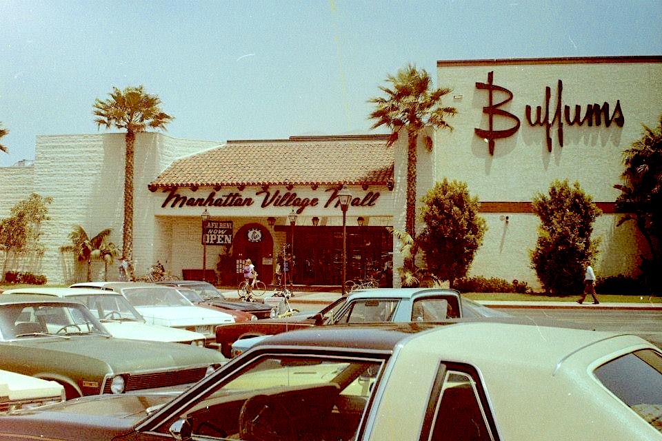
Buffums department store and mall entrance sign. Undated, circa early 1980s. (Credit: Manhattan Village Facebook page)

Construction on the enclosed mall, which would be on a much smaller scale than others in the South Bay, began that September. Its two anchors were both department stores: Buffums opened in 1981 and Bullocks a year later in 1982. (Buffums would go out of business in 1990, and Bullocks was consolidated into Macy’s in 1996.) 

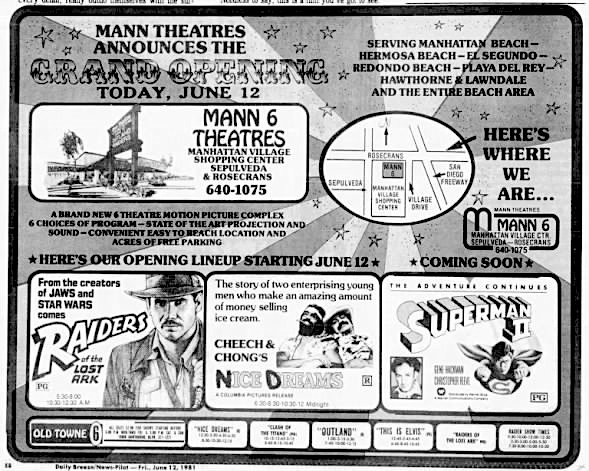
San Pedro News Pilot ad, June 12, 1981, Page 32. (Credit: San Pedro News Pilot archives)

In addition, the Mann Theatres chain announced that it would open a six-theater cineplex on the property. Its first two theaters began operation on June 12, 1981, showing “Raiders of the Lost Ark” and “Cheech & Chong’s Nice Dreams.” Pacific Theatres bought out Mann in 1996, and the Manhattan Village theaters operated as Pacific’s Manhattan Village 6 unti the complex closed on May 28, 2012.

The new mall may have been smaller than most, but its carefully selected department stores and specialty retailers were targeting a very specific set of consumers: the upscale residents of the beach cities, especially in its home town of Manhattan. The developers even trucked in 2,000 grown trees at a cost of nearly $1 million to give the mall’s exterior a fully formed look from the beginning.

The mall changed ownership several times after Haagen first sold it for $70 million to the Pacific Telesis pension fund in 1990. It underwent its first remodel in 1992. 

One of its most anticipated and influential tenants arrived when the Apple Store opened for business at the mall on July 30, 2005. It was the first and remains the only Apple Store operating in the South Bay/Harbor Area.

A year after it opened in 2006, its current owner, the Deutsche Bank-owned real estate trust firm RREEF America L.L.C., began talking with the city of Manhattan Beach about a long-range development plan for the mall and surrounding area. RREEF had purchased the mall in 2004.

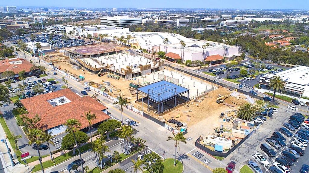
Aerial photo shows the South Parking Structure and Village Shops under construction. July 22, 2019. (Credit: Manhattan Village Facebook page)

Long-range being the operative word, as its owners and Manhattan city fathers would continue to dicker over the proposal for the next six years. In 2012, a revised plan was made public. It would include new parking garages, an expanded outdoor shopping area known as the Village Shops, and construction of a new building that would allow Macy’s to consolidate its two outlets at the mall into one store.

It would be two years before the Manhattan Beach City Council would give final approval to  the $110 million plan in December 2014. The group Sensible Citizens of Manhattan Beach sued the developers in an attempt to stop the expansion. A settlement was reached with them in 2017, and work began in earnest on the revamp.

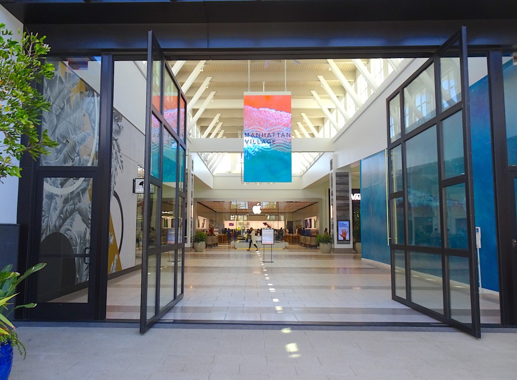
Under the plans, the Apple Store has become the focal point of Manhattan Village. The mall’s new central court has a fountain and a concierge counter, both situated in front of the Apple location.

The Apple Store, rear, is highly visible from this entrance to the Manhattan Village mall. (March 2022 photo by Sam Gnerre)

Don Ziss, senior general manager of the mall’s operating company, Jones Lang LaSalle, told the Daily Breeze’s Kirsten Farmer in 2019 that the Apple store serves as a regional draw to the otherwise locally focused shopping center.

Cost for the project increased to an estimated $250 million as various other improvements, such as the conversion of a Wells Fargo Bank branch into two restaurants, were added to the mix.

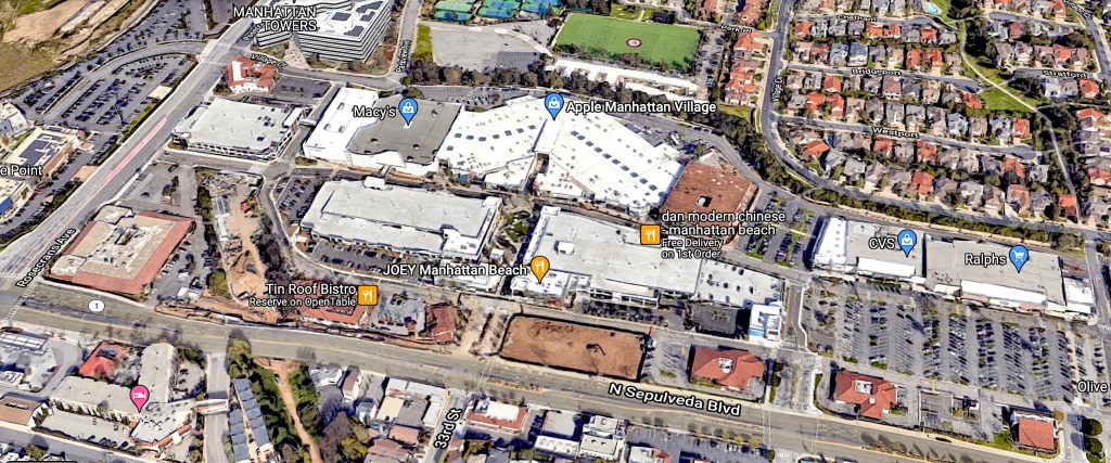
As of this writing, the interior redesign of the mall has been completed, the new parking garages, including electric car charging stations, have opened and much of the outdoor Village Shops development has been finished. The entire project is scheduled for full completion by the end of 2022.

Plans for the former Fry’s Electronics site on the site’s northwest corner at Rosecrans and Sepulveda boulevards are ongoing. The entire Fry’s chain closed in February 2021.

The Manhattan Village complex in January 2022 as viewed looking east. The main mall at top (with white roof) is flanked by three new parking garages with grey roofs. The closed Fry’s store is at far left near Rosecrans-Sepulveda intersection. (Credit: Google Earth)

Sources:

Beach Reporter archives.

Daily Breeze archives.

El Segundo: Seventy-Five Years: A Pictorial History of El Segundo, California, by Eileen Curry Hunter, H2 Limited Publishers, 1991.

Los Angeles Times archives.

“Pacific’s Manhattan Village 6,” Cinema Treasures website.

The 1956 deluge that swamped Torrance and forced flood control improvements

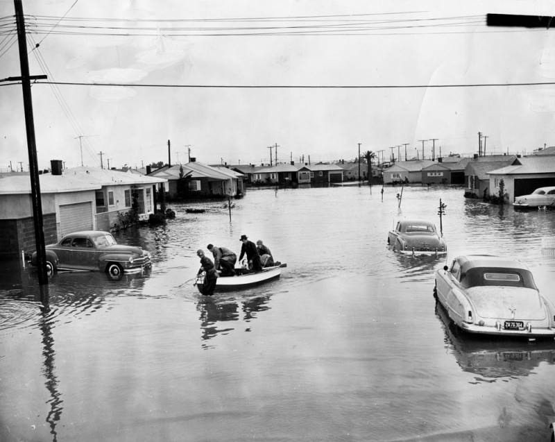
Floodwaters put much of Elgar Ave. and 168th St. in Torrance underwater in this undated photo taken during the January 1956 rainstorm that inundated the area. (Credit: Los Angeles Public Library Photo Collection)

In a recent post about the Dominguez Channel, I mentioned how Los Angeles County Supervisor Kenneth Hahn vowed to improve the flood control situation in the South Bay after meeting local residents forced to evacuate to the Leuzinger High School gym during a 1952 rainstorm.

That storm dropped more than five inches of rain during a five-day period in January 1952. Four years later, work scarcely had begun on rebuilding the Dominguez Channel when the largest downpour in recorded weather history pounded the area in January 1956.

It came just in time for local agriculture, as the Southern California area just previously had been suffering from a prolonged drought. But farmers may have been one of the few groups to benefit from the storm, which caused much damage in urban areas.

According to the Torrance Herald, the two-day deluge on Wednesday, Jan. 25 and Thursday, Jan. 26,  dropped 8.53 inches on the city. The city of Los Angeles reported 7.97 inches. By contrast, only 7.66 inches have fallen in the South Bay during the entire 2021-22 rainy season, including the potent storms last December.

El Segundo Herald, Feb. 2, 1956, Page 1. (Credit: El Segundo Herald archives)

Put simply, the January 1956 storm was a major disaster. It caused damage throughout the South Bay, with El Segundo and the North Torrance/Gardena/Lawndale areas being particularly hard hit. 

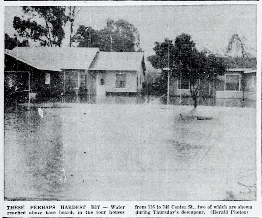
In El Segundo, where 7.81 inches fell, houses were damaged in low-lying areas of the city when flood waters rose high enough to cover the baseboards. Emergency responders had to come to remove residents stranded in their houses and take them to the Red Cross shelter at the Scout House on Grand Ave.

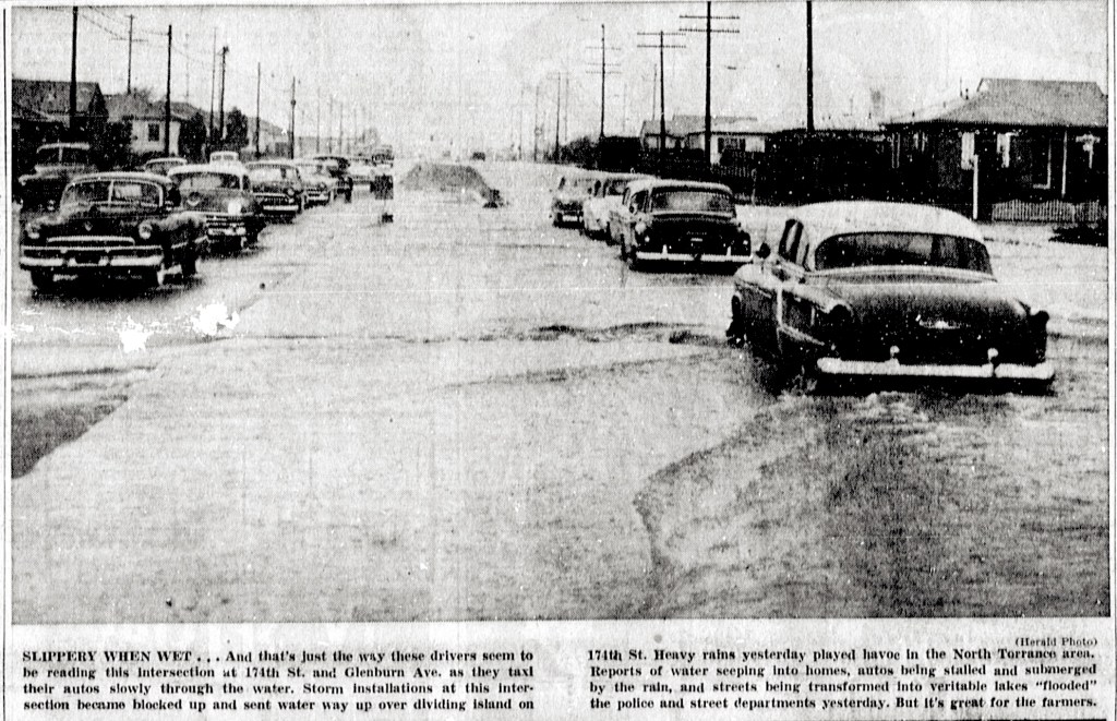
Streets became lakes and cars were swamped. According to the El Segundo Herald, Valley St. resident Hubert Armstrong told police, “I was backing out of my driveway and the street caved in.” Police found his car straddling a six-foot-wide and 12-foot-deep hole. Neither Armstrong nor his car were hurt.

Schools were closed that Thursday and Friday, and several businesses in the city’s industrial sector also shut down rather than risk employees’ safety.

Such closures were widespread throughout the area, as many schools and businesses shut down in the wake of the powerful storm.

Torrance Herald, Jan. 26, 1956, Page 1. (Credit: Historical Newspapers Archive database, Torrance Public Library)

When the Coast Guard is among those resources called in to help rescue residents from an area of widespread flooding, it’s safe to assume that a major problem exists. Such was the case in the areas of Lawndale, North Torrance and Gardena through which the Dominguez Channel currently runs.

The Laguna Dominguez and Bixby sloughs had yet to be tamed, so floodwaters also ran unchecked through parts of Harbor City and Carson. The Los Angeles Times reported that a professional scuba diver was called in after rains stopped to locate and help rescue a totally submerged car near 190th and Figueroa streets.

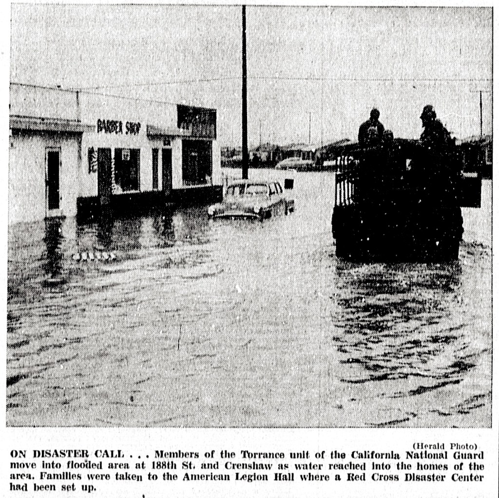
Flooding was rampant in North Torrance in particular.  Many residents had to be evacuated by lifeboats from the area near Elgar Ave. and 168th St., just west of Crenshaw Blvd. Dozens of families from this and other nearby affected neighborhoods were taken to the Red Cross shelter established at the Torrance American Legion Hall, then located on Border Ave. downtown.

In Gardena, Vermont Blvd. was underwater for at least one mile south from Gardena Blvd., with several cars reported completely underwater at Vermont’s intersection with Artesia Blvd. Several families also were rescued from their homes on Wilkie Ave. in Hawthorne.

Torrance Herald, Jan. 30, 1956, Page 3. (Credit: Historical Newspapers Archive database, Torrance Public Library)

The storm completely inundated four houses on Condon Ave. in Lawndale, and temporarily trapped 100 students inside Jane Addams School on 153rd Place. Buses eventually were able to transport the students home. Leuzinger High’s gym once again served as a shelter, as it had four years earlier.

Students at Morningside High in Inglewood also were sent home after muddy floodwaters swamped their campus. Schoolchildren involved in these rescues often had to clamber onto school buses that had to pull up right to the front steps at the entrances to the schools to reach them.

Help during the emergency came not only from the Red Cross, but from L.A. County lifeguards, police and fire rescue units (including the Torrance Mounted Police), the National Guard, amateur ham radio enthusiasts and many other local volunteers. Torrance’s new Civil Defense communications system also kicked in successfully during the crisis.

This Torrance Press headline would prove exceedingly prescient a couple of months later. Torrance Press, Nov. 17, 1955, Page 1. (Credit: Historical Newspapers Archive database, Torrance Public Library)

By Friday morning, the rainfall mostly had stopped, though floodwaters would plague severely affected areas for several more days. Most residents were able to return to their homes over the weekend to assess the damage, which was considerable in many instances.

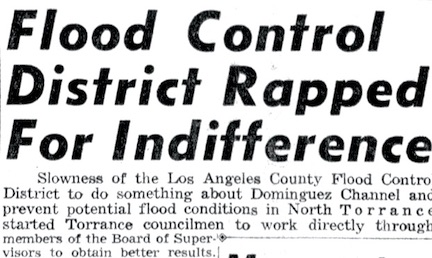
Assistance became available after California Gov. Goodwin Knight declared the city of Torrance a disaster area during the storm. The County Board of Supervisors launched an inquiry in early February 1956 to assess the many failures of its flood control system.

By July 1956, construction projects to remedy various flood control deficiencies, including rebuilding the Dominguez Channel, had begun in earnest. Eight-plus inches of rain in a two-day period had served a drenching wake-up call.

Aerial view of flooded areas in Carson as a result of the January 1956 storm shows the vicinity of Avalon Boulevard and 190th Street (later renamed Victoria St.), near the present site of Cal State University, Dominguez Hills. Jan. 28, 1956. (Credit: Los Angeles Public Library Photo Collection)

Sources:

El Segundo Herald archives.

“A History of Significant Weather Events in Southern California Organized by Weather Type,” National Weather Service website.

Los Angeles Times archives.
Palos Verdes Peninsula News archives.

Torrance Press-Herald archives.

Rancho Palos Verdes has big plans for Ladera Linda Park

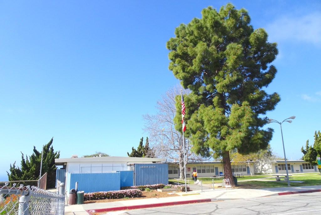
Rancho Palos Verdes will replace these 1960s-era former school buildings with a new community center. (March 2022 photo by Sam Gnerre)

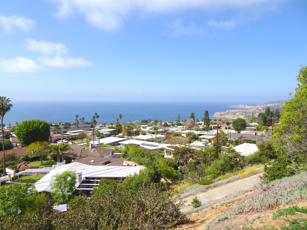
Ladera Linda translates into “lovely hillside” in English, so it’s an apt name for the 11-acre park with the amazing ocean views nestled against the coastal Rancho Palos Verdes hills.

With the city’s announcement that a long-planned $18.7 million complete renovation of the park and its community center will become a reality, a look back at its history seems in order.

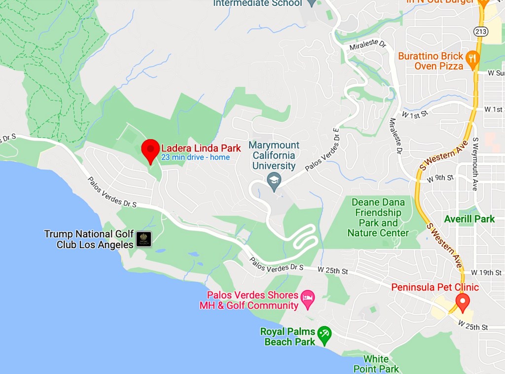
The site on Forrestal Drive just north of Palos Verdes Drive South and the Trump National Golf Club abuts the 155-acre Forrestal Nature Reserve. Before it became a school, and then a park, it was the site of the Livingston Rock Quarry, which operated there until the late 1950s. 

(Credit: Google Maps)

During its operation, the quarry produced granite and crushed stone used for ocean breakwaters and other construction projects, as well as barite, quartz, dolomite, gypsum, and basalt.

The Los Angeles County Board of Supervisors first included plans for a 195-acre park that included the quarry land in November 1955, but it never was built.

After the quarry’s closure, the land remained vacant until 1966, when the Palos Verdes Peninsula Board of Education announced plans to open a K-5 elementary school on the site to be named Ladera Linda.

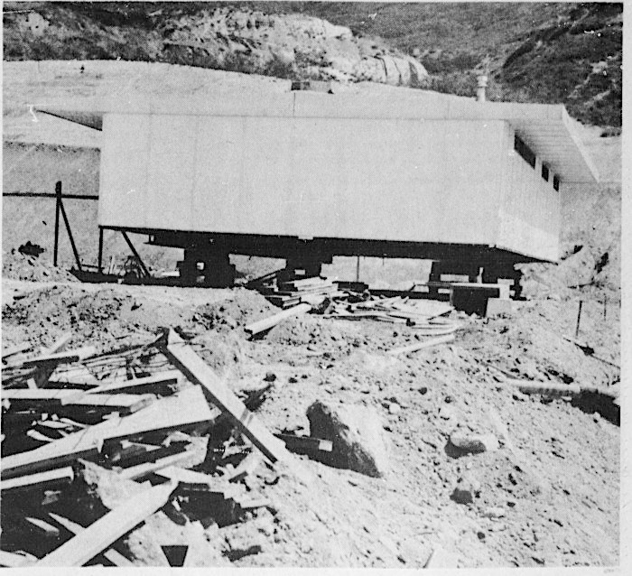
Ladera Linda elementary would become the first school to serve the Seaview area, a 190-home development designed by architect Paul Revere Williams that had opened in 1960. Ground was broken for the new school in April 1967.

Ladera Linda school building under construction. Palos Verdes Peninsula News, Aug. 30, 1967, Page 1. (Credit: Palos Verdes Peninsula News archives)

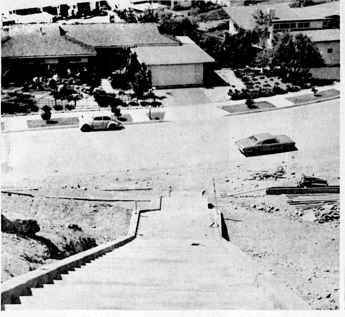
Drainage problems delayed the school’s planned September opening by a month. Before the opening took place, a major controversy arose from the construction of a 124-step flight of stairs. The stairway rising up the hill from Dauntless Drive would serve as the main entry point to the school from the SeaView neighborhood.

Neighborhood parents became alarmed when they saw how steep the stairs were, and how few resting landings, four, the stairway contained. They felt that it would pose a safety hazard when crowded with students, and 219 of them signed a petition calling for the construction of a new, safer stairway on the Forrestal Drive side of the school.

The view down the contested stairway to Ladera Linda, still under construction. Palos Verdes Peninsula News, Aug. 30, 1967, Page 1. (Credit: Palos Verdes Peninsula News archives)

Schools superintendent Dr. Thomas E. Woods estimated a new stairway would cost $14,000, and altering the old one would cost $4,000, money not in the construction budget. The parents contested his claims. Four of the five school board members tested out the new stairs, with three of them seeing potential problems with the set-up.

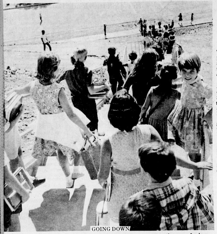
The school opened on Oct. 9, 1967, and Palos Verdes Peninsula News photographers were there to document the student traffic flow up and down the stairs before and after school, and no major problems occurred.

Departing students use the finished staircase at Ladera Linda. Palos Verdes Peninsula News, Oct. 11, 1967, Page 1. (Credit: Palos Verdes Peninsula News archives)
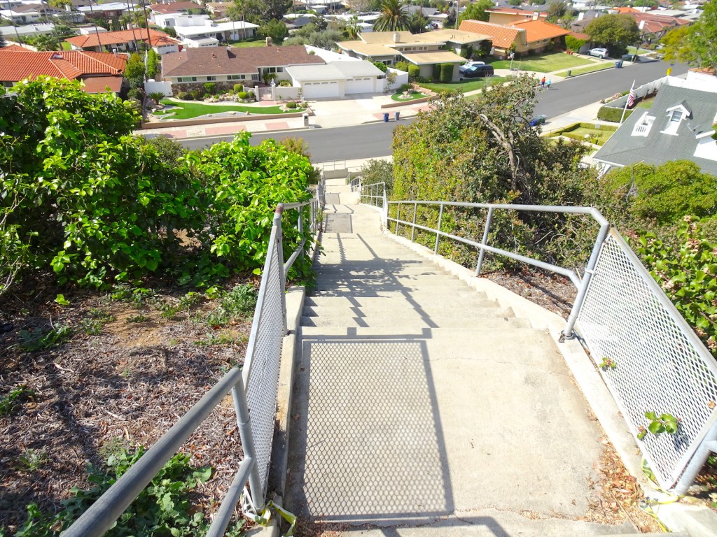
A look down the once-controversial steps in March 2022. (Photo by Sam Gnerre)

The debate, which included an unsuccessful lawsuit, raged on until the following March, when the school board made a final decision to keep the stairs despite continued pressure from neighborhood parents.

There were no further problems with the stairs, but the school’s existence turned out to be relatively short-lived. Falling enrollments led to its closure by the district 13 years later, at the end of the school year in June 1980. Its students were transferred to the Point Vicente and Mira Catalina schools.

The site was then used as a makeshift community meeting hall. Funds were allocated to renovate the hall in 1981, and the new Ladera Linda Community Center was dedicated on Jan. 23, 1982.

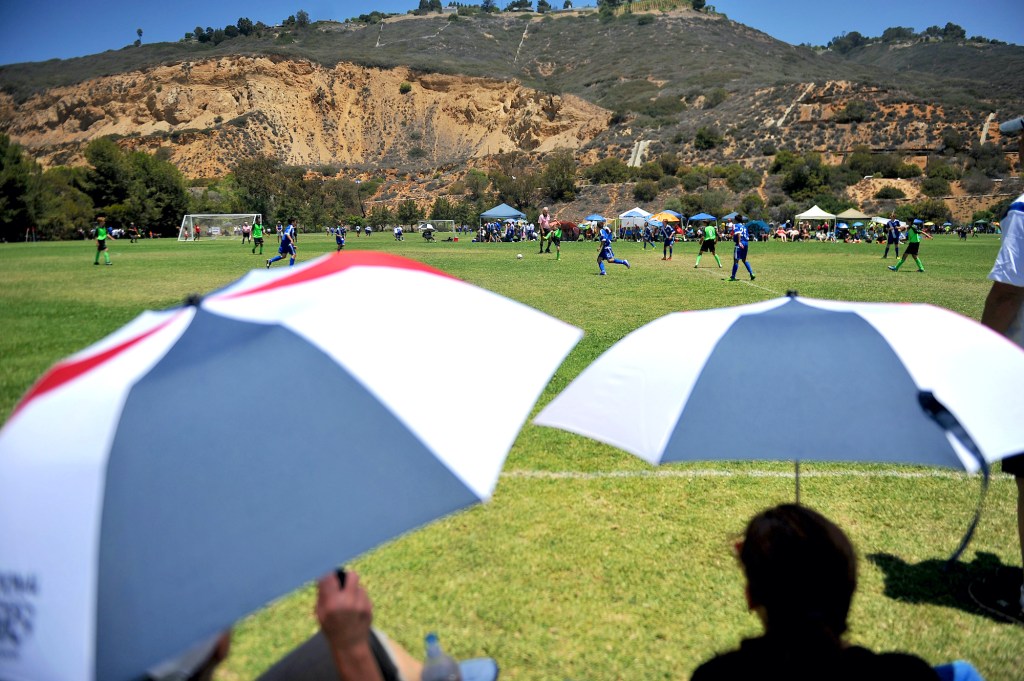
The remainder of the land was transformed into Ladera Linda Park. It grew to include paddle tennis courts, a children’s playground, basketball courts and two large soccer fields used regularly by AYSO leagues.

Soccer parents make their own shade at the AYSO National Games at Ladera Linda.. July 4, 2014. (Daily Breeze staff file photo by Brittany Murray)

Over the years, the old school buildings and the community center began to become dilapidated. In the early 2010s, the city began plans to renovate the center and the park. A master plan to do so was formulated in 2015, based on a 2013 engineering report that found the community center’s infrastructure to be inadequate.

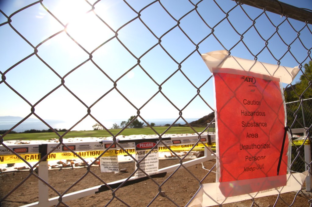
Another controversy erupted in 2016, when community members began to raise concerns that fill dirt trucked in from a Torrance construction site to an area of the park above the soccer fields contained asbestos that could contaminate the grounds. 

Plastic tarps cover an area where asbestos warning tapes and signs are posted by the upper fields at Ladera Linda Park in Rancho Palos Verdes on Nov. 3, 2016. (Daily Breeze file photo by Chuck Bennett)

The fields were closed. After an investigation lasting more than a year, state toxic waste experts determined the soil was safe.

Meanwhile, the plans to renovate Ladera Linda Park continued to take shape. Some community members expressed opposition to the scope of the plan, which called for greatly enlarging the community center building. 

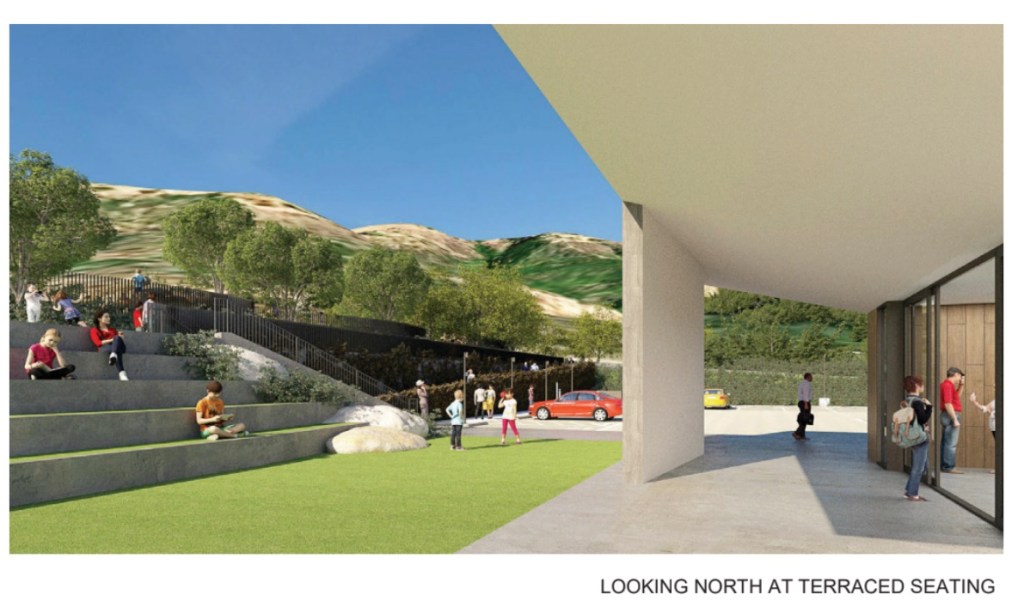
Artist’s rendering of the terraced seating planned for the Ladera Linda Community Center in Rancho Palos Verdes. (Credit: Courtesy of Johnson Favaro)

In April 2021, the plan, then estimated to cost $15.7 million in total, received final approval from the RPV City Council.

By the time the project’s budget was approved in March 2022, its total cost had risen to $18.7 million. The renovation, designed by Culver City architecture firm Johnson Favaro, is expected to take about 15 months to complete.

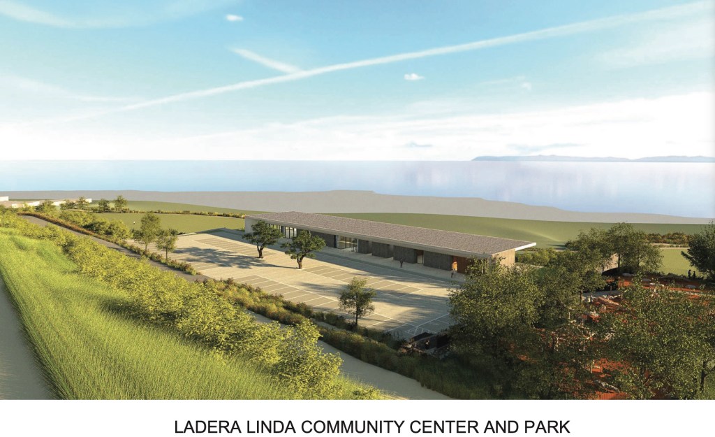
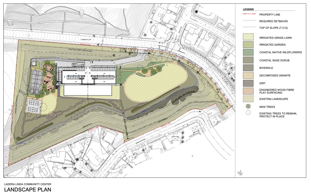
It will create a new 6,790 square-foot Community Center, an outdoor, tiered seating area, a 54-stall parking lot and a new children’s playground. The soccer fields will not be affected by the renovation plans.

Artist’s rendering of the planned Ladera Linda Community Center in Rancho Palos Verdes. Credit: Courtesy of Johnson Favaro)

Note: Special thanks to Megan Barnes, Senior Administrative Analyst, City of Rancho Palos Verdes.

Sources:

Daily Breeze archives.

“City of Rancho Palos Verdes Ladera Linda Community Center and Park,” Johnson Favaro website.

“Livingston Quarry (site),” Wikimapia.org.

Los Angeles Times archives.
Palos Verdes Peninsula News archives.

City of Rancho Palos Verdes website.

Torrance Press-Herald archives.

The view from Ladera Linda Park in Rancho Palos Verdes. (March 2022 photo by Sam Gnerre)
Layout and planned landscaping for the new Ladera Linda Community Center in Rancho Palos Verdes. (Credit: Courtesy of Johnson Favaro)

The early days of Avalon, Catalina Island’s only incorporated city

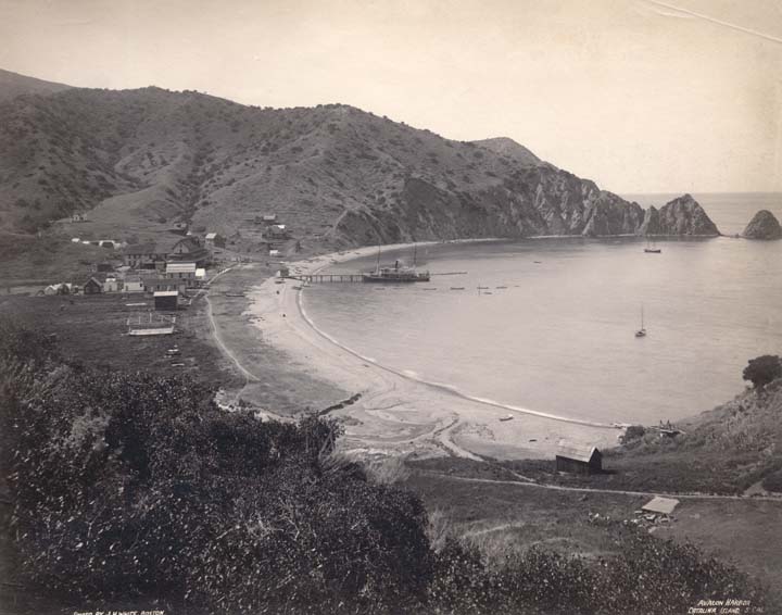
Hillside view overlooking Avalon harbor shows the steamer Falcon at the dock, small boats and two sail boats in harbor, the Metropole Hotel, top left, and several buildings along the shoreline. Photo circa 1888. (Credit: California State Library)

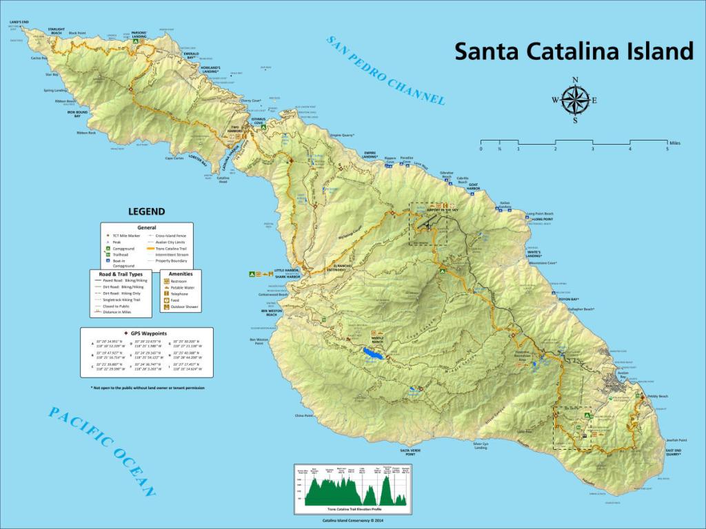
The natural harbor on the eastern end of Catalina makes it a perfectly logical choice as the island’s main port and settlement area.

Augustus Timms found it a good place from which to operate his goat farm in the 1860s, and the sparsely settled location became known as Timms Landing. Timms got around. He later moved to San Pedro, and the coastal land he owned there also became known as Timms Landing.

Catalina Island passed through many hands before developer George Shatto and his partner A.C. Sumner bought it for $200,000 in 1887, with plans to develop it as a resort and fishing mecca. 

(Credit: Visit Catalina Island website)

His sister-in-law Etta Whitney suggested the the new city being built by Shatto and his partner A.C. Sumner at the harbor be renamed “Avalon” after the mythical paradise described by Alfred Lord Tennyson in his epic poem cycle, “Idylls of the King.”

Shatto, who built the island’s first hotel, The Metropole, liked the idea, and the Avalon name stuck. He couldn’t make a long-term go of it, however, and sold it to the prosperous Banning family in January 1892.

Wilmington shipping magnate Phineas Banning had expressed an interest in buying the island a decade earlier. He died in 1885, but the company he built, now run by his three sons, Joseph, William and Hancock, saw the business possibilities the island offered, and made the deal to purchase it from Shatto for $128,740.

The Bannings immediately began making major improvements to Avalon. They attempted to transform it into a high-class tourist destination, and under their stewardship, the island became a fashionable vacation spot for the well-to-do. (Minorities were not welcome, unless they were servants.)

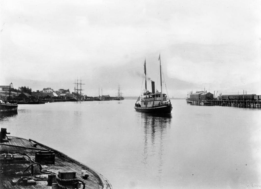
The Wilmington Transportation Company’s steamboat “Falcon” in San Pedro, Los Angeles, circa 1905. The boat offered transport to Catalina Island.(Credit: USC Digital Library)

Their plans included taking complete control of access to the island. Visitors were not charged an entry fee, but only could be transported there on ships owned and operated by the family’s Wilmington Transportation Company.

This attempt to monopolize transportation led to ongoing skirmishes between the Bannings and the operators of what the family called “tramp steamers,” independently owned boats that also brought visitors to the island on the pretext that the harbor was open to all comers.

Catalina’s growing popularity led to an increased influx of people, one way or another, during tourist season. More people brought other problems to Avalon, including illegal gambling and rowdy alchohol-fueled behavior at local saloons.

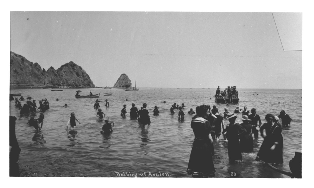
Bathing scene at Avalon shows women in dresses and hats wading in shoreline water in foreground, children and other people in water beyond at left and men sitting on raft in background at right. Catalina Island, 1895. (Credit: California State Library)

The Bannings tried to control that at first, too, making sure that the Hotel Metropole was issued the city’s only liquor license. But eventually other establishments serving liquor began to open, including the posh Pilgrim Club in 1902. Occasional gambling raids even began to occur, sullying the family’s attempts to maintain a family image for the town.

Avalon was indeed just a town during this era, unincorporated and under the legal control of the Los Angeles County Board of Supervisors. And the Banning family’s battle to keep the transportation monopoly had grown more intense, with barbed wire fences and physical confrontations on area beaches becoming more frequent.

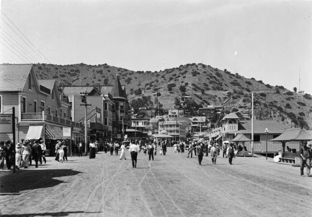
Photograph of the Strand in Avalon, Santa Catalina Island, circaa.1905. Mostly wooden buildings line the street, including the Grand View Hotel. Legible signs include: “Sumner Ave., Del Mar, Glenmore Hotel, Island Villa, Campus Virginia”, “Ocean View Metropole Annex no. 26”, “Sumner Ave., Ocean View, Avalon Inn, Camp Albert, Golf links, Tennis courts”, “McCall patterns, 10¢, 15¢”, “Bristol Cafe”, “Darlington”, “Island Buffet, bar & restaurant”, “Cigars, tobacco”, “Ladies entrance”, “Hotel, Bay View”, “Hotel Grand View”, “Billy’s”, “Optimo aquarium”. (Credit: USC Digital Library)

The Bannings expressed their outrage at the intruding boats by regularly threatening to vacate Avalon and re-establish themselves at the Two Harbors settlement near the western end of the island, but this never came to pass. A series of  adverse legal decisions in the early 1900s finally broke their grip on transportation to the island.

In addition, the establishment of the Avalon Freeholders Improvement Association in 1909 led to a movement to break the Bannings’ grip on the island itself. The group, made up of those who’d purchased lots under Shatto’s ownership, worked with the family, with some success, to bring more improvements and amenities to the Avalon area, including improved streets, water, gas and other utilities.

But it wasn’t enough. The move toward incorporating Avalon as an independent city arose in large part from new powers voters gave L.A. County to control liquor sales in its unincorporated areas, which included Catalina. Saloon owners teamed with residents who opposed the restrictions to begin a concerted effort to press for Avalon’s incorporation, which potentially could break both the County’s and the Banning family’s hold on their operations.

When the June 1913 election results came in, pro-incorporation voters had succeeded in creating a new city of the sixth class by a yes vote of 132-88. By early 1915, the Bannings had made their peace with Avalon’s new governance, and were working with the Freeholders Association on improvements to Avalon’s facilities and infrastructure.

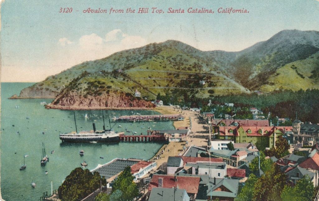
Postcard view of Avalon in 1913. Hotel Metropole, green with red roof, center right.

Sadly, much of that work was damaged by a devastating fire that began on the morning of Nov. 29, 1915. It destroyed a good portion of the city and dealt a $2 million blow to the Bannings’ investment. No official cause for the fire ever was found.

The Bannings and the new city undertook a fervent rebuilding program, but family squabbles made an offer from chewing-gum tycoon William Wrigley Jr. easier to accept. Only Hancock Banning opposed the $3 million sale, and his brothers outvoted him. The deal was announced in February 1919.

Building on the foundation laid by the Bannings, the Wrigley family further transformed the island into the tourist mecca that had been envisioned more than thirty years earlier by George Shatto. Movie star sightings and the Chicago Cubs spring training years followed.

Restrictions on island transportation and individual property ownership in Avalon were eased.  Crucially, though, the island’s natural beauty came under more protection through the actions of the Catalina Island Conservancy, to whom the Wrigley family deeded most of the island’s land in 1975.

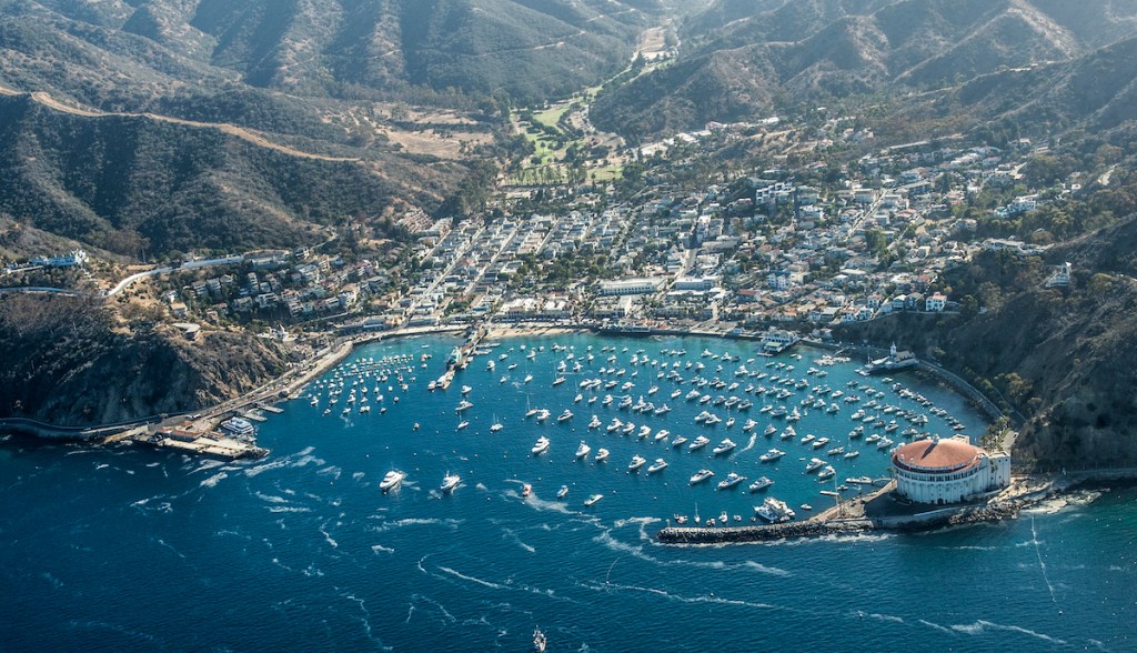
Avalon at Catalina Island from the sky on Sept. 15, 2016. (Daily Breeze file photo by Thomas R. Cordova)

Sources:

“Avalon’s History,” Islapedia website.

The Catalina Story, by Alma Overholt, Catalina Island Museum Society, 1962.

Grand Ventures: The Banning Family and the Shaping of Southern California, by Tom Sitton, Huntington Library, 2010.

Los Angeles Times archives.
San Pedro News Pilot archives.

Borax firm remains a fixture at the Port of Los Angeles after nearly a century

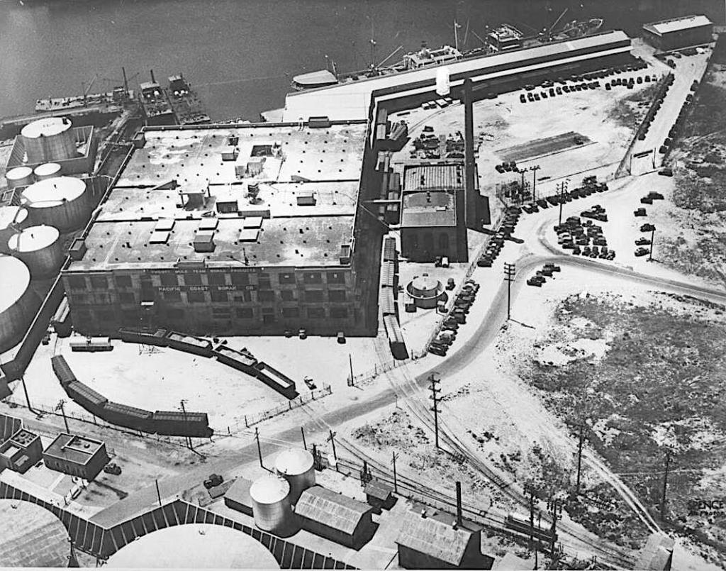
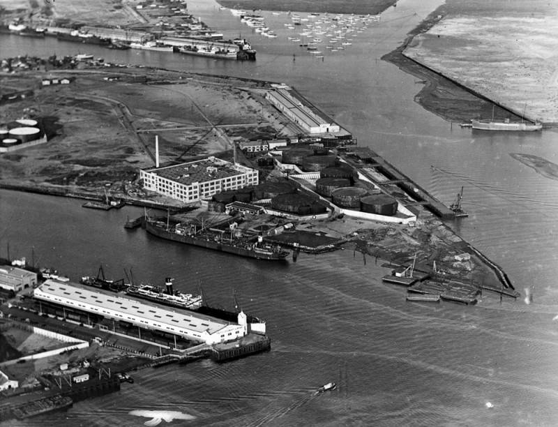
The Pacific Coast Borax Company plant on Mormon Island at the Port of Los Angeles as seen from the air in 1930. Its concrete buildings were designed by architect Albert C. Martin. (Credit: USC Digital Archives)

The company that helped make Death Valley famous via its long-running radio and television anthology series “Death Valley Days” also has had an imprint on the Port of Los Angeles since 1924.

Formed in an 1890 consolidation, the Pacific Coast Borax Company’s roots stretch back to 1872 and the formation of the Smith and Storey Brothers Borax Co. in Nevada by Francis Smith, the “Borax King.”

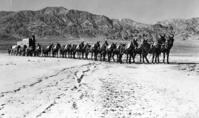
One of the assets acquired in its 1890 consolidation of several smaller companies was the Harmony Borax Works in Death Valley. Its use of mules to transport the mineral to railroads and then to market gave the company a trademark image that it would use for decades: Twenty Mule Team Borax, based on the distinctive mule trains that pulled the wagons.

A mule team hauls a load of borax out of Death Valley in the Mojave Desert. Undated photo.
(Credit: Los Angeles Public Library Photo Collection)

Borax is a water soluble salt derivative often found in desert lake beds that has a wide variety of uses. It’s used in soaps and detergents, pesticides, water softeners, glass and pottery making, swimming pool chemicals and many other products.

Pacific Borax built its first West Coast refinery at Alameda in the Bay Area in 1893. In 1921, the company bought nine acres of land on the southern tip of Mormon Island in the Wilmington section of the Port of Los Angeles that formerly had housed the Chandler Shipbuilding Co.

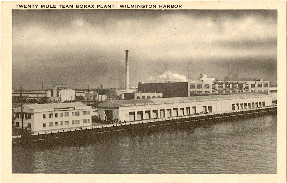
The new $2 million plant the company built there opened on Sept. 1, 1924. It consisted of a large refinery, a warehouse and several smaller buildings. The land on which it was built bordered what was then one of the Port’s deeper channels, giving larger ships easy access to the new wharf, Berth 166, the company also built there.

The Pacific Coast Borax Co. in Wilmington. Postcard circa 1943. (Credit: CSUDH Digital Archives)

It was a major investment for Pacific Coast Borax, but the company’s leaders, including general manager C.B. Zabriskie, calculated that the plant’s closer proximity to the company’s Death Valley mining operations would cost far less than shipping the raw materials to Alameda. (Zabriskie Point north of Death Valley was named for the Pacific executive long before the 1970 Michelangelo Antonioni film of the same name.)

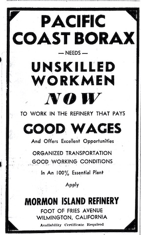
Torrance Herald, Aug. 17, 1944, Page 5. (Credit: Historical Newspapers Archive database, Torrance Public Library)

The Alameda plant was shuttered soon afterward. About 250 employees and their families moved to the Harbor Area to work at the newly opened plant. 

By 1928, the borax sites in Death Valley had been worked out, but a new source was found in the Kern County desert just northeast of Edwards Air Force base. A new company town, Boron, quickly sprung up, populated mostly by Pacific Borax employees.

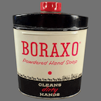
Despite the onset of the Depression, business at the plant remained brisk throughout the 1930s. Demand for its new hand cleaner product Boraxo, introduced in 1935, led to higher visibility among consumers.

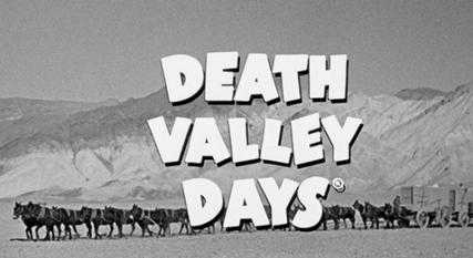
In 1930, Pacific Borax went to its public relations firm, McCann Erickson, with the idea of launching a radio program, “Death Valley Days,” that would recount the history of Death Valley and the borax industry there, from the 20-mule-team days onward. 

Ruth Cornwall Goodman was hired to write the half-hour shows, a job she performed for more than three decades. She got material for the shows by traveling around the Death Valley area and the West in general, listening to stories from old-timers and local historians.

Screen grab from early “Death Valley Days” episode. (Credit: Wikipedia)

The radio show’s run ended in 1951. “Death Valley Days” moved to television beginning in 1952, and the syndicated show ran until 1970. Each episode of the series was introduced by a host. Stanley Andrews introduced them until 1964, when Ronald Reagan, in his last acting job before entering politics, hosted for the next couple of years.

Later hosts included actress and Torrance resident Rosemary de Camp, followed by actors Robert Taylor and Dale Robertson. The long-running series, whose episodes were a distinctive mix of Western history and drama, lives on in reruns. It currently airs on the Encore Westerns cable channel.

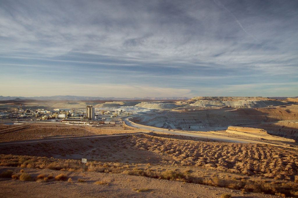
In June 1956, Pacific Borax and its 1400-plus employees merged with the United States Potash Co., forming the U.S. Borax and Chemicals Corp. In 1968, U.S. Borax was acquired by the British-based RTZ Group, short for Rio Tinto-Zinc, one of the world’s largest mining conglomerates.

The Rio Tinto borax mine, right, and accompanying plant, left, in Boron, California in 2012. (Credit: Wikimedia Commons photo by Tillman from Flickr)

In 1988, the soap-making firm Dial Corp. purchased the 20 Mule Team division of U.S. Borax, the arm of the company that produced its consumer products such as Boraxo and Borateem bleach. Thus ended U.S. Borax’s days of producing borax-based products for the retail market.

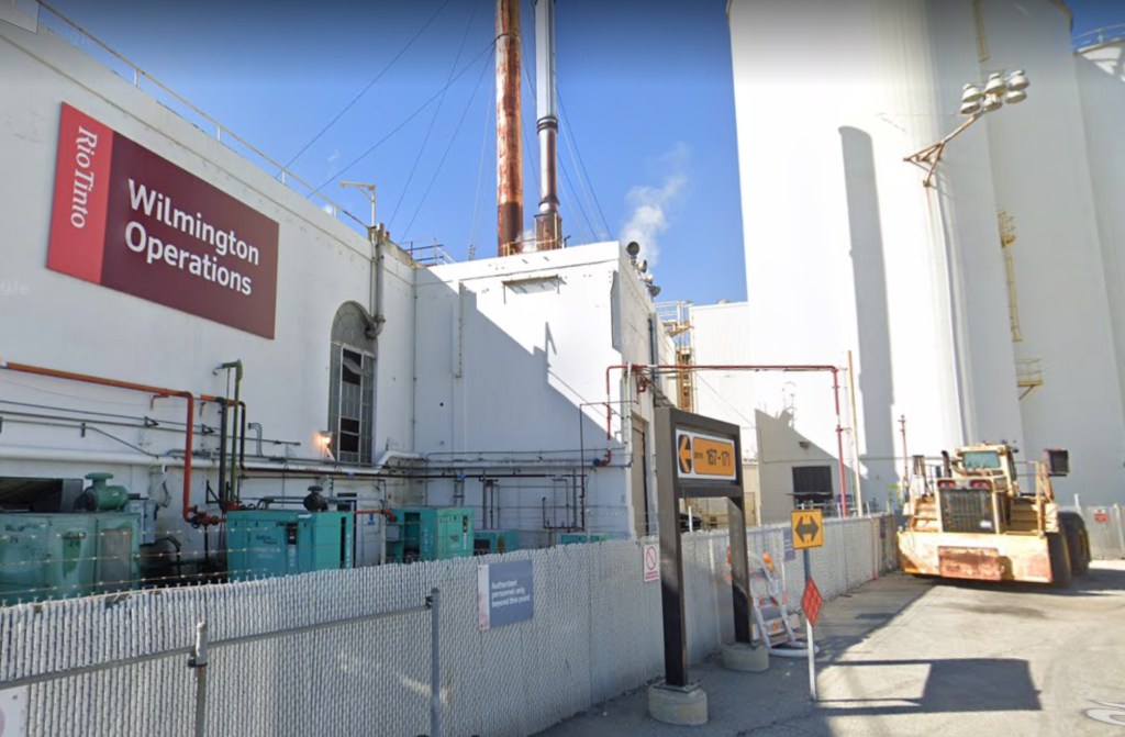
The U.S. Borax/Rio Tinto plant at 300 Falcon St. at the southern terminus of Fries Ave. continues to produce and ship more than 36,000 tons of packaged goods and more than 300,000 tons of bulk material to customers in Europe, Malaysia, and China. 

As a result of its shrewd land purchase nearly 100 years ago, its Wilmington facility remains the only privately owned shipping terminal at the Port of Los Angeles.

The U.S. Borax/Rio Tinto plant on Mormon Island in Wilmington in February 2022. (Credit: Google Earth)

Sources:

Daily Breeze archives.

Los Angeles Times archives.
San Pedro News PIlot archives.
Torrance Herald archives.
“U.S. Borax/Rio Tinto Terminal,” Port of Los Angeles website.
Wikipedia.

“Wilmington, California Operations,” 20 Mule Team Borax website.

Aerial view from 1924 shows a lightly developed Mormon Island (center), the Los Angeles inner harbor, with the new $2 million Pacific Coast Borax Co. plant (center left), Shell Oil Marine loading station (center), the new city berths 175 to 176 next to Shell Oil tanks, California Yacht Club and anchorages (in background), and Pacific Steamship Company’s pier, with the Manchuria (Panama-Pacific Liner) in the foreground. (Credit: USC Digital Library)
Is this your new site? Log in to activate admin features and dismiss this message
Log In