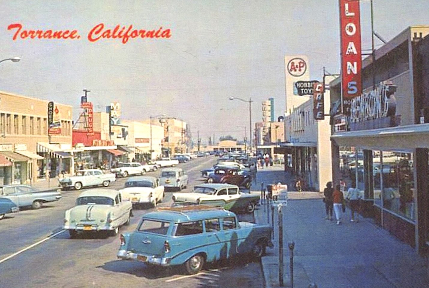
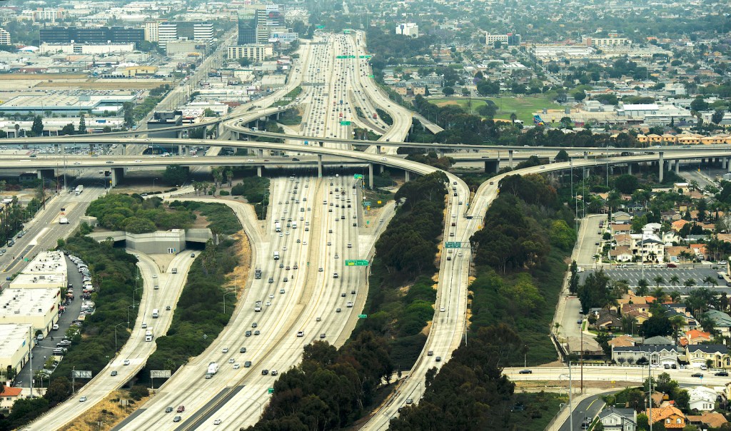
Freeways figure so prominently in the everyday experience of most Southern Californians that it’s difficult to imagine the local landscape without them. The first Los Angeles freeway, the 110 in Pasadena, opened fully on New Year’s Eve, 1939.
Los Angeles city and county officials and the Automobile Club of Southern California had all conducted studies recommending a system of freeways, and the arrival of state and federal funds for the project in 1947 expedited roadway construction.
The South Bay/Harbor Area has four major freeways: the 110, 91, 105 and 405. Today we’ll look at how the 405, also known as the San Diego Freeway, came into being piece by piece.
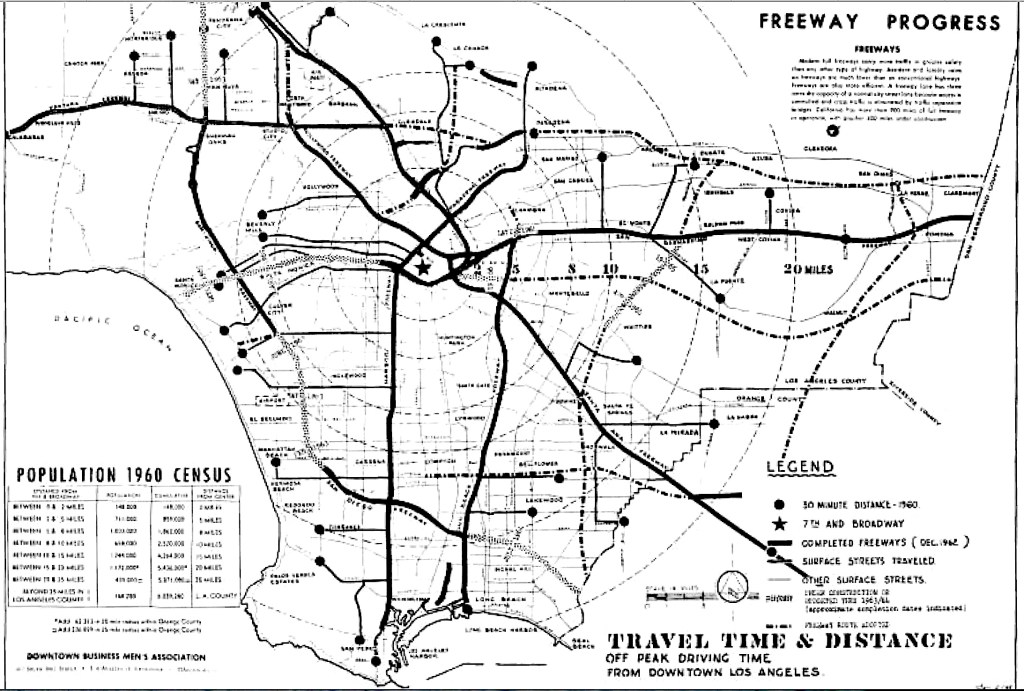
Unlike the more recent 105 (Century) Freeway, which opened as a complete finished roadway in 1993, the other three South Bay freeways opened in segments. In the case of the 405 Freeway, the segmentation caused controversy.
The initial segments of the 405 were built at its northern and southern legs, from Burbank Blvd. in the San Fernando Valley southward, and from Long Beach northward, in the late 1950s and early 1960s.
This, despite widespread agreement that the most dire traffic congestion in the Los Angeles basin was at that time occurring in and around Los Angeles International Airport, which had become increasingly crowded since its opening in 1949. The airfield was situated smack in the middle section between the two segments that were built first.
South Bay residents, particularly those in Westchester and Inglewood near LAX, expressed alarm. They formed the Inter-City Highway Committee to present a unified appeal to state highway engineers to rethink their priorities and begin building the 405 segments that pass through the South Bay. Other cities represented on the committee included Culver City, Torrance, El Segundo, Hawthorne and the beach cities of Hermosa, Manhattan and Redondo.
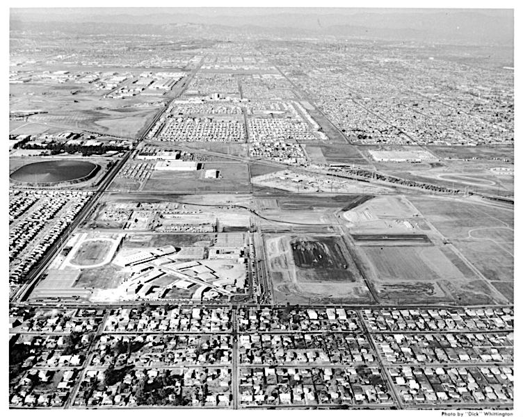
By 1960, the 405’s northern and southern segments had been mostly completed, and the ICHC’s urgent admonitions to speed up freeway construction in the remaining middle section had been echoed by Los Angeles County Supervisor Kenneth Hahn. The area where the freeway was not being built at that time was in Hahn’s district.
State officials defended their methodology. “We try to build freeway links so they can be connecting to another freeway and put it into use immediately rather than put up disconnected structures,” state highway commission information officer Milton Stark told the Los Angeles Times in November 1959.
State engineers originally predicted that the 405 link through the South Bay would be completed by the fall of 1962. By March 1961, the freeway’s path had been cleared from Manchester Blvd. to the 110 Freeway at 190th St., but the only construction underway was an underpass being built near Manchester.
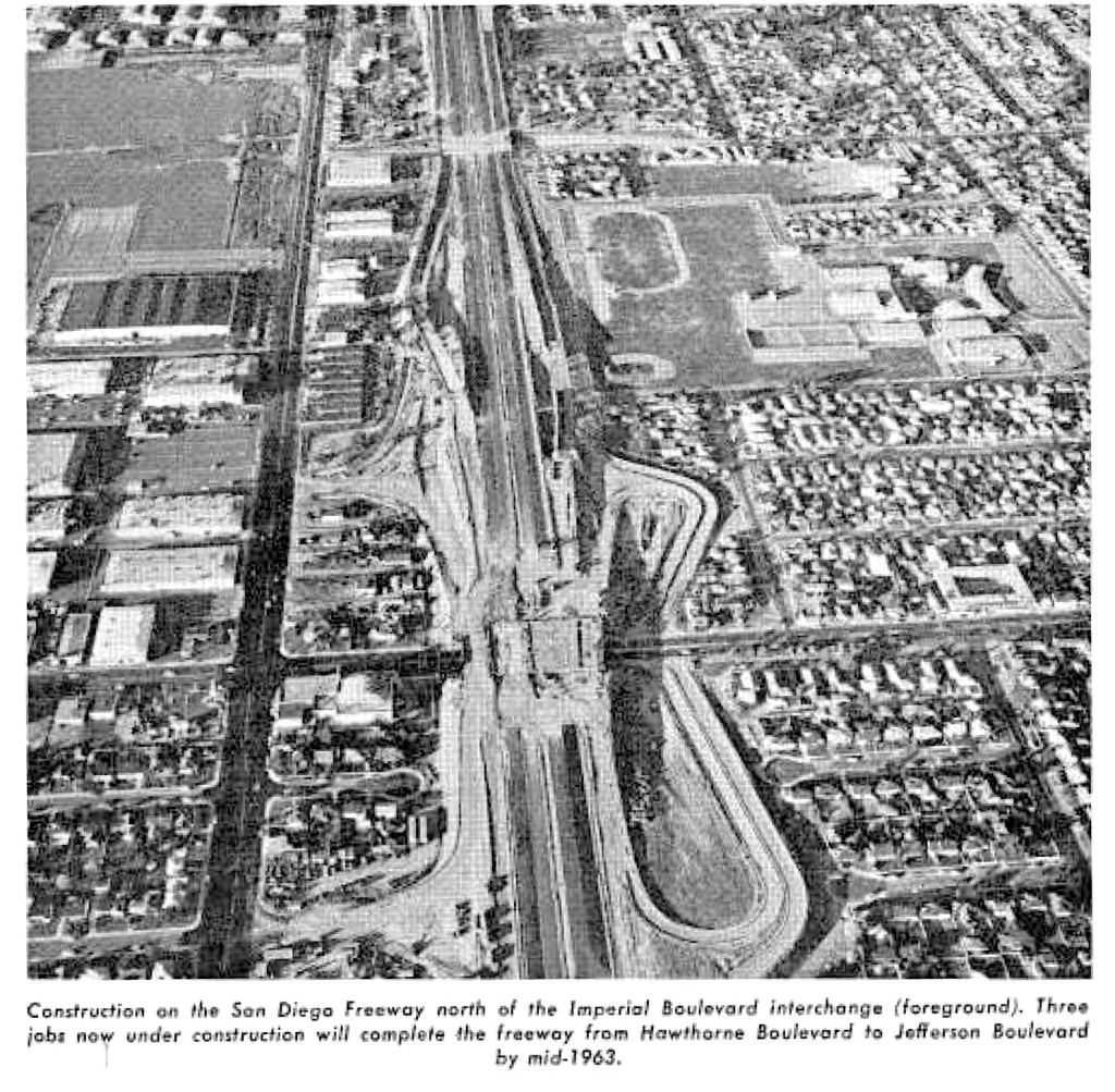
Over the next two years, however, the work would be completed. Here is a list of the South Bay 405 sections from north to south, and the dates they were completed:
- La Tijera to Jefferson Blvd, 1.5 miles. Completed: 1963.
- La Tijera to 137th St., 4.8 miles. Completed: 1963.
- 137th St. to Hawthorne Blvd., 2 miles. Completed: 1963.
- Hawthorne to Artesia Blvd, 1.1 miles. Completed: 1963.
- Artesia Blvd. to 190th St., 3.5 miles. Competed: 1962.
- 190th St. to Carson St., 2.9 miles. Completed: 1962.
- Carson to Alameda St., 1.9 miles. Completed: 1962.
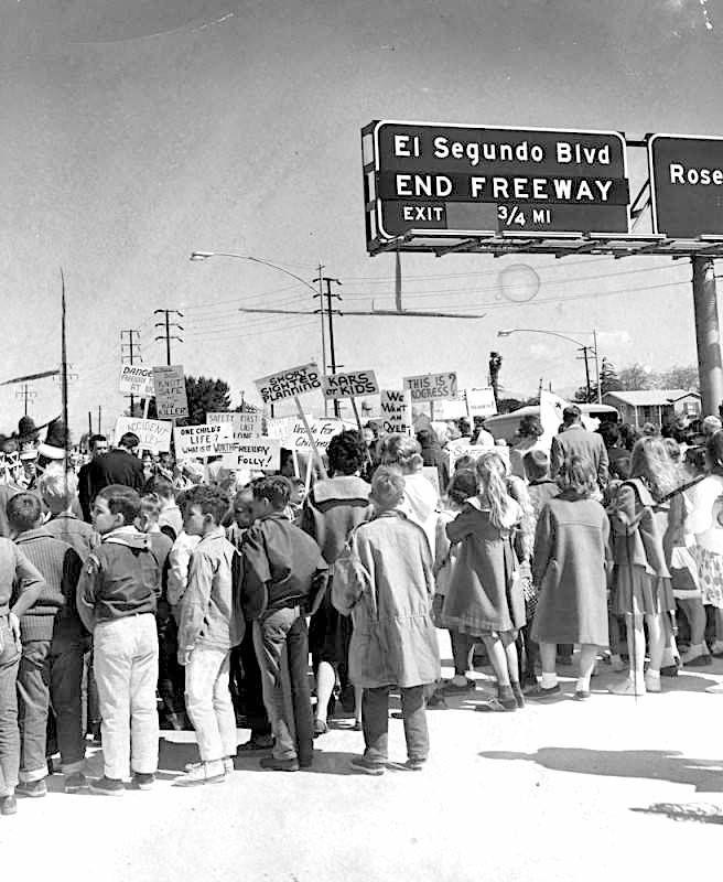
The segment from La Tijera to Jefferson was the final one to be dedicated. The La Tijera ramps remained closed even after the roadway opened on June 10, 1963, thanks to ongoing protests from Westchester and Inglewood parents.
The picketers were parents demanding that officials live up to their promise to build a separate pedestrian bridge over the freeway at La Tijera to reduce the dangers of students from Osage Elementary at St. Jerome Parochial School having to cross the freeway bridge there on foot.

The highly visible protests reached Supervisor Hahn, who pledged that the county would make good on the promise, but, ultimately, a separate pedestrian bridge over the 405 Freeway at La Tijera would never be built. Instead, chain-link fencing approved by the Los Angeles City Council in 1964 is their only protection on the sidewalk from street traffic on both sides of the busy thoroughfare.
Other than that, the newly opened roadway then stretched for 41.8 miles, from the 5 Freeway in the city of San Fernando south to the 710 Freeway in Long Beach. The total cost of construction was $16.5 million, which amounts to nearly $150 million in 2021 dollars. By the end of the 1960s, it would extend through Orange County, and eventually provide a through link to San Diego.
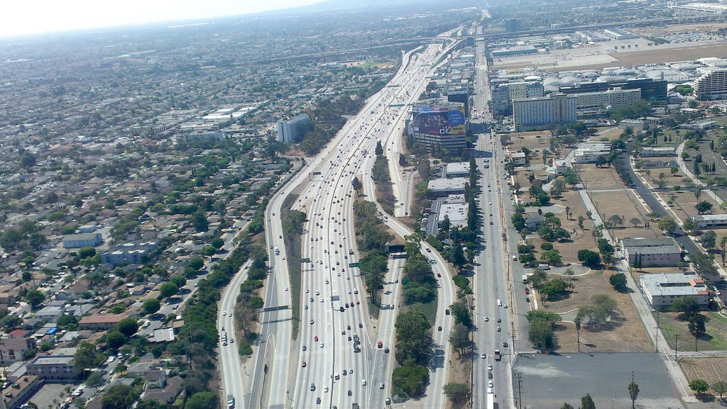
Of course, the 405 Freeway has morphed from a traffic solution to a traffic nightmare over the ensuing decades. As the old joke goes, it’s called the 405 because traffic moves at 4 or 5 miles an hour. Whatever its foibles, though, it remains the longest freeway in Southern California, and the busiest freeway in the world.
Sources:
Daily Breeze archives.
Freewaytopia: How Freeways Shaped Los Angeles, by Paul Haddad, Santa Monica Press, 2021. (Covers not only the 405, but the history of all major freeways in the Los Angeles area.)
Los Angeles A to Z: An Encyclopedia of the City and County, by Leonard and Dale Pitt, University of California Press, 1997.
Los Angeles Times archives.
Palos Verdes Peninsula News archives.
Torrance Press-Herald archives.
Additional comments:
Former Ventura County Historical Museum Library director Charles Johnson shared this Memory of the freeway’s construction:
“I had just arrived in Lennox in 1961 as they were building the 405.
I had just moved from the Crenshaw / Imperial area of Inglewood, due east of Lennox, and was going to Felton.
My most vivid memory, after I wandered up on the freeway one weekend with my skateboard (age 11), was the entire stretch from Imperial to Century was covered in “Indian” rugs, which were being soaked by a watering truck that was up there, moving slowly up and down the line.—later learned this was part of the concrete curing process. It was quite a sight. Unreal.
Only other recollection was how often that stretch of road just to the east of the freeway came to be used for car races.
Only much much later, over fifty years later, when working on a history of the Freeway system in Ventura County, did I come to learn the entire project was financed at a level of 90% federal funds because President Eisenhower, after serving as a general during WWII, had been impressed by how quickly our troops could travel on Germany’s autobahn, so was able to go back to the US and sell this improved system of roads as a public safety issue (in case of attack). Of course it didn’t feel so safe to the largely impoverished folk who were summarily displaced for the “greater good” by the largest eminent domain project in California history.”
Richard Kistler remembers:
I, also, recall the world before the 405. The old Lennox Little League field was taken out by the 405. I think there was a trailer park near the little league field.
The 405 took out a dozen or so “mini-homes” west of Lennox High’s football field. Eugene, a Navajo Indian and a class-mate, lived in one of these garage-size houses with his parents and three siblings. I remember he took off his socks when he got home to “save them” for school. It was one of the first times I ever encountered real poverty.
My cousin, Bob Wolfenden, used to ride go-carts with his friends on the unfinished 405 in Westchester. The cops showed up and were about to roust them, when the cops discovered that my Aunt Agnes (Bob’s Mom) was riding go-carts with the kids. They got off with a warning. A simpler time.
Steve Thompson:
I vividly remember playing on the unopened lanes behind the high school. We (I think it was Dennis Kiser) would walk (and screw around) between Imperial and 104th. The photos clearly show how the freeway “ripped” through established neighborhoods.

