The Battle of Dominguez Rancho and “The Old Woman’s Gun”

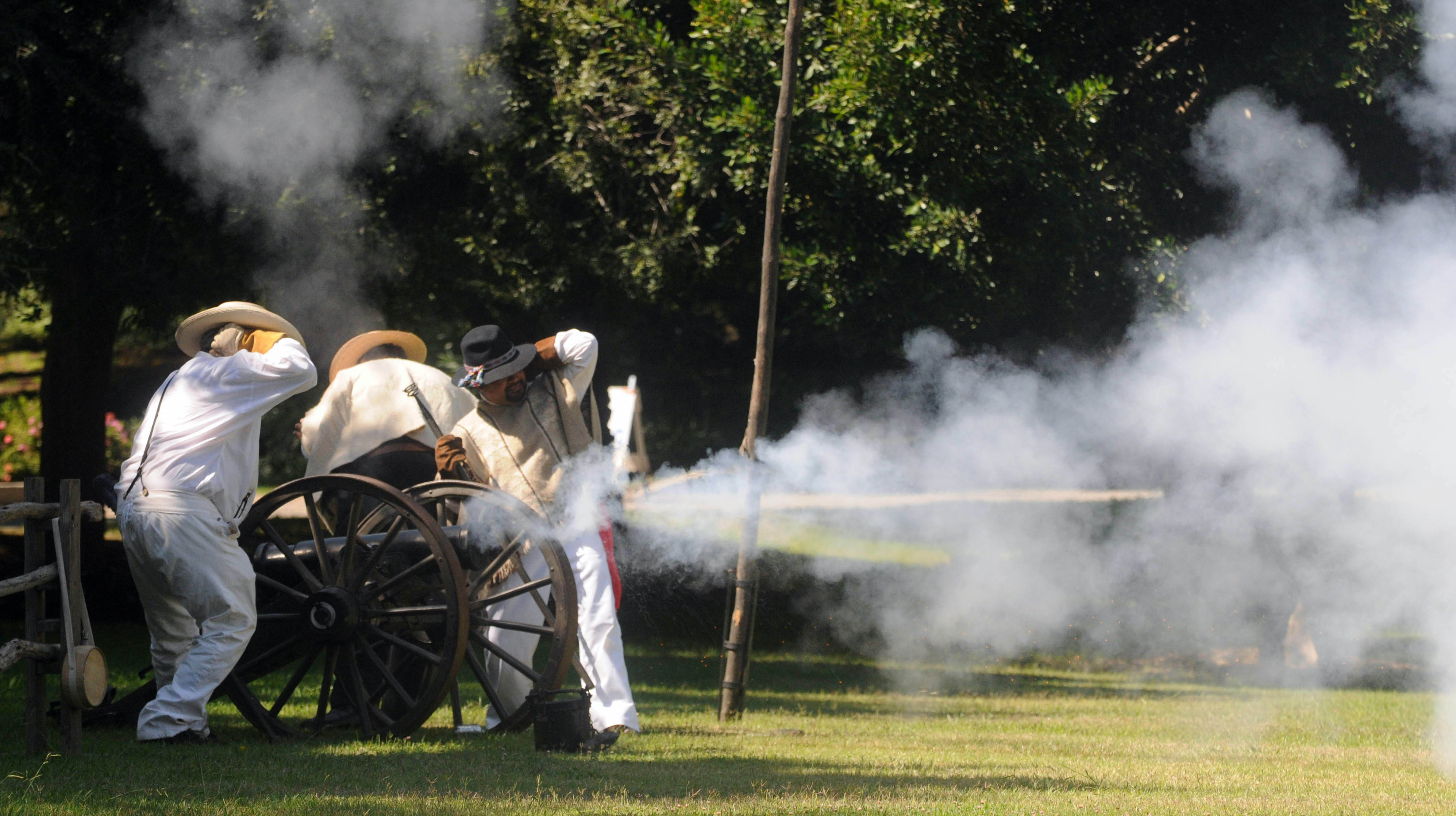
Men playing the role of Californios use a replica cannon of the one that was unearthed to help defeat the U.S. Marines in the Battle of the Old Women’s Gun during the Mexican-American War reenactment at the Dominguez Adobe in Carson in October 2010. (Daily Breeze staff file photo)

Historians have pored over the details of the October 1846 encounter known as “The Battle of Dominguez Rancho” at great length. The story has been retold and even re-enacted many times, though the “battle” really was little more than a skirmish.

It occurred on Dominguez Hill near the house that Rancho San Pedro land grant owner Manuel Dominguez had built in 1826. Now the Dominguez Adobe museum, the oldest house still standing in the South Bay and Harbor Area, it played a central role in the Battle of Dominguez Rancho, even though Manuel and his family most likely were not home when it happened. 

We’ll need some back story for context in order to understand the events surrounding the battle. Firstly, Mexico still had possession of California at the time, and the population of the ginormous city of Los Angeles, then known informally as the Pueblo de Los Angeles, was around 2,000 people.
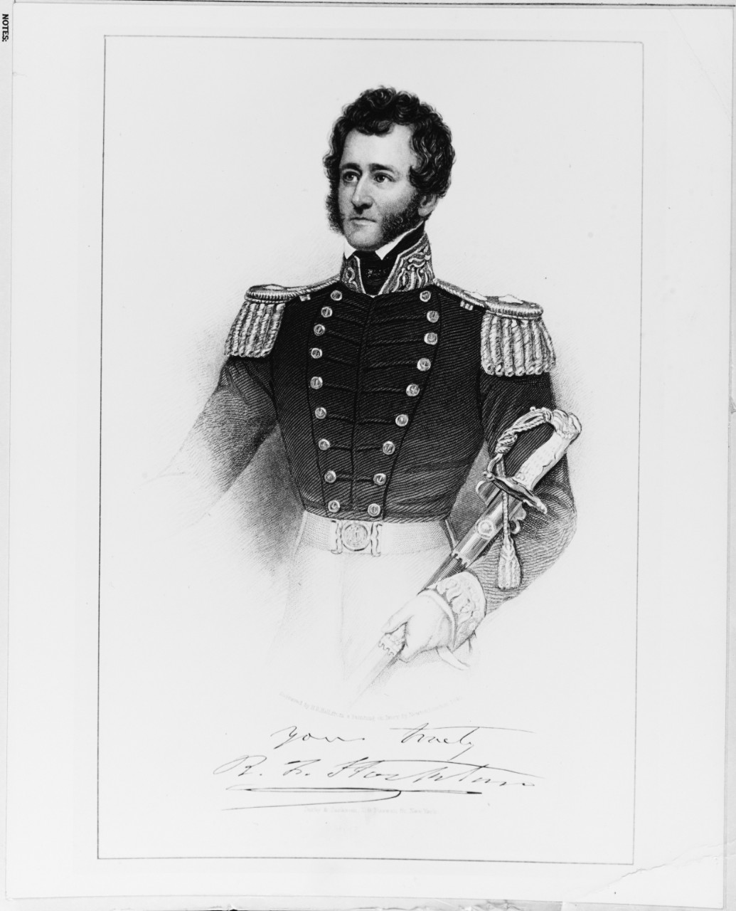
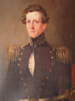
Commodore Robert F. Stockton. (Credit: U.S. Naval History and Heritage Command)

The mid-1840s brought unrest to California. Mexico felt the need to strengthen its hold on the territory following the U.S. annexation of Texas as its 28th state in 1845. But California already had become a promised land for American settlers during the westward expansion, and a clash between the two countries became increasingly inevitable.

Shortly after the Mexican-American war began in April 1846, U.S. Navy Commodore Robert F. Stockton (for whom the California city was named) sent American soldiers down from his base in Monterey to occupy the Pueblo de Los Angeles. He assigned Captain Archibald Gillespie to command a garrison of fifty men with which to rule the city.

Gillespie’s harsh rule antagonized those in the community, especially the Hispanic natives known as “Californios,” and he was ousted during a revolt in September 1846. He asked for reinforcements for Monterey, but before they could arrive, he and his men were driven from the Pueblo.
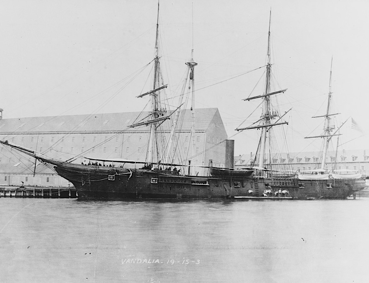
The USS Vandalia at the New York Navy Yard, circa the later 1870s or the early 1880s. (Credit: U.S. Naval History and Heritage Command)

They were allowed to march south to San Pedro, where a merchant ship, the Vandalia, was docked. They were instructed to board the ship and leave the area for good. But Gillespie stalled for a few days, hoping that the reinforcements would arrive at the port. (The troops gathered at the military reservation area that eventually became Fort MacArthur.)
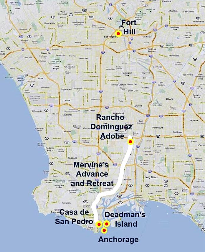
Modern map with overlay shows Mervine’s route towards Los Angeles, which roughly followed present-day Alameda Blvd. (Credit: Google Maps via MySanPedro website)

Arrive they did a few days later, 300 marines aboard the USS Savannah, a frigate commanded by Capt. William Mervine. As they united forces in preparation for a return march from the port to the Pueblo, Gillespie warned Mervine to take food and water, draft animals, supplies and artillery, as he knew the Californios had at least one piece of small artillery. 
Undated portrait of Rear Adm. William Mervine painted by M. E. D. Brown at Utica, NY. (Credit: James Mervin via Findagrave.com)

Mervine scoffed, saying that the enemy, whom he considered fearful and cowardly, would scatter when it saw the 379 American troops. He was convinced the Americans could carry everything they needed on their backs. They would find horses and water along the way.

About that piece of artillery possessed by the Californios: It turns out that it was a small cannon mounted on a swivel that had been used to fire ceremonial rounds during celebrations of the Virgin Mary in the Pueblo.

Fearing that the American forces would seize it during their occupation of the city, local rancher Antonio Reyes had it buried, probably in his peach orchard near 2nd and San Pedro streets, with the help of his wife, Maria Clara Cota Reyes and their children. Maria then was about 56, an age considered to be fairly old in those days. Hence, “The Old Woman’s Gun.”

When the Californios in the Pueblo got wind of the American plans to retake their city, about 50-100 horse soldiers under the command of Juan Antonio Carrillo (great uncle of actor Leo Carrillo) unearthed the gun and added “The Old Woman’s Gun” to their arsenal as they headed south for battle. They had to cobble together a somewhat meager amount of gunpowder with which to fire it.
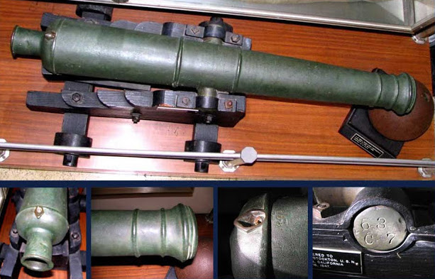
The cannon represented as “The Old Woman’s Gun” in the collection at the U.S. Naval Academy Museum in Annapolis, MD. (Credit: U.S. Naval Academy Museum)

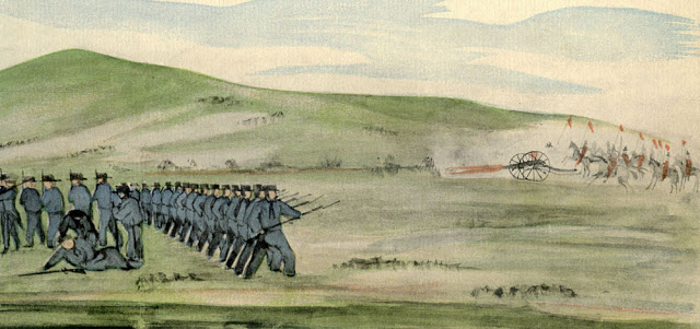
Mervine’s troops had reached Compton Creek in Rancho Dominguez on Oct. 9, 1846, when they encountered Carrillo’s mounted troops on top of Dominguez Hill. Using tactics that would come to be known as guerrilla warfare, the Mexican troops created clouds of dust with horses and rode in formations that made their small force appear much larger.

They also deftly maneuvered their cannon, using the Old Woman’s Gun to inflict casualties on the relatively defenseless Americans, who already were fatigued and thirsty from their hike up from the harbor, during which they found no horses, cattle or water.
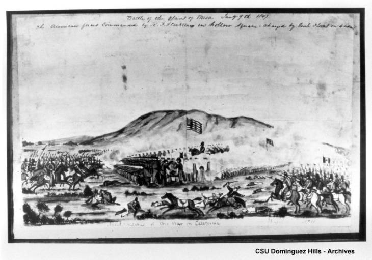
Photostat of drawing showing American and California troops in battle near Dominguez Hill in October 1846 during the war for California. (Credit: CSUDH Archives)

The Californios stymied Mervine’s attempts to advance with quick hit-and-run attacks from the cover of the hillside’s abundant growth of five-to-six feet high wild mustard plants. In addition, the American solders found the Dominguez house had been abandoned by its occupants, wh, forewarned, had taken all their animals with them. In their place were Carrillo’s troops.

Mervine realized he couldn’t advance, and the Americans retreated back down to San
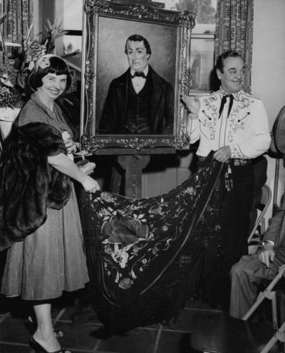
Actor Leo Carrillo unveils a portrait of Juan Antonio Carrillo in 1955. Artist Orpha Klinker is at left. (Credit: UCLA Library Dept. of Special Collections)

Pedro. At least five Americans were killed in the battle, their bodies buried on Dead Man’s Island in San Pedro Bay. (The island laterwas dredged away, and ceased to exist in 1929.) No Californios died during the battle, but two died from battle wounds some days later.

His strategy had been a disaster, as American footsoldiers in the lowlands armed only with muskets were no match for either Carrillo’s well-outfitted horse soldiers or The Old Woman’s Gun attacking from the hills above.

No further invasion of the Pueblo from San Pedro ever was undertaken. Commodore Stockton instead sailed to San Diego and battled his way north to the Pueblo. After a victory at the Battle of La Mesa (near present-day Vernon) on Jan. 9, 1847, he led American troops into Los Angeles with no further resistance, and the California portion of the war was over.

The Mexican-American War ended a year later on Feb. 2, 1848, and California became the 31st state admitted to the Union on Sept. 9, 1850.
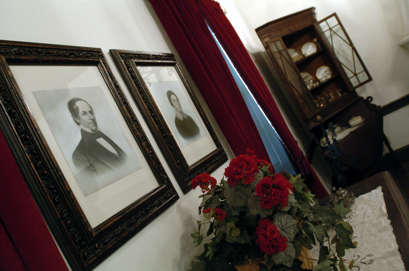
Portraits of Manuel Dominguez and his wife Maria Engracia Cota de Dominguez hang in the dinning room of the Dominguez Adobe museum in Rancho Dominguez in 2004. (Daily Breeze staff file photo)

Sources:

“Battle Road: Comparing Source Material on the Battle of Dominguez Rancho,” Remnants blog, June 24, 2019.

Daily Breeze files.

Eternity Street: Violence and Justice in Frontier Los Angeles, by John Mack Faragher, W.W. Norton and Co., 2016.

Findagrave.com.

The Rancho San Pedro: The Story of a Famous Rancho in Los Angeles County and of its owners, The Dominguez Family, by Robert Cameron Gillingham, Cole-Holmquist Press, 1961.

“San Pedro Stories: Battle of the Old Woman’s Gun,” My San Pedro website, Oct. 7, 2011.

Torrance Press-Herald archives.
Wikipedia.

The Battle of Dominguez Rancho as depicted by William H. Meyers in Naval Sketches of the War in California, published in 1939. It shows an idealized version of the battle, including an incorrect cannon and the troops facing each other in an open field sans wild mustard plants. (Credit: Remnants blog)

“Specs” Saunders and his Skateland roller rink enlivened Redondo Beach during the 1950s

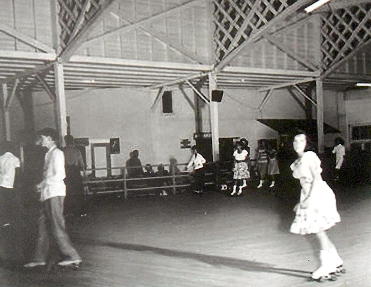
Free skating at the Skateland roller rink in Redondo Beach. Undated photo circa 1950s. (Photo by Galen Hunter, from Redondo Beach pier exhibit)

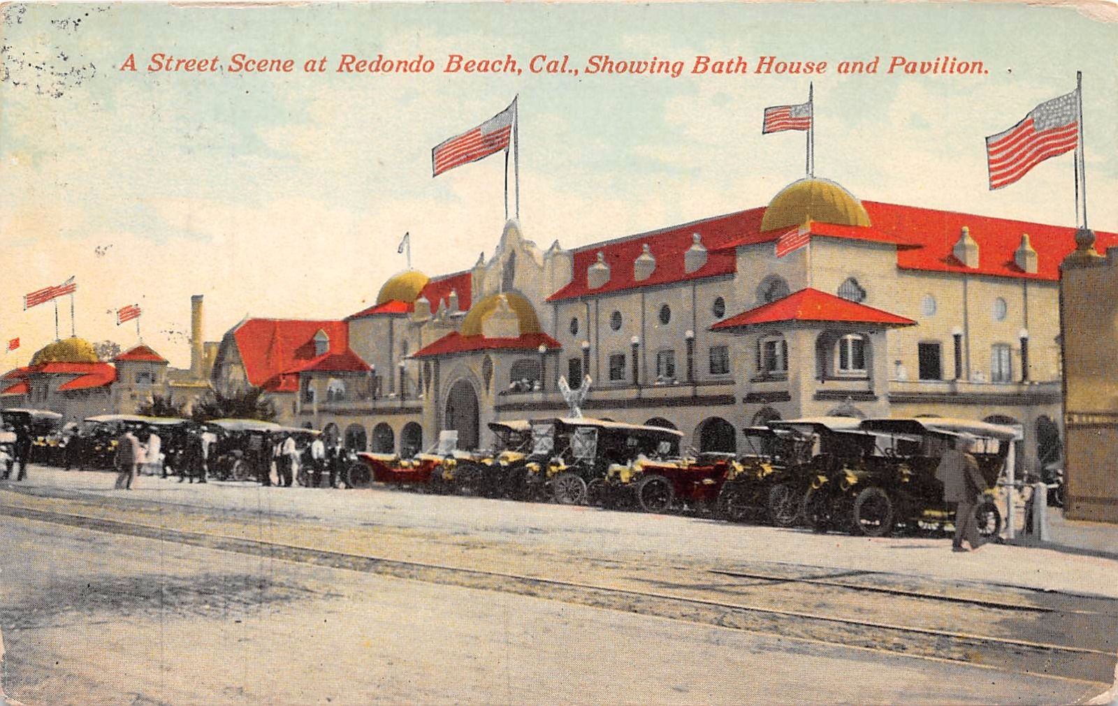
The Redondo Beach Pavilion building truly served as a multipurpose entertainment center for the more than half a century that it stood at 123 El Paseo at the foot of Emerald Ave., near the city’s Municipal and Monstad piers.

Built in 1907, it housed the second-floor Mandarin Ballroom (later the Redondo Barn) for dance concerts, and had a bottom floor that included, at various times, a penny arcade, shops, a casino, a theater and a restaurant. And, in its later years, it also was home to the Skateland roller rink.

Postcard shows the Redondo Beach Pavilion in 1912.

Skateland arrived on the scene in the early 1950s, inspired by the growing popularity of roller derby. (An earlier rink, the Hippodrome Roller Rink, operated there during the early 1940s.) 

Entrepreneur/promoter Leo A. Seltzer gets credit for introducing the sport of roller derby nationally with his staging of the Transcontinental Roller Derby show to 20,000 fans at the Chicago Coliseum on Aug. 13, 1935.

This original version wasn’t a team game, but consisted mostly of races between pairs of skaters around a flat oval wooden track. Roller derby as a team game began in 1937, growing to eight teams in pro competition by 1941.

But World War II brought a temporary hiatus to its growth. In 1942, though, a 17-year-old aspiring skater from Louisville, Ky., Charles Saunders, managed to break into its professional ranks.

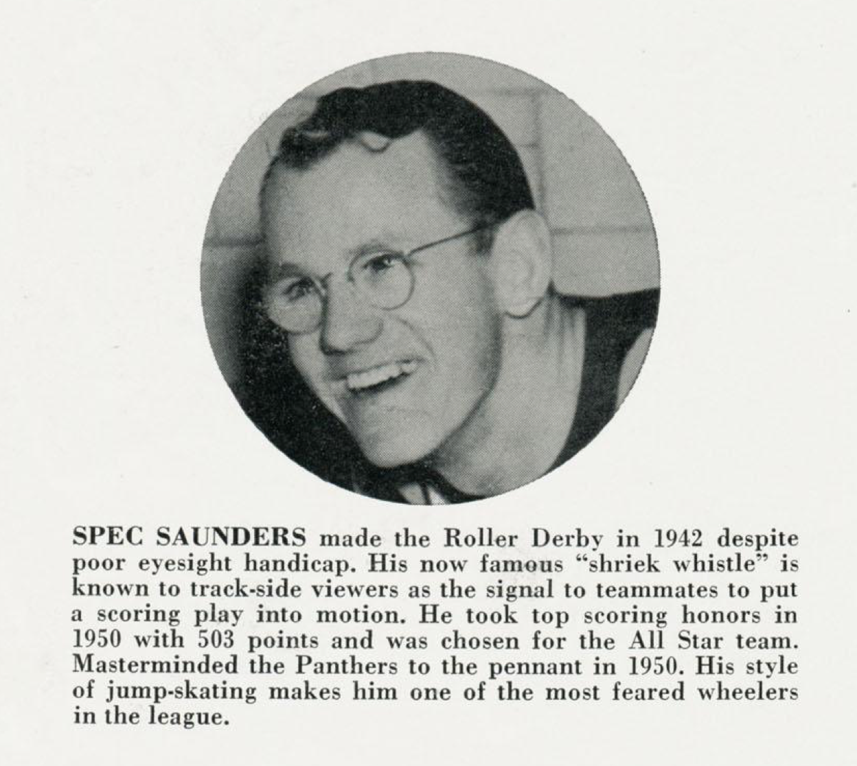
(Credit: National Roller Derby League official program, 1951)

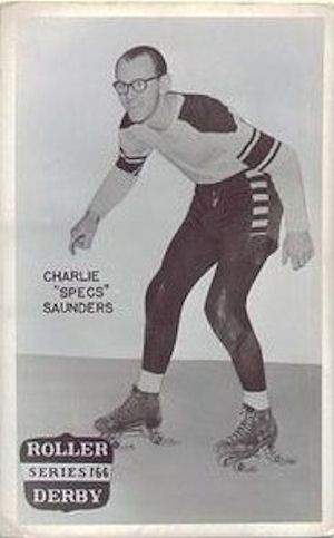
Saunders quickly acquired the nickname “Specs,” for his status for many years as the only skater in the pro ranks to wear eyeglasses while competing. During his early days, he was known for his speed and elusiveness on the track, so his glasses weren’t subject to as much of the rough-and-tumble action as we associate with the sport. 

Undated postcard.

In 1945, he enlisted in the Army Air Force for two years. Following his military service, he returned to professional skating in 1947. He played for the Philadelphia Panthers team, part of a group of teams organized by Seltzer who were beginning to attract fans.

The confluence of the market for entertainment in the postwar era, combined with the arrival of television on a large scale and its need for programming, proved advantageous for the telegenic sport of roller derby.

So it was that Seltzer founded the National Roller Derby League on Oct. 1, 1949, with the express purpose of gaining exposure on the new medium to help boost attendance by publicizing the action-filled spectacle.

Skaters often shifted between team rosters, depending on where and when they were playing. Women were part of the sport from its earliest days, with skaters such as Midge “Toughie” Brasuhn, Gerry Murray and Anne Calvello becoming well-known performers.

The Los Angeles area was a hotbed for the sport, with NRDL matches held at the Pan-Pacific Auditorium, Olympic Auditorium and even the Rose Bowl on occasion. Closer to home, live roller derby action occasionally could be seen at Veterans Stadium in Long Beach, and, for a time in the early 1960s, at the Western Speedway in Gardena.

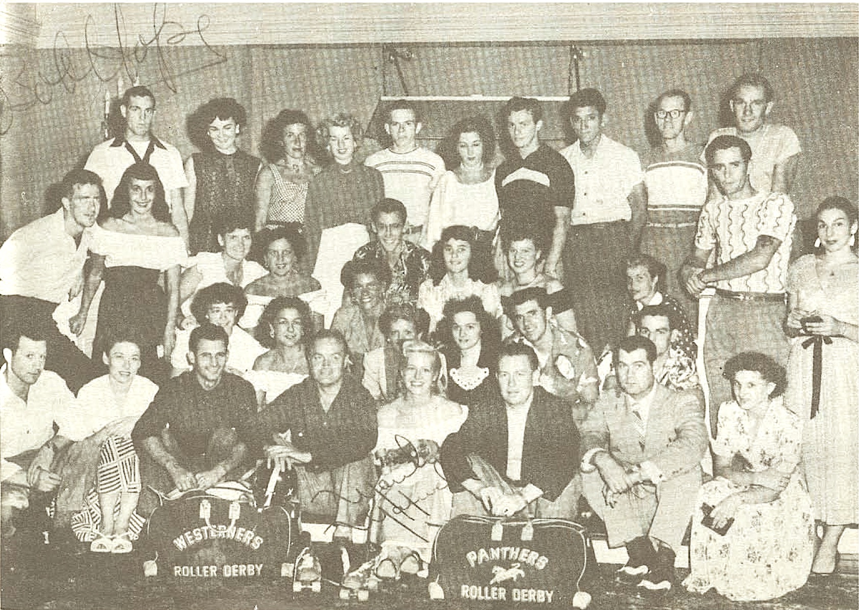
Members of the Westerners and Panthers National Roller Derby League teams visit Bob Hope and Marilyn Maxwell, center pair between team bags in bottom row, during the filming of Hope’s “The Lemon Drop Kid” in 1950. Specs Saunders, top row, second from right. (Credit: National Roller Derby League Yearbook, 1951)

“Specs” Saunders had moved to the South Bay by the time the sport started booming in the early 1950s, living with his wife Joanie in a house on Gaycrest Ave. in western Torrance near the Redondo Beach border. 

The growing popularity of roller derby inspired Saunders, already one of the top performers in his sport, to take over management of the Skateland roller rink. Skateland was located on the second floor of the Pavilion in Redondo, at the top of a large staircase leading up from the first-floor penny arcade.

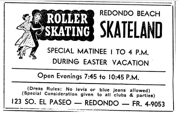
Palos Verdes Peninsula News ad, April 3, 1952, Page 7. (Credit: Palos Verdes Peninsula News)

The rink proved immediately popular, hosting community events and free skating times as well as organized sports. Saunders immediately began a pro roller hockey league based there. The Pacific Coast Roller Hockey League began in 1952 with three teams representing Los Angeles, Hollywood and Long Beach. Its games were televised locally on KTTV starting in 1952, with Bill Welsh doing the announcing. (The Los Angeles Arrows won the title.)

Skateland thrived during the 1950s, but Redondo Beach’s giant King Harbor redevelopment brought its existence to a close when the Pavilion building was torn down in December 1960. The plan spelled the end not only of the various amusements on El Paseo, but also the end of the street itself, one of several bulldozed out of existence for the new harbor.

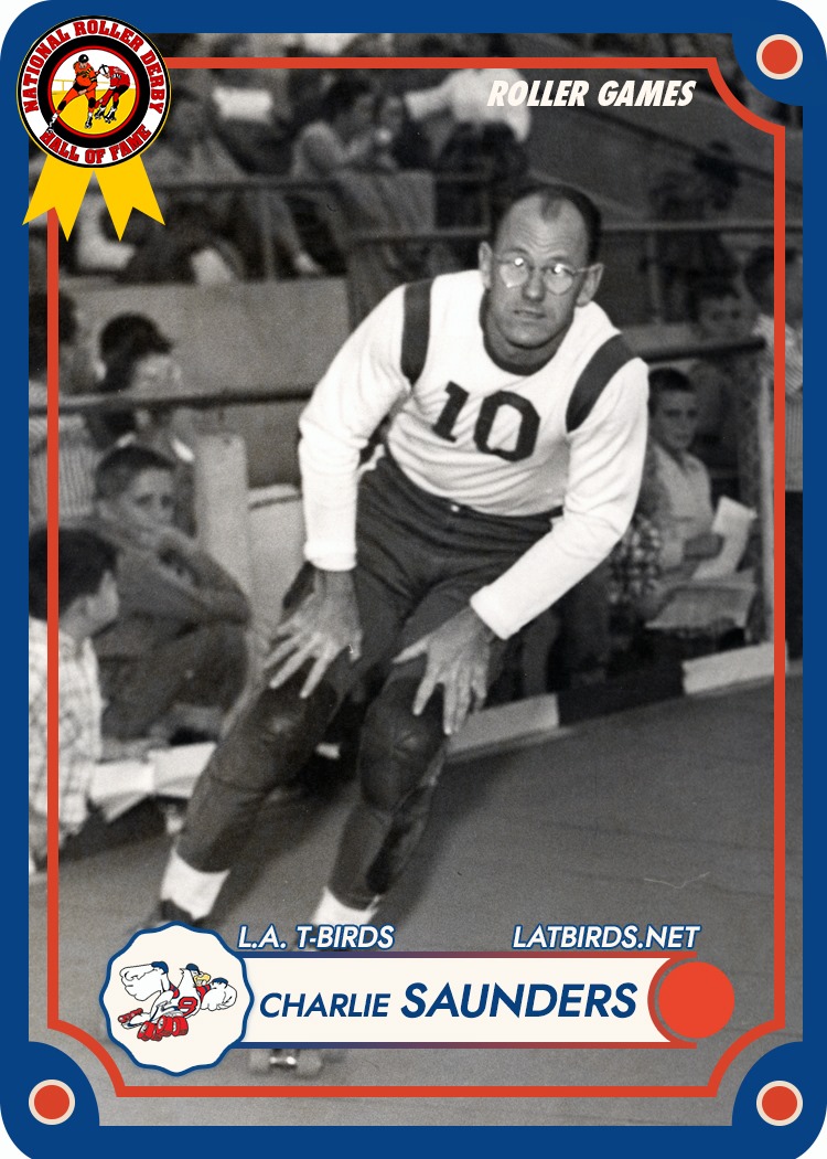
Roller Derby Hall of Fame card for Specs Saunders.

Saunders continued his pro roller derby career after the demise of Skateland. The National Roller Derby Hall of Fame admitted him as a member in 1959. As the sixties dawned, he assumed more of a player-coach role for teams such as the New York Bombers and, of course, the Los Angeles Thunderbirds. Formed in 1962, the T-Birds would go on to become a highly successful franchise during the 1960s and 1970s.

Saunders eventually retired to Parker, Arizona, where he died on Sept. 11, 1992.

Roller derby has had its ups and downs over the years, but the sport continues to enjoy popularity on a grassroots level. The overheated, entertainment-heavy story lines and over-the-top flamboyant style of play peaked in the early 1980s; though still a physical sport, the modern game relies more on strategy and skating skill and less on staged violence. Even the banked tracks have disappeared from some competitions.

Note: Special thanks to Douglas Thompson, Redondo Beach Public Library.

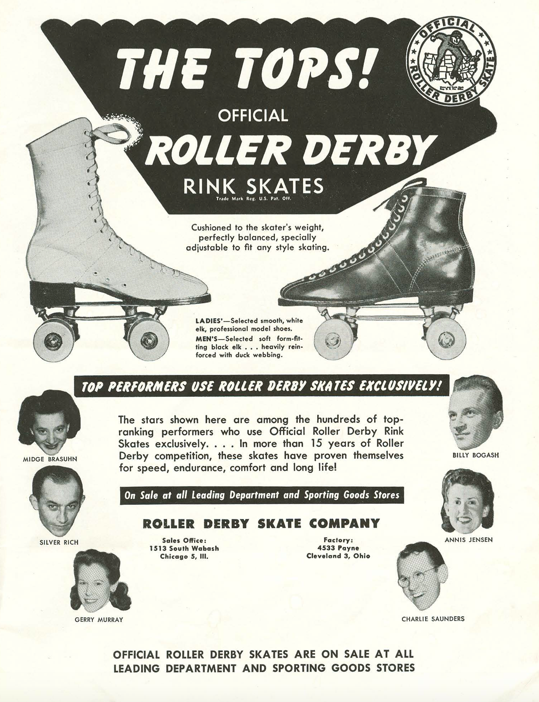
Specs Saunders, lower right, helps Midge “Toughie” Brasuhn and other stars endorse roller skates. (Credit: National Roller Derby League Yearbook, 1951)

Sources:

Cougartown.com website.

Daily Breeze files.

“Keep ‘Em Rolling,” TV-Radio Life magazine, July 18, 1952.

Los Angeles Times files.

National Roller Derby League 1951 official program and 1951 Yearbook.

Old Redondo: A Pictorial History of Redondo Beach, California, by Dennis Shanahan, Legends Press, 1982.

Palos Verdes Peninsula News files.

Torrance Press-Herald files.

Fort MacArthur played a key role in Southern California’s coastal defense system for decades (Part 2)

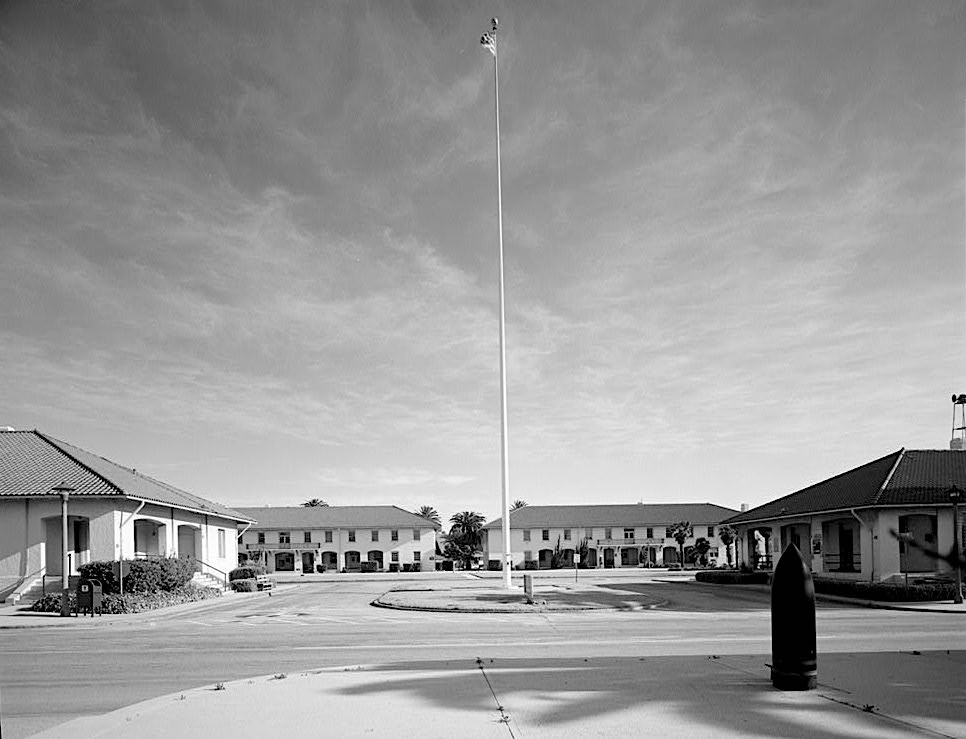
The Patton Quadrangle at Fort MacArthur, San Pedro. Undated post-1933 photo. (Credit: Library of Congress, Prints and Photographs Division)

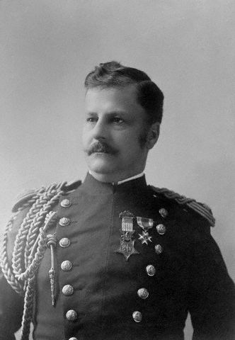
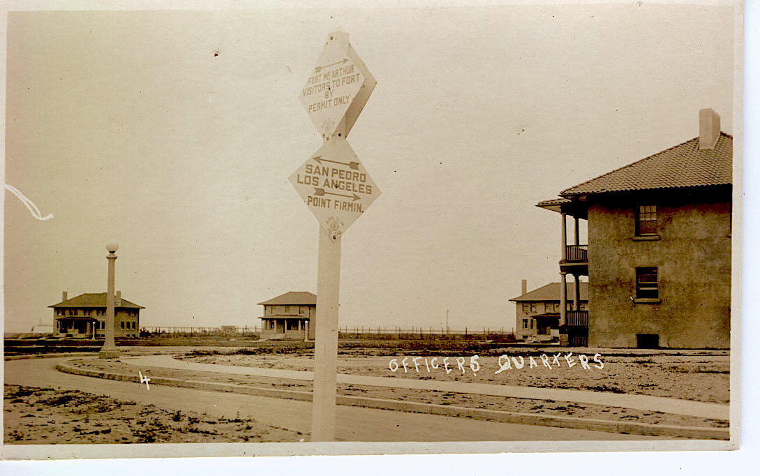
Fort MacArthur in San Pedro got its name not from Gen. Douglas MacArthur, but from his father, Lt. Gen. Arthur MacArthur.

Lt. Gen. Arthur MacArthur, father of General Douglas MacArthur.

Career soldier Arthur MacArthur earned the Medal of Honor in 1890 for his valor in battle as a 19-year-old soldier during the Civil War. He and Douglas later became the first father and son duo to win the Medal of Honor. Only politics kept him from rising to head of the entire U.S. Army near the end of his long and accomplished career.

So the Army chose instead to honor him by naming its new fort, officially established in San Pedro on Oct. 31, 1914, after him.

World War I already had begun when construction on the new army base began. Its original focus lie in strengthening Southern California’s coastal defenses from attack and protecting the Port of Los Angeles from invaders during a time of unrest in both Europe and Asia. 

The Russian-Japanese war of 1904-05 jarred the War Department to act to protect the West Coast from the threat of imperialist tendencies shared by both Russia and Japan.

To that end, installing artillery fortifications at the new fort became a main priority, in addition to the construction of the fort’s barracks, administration buildings, and other facilities.

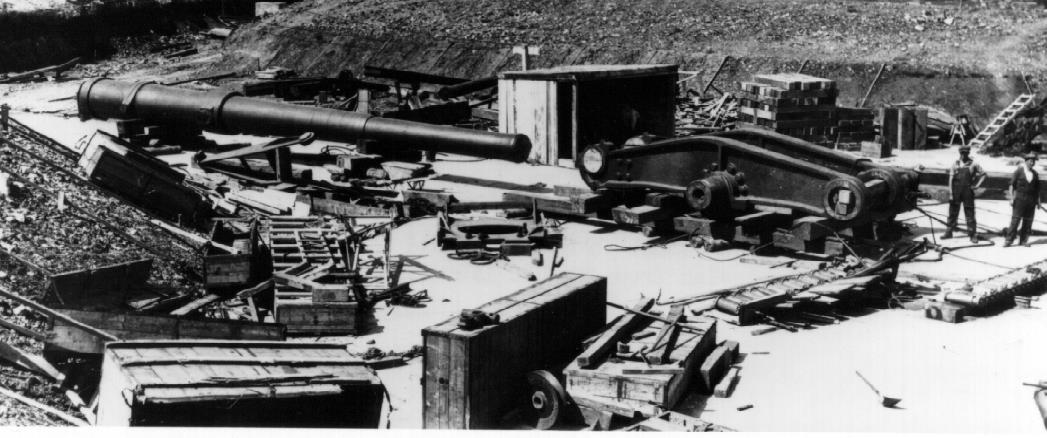
Artillery battery components await assembly at Fort MacArthur’s Upper Reservation in 1916. (Credit: USC Library Photo Collection)

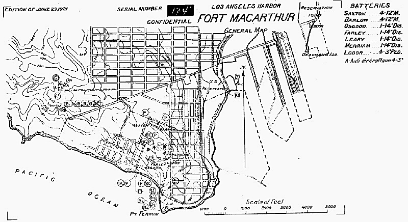
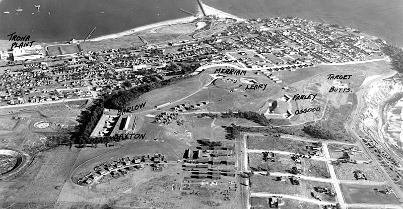
Fort MacArthur had three distinct sections: the Upper Reservation, Middle Reservation and Lower Reservation. Long guns were placed in the Upper (batteries Osgood and Farley) and Middle (batteries Merriam and Leary) reservations, and smaller mortars in the Lower Reservation (batteries Saxton and Barlow).

The arrival of the giant guns caused a commotion in San Pedro. Residents watched as the heavy 55-ton tubes had to be inched up the hill to the batteries dug into the hillsides by giant dollies normally used to move houses.

Construction continued as the war raged in Europe. The initial batteries were completed in 1917. Earlier that year, units of the regular Army and California National Guard troops had begun to occupy the post. The U.S. entered The Great War in November 1917, and, by the following March, trainees at the fort had begun to be sent overseas to fight.

Fort MacArthur map from 1921.

At war’s end, the fort returned to its role as a coastal artillery base. By 1919, additional buildings, including Its hospital, had been completed, and the gun installations were fully built out by 1923. (Several other installations would be added over the years.)

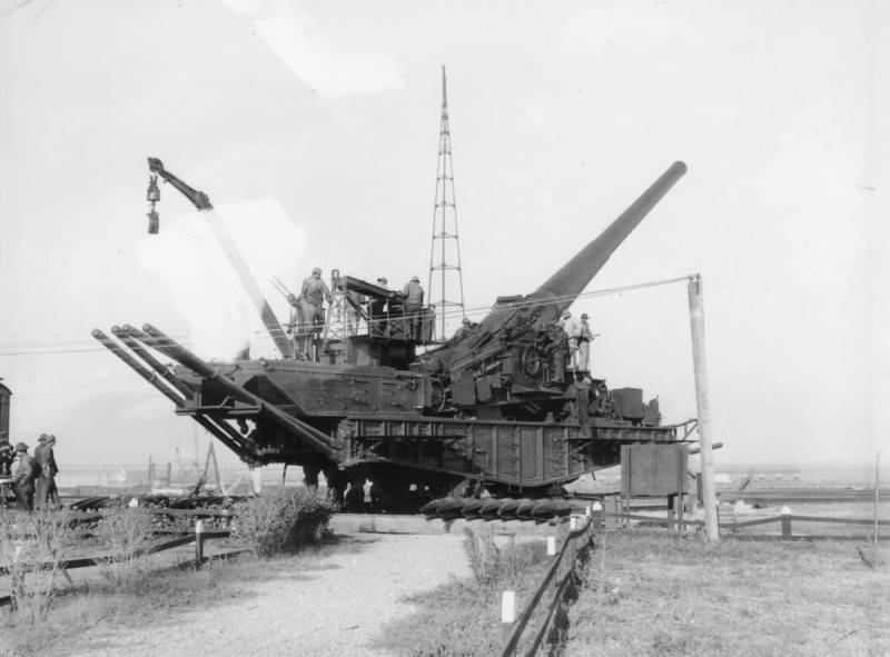
Concerns were raised during the 1920s over the adequacy of the armaments at the fort, so more large 155 mm guns were installed. Called “railway guns,” they were mounted on rails to absorb the strong recoil at firing. Test firings of these guns so rattled the nerves and damaged the china of San Pedro residents during the mid-1920s that the War Department finally had to call an end to the firings in 1928.

Circa 1925 photo shows the size of a large railway mounted gun at Battery Erwin at Fort MacArthur in San Pedro. Battery Erwin included the longest ranging artillery pieces at Fort MacArthur prior to World War II. Its guns were designed to shoot a 1,450 pound shell up to 27 miles. The railway-mounted guns could turn 360 degrees and fire in any direction. (Credit: Los Angeles Public Library Photo Collection)

Anti-aircraft guns also were added to the fort’s arsenal between the two wars in response to the rise in sophistication of military aircraft. All the military hardware began to be beefed up considerably in the buildup to World War II, whose outbreak made the fort a key piece in California’s coastal defense system.

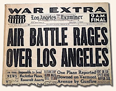
Perhaps the most famous wartime incident involving Fort MacArthur occurred in the early morning hours of Feb. 25, 1942. A rumored attack by Japanese aircraft off the California coast caused a major panic. Searchlights combed the sky while coastal anti-

Los Angeles Examiner front page, Feb. 25, 1942. (Credit: Fort MacArthur Museum Facebook page)

aircraft guns fired off rounds at the supposed invaders.

Japan claimed after the war that it never sent airplanes to attack the American mainland, and the U.S. government blamed the panic on a misplaced weather balloon. The Fort MacArthur Museum annually commemorates the “Battle of Los Angeles,” also known as “The Great L.A. Air Raid” on the grounds of the fort.

Fort MacArthur took on a major role during World War II as a training ground and induction center for Army troops headed for war. Over 750,000 troops passed through through its portals.

On July 1, 1945, it became an Army Separation Center, processing thousands of GIs returning from the war. In the late 1940s, its personnel was pared down considerably, and most of its artillery emplacements were dismantled.

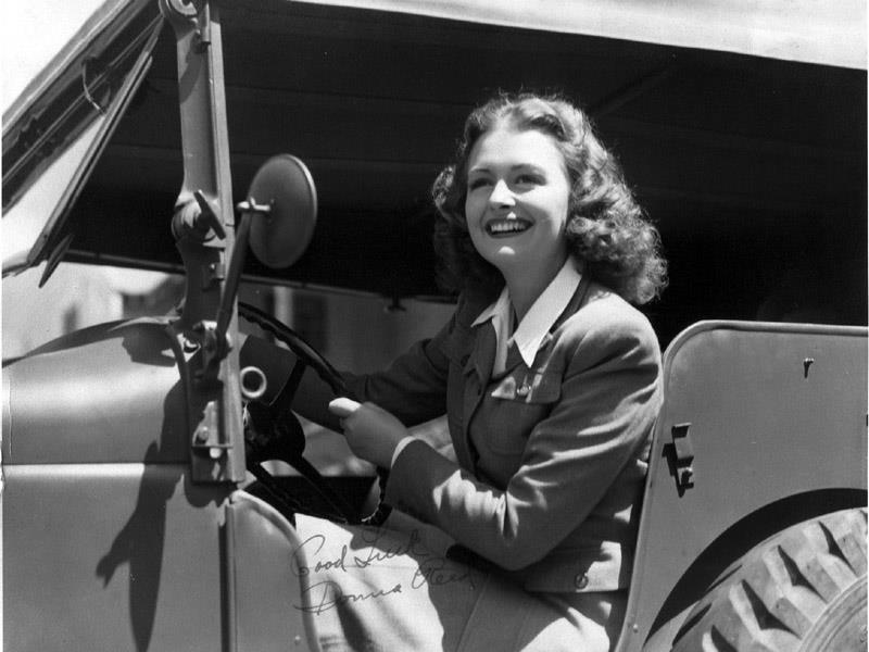
Undated photo of Hollywood star Donna Reed visiting Fort MacArthur during World War II. (Credit: Fort MacArthur Museum Facebook page)

Beginning in 1954, the fort became an important component of the Nike missile system, a collection of missile sites that formed a defense umbrella during the Cold War. At its peak, the operation managed 18 separate Nike missile sites from Fort MacArthur, including the one installed on its own Upper Reservation.

As that program wound down during the early 1970s, the Nike sites began to shut down. By 1974, the missiles were declared obsolete, and the Army began to reduce its presence at the fort. It kept its administrative center on the Middle Reservation, but eventually disposed of the rest of its land.

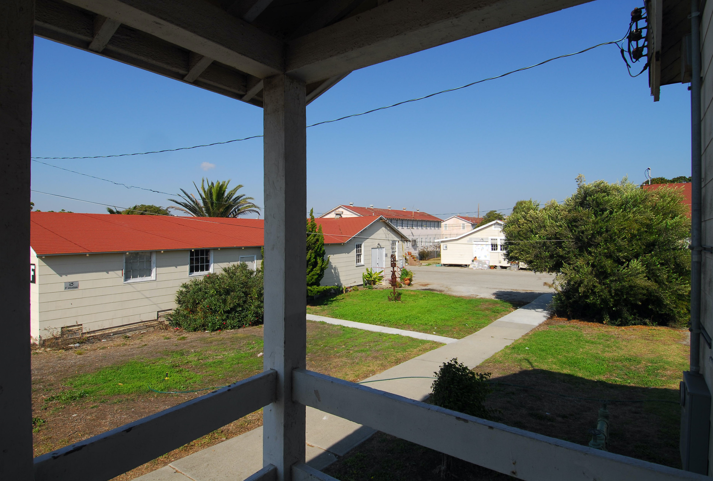
In 1977, the fort was declared surplus by the Army, which transferred the Upper and Lower Reservation lands to the City of Los Angeles. The Upper Reservation was transformed into the Angels Gate Cultural Center, which opened in 2000, and the John and Muriel Olguin Campus of San Pedro High School, which opened in 2015.

Part of the former Upper Reservation at Fort MacArthur miltary base has become the Angels Gate Cultural Center in San Pedro in this photo from Oct. 17, 2006. Buildings that once served as barracks have been repurposed into artist studios. (Daily Breeze staff file photo)

The Lower Reservartion was cleared, dredged and developed into the Cabrillo Marina, a small-boat facility that opened in 1986.

In September 1979, the Department of Defense approved the transfer of Fort MacArthur from the Army to the Air Force. The move became official on Oct. 1, 1982. The fort’s Middle Reservation now provides housing for USAF personnel stationed at the Los Angeles Air Force Base in El Segundo.

The Fort MacArthur Museum continues to be the on-site authority for the installation’s history, which is much more detailed and fascinating than the brief sketch I’ve posted here. The museum is closed temporarily due to the Coronavirus pandemic, but its website remains a lively and informative resource in the meantime.

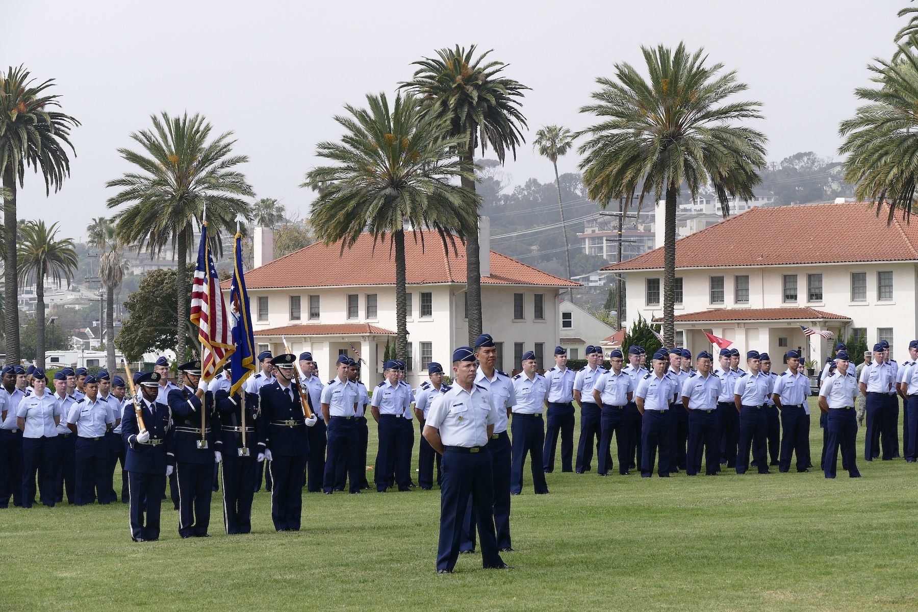
Change of command ceremony at Fort MacArthur, San Pedro, for the US Air Force Space and Missile Systems Center. May 22, 2017. (Daily Breeze staff file photo)

Sources:

Daily Breeze files.

“Fort MacArthur,” Fort Wiki website.

“Fort MacArthur History,” by California Center for Military History, California Military Department, Historic California Posts, Camps, Stations and Airfields website.

Fort MacArthur Museum website.

Images of America: Fort MacArthur, by Stephen R. Nelson and David K. Appel, Arcadia Publishing Co., 2005.

Los Angeles Herald files.

Los Angeles Times files.

San Pedro News Pilot files.

Wikipedia.

Aerial view of Fort MacArthur in San Pedro in 1937, with artillery batteries labeled in dark ink. (Click to enlarge.)

Fort MacArthur’s back story includes a bare-knuckles legal brawl over its land (Part 1)

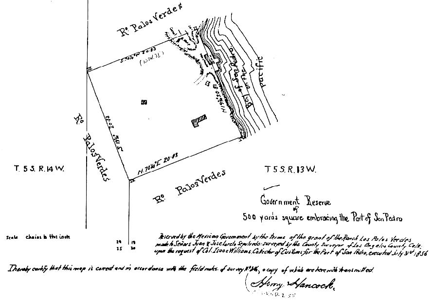
The original military reserve set aside by Mexico in 1846 is reflected in this Los Angeles city map from 1856. (San Pedro Bay at right. Click to enlarge.)  (Credit: City of Los Angeles, via Historic California Posts, Camps, Stations and Airfields website)

Fort MacArthur once served as the only coastal military base defending the Southern California coast, with the exception of the naval bases in San Diego.

But its genesis and contentious history began well before any physical military presence became ensconced there.

The Mexican government first designated the area overlooking San Pedro Bay as a strategic site to be used for coastal defense during the 1840s. The land in question was clearly delineated by four stone markers with inscriptions, one at each corner of the parcel.

American Marines led by Jacob Zeilin had the same idea, using the area as a staging area in 1846 from which to launch a quixotic attack on the then-Mexican city of Los Angeles that ultimately was rebuffed by Mexican forces.

Despite losing that battle, the U.S. would prevail in the war. Under the terms of the Treaty of Guadalupe Hidalgo, the document signed on Feb. 2, 1848 ending the Mexican-American War, Mexico ceded 55 percent of its land to the United States, including the parcel of land in San Pedro.

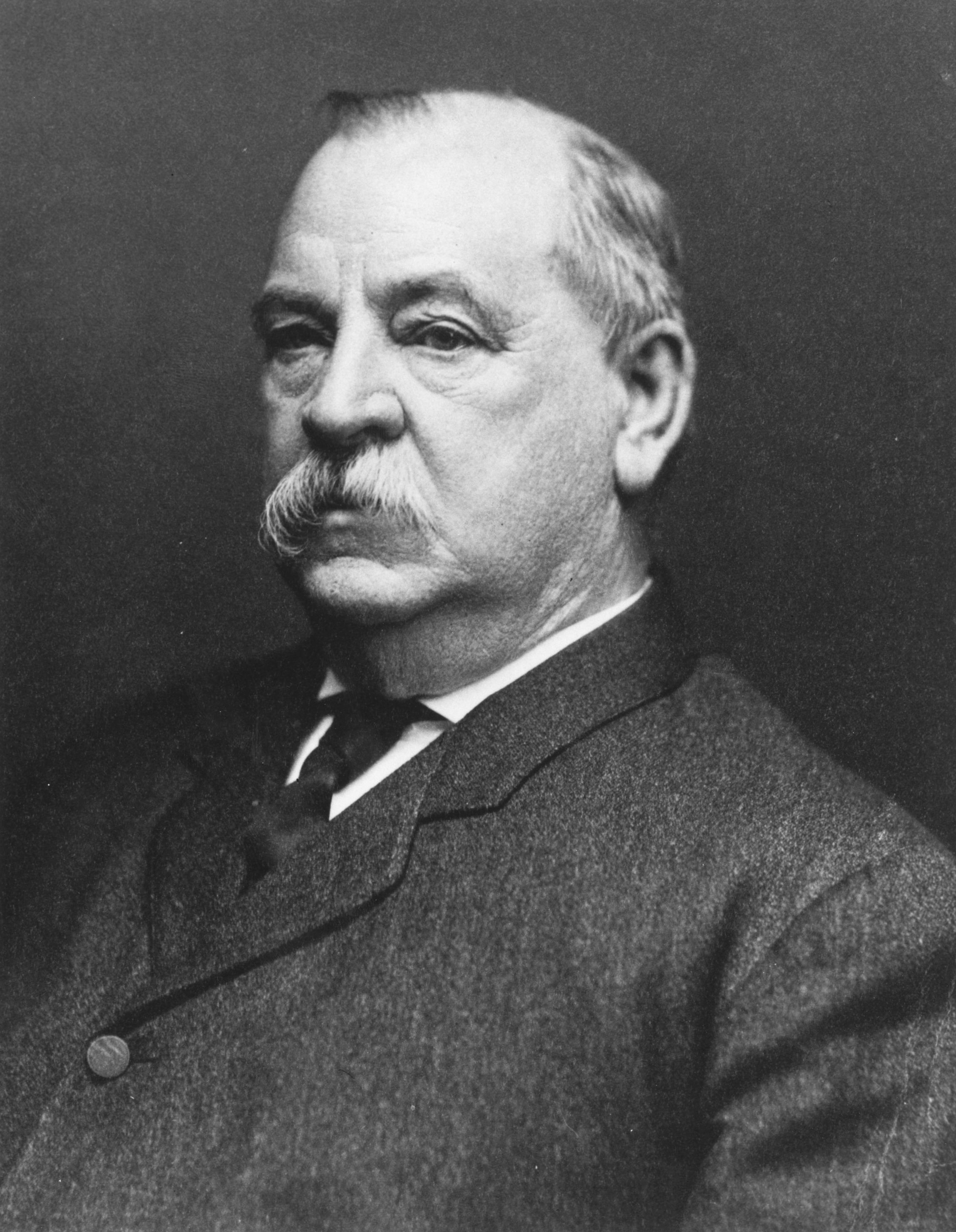
President Grover Cleveland

Under the terms of the treaty, it became the property of the U.S. government, and would not become available to the public for any reason.

Part of the Rancho Palos Verdes land grant, It retained that status even following the official division of the land grant in 1881.

With the early growth of California during the post-Civil War years, the federal government tried to keep that piece of land out of private hands, looking toward eventually using it for military purposes.

On Sept. 14, 1888, President Grover Cleveland signed an executive order mandating that the government’s still-empty plot of land in San Pedro officially would be declared a government military reservation, with no incursions by private enterprise allowed, either in the selling or leasing of lots or the building of structures on it or across it.

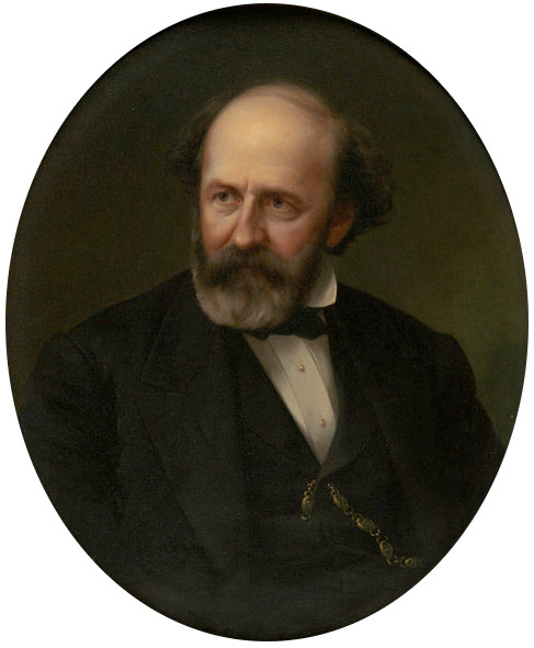
Collis P. Huntington

The feds probably made the move in response to an April 23, 1888, filing by the San Pedro Harbor, Dock and Land company, based in San Francisco and associated with the Southern Pacific railroad, owned by railroad baron Collis P. Huntington. That transaction deeded a 22-acre strip of land cutting through the military reservation to Huntington’s Southern Pacific firm for the princely sum of $1.

The San Francisco firm, a shell company, of course had no claim to the land. But it didn’t stop Huntington from using it essentially to deed the land, which he didn’t own, to himself. Once he had “acquired” his pathway to build the railroad through the land, he began looking to bring the remaining 40 acres of land under his control.

First, he bought off a squatter with a farm on the land with $500. The squatter, known only to history as “Woodward,” left, never to return. Then San Pedro pioneer James H. Dodson came in, cleared the land, apparently without Southern Pacific’s permission, and made a profit raising barley there for the next three years.

Dodson lasted until 1891, when Southern Pacific proceeded to build a fence around the land, subsequently ordering Dodson to clear out immediately. “I thought I might as well go,” Dodson told the Los Angeles Herald in 1895. “I knew they had no more title to the land than I had, but they were all-powerful and I had no money to waste in trying to fight them.”

The railroad then built its railroad line through the reservation, and leased the rest of the land out to sheep ranchers, among other tenants, for its own profit.

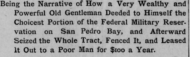
Los Angeles Herald front page headline, Jan. 28, 1895. Click to enlarge. (Credit: Los Angeles Herald archives)

By 1895, Huntington’s scheme to take control of the government land had become known to the public thanks to a series of scathing exposes in the Los Angeles Herald and the Los Angeles Times. (The Herald stories refer to the larcenous railroad magnate as “Squatter Huntington” for his brazen land grab.)

The controversy over Southern Pacific’s actions lasted for more than a decade. Finally, the city of Los Angeles sued the railroad over the land rights in 1910. The office of California state attorney general Ulysses S. Webb stepped in to try the case against the railroad on behalf of the city. In June 1912, a judge ruled in the city’s favor, declaring that Southern Pacific had no legal claim to the land.

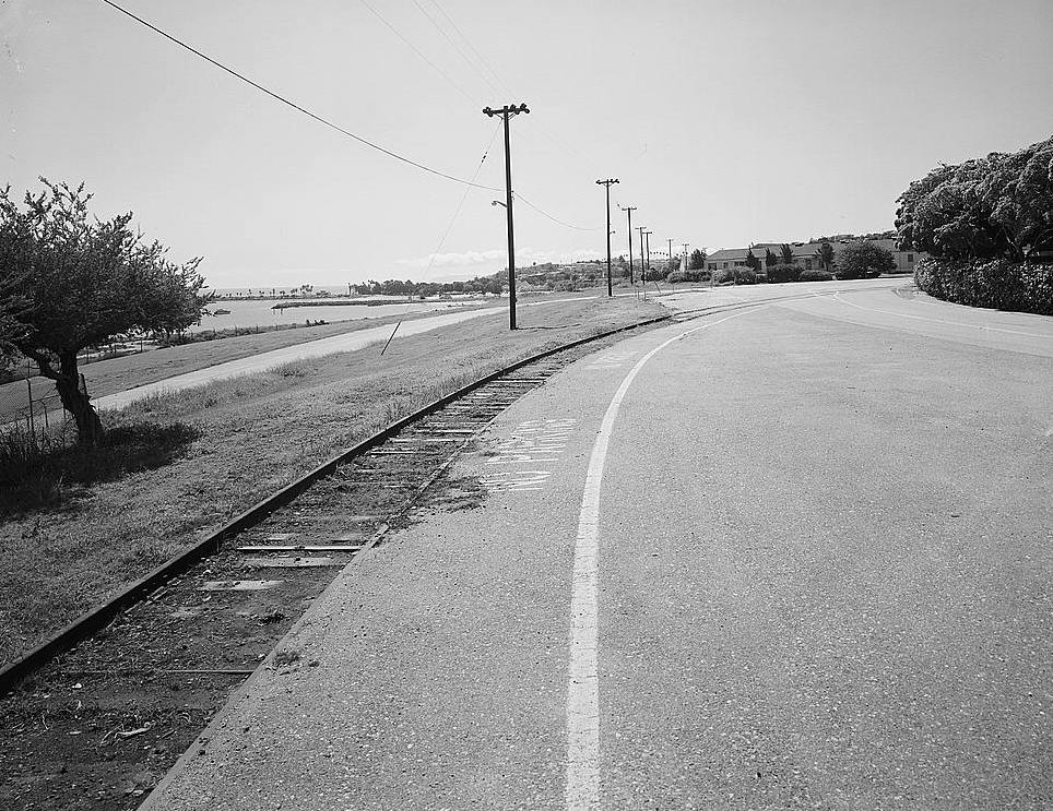
Undated post-1933 photo shows the abandoned Southern Pacific railroad tracks at Fort MacArthur in San Pedro. (Credit: Library of Congress)

But it would take another five years for Southern Pacific to give up all claims to the right-of-way through the military reservation, which it finally did in an agreement signed in July 1917.

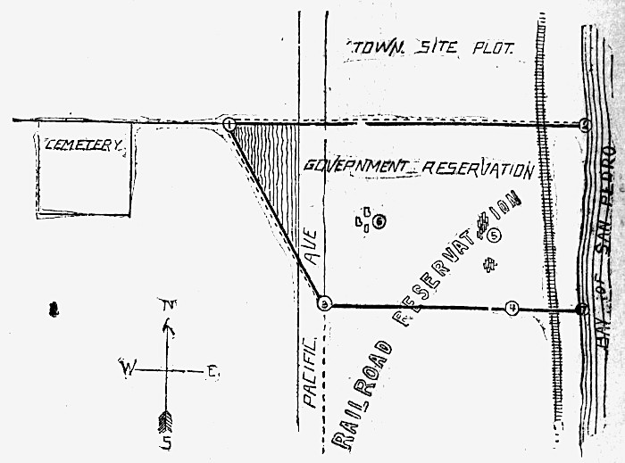
The Los Angeles Herald has overlaid the facetious description “Railroad Reservation” over the map of the San Pedro military reservation in this map from its edition of Jan. 28, 1895. Note the Southern Pacific railroad tracks indicated at right. (Credit: Los Angeles Herald archives)

By then, it was a moot point, as the new military base already had opened. 

As early as 1906, the federal government had issued a report estimating the cost of protecting the new Port of Los Angeles at $2 million. Money from that budget was used to purchase additional land above Point Fermin from partners William Kerckhoff and George Peck for $249,000 in 1910. (More about Kerckhoff in a future post.)

Two years earlier in 1908, the War Department had called for the building of a fort on the land to protect the strategic coastal area, in light of rising international tensions that seemed to be leading to war.

But it took the outbreak of World War I on June 28, 1914, to put the development of Fort MacArthur on a fast track. Months later in early October 1914, construction of the fort officially began. 

On Oct. 31, 1914, the U.S. Army officially declared the establishment of the coastal artillery post, though it was still only in the beginning phase of construction at that point.

We’ll pick up the story there next week in Part 2.

Early undated view of the Middle Reservation, Fort MacArthur. (Daily Breeze file photo)

Sources:

Daily Breeze files.

“Fort MacArthur,” Fort Wiki website.

“Fort MacArthur History,” by California Center for Military History, California Military Department, Historic California Posts, Camps, Stations and Airfields website.

Fort MacArthur Museum website.

Los Angeles Herald files.

Los Angeles Times files.

San Pedro News Pilot files.

Wikipedia.

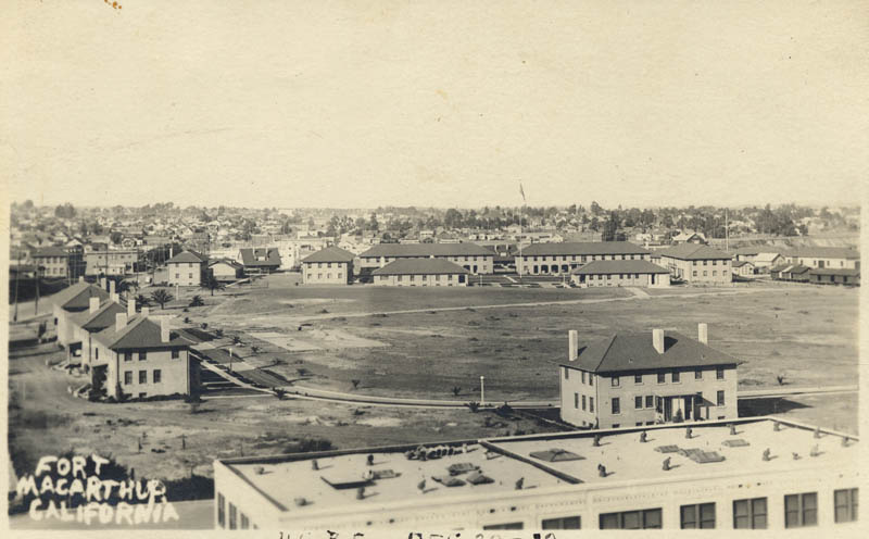
This elevated view of Fort MacArthur shows two-story stucco buildings arranged around an open field. 1922 photo. (Credit: California State Library)

Lomita Flight Strip in Torrance housed relocated Japanese-Americans after World War II

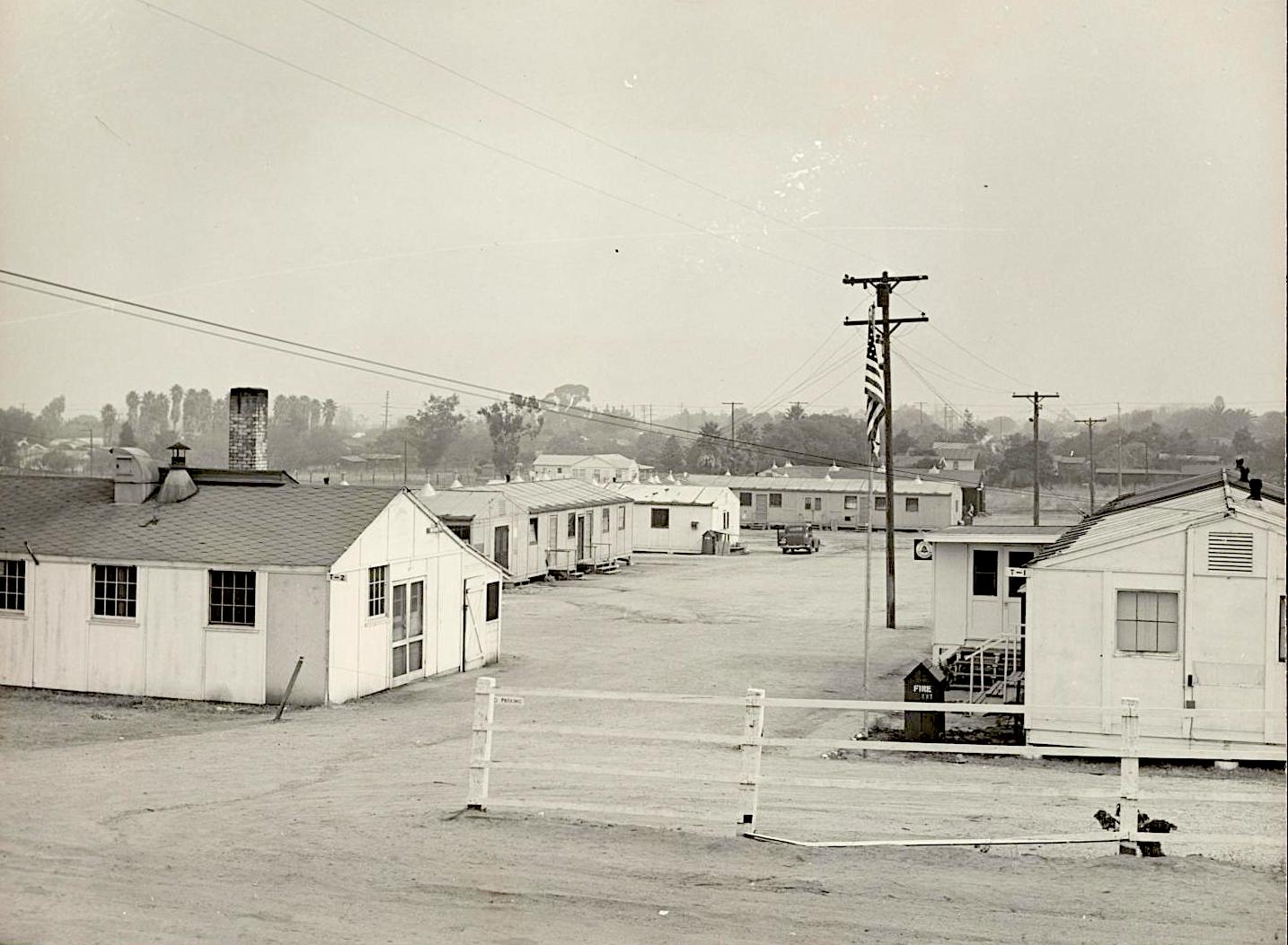
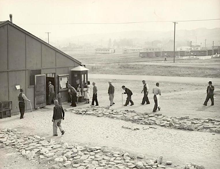
Barracks at the Lomita Flight Strip in Torrance provided temporary housing for Japanese-American returnees from internment camps following the end of World War II. Photo by Tom Parker, November 1945. (Credit: Bancroft Library, University of California, Berkeley via Online Archive of California)

I want to explore in greater detail what I mentioned in a post awhile back regarding the government’s use of Torrance Municipal Airport, then known as the Lomita Flight Strip, to house Japanese-Americans returning from internment camps following World War II.

During the war, the government owned the Lomita Flight Strip, and had been using it for  training Army Air Corps pilots. Barracks for trainees had been built on its western end.

The Army left at war’s end, and the government deeded the site to the city of Torrance, but retained control of the airstrip temporarily.

The return of the more than 110,000 relocated Japanese-Americans from internment camps posed a variety of logistical problems for the U.S. government. Houses, land and possessions had been taken from many of them, and some of them were ill.

The agency in charge, the War Relocation Authority, had to find temporary quarters for the internees, more than half of whom were U.S. citizens, while they were attempting to reassimilate back into society.

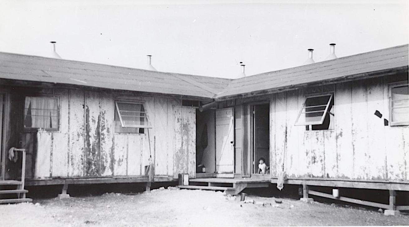
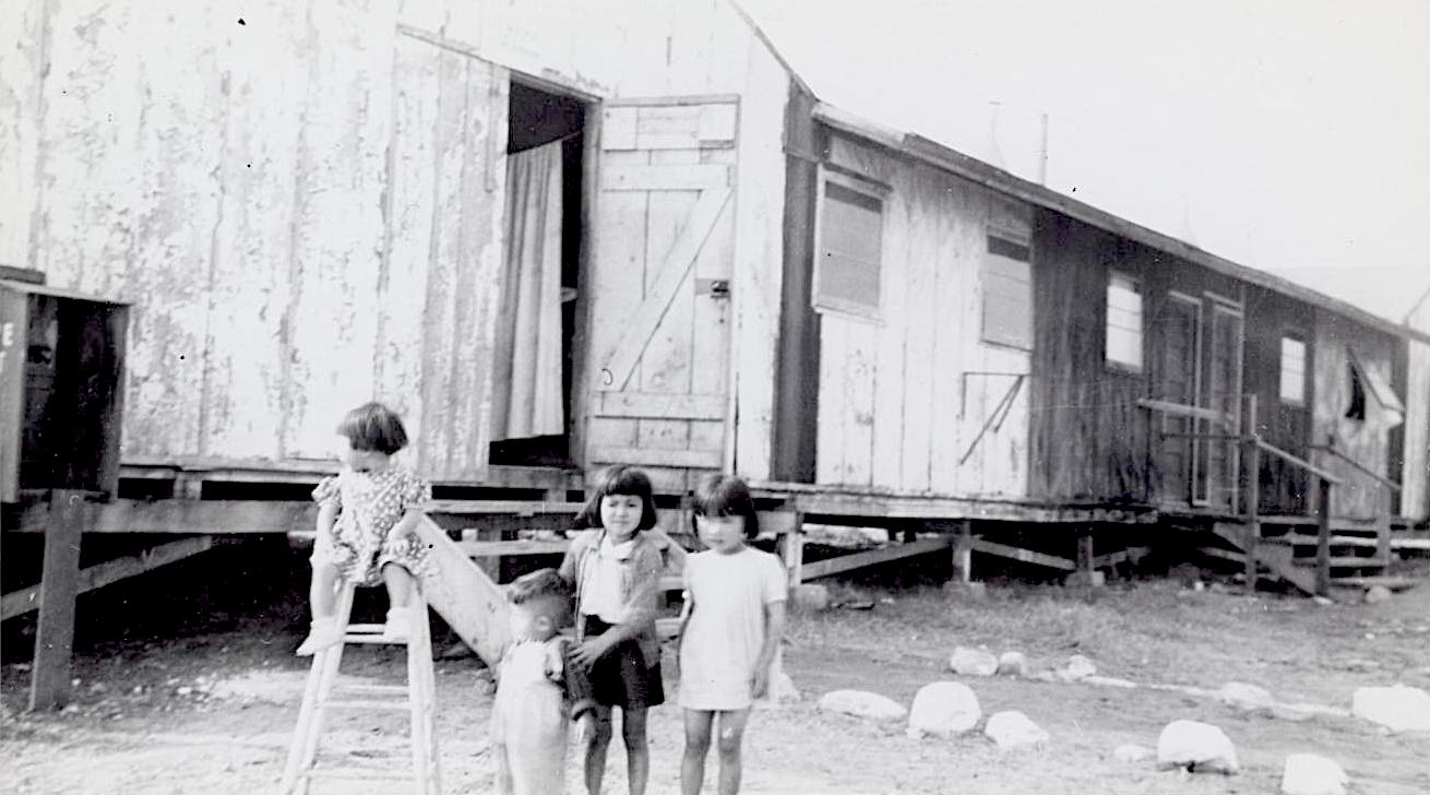
A child sits in the doorway of one of the converted barracks buildings at the Lomita Flight Strip in this undated 1945 photo. (Credit: Bancroft Library, University of California, Berkeley via Online Archive of California)

Hence the WRA’s decision announced in September 1945 to house about 125 Japanese-American internees from about 78 families in the barracks at the flight strip. They were returning from Camp Granada in Colorado, the first internment camp to close. All the camps had been ordered closed by Oct. 15 due to government budget cuts.

The Lomita Flight Strip encampment was the first of 16 regional relocation centers in the greater Los Angeles area to be used for resettlement staging.

Leslie Lahr, commander of the Lomita post of the Veterans of Foreign Wars (VFW), protested immediately. The VFW felt that all available temporary housing, including the flight strip,  should be used for returning U.S. servicemen instead, he insisted.

Regardless of the objection, the first families moved into the barracks on Oct. 8, 1945. Only families in good health were accepted; those who were ill, aged or indigent were referred to local welfare agencies.

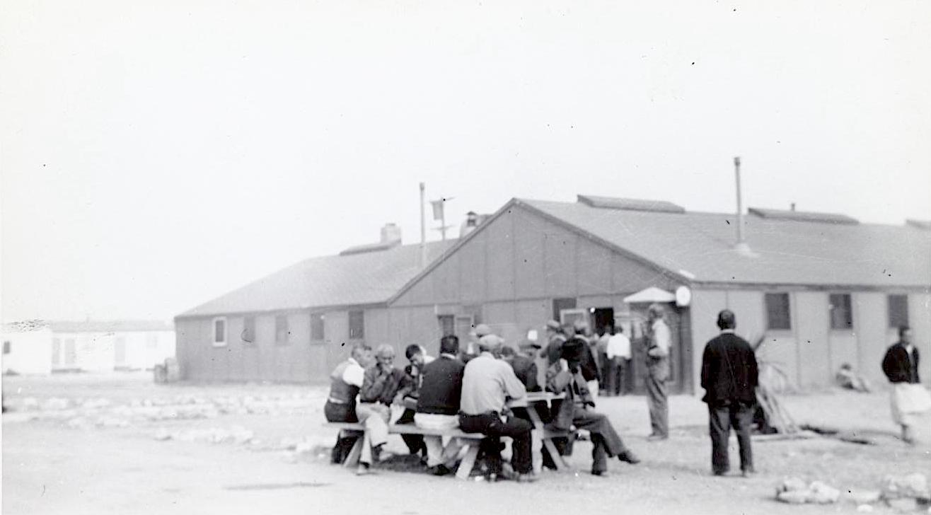
Residents of the Lomita Flight Strip temporary camp head to the mess hall for a meal. The camp   provided trailer and barracks-type quarters for returnees while they were locating jobs and permanent homes. Photo by Tom Parker, November 1945. (Credit: Bancroft Library, University of California, Berkeley via Online Archive of California)

Life in the barracks wasn’t all that different in some ways than life in the camps had been. The grounds were secured at all times by armed guards, but this time they really were there to protect the former internees from unauthorized visitors.

A San Pedro News Pilot article from Oct. 8, 1945, described the accommodations as follows:

“The flight strip barracks, set aside by the WRA, are essentially unchanged from army quarters. Carpenters have divided the empty barracks into partitioned cubicles. These have been furnished with army cots and mattresses. Cooking will be done army style, with the families eating in mess halls. Washing will be done in a community wash room equipped with hot water boilers and wash trays. It is expected that! barracks will be heated with oil stoves.”

For this, the internees had to pay monthly rent, as well as pay for meals.

Over the next few months, families arrived from former internment camps all over the West, including the Colorado River camp near Poston, Arizona, the Tule Lake camp in California near the Oregon border and the Hart Mountain camp in Wyoming.

Japanese-American children play in front of the repurposed barracks at the Lomita Flight Strip. Undated, 1945. (Credit: Bancroft Library, University of California, Berkeley via Online Archive of California)

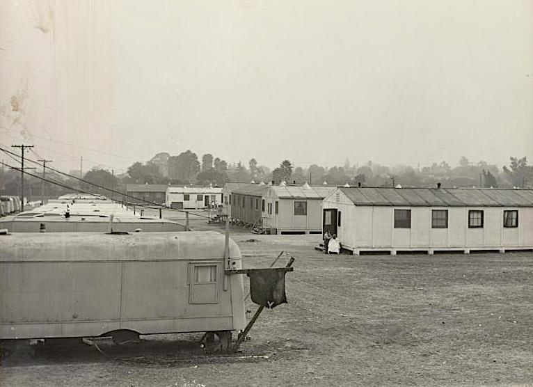
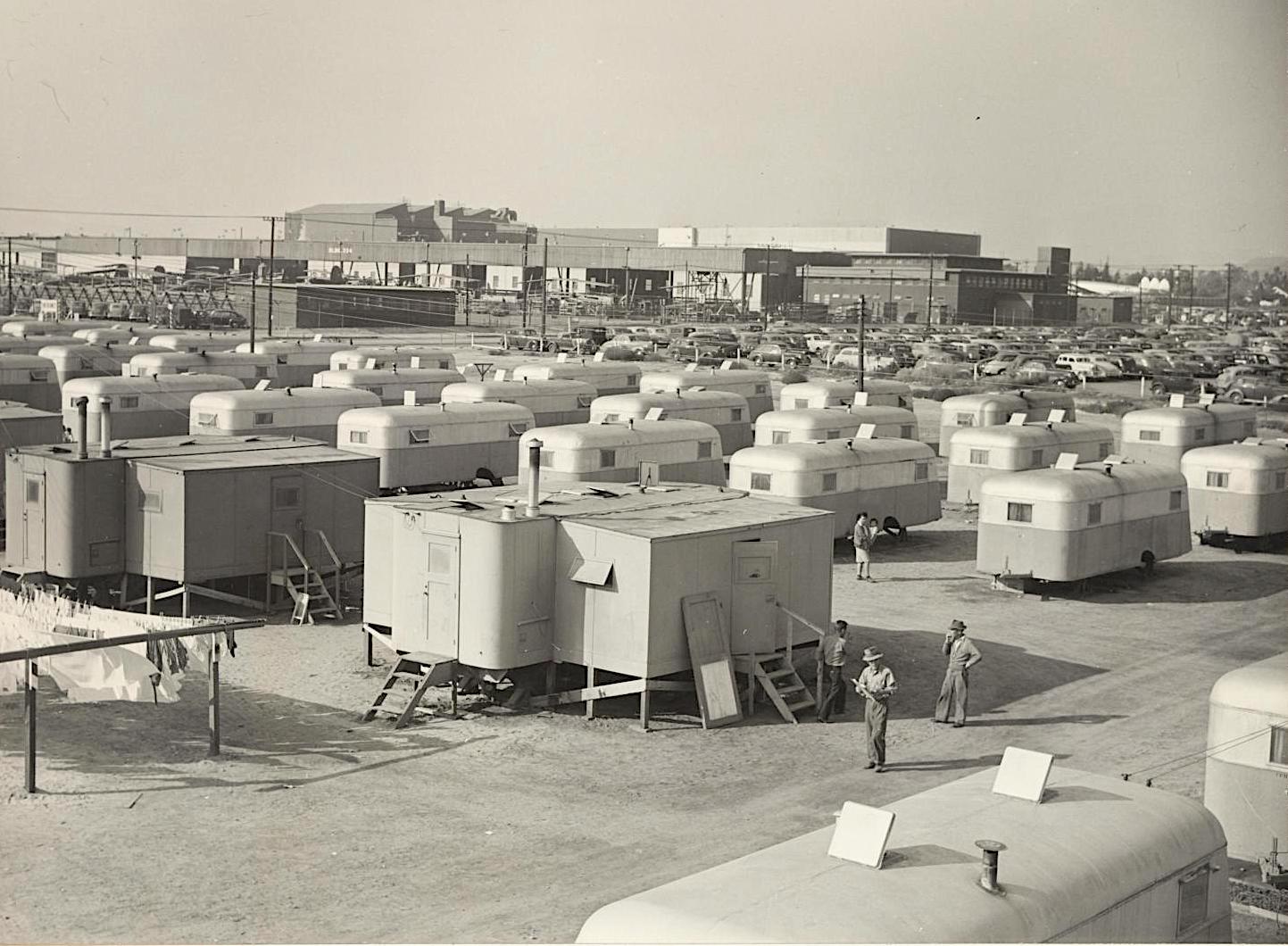
Additional trailers were brought in to handle the overflow at the  temporary camp, which grew to more than 1,000 residents by early 1946. About one-third of the residents were children, who were placed in area schools. 

Most went to Walteria Elementary at first before being moved to different schools to reduce crowding. Walteria had to hold classes in the auditorium and eventually build two additional classrooms to handle the initial rush of students.

The WRA brought an employment counselor onsite to help the able-bodied find work. Some returned to agricultural jobs on South Bay and Palos Verdes Peninsula farms, while others found work as domestics or in local industries.

A section of the Winona Housing Project in Burbank, where trailer homes were provided for returned evacuees while they were securing permanent homes in and around Los Angeles. Photo by Tom Parker, November 1945. (Credit: Bancroft Library, University of California, Berkeley via Online Archive of California)

The numbers of those remaining at the camp began to dwindle during the spring of 1946. The WRA announced it would close the facility by July 1. Many families eventually were moved to the Winona Housing Project trailer camp at Hollywood Way and Winona Avenue in Burbank.

The last families left the flight strip barracks on June 28, with some going to onsite training centers at Cal-Sea Food Co. in Harbor City and the rest to flower grower Fred H. King’s farm in Torrance.

A row of trailers situated near the barracks buildings at the camp for returning Japanese-Americans at the Lomita Flight Strip in Torrance. Nov. 8, 1945. (Credit: Los Angeles Public Library Photo Collection)

With the barracks now empty, James Caldwell, head of the Torrance Area Veterans Service Center, began his fight to allow returning war vets to use the barracks as temporary housing.

After initial resistance from the Torrance City Council, he succeeded. Veterans began moving into the barracks in August 1947, using them as temporary housing until they could find jobs and places to live.

After that, Torrance’s National Guard units occupied the barracks and additional ones trucked in from Fort MacArthur while they were based at the airport temporarily between 1948 and 1950, before the permanent National Guard armory in Torrance was built.

The often-used buildings finally were removed in favor of new airport hangars after the city of Torrance took control of the management of the airport on April 1, 1958.

Returning Japanese-American internees gather at the mess hall at the temporary relocation center at the Lomita Flight Strip in Torrance in late 1945. (Credit: Bancroft Library, University of California, Berkeley via Online Archive of California)

Sources:

“Correspondence on Resettlement Assistance,” Department of Social Welfare – War Services Bureau, California State Archives Exhibits.

Daily Breeze files.

San Pedro News Pilot files.

Torrance Herald files.

Wikipedia.

Wilmington’s Harbor Generating Station power plant took some time to come online

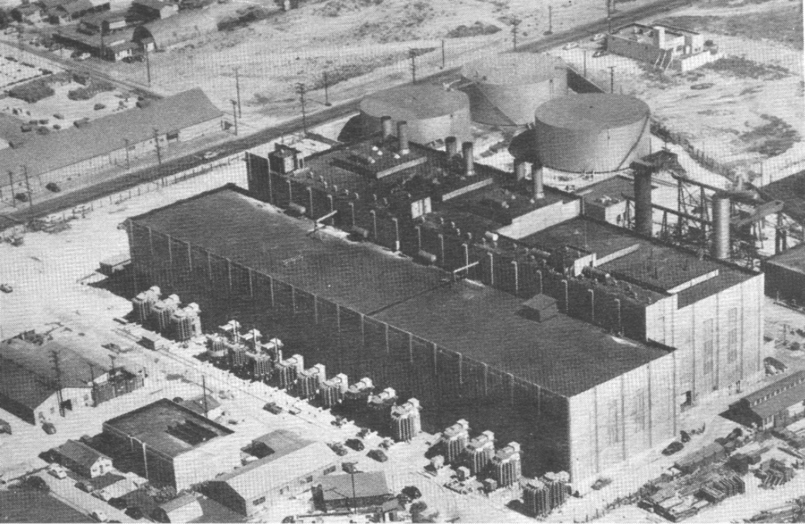
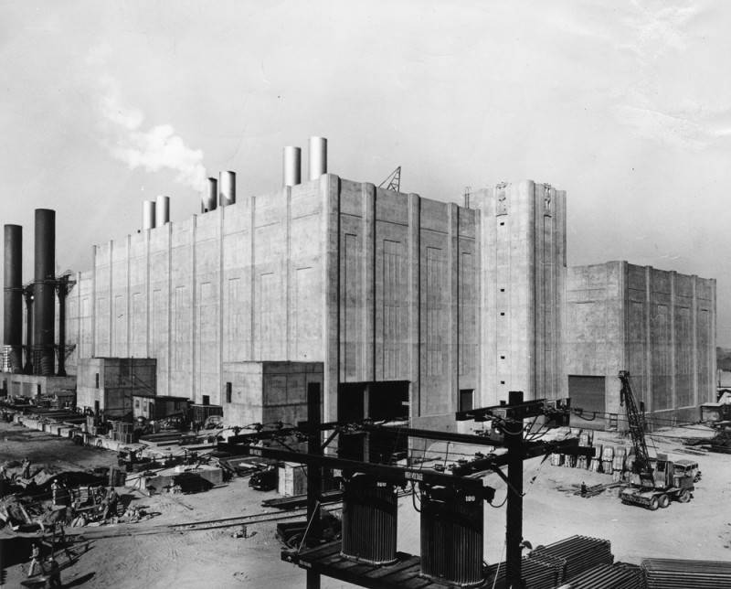
Exterior view of the art deco-styled Harbor steam plant building taken during the second phase of  its construction. Dec. 6, 1948. (Credit: Historical Photo Collection of the Department of Water and Power, City of Los Angeles)

The continuing industrialization at the newly minted Port of Los Angeles had made at least one critical infrastructure need a necessity little more than a decade after the Port was formed in 1909: the Harbor Area needed its own power plant.

Welders at the giant shipbuilding plants such as Los Angeles Shipbuilding, founded in 1917,  needed juice to power their torches, shipping companies needed electricity to operate cranes and other equipment and the energy needs of fish processing plants and oil facilities such as the Union Oil Terminal also increased the demand for power.

The push for the new power plant began in earnest in March 1924, when the Los Angeles Dept. of Water and Power (DWP) suddenly announced fully formed plans to build a $6 million major steam power plant at an unspecified site in the Harbor Area.

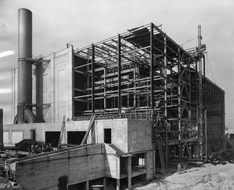
Exterior view of the Los Angeles Department of Water and Power’s Harbor steam plant building taken during the second phase of its expansion. March 18, 1947. (Credit: Historical Photo Collection of the Department of Water and Power, City of Los Angeles)

This early proposal failed to make the city’s final budget, but the idea had been planted. For the next few years, the DWP jousted with Southern California Edison over who had the rights to build (and profit from) the new steam plant.

The San Pedro News Pilot noted in an August 1924 editorial promoting the plant that the area was using 16 times the amount of power than it had just seven years earlier in 1917. That number would continue to increase as more industrial plants were built in the area during the boom times of the 1920s.

A year later, the DWP authorized the construction of the plant, though a site had yet to be selected. DWP engineer E.F. Scattergood was put in charge of that and other particulars  pertaining to the building of the plant.

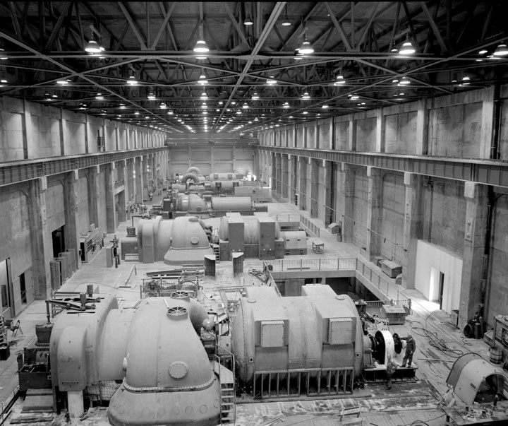
New turbines inside the steam plant were brought online on July 5, 1949. (Credit: Historical Photo Collection of the Department of Water and Power, City of Los Angeles)

By February 1926, the DWP had acquired a 2.5-acre plot of land for the project near the terminus of the harbor’s West Basin channel in Wilmington, near the intersection of Island Ave. and B Street (later renamed Harry Bridges Blvd.).

Edison finally lost its suit against the DWP in January 1928. But the 1929 stock market crash and ensuing economic depression put a temporary hold on construction. In 1931, plans to ramp up construction were announced, and work began anew in early 1932.

But not for long. In November 1932, the L.A. City Council agreed to stop construction on the Harbor steam plant in a deal it cut with Edison to obtain lower rates for electricity. The promise of cheaper electricity from the under-construction Boulder Dam (renamed Hoover Dam in 1947) also played a role in the decision to put the kibosh on the steam plant project.

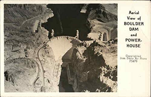
Undated (pre-1947) postcard of Boulder Dam.

Boulder Dam was dedicated in 1935, and began fully coming online with abundant power shortly thereafter. But the arrival of World War II and the beefing up of defense industry plants in the Harbor area rekindled enthusiasm for the Harbor plant in 1940, a year before Pearl Harbor.

On April 21, 1941, work on the project, now estimated to cost more than $8 million, began again. The imminent opening of the government-backed California Shipbuilding Corp. that May surely influenced the decision, as did the energy needs of related firms, including rubber plants and the new large Aluminum Corporation of America (ALCOA) plant in Torrance that were producing war-related raw materials.

At long last, the Harbor steam plant opened with fanfare on June 17, 1943, with Los Angeles Mayor Fletcher Bowron throwing the ceremonial switch. But only part of the planned plant actually had been built. 

Exterior view of the Los Angeles Department of Water and Power’s Harbor steam plant building taken during the second phase of its construction. March 18, 1947. (Credit: Historical Photo Collection of the Department of Water and Power, City of Los Angeles)

The idea was to put it partially online, and complete the rest after the war, when additional building materials and labor would become more readily available. In fact, one whole wall of the eight-story-high plant was built of wood, to facilitate its later removal when the remainder of the plant was completed.

Construction on the remainder did indeed begin after the war, in February 1947. The new work included bringing on three additional giant steam turbine generators. Their addition would increase the plant’s capacity to 355,000 kilowatts, more than a fourth of the total power the city was receiving from Hoover Dam, which then provided 80 percent of the city’s needs.

The Harbor Steam Plant was completed and came online on the afternoon of July 5, 1949. The DWP named the operation at 161 N. Island St. in Wilmington the Harbor Generating Station, which remains its name to this day.

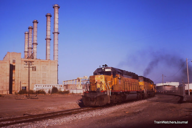
A San Pedro-bound coal train negotiates the “Power Plant Curve” near the Harbor Generating Station in Wilmington in August 1986. (Credit: Train Watchers Journal website)

As the plant aged, its production grew less efficient. In 2010, the state of California mandated that plants such as Harbor that used ocean water to cool its turbines be shut down. The ocean-intake method was found to be environmentally unsound, as it killed a variety of marine wildlife in the process.

Thanks to its own inefficiency and dated technology, though, the Harbor Generating Station   already had saved itself.

It had become so ineffective that it was taken off the DWP’s power grid in March 1991. A $220 million retooling and updating project over the next couple of years saved the plant from the eventual mandated closure by transforming it from a steam-powered, water-cooled operation to a natural gas-powered, air cooled one.

Natural gas-fired power plants such as Harbor supply a lower percentage of the overall power to the grid than they once did, but they still play an important role in providing spot power when needed.

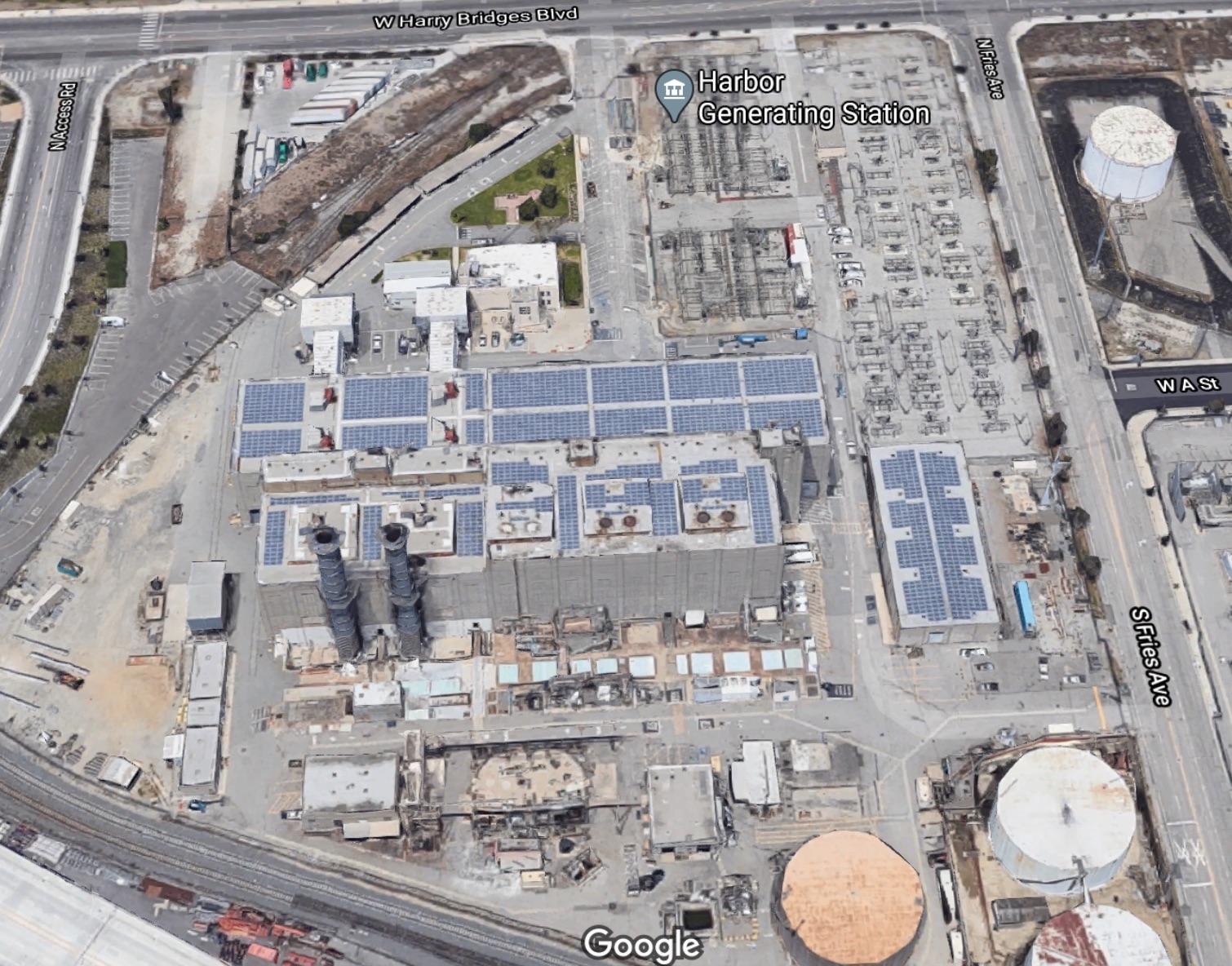
The Harbor Generating Station’s two smokestacks can be seen at left middle, just below the plant’s main building. (Credit: Google Earth)

Sources:

Daily Breeze files.

“Early Power Generation,” Water and Power Associates website.

“Harbor Generating Station,” The Right To Know Network, Houston Chronicle website.

“Harbor Steam Generating Plant, 1941-1950, Wilmington,” Los Angeles Citywide Historic Context Statement, City of Los Angeles Department of City Planning Office of Historic Resources, August 2017.

“Power Plant Curve — Harbor Belt — Wilmington, California,” Train Watchers Journal website.

San Pedro News Pilot files.


Donald Trump transforms Ocean Trails into Trump National Golf Club

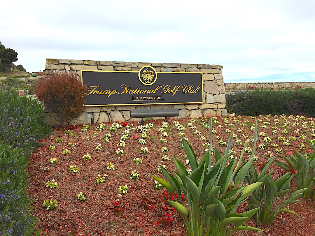
Entrance to Trump National Golf Club in Rancho Palos Verdes. (Daily Breeze staff file photo)

Everything changed for the troubled Ocean Trails Golf Course when real estate mogul Donald Trump announced he was buying the 261-acre property on Aug. 19, 2002.

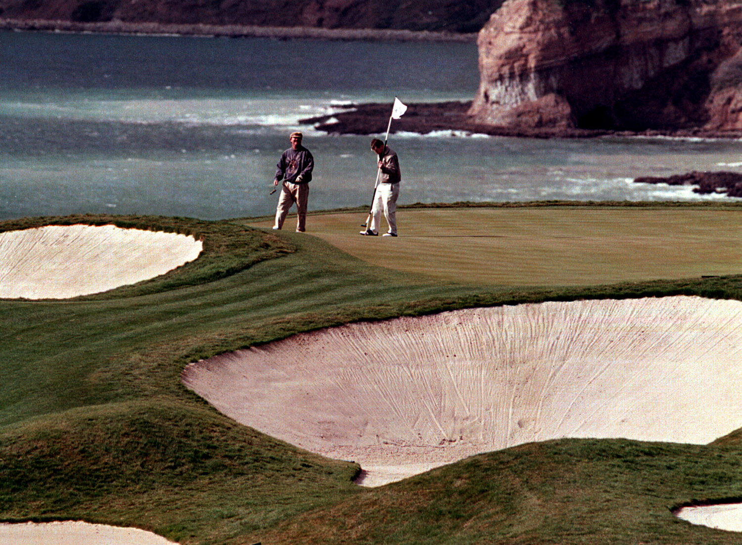
The course had yet to be restored to its full 18 holes after the June 1999 landslide that caved in the 18th fairway shortly before its planned grand opening. It had been operating as a 15-hole course since finally opening in November 2000.

Trump had been eyeing the distressed property for some time, and already had expressed interest in it to then-owner Ken Zuckerman in a 2001 meeting. He paid $27 million in November 2002 for the course and adjacent land to be used for luxury housing.

Donald Trump poses near the 11th green at his newly acquired Ocean Trails golf course in Rancho Palos Verdes in 2002. (Daily Breeze staff file photo)

At the time, he announced plans to sink an additional $30 million into upgrading the course, with a planned completion date of late 2003. He also said something which alarmed the city of Rancho Palos Verdes: he couldn’t decide if he would keep the course, now renamed Trump National Golf Club, open to the public, or make it a private club.

It wouldn’t be the first time that Trump and the city would clash. Any plans to make the course private became unworkable when the city pointed out that conditions of the 1997 agreement okaying the golf course clearly stated that it must be kept public. The city council unanimously reaffirmed that shortly after the sale to Trump became final.

City leaders also took offense at the official name of the course, Trump National Golf Club of Los Angeles, feeling that it slighted Rancho Palos Verdes, the city in which it actually was located. They also weren’t crazy about renaming Ocean Trails Drive as Trump National Drive, but he won that years-long battle in 2012.

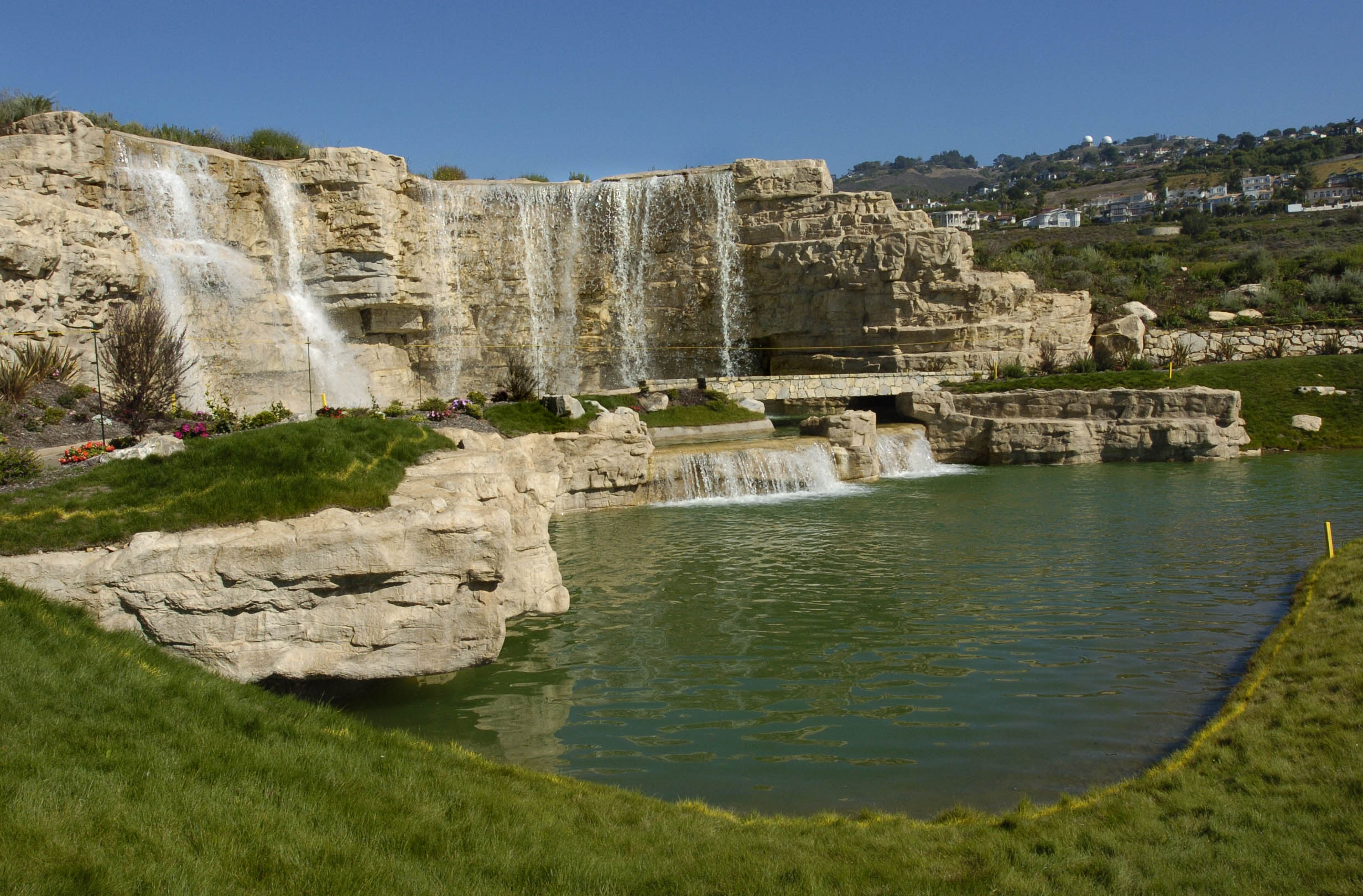
Trump worked with golf architect Tom Fazio to revamp the Pete Dye-designed course, making it longer and widening its fairways. He also added man-made waterfalls, including a large 30-footer; waterfalls are a prominent feature of many of his other golf courses. 

Lake and waterfalls behind the 17th green at Trump National Golf Club in Rancho Palos Verdes. Sept. 27, 2005. (Daily Breeze staff file photo)

Since water seepage had been cited as a possible cause of the landslide, city engineers expressed some concerns at first, but the structures were built in a way that prevented excess underground water runoff.

Repairs to the course took longer than expected, and had not yet been completed when Trump signed a deal with the LPGA in November 2004 to hold its Office Depot Championship tournament on the course in October 2005. 

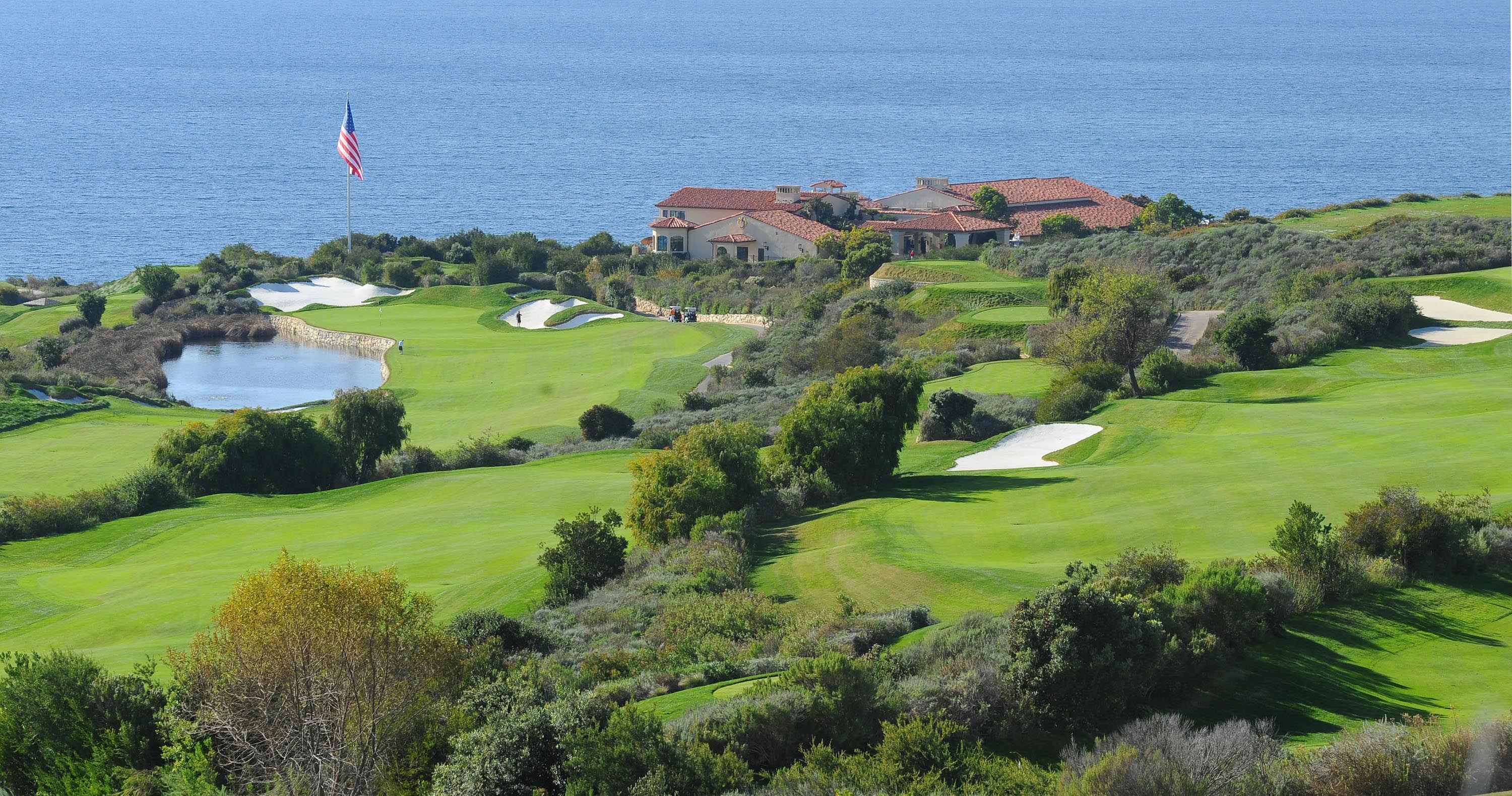
Trump had long eyed the course’s spectacular coastal location and ocean views as a natural site for pro tournaments, challenging other California courses such as Pebble Beach for the honors. He has often pointedly referred to it as “the most beautiful golf course in California.”

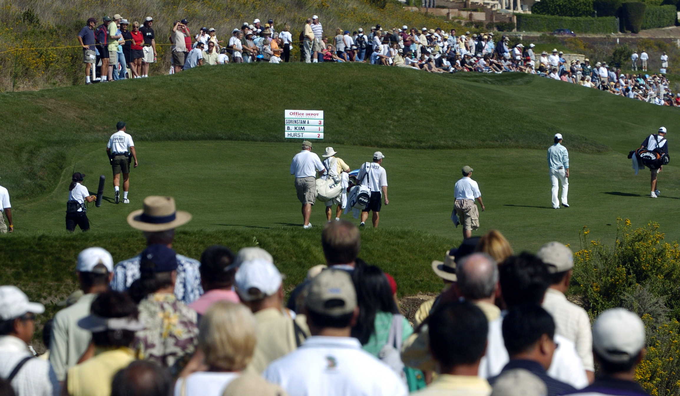
LPGA final round of the Office Depot Championship at Trump National Golf Club. Oct. 2, 2005. (Daily Breeze staff file photo)

Crews rushed to prepare the course, and Trump was able to stage the event. The LPGA tournament went off without a hitch, other than a weather delay that caused it to finish on Monday, Oct. 3, 2005. (South Korean golfer Hee-Won Han was the winner.)

Unfortunately for Trump, it would be the last professional tournament held at the course to date. Plans to hold the 2015 PGA Grand Slam of Golf men’s event there were scotched by the PGA following inflammatory anti-immigration remarks made by Trump during his campaign for the 2016 Republican presidential nomination. The tournament was canceled.

The course itself officially reopened in its restored 18-hole configuration on Jan. 20, 2006. Greens fees were $195 for weekday morning play and $300 for weekend mornings. Those fees have fluctuated over the years, but Trump National still is considered an expensive course to play.

Donald Trump officially opens The Estates at Trump National Golf Club. Trump and his 24-year-old daughter Ivanka Trump greet a guest, left, at the opening. June 8, 2006. (Daily Breeze staff file photo)

After the course reopened, Trump’s battles with the city of Rancho Palos Verdes only escalated. The city took issue when he erected a giant 70-foot flagpole on the property in 2008. It finally was officially approved in 2016.

He had to remove a row of tall ficus trees that he planted on the driving range in order to block the view of what he felt were “unsightly” homes in 2007, another battle that went on for years.

Trump battled with the city over development of luxury homes on the property. Trump refuted the city’s concerns over land instability where the houses would be built, saying the city was just denying him the use of his property and unfairly imposing restrictions on it that the city did not apply to other residents.

Trump also chafed at having to pay city permit fees for his various improvements at the course, again accusing city officials of singling him out for more stringent regulation.

Having grown increasingly fed up with the city, Trump finally responded with his trademark move in December 2008: he sued the city, which had a $20 million annual operating budget at the time, for $100 million over his various grievances.

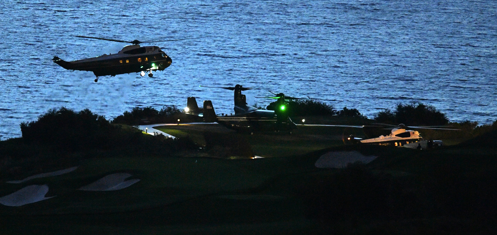
Marine One helicopter carrying President Donald Trump lands at his golf course in Rancho Palos Verdes on Friday, Apr. 5, 2019. (Daily Breeze staff file photo)

At the time, he claimed to have conducted a poll of local residents that showed that 88 percent of those queried supported him.

The suit wound through the courts for four years before finally being settled in September 2012 when both sides agreed to a confidential settlement.

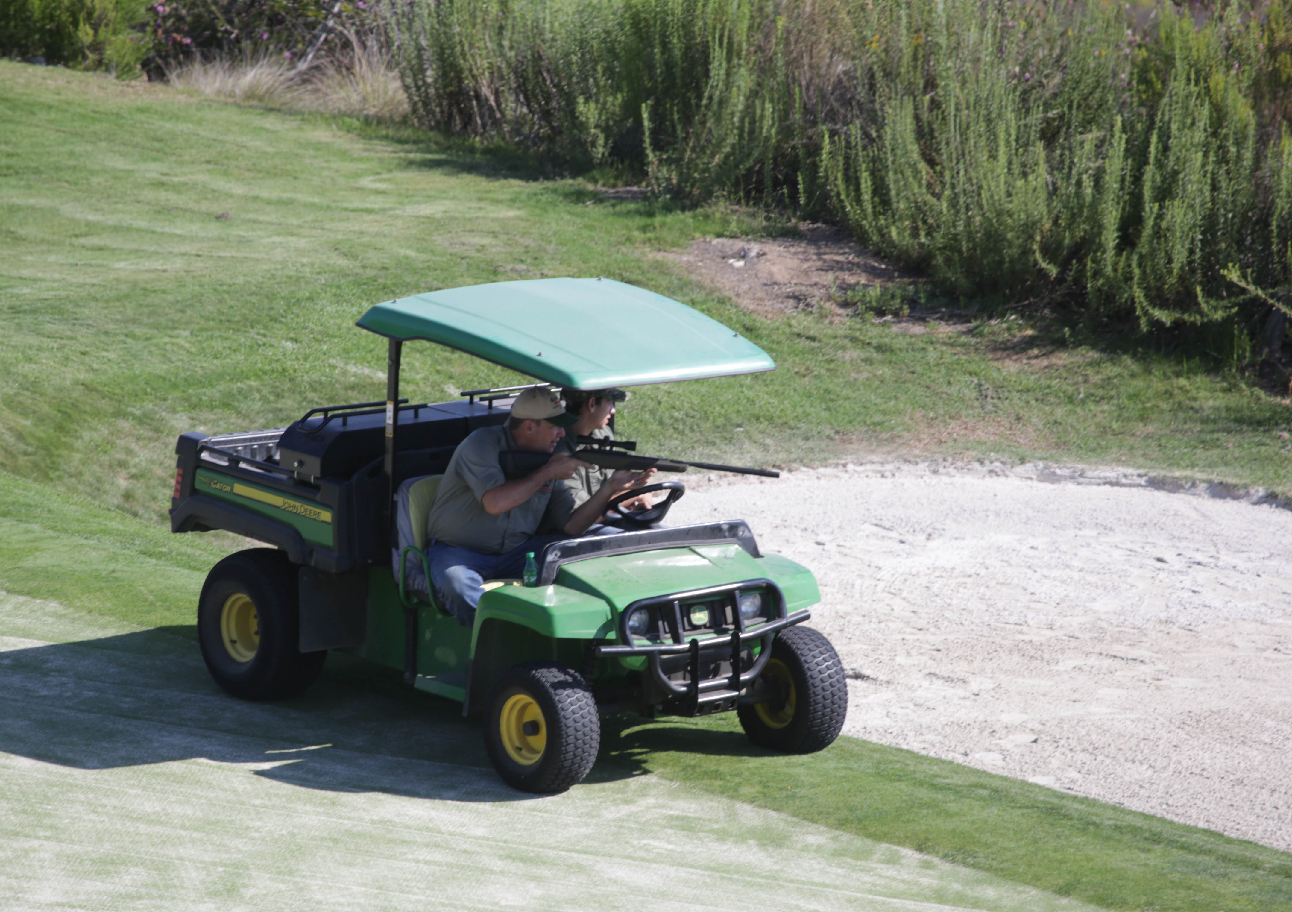
Since then, his tiffs with local authorities have been less frequent, though environmentalists and wildlife advocates were none too happy with the apparent use of a pellet gun to shoot and kill squirrels, rabbits and gophers on the golf course grounds in July 2017.

Grounds crew member at Trump National Golf Club takes aim at gophers and squirrels in Rancho Palos Verdes, July 25, 2017. (Daily Breeze staff file photo)

He indeed may have rescued a struggling golf project from bankruptcy, but Trump’s relationship with the city of Rancho Palos Verdes remains testy, 

Note: On Aug. 30, 2020, the Daily Breeze reported that New York’s state attorney general was looking into an 11.5-acre conservation easement near the course’s driving range as part of an investigation into the possible inflation of asset values by the Trump Organization in order to receive more favorable loans and insurance.

See also Part 1 on the earlier history of Ocean Trails Golf Course.

Trump National Golf Club in Rancho Palos Verdes. 2011 photo. (Daily Breeze staff file photo)

Sources:

Daily Breeze files.

Los Angeles Times files.

Palos Verdes Peninsula News files.

“PGA cancels Grand Slam of Golf event at Trump golf course,” by Mark Hensch, The Hill website, Sept. 3, 2015.

Trump National Golf Club Los Angeles website.

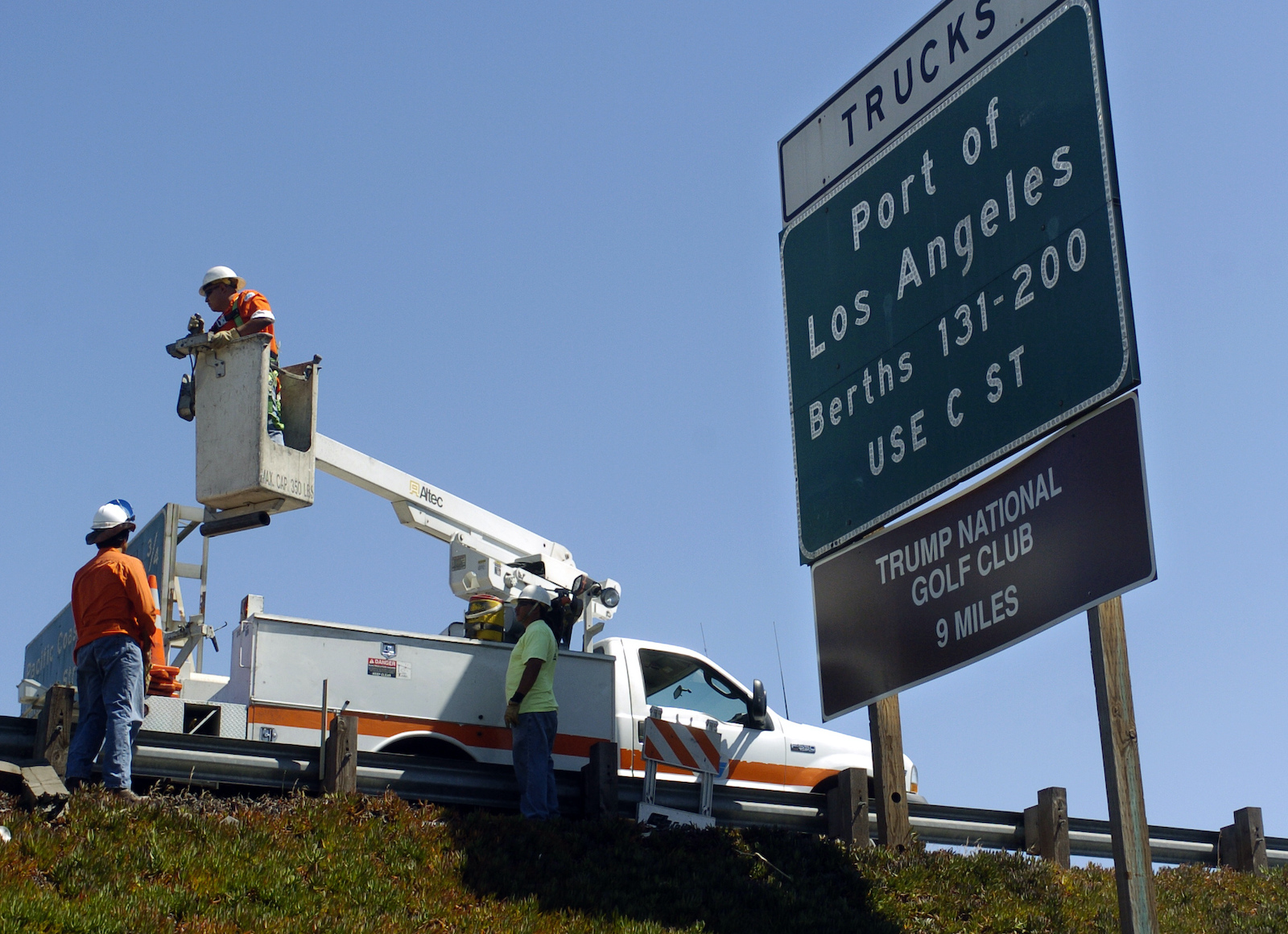
Caltrans crews track down and remove unofficial  Trump National Golf Club signs that were hung on existing state highway signs in 2006. This sign was on the southbound 110 freeway between Sepulveda and Pacific Coast Highway. (Daily Breeze staff file photo)


Ocean Trails Golf Course in Rancho Palos Verdes takes shape on former coastal farmland

Golfers finish up on the tenth hole of the then 15-hole Ocean Trails Golf Course. Jan 24, 2001. (San Gabriel Valley Tribune staff photo)

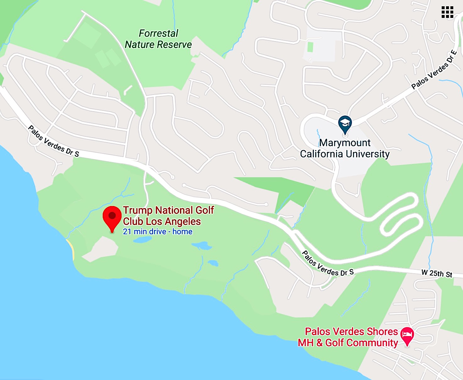
The Rancho Palos Verdes site on which the Trump National Golf Club of Los Angeles now operates once was part of the Rancho de los Palos Verdes land grant. After an 1882 legal settlement, ownership passed to the Bixby family.

In the early 20th century, the Ishibashi family became the first of many Japanese farmers to work the land in the South Bay, thanks to lease arrangements signed off on by the Bixbys. In addition to avocados, the Ishibashis grew poppies, strawberries, carrots, beets and sweet peas on the coastal site.

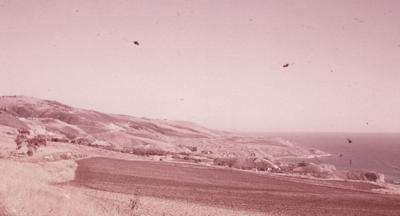
View of the Ishibashi agricultural fields looking east toward San Pedro in 1959. The future Ocean Trails/Trump National site can be seen in the distance at center right. (Credit: PV Local History Center, Palos Verdes Library District. Photo by Rebecca Bates.)

The Ishibashis were one of just a few Japanese families who returned to the area after being taken to internment camps during World War II. A historical marker at the golf course commemorates the Ishibashis.

After the war, developer Barry Zuckerman and his partner Barney Morris began buying up land parcels on the Peninsula and building housing to satisfy the postwar demand. The land along Palos Verdes Drive South west of Portuguese Bend was among their acquisitions.

(Credit: Google Maps)

The Ishibashis were allowed to continue farming there, as the area remained mostly undeveloped for the next few decades.

In January 1987, Orange County developer Barry Hon purchased 900 acres of land from Palos Verdes Properties. It included a 93-acre parcel adjoining the Zuckerman property. Hon wanted to build a Ritz-Carlton luxury hotel and an 18-hole golf course on a combined 457 acres.

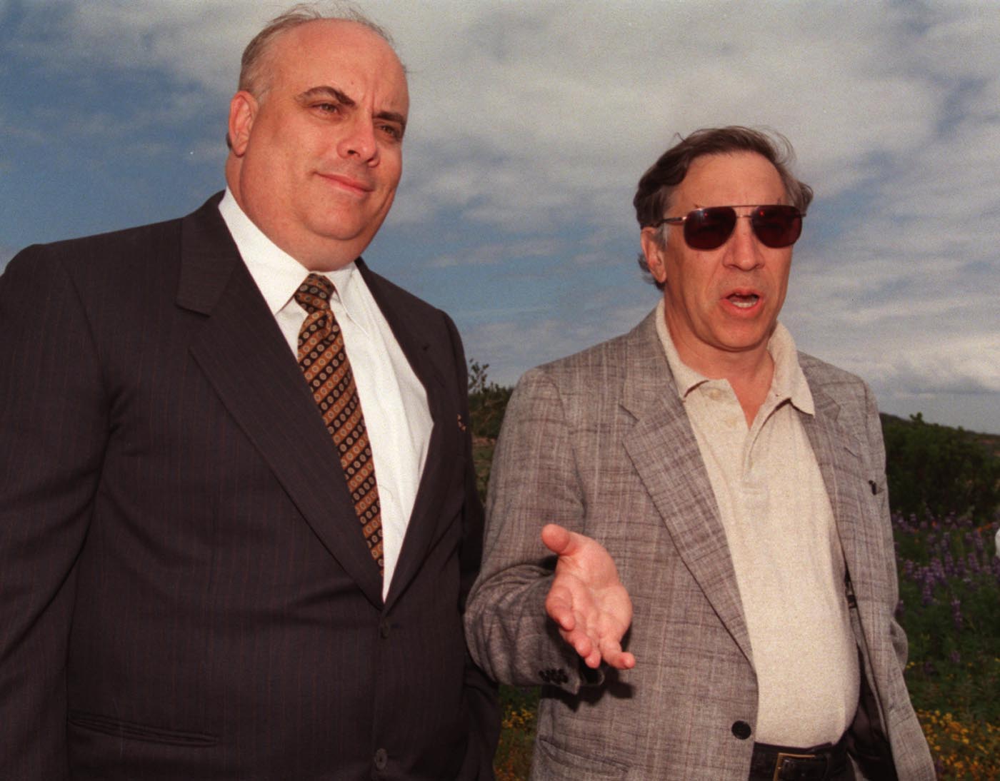
Ocean Trails developers Robert (left) and Kenneth Zuckerman in 1999. (Daily Breeze staff file photo)

The problem? The Zuckermans didn’t want to sell their portion of the land to him. The negotiations stalled Hon’s project, which also faced stiff opposition from area residents.

In March 1991, Hon dropped the Ritz-Carlton idea and announced plans to build 120 homes and the golf course in conjunction with the Zuckermans, with whom he had formed an alliance.

Nationally renowned golf architect Pete Dye announced his plans for the course in February 1992. He’d actually started working on the project in 1988. Developers hoped his links-style championship golf course someday would host the U.S. Open and other prestigious tournaments.

Golf course designer Pete Dye at the under-construction Ocean Trails Golf Course in RPV in February 1999. Behind him are the 10th and 11th fairways. Dye passed away on Jan. 9, 2020.  (Daily Breeze staff file photo)

After the California Coastal Commission vetoed the initial version of the project, the developers added more open space and reduced the number of houses planned. This version won the commission’s approval in April 1993.

Environmental complaints over the loss of native habitats, including those of the California gnatcatcher, led to more delays and two major lawsuits. Those were settled in 1996, but grading for the project, now known as the Ocean Trails Golf Course, didn’t begin until January 1998. (Developer Hon withdrew from the project in 1997.)

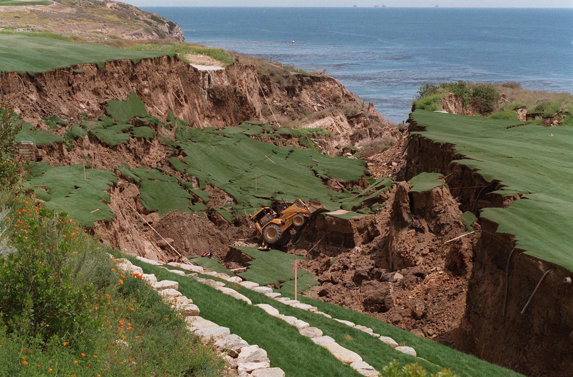
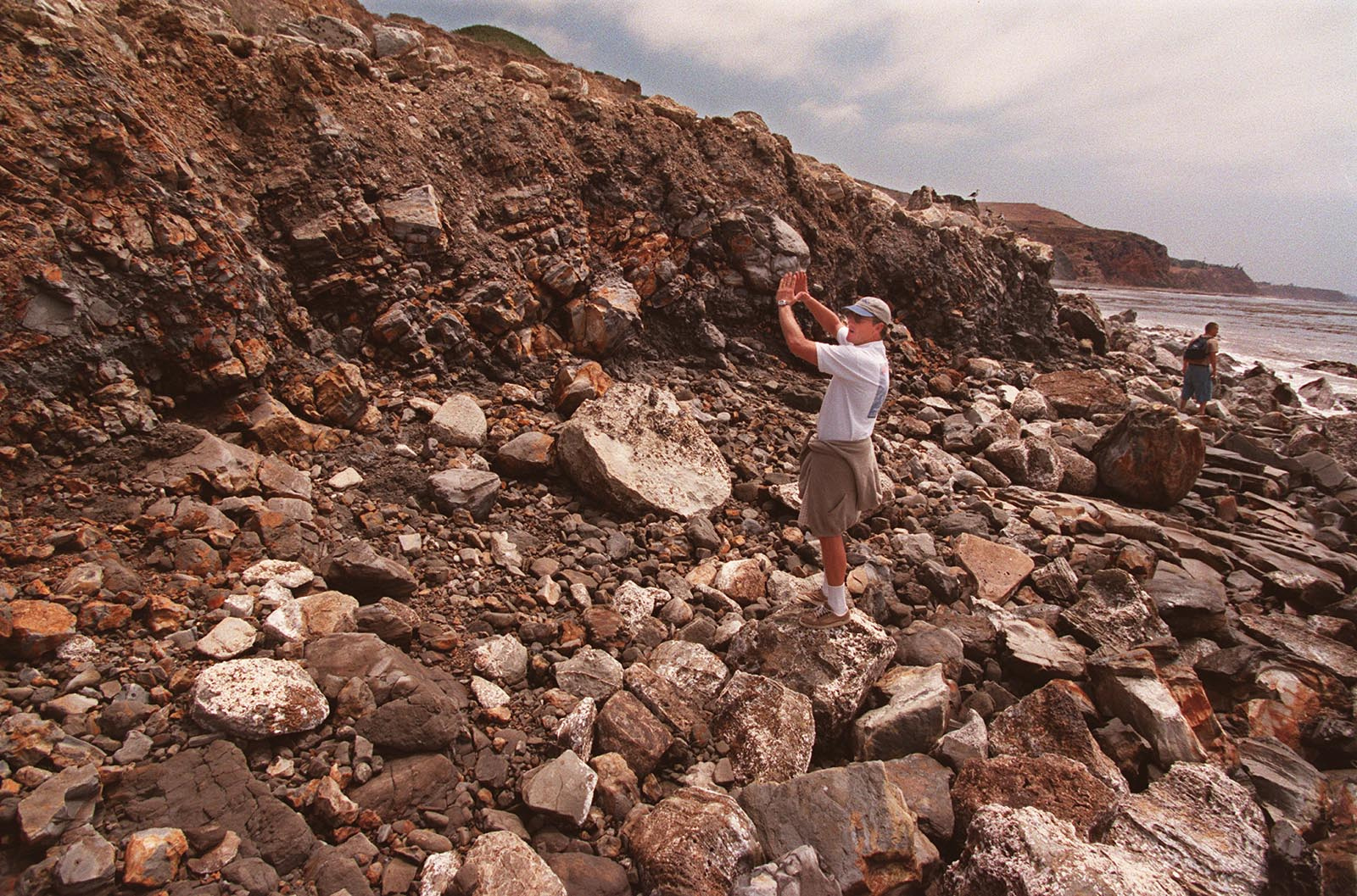
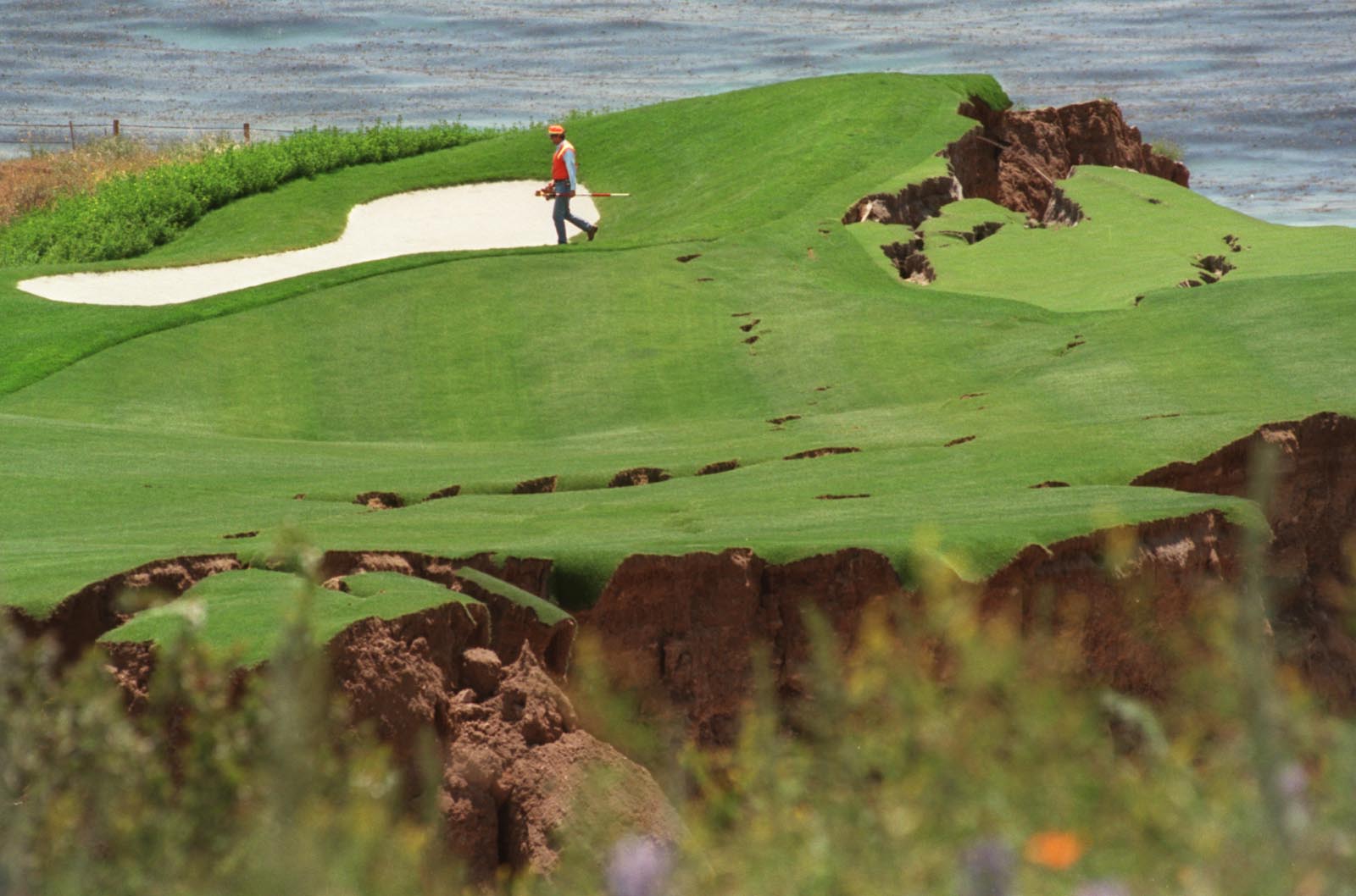
Though not yet open, the course was little more than a month from  its July 4, 1999, opening target date when a massive landslide cut a giant swath through the 18th hole on the morning of June 2.

The 18th hole of the new Ocean Trails golf course in Rancho Palos Verdes collapsed due to a landslide on June 2, 1999, just weeks before the course’s planned opening date. June 2, 1999. (Daily Breeze staff file photo)

More than 80,000 pounds of earth slid toward the Pacific Ocean. All work had to be halted while the cause of the 16-acre slide was determined. 

Some pointed toward a leaking sewer pipe beneath the course as the culprit, though Los Angeles County engineers insisted it was intact before the slide. Others pointed at possible leaks from the course’s artificial lakes

Most engineers blamed unstable ground in the area, which sits just down the road from the famously unsteady Portuguese Bend landslide area.

San Pedro resident Tom Kirk at the beach beneath the Ocean Trails project in Rancho Palos Verdes describes how the shoreline has shifted after the 1999 landslide. The rocky beach where he is standing and the rock wall in front of him were once level with each other. June 7, 1999. (Daily Breeze staff file photo)

The Zuckermans, determined to get their golf course built, poured $24 million into stabilizing the ground beneath the 18th hole. Meanwhile, skittish bankers at Credit Suisse, who had loaned the Zuckermans $100 million for the project, filed lawsuits when revenues from the golf course failed to materialize due to the landslide. The Zuckermans’ firm was  forced to file for Chapter 11 bankruptcy protection in the fall of 1999.

Finally, the Ocean Trails Golf Course opened to the public in November 2000. Construction had only recently begun on the 18th hole repair, and the 9th and 12th holes were needed as a construction staging area, so only 15 holes actually were available for play.

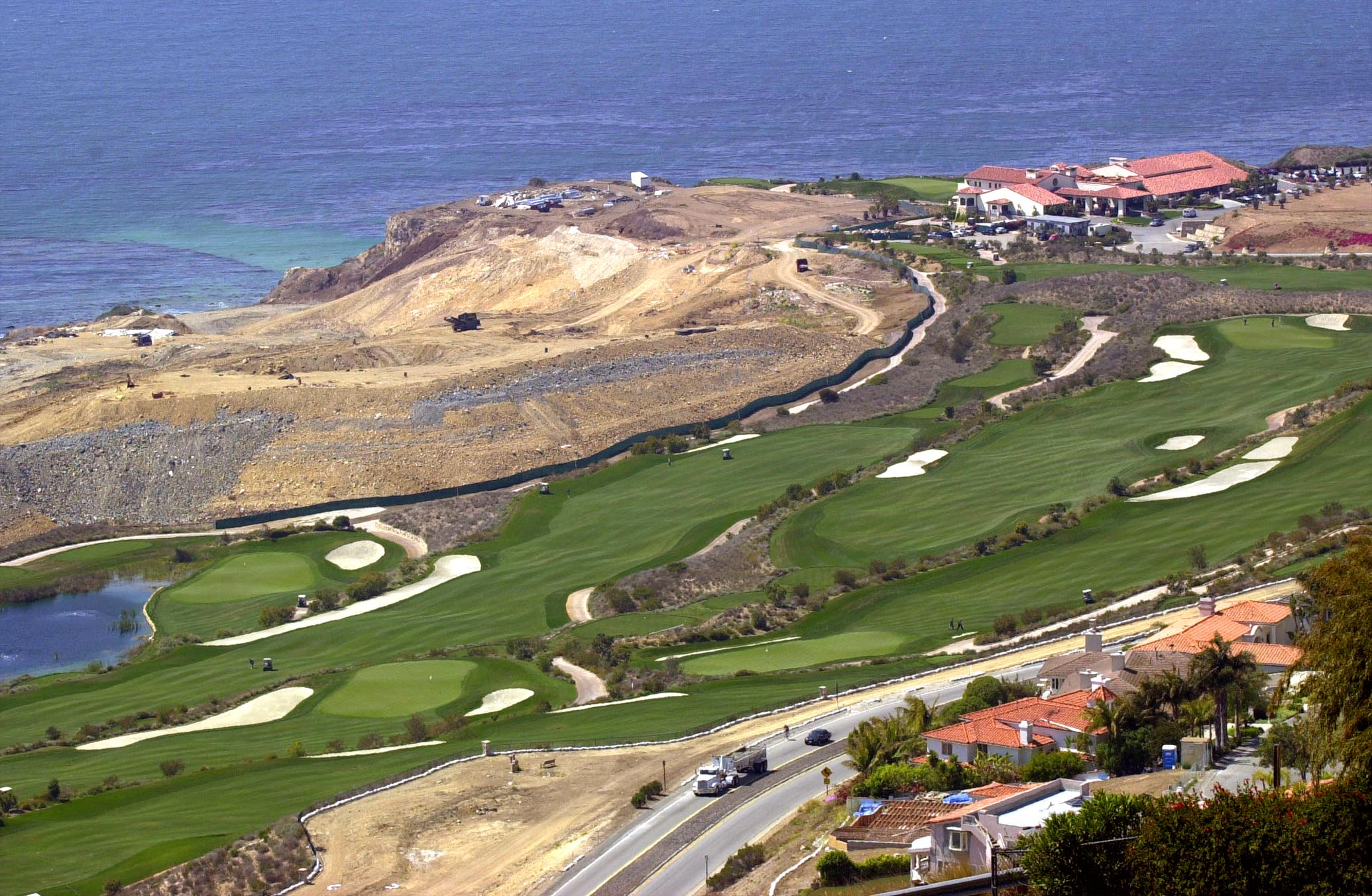
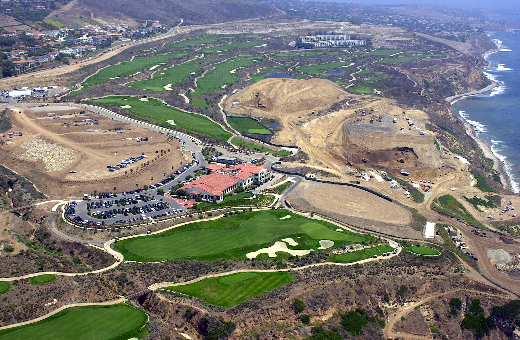
Golfers play on at Ocean Trails Golf Course in Rancho Palos Verdes. Area of the course under repair, top left. March 26, 2002. (Daily Breeze staff file photo)

The home lots remained empty as developers concentrated their efforts on permanently finishing the golf course itself first. Ever-rising costs exacerbated by the landslide already were topping $160 million.

Despite the valiant efforts of the Zuckermans, Credit Suisse eventually lost patience and called in its loan in early 2002, taking ownership of the golf course development and turning its management over to the Douglas Wilson Co. of San Diego.

But that turned out to be just a temporary arrangement until a well-known new buyer for the property turned up a few months later.

Next week: Part 2: Donald Trump arrives.
Aerial view of the Ocean Trails golf course looking east, and the continuing repairs following the 1999 landslide, center right. Palos Verdes Drive South runs across top left of photo. Aug. 9, 2001. (Daily Breeze staff file photo)

Sources:

Daily Breeze files.
“History of Ocean Trails/Trump National Golf Club,” by Maureen Megowan, active rain website, Jan. 9, 2014.

Los Angeles Times files.
Palos Verdes Peninsula News files.
A surveyor walks on part of 18th hole at Ocean Trails Golf Course in Rancho Palos Verdes. This section of the hole now resembles an island after landslide left it separated from the rest of the course. June 2, 1999. (Daily Breeze staff file photo)

Closure yet to come for South Bay families devastated by loss of their daughters in early 1960s

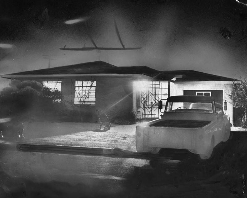
The Tompkins home on Dalton Ave. in Harbor Gateway is brightly lit to guide the missing 11-year old Karen Tompkins home on Aug. 22, 1961. (Credit: Los Angeles Public Library Photo Collection)

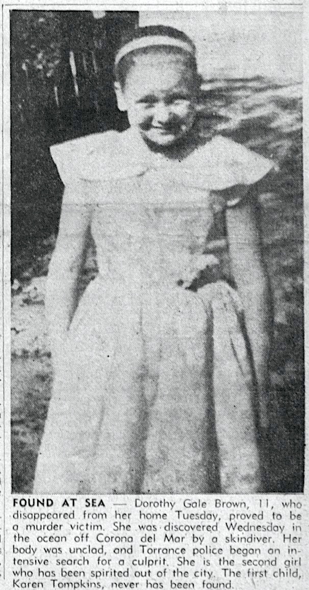
11-year-old Karen Lynn Tompkins disappeared after she began walking home from an arts and crafts summer class at Halldale Elementary School in Harbor Gateway on Aug. 18, 1961, carrying two covered wagon models she’d made there.

Nearly a year later, a skin diver found the unclothed body of Dorothy Gale Brown in the ocean  off Corona del Mar on July 4, 1962, a day after the 11-year-old went missing near her parents’ trailer park home at 1820 Torrance Blvd. in Torrance. 

The two heartbreaking cases jarred the suburban South Bay’s peaceful early 1960s veneer, causing justifiable fears among parents for their children’s safety. (In 1963, police worked with local PTAs to set up a “Block Mothers” community watch program in the area.)

In both cases, local police undertook massive investigations, following every possible lead. The communities became involved as well. Newspapers covered the cases intensively, rewards were offered and volunteers joined in the efforts.

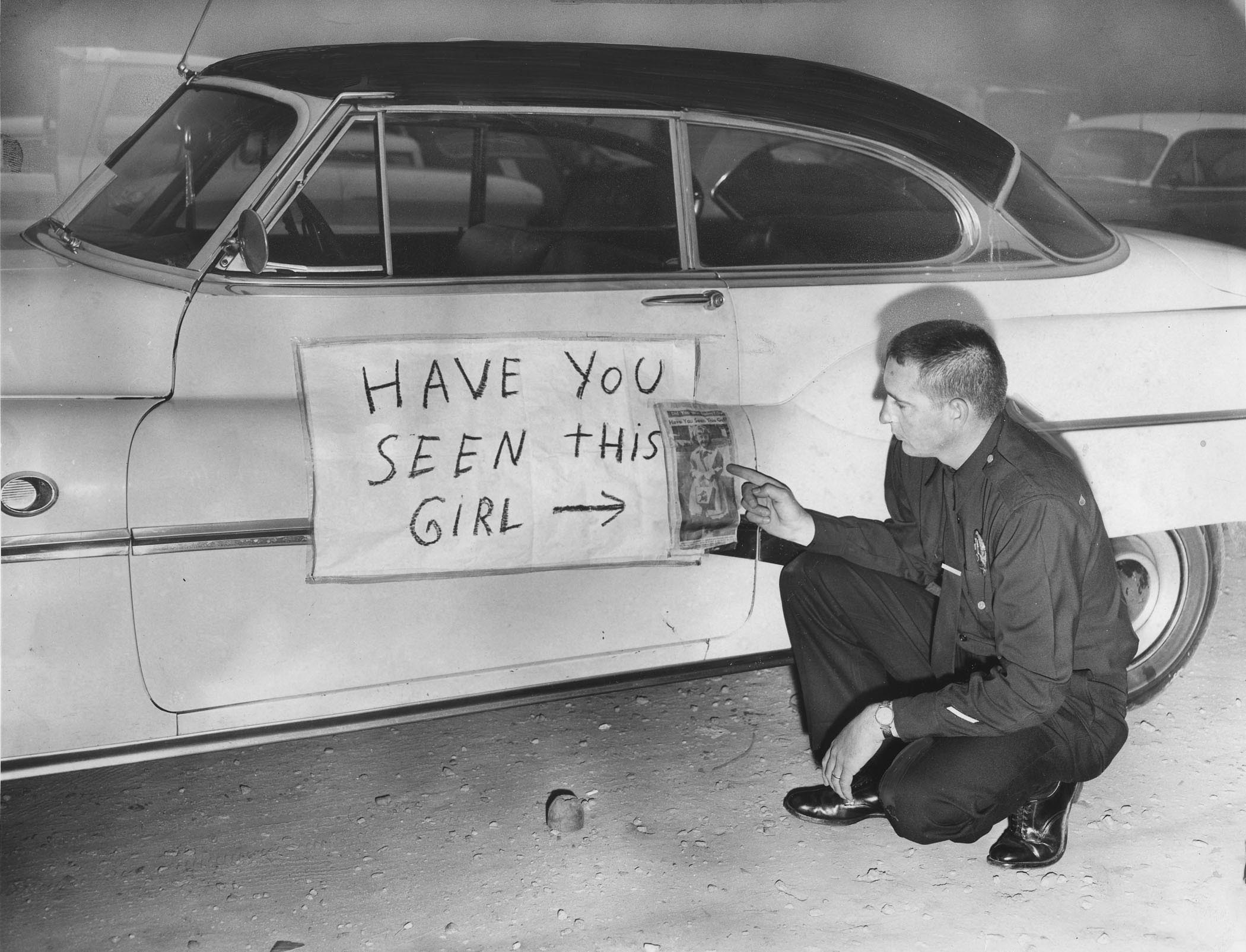
Officer James Pittman looks at a sign on a car with a picture of Karen Tompkins. Aug. 23, 1961. (Credit: Los Angeles Public Library Photo Collection)

 In the Tompkins case, posters asking for information on the case were put on the sides of autos and police vehicles with loudspeakers rolled through the streets in search of information and possible witnesses.

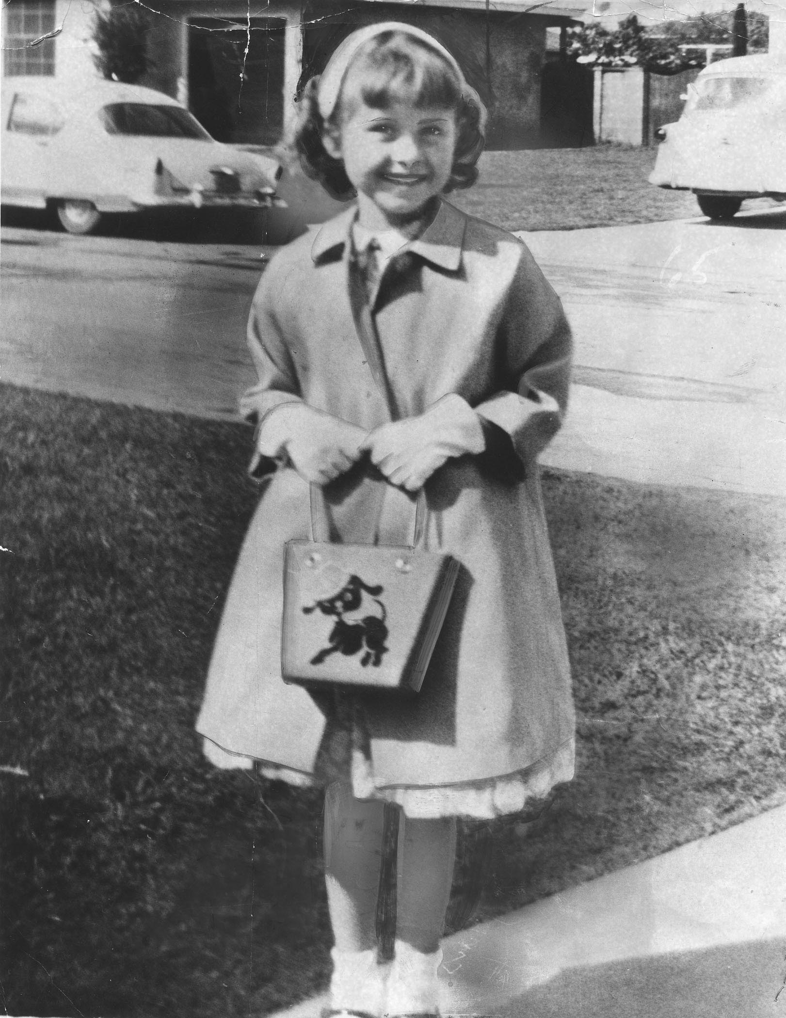
Karen Lynn Tompkins in 1961. (Credit: Los Angeles Public Library Photo Collection)

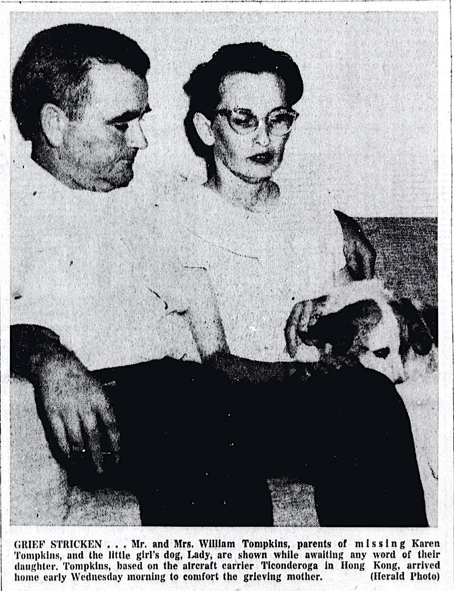
Tompkins, who lived with her parents on Dalton Ave. in Harbor Gateway, just east of the Torrance city limit, had an older brother, Michael, and a younger sister, Lori. Her mother, Laura, worked at the Broadway store in the Del Amo shopping center. Her father, William, was in the U.S. Navy.

William Tompkins was stationed on the USS Ticonderoga aircraft carrier in Hong Kong when Karen disappeared. The Navy gave him emergency leave to return home to be with his family.

Karen left the school at about 5:00 p.m. on foot to walk the four blocks to her home. She talked briefly with a friend on a bicycle when she was halfway home; she was the last person ever to see Tompkins before she disappeared.

For the next three weeks, local, state and federal police and rescue agencies continued their intensive search, including using a sheriff’s mounted posse to comb the Palos Verdes Peninsula hills and helicopters to scan coastal areas.

Several suspects were arrested and released, but no trace of Karen has ever been found. Not even the two eight-inch covered wagon models.

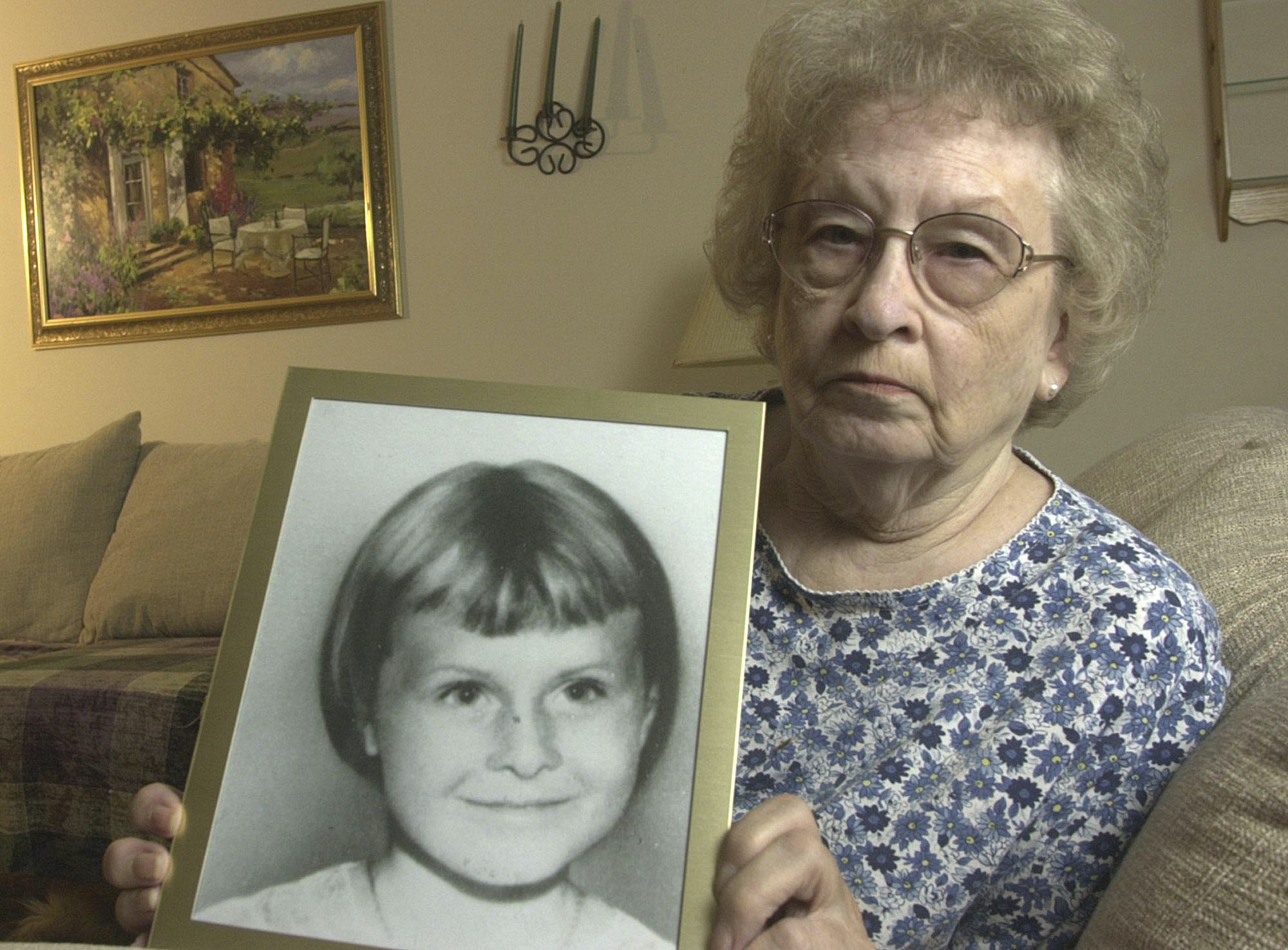
Laura Tompkins, 74, holds a photo of her daughter, Karen Lynn Tompkins, on Thursday, July 31, 2003, in Orange Park, Fla. (Associated Press photo/Oscar Sosa)

Speaking from Orange Park, Florida, Karen’s mother Laura Tompkins told Daily Breeze reporter Larry Altman in 2003, “If you know someone is killed in an accident or something, it’s closure. But this way it isn’t. You never know if she was killed or if she is somewhere being tortured or something. You think about it a lot.”

After returning from the beach on July 3, 1962, Dorothy Gale Brown decided to take a ride on her bike, leaving her home at the Skylark trailer park in Torrance, just a few blocks from where Tompkins lived, at 7 p.m.

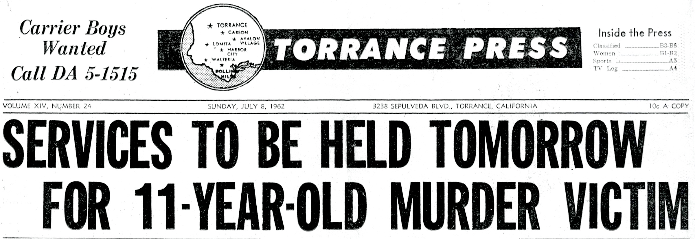
Torrance Press, July 8, 1962, Page 1. (Credit: Torrance Historical Newspaper and Directories Archive database, Torrance Public Library)

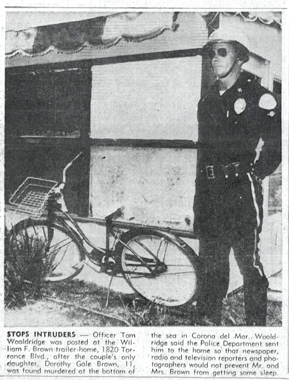
Her father, William, found her bike a block and a half away on 213th St., just west of Bow Ave. Police found no signs of a struggle where the bike was found.

Following the discovery of her body on July 4 by two skin divers in a kelp bed in 25 feet of water off of Corona del Mar, an examination determined that she had been sexually molested.

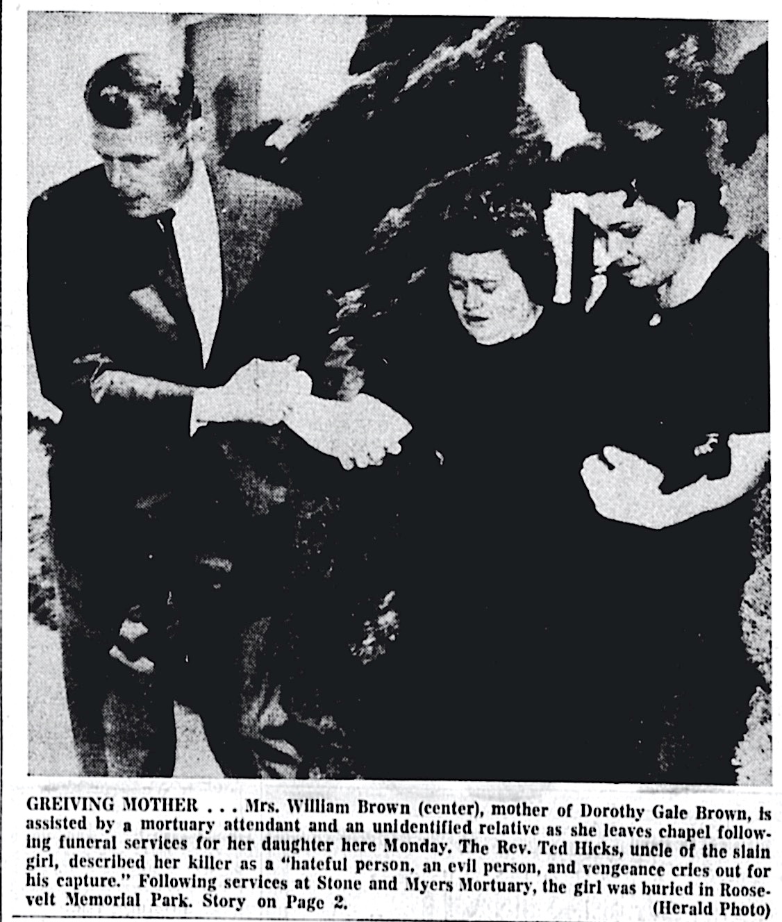
Her funeral was held at Roosevelt Memorial Cemetery in Gardena on July 9. More than 100 friends, relatives and classmates attended.

Funeral services announced for Dorothy Gale Brown in 1962. Torrance Press, July 8, 1962, Page 1. (Credit: Torrance Historical Newspaper and Directories Archive database, Torrance Public Library)

Police couldn’t help but notice the geographical and other similarities in the Brown and Tompkins cases.

Once again, they questioned and arrested a variety of suspects, but, as in the Tompkins case, none ever were determined to be the culprit. The arrests did lead to several molestation cases being brought against suspects in other unrelated incidents.

The disappearance of Tompkins and the murder of Brown have never been solved, though many investigators have tackled the cold cases over the ensuing decades.

Torrance Press, July 8, 1962, Page 1. Dorothy Gale Brown’s bicycle, left. (Credit: Torrance Historical Newspaper and Directories Archive database, Torrance Public Library)

Author Weston DeWalt of Pasadena posited in 2007 that serial killer Mack Ray Edwards, who killed himself on Death Row in San Quentin in October 1971, may have been responsible for more than the six child killings for which he had been convicted. 

DeWalt, investigating the killing of 8-year-old Tommy Bowman of Redondo Beach in Pasadena in 1957, noticed a composite drawing of a suspect who resembled Edwards in connection with the case. Bowman’s body was never found. 

Edwards later claimed to have killed as many as 18 children when questioned by police, but remained vague about the details. Some of the circumstances connected with his killings suggested to DeWalt that his victims possibly could have included Tompkins and Brown.

Police have considered DeWalt’s theory seriously in recent years, but as of this writing, the cases of Karen Tompkins and Dorothy Gale Brown remain open.

Torrance Herald, July 12, 1962, Page 1. (Credit: Torrance Historical Newspaper and Directories Archive database, Torrance Public Library)

Sources:

Daily Breeze files.

Los Angeles Times files.

“Mack Ray Edwards,” Murderpedia website, Juan Ignacio Blanco.

Pasadena Star-News files.

Torrance Press-Herald files.

Torrance Herald, Aug. 24, 1961, Page 1. (Credit: Torrance Historical Newspaper and Directories Archive database, Torrance Public Library)

Palos Verdes College: Noble 8-year experiment may have been ahead of its time

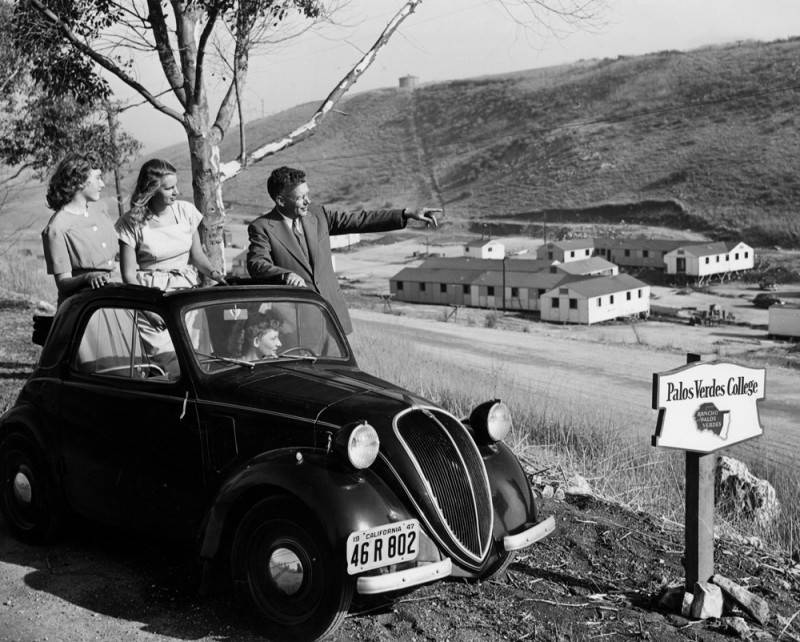
From left, students Coralio “Teddie” Howard, Barbara Lois Verket and Ruth Lissauer (seated) look out over the new campus with Dr. Richard P. Saunders, pointing, President of Palos Verdes College, during a visit. Sept. 12, 1947 photo. (Credit: PV Local History Center, Palos Verdes Library District)

After founding New London Junior College in Connecticut in 1939, Dr. and Mrs. Richard P. Saunders became enamored of the idea of establishing a similar small community college in California.

The couple had moved to the Los Angeles area after World War II from San Francisco, where Dr. Saunders had been stationed. They explored the area for workable sites, and when they learned that the U.S. Army was selling its wartime Army Air Force camp on the edge of Rolling Hills, they found one.

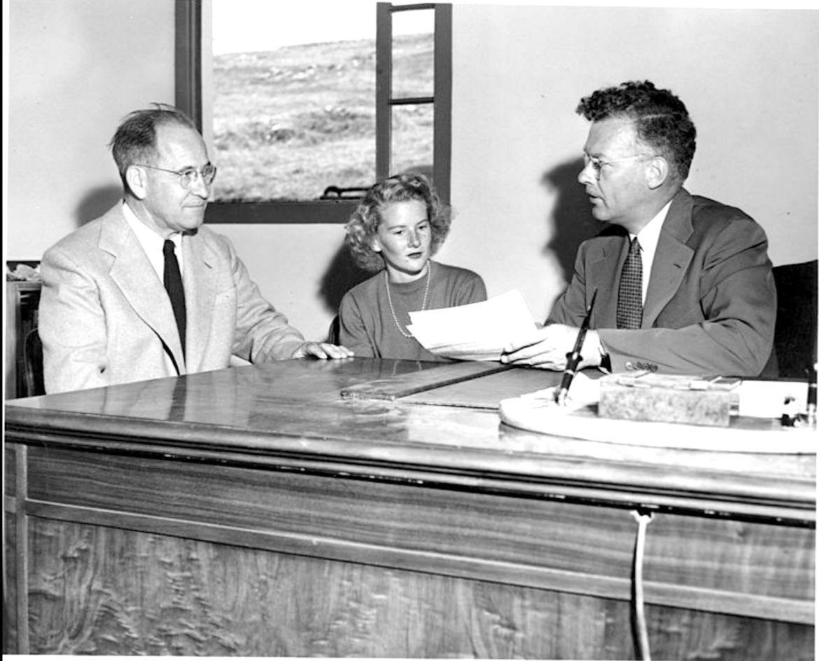
Dr. Richard Saunders speaks with Robert Walker and his daughter, Susan, before the opening of Palos Verdes College. Sept. 11, 1947. (Credit: PV Local History Center, Palos Verdes Library District)

Saunders told the Palos Verdes Peninsula News, “The moment I saw Rolling Hills and the Palos Verdes Peninsula, I knew that here was the ideal spot for a college. It is spectacularly beautiful, it offers the quiet so necessary for study, and yet it is but an hour’s drive from Los Angeles and Hollywood. thereby making available to the student body and faculty the cultural and recreational advantage of a great metropolitan center.”

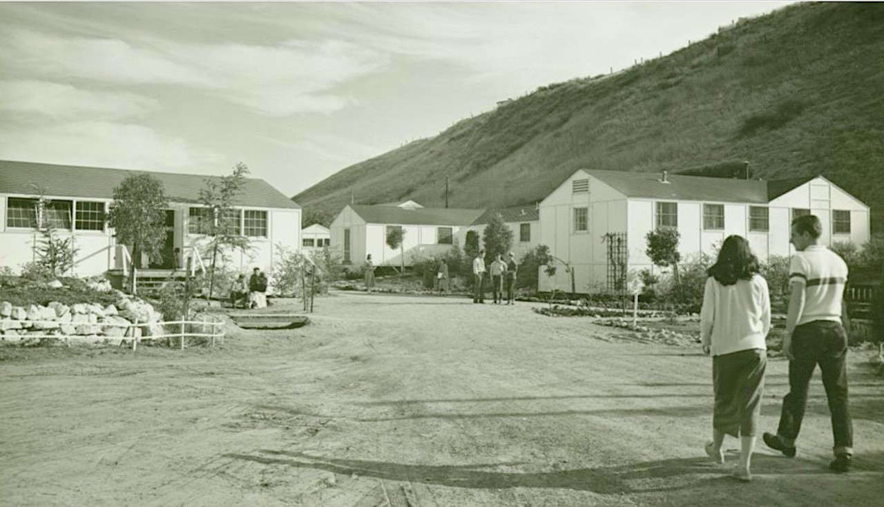
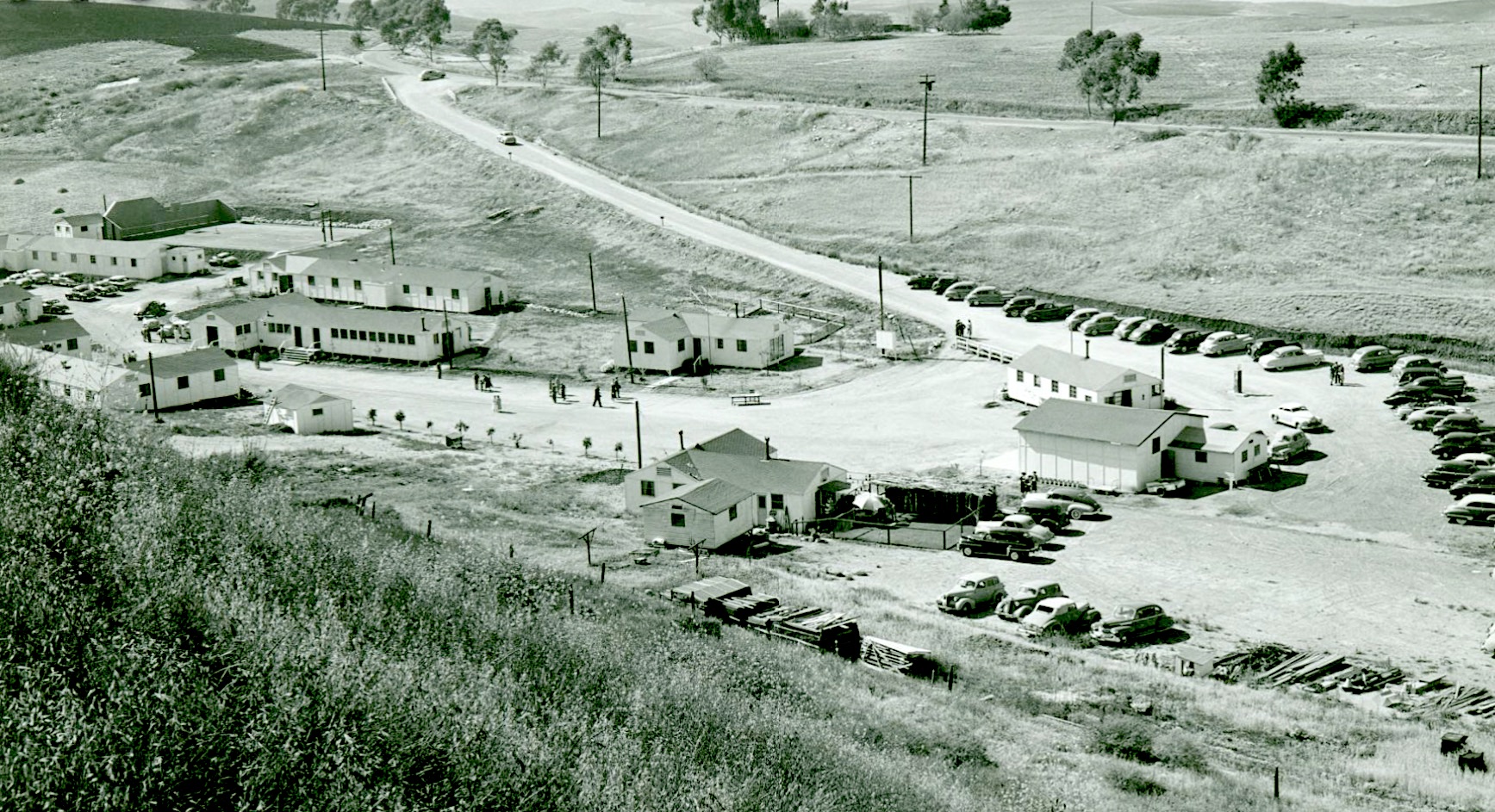
Saunders announced in October 1946 that the couple would open the new college on 70 acres of land overlooking the Pacific Ocean, much of it donated by the Vanderlip family, owners of the Palos Verdes Corporation. A grander campus with a spectacular ocean view was envisioned, but at first the campus would occupy the barracks and various other portable buildings the army had left behind in a small valley nestled behind the hills.

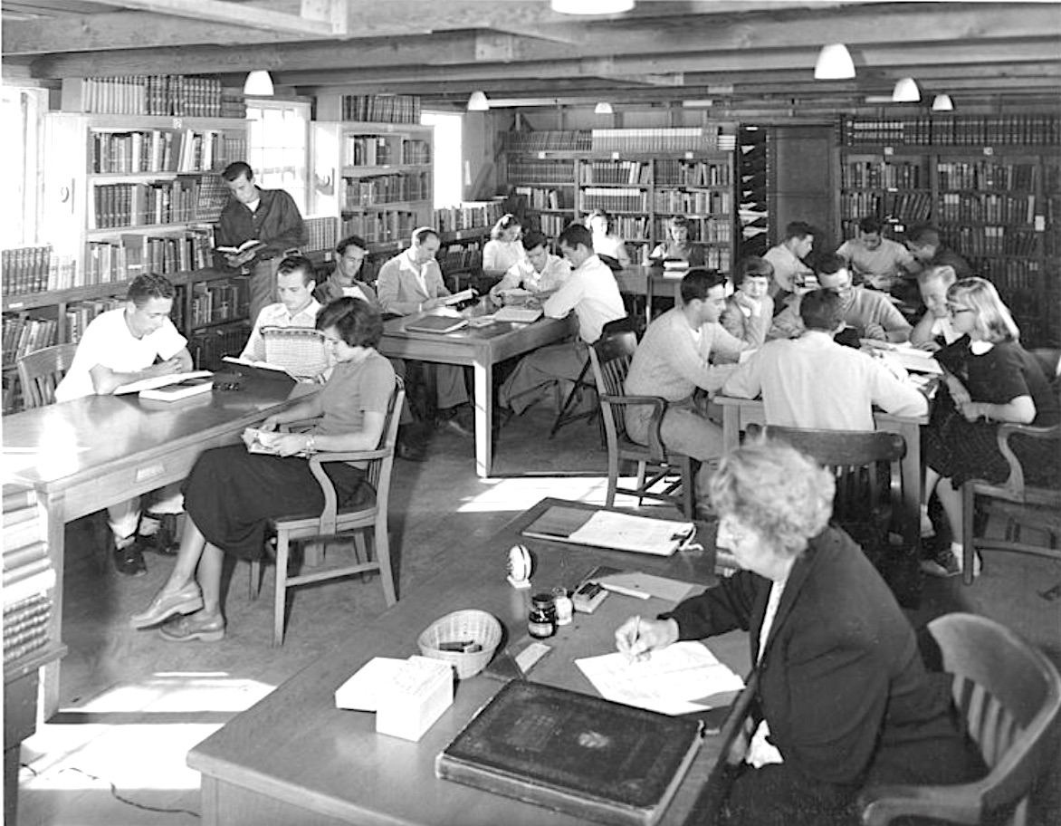
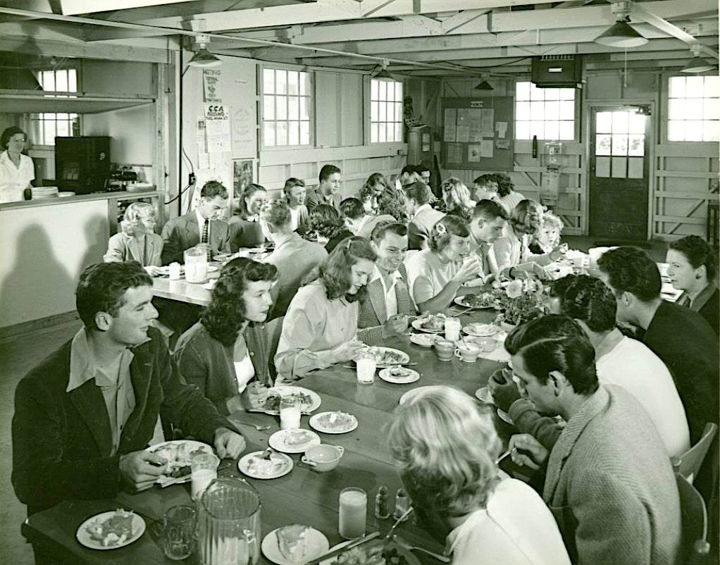
The buildings were easy to rearrange into a small college campus, and were repurposed into three dormitories, classroom buildings, a library and a combination cafeteria/recreation hall at a low-budget cost of $50,000.

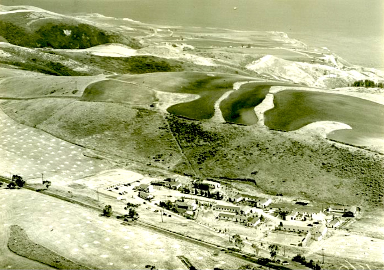
The ocean can be seen beyond the hills behind Palos Verdes College in this photo circa 1947. (Credit: PV Local History Center, Palos Verdes Library District)

Some of Saunders’ guiding concepts for Palos Verdes College included keeping its enrollment low and focusing on educating recent high school students, including those without stellar academic records. He hoped to prepare all its students for further education by teaching core subjects well in a small-class environment.

He also wanted to draw enrollment from all backgrounds, including international students, to give all students a chance to interact and learn from each other as well as from teachers.

Students walk down the unpaved road at Palos Verdes College. Circa 1947 photo. (Credit: PV Local History Center, Palos Verdes Library District)

The school’s community engagement efforts included sponsoring at least three well-attended  picnics on its picturesque grounds for students, donors and nearby residents in the months leading up to its opening.

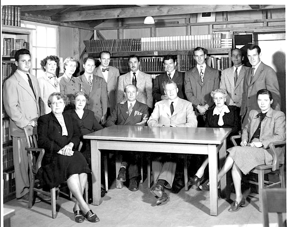
The Palos Verdes College faculty for the first 1947-48 school year surround Dr. Richard Saunders, center, seated in light coat. 1947 photo. (Credit: PV Local History Center, Palos Verdes Library District)

The college started small. Its first class of 34 students began school on Sept. 29, 1947. Saunders had assembled a young, talented faculty, and the school stressed student involvement in all of its activities.

It grew to more than 100 students in 1948, and its first class graduated with Associate of Arts (A.A.) degrees in 1949.

Early attendees included members of the Hormel family of meatpacking fame, actress and dancer Leslie Caron, and Elizabeth Taylor’s older brother, Howard.

Students use the Palos Verdes College library while a reference librarian works at her desk, lower right. Circa 1948 photo. (Credit: PV Local History Center, Palos Verdes Library District)

Though the school had succeeded in raising funds for its opening, Saunders found that that student tuition fell short of funding the school’s needs on an ongoing basis. 

Various fundraising events to attract potential donors were held, including dances at the Hollywood Riviera Beach Club, more picnic luncheons and other activities. One event first held in 1948, the Palos Verdes Homes Tour, took on a life of its own following the college’s closure, and continues as an annual charitable fundraiser to this day.

Unfortunately, the struggle for funds continued. Dr. Saunders left the school in 1951, feeling the college could no longer afford his salary. He was replaced by teacher and student advisor John Howard.

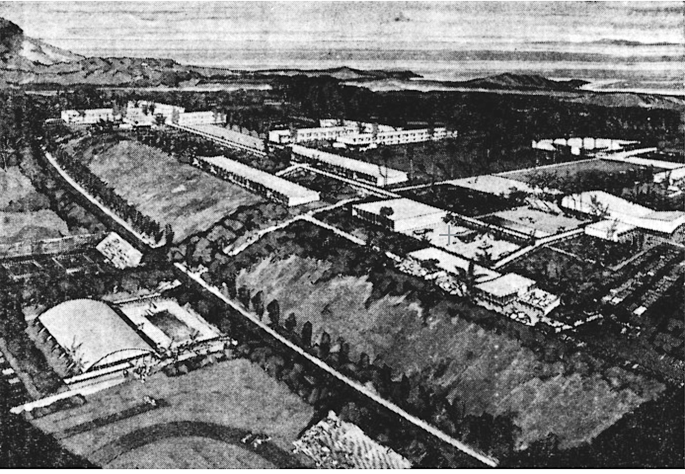
Rendering of proposed hilltop Palos Verdes College campus that never was built. Palos Verdes Peninsula News, April 30, 1953, Page 1. (Credit: Palos Verdes Peninsula News)

The promise of the proposed permanent hilltop campus, with plans drawn up by Los Angeles architectural firm Welton Becket and Associates, began to fade as the money dried up. The college, still holding classes in its former temporary military buildings, tried converting to a four-year school, awarding its first Bachelor of Arts degrees in 1954.

But Howard just could not keep the respected school afloat financially. He was forced to announce its permanent closure in August 1955, telling the PVP News, ““It is difficult to declare an end to an institution to which so many people have devoted their efforts and resources.”

Students eat in the Palos Verdes College cafeteria in this 1952 photo. (Credit: PV Local History Center, Palos Verdes Library District)

The Palos Verdes Peninsula Unified School District moved its headquarters into the buildings at 38 Crest Road West, which also became the site of its La Cresta Elementary School. Plans were announced to replace the dilapidated buildings occupied by both, a job that was completed in 1965.

La Cresta was closed in 1984, and was replaced by the Rancho Del Mar Continuation High School that continues to operate on the site. The PVP school district moved its headquarters to Malaga Cove School in 2006.

Higher education did return to the Peninsula with the 1968 opening of Marymount Palos Verdes College, since renamed Marymount California University, on Palos Verdes Drive East in Rancho Palos Verdes.

View of the Palos Verdes College campus from a nearby hillside. Circa 1947-48. (Credit: PV Local History Center, Palos Verdes Library District)

Sources:

Daily Breeze files.

Los Angeles Times files.

Palos Verdes Local History Center, Palos Verdes Library District.

Palos Verdes Peninsula News files.

The Palos Verdes Story, by Delane Morgan, The Palos Verdes Review, 1982.

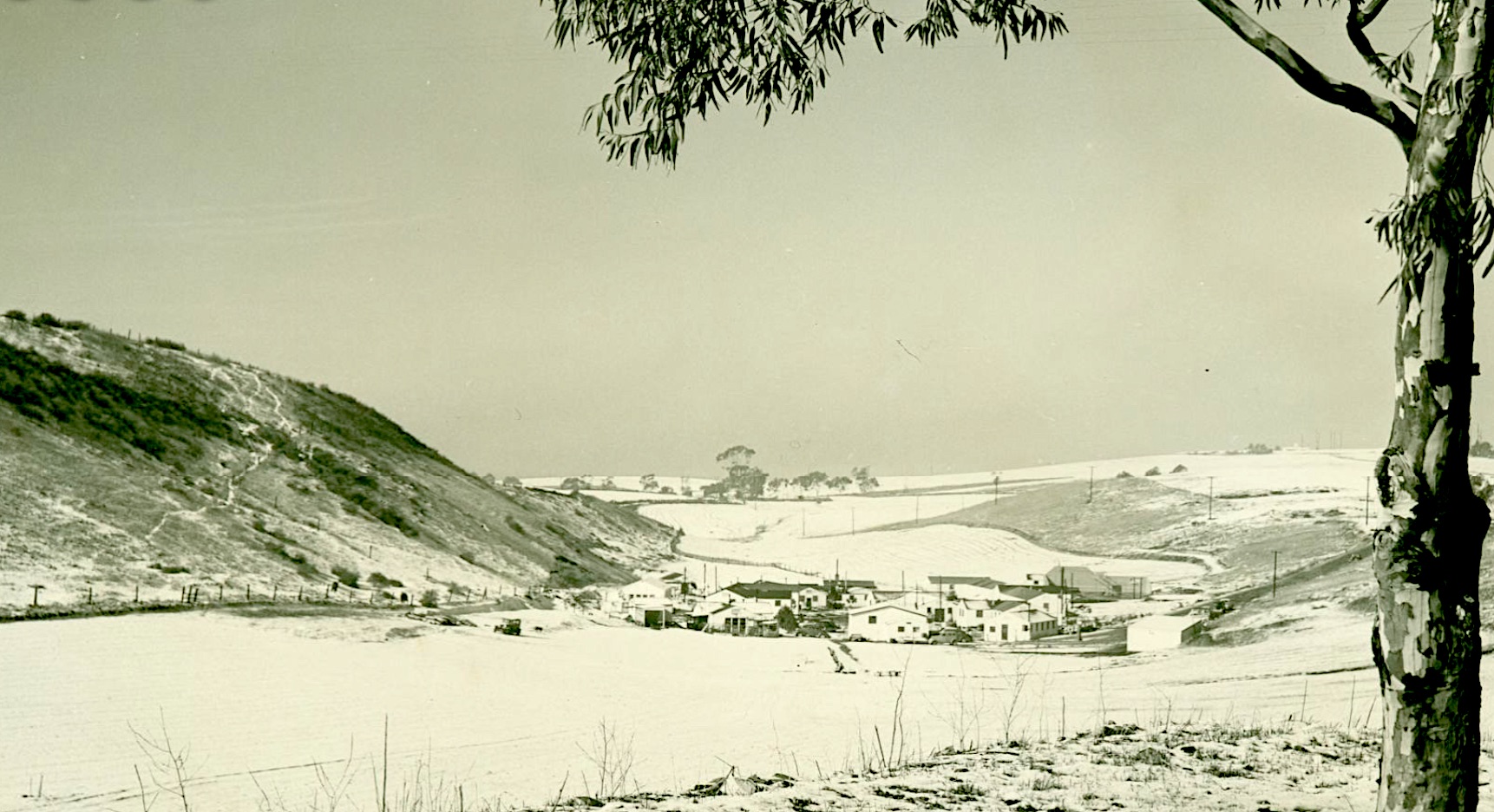
Snow covers the Palos Verdes College campus during the unusual January 1949 snowstorm. Jan. 12, 1949. (Credit: PV Local History Center, Palos Verdes Library District)