Hawaii’s Duke Kahanamoku a major figure in South Bay surf culture

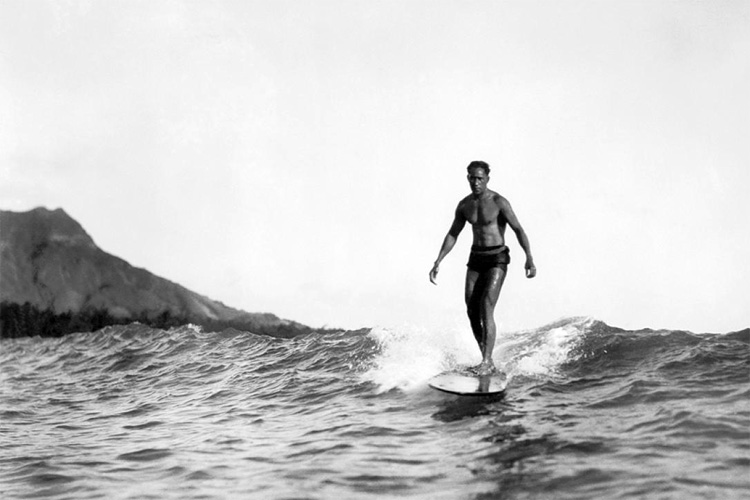
Duke Kahanamoku surfs at Wakiki in this undated publicity shot from the early 1900s.

George Freeth rightfully gets credit for introducing the sport of surfing to the South Bay in Redondo Beach in 1907. Freeth learned the sport while growing up in Hawaii in the late 1800s.

But without the influence of Duke Kahanamoku, born Duke Paoa Kahinu Mokoe Hulikohola Kahanamoku in Honolulu, Hawaii, on Aug. 24, 1890, the sport never might
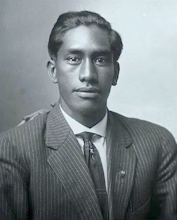
Duke Kahanamoku. Undated.

have captured the imagination of the mainland, and become so ingrained in its culture as a result.

It’s hard to overestimate the Duke’s impact on West Coast beach culture after his arrival in  1912. Mention his name to an informed surfer these days and they will acknowledge the sport’s debt to him.

But he did so much more. His initial fame came not from surfing, but as a championship swimmer. In fact, he first came to Southern California in order to train for the 1912 Summer Olympics in Stockholm.

His swimming exploits already were legendary at the time, and he would go on to show his prowess on the world’s largest athletic stage. He participated in four Olympics in total, winning three gold medals and two silver. At age 42, he went to his final Olympics, serving as an alternate for the U.S. water polo team at the 1932 Los Angeles Games.
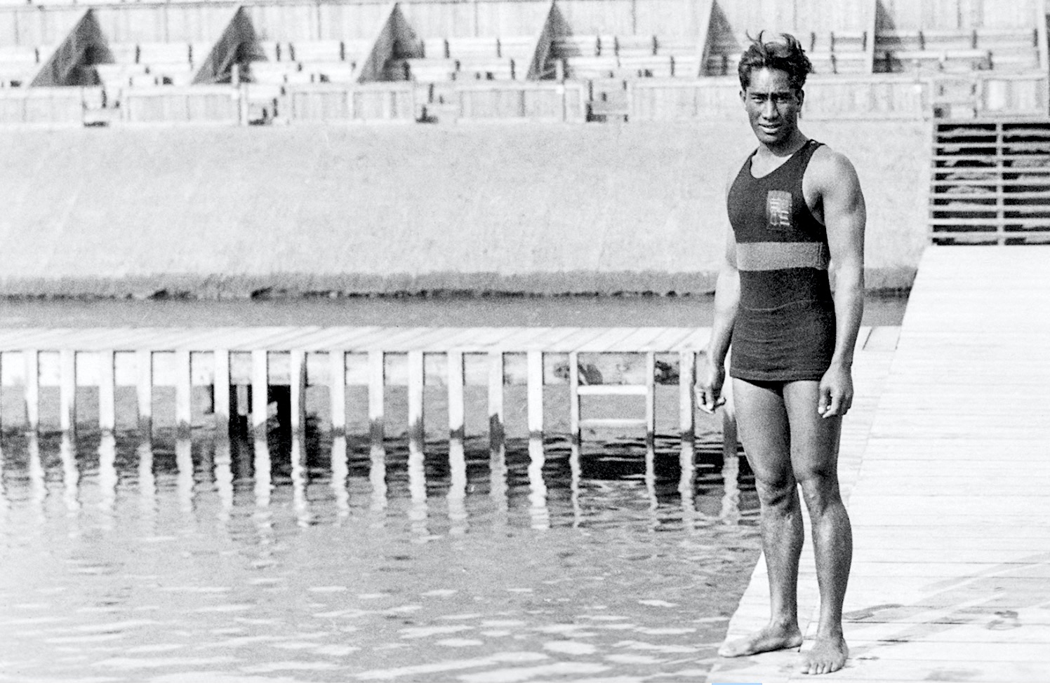
Duke Kahanamoku at the 1912 Summer Olympic Games in Stockholm. (Credit: Photo courtesy International Olympic Committee)

Another legendary swimmer, Johnny Weismuller, edged him out for the gold in the 100 meter freestyle at the Paris Games in 1924, and Kahanamoku enjoyed telling reporters for years afterward that “it took Tarzan to beat me.”

Like Weismeuller, the handsome Duke — his name, not an official title — followed his Olympic successes with an acting career, playing supporting roles in a series of films during the late 1920s. He returned to Hawaii in the early 1930s, but still appeared in the occasional film, including “Wake of the Red Witch” (1948) with John Wayne, and “Mister Roberts” (1955).
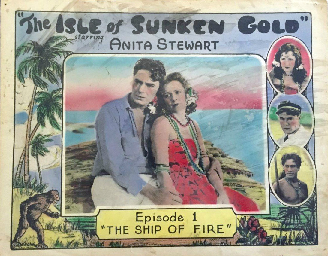
Lobby card for the American film serial “Isle of Sunken Gold” (1927), with Bruce Gordon, Anita Stewart, and Duke Kahanamoku, lower right inset. The film is thought to be lost.

That’s just part of the story, and doesn’t even include surfing. In his early days, Kahanamoku appeared in major swim meets throughout the world, usually winning and often breaking records in the process. He’s credited for inventing a new style of kicking for swimmers, the “Kahanamoku kick,” which, when used together with his unusually long arms, gave him his great speed in the water.

He swam in many meets in California, including those held at the Redondo Beach saltwater plunge, Ocean Park in Santa Monica and at a major annual meet held in San Francisco.
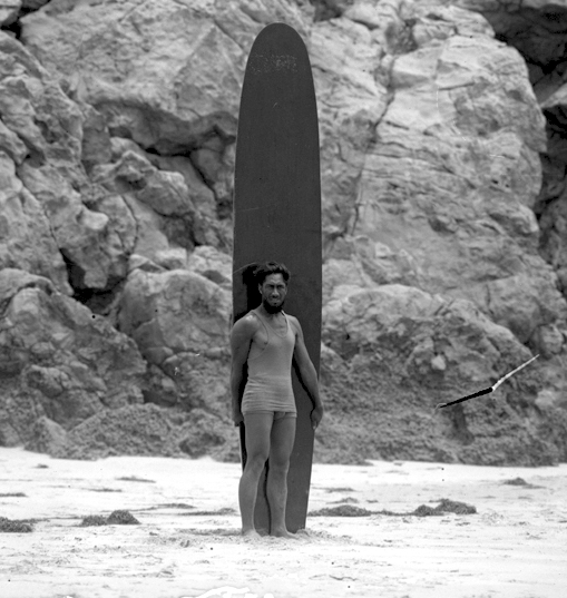
A bearded Duke Kahanamoku poses with his board on an unidentified Los Angeles-area beach in 1920. (Credit: UCLA Library, Special Collections Dept.)

While touring around and training for these competitions, he also took the time to introduce mainlanders to his first love, surfing. He used wooden surfboards, his favorite being his Hawaiian Olo board, a carved plank measuring 16 feet, two inches in length, 21 inches in width and weighing 125 lbs.

He loved to demonstrate his technique for riding the waves using the big board, a feat that most witnessing never had seen in person before. Unverified legend has it that he caught his first Southern California waves at 2nd St in Hermosa Beach in 1912. He became close friends with Freeth, and the pair often surfed on South Bay beaches, most notably at Redondo Beach during a July 1913 visit by the Duke.

Kahanamoku also is credited with introducing the sport in Orange County at Corona del Mar  in 1912, on the East Coast at Atlantic City, New Jersey that same year, and to the now-surfing mad continent of Australia in 1914. 
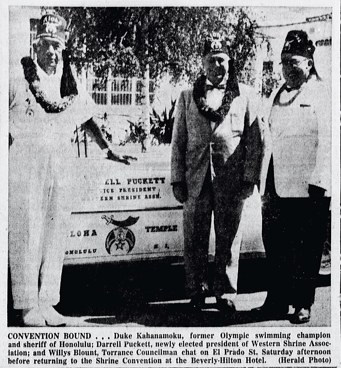
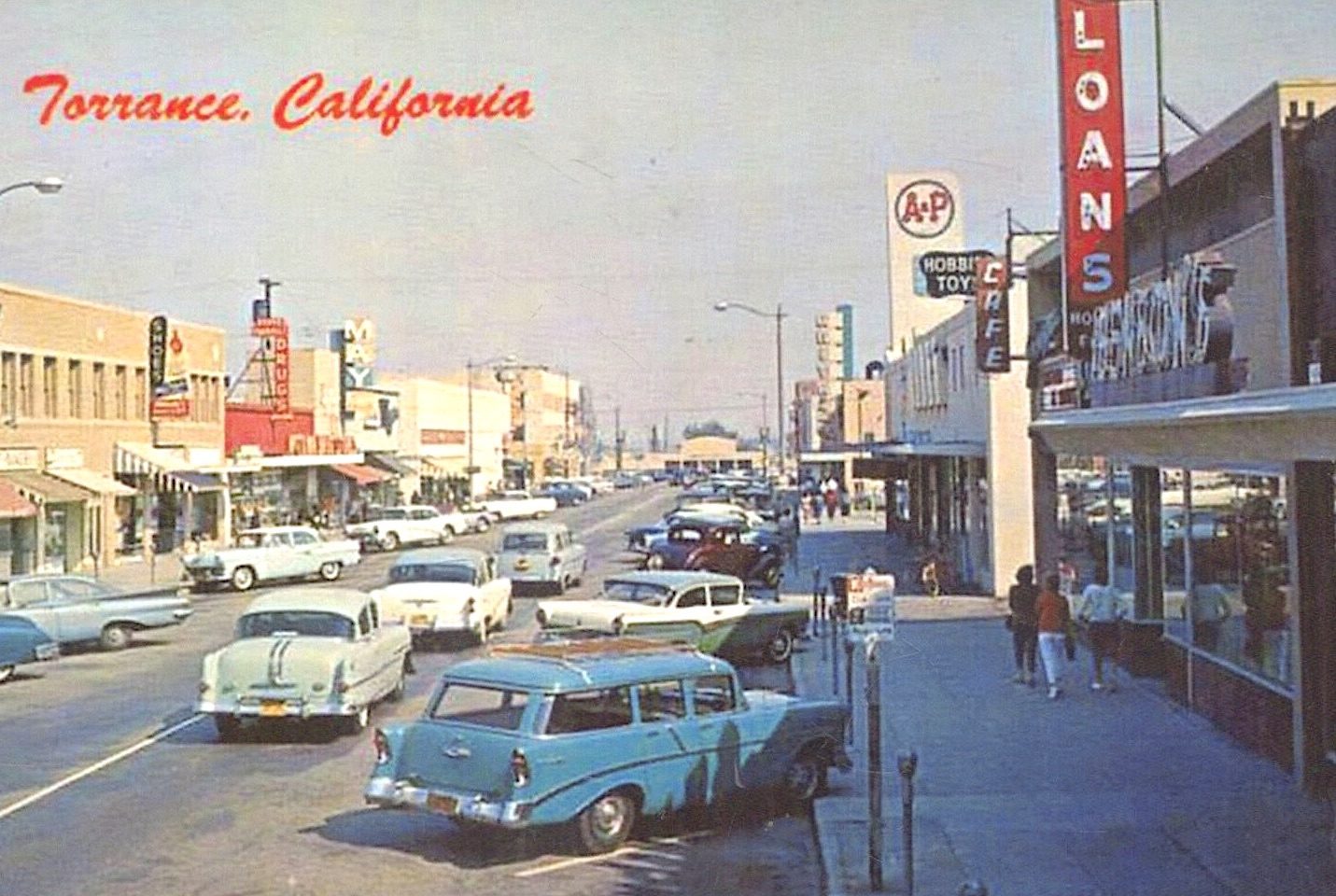
Duke Kahanamoku in Torrance. Torrance Herald, Aug. 9, 1959, Page 1. (Credit: Torrance Historical Newspaper and Directories Archive database, Torrance Public Library)

During his frequent visits to the South Bay/Harbor Area, he often stayed with local residents, including in San Pedro with Rudecinda Florencia Sepulveda de Dodson, daughter of land grant holder Jose Diego Sepulveda.

In addition to his swimming and surfing exploits, Kahanamoku became a hero for making two remarkable open-ocean rescues from capsized boats. On June 14, 1925, he rescued eight men from a sinking fishing vessel in an accident near Newport Beach that took 17 lives. On May 3, 1926, he rescued two men from a floundering sailing ship being used in the film “Old Ironsides” after its mast snapped in heavy seas near Catalina Island.
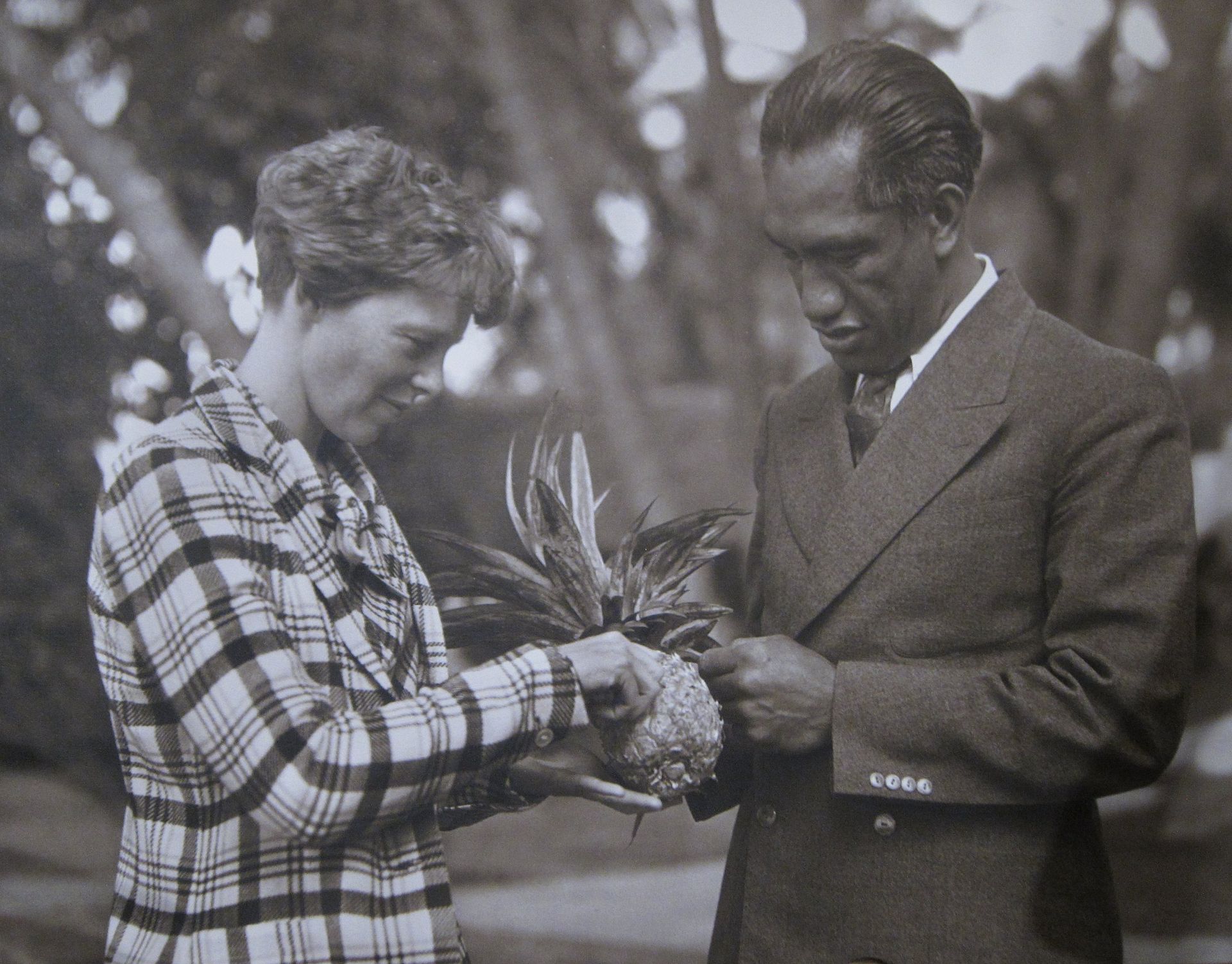
Amelia Earhart and Duke Kahanamoku in Hawaii in Dec., 1934 or Jan., 1935. (Credit: Matson Navigation Company)

After his swimming career, he returned to Honolulu, becoming sheriff of the city in 1934, a post he held until 1961. He helped define the term “waterman,” continuing to act as an ambassador for surfing and ocean water sports in general.

During the 1960s, he acted as the designated official greeter to dignitaries and celebrities arriving in Hawaii. He died of a heart attack on Jan. 22, 1968, at 77. His ashes were scattered into the Pacific.
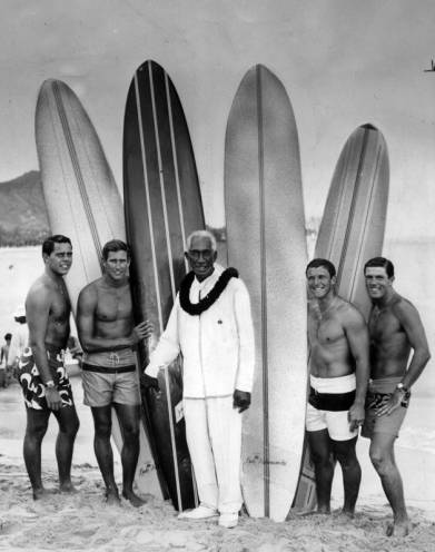
Duke Kahanamoku gathers his competition surfing team together for a briefing prior to the 1965 U.S. Open championships at Huntington Beach. From left: Paul Strauch, Joey Cabeli, The Duke, Fred Hemmings and Butch Van Artsdalen. Sept. 23, 1965. (Credit: Los Angeles Public Library Photo Collection)

The tributes to the Duke have been numerous. He was the first athlete to be inducted into both the international Swimming Hall of Fame and Surfing Hall of Fame, as well as being named to the U.S. Olympic Hall of Fame.
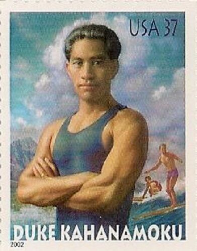
The first international big-wave surfing event at Sunset Beach on Oahu’s North Shore, held in 1965, was named the Duke Kahanamoku Invitational Surfing Championship in his honor.

Statues saluting him have been erected in Huntington Beach, at New South Wales, Australia, in Christchurch, New Zealand (where he introduced surfing in 1915), and, of course, in Honolulu. In addition to the iconic statue, the city also has named a section of Wakiki as “Kahanamoku Beach.”

Surfer magazine named him as its “Surfer of The Century” in 1999, and he was honored with his own postage stamp by the U.S. Postal Service in 2002.
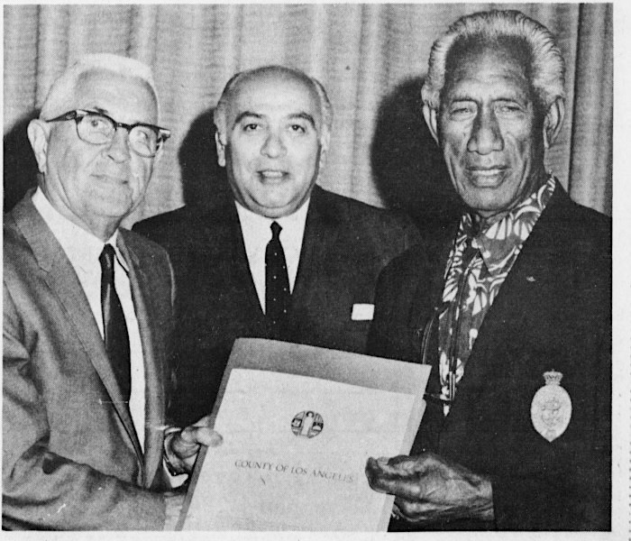
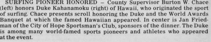
Palos Verdes Peninsula News, June 28, 1967, Page 29.  (Credit: Palos Verdes Peninsula News)

Sources:

Daily Breeze files.

“Hall of Fame: Duke Kahanamoku,” United States Olympic & Paralympic Museum website.

“Heroes of Swimming: Duke Kahanamoku,” Heroes of Swimming blog, The Guardian.

Los Angeles Herald files.

Los Angeles Times files.

Palos Verdes Peninsula News files.

San Pedro News Pilot files.

Torrance Press-Herald files.

Wikipedia / Wikimedia Commons.

Further reading:

Waterman: The Life and Times of Duke Kahanamoku, by David Davis, University of Nebraska Press, 2015.
 

Historic Wilmington Cemetery has weathered its share of storms

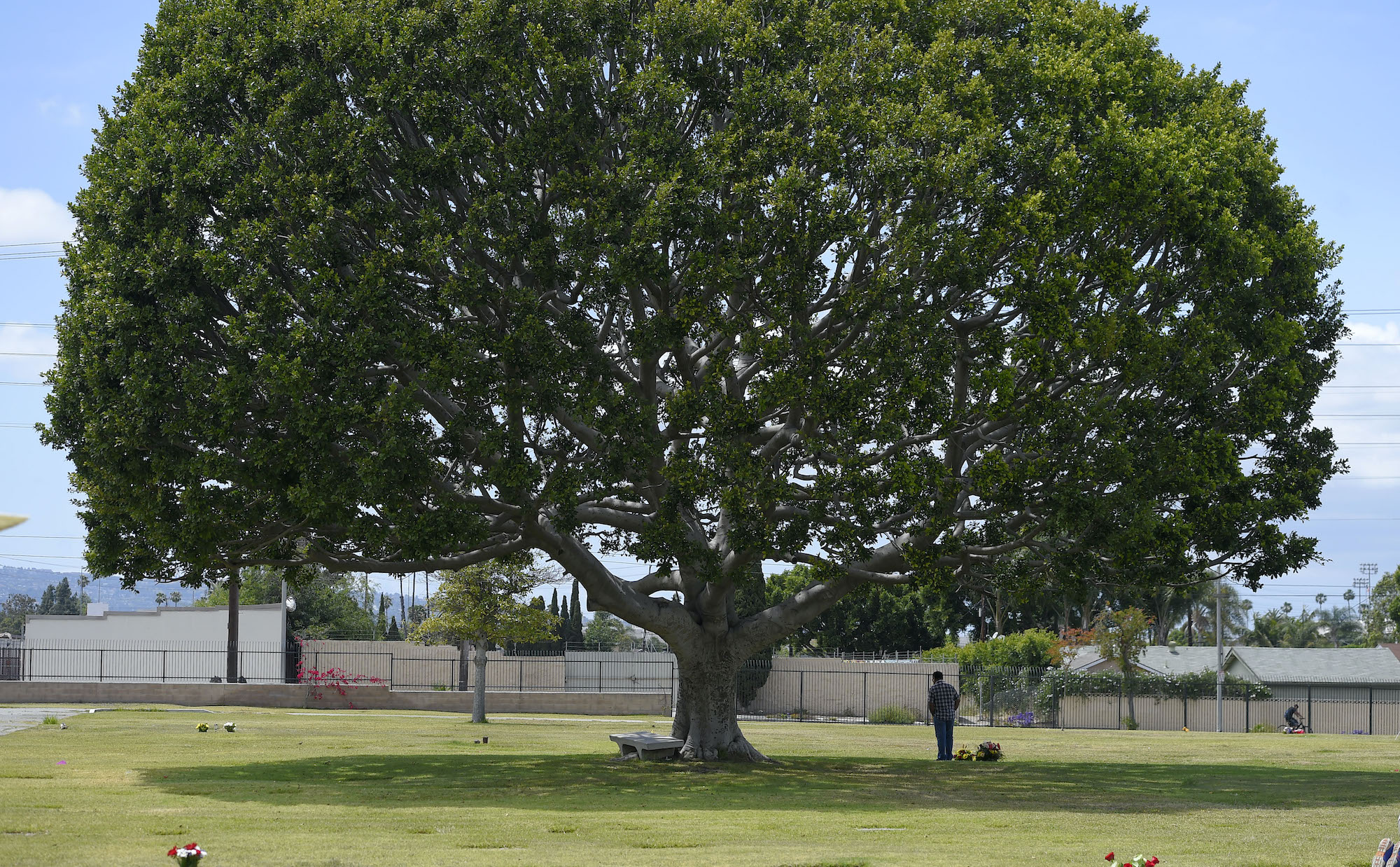
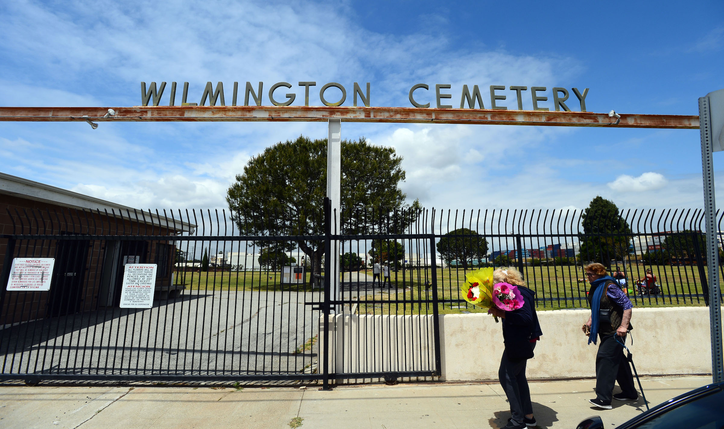
A pair of women arrive with flowers at the Wilmington Cemetery on May 10, 2017.  (Daily Breeze staff file photo)

Phineas Banning built the Wilmington Cemetery in 1857 on three and a half acres of land in the town named for his Delaware city of origin. He designated a separate fenced plot for his family members on its grounds following the death of his 2-year-old son.

The cemetery, originally operated by the Wilmington Cemetery Association, was expanded when Joseph Pashke and his son acquired an additional four acres in the years after Banning’s death. It would eventually grow to 10.2 acres.

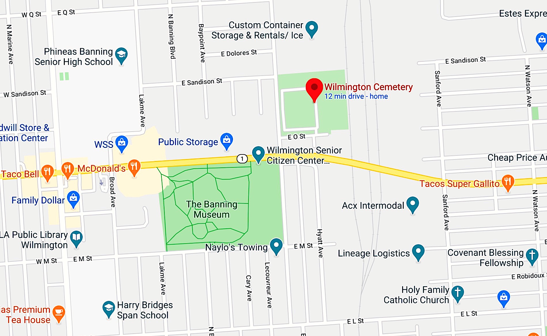
(Credit: Google Maps)

Located at Eubank and O streets just northeast of Banning Park and the Banning Mansion, it’s the oldest active graveyard in Los Angeles County.

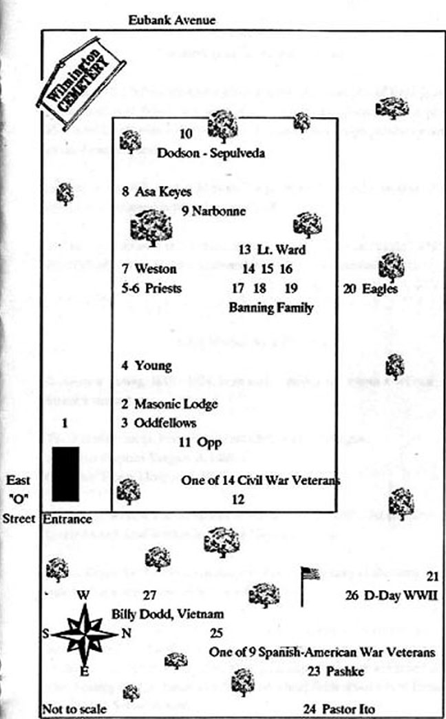
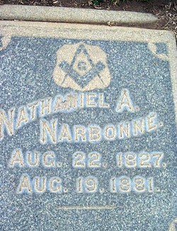
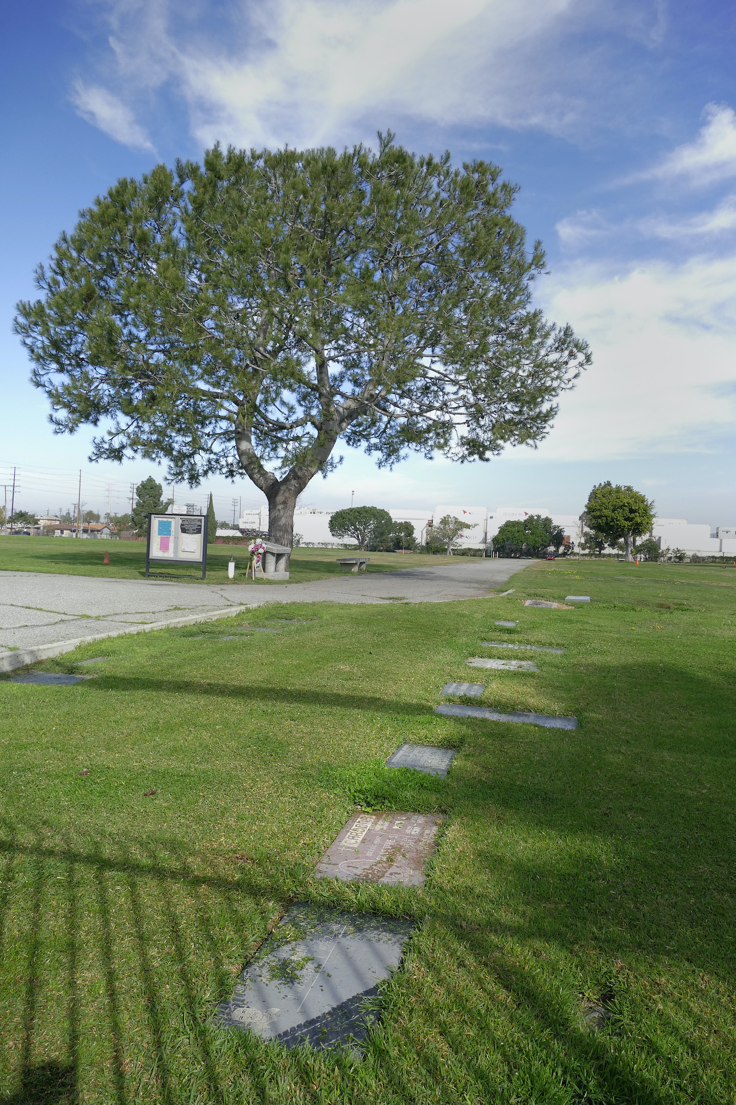
Many important historical figures are buried there, including members of pioneer families the Carsons, the Sepulvedas and the Dodsons. Nathaniel Narbonne and his wife are buried there, as is Juan Antonio Machado, after whom Machado Lake in Harbor City is named.

Diagram shows location of historic gravesites at Wilmington Cemetery. (Credit: Wilmington Historical Society, via Findagrave website)

37 Civil War veterans lie in repose there, as do soldiers from the Spanish-American War and from the Normandy D-Day invasion. The cemetery annually hosted large

Decoration Day (later to become Memorial Day) ceremonies honoring America’s war dead dating at least back to the1880s. 

(Credit: Floydster, via Findagrave website)

Banning’s first wife and five of his children are buried in the designated family area. Banning himself was interred at the cemetery following his death in 1885, but he’s no longer there.

His second wife, Mary, had specified that his body be moved to a grave next to hers at the tonier Angelus-Rosedale Cemetery in the Pico-Union district south of downtown Los Angeles following her death in 1919.

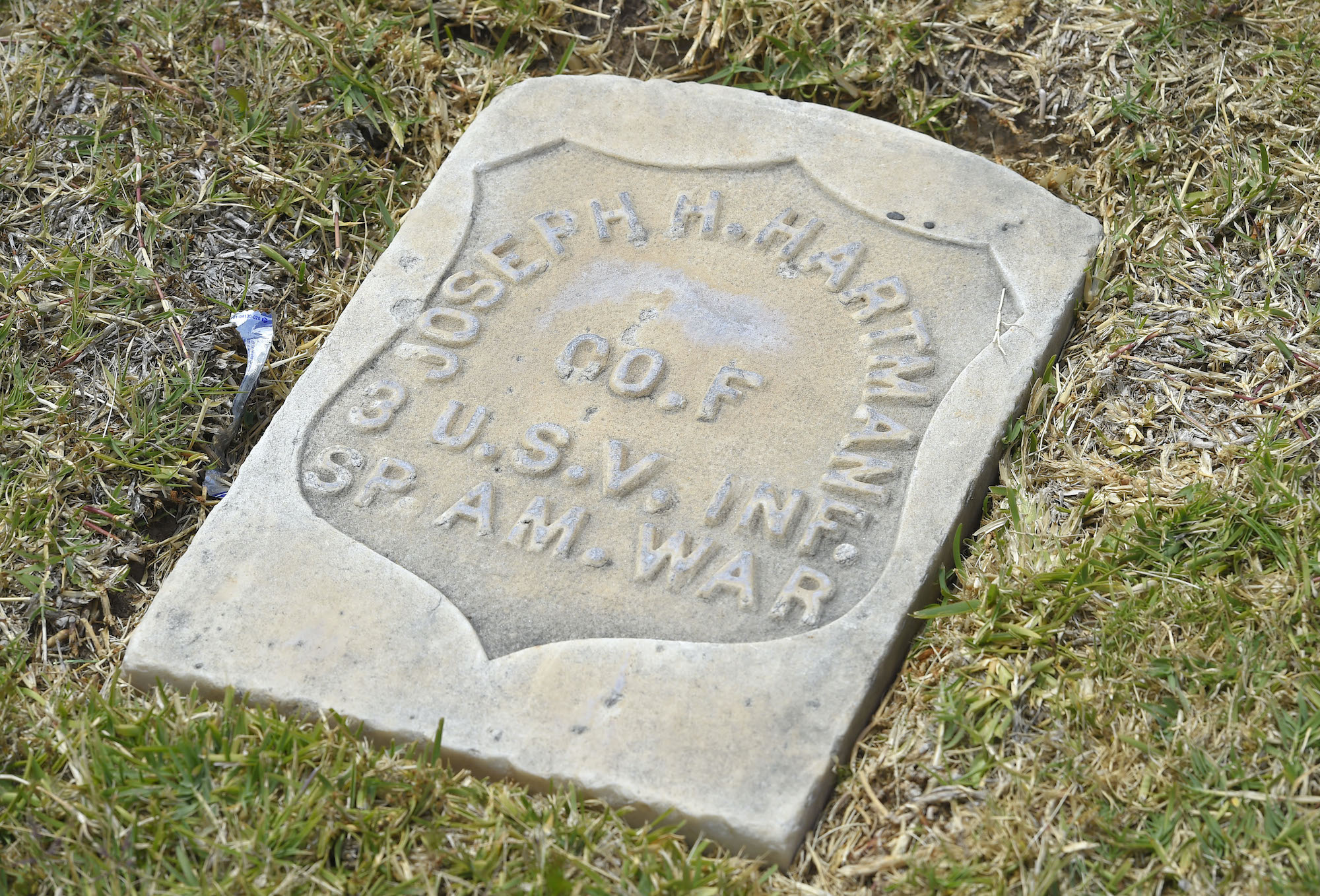
In 1922, a Spanish-American War veterans group dedicated a special area of the cemetery where the “Boys of ‘98” were buried. The United Spanish War Veterans also purchased an additional 210 plots for future former soldier interments.

Deteriorating conditions and financial difficulties at the cemetery led to the formation of the Wilmington Cemetery District by the county Board of Supervisors in 1958, 101 years after the cemetery’s creation.

Passage of Proposition CC that November created an assessment district that collected tax revenue for the continued maintenance of the historic burial ground, with the aim of preventing it from future financial difficulties.

In 1963, the cemetery became a publicly operated facility governed by a regulatory board, with money for its employees and maintenance provided by tax funds managed by the county.

(Credit: Floydster, via Findagrave website)

It worked for a while, but in 1987, financial mismanagement led to the first of an ongoing series of troubles at the cemetery when its three employees stopped receiving their paychecks due to a lack of funds. Neighbors also complained of poor maintenance, including trash, weeds and overgrown grass at the cemetery.

It was shut down for about a month, but was reopened after receiving a $36,000 loan from the city of Los Angeles and a $20,000 gift from Exxon Corp.

In 1989, local historian Gertrude Schwab led a successful effort to have the cemetery declared a city monument by the Los Angeles City Council.

But its recurring troubles exploded in 1991 with the discovery that bodies were being buried improperly in too-shallow graves. Some caskets were buried mere inches under the soil or were placed on top of other caskets, while others were identified incorrectly.

Many service members, including this victim from the Spanish American War, are buried at the Wilmington Cemetery. 2017 photo. (Daily Breeze staff file photo)

Bereaved families threatened lawsuits, and the state even passed a law defining  depth-of-burial requirements as a result. The cemetery’s caretaker was accused of embezzling funds meant for the cemetery, and was replaced by Joseph Poland in 1991.

The controversy lasted into 1994, with nearly 200 graves affected by the mismanagement. Poland supervised much of the necessary repair work, but then it was discovered that he had also begun operating a scam selling nonexistent burial plots at the cemetery.

He pleaded guilty to fraud charges and began serving a three-year prison term in 1999.

Heavy winter rains caused the closure of the cemetery again in February 2017. The soaked grounds lead to the sinking and dislodging of headstones and graves, though no remains were exposed.

The damage was serious enough to lead Supervisor Janice Hahn to widen the cemetery’s assessment district, which hadn’t been enlarged since 1958, in order to increase its funding so that proper maintenance could be performed more consistently.

As she told Daily Breeze reporter Donna Littlejohn in May 2017, “When I toured that storm damage I promised to get the Wilmington Cemetery District the funding it needs to make repairs and maintain the cemetery in a way that respects its history and the memories of those buried there.”

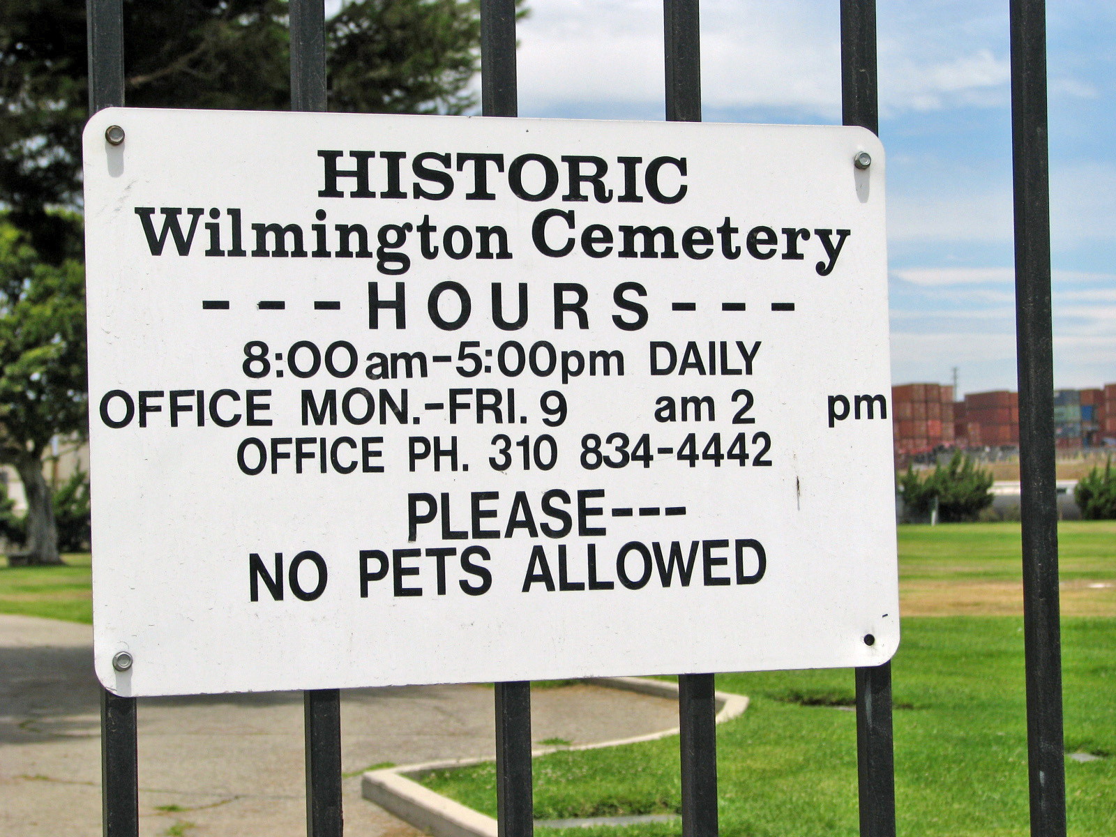
Since then, problems at the historic cemetery at 605 E. O St., where more than 11,000 people are buried, seem to have subsided.

A man visits a grave under a large tree at the Wilmington Cemetery on May 10, 2017. (Daily Breeze staff file photo)

Sources:

Daily Breeze files.

Findagrave website.

Los Angeles Herald files.

Los Angeles Times files.

San Pedro News Pilot files.

The Wilmington Cemetery during its 2017 closure while work was done to shore up graves and headstones impacted by heavy rains. (Daily Breeze staff file photo)

The Polynesian restaurant brought South Seas atmosphere to the South Bay

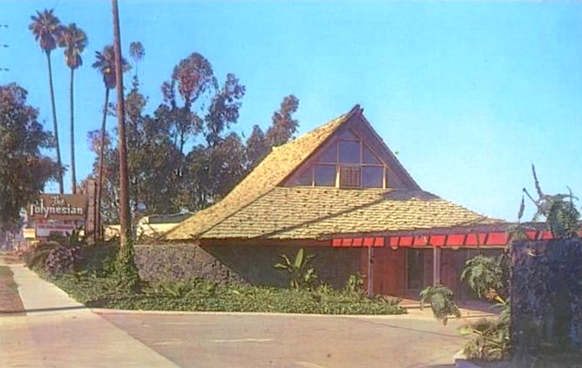
The Polynesian restaurant on Pacific Coast Highway in Torrance. Undated postcard.

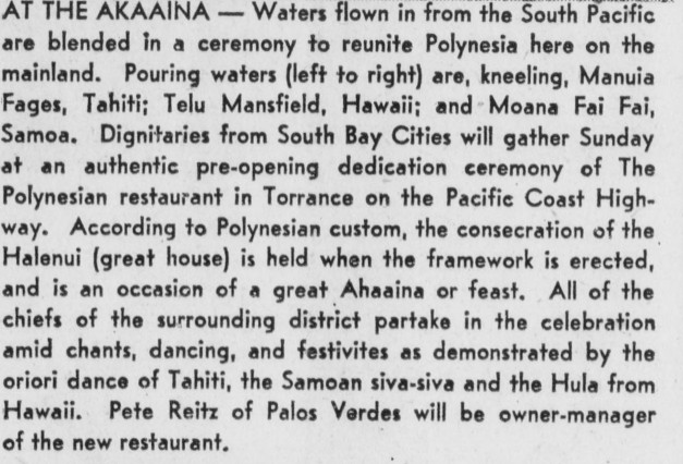
Pete and Pearl Reitz of Palos Verdes Estates often had traveled to Hawaii and other parts of Polynesia before opening their South Seas palace The Polynesian in Torrance.

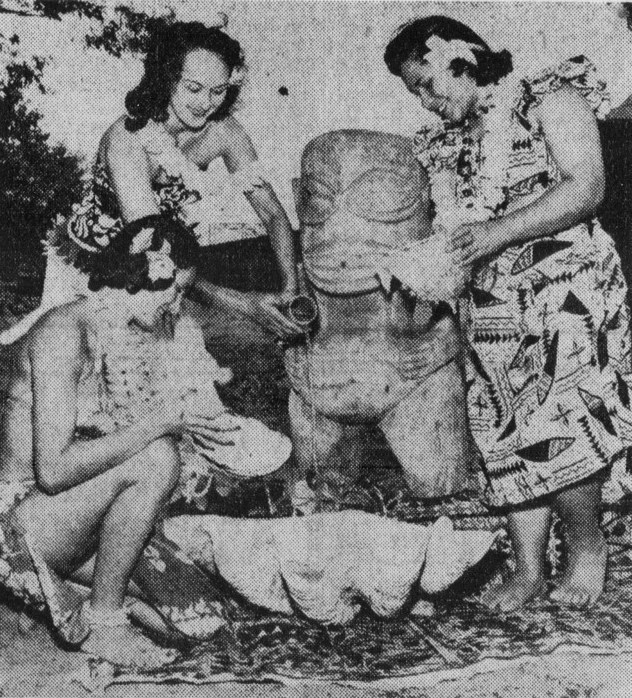
They were so enamored of the culture that they held the traditional Halenui home blessing ceremony and feast at their new restaurant while it was under construction at 3901 Pacific Coast Highway on Aug. 25, 1957, three months before it opened that November. They even used water brought in from the South Pacific to help do it.

Palos Verdes Peninsula News, Aug. 22, 1957, Page 8. (Credit: Palos Verdes Peninsula News)

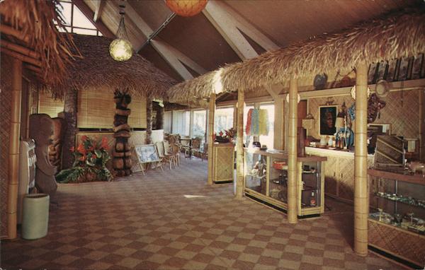
The restaurant lovingly re-created its South Seas ambience using the trappings of what would come to be known in later years as tiki culture. It was festooned with statues of idols, torches and artifacts, lots of palms and other exotic flora to frame diners enjoying authentic Polynesian cuisine. They even had a miniature volcano and waterfall built in the tropical garden, which also featured an ornate bridge.

It was a deluxe theme restaurant before the term came into common use, like its PCH neighbor, the Smith Bros. Fish Shanty, that had opened a decade earlier. The addition of other restaurants on the street such as The Parasol and Del Conte’s led to the corridor being termed Torrance’s “restaurant row.”

Interior of The Polynesian. Undated postcard.

Torrance Mayor Albert Isen was among the guests at the Halenui ceremony, and the restaurant would go on to become a popular meeting place for community groups as well as for adventurous diners. Traditional live Polynesian music and dancers also added to its ambience.

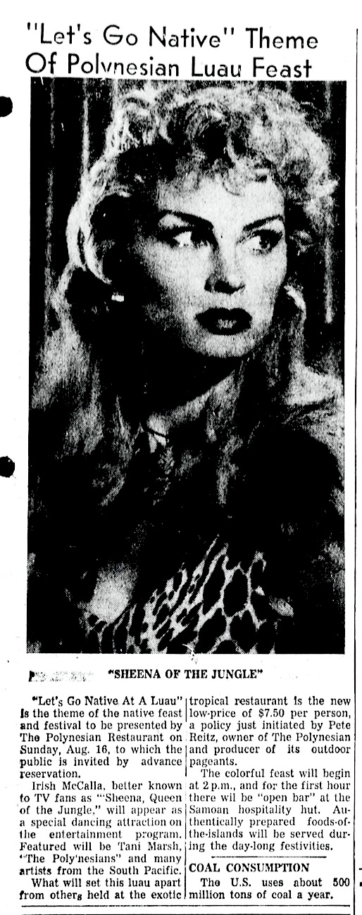
Organized luau feasts were also a mainstay, sometimes featuring guest dancers, including the “Sheena, Queen of the Jungle” television star herself, actress Irish McCalla. She was just one of many celebrities who would eventually grace the restaurant’s stage.

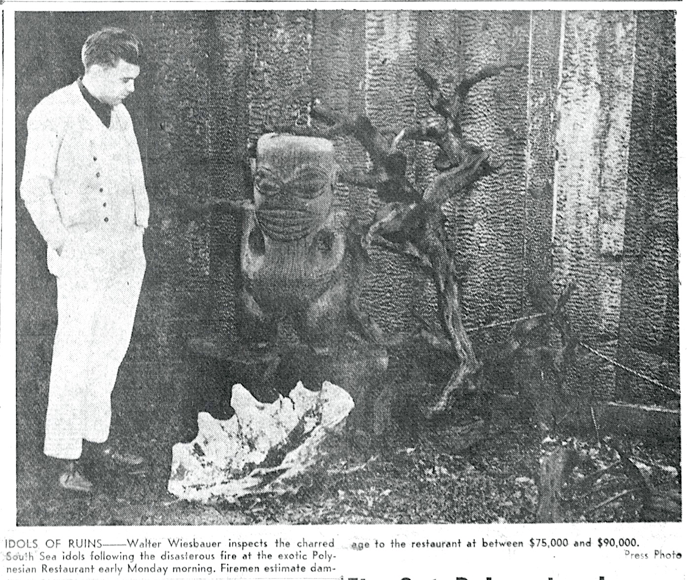
On Feb. 16, 1959, a fire of unknown cause gutted the interior of The Polynesian, though the kitchen was spared. The restaurant was closed for several months for rebuilding, and reopened in June 1960 with improved interior features designed by architect Earl Mason.

Torrance Press, Feb. 19, 1959, Page 1. (Credit: Torrance Historical Newspaper and Directories Archive database, Torrance Public Library)

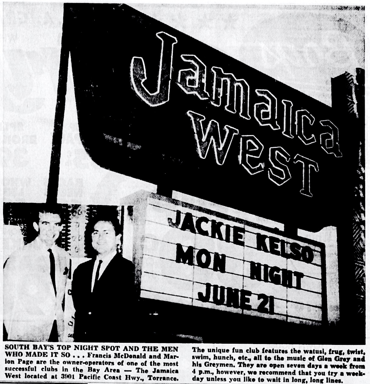
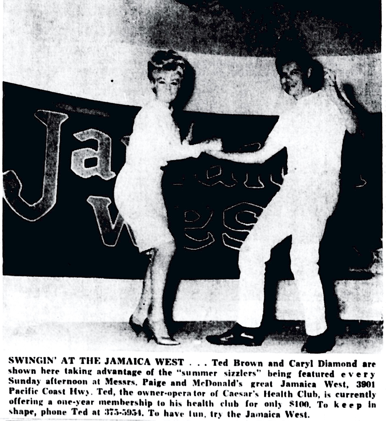
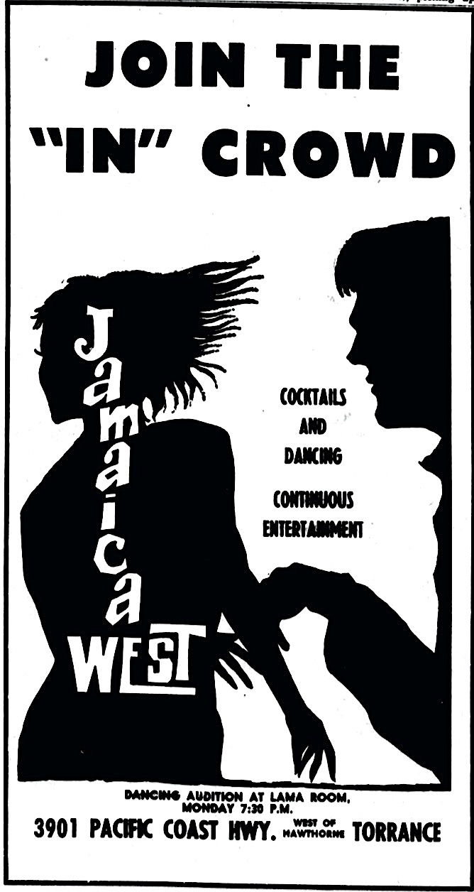
The Reitzes sold The Polynesian in 1964 to Frances McDonald and Marlon Page, who decided to revamp it as a more youth-oriented nightspot. They opened the renamed venue as Jamaica West on May 13, 1965, and they did it in their own different style.

They chose the fast-rising Sonny & Cher as their opening night musical act. Three months later, “I Got You Babe” would spend three weeks at #1 in the charts. The story of that night’s  opening act, South Bay family band The Scuzzies, is too long to retell, but you can read all about it here.

Torrance Press-Herald, June 30, 1965. (Credit: Torrance Historical Newspaper and Directories Archive database, Torrance Public Library)

Jamaica West emphasized dining and dancing, with a large dance floor, and glass cages with go-go dancers. House band Glenn Grey and His Greymen provided the swinging sounds, and the emphasis was more on nightlife than tiki trappings.

Torrance Press-Herald, July 28, 1965, Page 8. (Credit: Torrance Historical Newspaper and Directories Archive database, Torrance Public Library)

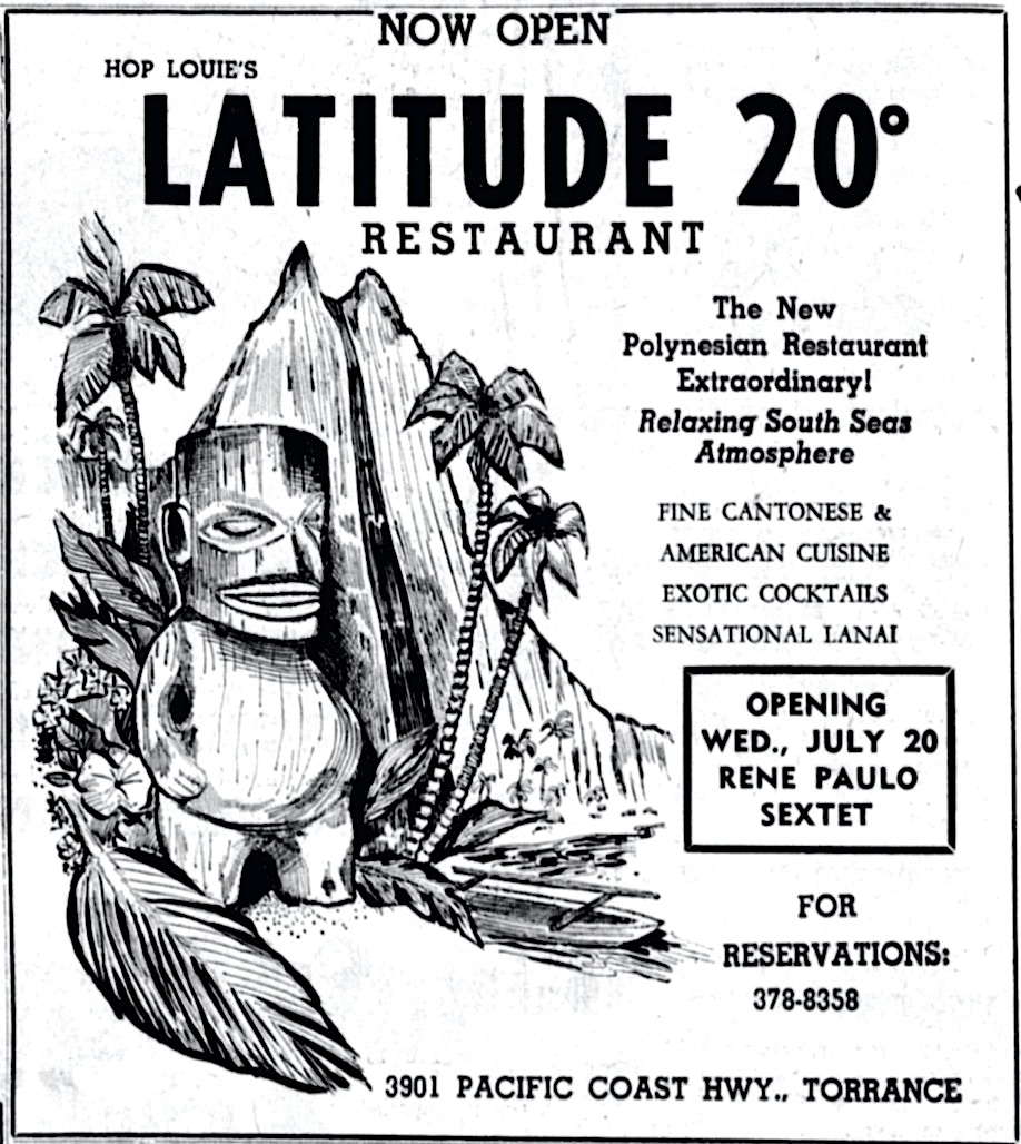
Jamaica West barely lasted a year. Chinatown restaurateur Hop Louie took over the club, renaming it Latitude 20 and reopening it on July 15, 1966. The name referred to the location of Hawaii, just part of Louie’s conscious attempt to return the restaurant to its cultural roots.

Latitude 20’s choice of entertainment reflected that, eschewing teen dance music in favor of more traditional Polynesian performers. Hawaiian crooner Ernie Manehune was a popular draw in the early years, as were bandleaders Martin Denny and Arthur Lyman.

Torrance Press-Herald, July 23, 1966. (Credit: Torrance Historical Newspaper and Directories Archive database, Torrance Public Library)

Lyman so enjoyed playing at the venue that he made his first album on the U.S. mainland there, recording and releasing “Latitude 20” in 1968.

This iteration of the restaurant actually had the longest run of any of those at the site, operating for more than two decades. Clarence “Charlee” Fong owned the club in its later years, keeping the Latitude 20 name and decor. During his tenure, exotica titans Denny and Lyman actually played a week of dates together there in 1977.

Latitude 20 and the Reitz’s Polynesian vision finally vanished for good in December 1980, when the club closed. (Charlee Fong went on to own the local Mexican restaurant chain Miguel’s.)

Possibly inspired by the craze inspired by the film “Urban Cowboy” (1980), a group of investors including KABC radio engineer-turned personality Patrick “Waco Pat” Patryla, took over the site and transformed it into Waco’s, a country western nightclub and restaurant. Country music legend Merle Haggard performed there on its opening night in 1981.

After Waco’s, its last incarnation was as Calamity’s, another restuarant/nighspot. Finally, the wrecking ball came in early 1984, turning the once-exotic Polynesian hotspot into a vacant lot.

The Ocean West Plaza strip mall now occupies the northwest corner of PCH and Ocean Ave., where palms trees and grass skirts once swayed, and a special ceremony blessing an as-yet-uncompleted restaurant building was held more than six decades ago.

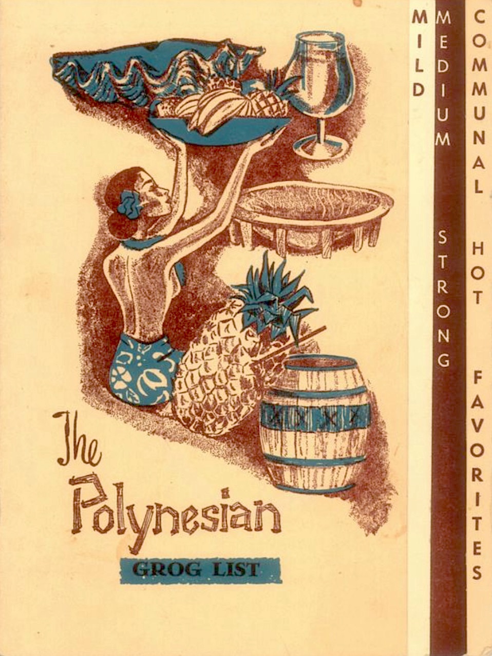
Cover of the bar menu from The Polynesian. (Credit: Critiki website)

Sources:

Critiki website.

Daily Breeze files.

Los Angeles Times files.

Palos Verdes Peninsula News files.

“Latitude 20 – Torrance, California,” Tiki Bar T-shirt website.

“Return to the Quiet Village,” by Chris Jepsen, Trader Chris’ Tiki Lagoon website, Sept. 28, 2012.

“The Scuzzies,” Doo Wop Heaven website.

Torrance Press-Herald files.

“Where Are They Now? Los Angeles Radio People,” compiled by Don Barrett, LARadio.com website.

Torrance Press-Herald ad, May 19, 1965, Page D3. (Credit: Torrance Historical Newspaper and Directories Archive database, Torrance Public Library)
Torrance Press, Aug. 13, 1959. (Credit: Torrance Historical Newspaper and Directories Archive database, Torrance Public Library)

Pietro Di Carlo’s successful life ends mysteriously on the San Pedro docks

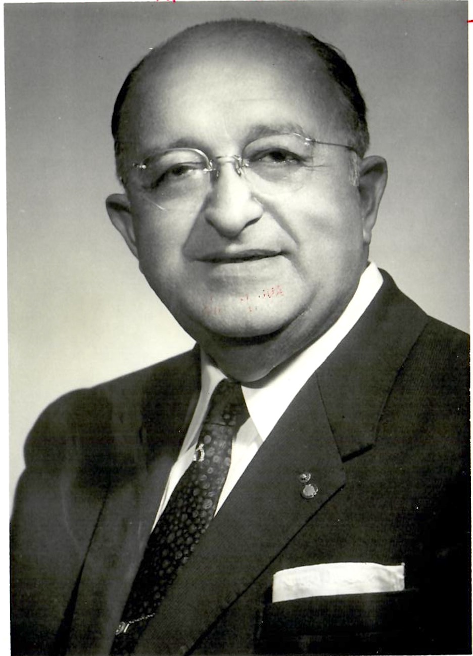
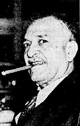
Pietro Di Carlo in 1966.

Last week, we told the story of San Pedro’s Di Carlo Bakery, founded by Italian immigrant Lorenzo Di Carlo in 1906.

Born in Italy on Feb. 14, 1898, Di Carlo’s son Pietro was a toddler when the family came to the U.S. in 1900. From a very young age, Pietro worked in the family business.

By the 1920s, he was the bakery’s general manager, a position he would hold for the next three decades.

After Lorenzo died, the family sold the business to Interstate Bakeries in 1958. Pietro left his post as general manager, and decided to go into a different business: finance.

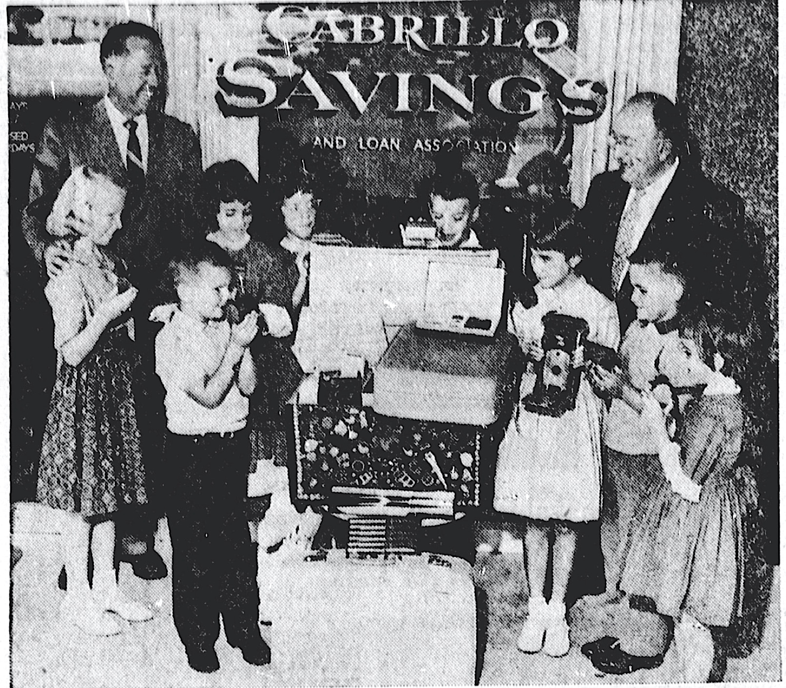
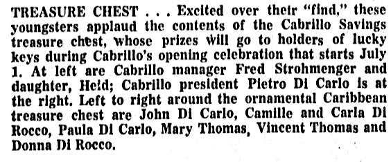
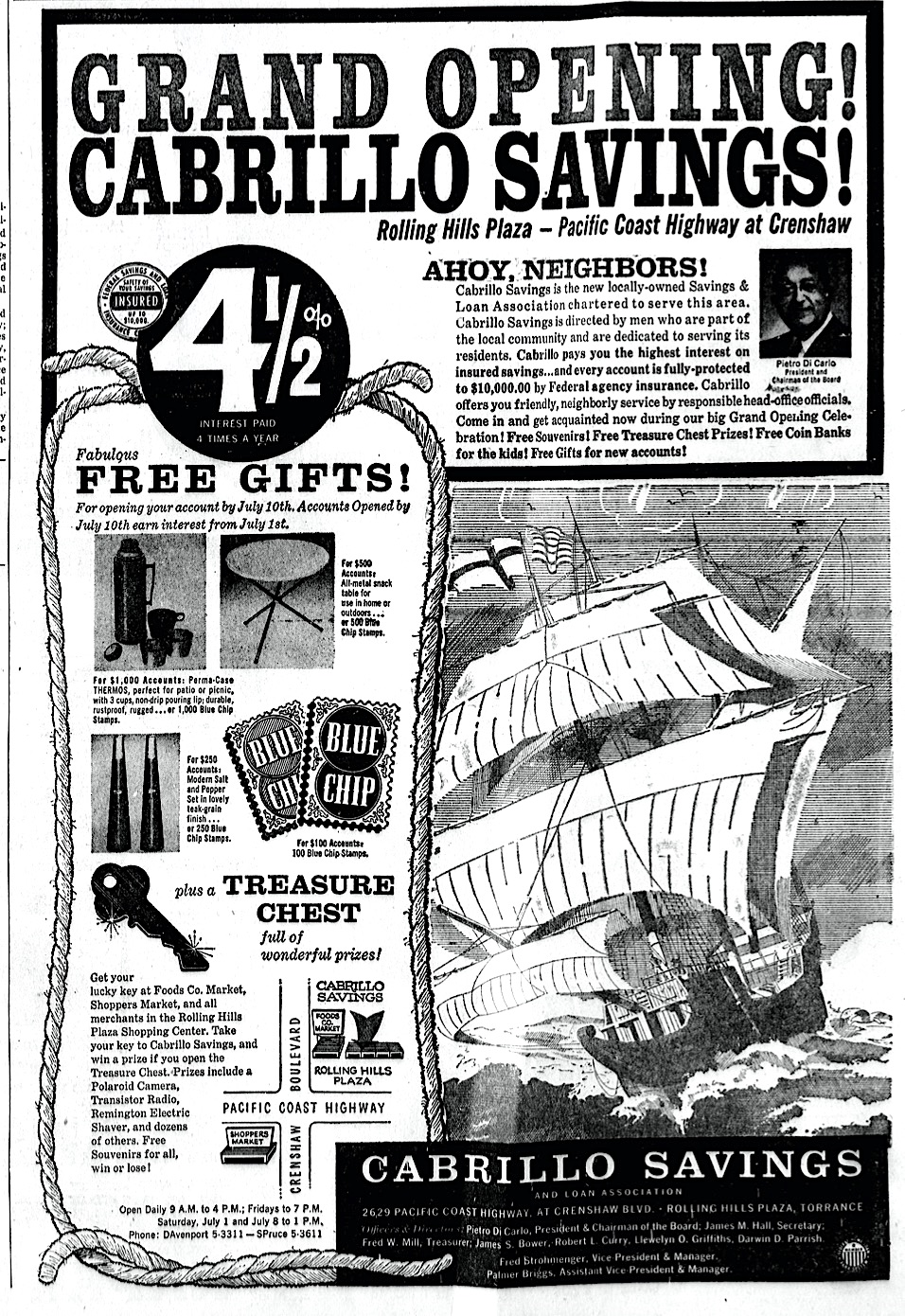
In 1961, Di Carlo started the Cabrillo Savings and Loan Association. The new savings and loan opened in the Rolling Hills Plaza shopping center in Torrance on July 1, 1961.

Torrance Herald, June 29, 1961, Page A-8. (Credit: Torrance Historical Newspaper and Directories Archive database, Torrance Public Library)

It paid 4.5% interest on savings accounts, and gave out premiums, and Blue Chip Stamps, for new accounts. Two years later, the thriving business moved into larger, custom-built quarters at the same shopping center. 

Di Carlo had remained active in the San Pedro community. He was a member of the Metropolitan Water District (MWD) board, and served on the board of the Fisherman and Merchants Bank of San Pedro.

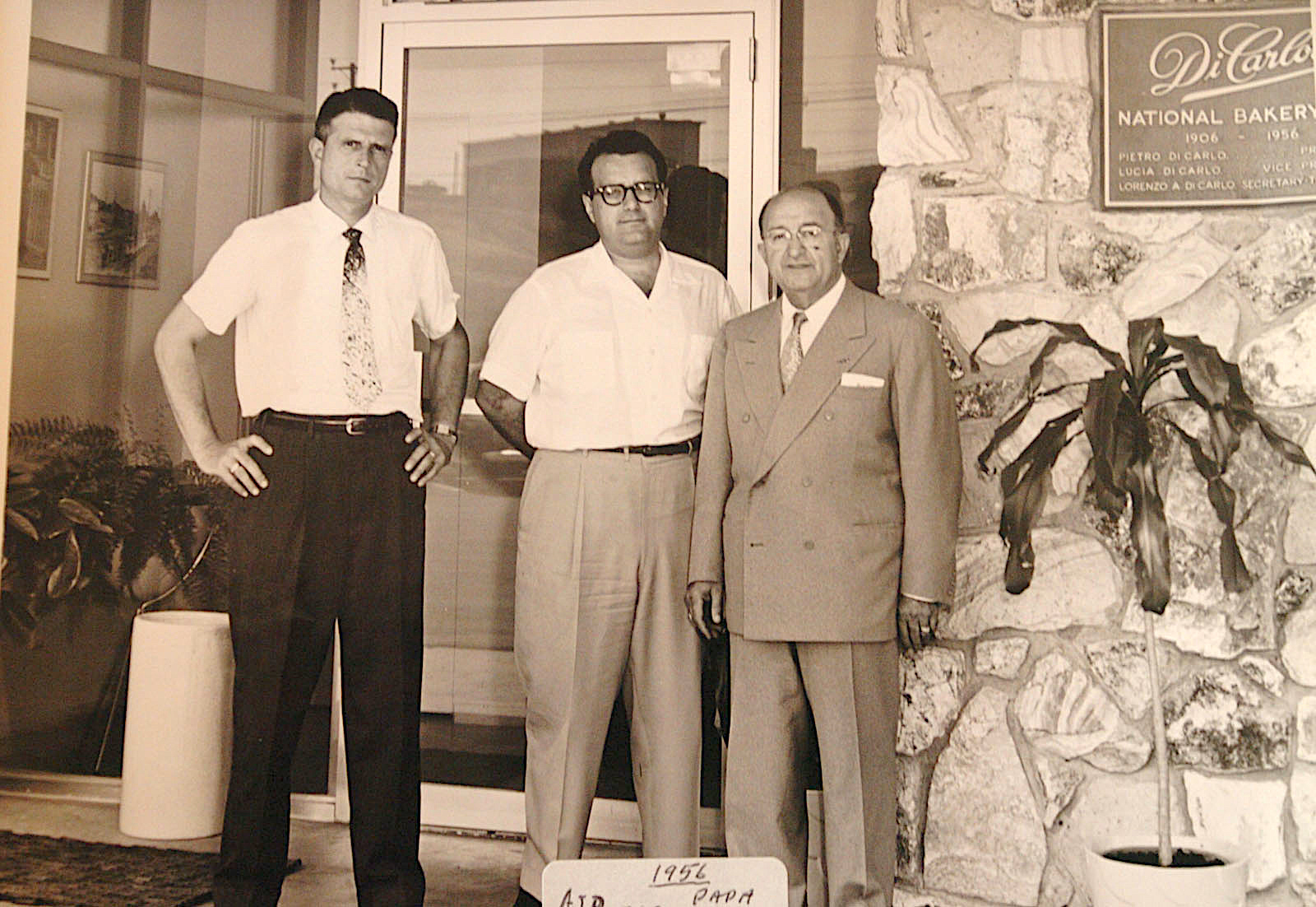
Pietro Di Carlo, right, with his son, Lorenzo (Lawrence), center, in a family archive photo taken in front of the Di Carlo Bakery in San Pedro in 1956. Man at left is unidentified. (Daily Breeze file photo)

On July 28, 1964, Los Angeles Mayor Sam Yorty appointed him to the Los Angeles Board of Harbor Commissioners. Di Carlo had been on the city’s zoning board, but switched spots with Gordon MacLean to join the harbor commission.

In 1966, Di Carlo succeeded George D. Watson as chairman of the Board of Harbor Commissioners. He was reappointed to that post for a second term in 1967.

One of the first projects he worked on was the proposed Cabrillo Marina, a 3,100-slip small boat marina just north of Cabrillo Beach, a scaled-down version of which opened in 1986.

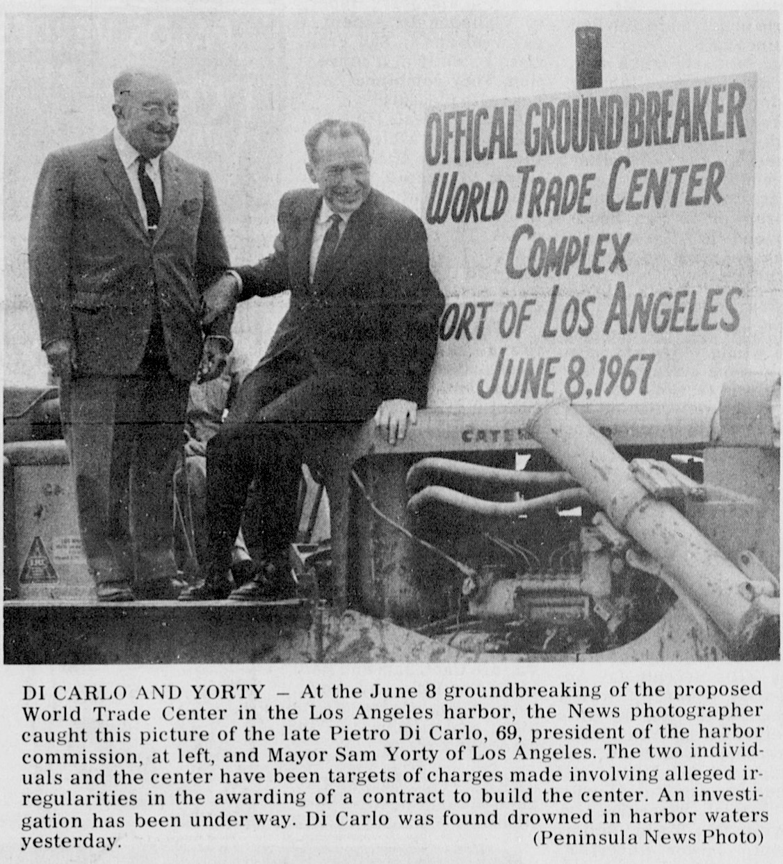
Pietro Di Carlo, left, and Mayor Sam Yorty. Palos Verdes Peninsula News, Nov. 8, 1967, Page 1. (Credit: Palos Verdes Peninsula News.)

But the project that embroiled Di Carlo and the commission in a furious controversy was the planned construction of the World Trade Center building on Terminal Island, part of a $200 million harbor development.

The center had been proposed five years earlier, and ground was broken for it on June 8, 1967. But it was the harbor commission’s awarding of the lucrative contract for its construction to Keith Smith’s San Sebastian Development Co. that sparked the firestorm.

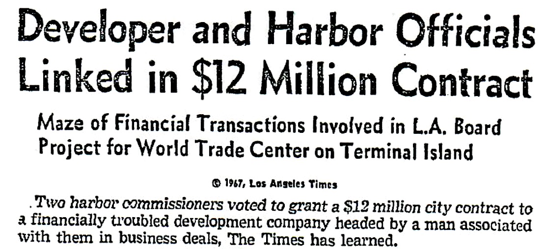
Smith, a San Pedro Resident, served on Yorty’s Human Relations Commission. The Los Angeles Times reported that Smith had business dealings with several commission members at the time they awarded him the $12 million contract without competitive bidding. Four commissioners, including Di Carlo, voted in favor.

Smith also had a banking relationship with Cabrillo Savings, according to the Times’ Oct. 18, 1967 story, and had bought 19,620 shares in the firm at above-market value prior to the awarding of the contract. The major investigative piece also detailed the financial woes of  Keith Smith and his firm, San Sebasatian.

Los Angeles Times, Oct. 18, 1967, Page 1. (Credit: Los Angeles Times online archives)

Over the next couple of weeks, Di Carlo and Smith issued forceful denials of the improprieties suggested in the Times expose, and Yorty called the newspaper’s report “lies,” a “smear” and “full of innuendo,” though he offered no evidence to counteract its claims.

On Nov. 7, 1967, Di Carlo attended 6 a.m. Mass at Mary Star of the Sea Church in San Pedro with his wife. He drove her home afterward, leaving for work at 9 a.m.

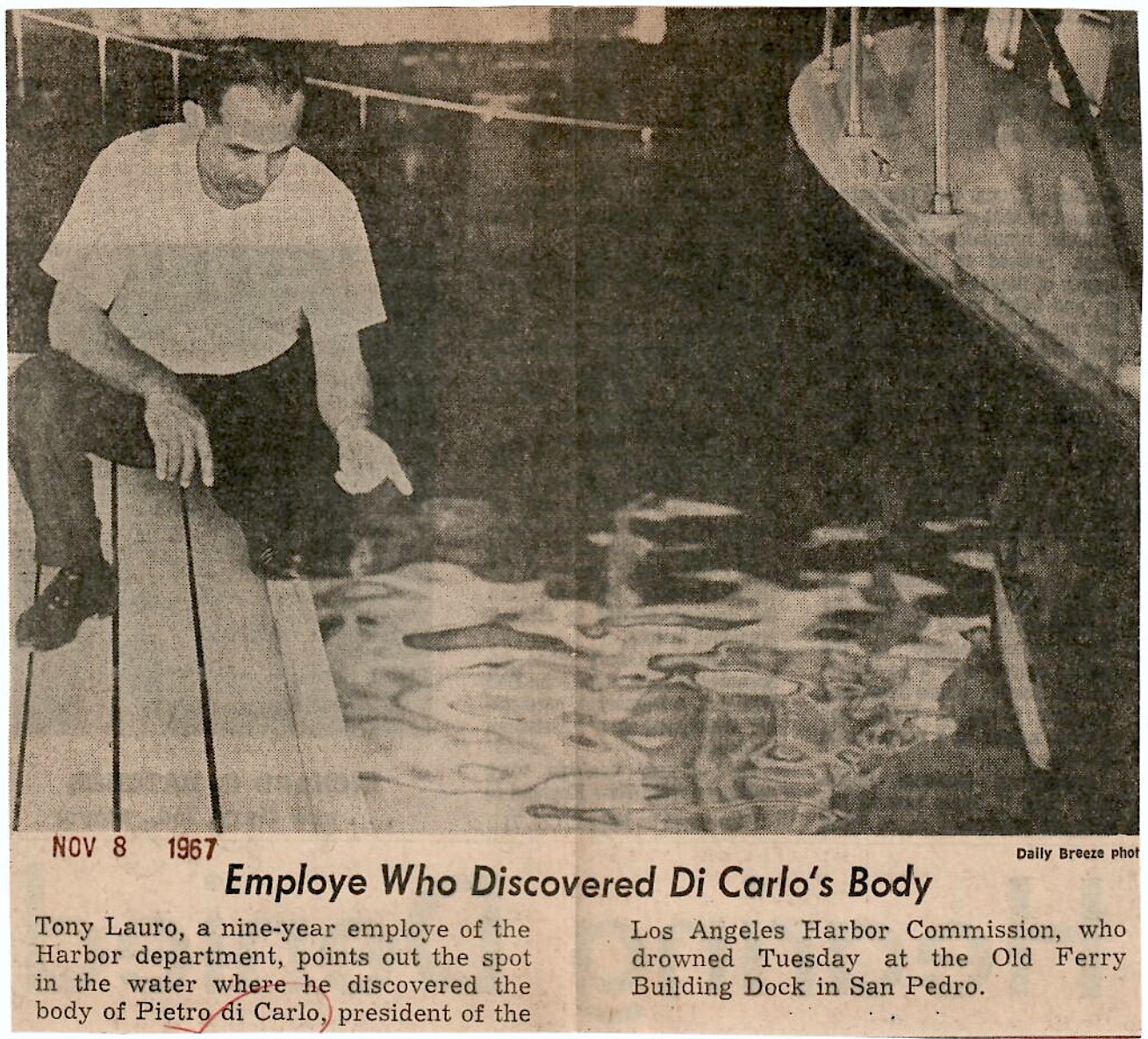
At 9:55 a.m., Harbor Department employee Tony Lauro found Di Carlo floating face down in 20 feet of water in a covered boathouse behind the old Ferry Building (now the Los Angeles Maritime Museum) near Berth 84. He was clad in a dark business suit, his hat floating near his lifeless body. He was still wearing his glasses and had two rings on his fingers and $84 in his wallet. No one saw him enter the boathouse.

Daily Breeze, Nov. 8, 1967, Page 1.

The county coroner’s office ruled Di Carlo’s death accidental, and a LAPD investigation reported no evidence to indicate suicide or foul play. His wife noted that Di Carlo, a diabetic, had gone to the boathouse to reserve a boat so the family could visit the incoming Queen Mary, and must have had a dizzy spell, slipped on the narrow walkway and drowned.

Palos Verdes Peninsula News, Dec. 31, 1967, Page 1. Click to enlarge. (Credit: Palos Verdes Peninsula News)

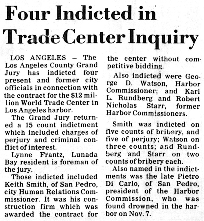
The L.A. County Grand Jury opened a criminal investigation of the World Trade Center deal on Nov. 15, just days after Di Carlo’s death. Indictments against the developer, Smith, three present and former harbor commissioners, and a posthumous one against Di Carlo, followed on Dec. 28.

The harbor commissioners were convicted and forced to give up their seats. Smith spent the next couple of years in litigation, and went on trial in San Francisco on bribery charges related to the case. He eventually was acquitted, and made an unsuccessful attempt to retake control of the World Trade Center project in a 1973 civil suit.

As it turned out, the proposed World Trade Center project never came to fruition, with the U.S. Customs House, built in 1967, its only present-day remnant.

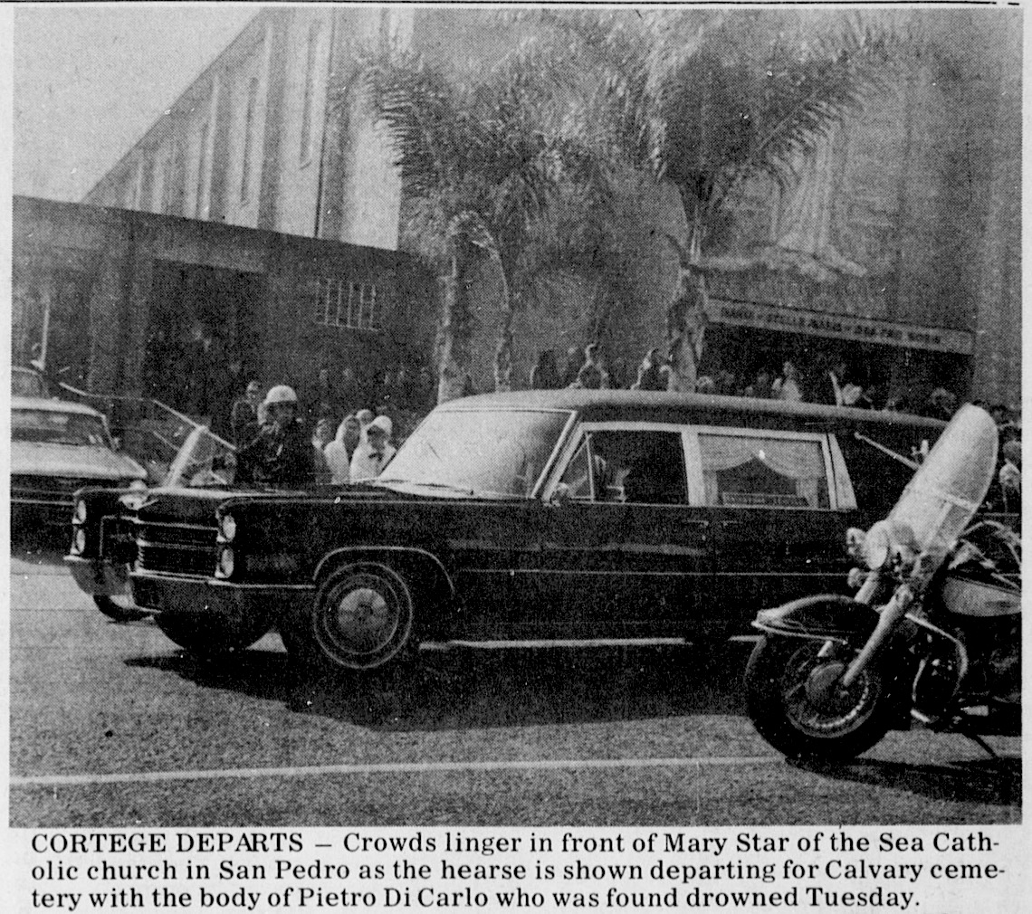
Hundreds attended Di Carlo’s funeral Mass at Mary Star of the Sea Church on Nov. 10, 1967, and business associates and politicians, including Yorty, praised him and paid him tribute. But the exact circumstances of his death remain a mystery to this day.

Palos Verdes Peninsula News, Nov. 12, 1967, Page 1. (Credit: Palos Verdes Peninsula News)

Sources:

Daily Breeze files.

Los Angeles Times files.

Palos Verdes Peninsula News files.

Torrance Press-Herald files.

Grand opening ad for Cabrillo Savings and Loan. Torrance Herald, June 29, 1961, Page A-8. (Credit: Torrance Historical Newspaper and Directories Archive database, Torrance Public Library)

Di Carlo Bakery served up goodness to San Pedrans for almost 100 years

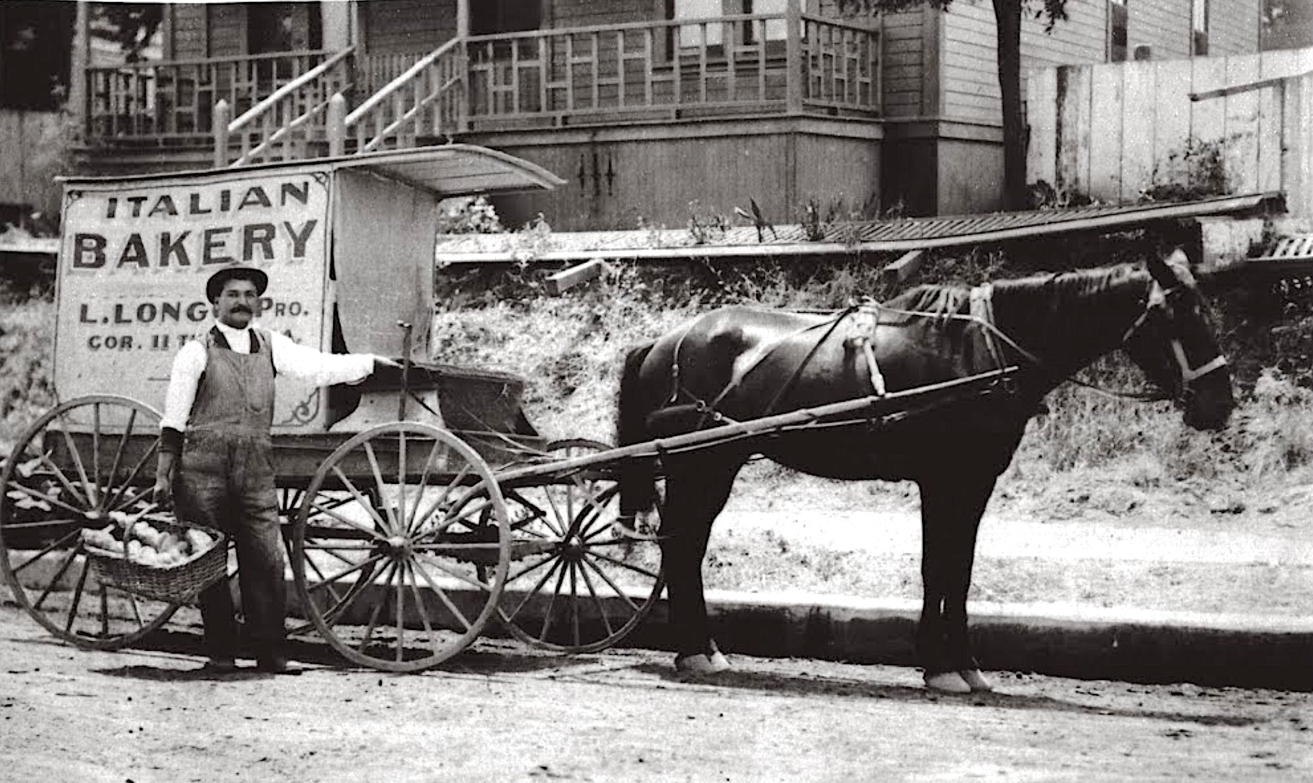
A horse-drawn truck delivers fresh goods from the Di Carlo family bakery. Undated photo ca. 1910-15. (Credit: San Pedro Bay Historical Society)
Lorenzo Di Carlo came to the United States from Italy with his wife, Filomena, and three-year-old son, Pietro, in 1901.

Lorenzo Di Carlo ca. 1939.
(Credit: San Pedro News Pilot archives)

The family settled in Steubenville, Ohio, where Lorenzo, originally a glass blower, found a job as a railroad worker. He saw an opportunity to start his own business, opening a bakery for his hungry fellow railmen. They had a tough time making a go of the business, though, and Lorenzo began looking west for a better location.

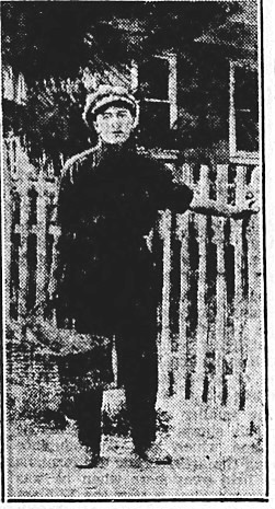
A young Pietro Di Carlo delivers loaves of bread from his basket at Second and Centre streets in San Pedro in 1908. (Credit: San Pedro News Pilot archives)

They decided on San Francisco, but arrived just after the legendary 1906 earthquake had destroyed much of the city, including the bakery where he planned to work.

The bakery’s owner directed him to San Pedro, which was then booming due to activity surrounding the soon-to-be-opened official Port of Los Angeles, which had a large Italian population amongst its growing workforce.

The Di Carlos made the move, and Lorenzo immediately built a brick baking oven in the back yard of their San Pedro house.

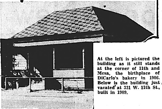
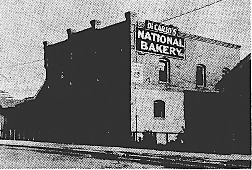
They set up their first bakery, called the National Bakery, in a building at 11th and Mesa streets. The small business thrived, and in 1909, they moved the bakery into a building at 331 W. Eleventh St.

Filomena handled most of the baking at first, with Lorenzo handling the books. Young Pietro was enlisted as a delivery boy, first walking the streets with a basket full of fresh bread, and later operating a horse-drawn delivery wagon.

Photos from the Nov. 3, 1939, San Pedro News Pilot show the original bakery site, top, and the 331 W. 11th St. bakery opened in 1909, bottom. (Credit: San Pedro News Pilot archives)

Eventually, the bakery’s delivery wagons would be replaced by a fleet of motorized delivery trucks.

By 1925, Pietro had become the National Bakery’s manager, and the family had moved to a showplace home atop a hill at 833 Oro Terrace in the new Vista del Oro tract. But many San Pedrans were  surprised to hear the announcement in May that the Di Carlos had decided to sell the bakery to Albert Albini of Bell.

After two years away from the bakery, the Di Carlos purchased it back from Albini in June 1927. Upon reacquiring their former business, they renamed it the Di Carlo National Bakery. They also planned to build a new plant on 14th St., but settled instead on remodeling their 11th St. plant.

The firm was able to continue operations after the Depression hit. Lorenzo would give record books to struggling families, who would use them to keep track of their bread purchases and pay back what they could when they could.

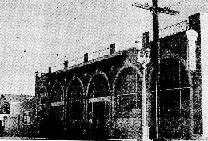
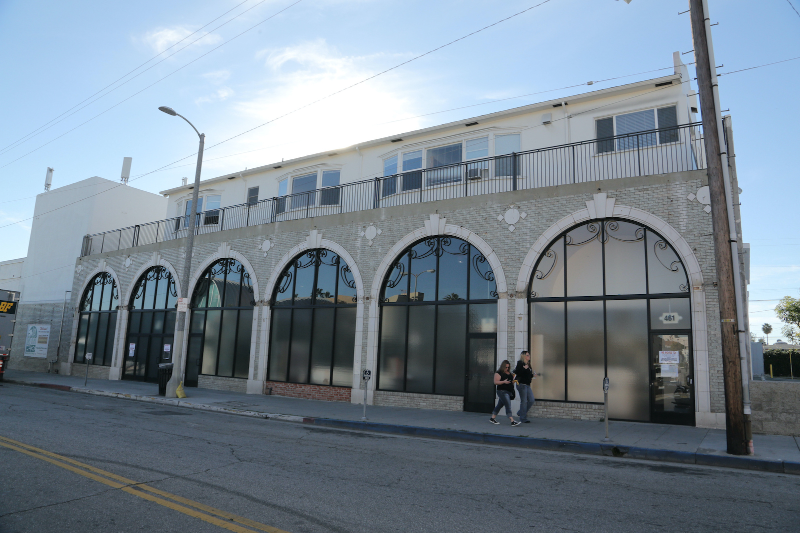
The one-time Ford dealership that became the Di Carlo National Bakery at 461 W. 9th St., top photo, now houses a charter school. The building was unoccupied in this 2014 file photo, bottom. (Credit: San Pedro News Pilot archives, top; Daily Breeze 2014 file photo, bottom)

After weathering the economic storm, the family decided to move its plant to larger quarters. They chose to remodel the former Soderstrom Ford building at 469 W. Ninth St., near Pacific Ave.

The work was completed in Nov. 1939, when it was shown off with tours given at a public open house. The remade facility contained all new equipment. The business would operate there for the next 18 years.

In 1957, the Di Carlos bought a 10-acre parcel of land just south of the San Pedro Drive-in Theatre on N. Gaffey St., where they built a whole new bakery plant from scratch. At the time, it was the largest independently owned baking company in California.

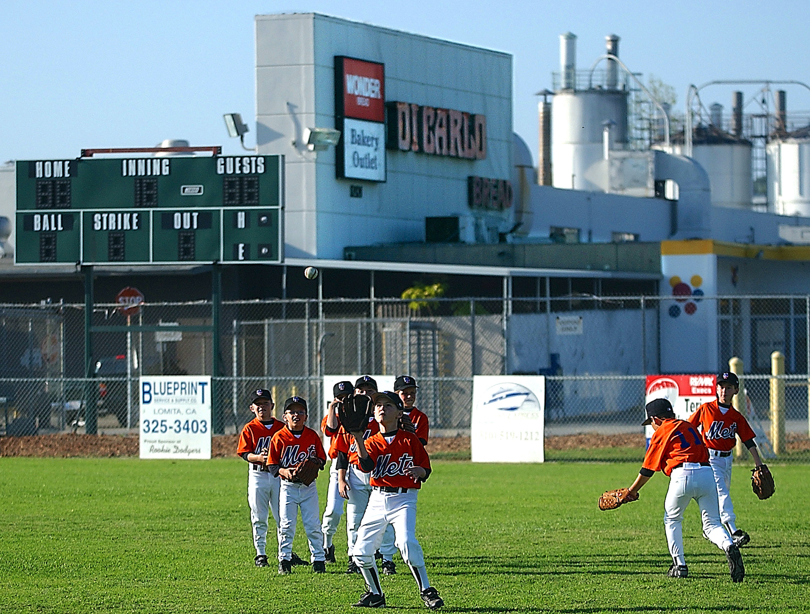
Eastview Little Leaguers warm up before a game at Joe Grigorio Field in San Pedro, owned by the adjacent DiCarlo Bakery, which closed in 2004. (Daily Breeze staff file photo)

A year later, the family sold the firm to the Continental Baking Co. After decades as general manager, Pietro decided to leave the family business and pursue a career in finance. (We will tell the rest of his story in next week’s post.)

In 1961, the Di Carlo family signed a deal with the Eastview Little League, leasing three acres of the property at 1701 Gaffey St. to them for $1 a year.

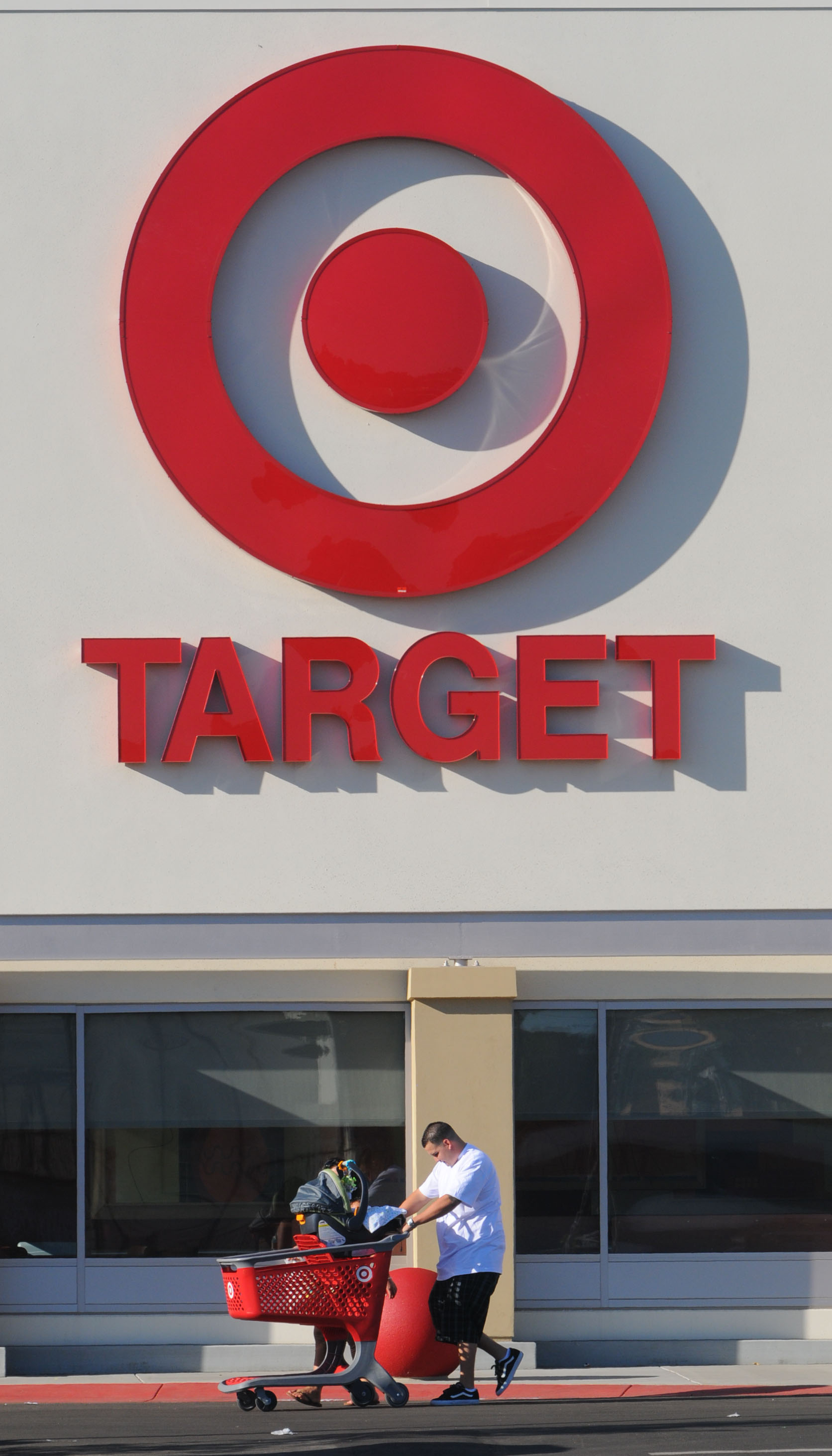
Shoppers leave the San Pedro Target on their first day open for business. Oct. 8, 2008. (Daily Breeze staff file photo)

The league would be thrown into chaos decades later when the bakery’s last corporate owner, Interstate Bakeries Inc., announced it would be closing the Di Carlo Bakery complex on May 14, 2004, forcing its 184 workers to find new employment.

Four months later, Interstate Bakeries declared bankruptcy. In July 2005, Target purchased the Di Carlo land for $18.7 million at Interstate’s bankruptcy auction, and announced plans to build one of its big-box stores there.

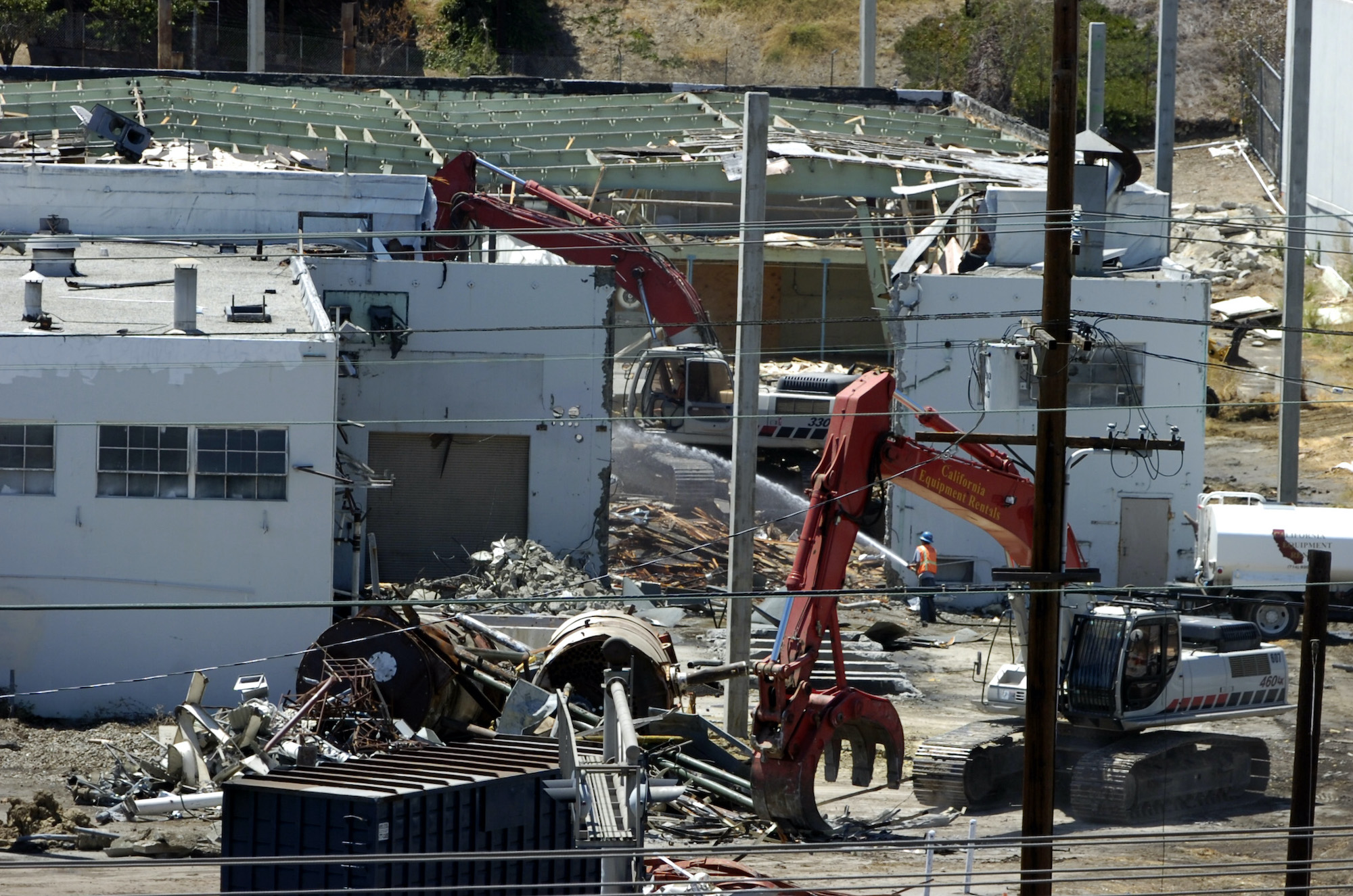
Eastview Little League’s last games at the site were played in June 2007. A month later,  wrecking crews began razing the venerable Di Carlo plant. The new Target store opened in its place in October 2008.

As for Eastview Little League, with help from then-Councilwoman Janice Hahn, they found a home by displacing the former dog park atop nearby Knoll Hill, building a $3.5 million, three-field baseball complex in time for the 2008 season.

Crews begin tearing down the former DiCarlo bakery on Gaffey St. in San Pedro on Aug. 7, 2007, to make way for a new Target store. (Daily Breeze staff file photo)

Sources:

Daily Breeze files.

Los Angeles Times files.

San Pedro News Pilot files.

American Honda finds its corporate home in Torrance

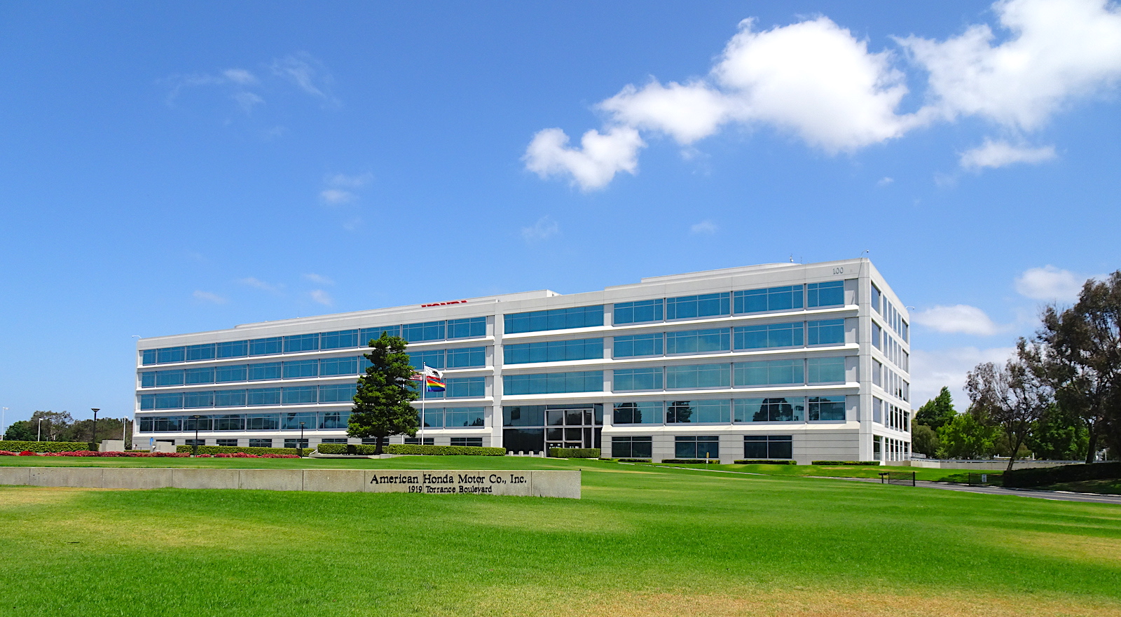
American Honda Motor Co.’s U.S. headquarters building at 1919 Torrance Blvd. in Torrance. (June 2020 photo by Sam Gnerre)

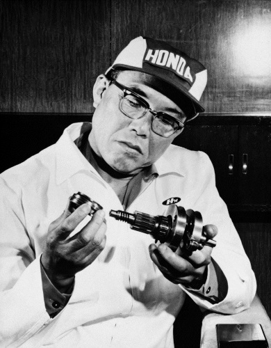
Soichiro Honda started out as an auto mechanic in the late 1930s, and the inveterate tinkerer eventually formed his own company to manufacture piston rings for Toyota.

Soichiro Honda. Undated.
(Credit: Honda Motor Co.)

After the start of World War II, his factory turned to manufacturing aircraft propellers for the war effort, until American bombs and a 1945 earthquake destroyed his Yamashita plant.

With money he made selling what was left of his company to Toyota in 1946, he started a research firm that evolved into the Honda Motor Co., Ltd., in 1949. The company’s first product was the 1949 D-Type motorcycle. By 1964, Honda had become the world’s largest motorcycle manufacturer.

As his company grew, Honda looked to expand into wider markets beyond Japan. With strong motorcycle sales in the U.S., establishing a corporate presence there seemed a natural move.

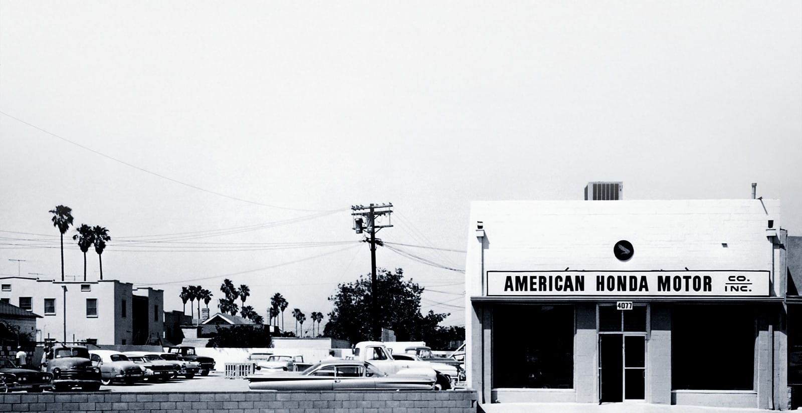
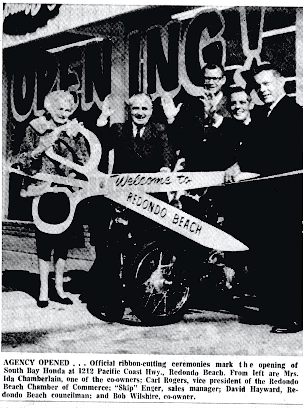
The Southern California postwar outdoor recreational lifestyle suite the company’s product line, one reason why Honda chose Los Angeles as the site of its American Honda Motor Co. subsidiary. Its combination sales office/corporate headquarters opened at 4077 Pico Blvd., just east of Crenshaw, on June 11, 1959.

American Honda established its first U.S. headquarters in 1959 at 4077 W. Pico Blvd. in Los Angeles. (Credit: American Honda Motor Co.)

Business was good at first, but not great. But Honda had faith, and continued to improve his products and expand production.

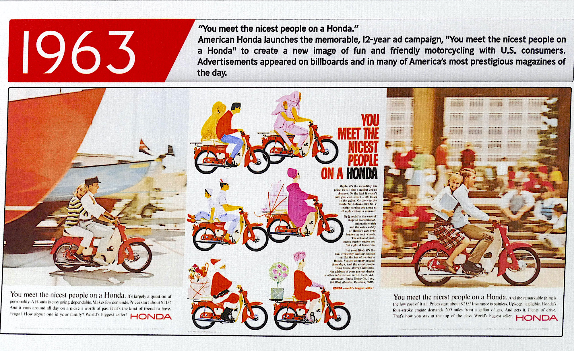
In 1963, it all changed. The company launched a massive marketing campaign, and its slogan, “You meet the nicest people on a Honda,” became ubiquitous.

Exhibit at American Honda’s private museum in Torrance shows 1963 magazine ads from the “You Meet the Nicest People on a Honda” campaign. 2016 photo. (Daily Breeze staff file photo)

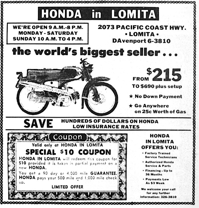
Marketers targeted the ad blitz at young buyers, downplaying the negative image of motorcyclists as juvenile delinquent members of biker gangs. The colorful ads featured clean-cut teens having wholesome fun on their Hondas.

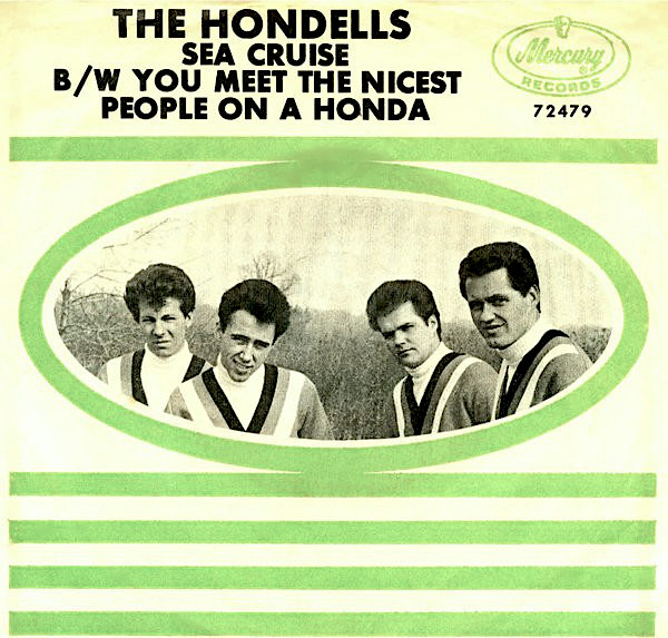
Sales went through the roof. Even the surf and hot rod groups so popular during the era got on board. Brian Wilson of the Beach Boys wrote “Little Honda,” which his group recorded. The hit version went to a studio group named The Hondells, who also recorded a song titled “You Meet the Nicest People on a Honda.”

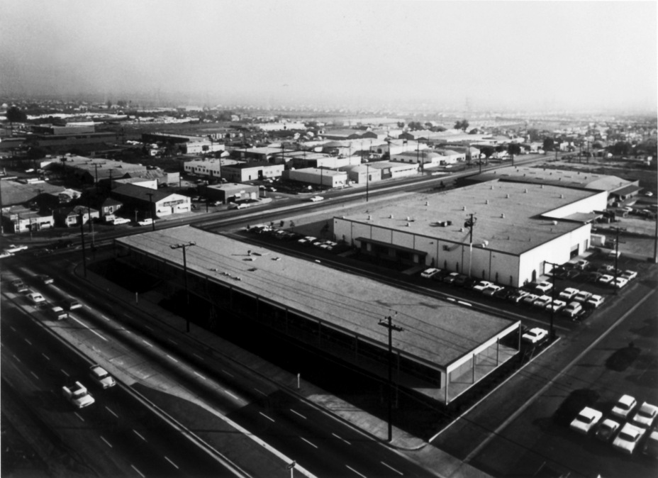
The company’s rapid growth caused it to outgrow its small Pico Blvd. location. In 1963, American Honda moved its corporate headquarters to a larger site at 100 W. Alondra Blvd. in Gardena.

American Honda moved its headquarters to this location on Alondra Blvd. in Gardena in 1963. (Credit: American Honda Motor Co.)

1963 also marked the production of Honda’s first automobiles, the T360 mini pickup truck and the S550 sports car, which were sold overseas but not in the U.S.

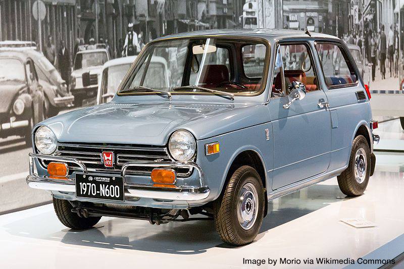
The company spent the rest of the 1960s selling large numbers of motorcycles in the states. Finally, Honda took the plunge in 1970, when it introduced its N600 sedan to the American market, starting with the West Coast.

The Honda N600, the first Honda automobile sold in the U.S. (Credit: Moro via Wikimedia Commons)

Consumers didn’t take the small, fuel-efficient cars seriously at first, but sales picked up when the 1973 energy crisis brought long lines to gas pumps everywhere. That year, Honda introduced its first Civic model, which has been a standard of the fuel-efficient transportation car ever since.

The company continued to expand its auto offerings with the Accord in 1976, and its Acura line of luxury cars ten years later.

Torrance Press-Herald, Dec. 9, 1964, Page B11. (Credit: Torrance Historical Newspaper and Directories Archive database, Torrance Public Library)

By the 1980s, Honda’s American operations had grown exponentially. In 1981, the company purchased 76 acres of industrial land in Old Torrance, the first step toward what eventually would be a 101-acre deluxe new headquarters site.

The city of Torrance had the responsibility of clearing out a variety of small businesses on the land, including the Shamrock roller skating rink and a variety of auto repair shops. One of them, former Carson city councilman Jake Egan’s Aable Muffler Shop, was the last holdout on the property, not agreeing to close until 1992.

Several Torrance city streets also disappeared in the redevelopment, including Mullin, Santa Clara and Llewellyn avenues.

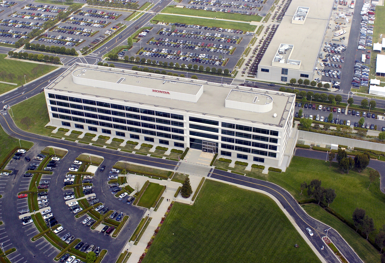
American Honda headquarters in Torrance in 2006. (Daily Breeze staff file photo)

The $225-million project was built in two phases. The first included buildings housing research and development and engineering divisions on the north end of the property. Employees moved into those departments in 1985.
After delays due to the identification and removal of underground methane gas, the second phase, including the five-story, 300,000-square-foot administration building, opened in 1990. Approximately 2,200 employees now are based at the company’s American headquarters at 1919 Torrance Blvd. (Company founder Soichiro Honda died in Tokyo on Aug. 5, 1991.)
Unlike Nissan and Toyota, who moved their corporate offices from the South Bay in 2006 and 2017, respectively, American Honda plans to keep its headquarters in Torrance.

As Honda spokesman Marcos Frommer told Daily Breeze reporter Nick Green on the occasion of the company’s 60th anniversary of U.S. operations in 2019, “We have no intention of moving — we’re part of the community.”.

Palos Verdes Peninsula News, May 13, 1965, Page 15. (Credit: Palos Verdes Peninsula News)

Sources:

Daily Breeze files.

“50 Years of Honda in America,” by Don Sherman, Automobile magazine, July 7, 2009.

Honda Motor Company, Ltd. website.

Los Angeles Times files.

Palos Verdes Peninsula News files.

Torrance Press-Herald files.

Wikipedia.

Torrance Press-Herald, Sept. 22, 1963, Page 2. (Credit: Torrance Historical Newspaper and Directories Archive database, Torrance Public Library)

Imperial Highway once figured as part of a superhighway plan

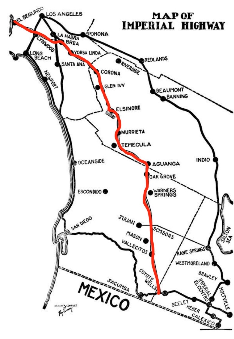
Route chosen in 1931 for the Imperial Highway project is highlighted in red on this 1936 map. (Credit: Orange County Historical Society)

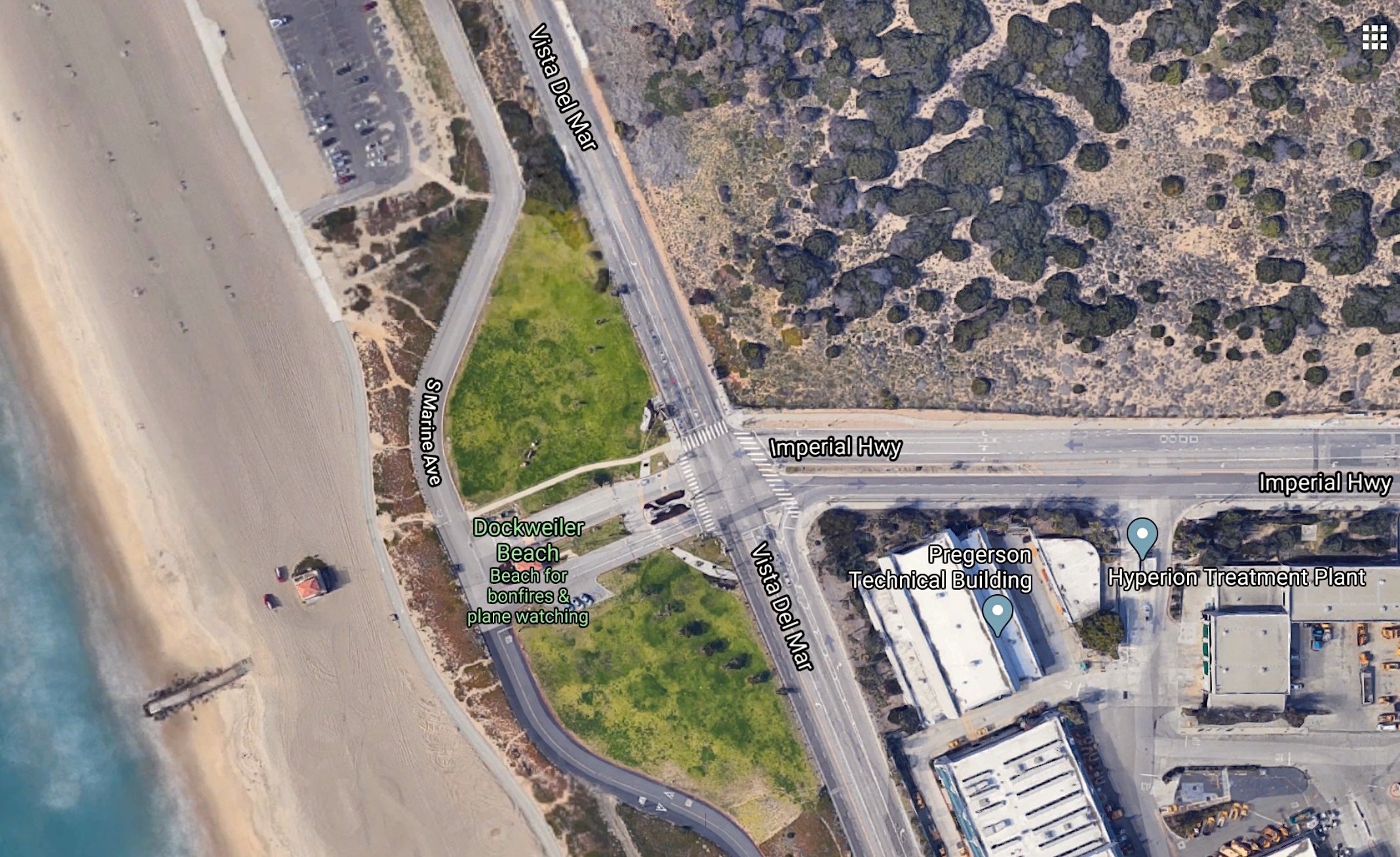
To South Bay residents, Imperial Highway is that east-west roadway on the southern border of LAX. Follow it on a map and you’ll see how it wends its way from the Pacific Ocean at Vista del Mar eastward for just over 40 miles before ending unceremoniously in Anaheim Hills in Orange County.

But its back story, and its name, actually come from much further south.

The Imperial Valley took its name from the Imperial Land Co., a subsidiary of the California Development Company charged with reclaiming the water-starved but arable land east of San Diego for agricultural purposes in the early 1900s.

The company began building canals in 1900, diverting water from the Colorado River for irrigation, and forming the Salton Sea in the process.

(Credit: Wikipedia)

As early as 1901, San Diegans were warned that unless they built a new road to the Imperial Valley, they would lose out on trade to Los Angeles, whose leaders already were eyeing the productive area.

Angelenos were keen on the idea of patching together a superhighway that would stretch from the Pacific all the way to Brawley in the Imperial Valley, a distance of 215 miles. (The roadway later would extend a few miles further south to El Centro.)

The most efficient route roughly followed the old Butterfield Stage overland route, established in 1858. This would cut as much as 75 miles from the then-current route, which involved driving down to San Diego before heading east at a right angle to the Imperial Valley.

The early Imperial Highway plans involved connecting up a patchwork assortment of roads of varying length and quality, but still would be a great improvement because of its shorter distance and its flatter elevations. Backers calculated that a trip that once took three days by truck could be made in 10 hours once the new route was completed.

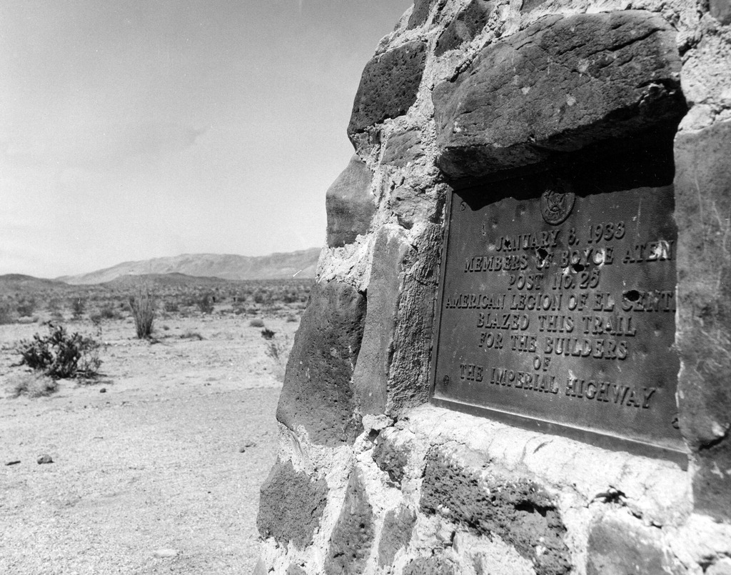
This historic maker in the Anza—Borrego Desert State Park reads, “January 8, 1933 — Members of Boyce Aten Post No. 25 America Legion of El Centro blazed this trail for the builders of the Imperial Highway.” Undated photo circa 1970s. (Credit: Escondido Public Library)

A faster route would keep perishable farm crops fresher longer as they were being trucked  back up to the Los Angeles area. Initially, the plan was named the Ocean to Ocean highway, and was to have its terminus in Yuma, Arizona.

In 1912, a group of Los Angeles boosters informally known as the Committee of One Hundred, working with the counties of Los Angeles, San Bernardino, Orange, Riverside and Imperial counties, settled on a route along the edge of the inland Salton Sea that completely bypassed San Diego County, from which Imperial County had been split off in 1907.

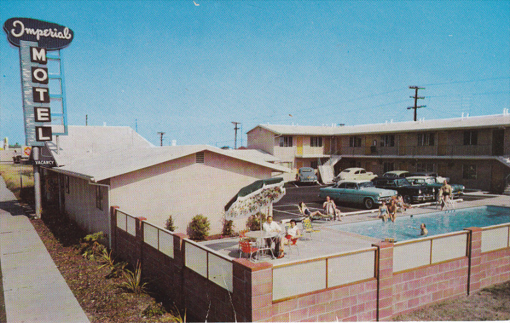
Imperial Motel postcard, undated, circa early 1950s. The motel, at 4709 W Imperial Highway in Hawthorne, still stands.

The Los Angeles section of road would be mostly a straight shot from LAX to Anaheim, where the proposed road would dip south diagonally before eventually reaching the Imperial Valley.

By the 1920s, the efficacy of the Imperial Highway concept had become apparent. A  new and more forceful private group, the Imperial Highway Association, was formed in 1929 to encourage the regions involved to mount a fully cooperative effort, including working closely with San Diego County, to get the job done.

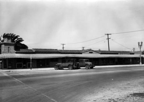
Imperial Highway in Lynwood, foreground, is a two-lane road in this circa 1920s undated photo. The building is a roadside business known as “The Splinter Building.” (Credit: Los Angeles Public Library Photo Collection)

The Association adopted an official route for a more streamlined, uniform highway in 1931 that ran slightly west of the earlier Salton Sea route. The improved roadway, now referred to informally as “the Cannon Ball Road,” would eliminate tight right angle turns that slowed down trucks, as well as smoothing out and widening the various roadways involved and building new bridges where necessary.

Imperial Highway boosters worked tirelessly over the next three decades to put the pieces of the roadway into place. A major section in Yorba Linda was completed in 1937. Two-lane portions of the highway through Inglewood had to be expanded to four. A  bridge over the Los Angeles River completed in 1951 eliminated a crucial bottleneck; it replaced an old one that had collapsed in 1948.

At long last, the final section of the Imperial Highway as envisioned by the Association was completed at the dedication of a scenic highway in a ceremony on the Imperial-San Diego county border in December 1961.

Of its 220 total miles, 77 were county roads, with the rest being state highways. The cost to complete the project was estimated at $16 million (about $138 million in 2020 dollars).

Almost as soon as it was completed, the lengthy Imperial Highway project began to be chipped away at, with several sections being used for other highway projects.

Looking west at a portion of the unfinished Century Freeway, with Imperial Highway at right, near Los Angeles International Airport. 1987 photo by Rick Meyer. (Credit: UCLA Dept. of Special Collections)

In 1965, the California Dept. of Transportation (Caltrans) planned a new freeway along the path of Imperial Highway, from LAX to Norwalk. It opened in 1993, though Imperial Highway itself remained in place, if somewhat less crucial than it once was.

Major chunks of the roadway in Riverside and San Diego counties were subsumed by other freeways and highways over the years.

The Imperial Highway project may be fragmented and forgotten today, but its proponents succeeded in opening up a vital trade route connecting Los Angeles and the farming land of the Imperial Valley. The Imperial Highway Association worked on a variety of other projects before disbanding in the 1980s.

The 41-mile Los Angeles stretch, which passes through El Segundo, Hawthorne, Inglewood, South Los Angeles, Lynwood, South Gate, Downey, Norwalk, Santa Fe Springs and La Mirada, retains the original Imperial Highway name, as does a section of California State Highway 86 in El Centro (aka Imperial Ave.).

Western terminus of Imperial Highway at Dockweiler State Beach on Vista Del Mar. Hyperion sewage treatment plant, lower right  (Credit: Google Earth)

Sources:

“A Brief History of the Plank Road of Imperial County,” by Arash Hashemi, The Branding Iron, Los Angeles Westerners Corral, Number 215, Spring 1999.

“CA History ‘Round the Town: Butterfield Stage,” by Sarah K. Bierle, Gazette 665 blog, April 29, 2016.

“The Imperial Highway,” by Phil Brigandi, OC Historyland blog, Orange County Historical Society, 2011.

Los Angeles Herald files.

Los Angeles Times files.

“A Road Fit for a King: Transit Service on Imperial Highway,” More Than Red Cars website, April 18, 2011.

Wikipedia.

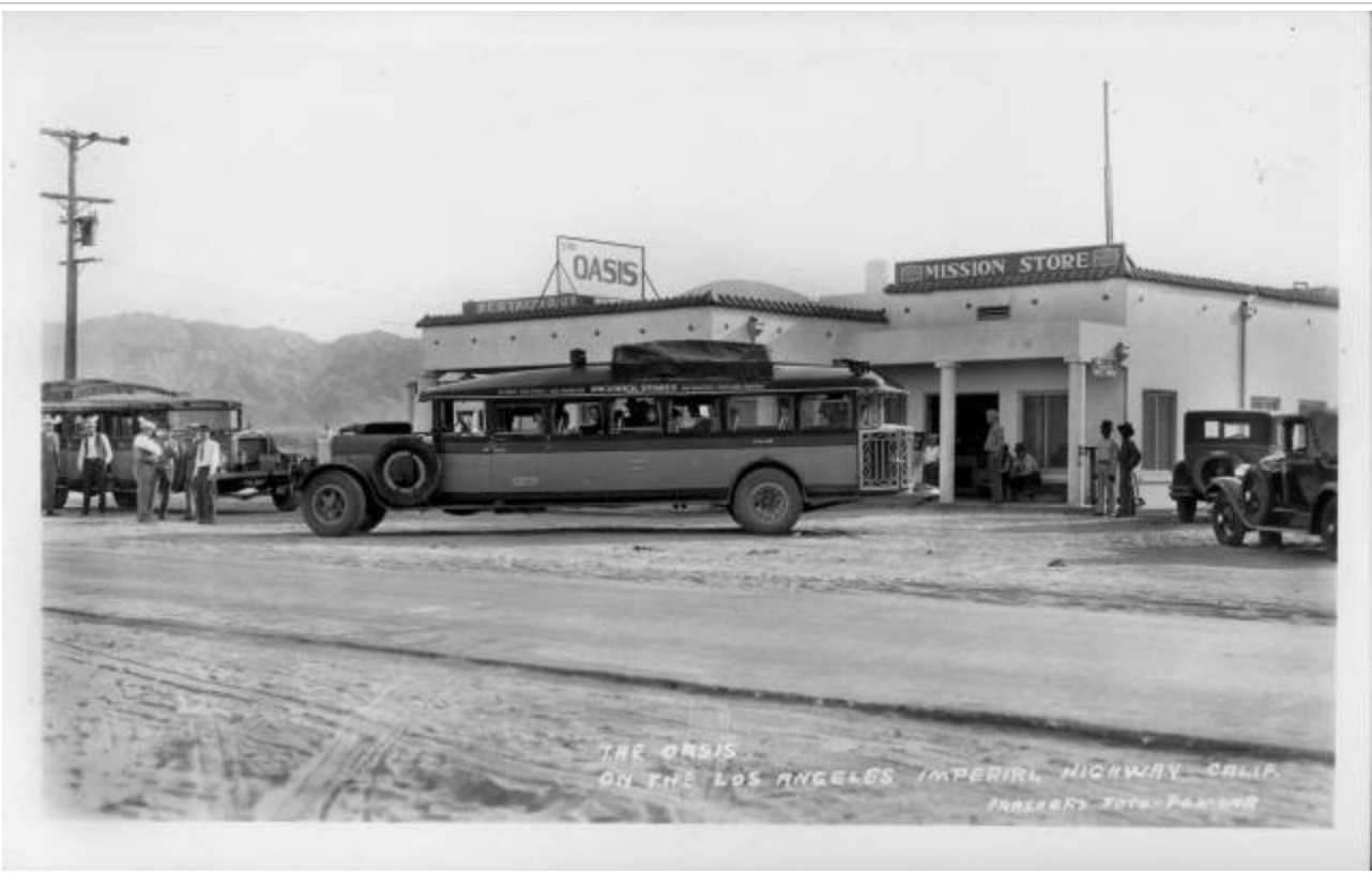
The Oasis restaurant, located on Imperial Highway in Los Angeles. 1929 photo. (Credit: Pomona Public Library)

Torrance’s National Guard armory opens with flyover, huge parade in 1955

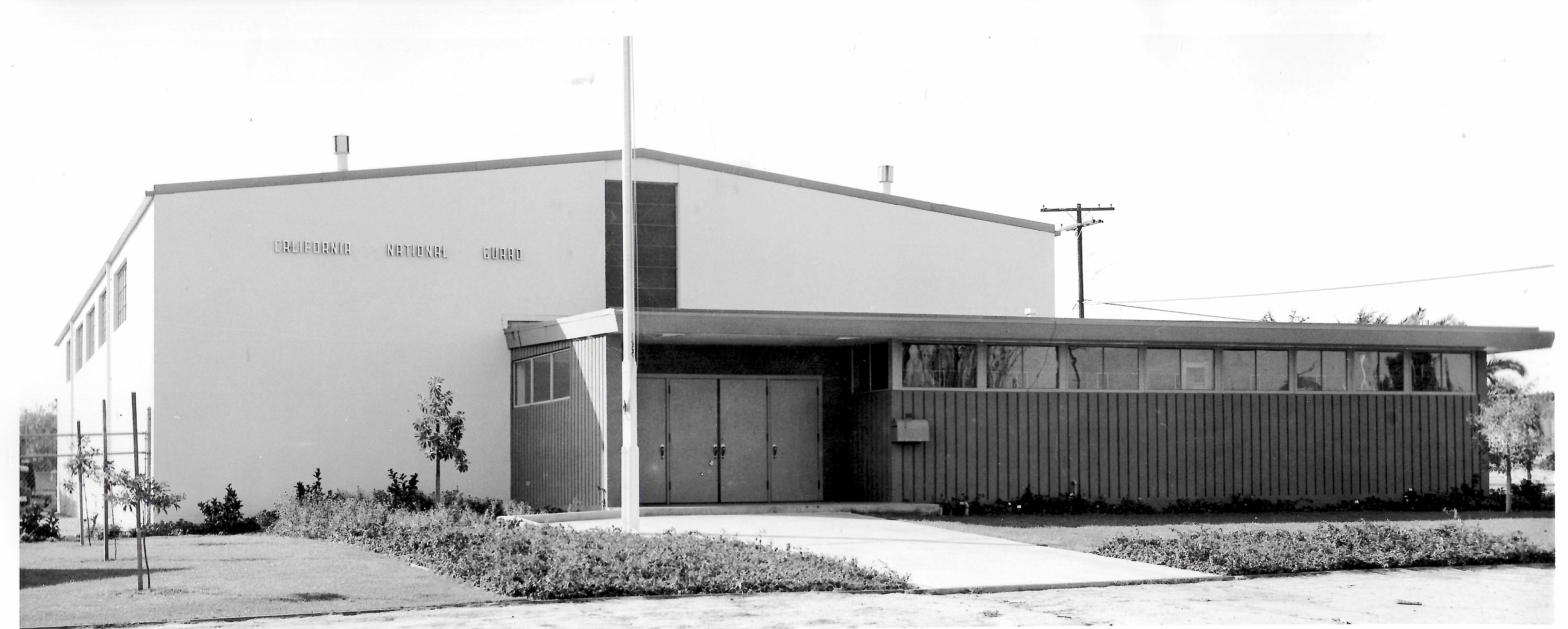
The California National Guard armory in Torrance in 1956, a year after it opened. (Credit: Military Museum website)

Military historians have traced the origins of the U.S. National Guard as far back as 1636, when the Massachusetts Bay Colony General Court formed three militia units to protect its citizens.

State militias were protected by the Second Amendment of the U.S. Constitution, and the Militia Acts of 1792 provided for the establishment of organized and regulated militias.

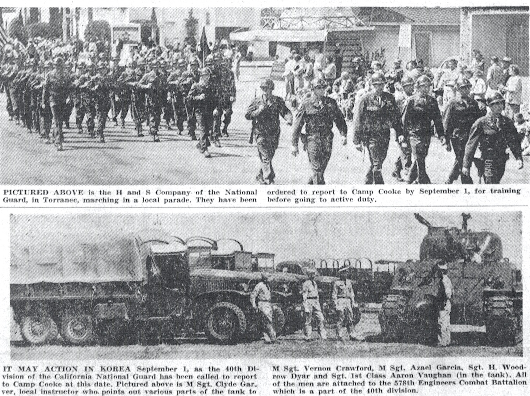
National Guard troops report to training in preparation for active duty in Korea. Torrance Press, Aug. 3, 1950, Page 1. Click to enlarge. (Credit: Torrance Historical Newspaper and Directories Archive database, Torrance Public Library)

These units were the forebears of the National Guard. The term “National Guard” was used as far back as 1824, but only became the official name of all state and territory militias with the passage of laws more clearly defining them in 1903 and 1916.

San Pedro had the earliest National Guard unit in the South Bay/Harbor area under the 1916 law when a coastal artillery defense unit was formed that same year and located at the recently opened Fort MacArthur. 

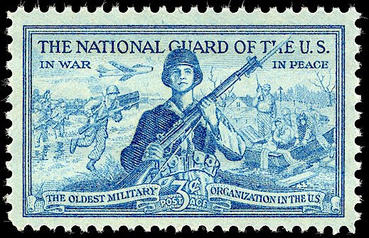
1953 U.S. postage stamp commemorating the National Guard.

San Pedro also had one of the first local armories in the area. It was built in 1942, but only after years of struggle with bureaucratic red tape.

In 1933, the National Guard Mobilization Act made the Guard part of the U.S. Army’s reserve forces. 18 divisions of National Guard troops would go on to fight in World War II.

The war exposed the need for strengthening the National Guard domestically. Many California cities petitioned to house Guard units following the war, when the state government began appropriating money to beef up its Guard presence.

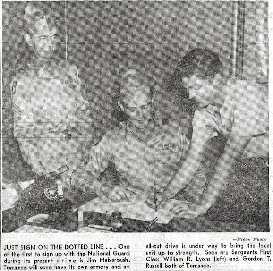
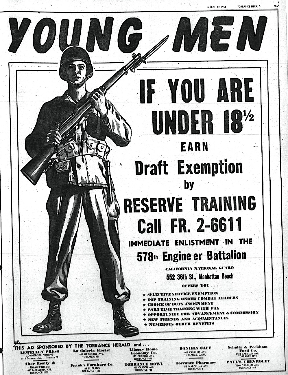
The Torrance City Council first petitioned to have its own National Guard unit in 1946, and its request was granted in April of that year. Company A of the 578th Engineer Combat Battalion of the California National Guard was approved for Torrance, partially because the city promised land to build its own armory as part of its petition.

Torrance had the parcel earmarked, a two-acre plot at Cabrillo and Lincoln avenues northeast of Torrance Park, just across the railroad tracks. The park itself had been used as an Army recruitment center during the war. After the war, it also doubled as the site of a temporary Guard armory.

Much like San Pedro’s, Torrance’s new armory would also face a long road to completion. In 1947, the nomadic Guard unit moved its temporary armory to the Torrance Municipal Airport, shortly after it was given back to the city by the federal government, which had commandeered it during the war.

Torrance Press, Oct. 14, 1954, Page 2. Click to enlarge.  (Credit: Torrance Historical Newspaper and Directories Archive database, Torrance Public Library)

The Guard was quartered in three large barracks buildings trucked up from Fort MacArthur to a five-acre site at the airport. In 1950, it moved back to its former digs at Torrance Park as negotiations concerning the permanent armory continued.

In 1952, the 578th moved to another temporary headquarters location, sharing quarters at the new National Guard armory that had opened in 1951 in Manhattan Beach.

Final approval for the armory project came through in June 1953. California Assemblyman Vincent Thomas stepped in to coordinate state and federal financing for the project, which would end up costing $250,000.

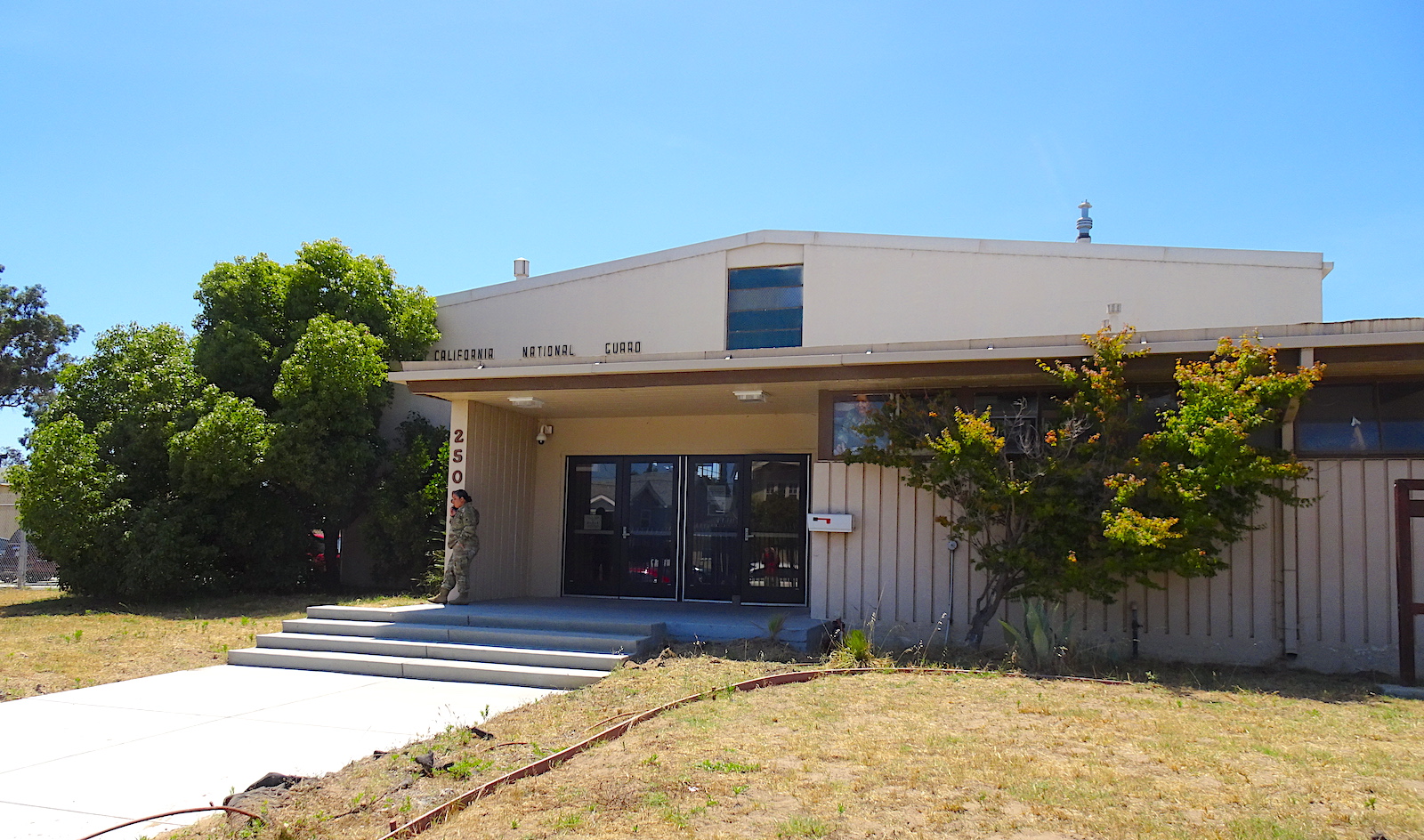
Construction finally began in late 1954, and the new armory at 2505 Cabrillo Ave. was completed in 1955.

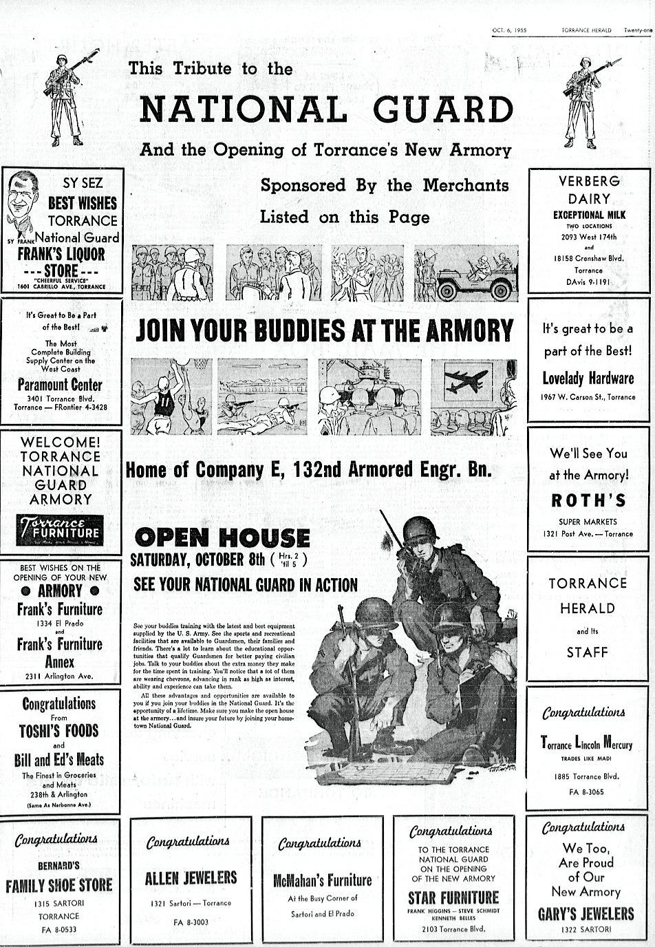
The city and the military cooked up a massive celebration for the occasion of the building’s dedication on Oct. 8, 1955. 

Torrance Herald, Oct. 10, 1955, Page 1. (Credit: Torrance Historical Newspaper and Directories Archive database, Torrance Public Library)

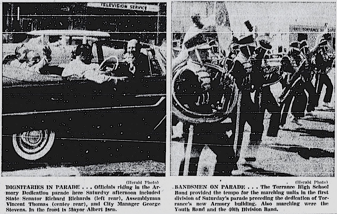
The official ceremony was preceded by a huge mile-and-a-half parade through downtown Torrance featuring military bands, tanks and a flyover by fighter jets from the California Air National Guard.

Dignitaries at the ceremony itself included company commander Lt. Douglas Horlander, Lt. Gov. Harold Powers, County Supervisor Kenneth Hahn, Assemblyman Thomas, Mayor Albert Isen and various other Torrance city officials. 

Military hardware from the parade was put on display afterward at the armory, which also hosted a community dance that evening to cap off the festivities.

Torrance Herald, Oct. 6, 1955, Page 21. (Credit: Torrance Historical Newspaper and Directories Archive database, Torrance Public Library)

In addition to the 578th, other units have called the Torrance National Guard Armory their home base over the years, including the 132nd Armored Engineer Battalion, and its current occupants, the 640th Aviation Support Battalion.

The armory has also served as an unofficial base of operations for Torrance’s Annual Armed Forces Day Parade since it began in 1959. (The annual May event was canceled this year due to the COVID-19 pandemic.)

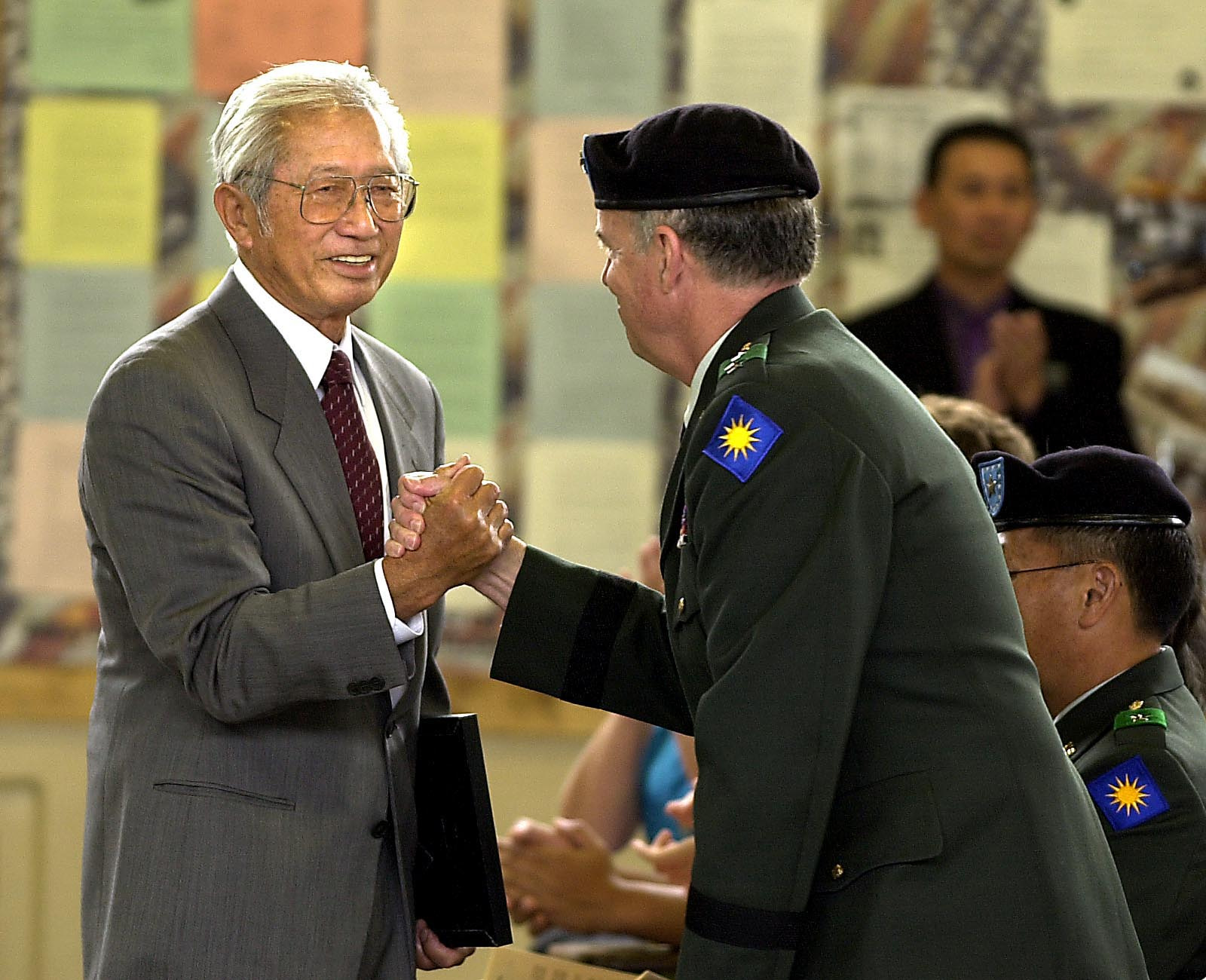
On May 19, 2002, a renaming ceremony was held at the Torrance California National Guard Armory. Thanks largely to a push from the Torrance High Alumni Association, the building was rechristened as the California National Guard Ted Tanouye Memorial Armory.

Tanouye remains the only Torrance resident to receive the Congressional Medal of Honor for his bravery as an army soldier during World War II battles in Italy. The medal and other honors were  awarded posthumously in 1996.

Iseo Tanouye, left, shakes hands after receiving a plaque in honor of his late brother Ted Takayuki Tanouye Sunday during the renaming ceremony at California National Guard armory in Torrance on May 19, 2002. (Daily Breeze staff file photo)

Sources:

“About the Guard: How We Began,” National Guard website.

Daily Breeze files.

Los Angeles Times files.

Militarymuseum.org website.

San Pedro News Pilot files.

Torrance Press-Herald files..

Wikipedia.

Torrance Herald, March 22, 1953, Page 5. (Credit: Torrance Historical Newspaper and Directories Archive database, Torrance Public Library)

South Bay/Harbor National Guard armories (year built):

Gardena, 2100 W. 154th St. (1953)

Inglewood, 111 Grosvenor St. (1953)

Manhattan Beach, 3601 Bell Ave. (1951)

San Pedro, 891 W. 13th St. (1942)

Torrance, 2505 Cabrillo Ave. (1955)

The California National Guard Ted Tanouye Memorial Armory in Torrance. June 2020. (Photo by Sam Gnerre)


Deadly 1949 oil tank blast in Inglewood wasn’t the end of Basin Oil’s woes

Firefighters train their hose on the massive fire following the explosions at the Basin Oil tank farm in Inglewood in 1948. Madera Daily News, Sept. 17, 1948, Page 1. (Credit: Madera Daily News)

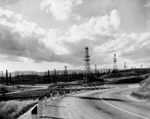
Oil drilling proliferated in Southern California beginning in the 1920s. Derricks and wells dotted the landscape, from Venice Beach to Huntington Beach. South Bay landscape photos of Torrance and other cities from the first half of the 20th century show forests of wooden derricks blanketing the area.

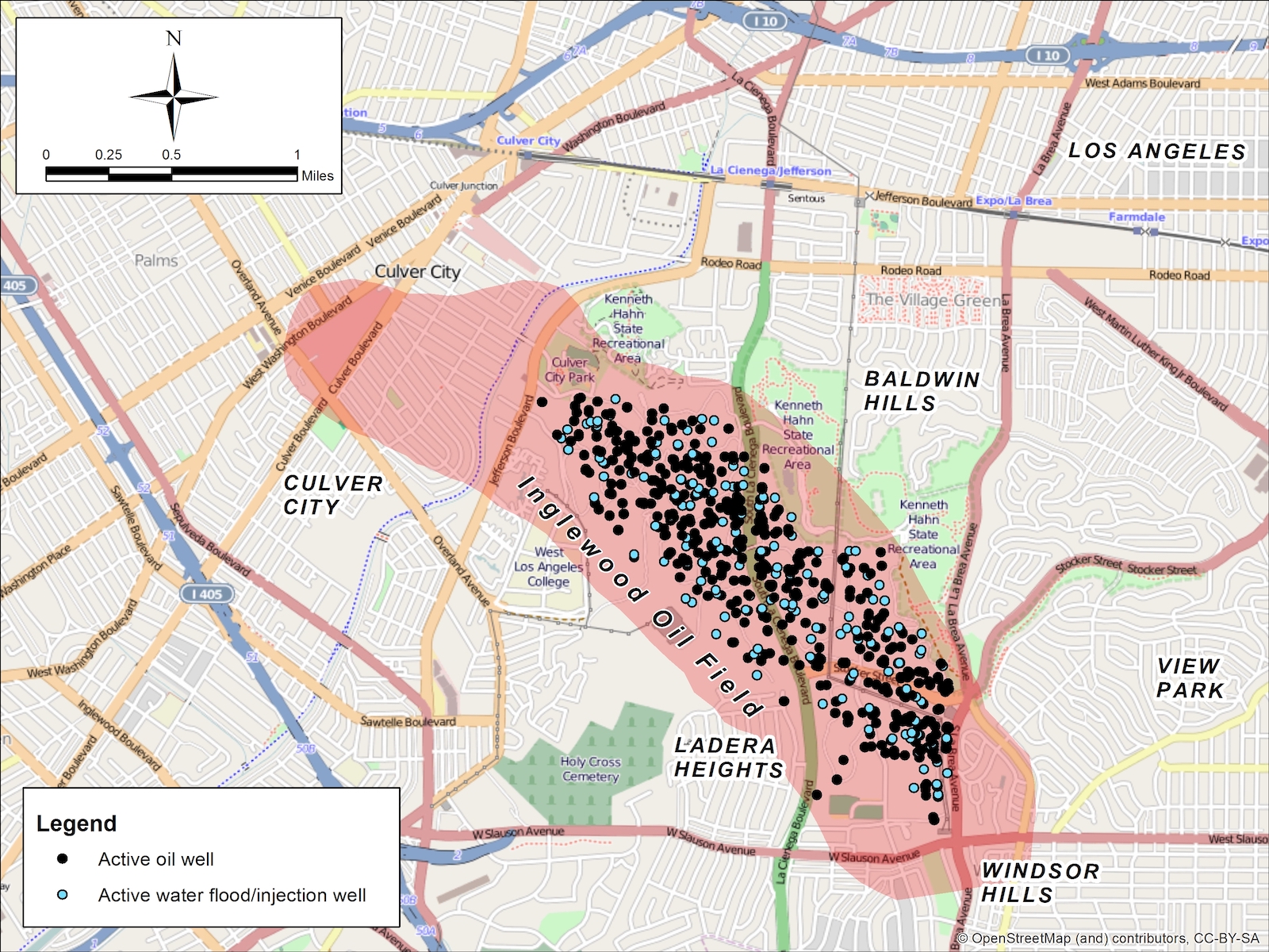
One of the larger oil strikes still operates in the hilly area northeast of Inglewood. Known as the Inglewood Oil Field, it actually barely touches the city’s northern border, with most activity in the Baldwin Hills area.

Discovered in 1924, the Inglewood Oil Field remains active to this day. (Credit: Wikipedia)

Standard Oil discovered the Inglewood Oil Field in 1924, and its peak production came in 1925. The amount of oil recovered began tapering off in the 1930s, but smaller oil companies continued to work the surrounding vicinity in hopes of striking it big.

Pasadena geologist Cornelius Willis owned one such firm, the Basin Oil Company. Willis was convinced that wells within the city of Inglewood also could be profitable. He pinpointed an area near Manchester Blvd. between Crenshaw Blvd. and Prairie Ave. as a likely spot to drill.

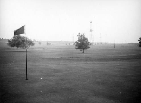
He wasn’t the first. The area in question was part of the Potrero Country Club, which later became the Inglewood Golf Club before closing in 1978. Potrero’s founders had leased 120 of its acres to the Association Oil Co. in 1926, a year after the club opened.

Basin Oil wells can be seen in the distance on the grounds of Potrero Country Club. Undated photo, circa late 1930s. (Credit: Los Angeles Public Library Photo Collection)

Only one well was built, though, and Associated sold its rights to Wilshire Oil. Then, in August 1937, Willis and Basin Oil leased 107 of those same 120 acres in a new deal, all but the land on which the earlier lone well stood.

By May 1938, Basin Oil had completed its first well on the property, drilling it to a depth of 4,645 feet. By November, a second well was producing 600 barrels per day. More wells followed, and a tank farm for the oil was built on Eucalyptus Ave. and Hyde Park Blvd.,  less than a mile north of Manchester.

Ten years later, on Sept. 15, 1948, tragedy struck there. 

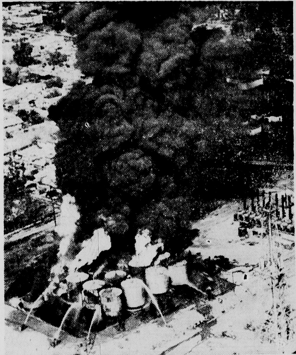
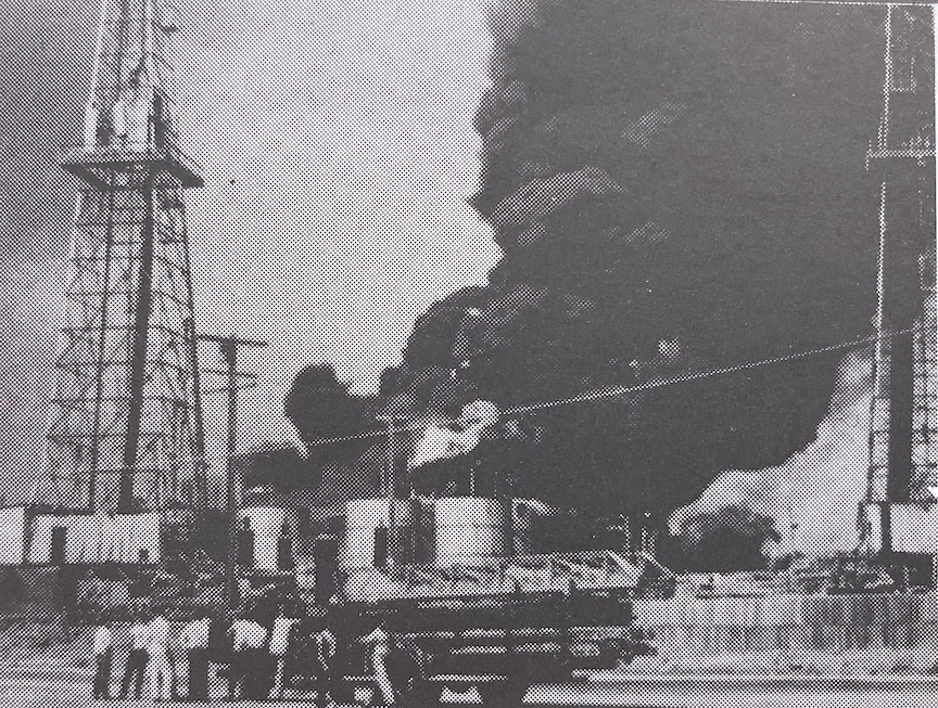
Spectators watch the 1948 Basin Oil tank farm blaze in Inglewood. (Credit: The History of Inglewood by Gladys Waddingham)

A series of explosions began in the 16-tank farm, spreading from one tank to another. Only four tanks were saved. Massive fires followed, and the explosions spewed globs of flaming oil across the street into the Smith Trailer Park, a 56-unit mobile home park at 719 N. Eucalyptus Ave.

Three residents were killed by the fiery flying debris: Mrs. Lillian Reynolds, 35, and Mrs. Olive Ziegler, 27, and her three-year-old daughter, Judy. 17 people were hospitalized, ten of them with burns from the flaming oil.

14 trailers burned, six of them completely destroyed and the other eight rendered uninhabitable. The rest of the park itself was also heavily damaged.

Fire officials later theorized that some sort of spark, perhaps from the mobile home park, had ignited vapors which spread back to the tanks during the process of heating the oil in them to separate out impurities. 

A week later, a coroner’s jury ruled that the three deaths were accidental, though it did recommend several new safety measures be implemented at the Basin Oil tank farm.

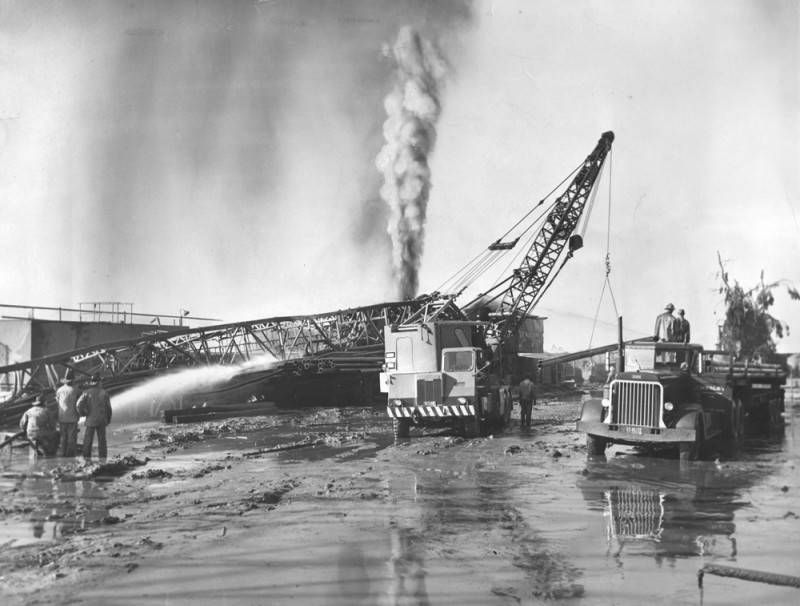
White-hot flames and a mixture of mud and oil gush skyward while firemen play water on other nearby equipment to prevent the spread of flames at the Basin Oil wells in Inglewood. December 31, 1952. (Credit: Los Angeles Public Library Photo Collection)

Then, on April 22, 1949, a huge steam boiler at the tank farm exploded, throwing 100-lb. chunks of metal hundreds of yards in the air. The steam boiler itself hurtled 100 yards skyward before landing in the middle of Eucalyptus Ave.

Residents of the mobile home park, still skittish after the accident the year before, raced out of their homes and up onto a nearby hillside when the blast occurred. Miraculously, no one was injured by flying debris this time, and firefighters kept a blaze caused by the explosion from spreading.

A month later, area PTA leader Mrs. Evelyn McClisha presented a petition signed by 1800 local residents asking the Inglewood City Council to meet with Basin Oil to impose stronger safety measures in the Inglewood Brickyard Field, as the oil-producing area was then known.

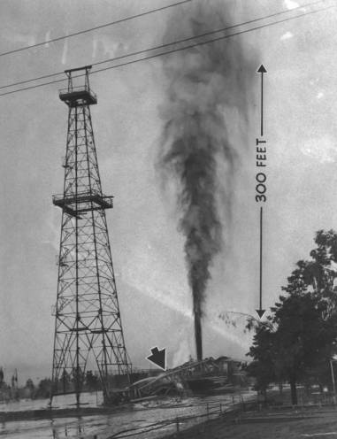
A geyser of hot mud, oil and flame shoots 300 feet into the sky as one of two blown-out oil wells on the Inglewood Country Club continues to erupt uncontrolled. Heat was so intense that one well tower melted and collapsed (arrow). Dec. 31, 1952. (Credit: Los Angeles Public Library Photo Collection)

But Basin Oil’s troubles continued three years later. This time, the accident occurred not at the tank farm, but at the company’s wells at the golf course, now known as the Inglewood Country Club, bordering Manchester.

The Potrero #18 well burst into flames at 6 p.m. on Dec. 30, 1952, with a second well igniting an hour later. Oil from the wells shot 100 feet in the air, with flames rising 200 feet above that.

The spectacular blaze drew hundreds of spectators, who were forced to run for their lives when showers of mud and rocks began landing on nearby Manchester Blvd. The two-inch thick layer of debris caused the closure of the roadway between Prairie and Crenshaw.

The oil well fires raged for three days. A special team of oil disaster experts from Texas had to be called out, and they finally stopped the blaze and capped the well. 

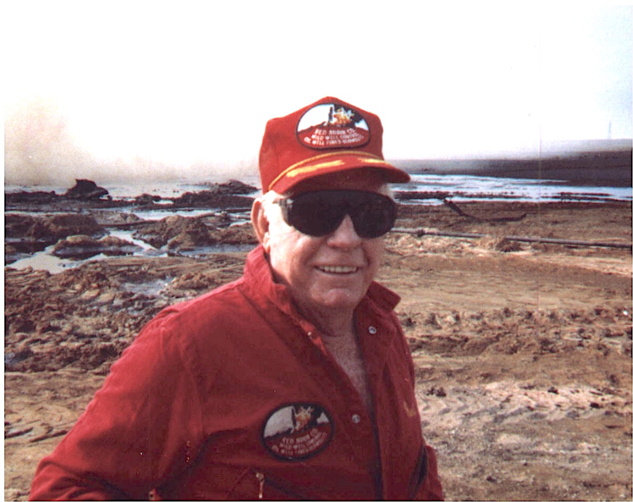
Oil fire specialist Red Adair. Undated photo. (Credit: Findagrave website)

During the process, one of the Texans, 36-year-old Paul N. Adair, was injured by a moving crane. He survived, and would go on to gain widespread fame in later decades as oil firefighting specialist Red Adair. He died in 2004.

Unbelievably, once again no one was seriously injured or killed during the fires. The oil wells continued to drill with no further calamities until Mobil Oil, which had purchased the operation in 1956, removed the last of the oil structures and equipment in 1970.

The Forum, opened in 1967 and recently purchased by Los Angeles Clippers owner Steve Ballmer, and two large housing developments now stand on the site where the golf course and the oil wells once operated.

Oil derricks blanket the Inglewood Oil Field, in what is now known as Baldwin Hills. View is toward the north along Fairfax Avenue. Undated photo. (Credit: Los Angeles Public Library Photo Collection)

Sources:

Calisphere website.

Daily Breeze files.

The History of Inglewood, by Gladys Waddingham, published by the Historical Society of Centinela Valley, 1994.

Los Angeles Times files.

Madera Daily News archives.

Wikipedia.

How and why the “Shoestring Strip” came into existence

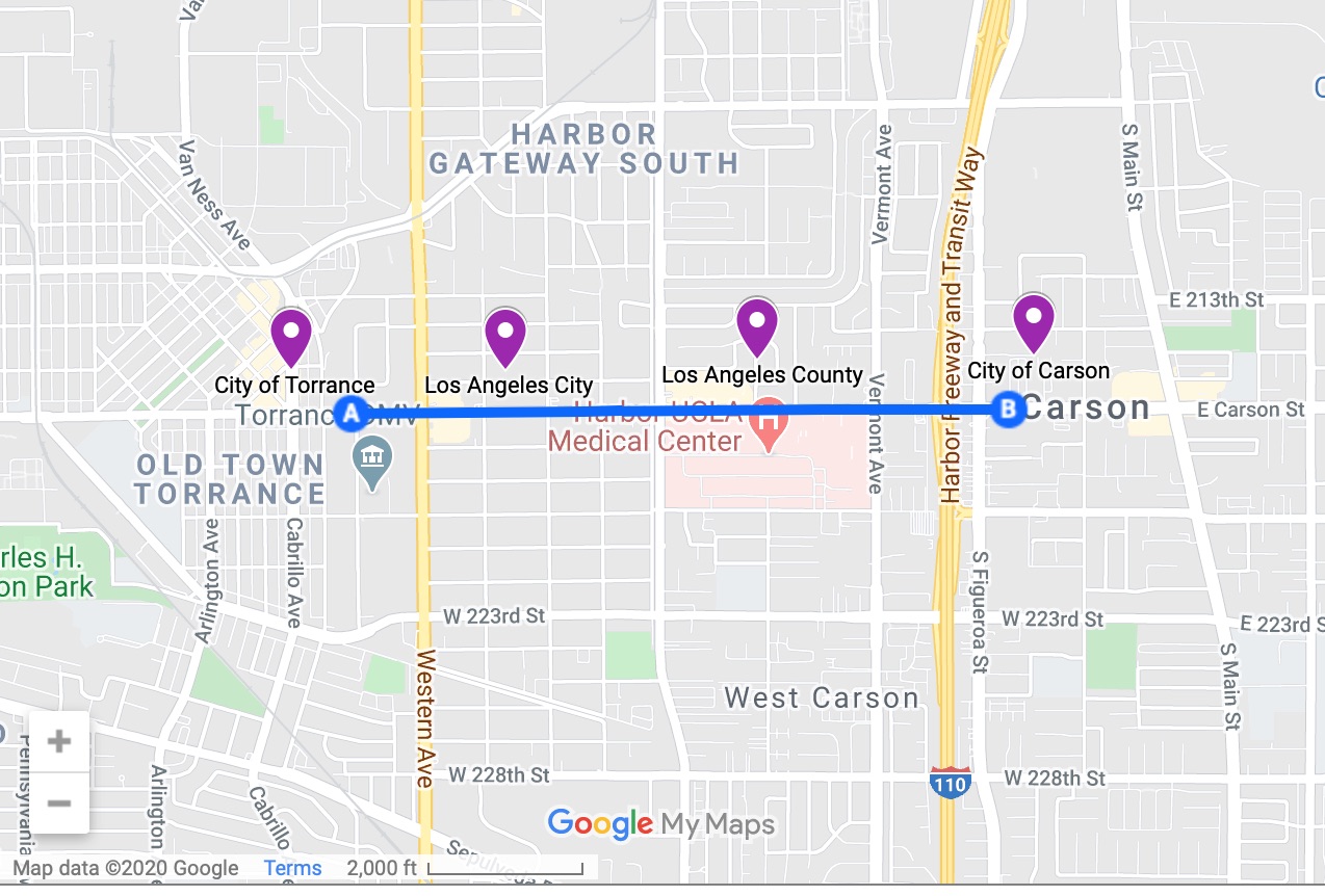
Traveling the short distance from Point A to Point B (blue line) on map takes one through four different jurisdictions, marked in purple from left to right. (Credit: Google Maps)

Head east on Carson St. from just west of Western Ave. (A) to just the other side of the 110 Freeway (B), roughly 1.4 miles, and you will pass through four jurisdictions: Torrance (west of Western), the City of Los Angeles (between Western and Normandie), unincorporated Los Angeles County (Normandie to 110 Freeway), and Carson (east of 110 Freeway).

Look at the area on a modern map, and it appears as though Los Angeles deviously forced its tentacles down from its southern city limit to grab San Pedro via a long finger of land. 

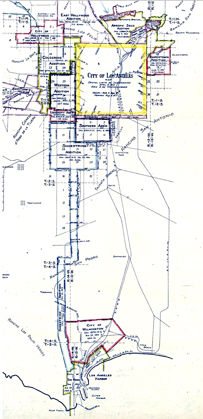
Map showing territory annexed to the city of Los Angeles, California, by Homer Hamlin, Los Angeles City Engineer, 1916. (Credit: Library of Congress)

Actually, L.A. City was the first to incorporate the South Bay portion of the Strip, in 1906. It was all very legal. Torrance incorporated its territory in 1921, and Carson in 1968.

The rationale behind the “Shoestring Strip,” as the annexed area was known from its beginnings in the early 1900s, had more to do with commerce than aesthetics. 

As the 20th century approached, the growing City of the Angels began to address its need for a permanent seaport with greater urgency. Various sites were considered during the 1890s.

Redondo Beach put in an unsuccessful bid, nixed mostly due to its occasional harsh winter storms. Santa Monica also looked like a strong contender, but ultimately was not selected. 

South-facing sites were thought to be more sheltered from weather than the west-facing candidates, and the decision began to focus on them.

Wilmington was considered, but its sandy harbor needed more dredging than nearby San Pedro. After vigorous campaigning by U.S. Sen. Stephen M. White, San Pedro officially was chosen as the site of the new harbor on March. 1, 1897.

Now then, how to accomplish it? City leaders began to consider what they called “consolidation”: annexing Wilmington and San Pedro and connecting them to the southern Los Angeles city limit by a narrow strip of land that’s only half a mile wide in some stretches.

This would put the city in accordance with California law, which stipulated that land annexed by a city had to be connected physically to that city. Enter the Shoestring Strip, a proposed annexation that ran from the southern Los Angeles city limit, at the time just east of Inglewood, for 16 miles south to San Pedro.

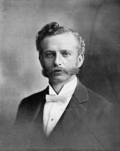
Meredith Pinxton Snyder. (Credit: Los Angeles Public Library Photo Collection)

The plan had influential boosters. In between his three separate terms as L.A. mayor, Meredith Pinxton Smith tirelessly boosted consolidation. He’s credited for working behind the scenes to push the Shoestring Strip annexation plan that made it all possible.

A lively debate over the annexation portion of the plan culminated in the idea finally being sent to voters both in L.A. and in the area under possible annexation in a Nov. 12, 1906 election.

L.A. voters passed the measure easily, but the residents of the Strip, who actually were deciding the issue, were nearly evenly divided on annexation. It passed there by only 10 votes, 213-203. The Strip officially became part of Los Angeles six weeks later, on Dec. 26.

The big city also made some attractive offers of services to the struggling new city of Wilmington, putting annexation pressure on it. Swayed by the enticements, its residents voted to unincorporate and be annexed by the larger city. 

A week after that August 1909 election, San Pedro also voted to become part of Los Angeles in a pro forma election. Consolidation was complete.

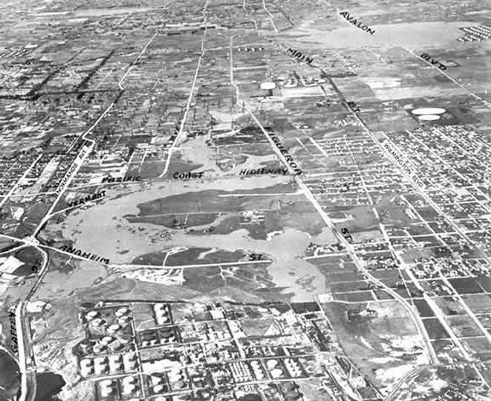
The Los Angeles City Strip, the area left of Normandie Ave., left, stretches northward from Machado Lake in Harbor City, bottom. The area directly north of Machado Lake, where oil derricks can be seen, is county land. Undated historical photo. (Daily Breeze file photo)

The Strip connected both of them to the big city up north. Part of the problem with the Strip seemed to be that once L.A. took possession of it, the city tended to take it for granted. Residents had to browbeat the city just to be hooked up to its water system in 1908.

Roads in the district were poorly maintained, and some important thoroughfares remained unpaved for decades. Stretches of one of its main thoroughfares, Western Ave. on the Strip’s western border, remained unpaved into the 1940s. Western didn’t become a fully through street until 1950. The section of 223rd St. running horizontally through the Strip remained a dirt road up until 1956, when the city finally decided to pave it.

The area also lacked a central government presence. There was no city hall or libraries, no central police or fire station. In fact, as late as 1939, more than three decades since annexation, there was no fire station at all.

Its long and skinny geographic layout, which worked so well to connect it to the harbor, also made it difficult to patrol effectively. From the beginning, law enforcement and civic regulation were more lax in the Strip than in neighboring communities.

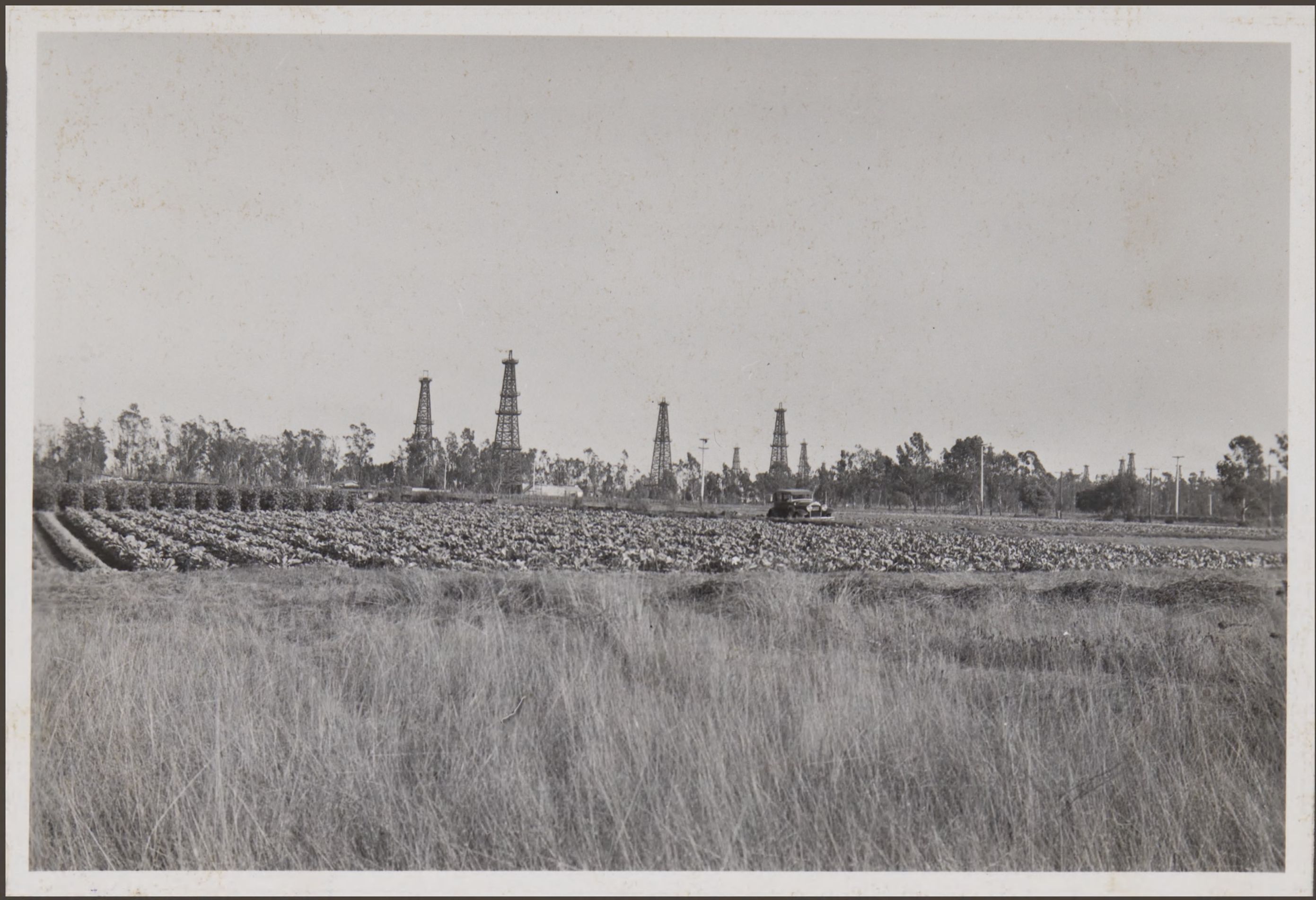
Early on, the area wasn’t densely populated; much of it was either farmland or oil fields. 

View looking southeast from Western Ave. in Torrance across the shows typical land use in the shoestring strip for farming and oil wells in the 1930s. Oct. 21, 1932. (Credit: California Historical Society)

As more people came to the area many very loosely regulated taverns , some operating gambling and other illegal activities sprung up, with the city seemingly unable or unwilling to  clean them up.

Eventually some of these problems were rectified, but it often took decades. The “Shoestring Strip” name gradually morphed into just the “city strip,” usually used with pejorative implications. Its reputation for lax regulation continued, with a higher concentration of bars, strip clubs, pot dispensaries and tattoo parlors than surrounding areas.

The oil fields and farms mostly vanished over the years, and were replaced by large industrial parks and manufacturing plants. 

Its residential sections had become more heavily populated and harder to police due to unregulated development during the 1970s and 1980s, which led to large numbers of apartment buildings replacing single family dwellings and greatly increasing density. 

During this era, violent crime increased as street gangs such as the 204th Street Gang began to flourish in the area. The violence has abated somewhat since the early 2000s, but problems remain.

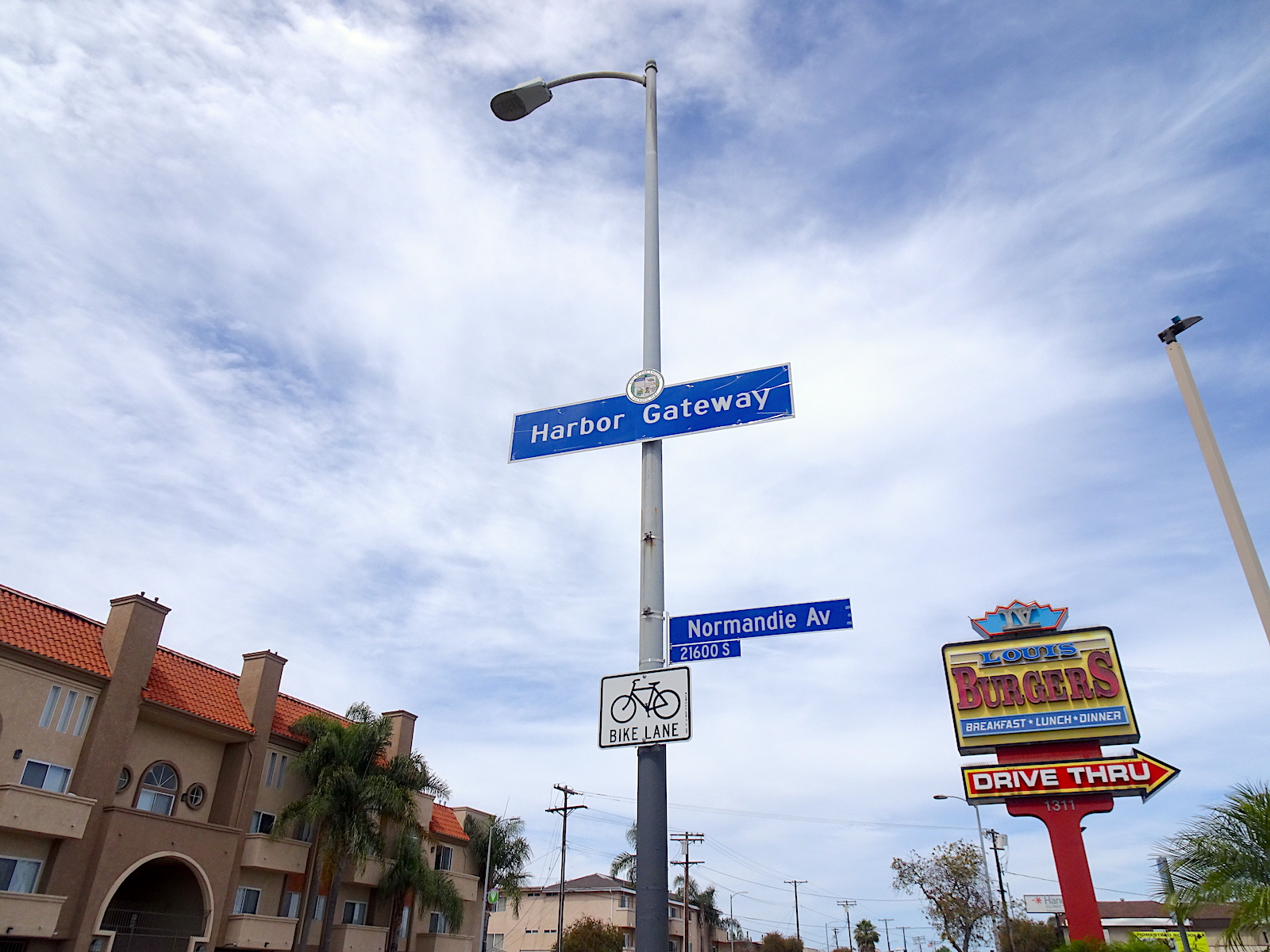
In November 1984, residents and businessmen looking to lessen the negative impact of the “city strip” name decided to rename the portion north of Harbor City as “Harbor Gateway.” 

Fashioned as an expedient pathway for Los Angeles to annex and control its own seaport, the narrow thread of land has presented its own set of geographic, demographic and social challenges with which its leaders and residents continue to battle.

Carson St. looking west from Normandie Ave. in Harbor Gateway, in the “city strip.” June 2020. (Photo by Sam Gnerre)

Sources:

“City Annexations Within the County of Los Angeles,” Los Angeles County Public Works Dept. website.

Daily Breeze files.

Los Angeles Herald files.

Los Angeles Times files.

San Pedro News Pilot files.

“Shoestring Corridor Begats Harbor Gateway,” by Vicky Kall, History Los Angeles County blog, April 10, 2009.

“The Shoestring Strip: Los Angeles Goes Out on a Limb,” by mdrakereitan, LAVENUES website, Feb . 1, 2015.