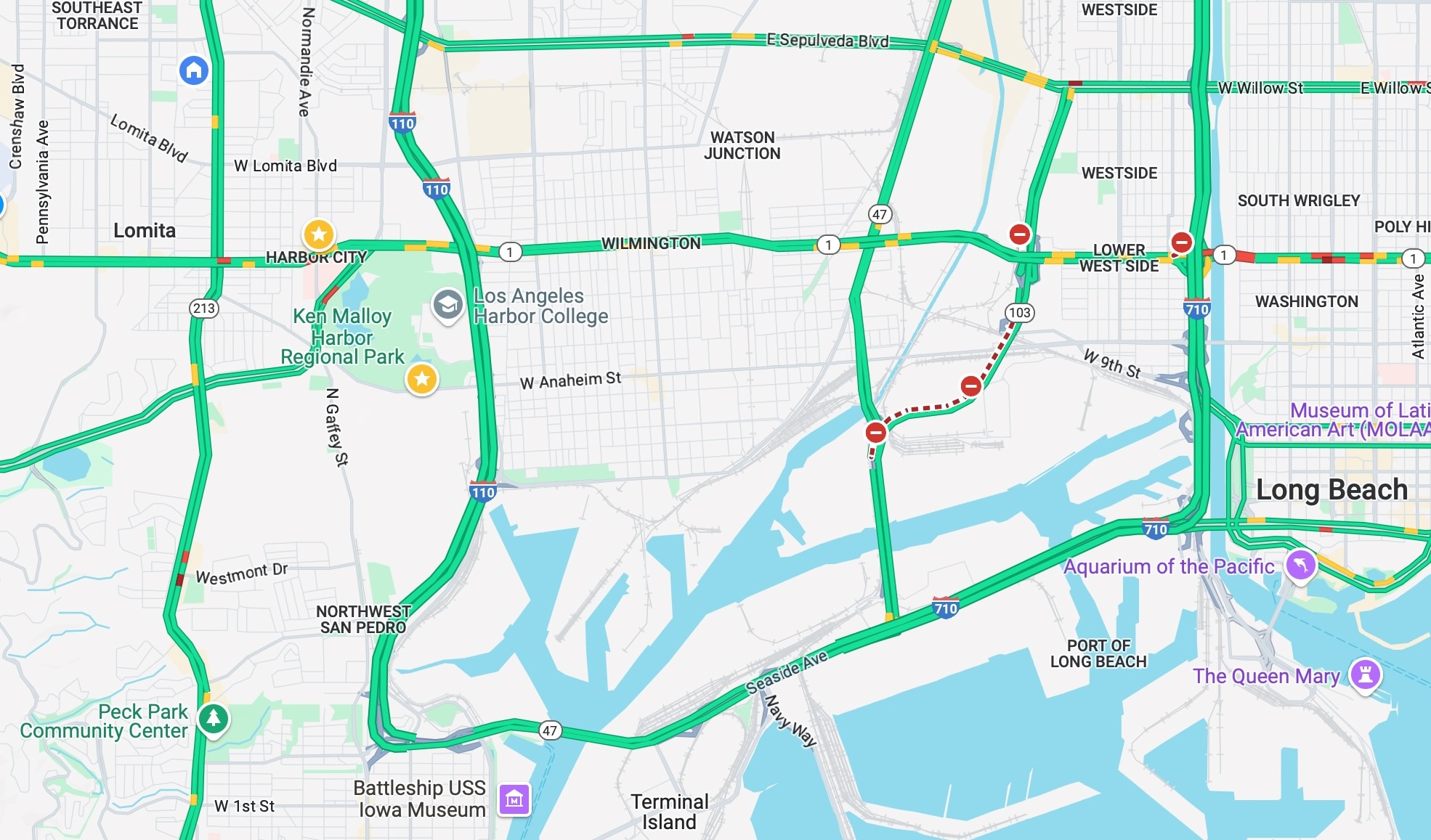
The 47 Freeway may not be the longest in the Los Angeles area – only the 3.1-mile Marina Freeway is shorter – but it provides a vital link to the ports of Los Angeles and Long Beach.
Officially known as California State Route 47, or California 47 for short, the freeway was part of the plan set forth by the Los Angeles Metropolitan Parkway Engineering Committee in 1946.
The ambitious planners envisioned a 1,500-mile network of freeways, expressways and parkways for the Los Angeles metro area. Only a third of the proposed roadways were ever built.
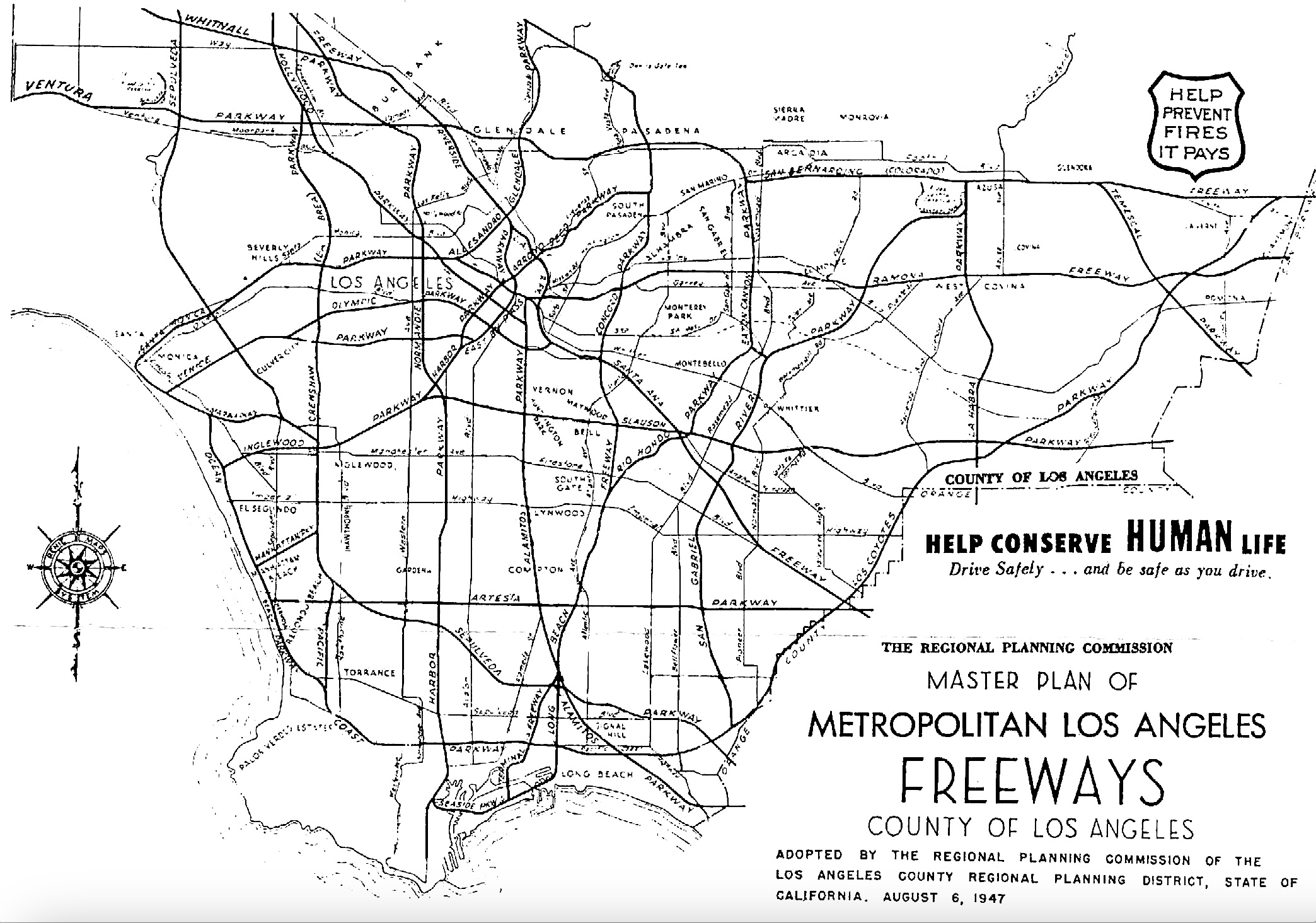
With the exception of the Arroyo Seco Parkway in Pasadena, whose first section opened in 1940, the sprawling city and its suburbs were then freeway-less, relying on an often crazy-quilt network of surface streets.
A look at a pre-freeways map of the Harbor Area shows that, while many north-south roadways stretched from the ports of Los Angeles and Long Beach to points north, very few east-west routes linked the ports to each other.
It would be many years before the 47 Freeway opened. In the meantime, Alameda Blvd. remained the main roadway linking the ports of Los Angeles and Long Beach to the north. The 710 Long Beach Freeway, originally named the Los Angeles River Freeway, became heavily used by trucks going to and from the port after it was completed in 1964.
The U.S. Navy, looking to improve access to its various operations on Terminal Island, financed the construction of the Terminal Island Freeway in 1946. The 2.1-mile roadway eventually became California State Route 103, which branches off from Henry Ford Ave. in Wilmington, heading northeast to its Willow St. terminus in Long Beach.
The master plan for the 47 Freeway called for a route from Terminal Island that would link with Seaside Blvd. (later changed to “Seaside Ave.”). Seaside, also called the Seaside Freeway even though it had traffic signals, was the east-west artery linking San Pedro to Long Beach. (Seaside becomes Ocean Blvd. at the Long Beach city limit, just east of Navy Way.)
It was the only part of the proposed “Industrial Freeway,” designed to stretch from Terminal Island to downtown Los Angeles, that was ever built.
From there, the proposed roadway would head northward along Alameda and link to the 103 before continuing all the way to the 10 Freeway in Los Angeles.
By the late 1960s, that plan had been scaled back to an eight-mile freeway from Terminal Island north to the 91 Freeway. But, first things first, a way was needed to cross the main channel of the Port of Los Angeles onto Terminal Island.
Before the construction of the Vincent Thomas Bridge in the early 1960s, the only transport from San Pedro to Terminal Island was via the Terminal Island Ferry.
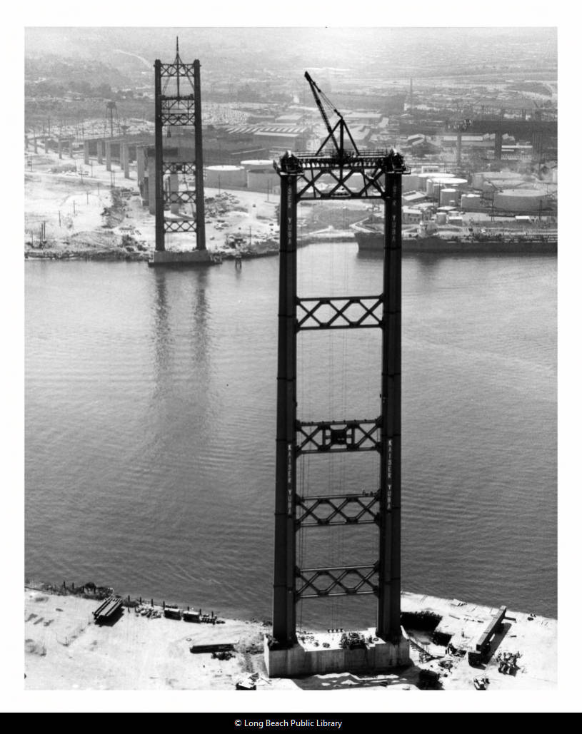
Thanks to the tireless efforts of San Pedro resident and longtime California Assemblyman Vincent Thomas, that came to an end when the iconic bridge bearing his name officially opened to traffic on Nov. 15, 1963. (The ferry made its final run the night before.)
Thomas paid the first toll, which at that time was 25 cents. It would rise to 50 cents in 1983. In 2000, the toll (and the toll booths) were eliminated.
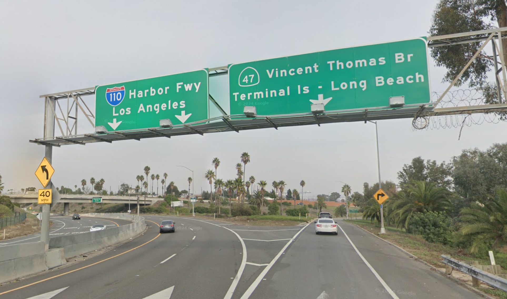
The bridge figured prominently in what would become the present-day 47 Freeway, which starts at the terminus of the 110 Freeway at Gaffey St. in San Pedro. The 47 follows the Vincent Thomas Bridge onto Seaside Ave., with one stoplight at Navy St. The section connecting the 47 Freeway to Seaside opened on July 9, 1970.
Originally, the 47 was designed to follow the Terminal Island Freeway (103), but in 1982 it was rerouted to parallel Henry Ford Ave. to Alameda, and from there, follow Alameda north to the 91 Freeway and ultimately all the way up to the 10 Freeway.
It was a grand plan, but it never came to pass. Civic officials were still pushing for its completion as late as 1975, but by the mid-1980s, the project was dead in the water. Though road signs identifying the Henry Ford Ave. and Alameda Blvd. stretches of the 47 Freeway up to the 91 Freeway still exist, the actual freeway project was never built.
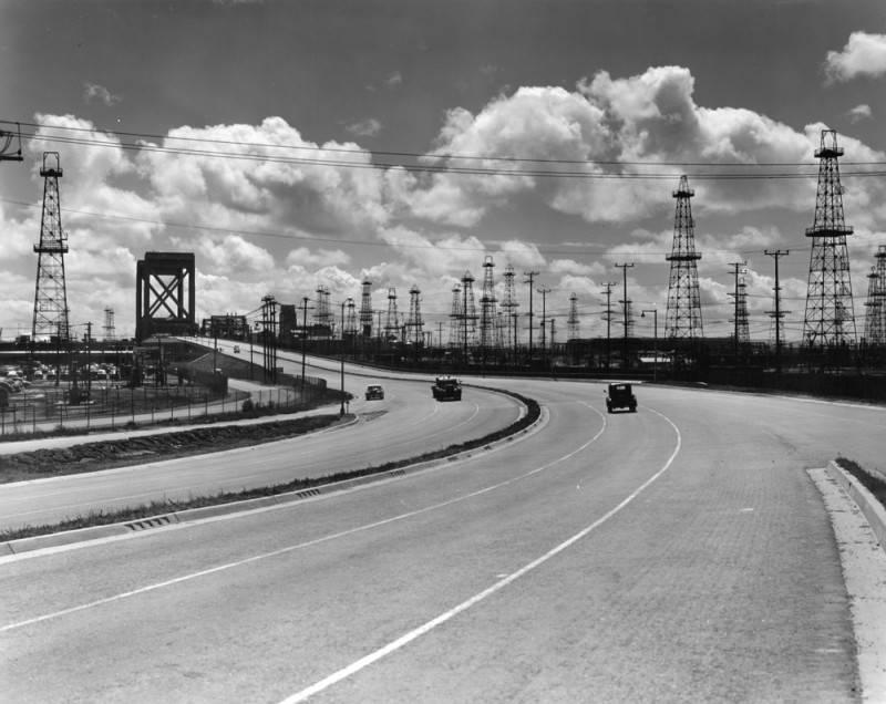
The massive Alameda Corridor project opened in 2002, but its goal, met successfully, had more to do with facilitating train traffic than motor traffic. Other than that project, no additional constructions or improvements have been made to the Alameda section of California State Road 47. Hundreds of trucks traversing it daily make maintaining it a challenge.
The city of Long Beach currently is seeking to decommission the northern portion of the Terminal Island Freeway (103) that runs from 20th St. to Willow St., a stretch of roadway that also has many rough patches. The city plans to transform it into a much smaller local road surrounded by new park and green space areas.
Sources:
AA Roads website.
California Highways website.
Daily Breeze archives
Freewaytopia: How Freeways Shaped Los Angeles, by Paul Haddad, Santa Monica Press, 2021.
Gribblenation website.
Los Angeles Times archives.
Southern California Regional Rocks and Roads website.
Wikipedia.

