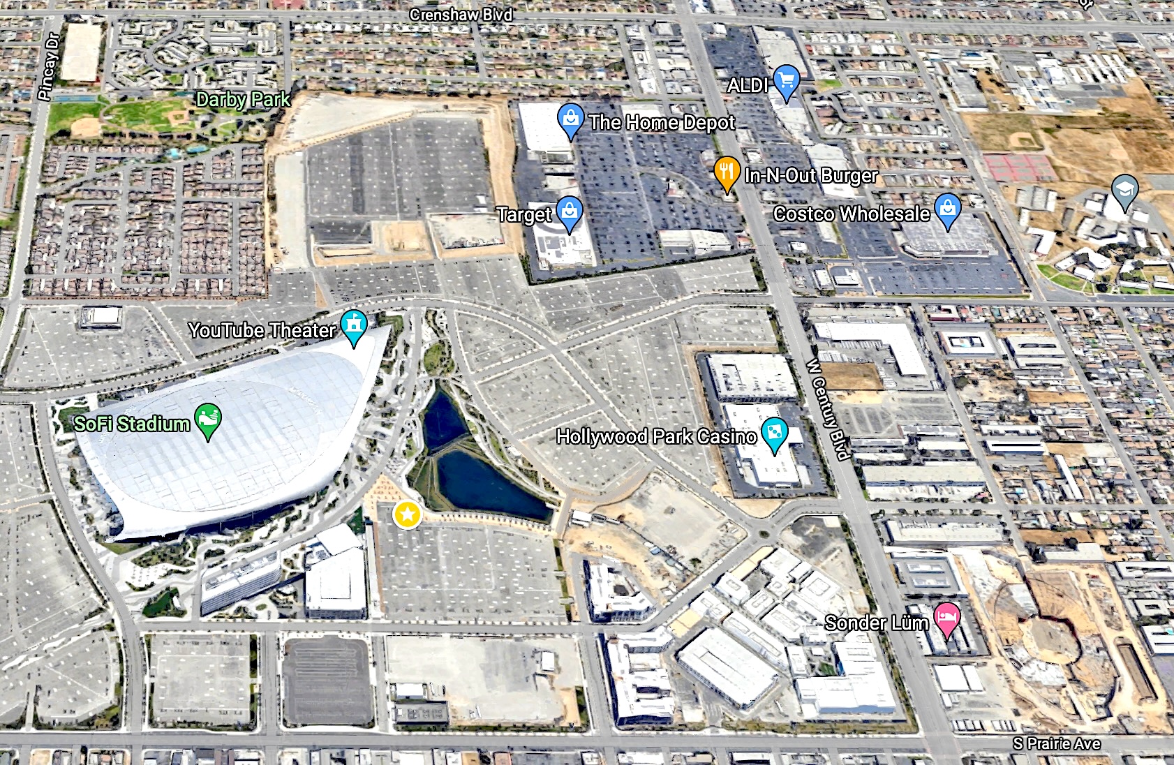
A drive westward down Century Blvd. from Prairie Ave. to Crenshaw Blvd. in Inglewood in 2024 reveals an entirely different set of major landmarks than those that existed there just a few short decades ago. Not to mention, an entirely different universe that existed when the street was named nearly a century ago in 1925.
Century’s name derives from its location between 99th and 101st streets in the Los Angeles City street numbering system. Except for three blocks between Central and Compton avenues in Watts, there is no 100th St. anywhere else in the city’s grid.
The boulevard itself wasn’t always a major thoroughfare. Its prominence began to grow with the development of Mines Field at its western terminus in the 1920s. The informal airfield occupied a large piece of land on the Bennett Rancho, and had become a popular spot for private planes to use.
In 1925, the Century Boulevard Association formed to lobby for the improvement of Century, which then was not significant enough of a roadway to be identified on most maps from the era. Proponents wanted to develop it into a major thoroughfare that would serve the still-developing airport on the west and become an urban highway extending eastward all the way to Santa Ana.
Much debate and discussion ensued, and the project began to show up on Los Angeles city and county government street planning wish lists. At the same time, the city started taking the idea of establishing its official airport at Mines Field more seriously.
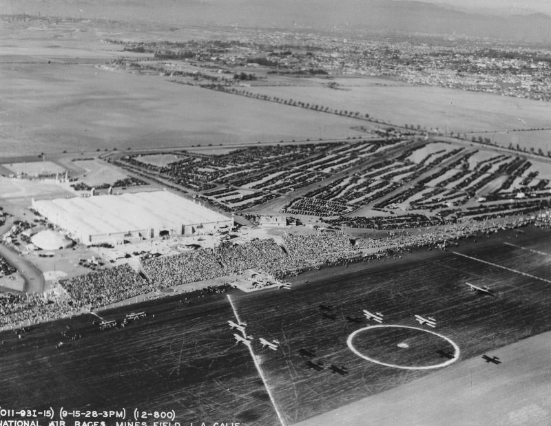
The National Air Races in September 1928 served as the catalyst that sparked real action on the improvement of Century. It’s difficult to overestimate the popularity of air races during this early aviation era. They attracted huge crowds of spectators wherever they were held.
So, when tens of thousands of people descended on Mines Field all at once in 1928, the inadequacy of the area’s ground transportation infrastructure quickly became apparent. Put simply, traffic at the airport was a mess. Imagine that!
One month after the races ended, city and county officials declared plans to fix the problem, calling for the improvement of major roadways to better serve the municipal airport, including Sepulveda, Lincoln and Century boulevards.
Mines Field became Los Angeles Municipal Airport in 1930, though it wouldn’t begin handling passenger airline traffic until after World War II. The Century Blvd. improvements began to be implemented during the 1930s.
Plans to connect the roadway to Santa Ana never came to pass, though the length of Century eventually would extend roughly 9.5 miles from the airport eastward through Inglewood and South Los Angeles.
The boulevard now terminates at the South Gate city border at Alameda Blvd., where it becomes Tweedy Blvd. Tweedy ends at Atlantic Ave., just west of the 710 Freeway.
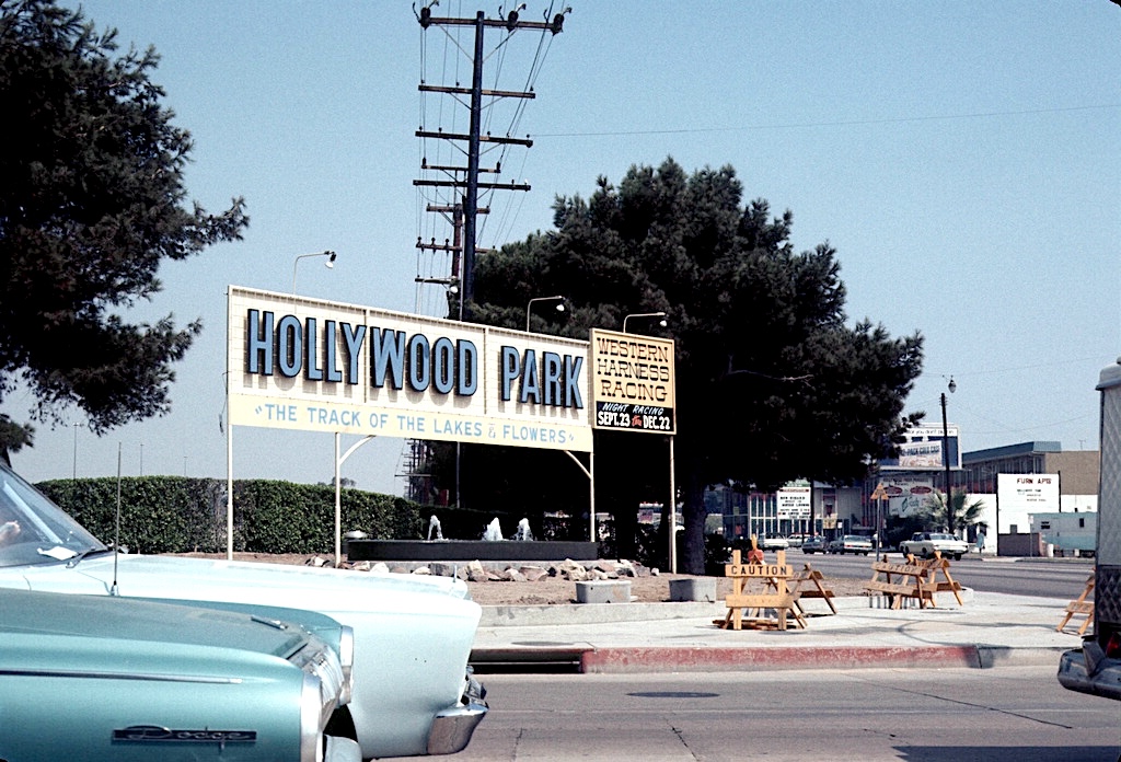
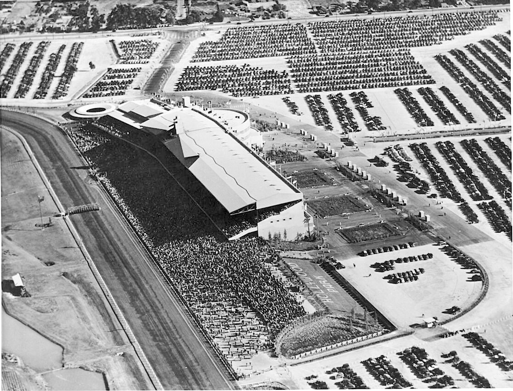
One of the first major developments on Century in Inglewood was the construction of Hollywood Park. The horse-racing mecca was built on 315 acres northeast from the intersection of Century Boulevard and Prairie Avenue. It opened on June 10, 1938, and would operate for the next 75 years.
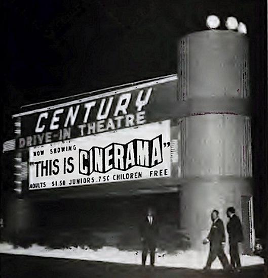
Another landmark sprang to life southeast of Hollywood Park on Century near Yukon Ave. on July 2, 1949, when Pacific Theatres opened the Century Drive-In with a screening of the boxing film “Champion,” starring Kirk Douglas.
The Century later became the first drive-in to offer films in the three-projector Cinerama format, installing a curved screen in front of its regular one. “This Is Cinerama” was the first, showing there in April 1964. (Film historians have doubted that the Century’s car-window-speaker sound matched its cinematic visuals.)
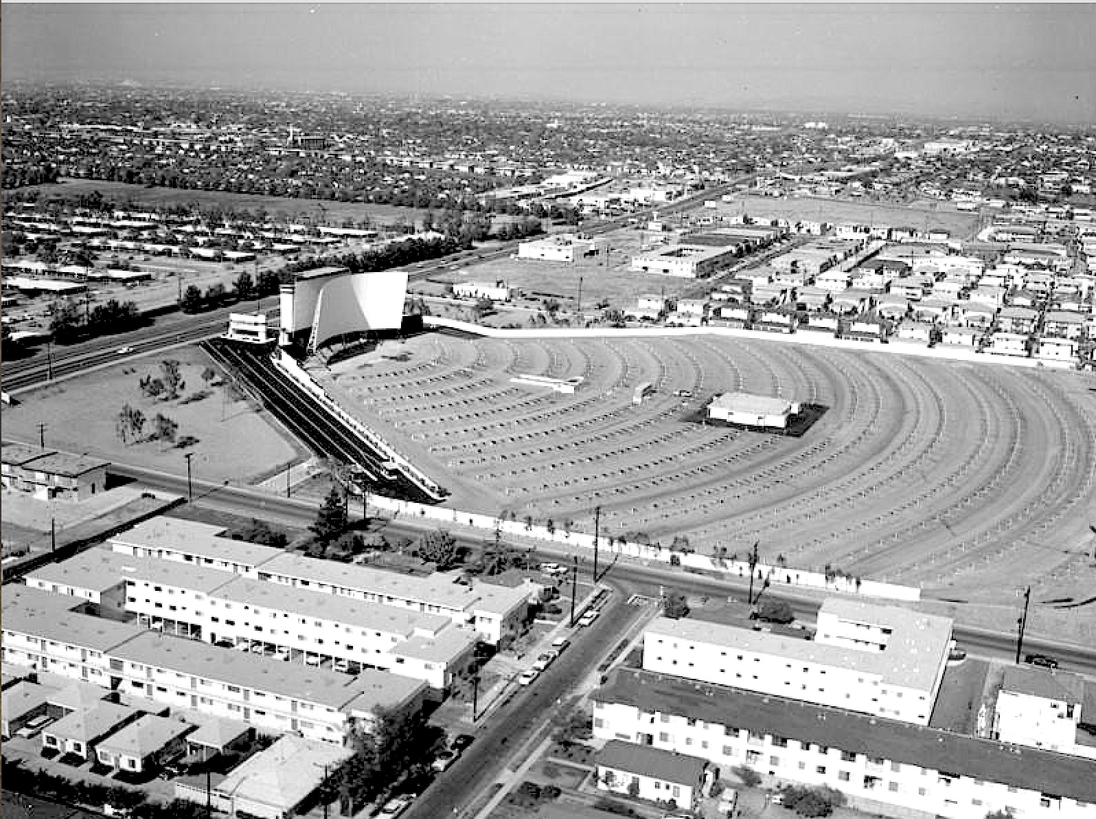
(Credit: Los Angeles Public Library Photo Collection)
The Century Drive-In closed in 1984, and a new concept in retailing appeared on the site in 1985 with the opening of the Price Club warehouse store. Costco and Price Club merged in 1993, and the Inglewood store became a Costco in 1997.
Another major modification began with the implosion and leveling of the Hollywood Park grandstand on May 31, 2015, to make room for the construction of the $5.5 billion Sofi Stadium on the site. Los Angeles Rams owner Stan Kroenke’s NFL showplace opened in 2020.
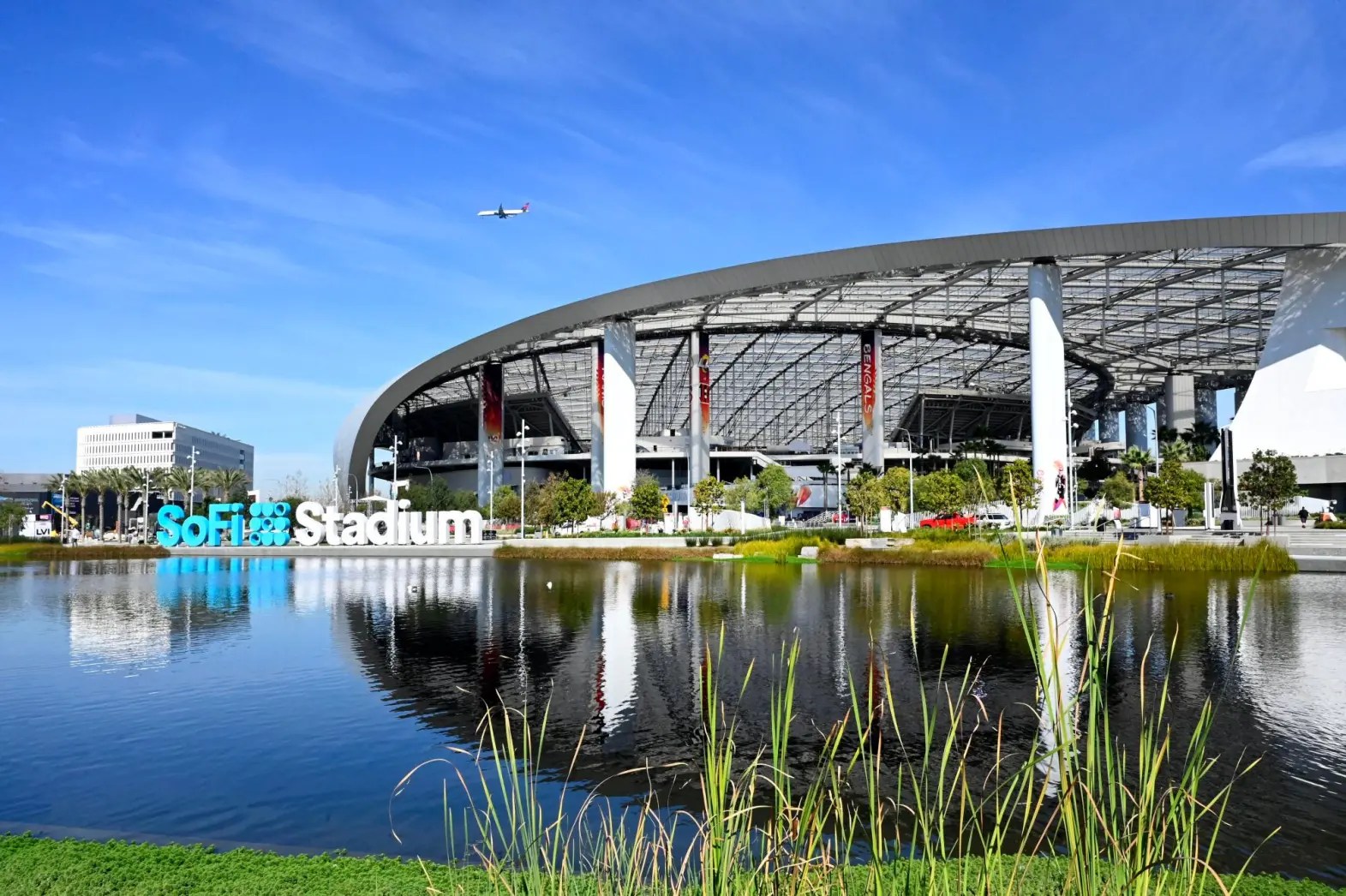
With its movie theaters, the YouTube live theater and shopping area (including Target and Home Depot stores), the massive facility dominates the area. One remnant of the land’s former occupant remains on Century: the Hollywood Park Casino. Formerly at the racetrack, it moved to a new building on Century in 2016.
Meanwhile, across the street to the south of Century near Prairie Ave., former Microsoft CEO and current Los Angeles Clippers owner Steve Ballmer is building another landmark. The Intuit Dome is on schedule to open in August 2024, in time for the Clippers to play their 2024-25 season home games there.
So that one-mile drive eastward down Century Blvd. from Prairie Ave. to Crenshaw Blvd now reveals the Sofi Stadium and ancillaries on the left, and Intuit Dome on the right. Just past the Hollywood Park Casino on the left lies another Southern California landmark: In-N-Out Burger, with Costco and supermarket newcomer Aldi on the right.

Sources:
“Century Blvd.,” L.A. Street Names website.
“Century Drive-In,” Cinema Treasures website.
Daily Breeze archives.
Los Angeles Times archives.